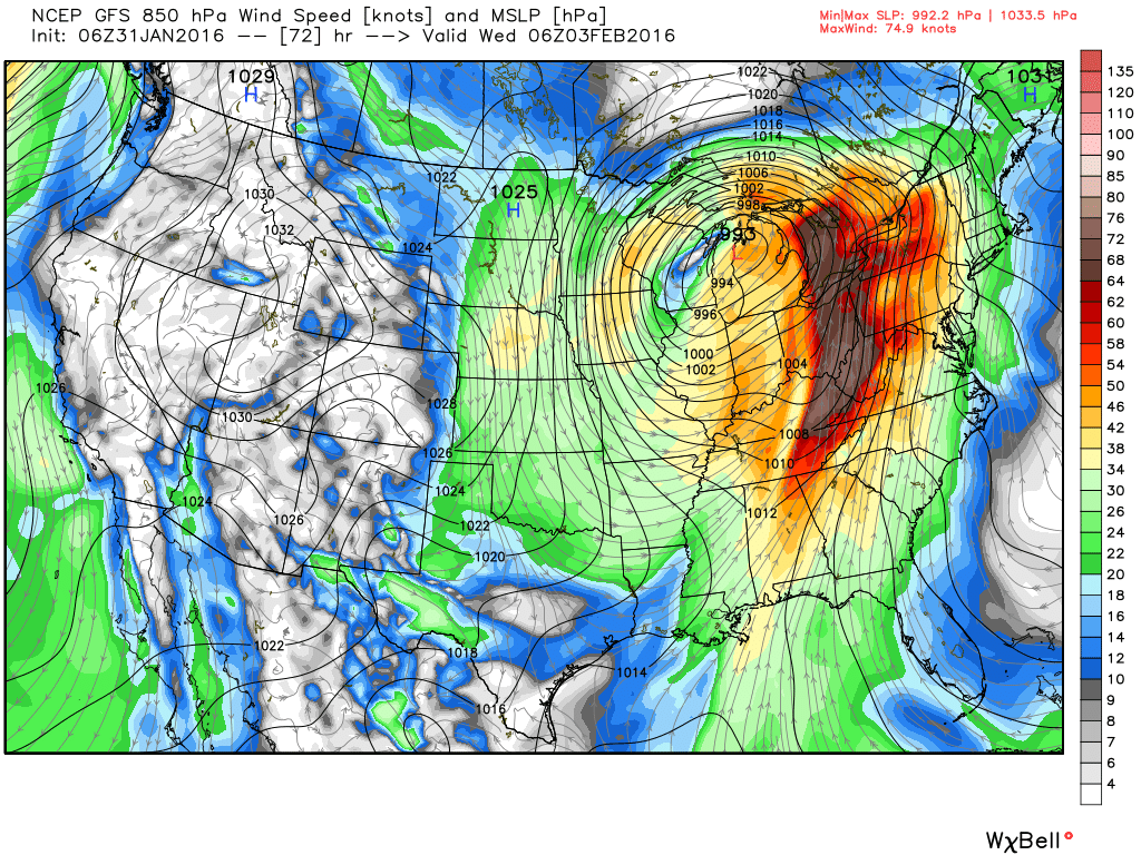
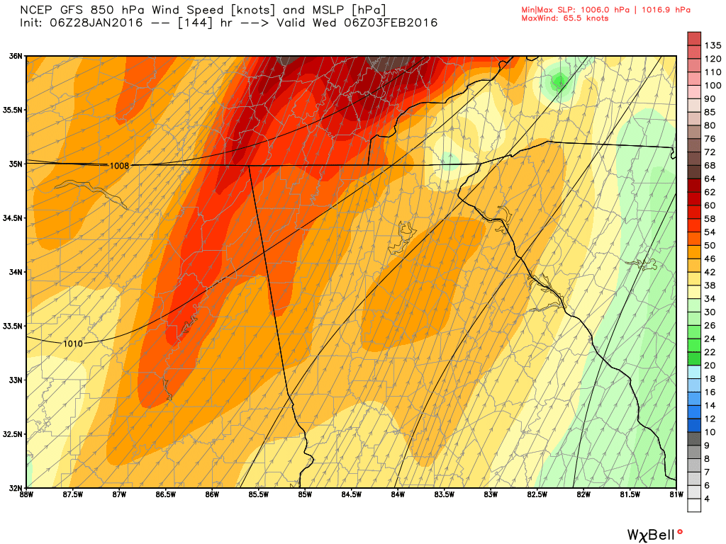
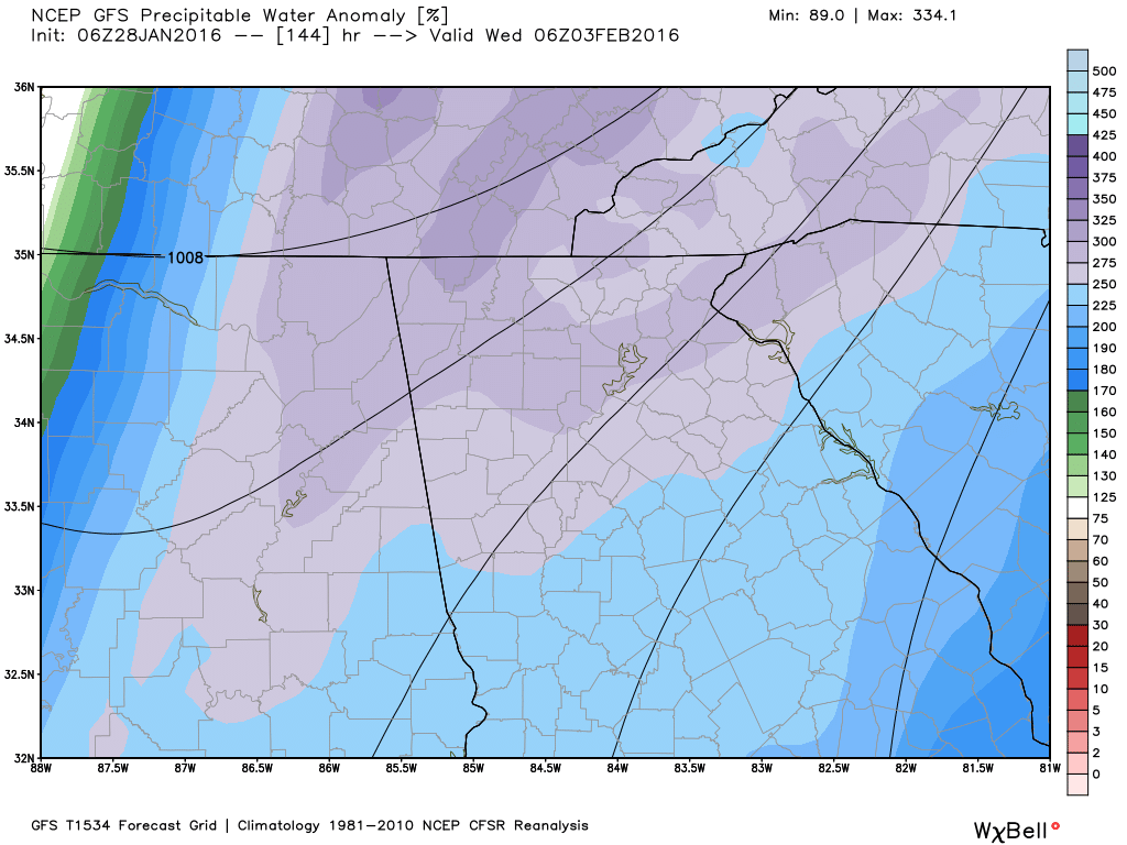
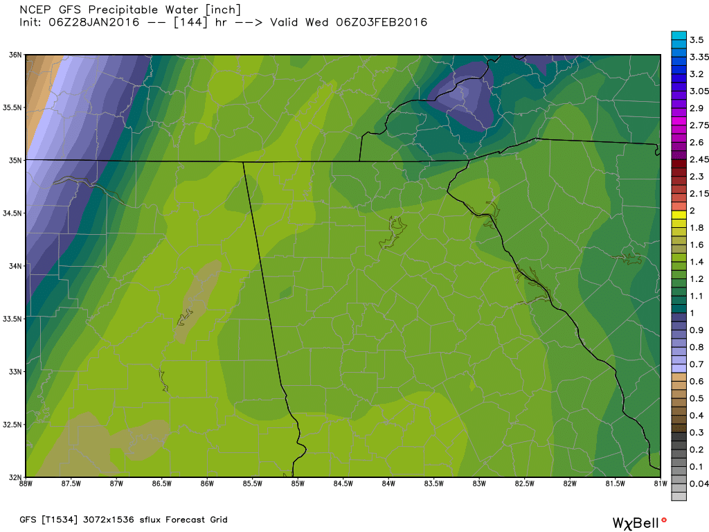
 850 MB wind speed in knots and MLSP @ 1 AM Tuesday in advance of the cold front. 850 MB wind speed in knots and MLSP @ 1 AM Tuesday in advance of the cold front. While there is currently not a lot to add about the upcoming changes, it appears that there should be a very active 6 weeks of winter left to come. The system to kick everything off will be coming here on Tuesday/Wednesday and will be bringing us showers and thunderstorms to start this party. IT appears for now that most of the severe weather will remain to our west. as the low that's bringing this weather moves from the southwest to northeast across the central part of the country, taking most of the severe dynamics with it. Behind the front, the cold air will slowly begin to filter in. Initially, there won't be a big blast, but instead a slow decrease in temps as the eastward movement of the front slows down and almost stalls. There may be a slight chance that some areas in the mountains see some flurries or light snow, depending on where the front decides to stall.
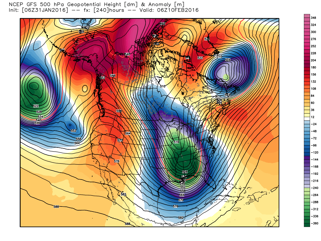
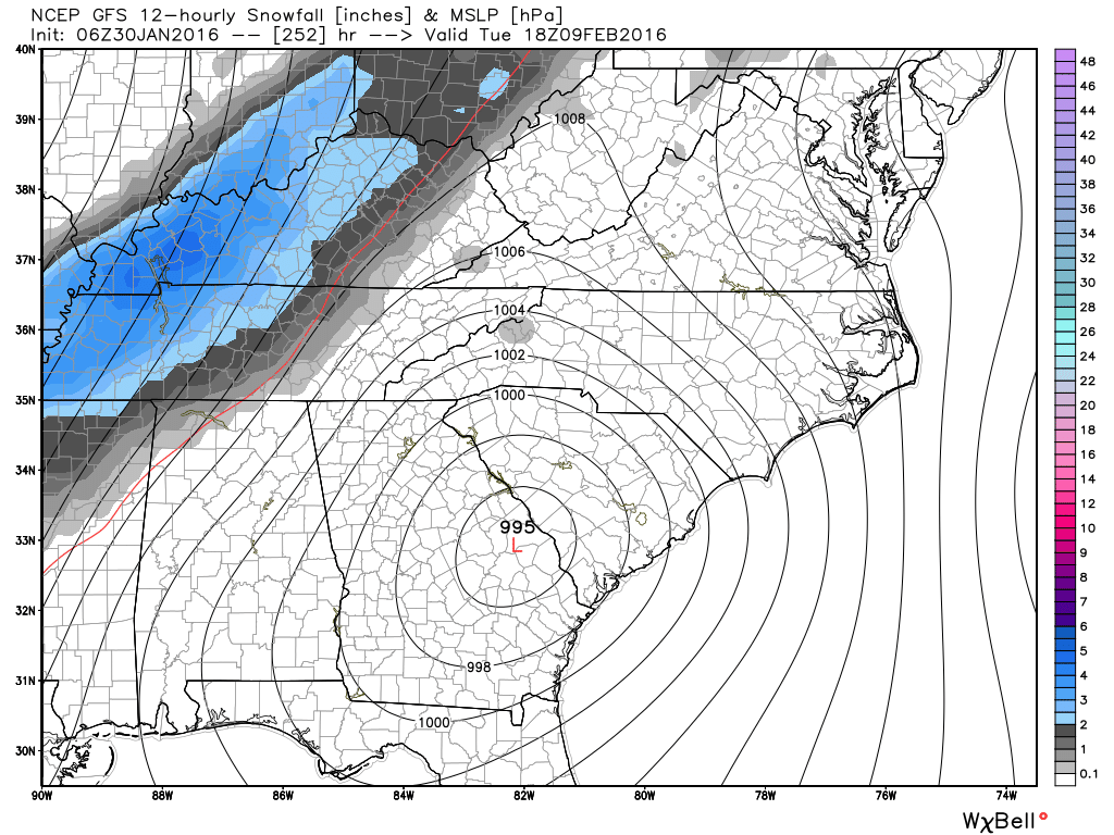
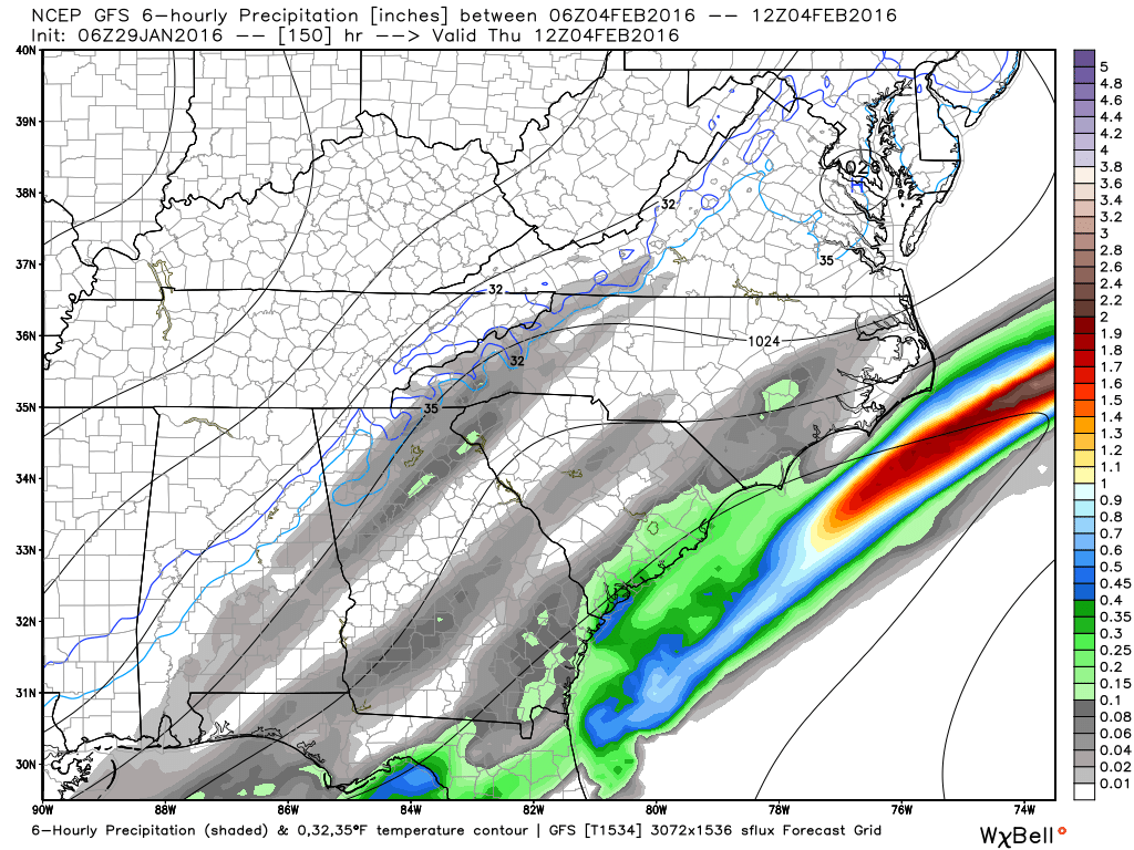
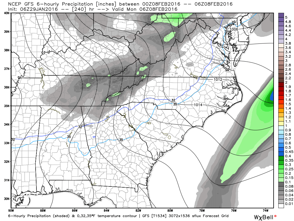
The Arctic cold appears to make its appearance around the 7th of February, and we're watching the time period around the 8-11th as a very promising period for potential winter weather across the southeast as multiple shots of arctic air and impulses riding the southern branch of the jet stream should combine at some point to finally bring us some real winter weather. Specifics for this period are unknown as it's just too far out for the models to have a good handle on it yet. Various models runs have seen big Gulf lows as well as systems like the one we just had that brought some of us some snow. Until we get within about 5-7 days of this system, we just won't know the whole potential. Larry Cosgrove said this just last night... This part of the forecast may prove to be downright troublesome, as many of the numerical models and the respective ensemble packages are implying that a significant (or worse) storm will take shape in Texas by February 9. Since it is odd to see that much agreement this far from the time, and case, of cyclogenesis, the situation must be watched. Analog forecasts also strongly endorse the threat, with the scenario of a strong southward intrusion of Arctic air through the Great Plains and Mississippi Valley late in the medium range. The images below show the Sunday, 06Z GFS run (top row of images below). A much stronger low than the 00Z run (2nd row of images below) gives indications of a CAD possibly building in from the NE on the 10th with a ton of precip dumping into cold air. I believe the low will eventually take track further south and the CAD scenario will not be an option.
Sunday, 00Z GFS Run
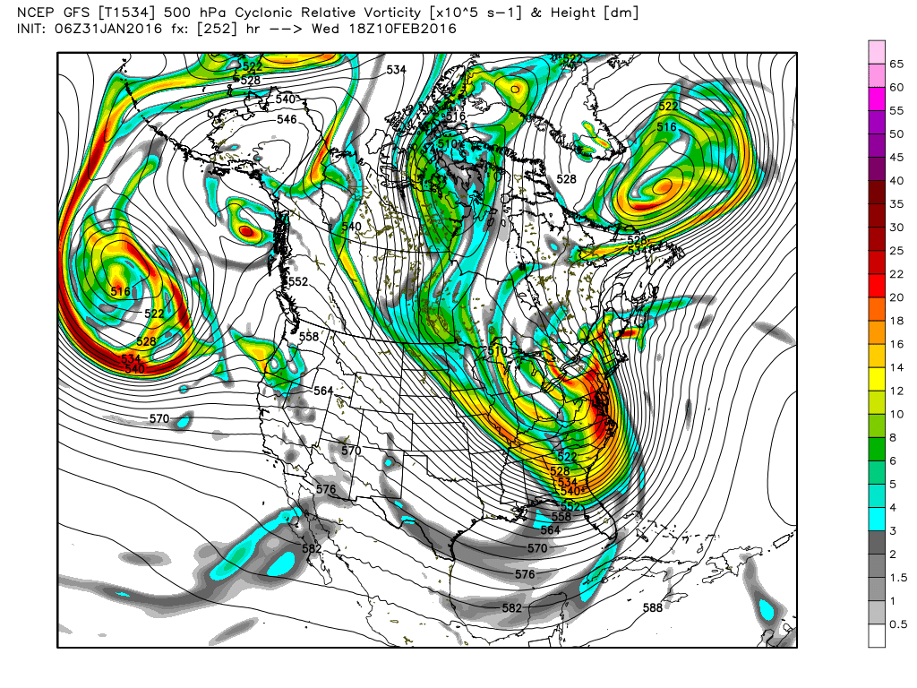
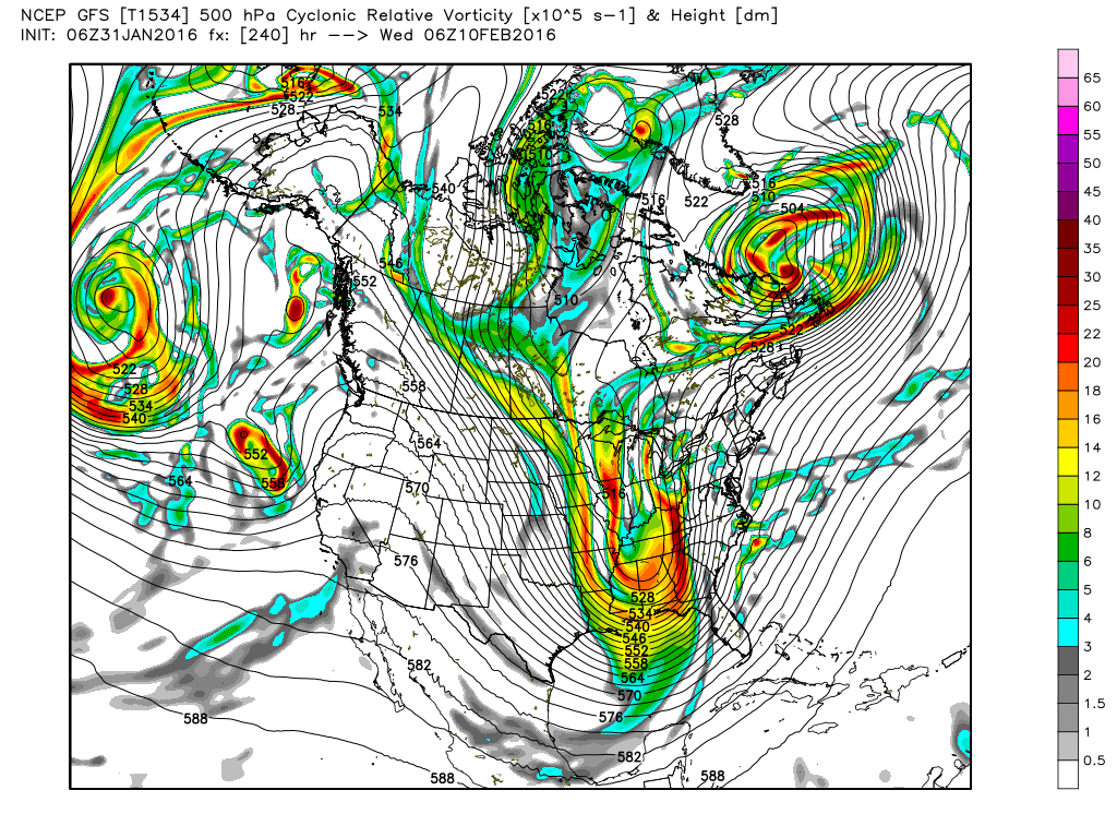
Here's a look at the vorticity of the 500 MB trough as it comes through... notice how the GFS has the trough taking on a negative tilt as it rotates through. This could have big implications on the strength of the UL low. Again, in this current configuration, the low would be too far north for us, but I suspect we'll see a southward trend. You can see in this low pressure plot from the GFS ensembles, there are plenty of options on the table. 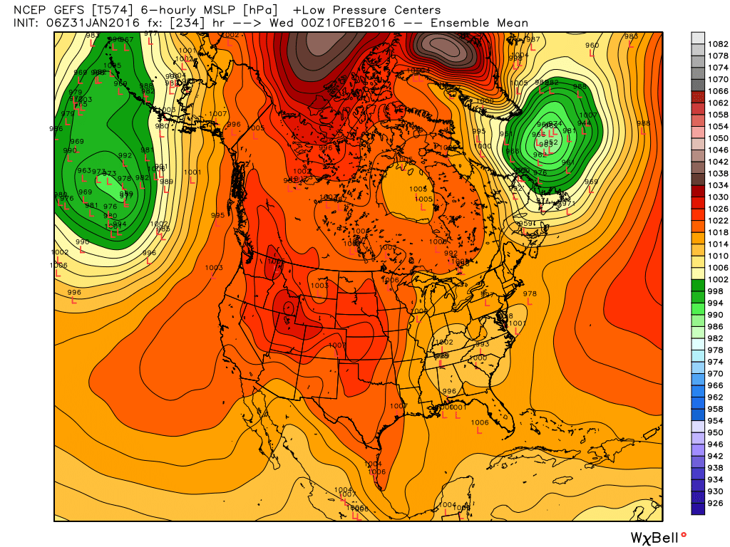 These are low pressure centers plotted from the 21 GFS ensemble members. For now, all options are on the table.
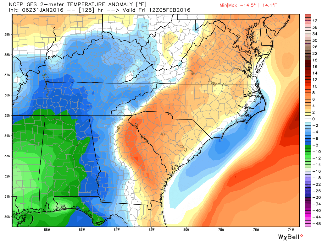
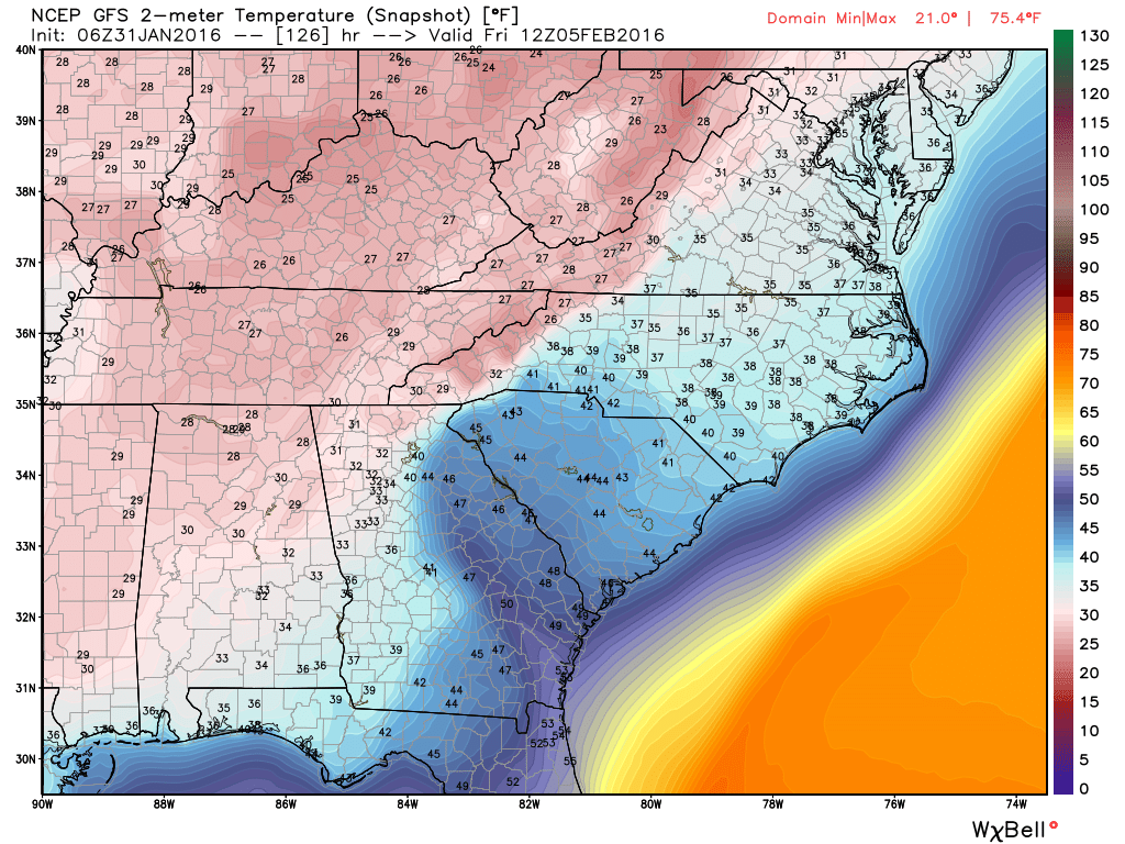
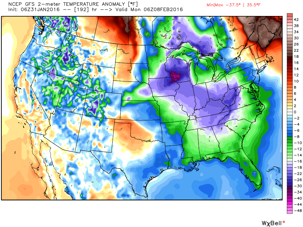
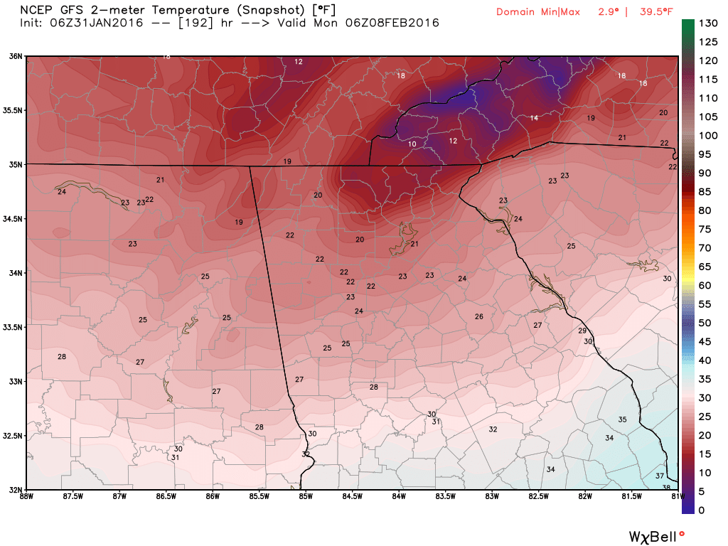
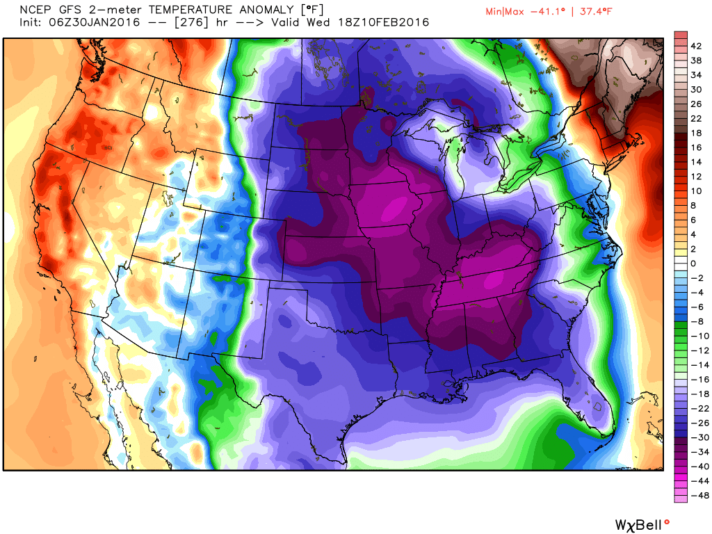
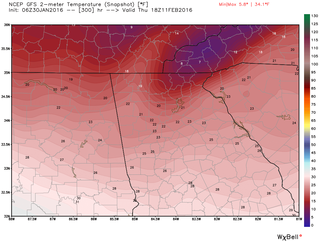
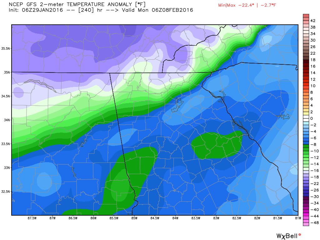
While I can't show you the Euro, it has very similar looks to it. Here are 1 AM temperature and temp anomalies on Monday the 8th. These are NOT the coldest temps coming... just the first of the real cold shots.
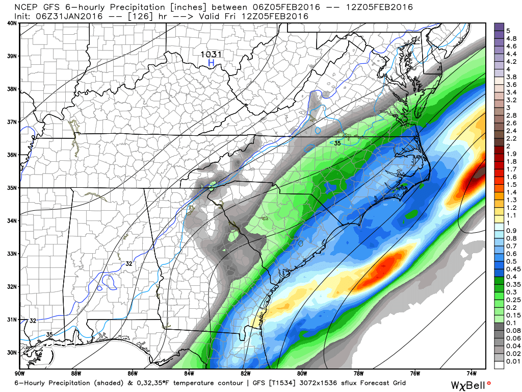
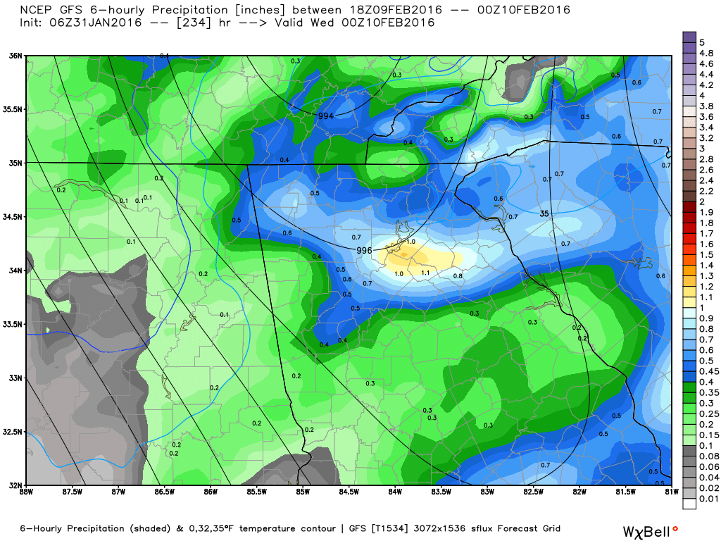
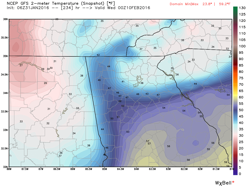
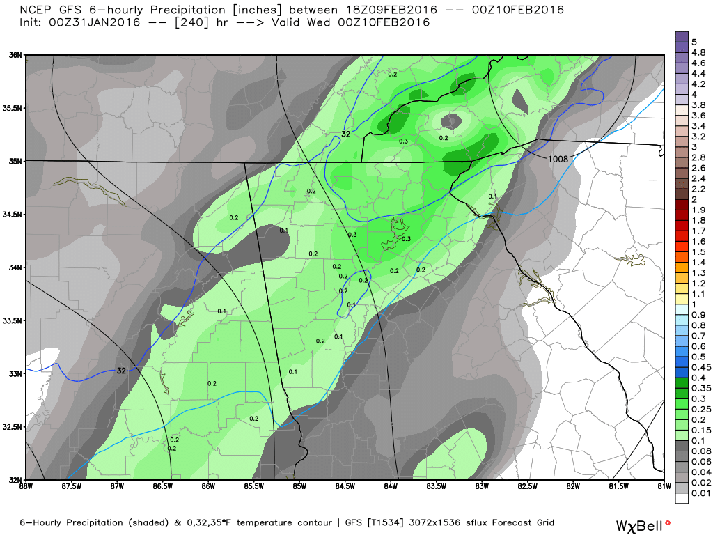
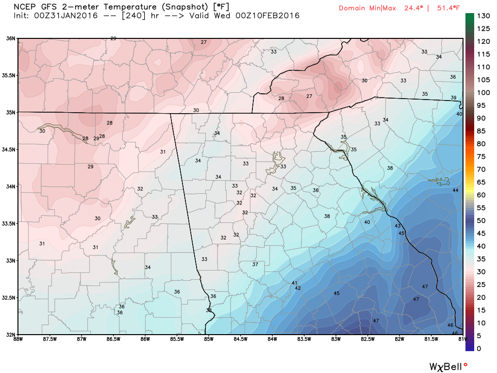
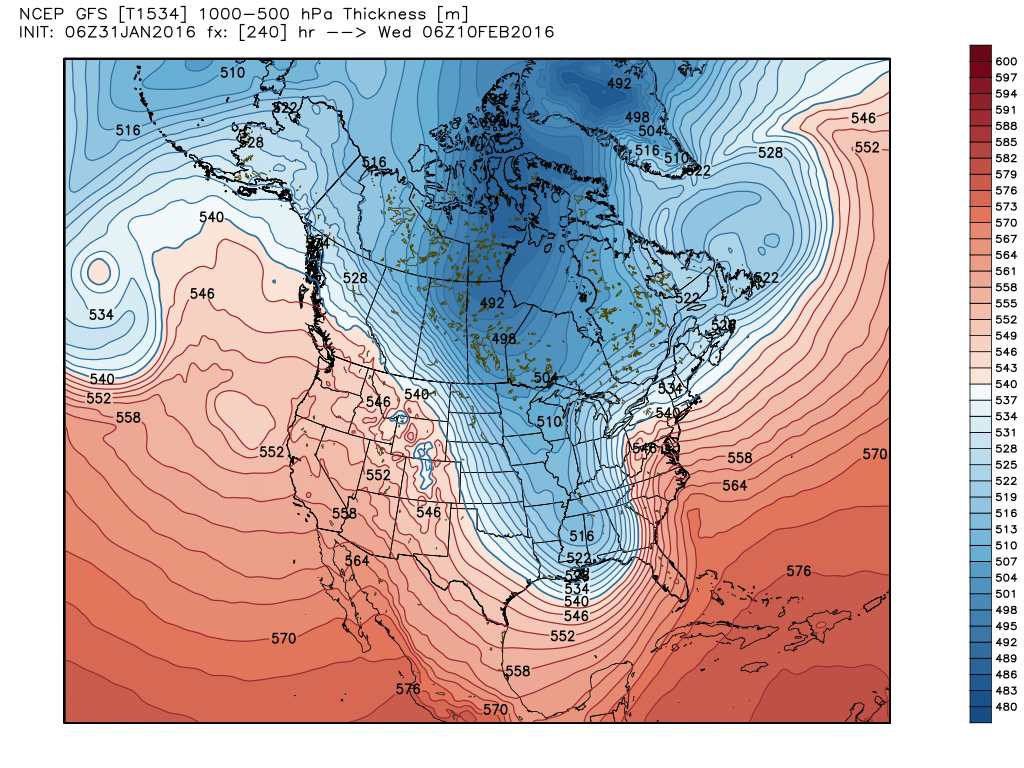
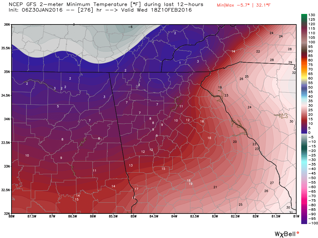
And a few images for Wed the 10th.
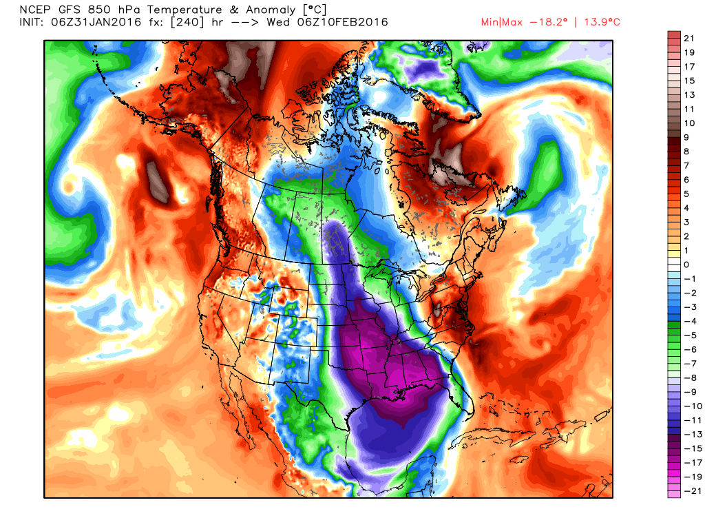
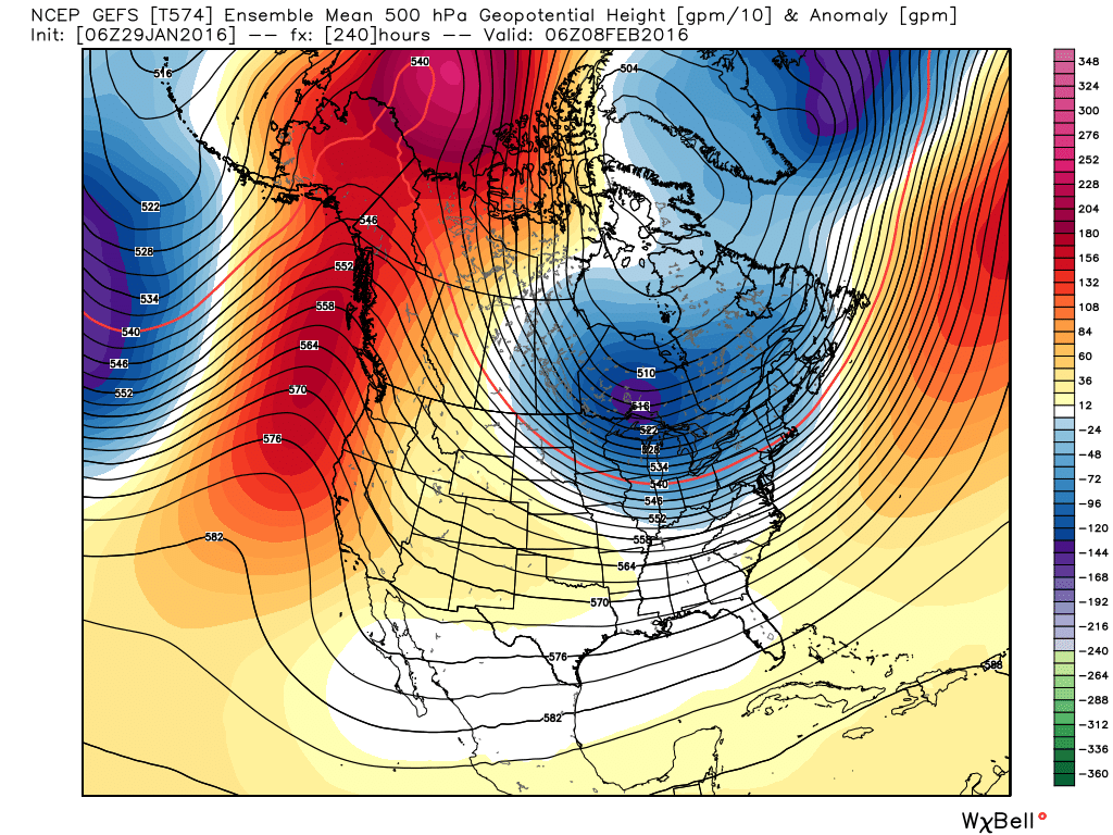
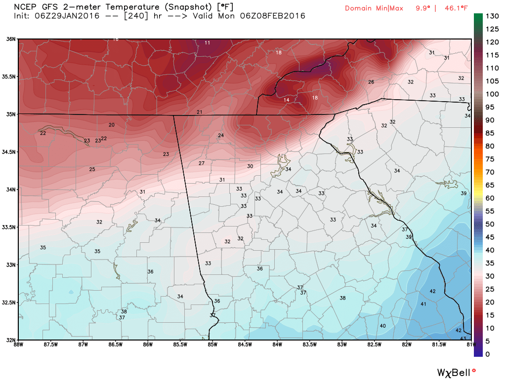
There will be lot's more to come on this, as we're still at least 7 days away from the real cold air, and it should be VERY exciting to watch unfold. I started looking at the computer models this morning, and I usually look at the GFS first since it appears first in the list of modes on the WeatherBELL site. I got out to around day 10-11 and and my jaw hit the floor. The GFS was bringing the whole arctic into the US. The images are explained below, but what the GFS is showing are temperatures 40-50 degrees below normal. Lows in north Georgia would be in the single digits if not lower, and highs would struggle to get above 20. But.... there is a possibility of a big storm during that period. THIS is the storm and period we can't afford to miss out on, so we'll wait and see if the low takes a more southern track. There is a lot of time for this pattern to evolve but it appears to be a prime period for winter weather. Just a reminder that these images are not a forecast, but one model run from one model. But we are certainly headed the correct direction for winter weather.
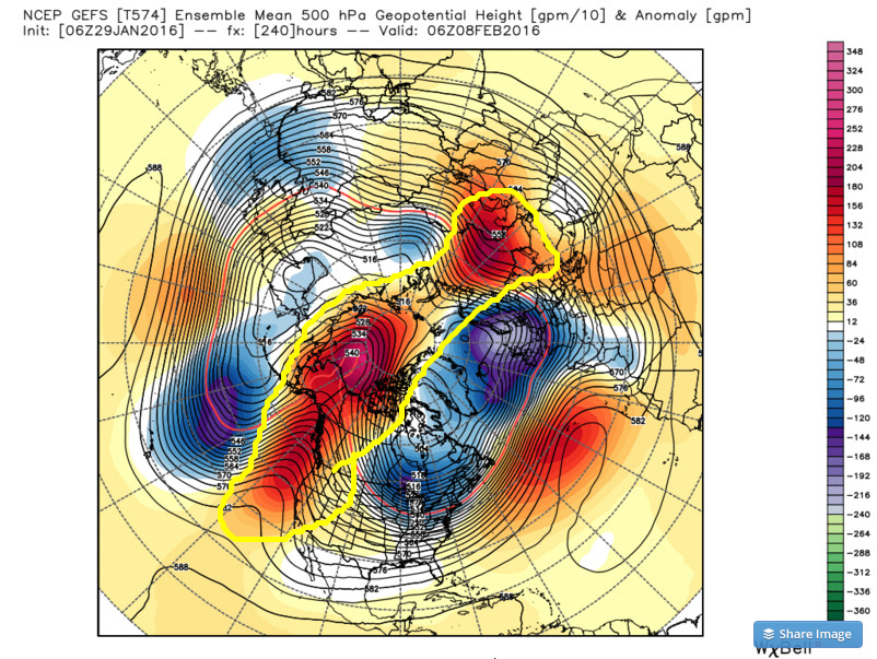
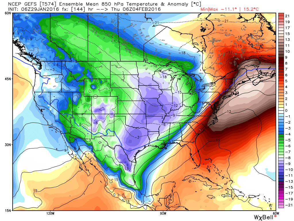
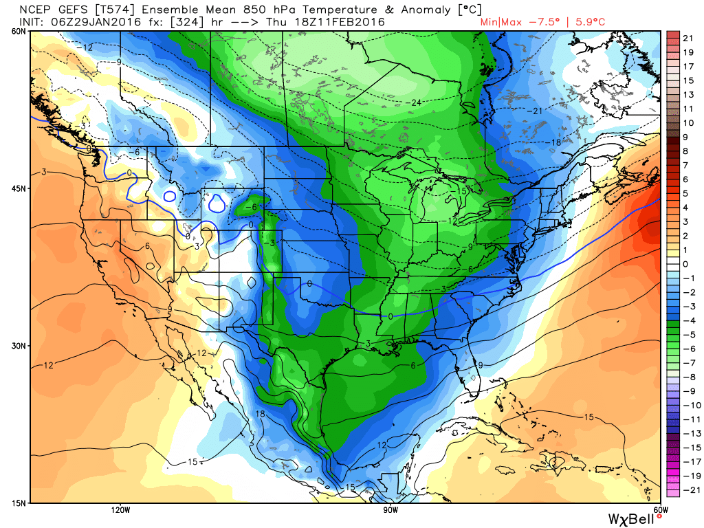
I've talked about the upcoming severe potential for next week, but for us and much of the central and eastern part of the country, may be the Arctic outbreak that is showing up on the models. Let's first take a look at the GFS ensemble mean and the evolution of the cold air. Remember, the ensemble consist of 21 members plus 1 low resolution control run and 1 high resolution deterministic run. These anomalies are in centigrade so the temp in fahrenheit will be colder than the temp values on the legend. 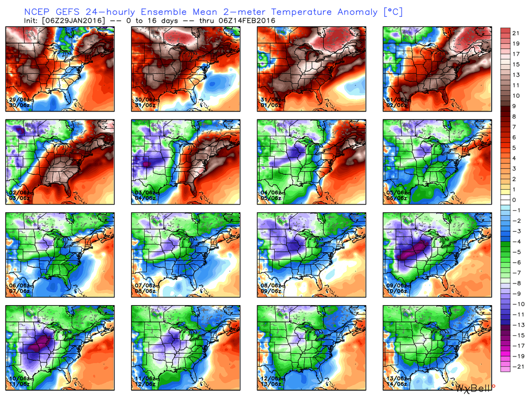 Looking at the upper air pattern, you can see that as we go out 10 days, we finally see strong blocking out west with the ridge extending all the way across the pole.
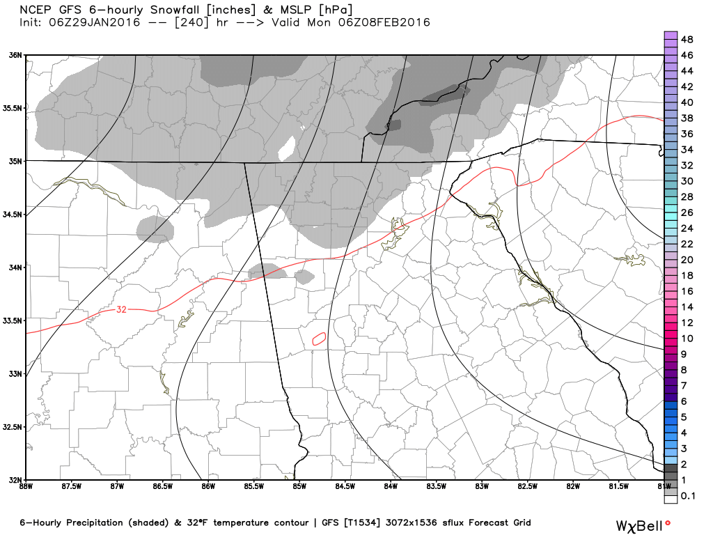
Even though this will be arctic air and is relatively shallow, temps higher up will be right where we need them to be for snow. Here's a look at 850 MB temps beginning around the 4th when the front comes through and again on the 11th. These images show anomalies and also the freezing line.
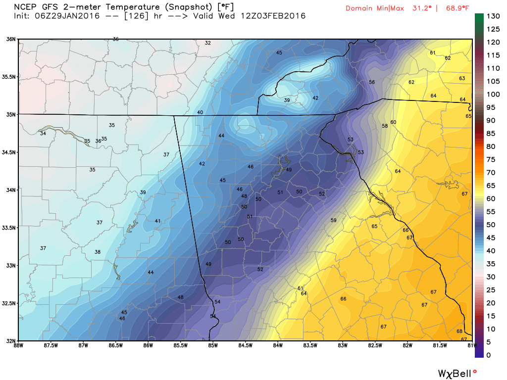
Keep in mind that you are looking at ensembles, so the 21 or so runs are all averaged or blended together. If we take a look at the deterministic run (zoomed in for us) for for around the same period we see these images. Waves of cold with
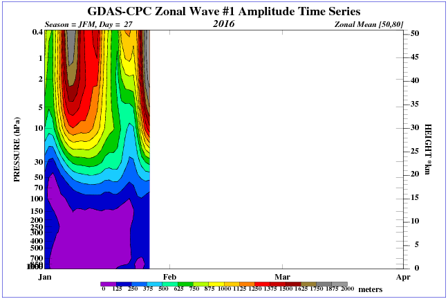
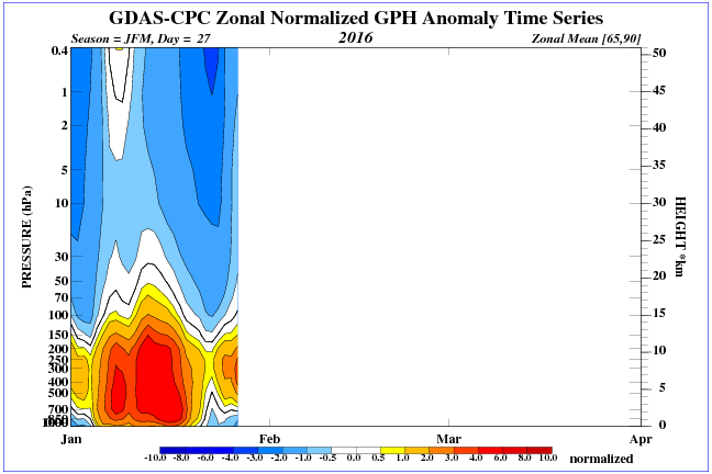
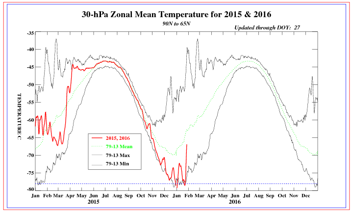
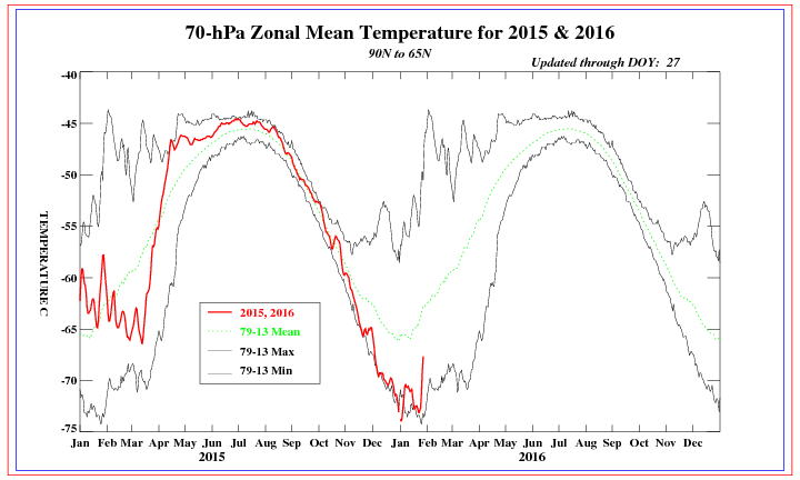
As you are aware, we're watching with interest as a stratospheric warming (SW) event occurs. If you've missed past post, SW events can have a big influence on the weather at the surface, as they tend to move the cold air off of the pole and displace it further south. In extreme events, it can tear the Polar Vortex (PV) into pieces and cause the high altitude stratospheric winds to reverse their flow, which in turn, causes ridging over the pole and sends the cold air elsewhere. You can see from the two images below, there are changes going on in the stratosphere. The image on the left shows the amplitude of Wave 1 heat flux and the pressures it creates. The higher pressures above heat the air and the stronger the pressures, the heat and the pressures will permeate further down in the atmosphere and help to move the PV off the pole. The second image shows pressure anomalies further down in the atmosphere due to changes in the stratosphere. These images and more can be found by clicking here. Many of the images in the post are from WeatherBELL.
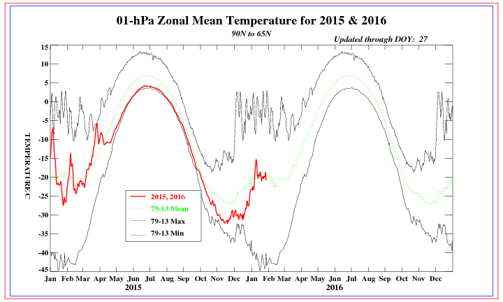
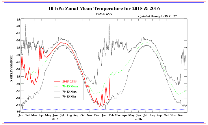
Temperature spikes are showing at all levels of the stratosphere right now, and the pounding on the PV has been pretty relentless over the winter. The constant beating will help to weaken the PV and dislodge the cold air from the pole. All of these images can be found by clicking here.
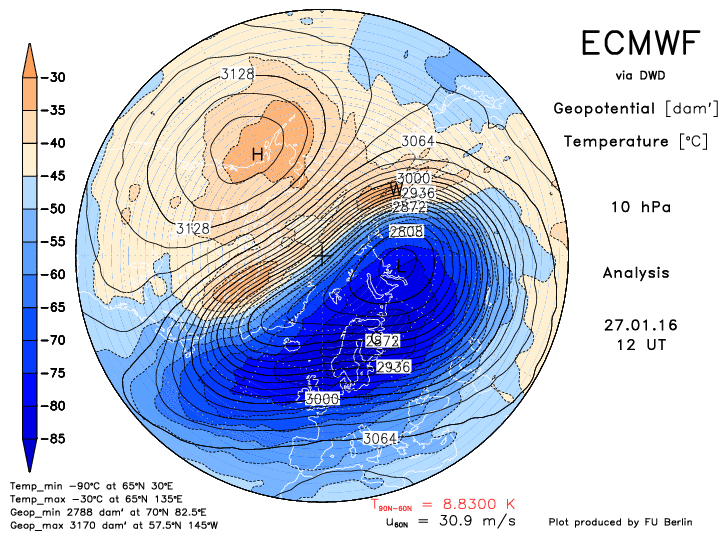
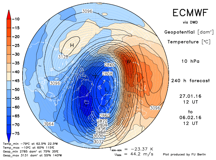
Here are two images from the Euro, current and 10 days. Notice how the PV is getting pushed around. These images can be found by clicking here.
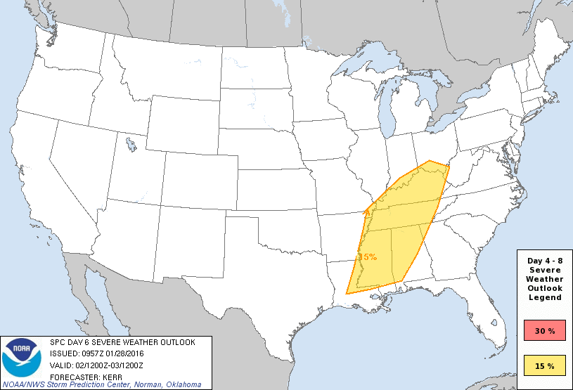
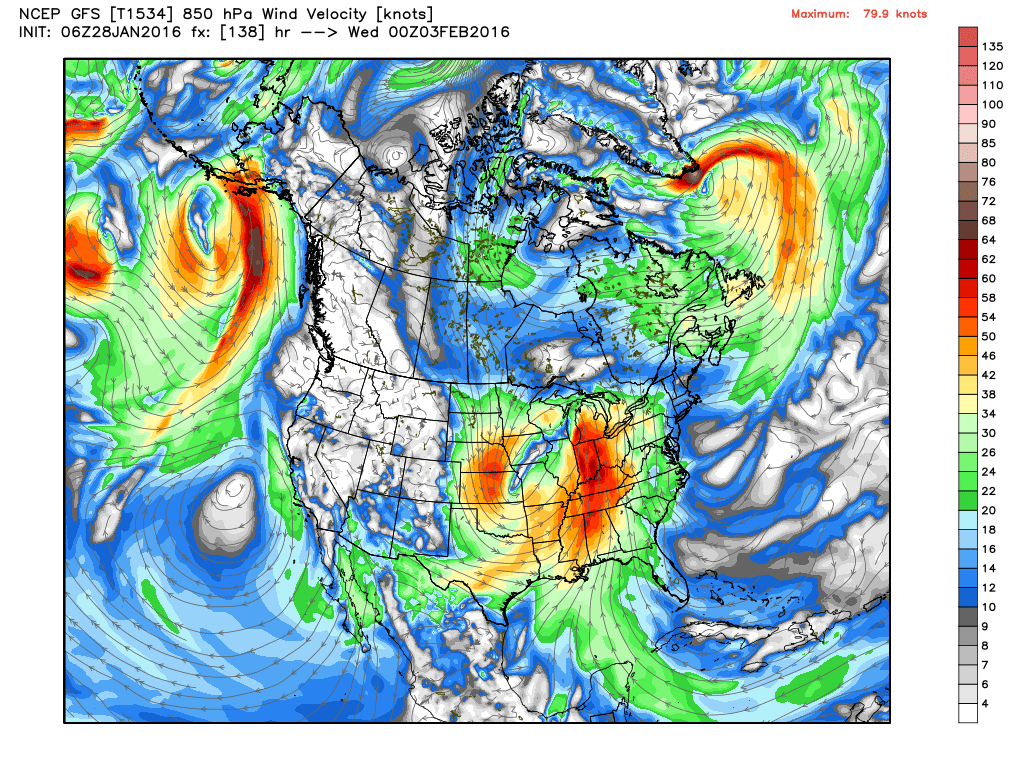
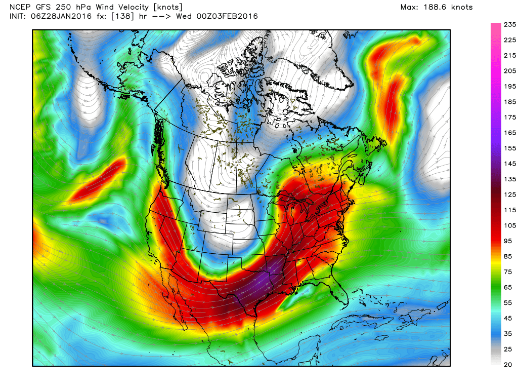
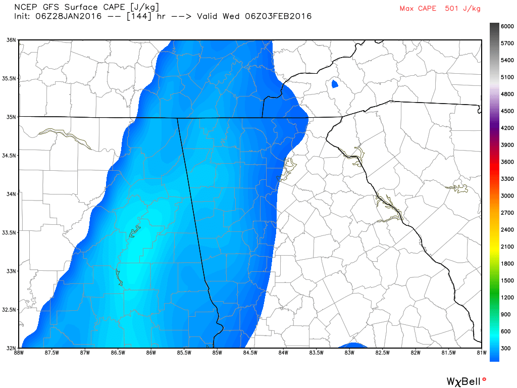
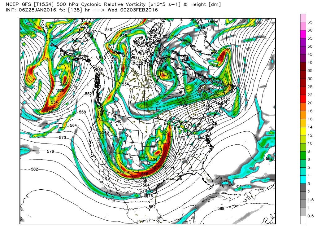
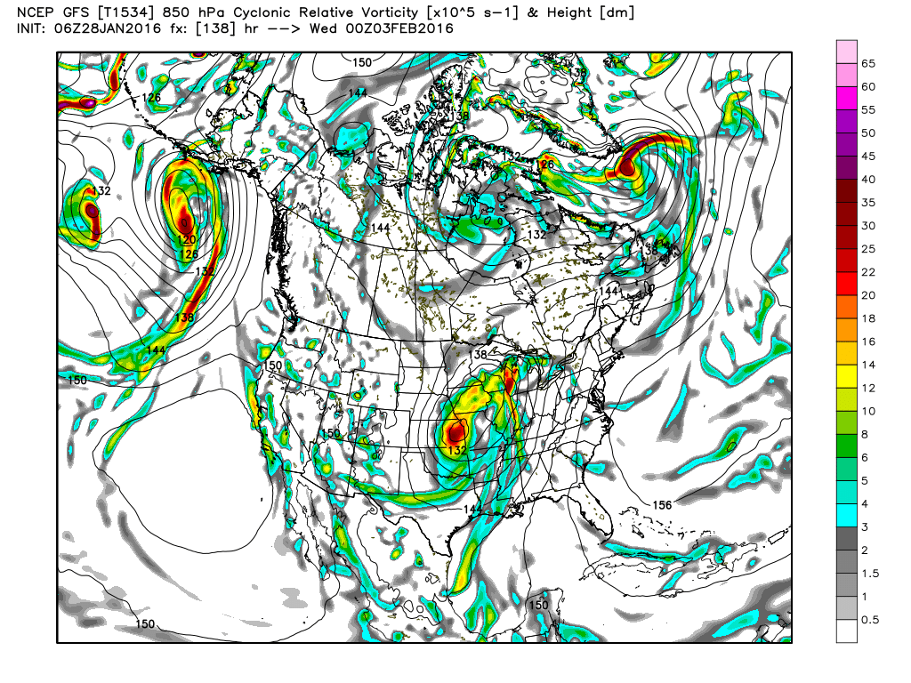
So while we're all looking ahead for the next snow system, I am beginning to have a big concern for the severe weather that the models are depicting for next week. The Storm Prediction Center already has part of northwest Georgia in the 4-8 day outlook for severe weather, and I would expect to see that expanded to the east over much of georgia before it's all said and done. Here's what the SPC had to say (Click here for full text) this morning. This event is something that we will need to watch very carefully as the time gets closer. "It still appears that strong cyclogenesis will accompany this feature along an arcing path... from the south central plains into the Ozark Plateau and Ohio Valley... through the St. Lawrence Valley by late week. These images below show various parameters that will be occurring in advance of the severe weather. The first two show the upper level winds at two different levels (as mentioned in the SPC text above), and the last two images show the vorticity or the amount of "spin" or rotation in the atmosphere. The second row of images show a close up of several severe parameters for 1 AM Tuesday. The large image below all of the smaller ones comes from the Storm Prediction Center (SPC).
 |
Archives
March 2019
Categories
All
|
OLD NORTH GA WX BLOG

 RSS Feed
|
Never base important decisions on this or any weather information obtained from the Internet. Always have a backup method of receiving weather information such as a battery powered weather radio.
Copyright © 2018 NorthGeorgiaWX.com and DaculaWeather.com 
|