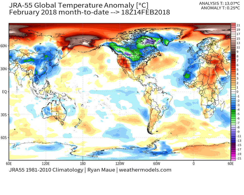
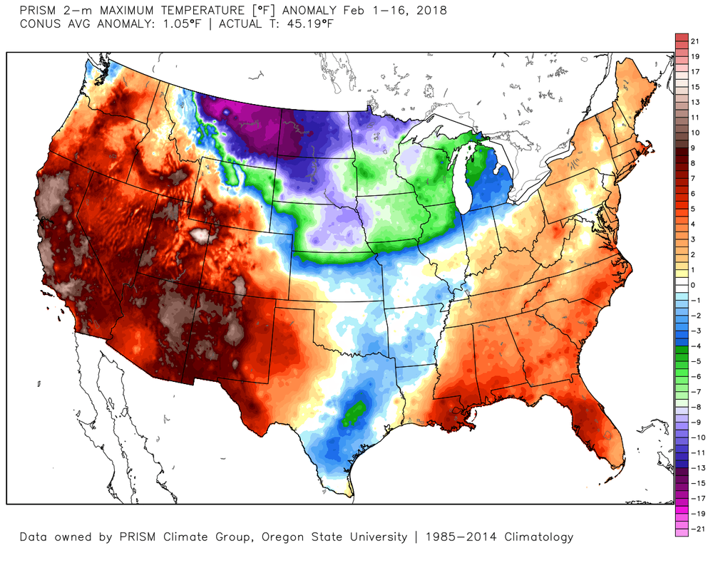
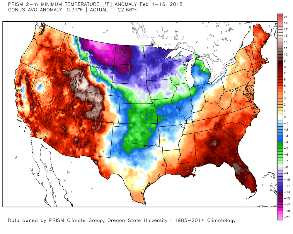
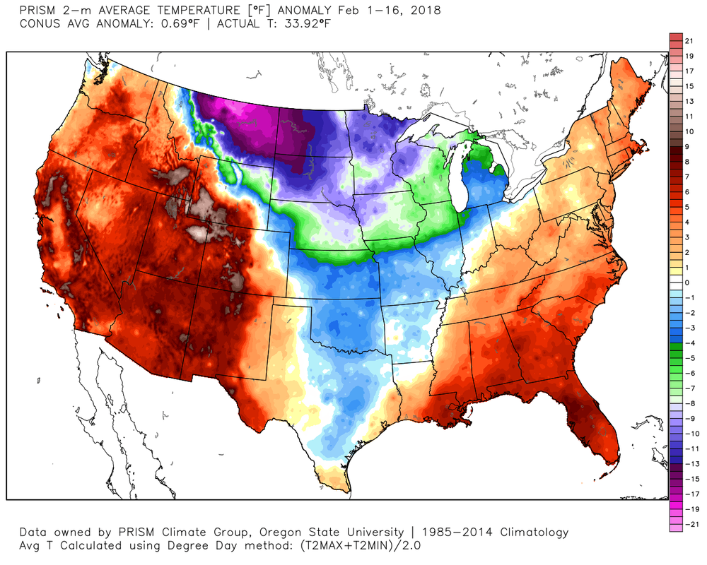
 February 2018 Global Temp Anomalies February 2018 Global Temp Anomalies It's been warm this month, no question about that. But how warm has it really been and where do we stand as far as our warm records go? The big world picture shows that for the month to date, February is running about 0.25º C above normal. This data comes from Temperature analysis (T319) from Japanese Met Agency (JRA-55 Reanalysis) and graphics from Dr. Ryan Maue's new website at http://wx.graphics/. So far the year to date anomaly is 0.28º C or about 0.50º F above normal. 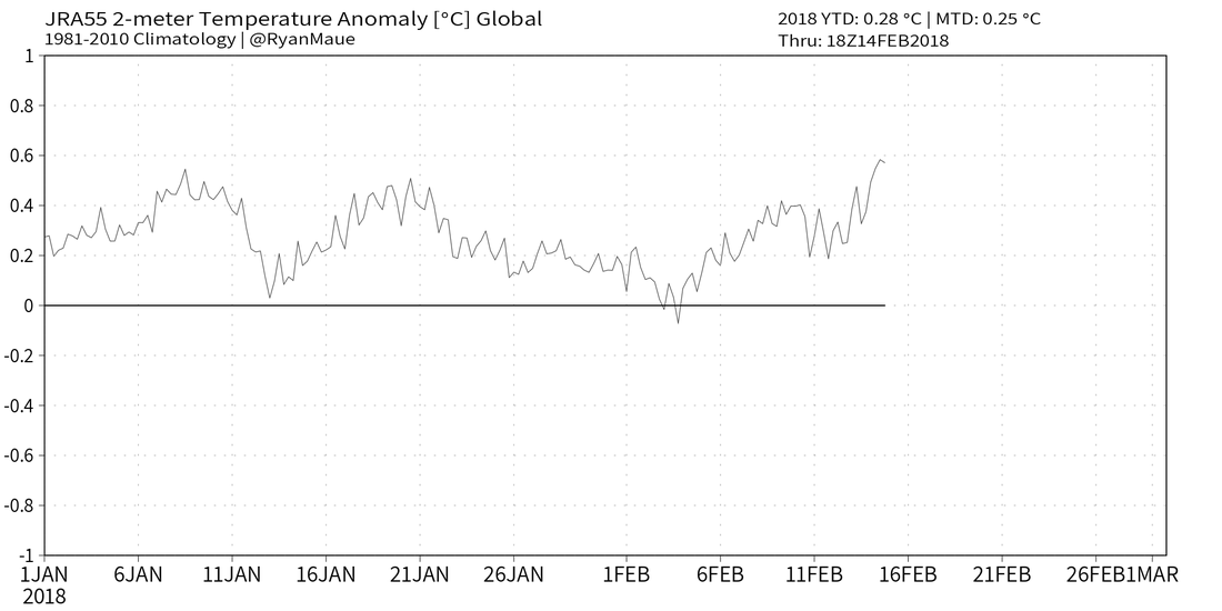 Lets look at February and see where we stand for the month. The three images below are the temp anomalies for the month and they show the max, min, and avg temp anomalies from left to right, and as always, you can click on any image to enlarge it. As you can see, the cold air has been confined to the central part of the country for the most part, while both coast basked in very warm temperatures. Overall the lower 48 states have averaged about 0.7º above normal. I would suspect the anomalies will go up some over the next 7-10 days before we return to more normal or even below normal temps.
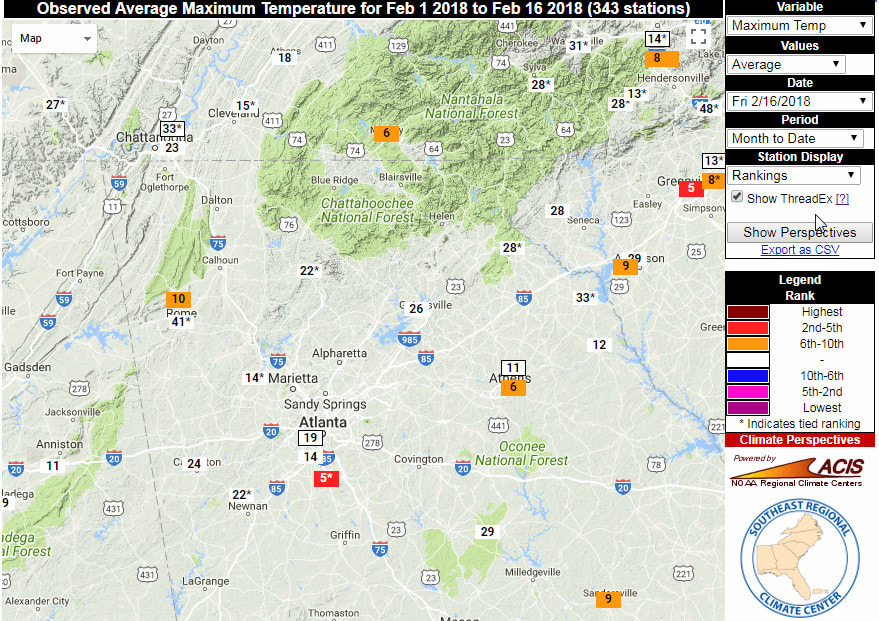
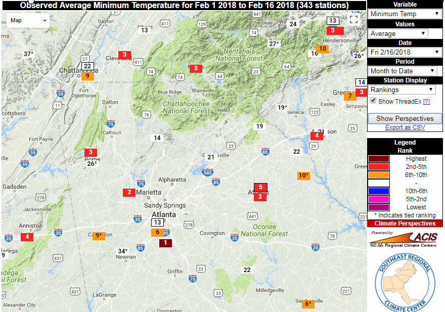
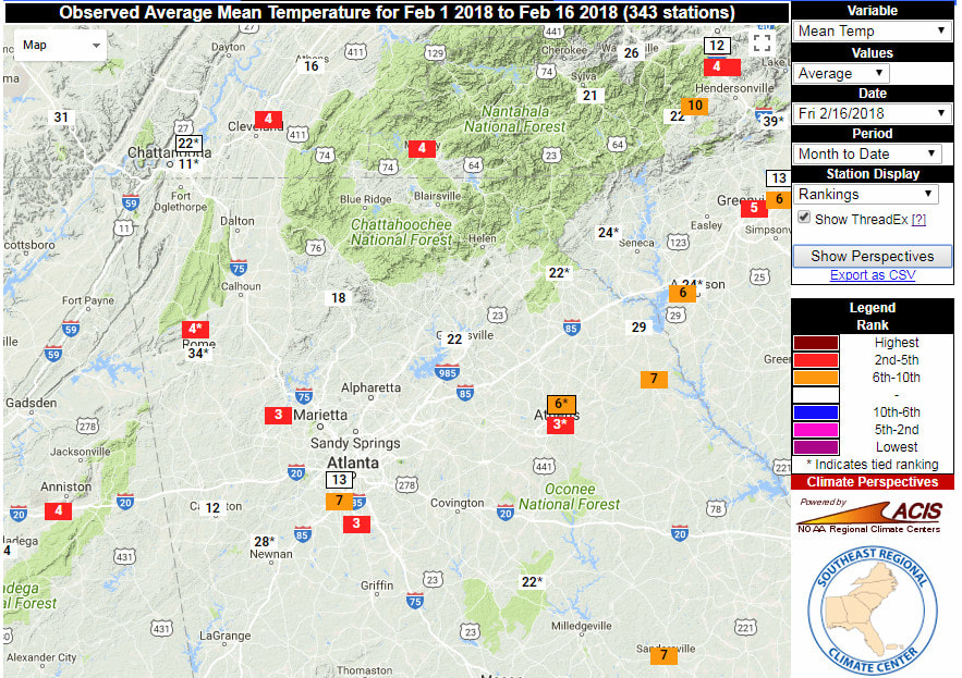
The three images below come from the Southeast Regional Climate Center. Instead of showing temps or anomalies, these images show the temperature ranking for various sites across the southeast so far for February. Max is left, Min is center and Avg is right. So a ranking of 1 would be the warmest period in that sites data records.
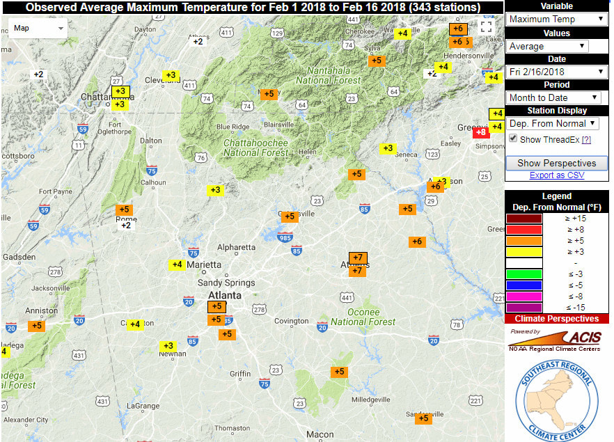
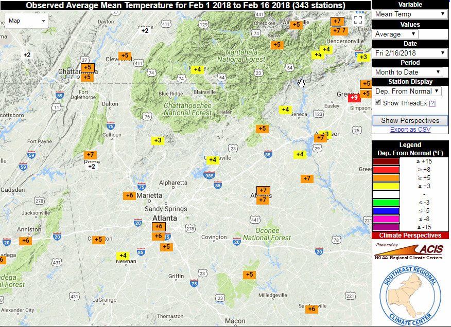
The images below are the temperature anomalies for the month to date from the official sites. Again, max, min, and avg from left to right.
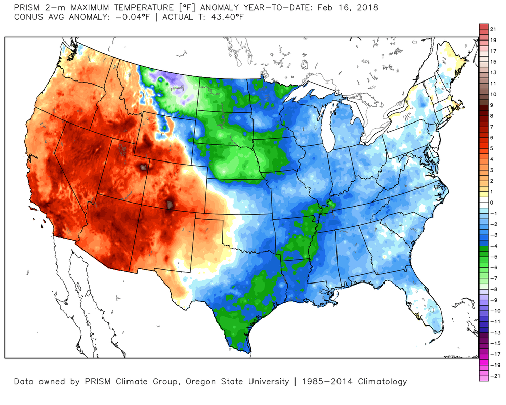
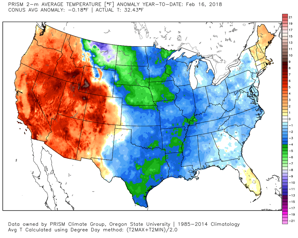
So we know February has been a little warm, but if we go back to the start of 2018, we begin to see a slightly different picture. We still see that the western part of the country was warm, but the east was normal to below normal. Keep in mind that these three images also include the warm February temps, so despite the warmth we've had so far, our year to date temps are still right around normal here, while a good part of the country was below normal.
Good afternoon. Here's the latest from the Atlanta National Weather Service office in Peachtree City regarding the potential for freezing rain and icing Monday. First, the text below is from the latest Area Forecast Discussion: ------------------------------------------------------------------------------- Obviously focused on late Sunday through Monday period with the update as we are getting more guidance consensus (albeit the latest Euro) on some freezing rain potential within a lingering hybrid CAD wedge. Nam and the Canadian continue to be the coldest/more robust solutions and the GFS ensemble members have all but a few indicating some freezing rain including the Atlanta Metro by Monday morning pretty much centered around 7 AM. Thermal profiles support some possible sleet transition and not much chance for snow, though primarily freezing rain given a pretty thick warm nose overrunning the wedge. Big question remains on the onset timing of precip and diabatic in-situ reinforcement potential of the wedge. Kept the temp trend slower to warm into Monday given this. Most locations should get above the freezing mark by mid to late morning. Also ended up fairly close to WPC QPF in the period and adjusted the ice accumulations to mainly upwards of 2 tenths of an inch though greater chance for closer to 1 tenth extending generally from south metro farther north. WPC keeps us in primarily the less than 1 tenth range. Will update accordingly and will need to consider Watch/Advisory products if confidence increases in this, but still too far out in period to include (also if the much drier Euro starts to trend in consistency).  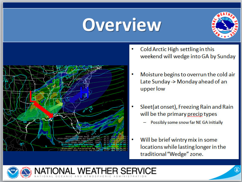 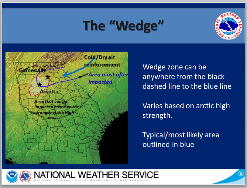 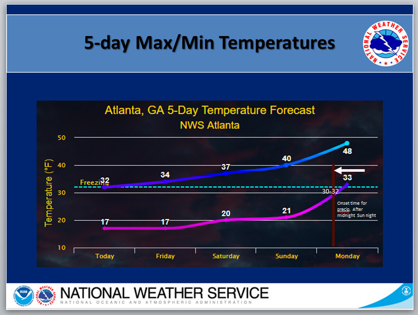 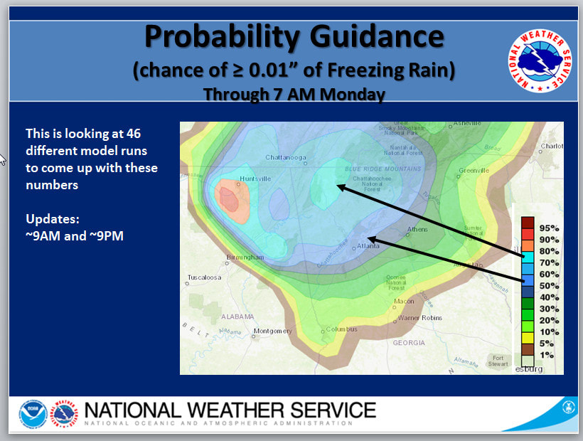 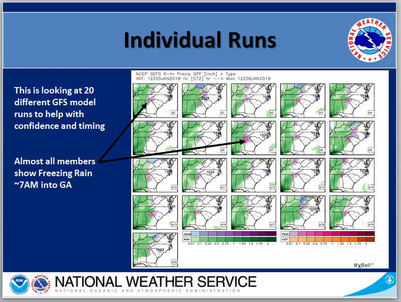 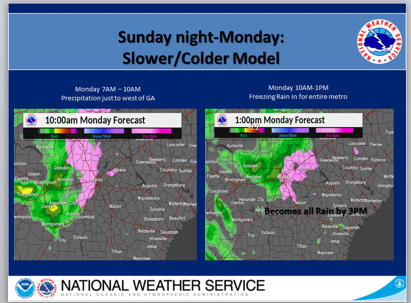 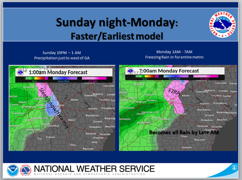 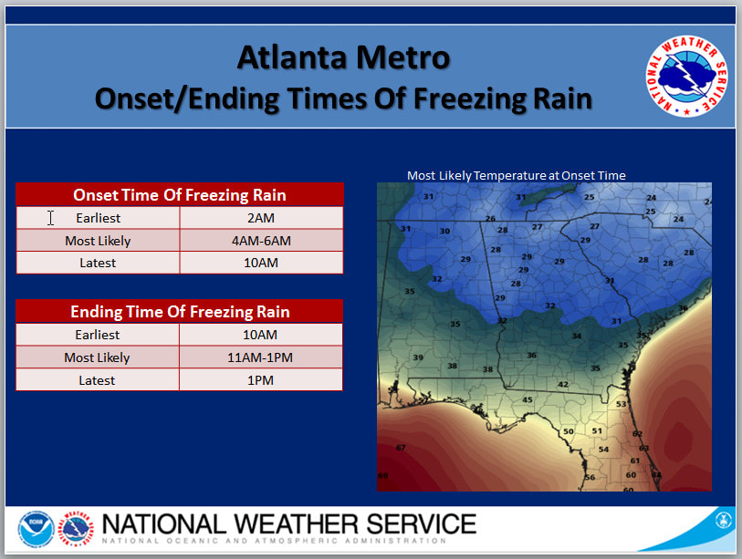 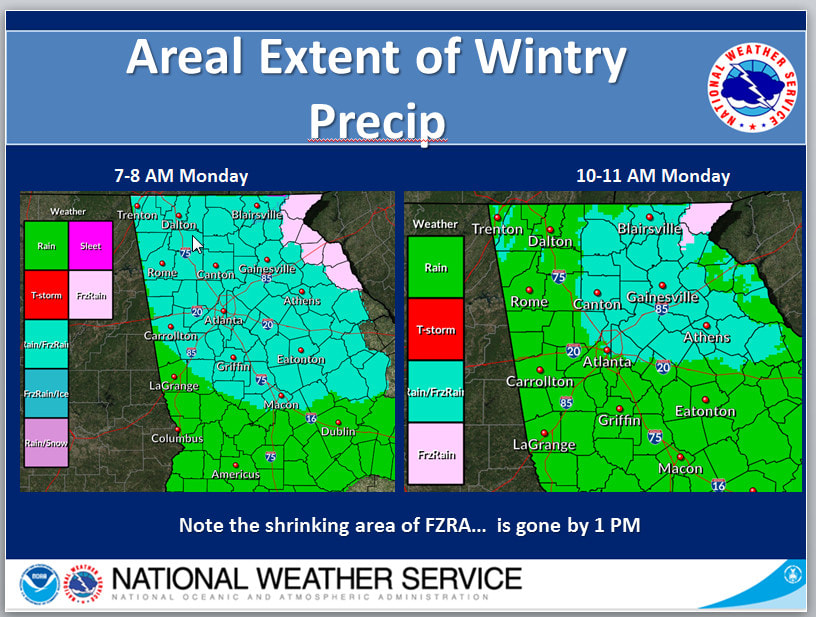 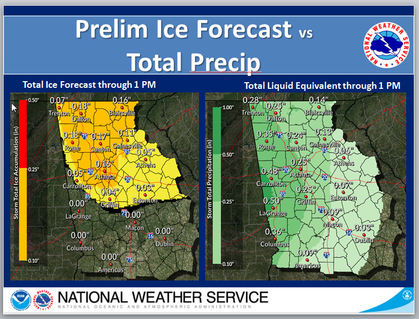 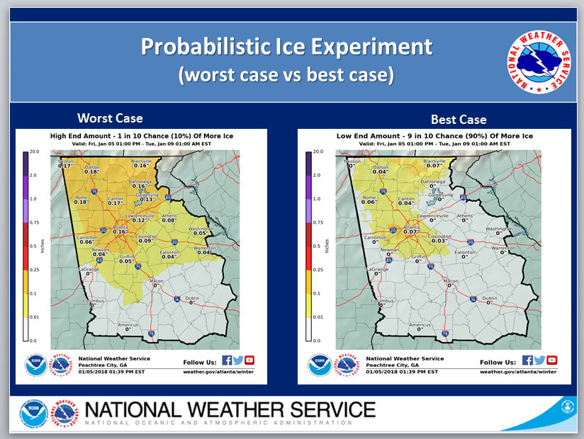 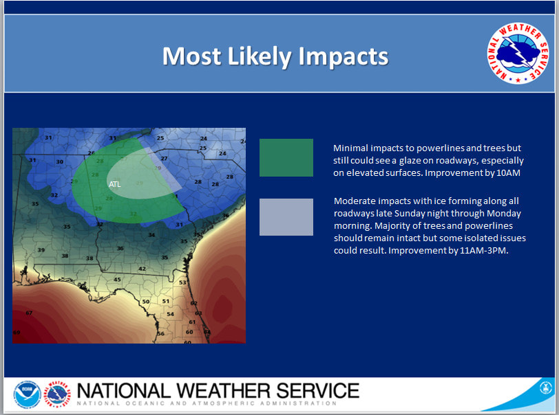 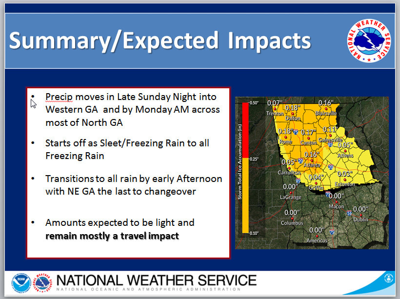 |
Archives
March 2019
Categories
All
|
OLD NORTH GA WX BLOG


 RSS Feed
|
Never base important decisions on this or any weather information obtained from the Internet. Always have a backup method of receiving weather information such as a battery powered weather radio.
Copyright © 2018 NorthGeorgiaWX.com and DaculaWeather.com 
|