|
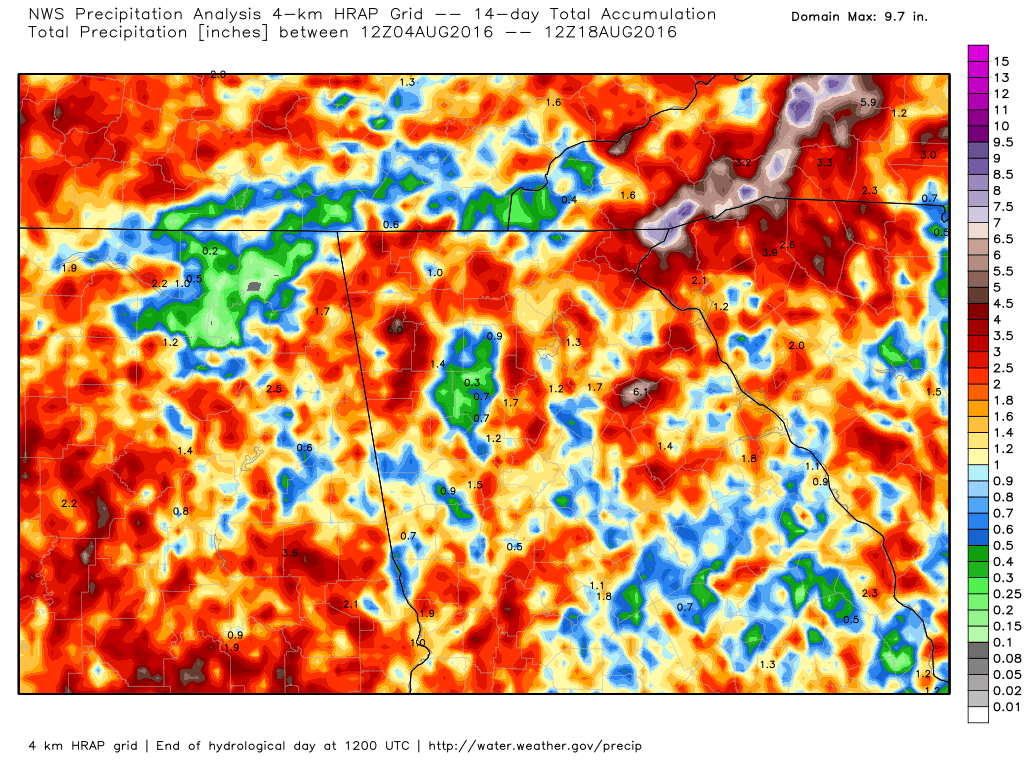
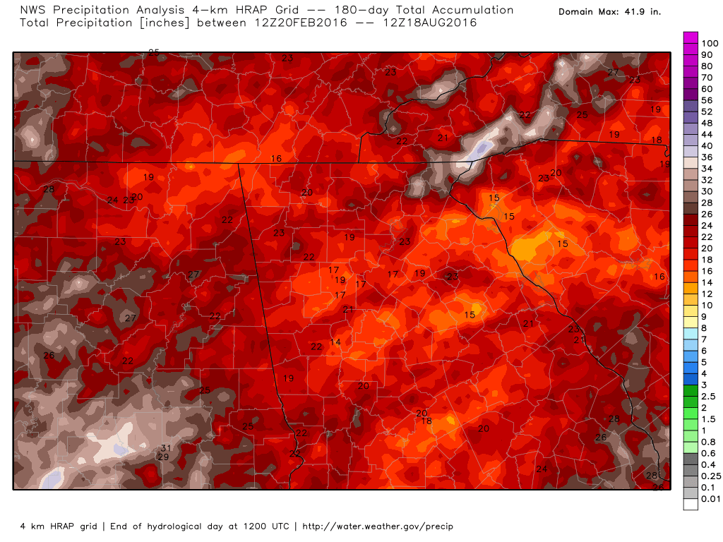
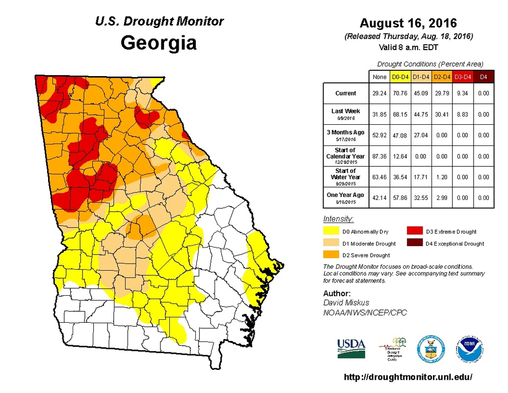
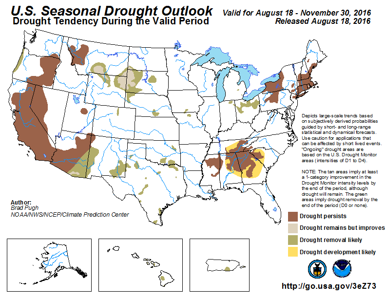
I wanted to pass along the Drought Information Statement from the National Weather Service, but I wanted to include images to help document what they are talking about. so I figured this would be a better place to do so. I will break this out into pieces so I can keep the images together with the text. Drought Information Statement for North and Central Georgia National Weather Service Peachtree City GA 1220 pm EDT Thu Aug 18 2016 ...A short-term...severe to extreme drought continues over portions of north Georgia including the Atlanta metro area... ...Abnormally dry to severe drought conditions continue to expand over portions of central Georgia... Several days of showers and scattered thunderstorms brought some minor relief to the short-term drought conditions across north and central Georgia during the past 14 days. Scattered rainfall amounts of 1 to 2.5 inches prevailed with some isolated spots receiving 3 to 6 inches. However...around half of the area received 0.5 to 1 inch of rain. This has allowed rainfall deficits to gradually worsen in many locations during the past 180 days.
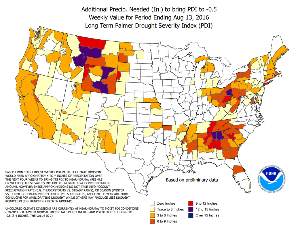
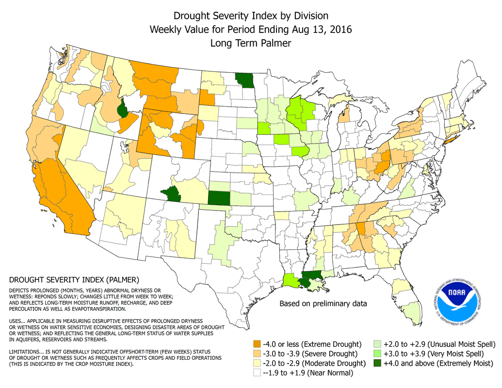
Due to consistent hot temperatures in the 90s with high evaporation rates...the soil moisture continues to decline in areas that received less than 2 inches of rain across north and central Georgia during the past two weeks. Consequently... a severe to extreme drought prevails over north Georgia which includes the Atlanta metro area. The driest areas were from Trenton to Rome... around Homer... and from Canton to Dallas to Douglasville... through Newnan to LaGrange and McDonough. Abnormally dry to severe drought conditions expanded over portions of central Georgia. http://www.daculaweather.com/4_drought_state.php
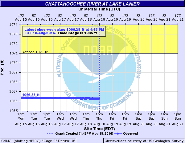
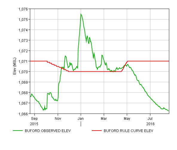
Climate Impacts Generally 15 to 75 percent of normal rainfall occurred over north and central Georgia during the past 14 days. The isolated 3 to 6 inch rainfall amounts were from 150 to 600 percent of normal. Location Total Rainfall Normal Departure Percent last 180 days value from normal of normal Atlanta 18.22 24.79 -6.57 73% Athens 22.79 22.86 -0.07 100% Columbus 19.30 24.44 -5.14 79% Macon 18.27 23.02 -4.75 79% Cartersville 20.69 25.53 -4.84 81% NE Atlanta 14.16 27.12 -12.96 52% West Atlanta 14.94 26.20 -11.26 57% Gainesville 18.60 26.57 -7.97 70% Peachtree City 15.45 25.42 -9.97 61% Rome 19.69 25.85 -6.16 76% 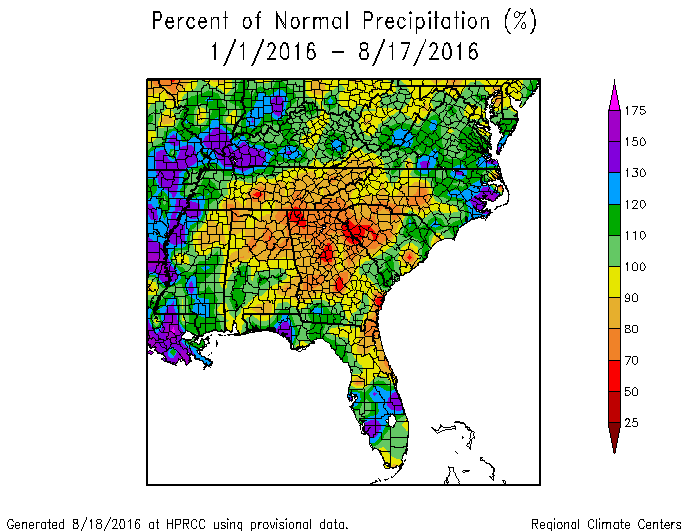 Some minor hydrological impacts to water supply...stream flows and ground water tables are continuing to occur over most of north Georgia. this includes the Lake Lanier pool elevation which has fallen another third of a foot during the past two weeks. http://www.daculaweather.com/4_lake_lanier.php
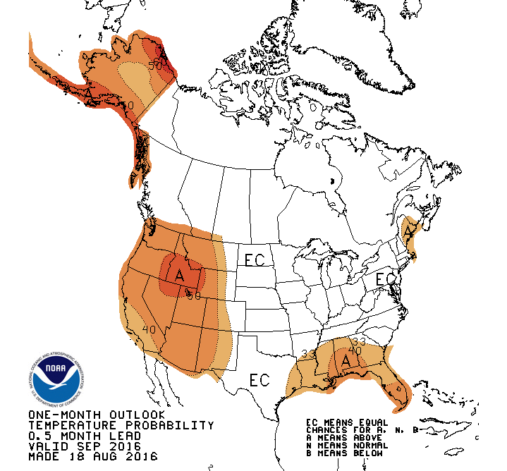
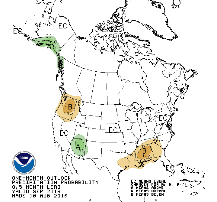
Reservoirs/Stream Levels Current lake levels at USACE projects were mainly from near summer pool level at Allatoona to near 5 feet below at Lanier. The pool levels are projected to remain nearly steady or slowly fall during the next four weeks. Lake Summer Pool Current Level Departure in feet Allatoona 840 839.48 -0.52 Carters 1074 1070.10 -3.90 Hartwell 660 655.85 -4.15 Lanier 1071 1066.28 -4.72 Thurmond 330 325.57 -4.48 West Point 635 631.88 -3.12 Average stream levels for the past 14 days were generally 3 to 55 percent of normal flow in most of north and central Georgia due to areas of recent rainfall. Please note that creeks and smaller rivers can change quickly due to runoff from heavy rain if it occurs. http://www.daculaweather.com/4_nws_river_lake.php Fire Danger Levels The latest fire danger assessment indicates a moderate to high risk across north and central Georgia. Please note that this assessment can change rapidly due to changes in moisture levels and rainfall received. Temperature and Precipitation Outlook For September... The outlook for north and central Georgia...above normal temperature and below normal rainfall is expected. the drought conditions will persist over north and central Georgia unless significant rain is received. 90 day outlook... for September through November...above normal temperature and below normal rainfall is expected.
|
Archives
March 2019
Categories
All
|
OLD NORTH GA WX BLOG
 RSS Feed
|
Never base important decisions on this or any weather information obtained from the Internet. Always have a backup method of receiving weather information such as a battery powered weather radio.
Copyright © 2018 NorthGeorgiaWX.com and DaculaWeather.com 
|