|
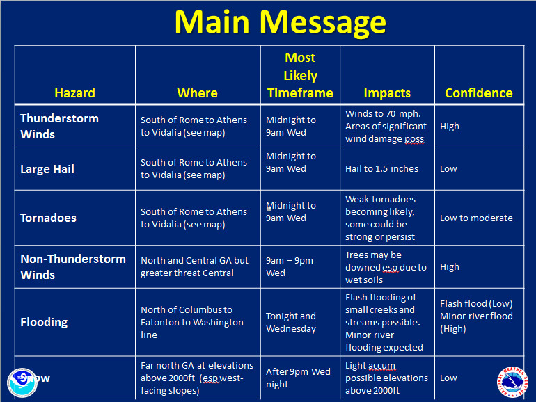
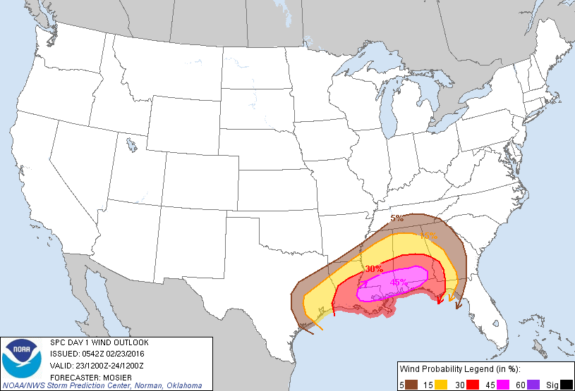
An update to the event that will be unfolding today. For us, most of the severe will come after midnight tonight, so please be sure to have a weather radio handy, as night time is always the worst time for weather like this. The darkness makes it almost impossible to spot tornadoes, and the type of tornadoes that spin with systems like these are quick and not often seen on a radar. For most of north and northeast Georgia, wind damage will be the biggest threat. Screaming winds just above the surface can mix down in any thunderstorm and bring high winds to ground level, and one way quick spin up tornadoes develop. This from the Storm Prediction Center in the their Day 1 Severe Weather Outlook ...SUMMARY... SEVERE THUNDERSTORMS CAPABLE OF DAMAGING WINDS AND TORNADOES WILL BE LIKELY OVER PORTIONS OF THE GULF COAST STATES TUESDAY. A FEW OF THE TORNADOES MAY BE STRONG...ESPECIALLY TUESDAY AFTERNOON AND INTO TUESDAY NIGHT. And this from the Atlanta NWS office... SHORT TERM /TODAY THROUGH WEDNESDAY/... 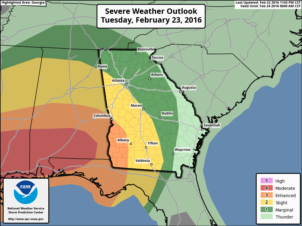
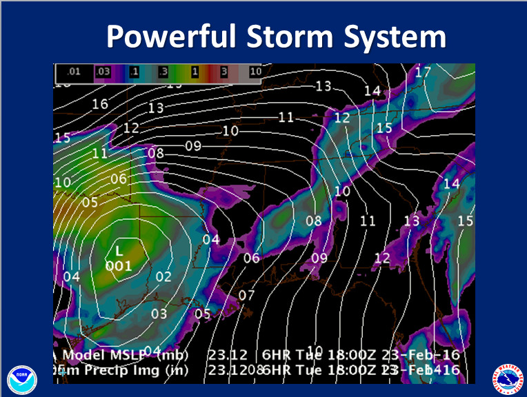
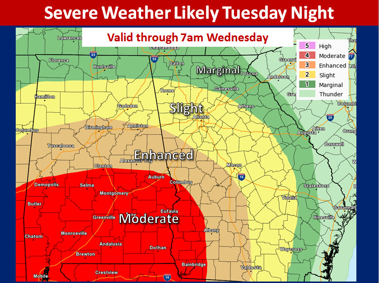
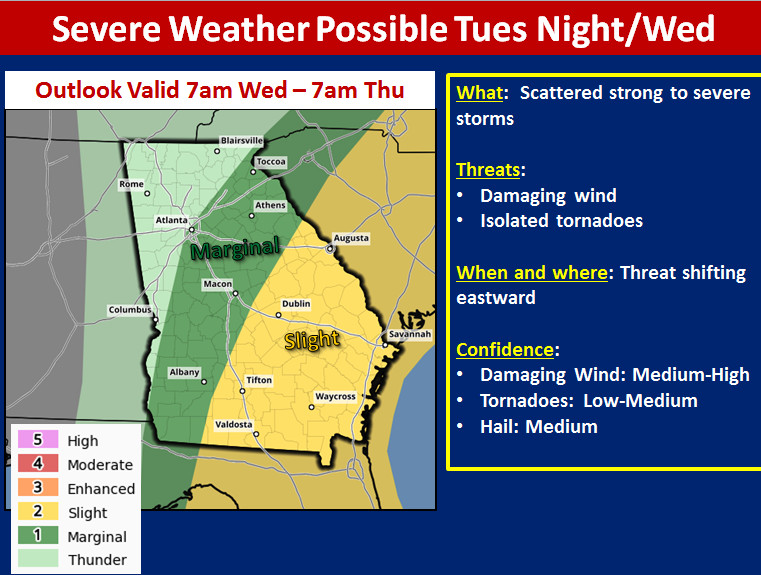
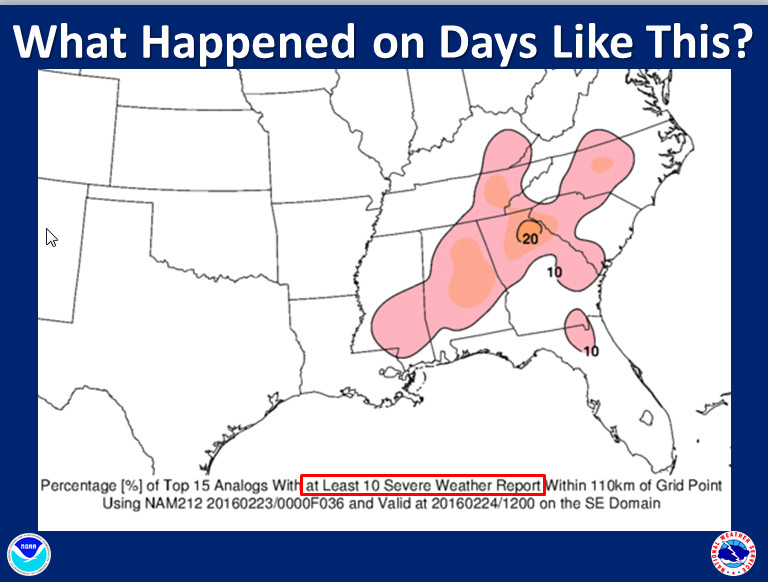
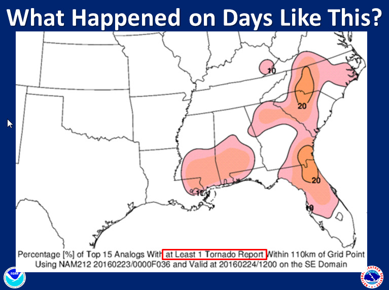
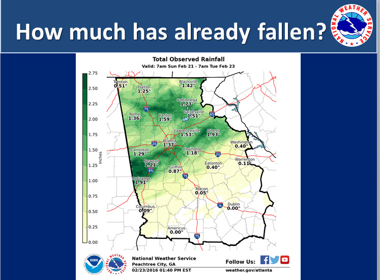
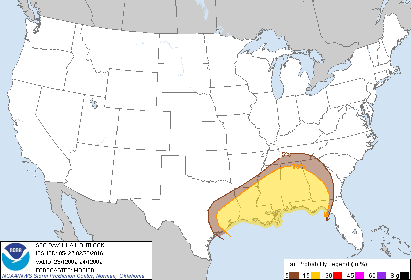
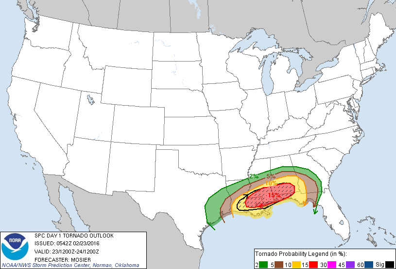
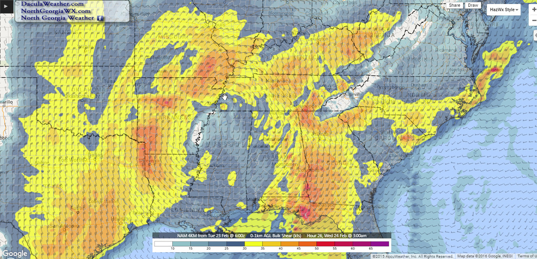
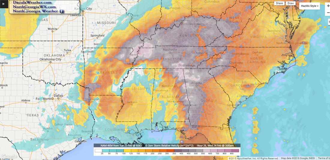
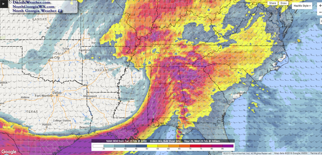
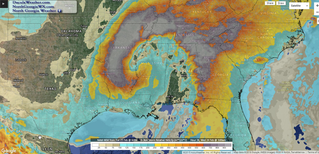
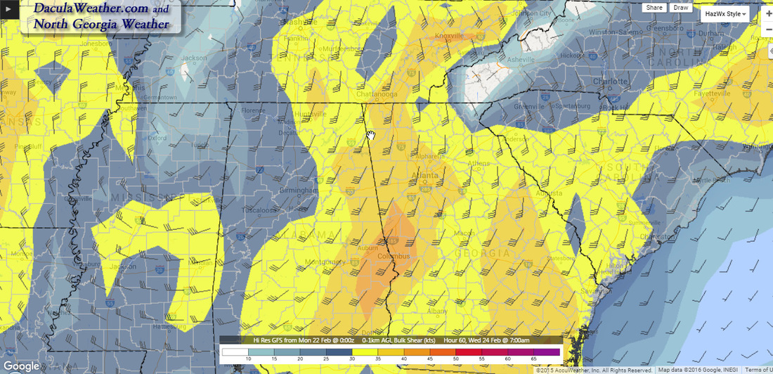
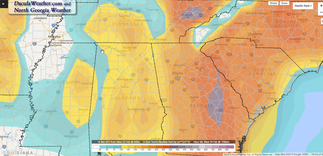
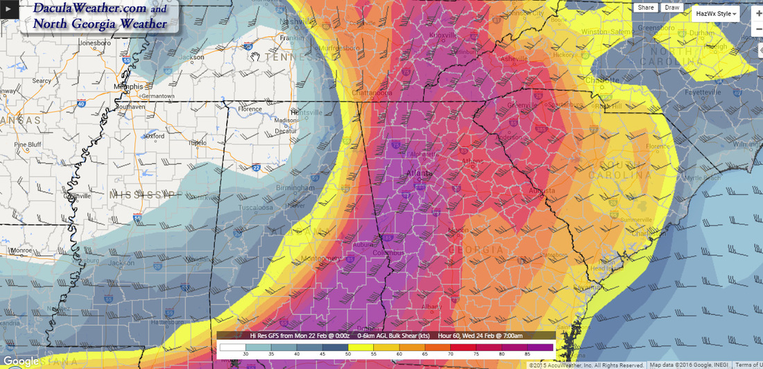
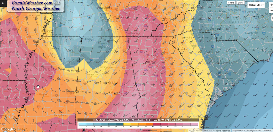
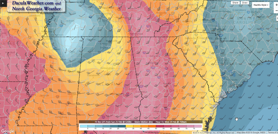
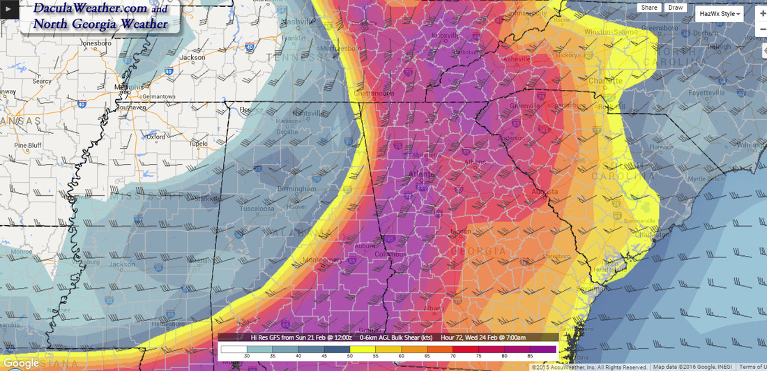
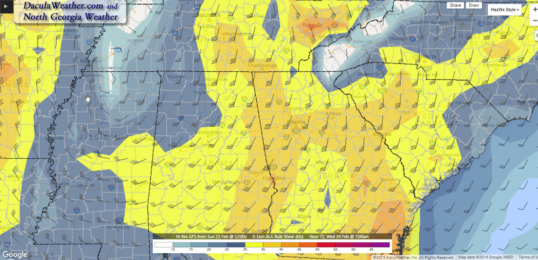
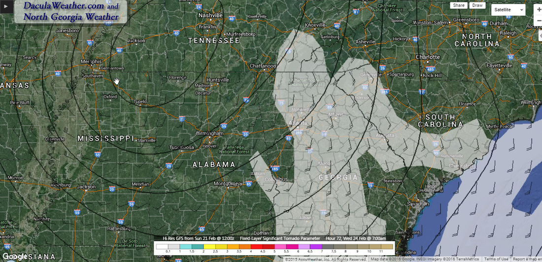
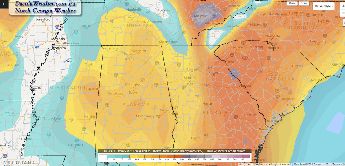
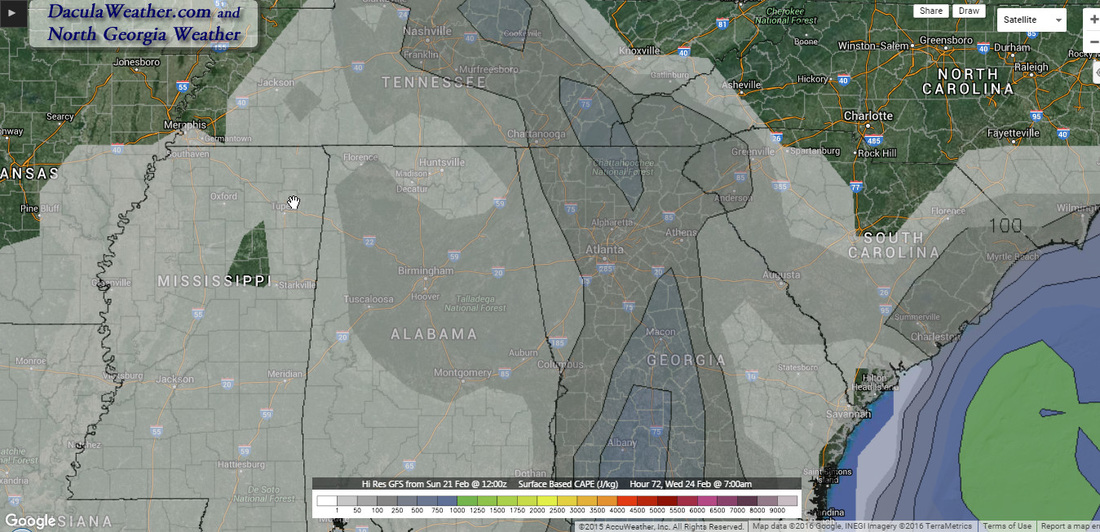
 It will be very important for everyone to pay close attention to the weather beginning late Tuesday into Wednesday morning for the potential for severe weather over north and central Georgia. First, here is the Atlanta National Weather Service office in their morning AFD: THIS SECOND WAVE OF CONVECTION WILL WARRANT MUCH CONCERN AS THE STRONG UPPER LOW OVER TX KICKS EAST AND INTERACTS WITH INCREASING AREA OF INSTABILITY AND DEEP LAYER SHEAR TO SUPPORT STRONG TO POSSIBLY SEVERE STORM DEVELOPMENT. THIS HAS PROMPTED SPC TO PLACE MUCH OF THE FORECAST AREA IN A MARGINAL RISK FOR SEVERE STORMS AND A SLIGHT RISK AREA ALONG AND WEST OF A CARROLLTON TO THOMASTON TO AMERICUS LINE. AT THIS TIME... THIS THREAT APPEARS TO BE GREATEST FROM LATE TUESDAY EVENING THROUGH WEDNESDAY MORNING... BUT STAY TUNED AS THIS COULD CHANGE. And here is more from the Storm Prediction Center in their Day 2 Severe Weather Outlook AN INTENSE MID-LEVEL SHORTWAVE TROUGH WILL TRACK EASTWARD FROM TX ACROSS THE GULF COAST REGION ON TUESDAY. A 100+ KT MIDLEVEL JET STREAK WILL OVERSPREAD THE NORTHERN GULF COAST AND PIVOT NORTHEAST INTO CENTRAL AL/WESTERN GA BY WEDNESDAY MORNING. As you can see from the images below, it appears that we will eventually fall into the Slight Risk category and i wouldn't be surprised to see our area elevated to Enhanced possibly later today. Also, VERY heavy rain coming in over the next three days, with almost 3-4" expected over a large area of north Georgia.  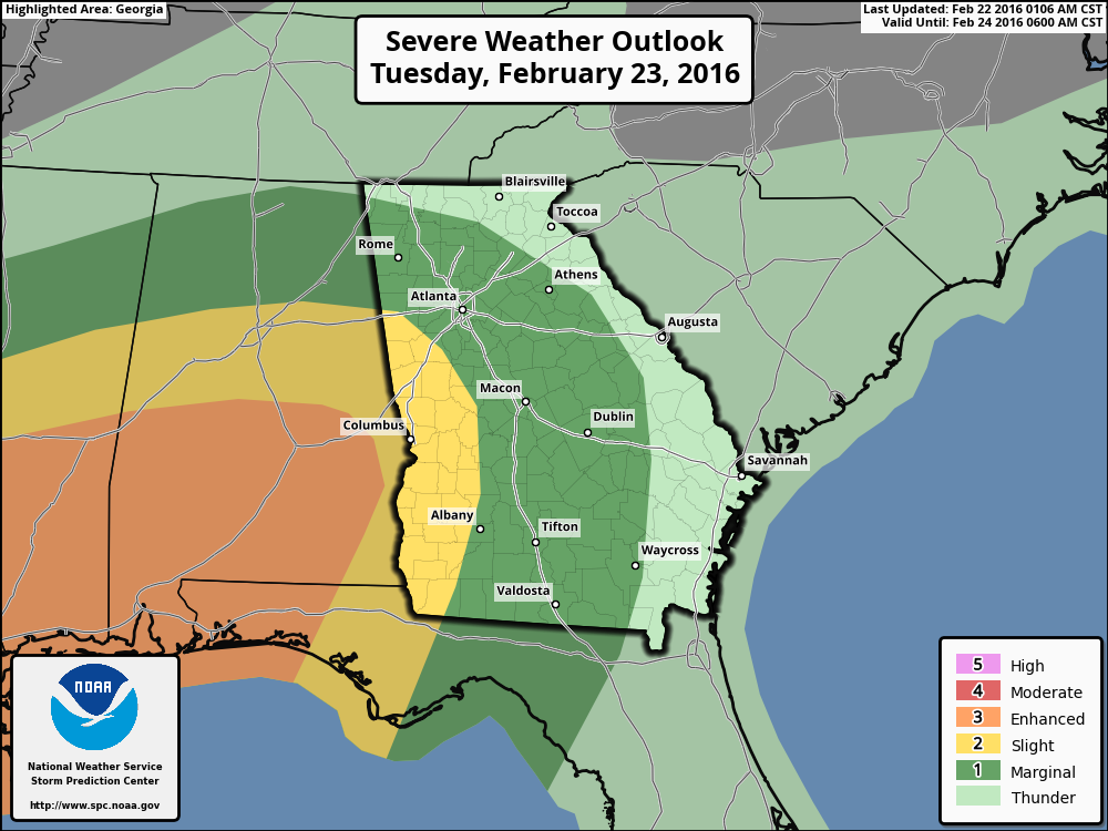  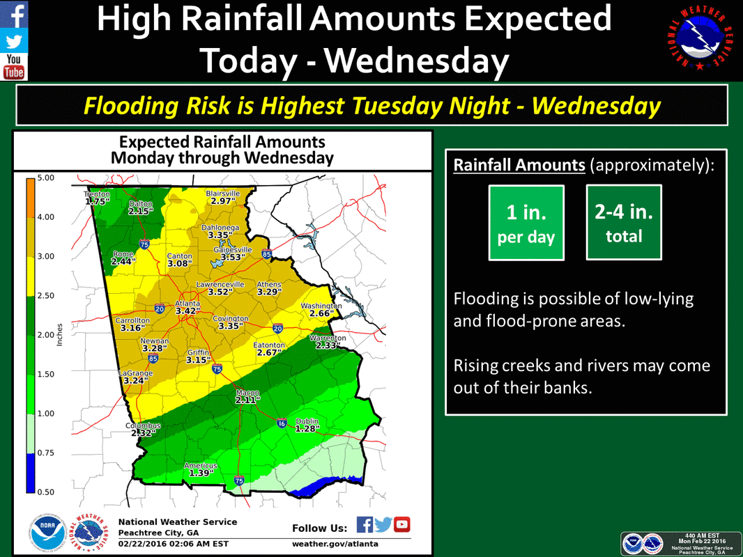
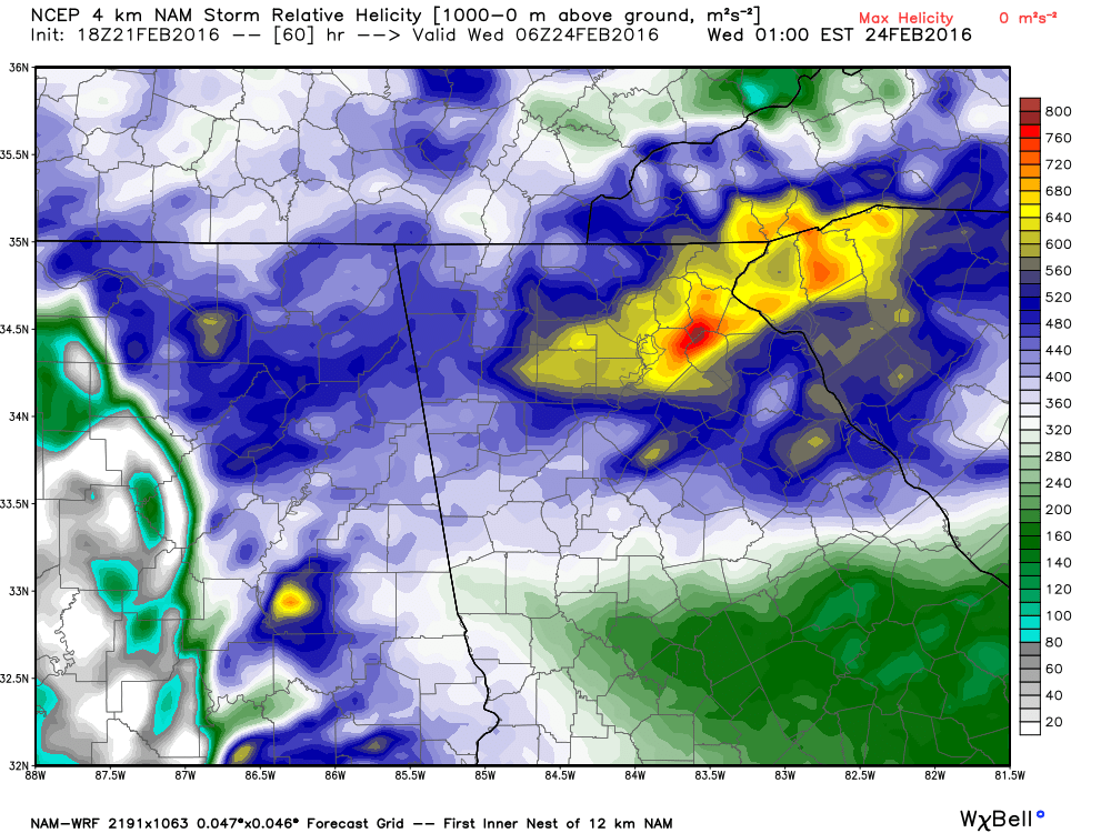
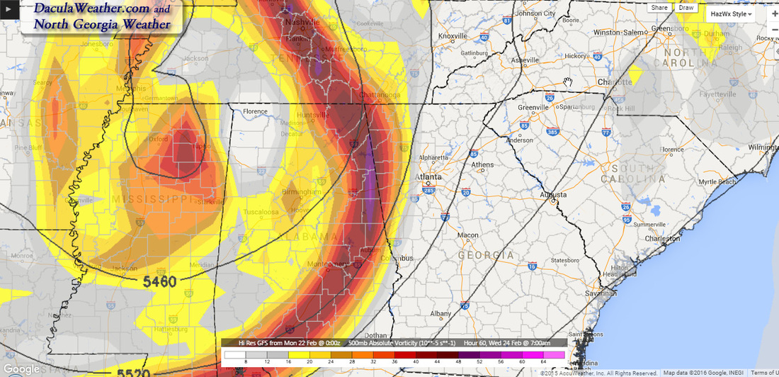 500 mb Vorticity 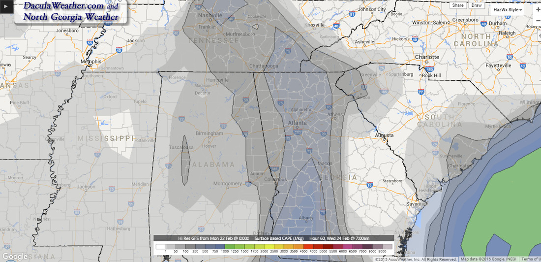 Surface Based CAPE - While not very strong, still enough CAPE to interact with very high shear for severe potential. Luckily it will be coming through in the early morning hours... it it were afternoon with some daytime heating, this might be a bad day for a lot of people. The GFS/NAM are still showing a high shear/low CAPE event. I want to update you with some severe parameter maps for 7 AM Tuesday morning, and what those mean in terms of severe weather. More on this later.
 |
Archives
March 2019
Categories
All
|
OLD NORTH GA WX BLOG


 RSS Feed
|
Never base important decisions on this or any weather information obtained from the Internet. Always have a backup method of receiving weather information such as a battery powered weather radio.
Copyright © 2018 NorthGeorgiaWX.com and DaculaWeather.com 
|