|
It would be hard to ask for better summer time weather over what we've already had so far, but the upcoming week might be about as nice as it gets around north Georgia. I'll quote the Sunday morning AFD from the Atlanta NWS office: THE MAIN WEATHER STORY IS A MUCH ADVERTISED COLD FRONT THAT PUSHES INTO NORTH GA BETWEEN 5-7 AM MONDAY MORNING... ACROSS THE ATLANTA METRO AREA BETWEEN NOON AND 2 PM MONDAY AFTERNOON... THEN TO NEAR A COLUMBUS TO MACON LINE BETWEEN 4-6 PM MONDAY It doesn't appear that north Georgia will get very much precipitation out of the frontal passage. Since the front will be passing in the early morning hours, we just won't have the heat of the day to aid in thunderstorm development. The worst of the weather should occur further to our south later in the day on Monday. 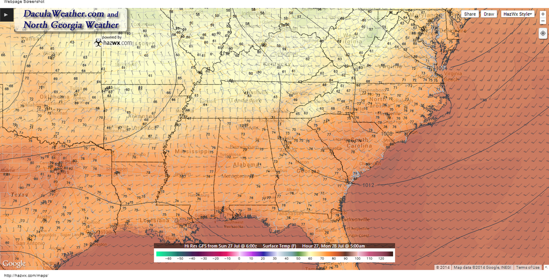 Temperatures 5 AM Monday - Big difference between 5 AM temperatures on Monday (this image) compared to the 5 AM temperatures on Tuesday (image below this one), almost a 15 degree drop. 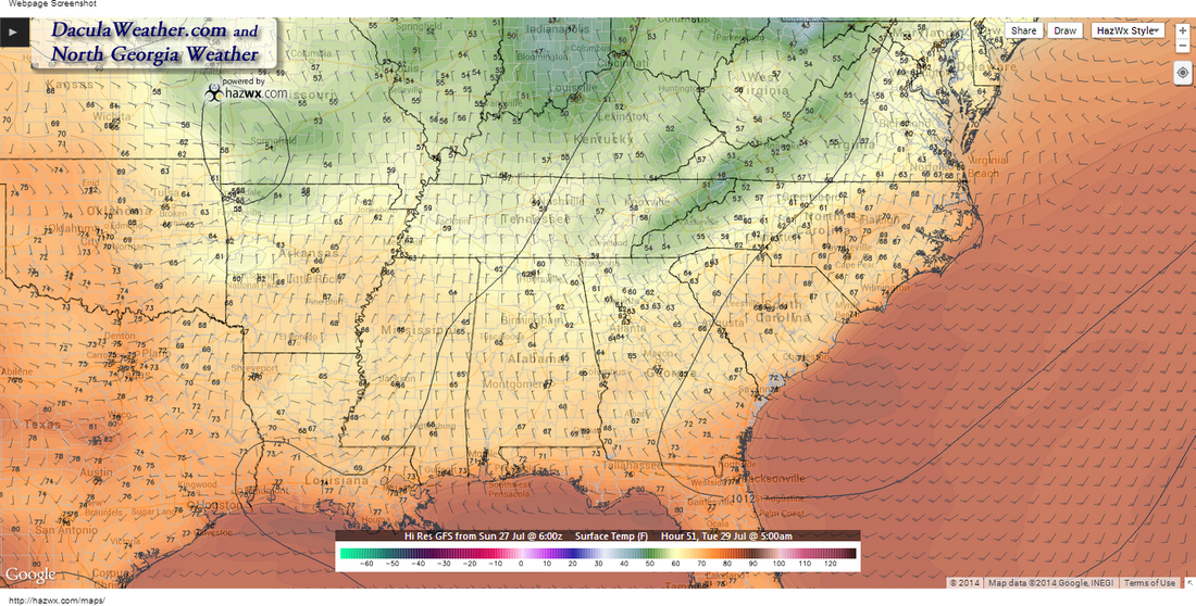 Temperatures at 5 AM Tuesday 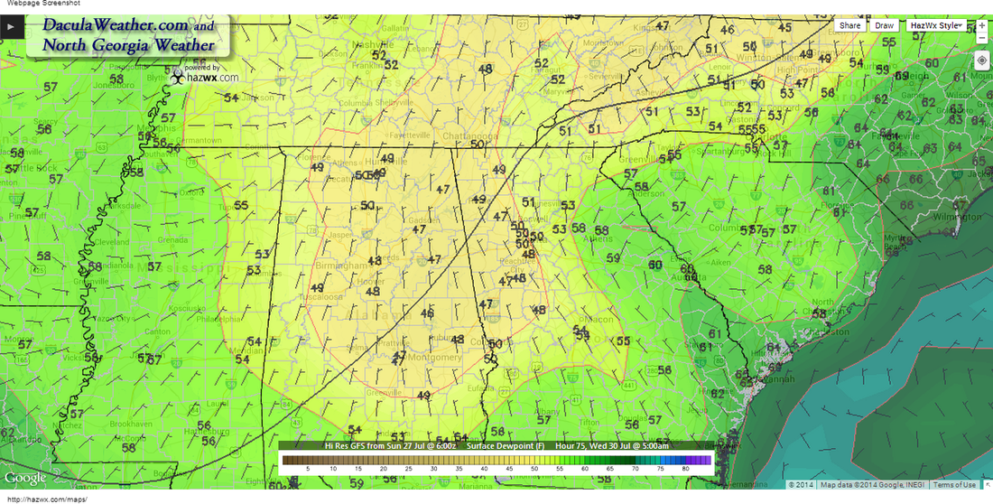 Dew Point - Wednesday July 30th, 5 AM
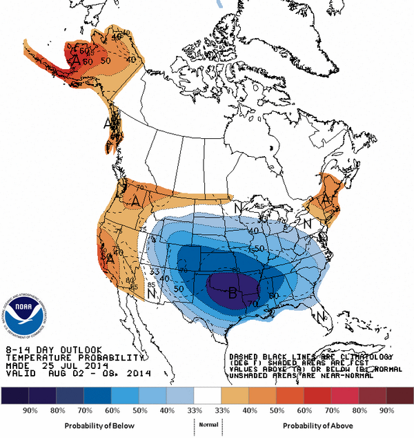
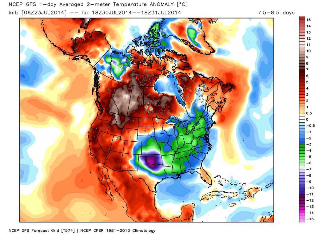
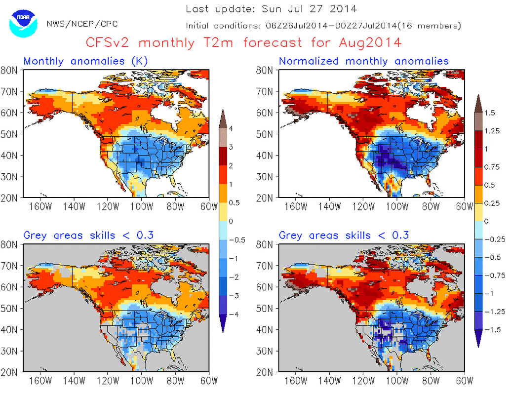
It looks like we're going to be in for a wet work week for the next to last week in July. This time of year is when our hottest temperatures occur, and our average high through the end of the month is 88 F degrees. We started the month out slightly on the warm side, but since July 14th, temperatures have taken a tumble as shown here in this graph. 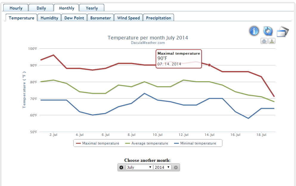 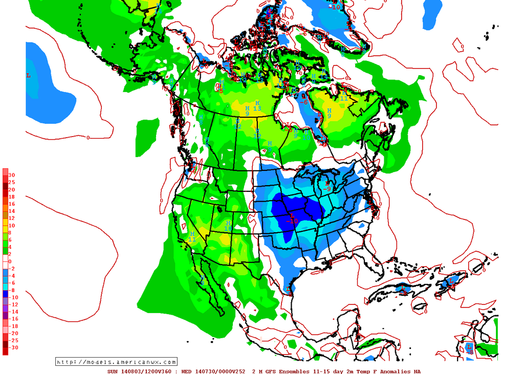 Image from meteorologist Allan Hoffman http://models.americanwx.com Image from meteorologist Allan Hoffman http://models.americanwx.com The good news is that the forecast for the end of July into August is more of the same for us. More rounds of cooler temperatures are forecasted to bring the eastern half of the country below normal temperatures as well as above normal rainfall. 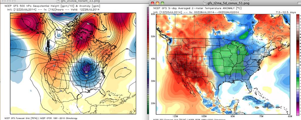 From Joe Bastardi and Weatherbell Upcoming WeekThe eastern part of the country will be stuck under a persistent upper level trough through at least the end of the week, and the result will be daily showers and thunderstorms and a considerable amount of cloudiness. The NAM and GFS are forecasting a cutoff upper level low to form over west Georgia Monday and Tuesday and pump moisture off the Gulf and Atlantic into the north Georgia area, bringing a chance of showers and thunderstorms through at least Thursday, before a front pushes southeast and brings more chances of rain. 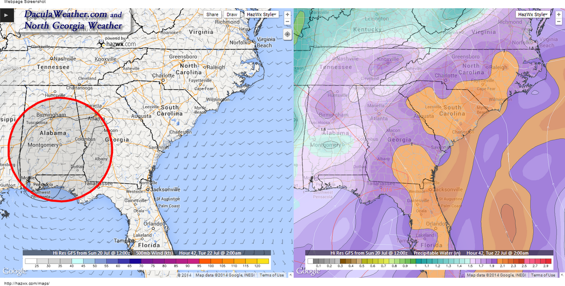
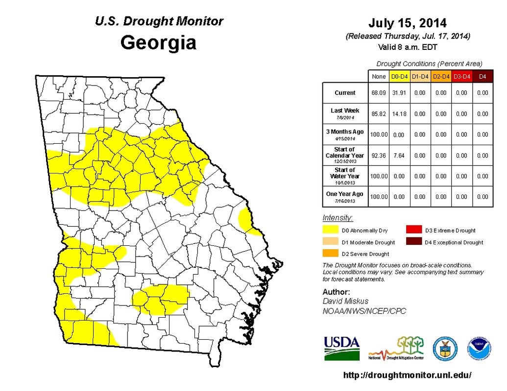
This map was generated based on July 15th conditions and we were a little dry then. But that has since been reversed and when the new maps come out I expect to see normal conditions over much of north Georgia. You can find all of the drought maps here at http://www.daculaweather.com/4_drought_state.php Rainfall amounts over the next 7 days aren't excessive, but may vary widely. If you happen to get caught under one of these thunderstorms you may see several inches over a short period of time, so localized flash flooding is possible with such high precipitable water values. 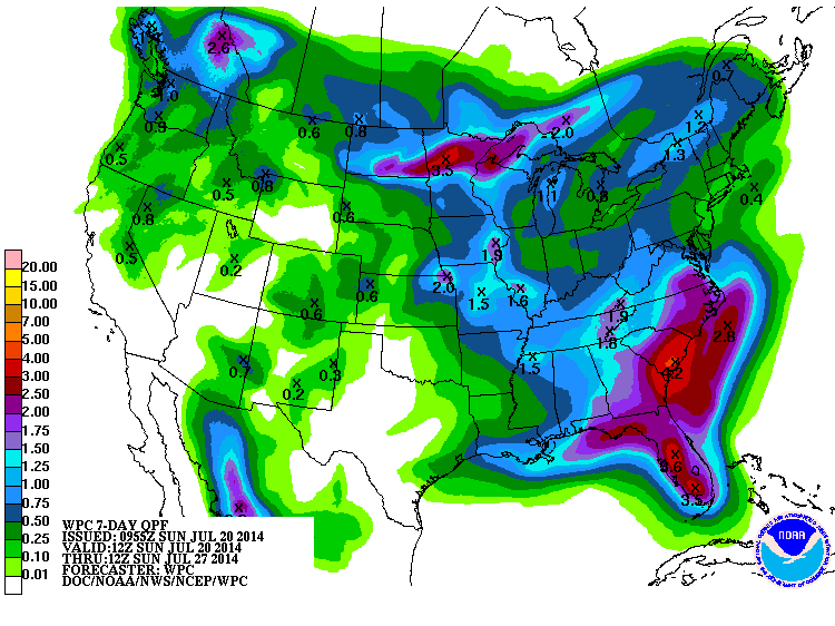 So here's the general forecast for most of the week, chances of rain each day will keep you guessing! Metro Atlanta Forecast: http://www.daculaweather.com/4_forecast_metro_atlanta.php Georgia Forecast: http://www.daculaweather.com/4_forecast_ga.php There are many other forecast available for other areas of the country, please visit http://www.daculaweather.com/ for more information. 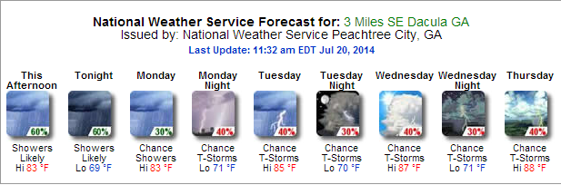 Great Smoky Mountains National Park Weather PageLast but not least, I've created a new weather page just for the weather in and around the Great Smoky Mountains National Park. I could never find all the things I wanted to see in one location, so I've tried to bring this together all on one or two pages. I'll be tweaking the page as time goes on so if you have any suggestions on something to see, please let me know. http://www.daculaweather.com/4_park_gsmnp.php 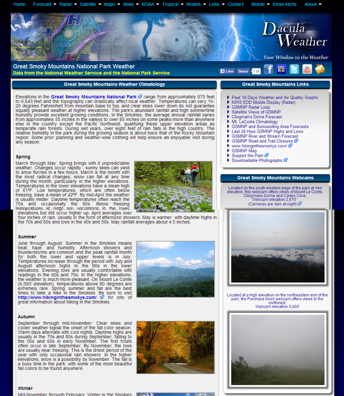 |
Archives
March 2019
Categories
All
|
OLD NORTH GA WX BLOG
 RSS Feed
|
Never base important decisions on this or any weather information obtained from the Internet. Always have a backup method of receiving weather information such as a battery powered weather radio.
Copyright © 2018 NorthGeorgiaWX.com and DaculaWeather.com 
|