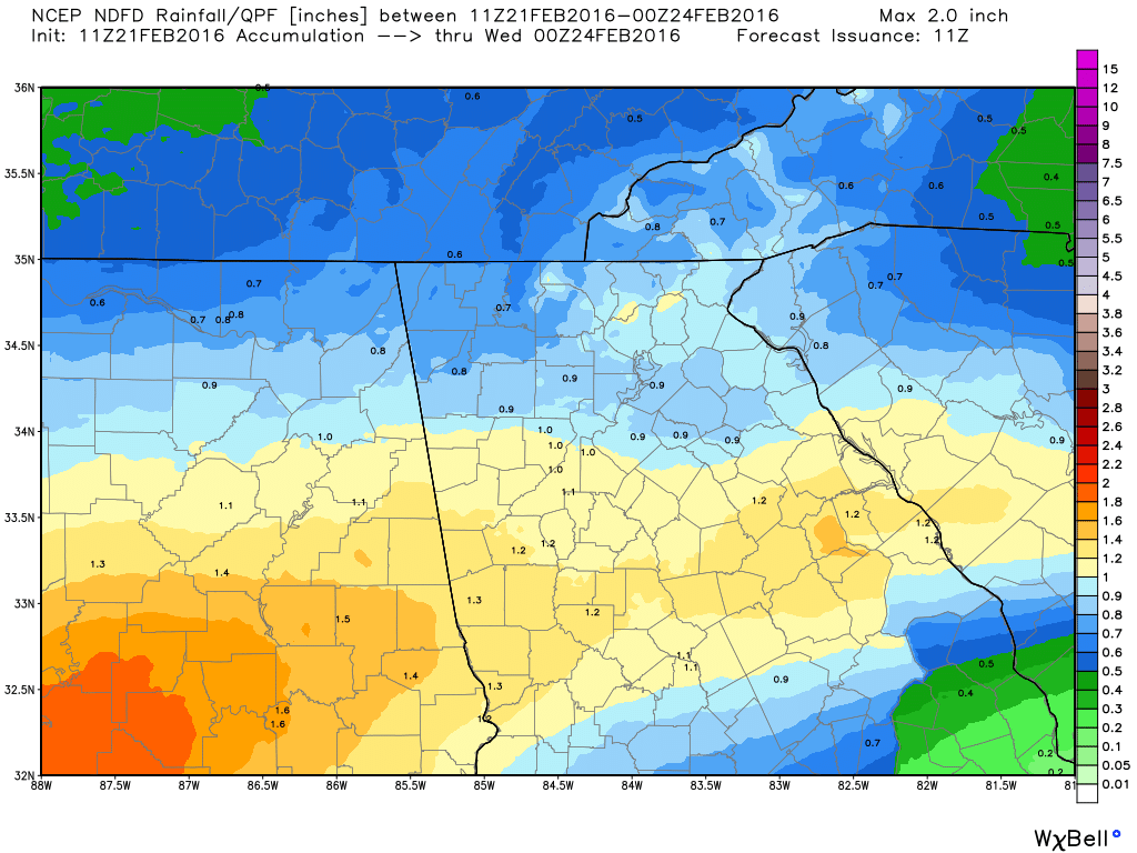
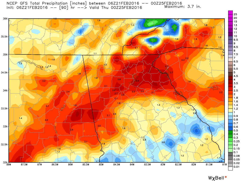
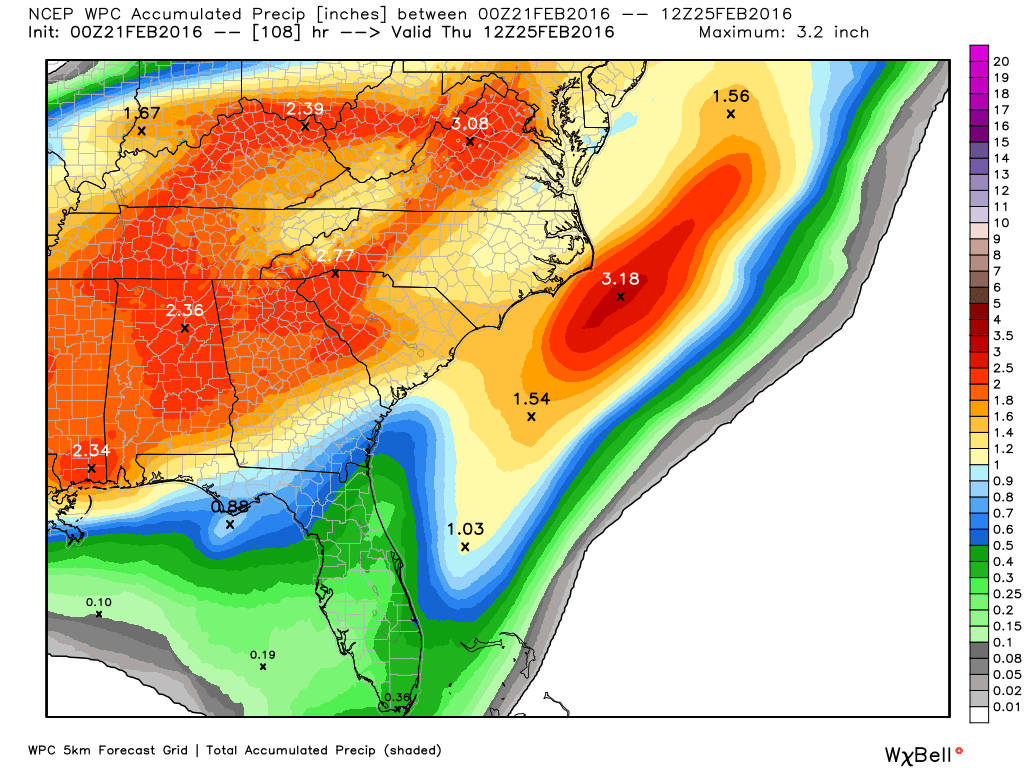
I think of songs like this on days like this, and any day it rains for that matter. And rain is what we've going to have... and for some, a cold rain before thunderstorms. To start, here's the latest from the NWS: "Gloomy short term in store for the state as a frontal boundary sinks into Georgia and a series of upper level disturbances supply ample moisture to the area... keeping the forecast looking cloudy and rainy." And rainy it will be, but it all depends on who you believe, I have the NDFD, GFS, and WPC ( in that order) rainfall maps, and the Euro is showing 2-3" across all of north Georgia through late Wednesday.
Temps will remain warm except for those people that reside in the CAD areas, as Tuesday brings the formation of a wedge back toward the metro area. Temperatures in the wedge will remain above freezing but will be 15-20º colder than the surrounding locations outside of the CAD. 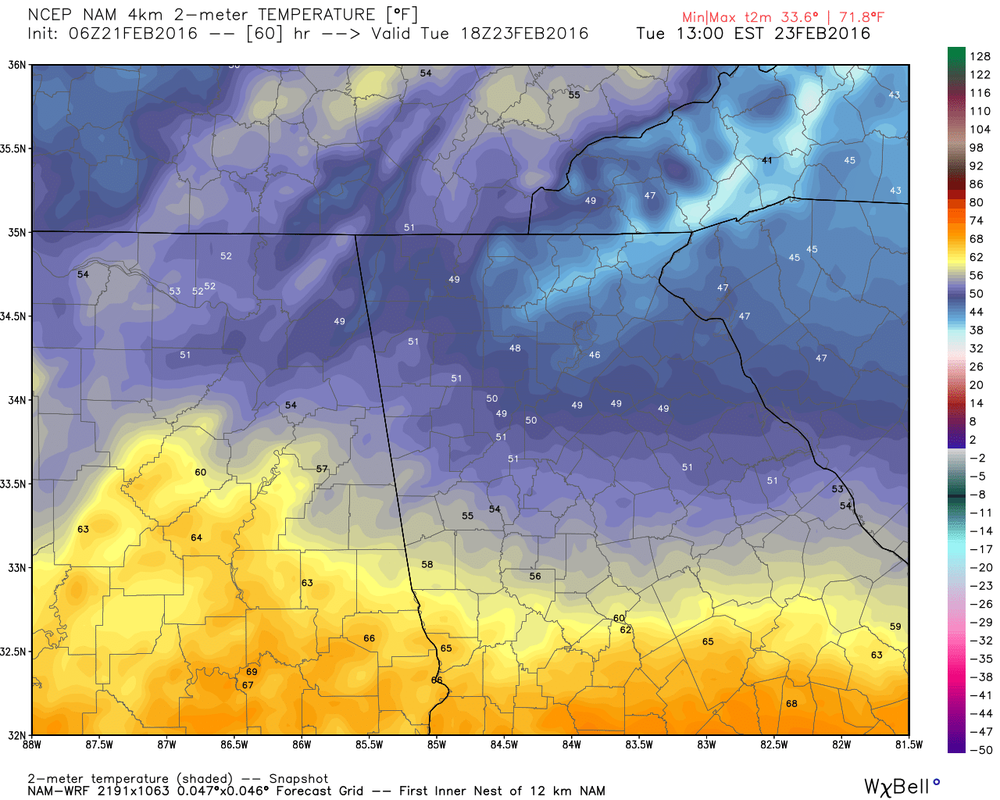 Severe parameters are pretty high for late Tuesday, and right now looks like a high shear/low CAPE environment., and in situations like these, you can see quick spin-up short lived tornadoes. We'll need to watch this as we get closer to the time. 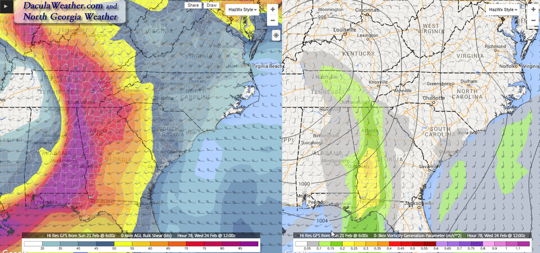 Shear on the left and CAPE on the right. 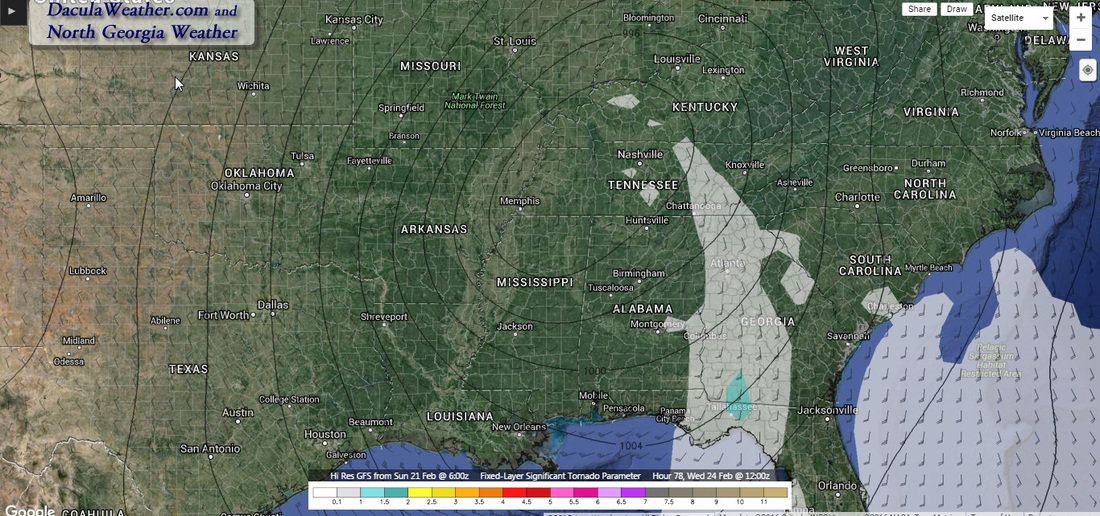 Fixed Layer Significant Tornado Parameter (STP) - As you can see, this is low but not non-existent. Who doesn't have one? Weather apps are everywhere and everyone believes them, so they must be good right? I would say don't get me started about weather apps but I guess that's too late now. :-) I use more than one weather app, because none of them do everything, but some of them do certain things very well. It really comes down to your needs and how much you actually follow the weather. So I thought I would share the apps I use on my phone and tablet, and the reasons why. Hopefully this will help you make a more informed decision about what you might want to use for your own personal weather information. I have seen some of the forecast that comes from some apps and in many cases, I wouldn't show those to anyone. You want a forecast that has been touched by human hands, not one that a computer model spits out verbatim. Radar
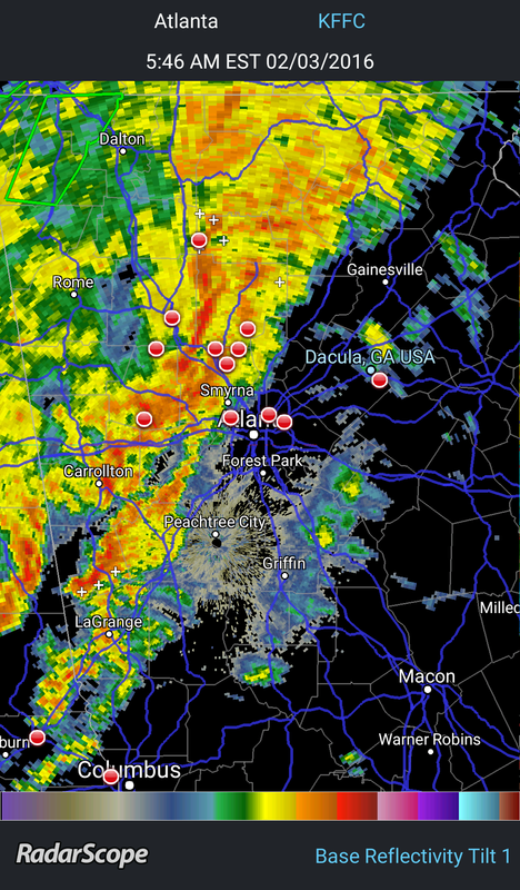
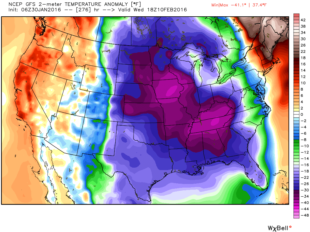
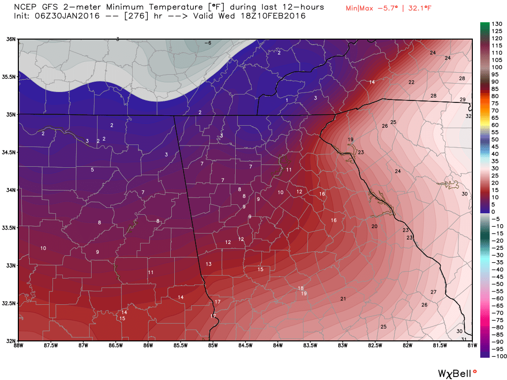
RadarScope is a specialized display utility for weather enthusiasts and meteorologists that allows you to view NEXRAD Level 3 radar data and severe weather warnings. It can display the latest reflectivity, velocity, and other radar products from any NEXRAD radar site in the United States, Guam, Puerto Rico, as well as Canada.These aren't smoothed PNG or GIF images, this is real Level 3 radar data rendered in its original radial format for a high level of detail. For those National Weather Service radar sites which have been upgraded with dual-polarization technology, RadarScope displays most of those products as well. The only other App that most people need...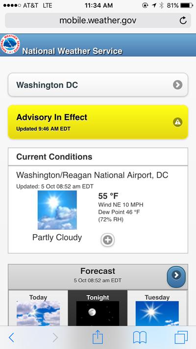 Weather apps that do it all are all over the place, and honestly, there are so many it's just not possible to try them all. What I use and recommend is the NWS Mobile app. If you need everything all bundled up in one package, this is it. The app will use the location of your device as the default starting page, the forecast is more accurate, and you have everything that most people need right at their fingertips. There are a lot more options available than what you see in this screenshot. This is not a true app, it's a webpage that functions like an app, so to add it to your device so that it behaves like an app requires just a couple of simple steps. The directions on how to get to the page and add it to your Apple or Android device can be found by clicking here. Other AppsI used another app called Storm Chasers Toolbox , but a few of the links are broken in it and you can't seem to get it anymore. I liked it because it was an easy way to get to the mobile version of the Storm Prediction Center Mesoanalysis maps. So I have added the Mesoanalysis page to my devices by going to the mobile page (click here), and then followed the same directions that I used to add the NWS mobile application to my device. (See the link for the directions above). 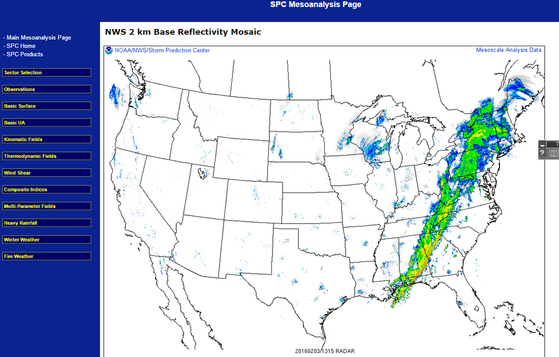 No offense to any media outlet, I'm sure some of their apps have some good points, but if you want accurate weather, straight from the source with no ads or gimmicks, the apps above are all you need. I started looking at the computer models this morning, and I usually look at the GFS first since it appears first in the list of modes on the WeatherBELL site. I got out to around day 10-11 and and my jaw hit the floor. The GFS was bringing the whole arctic into the US. The images are explained below, but what the GFS is showing are temperatures 40-50 degrees below normal. Lows in north Georgia would be in the single digits if not lower, and highs would struggle to get above 20. But.... there is a possibility of a big storm during that period. THIS is the storm and period we can't afford to miss out on, so we'll wait and see if the low takes a more southern track. There is a lot of time for this pattern to evolve but it appears to be a prime period for winter weather. Just a reminder that these images are not a forecast, but one model run from one model. But we are certainly headed the correct direction for winter weather.
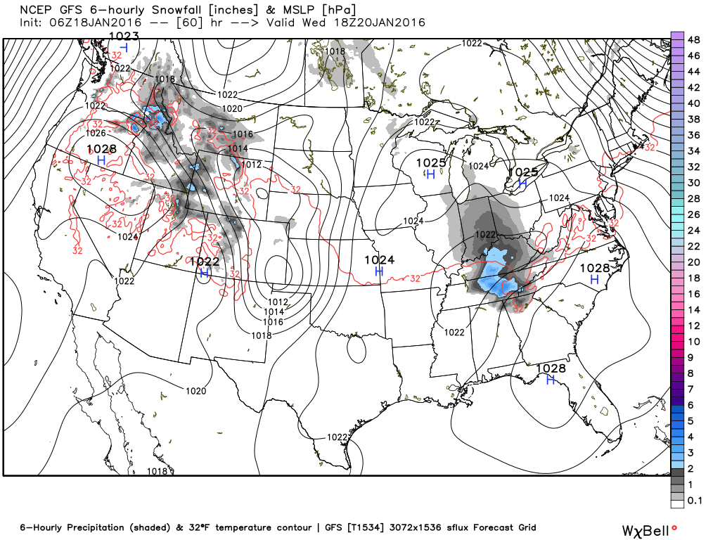
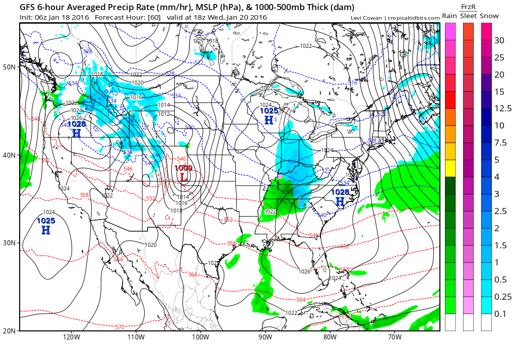
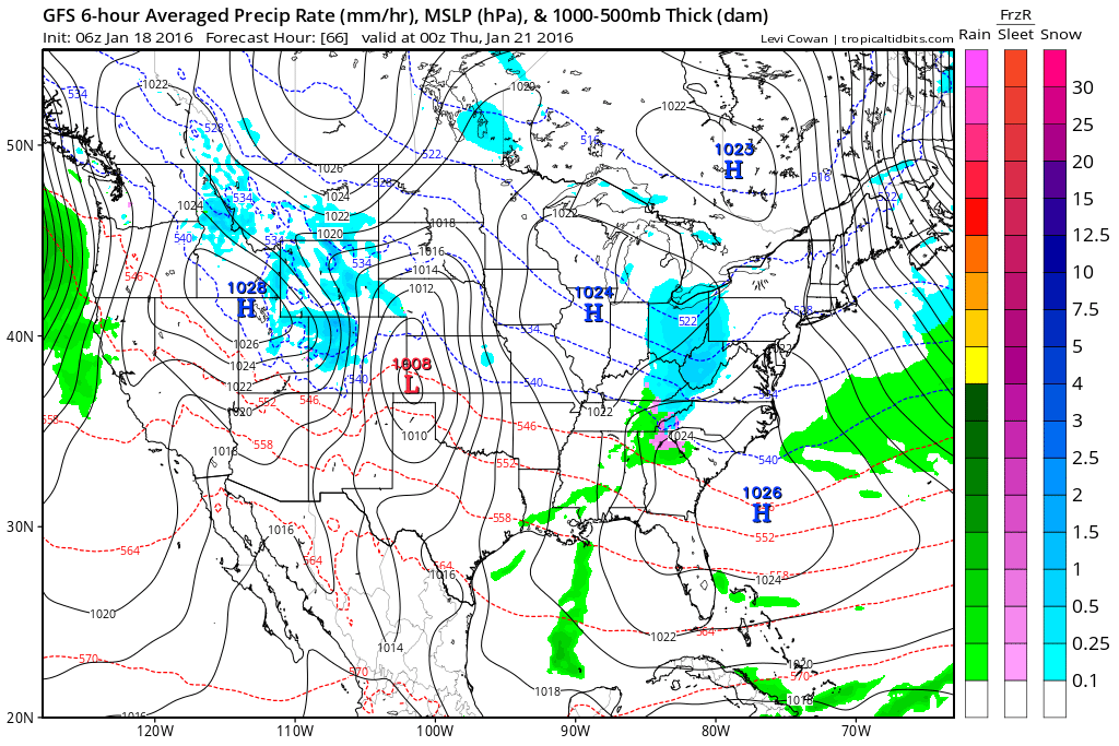
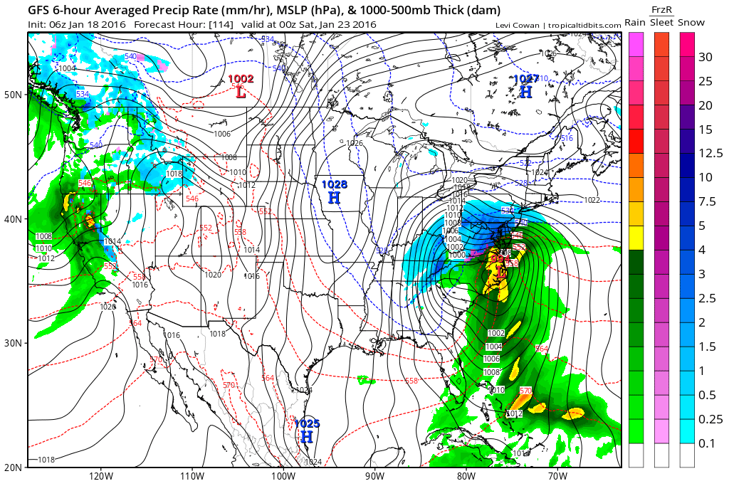
**** SNOW WISHCAST **** OK...I'm going to do something I don't like to do, but just so no one gets too discouraged after reading my message this morning... THIS IS NOT A FORECAST, THIS MAY NOT HAPPEN AT ALL, AND IT WILL MOST LIKELY NOT HAPPEN LIKE YOU SEE IT HERE. Do not go tell people I said it was going to do what these maps say. Do we have a deal? :-) This is the GFS on Wednesday. They simply show we're close. The image on the right shows some potential for icing as the moisture departs, although temps should rise above freezing.
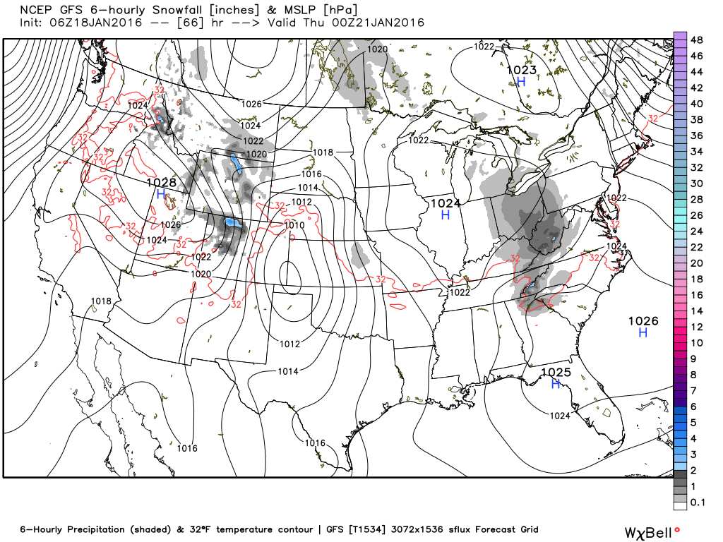
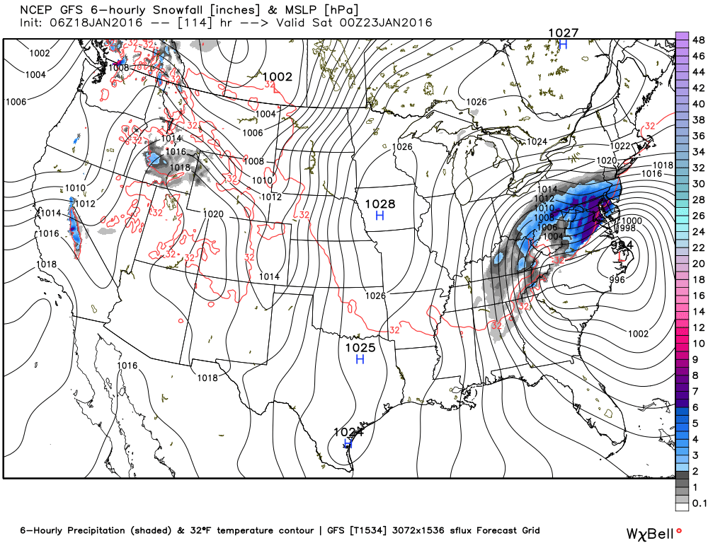
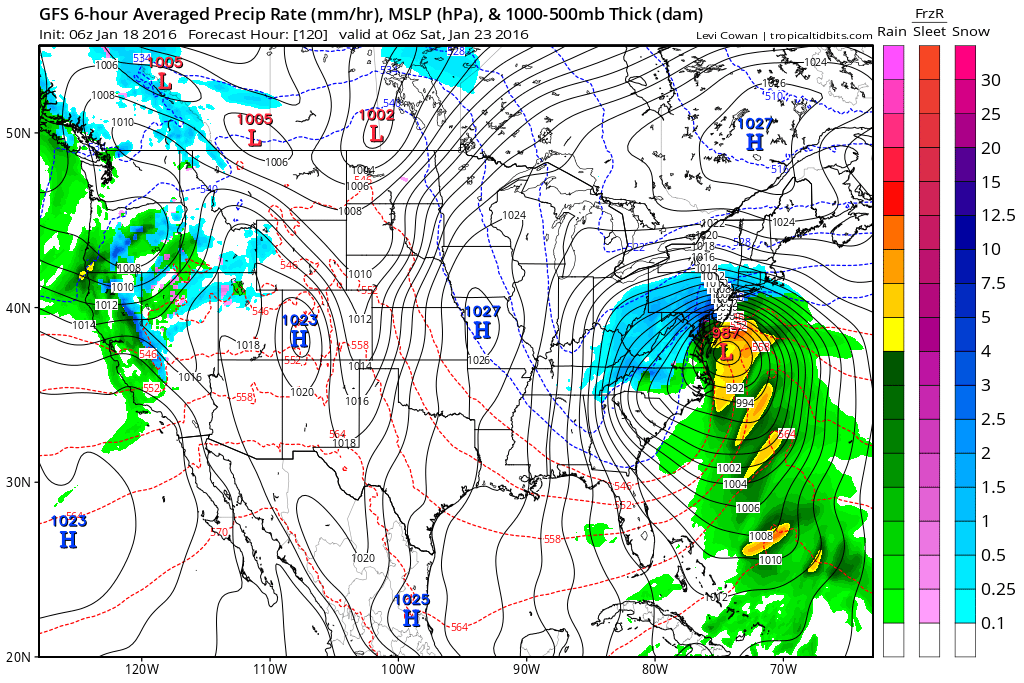
The next set of images are for Friday. you can see that our only hope in this scenario is that we get some wrap around moisture. This look is not usually good for us.
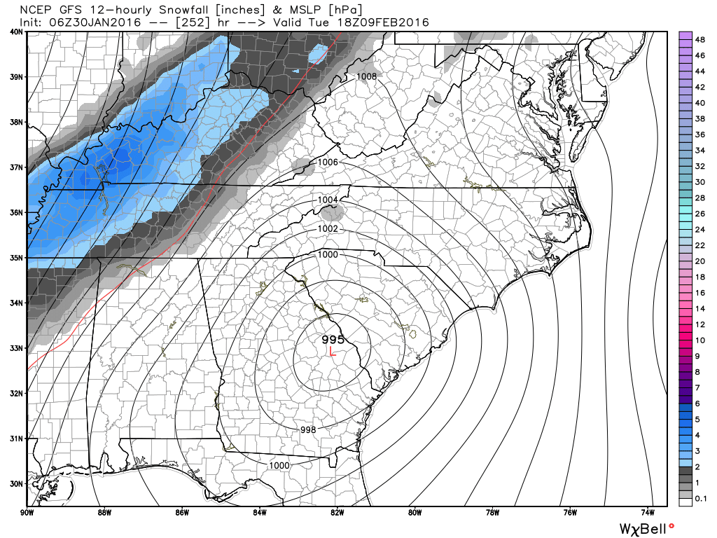
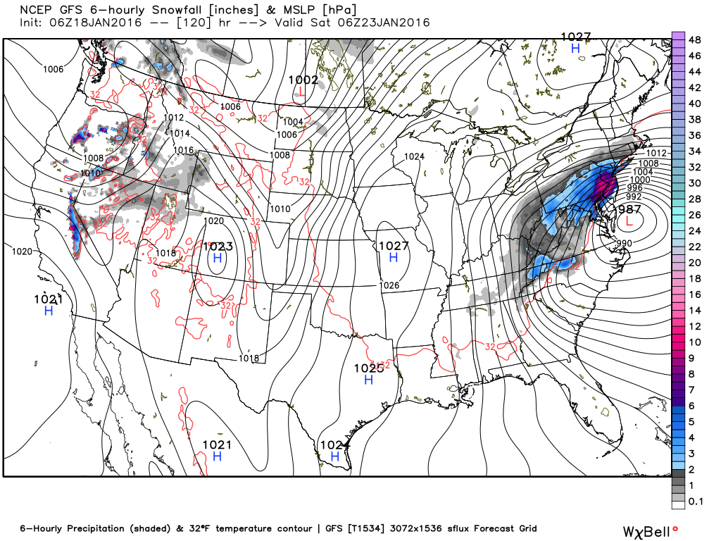
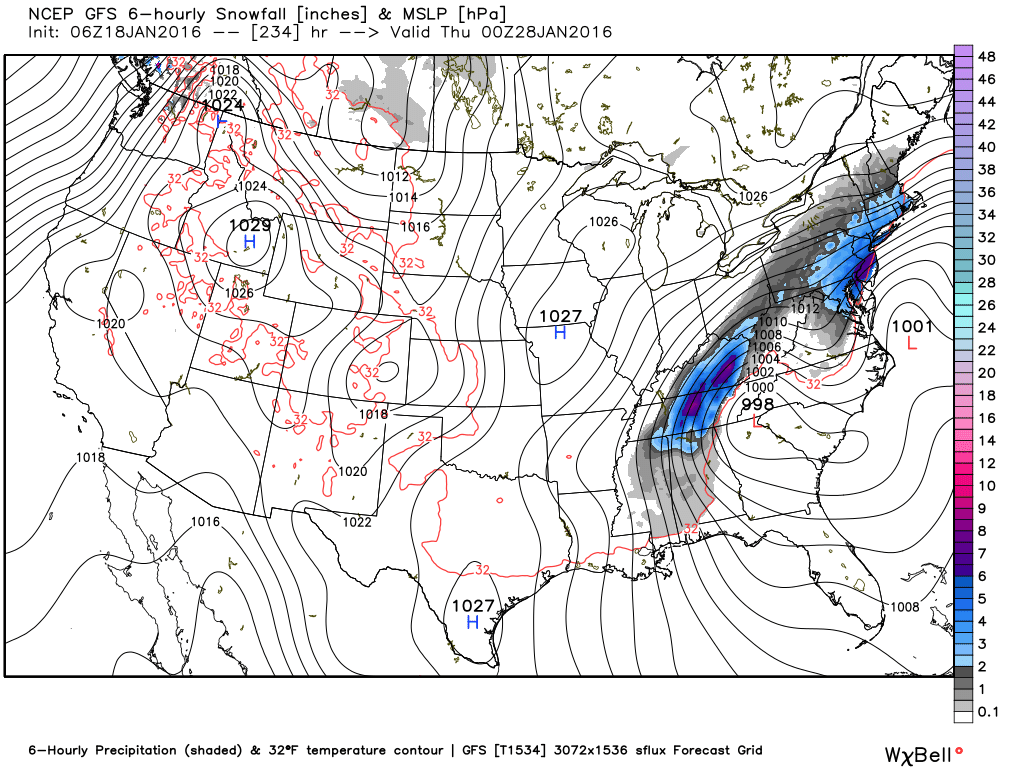
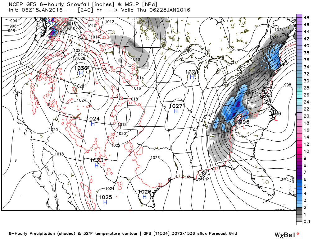
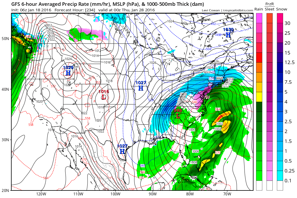
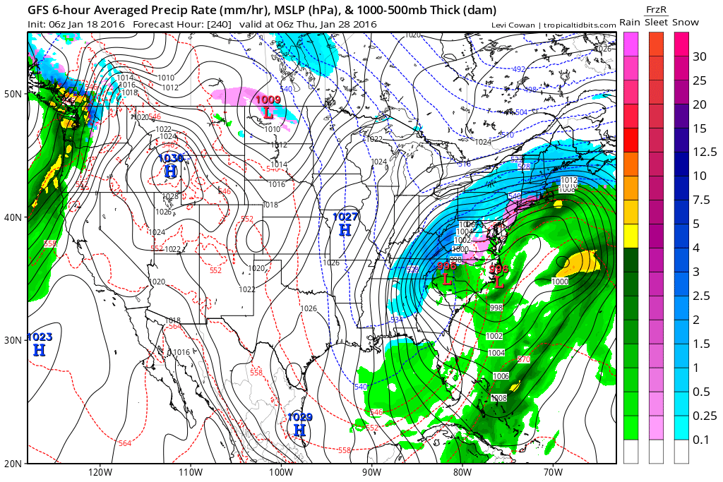
This system on the 28th is a big dog storm. Granted, for us at the moment these maps were produced, the low is too close, we would only get wrap around snow, but this is very much something to keep our eye on. And notice something else, notice how the track is further south than the system that we will see this Friday. As we go into February, those tracks should get even lower, and that's when we start to get excited. We get that track a little bit lower for this system and we might be looking at our first real winter storm. Drop that track down just a little further than that and it might just end up being a big winter storm. This is 10 days out, so I don't want to give any false hope to anyone, but we are heading into the prime time of our winter season, so there is certainly lots of reason to have hope. Images WeatherBELL and Tropicaltidbits
|
Archives
March 2019
Categories
All
|
OLD NORTH GA WX BLOG
 RSS Feed
|
Never base important decisions on this or any weather information obtained from the Internet. Always have a backup method of receiving weather information such as a battery powered weather radio.
Copyright © 2018 NorthGeorgiaWX.com and DaculaWeather.com 
|