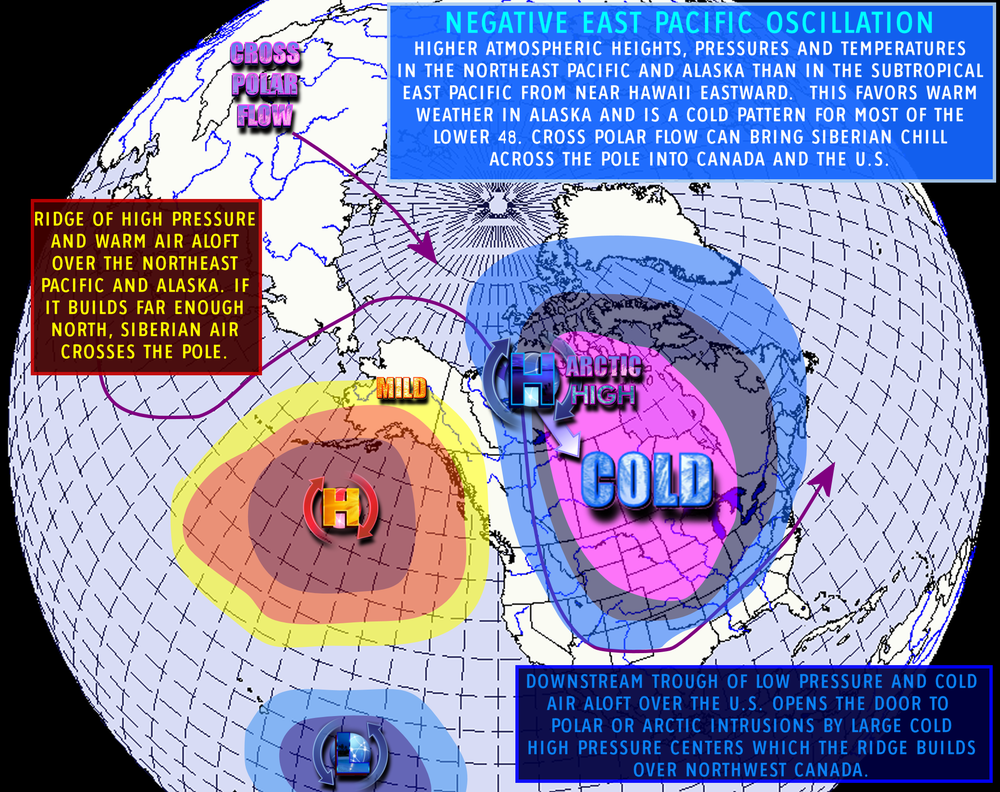
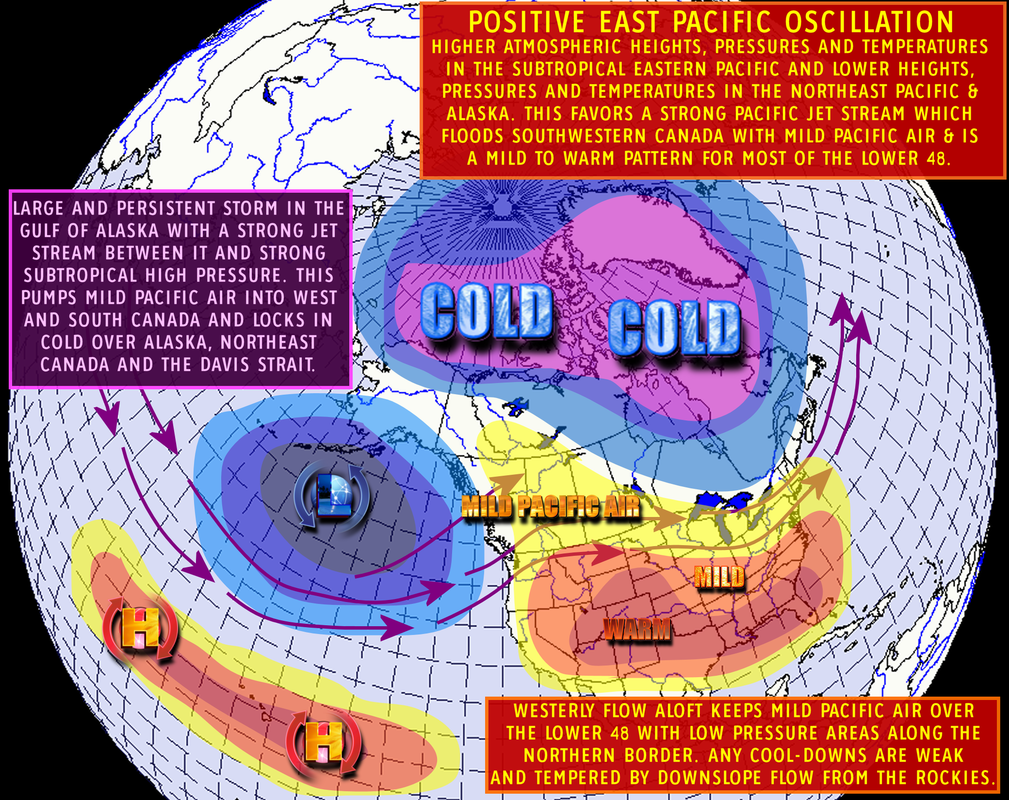
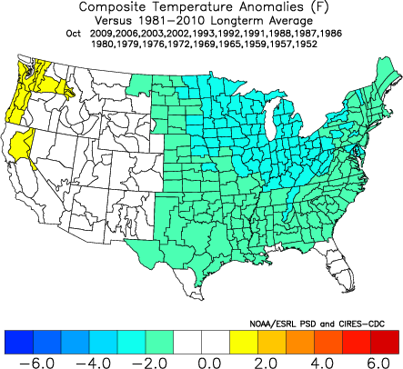
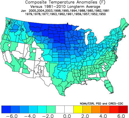
 I'd like to share some information that I read from Joe D'Aleo and Tom Downs yesterday, and from another Joe D'Aleo post this morning. The discussion was about the EPO or Eastern Pacific Oscillation. I'll have some other post in the next few days about some of the other important teleconnections that we'll be looking at this winter. Here's the definition of the EPO: "A dipole pattern similar to the NAO in the Atlantic, but located in the eastern Pacific. There is a tendency for heights/pressures/temperatures to be higher to the north and lower to the south in the negative phase and lower to the north and higher to the south in the positive phase. The negative phase corresponds to widespread cooling over central and eastern North America and the positive phase to warming. - Source: WeatherBell Analytics." This pattern will become very important during winter because the negative phase of the pattern opens the door to very cold Arctic and Siberian air into the US. Here's an image that depicts the negative phase of the EPO. Notice in this configuration how you have high pressure over low pressure off the west coast of the US. The next time you're looking at computer models, make a note of what the pressures are in the east Pacific, and especially look for this pattern this winter. The weather pattern in the positive phase of this teleconnection is just the opposite of the negative (of course!), and in this case, you have low pressure over high pressure which gives the central and eastern US a different outcome. To give you an example of how the EPO effects temperatures across the US, take a look at October and January temperatures when we have a negative EPO. Keep in mind several things about teleconnections:
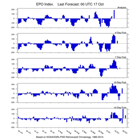
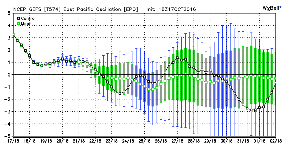
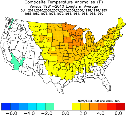
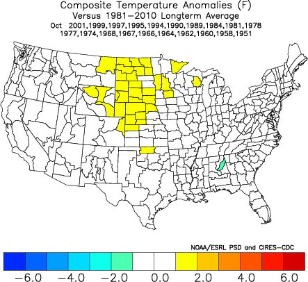
Lately we've been running a positive EPO with the big low pressure over the Gulf of Alaska. The models are depicting a possible change over the next several weeks to a more negative phase, and that would most likely mean cooler temperatures than what we've had recently. Here's a look at the GFS ensembles and what it thinks the EPO will do through the end of the month. The Euro is actually more bullish. All of the models have been flipping around from run to run on this, and often that is a sign that a pattern change is in the air. Notice that the EPO has been running positive lately and also notice that our temperatures have been above normal. The maps below show how October temperatures respond with a positive, neutral, and negative EPO. Again, the EPO isn't the only teleconnection responsible, but you can start to see how they do influence the weather. The three maps below are from Madweather.com |
Archives
March 2019
Categories
All
|
OLD NORTH GA WX BLOG

 RSS Feed
