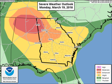
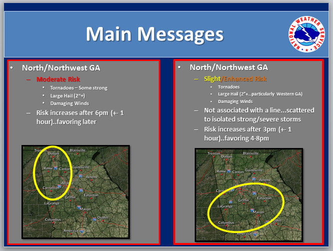
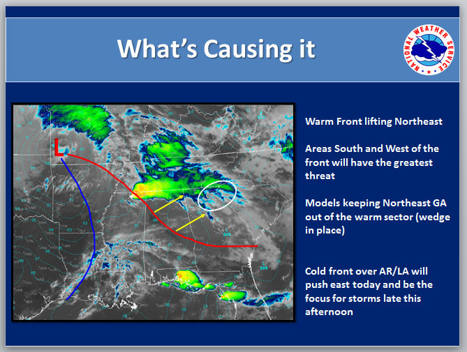
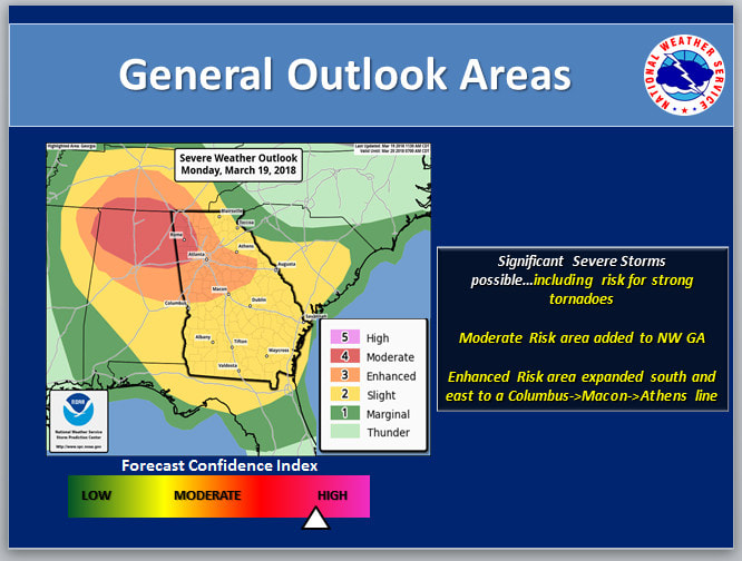
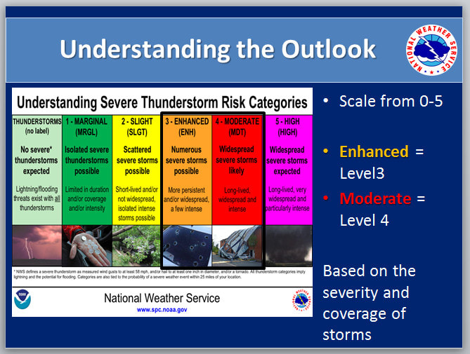
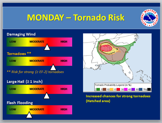
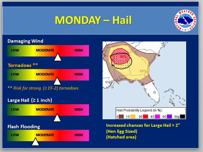
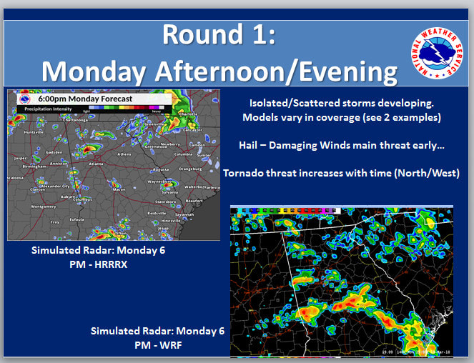
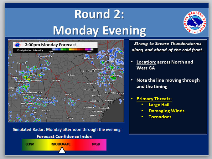
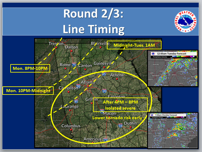
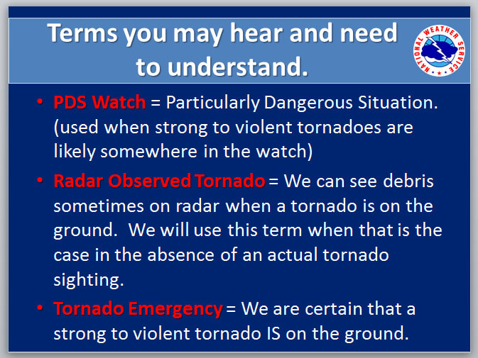
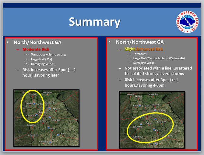
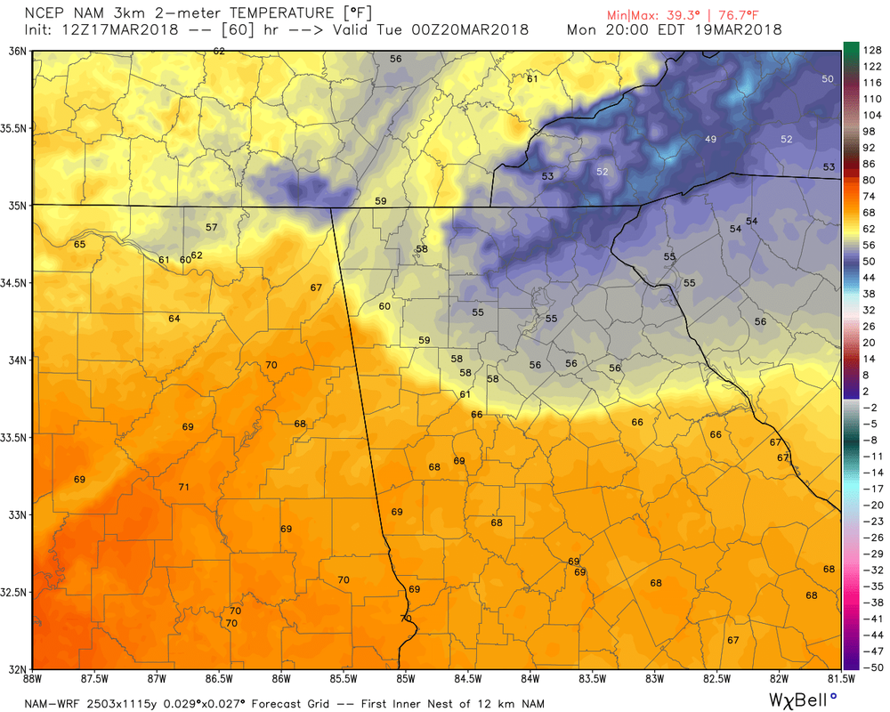
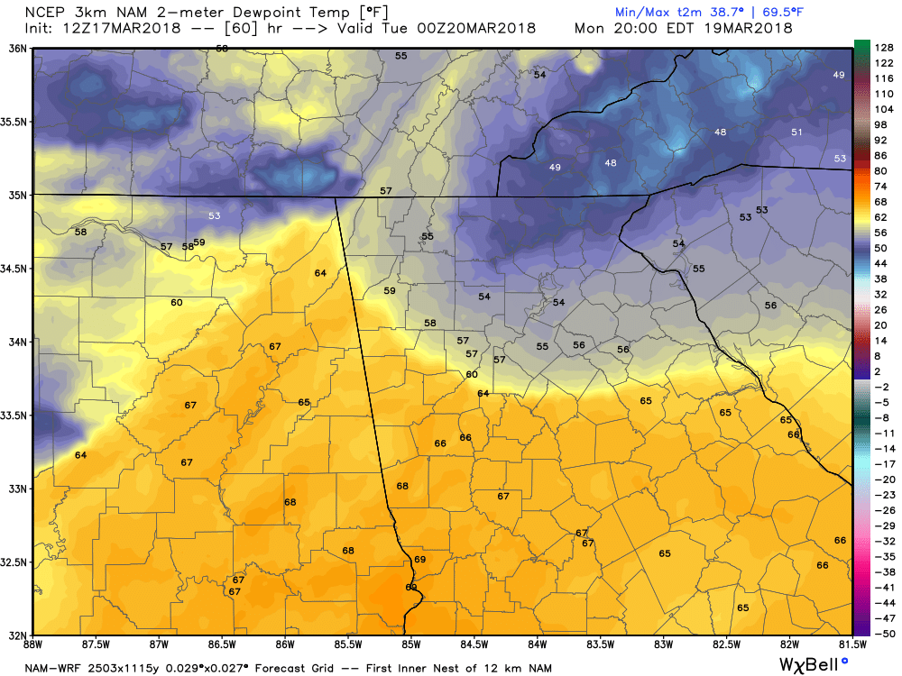
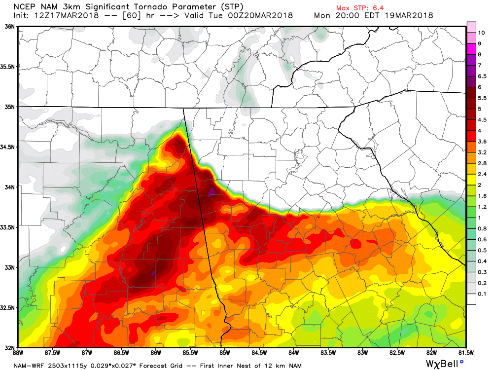
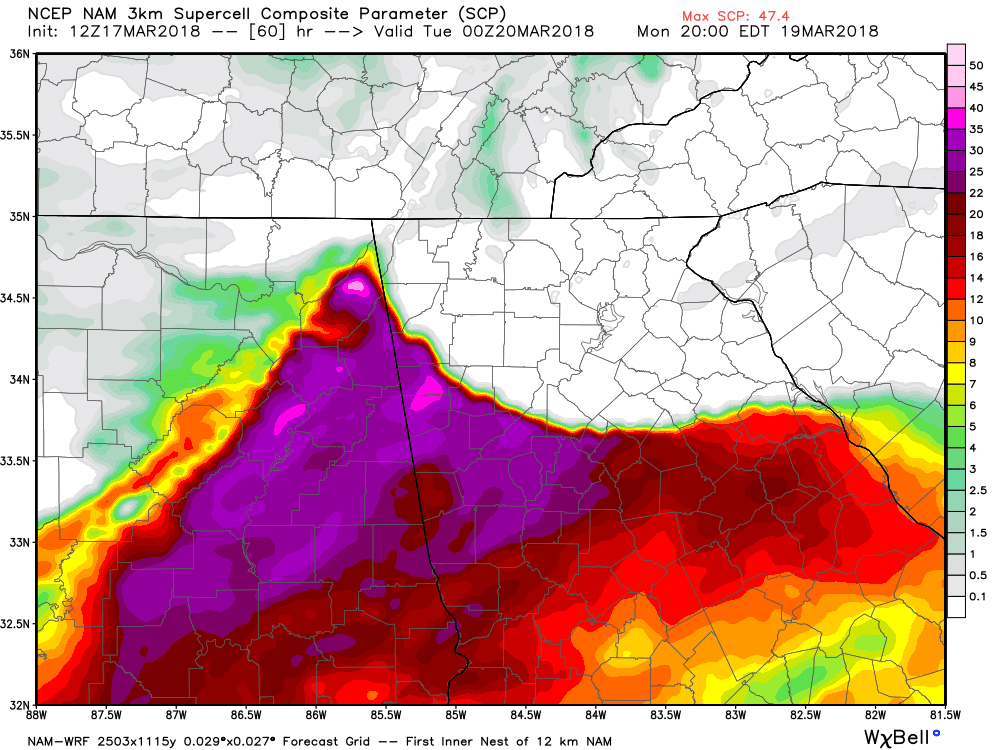
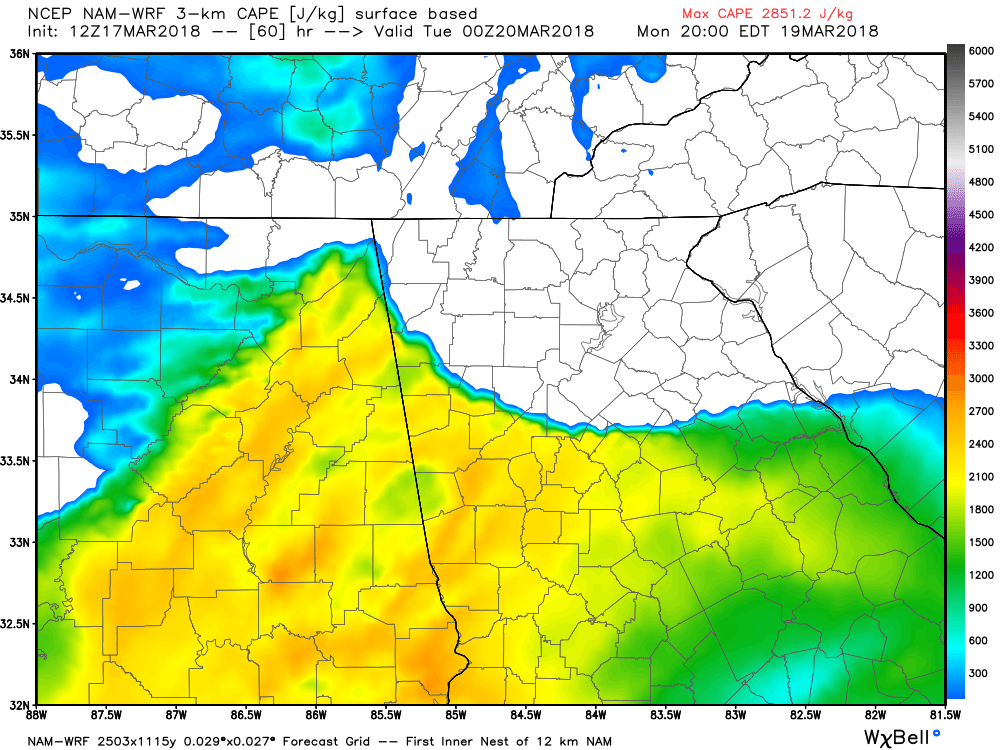
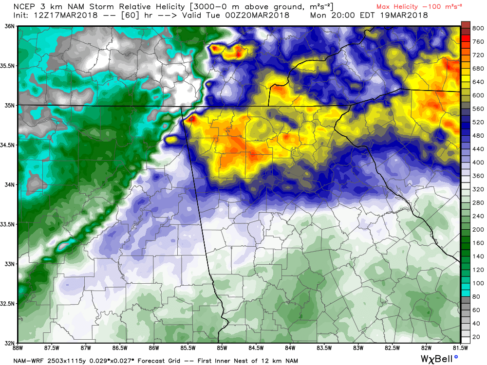
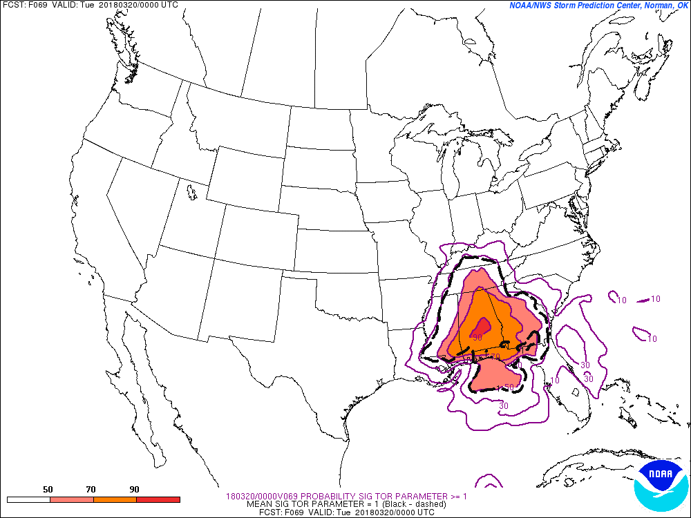
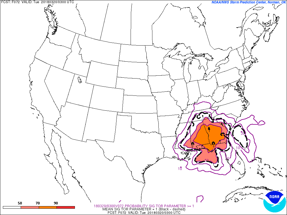
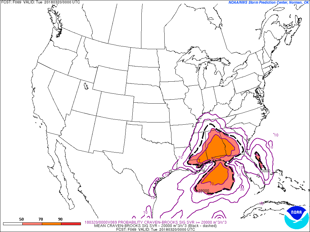
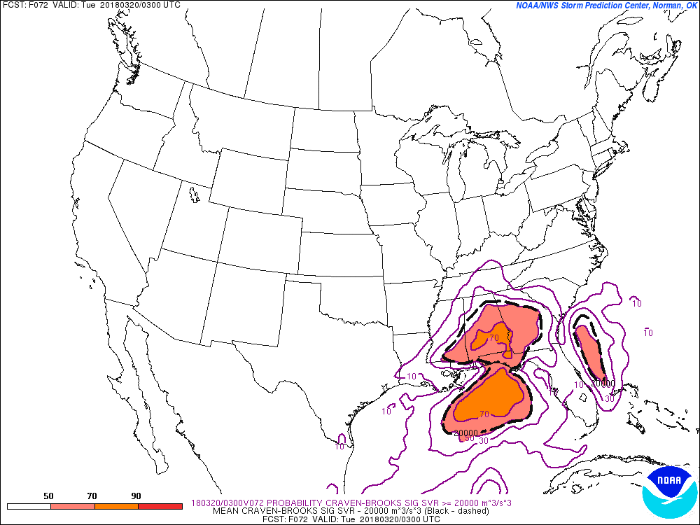
 Here are the slides from the latest severe weather briefing. First, the SPC discussion ...SUMMARY... Strong tornadoes, very large hail, and damaging winds are expected across parts of the Tennessee Valley and Southeast during the late afternoon and evening. ...TN Valley and Southeast... Have upgraded to Moderate risk for the increasing likelihood of several tornadic supercells between 21-03Z, centered on northern AL and portions of adjacent states. Expansions to Enhanced and Slight risks have also occurred across parts of GA and SC for this evening and tonight. Lowest confidence remains on northern extent of the strong tornado risk where the degree of surface-based destabilization is quite uncertain. An elevated storm cluster is ongoing across far northern MS to the Mid-MS Valley, still removed from appreciable surface-based instability that is present near/south of the warm front in north-central MS/AL. See MCD 144 for additional short-term information. Guidance is highly varied in the degree of warm front movement today, which may be in part explained by differences in the handling of the ongoing convection. The NAM robustly destabilizes into middle TN but has a distinct absence of convective precip where convection is ongoing. While the RAP has substantially less buoyancy in TN with SBCAPE >500 J/kg remaining largely south of the state border. While low/deep-layer shear and hodograph size will become increasingly favorable for rotating storms, confidence in the degree of northward destabilization in the late afternoon across TN is low. However, farther south in parts of MS/AL/GA, confidence is greater in moderately large buoyancy developing with MLCAPE of 1500-2500 J/kg becoming common south of the warm front. The northern extent of this instability plume with enlarged low-level hodographs should render the potential of several tornadic supercells during the late afternoon and early evening, a couple of which may be long track. Morning CAMs suggest the southern extent of probable supercell development will be across north-central AL, with convection becoming increasingly sparse to the south/southwest. During the evening, convection should become increasingly clustered/semi-discrete, but a risk for a few strong tornadoes should continue across parts of northern/central GA near the warm front. Damaging wind/tornado risk should persist but become increasingly localized across parts of SC tonight. 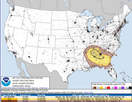 In order to get severe weather, there are several ingredients that need to come together, a warm moist atmosphere and a method to generate lift. If the winds turn with height, you get helicity or rotation. The latest NAM 3km high resolution model is really bumping up the severe potential on Monday, but not for everyone. The NAM has been the stronger of the models to this point. The images below show a weak wedge pushing into the east and north metro area Monday evening, keeping temperatures and dew points down. Also notice that the composite severe parameters keep the worst of the severe chances outside the wedge. There is still plenty of time for change, but in the scenario the NAM is showing, the north and northeast areas of north Georgia would not be in the worst location for severe. However, for those areas outside the wedge, the severe parameters are much more disturbing. The Supercell Composite alone is near the top of the scale while the Significant Tornado parameter runs 4-6. This is just one model and one run, and as you know, things can and will change, so a few more model runs will be needed before specifics will be known. Everyone needs to have a plan for Monday evening. More later... #knowwhereyoulive 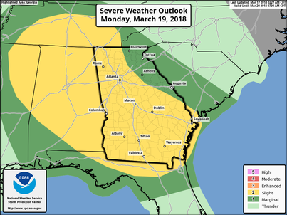 Severe Weather Outlook - Monday March 19 Severe Weather Outlook - Monday March 19 A severe weather threat is on the increase for Monday, and while the risk is "Slight", it appears that the Storm Prediction Center may consider raising that threat level to "Enhanced". NWS Atlanta talked about the event in their AFD this morning: "Instabilities increase during the day Monday with muCAPE increasing into the 800-1800j/kg range and shear and lapse rate values staying up as well. There is not as much deep moisture present but with a secondary cold front sweeping around the parent low and daytime high temps in the 60's and 70's... the atmosphere will be primed for severe storms to develop. SPC also agrees and has placed the majority of the state under a slight risk for day 3 with NW and west central GA under a 10 percent hatched area for significant severe weather. Will be keeping a close eye on this over the next few days" The following is from the Storm Prediction Center, the bold are my highlights: 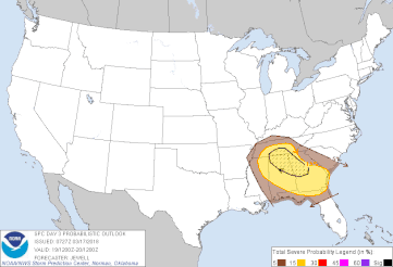 Day 3 Convective Outlook NWS Storm Prediction Center Norman OK 0227 AM CDT Sat Mar 17 2018 Valid 191200Z - 201200Z ...THERE IS A SLIGHT RISK OF SEVERE THUNDERSTORMS ACROSS MUCH OF AL... GA... SOUTHERN TN... AS WELL AS NORTHERN FL AND NORTHEAST MS... ...THERE IS A MARGINAL RISK OF SEVERE THUNDERSTORMS ACROSS MUCH OF THE SOUTHEAST... ...SUMMARY... Severe storms capable of tornadoes, damaging wind and hail are possible across parts of Middle Tennessee, Alabama, and Georgia. Severe wind is also possible into northern Florida. ...Discussion... The timing of a shortwave trough will play a critical role in severe potential on Monday across TN, MS, AL and GA. At this time, the NAM appears to be too slow and more amplified with this wave over MO compared to the ECMWF and GFS which show it over central KY or Middle TN at 00Z Tuesday. As a result, severe potential looks quite different amongst the models. For example, the latest NAM shows an extremely volatile setup over middle TN and northern AL clearly favoring strong tornadoes. However, the most likely solution appears to be a blend of the ECMWF and GFS, both showing a faster and lower-amplitude shortwave, as well as less low-level shear with relatively veered 850 mb flow. The most probable scenario appears to be for isolated, potentially significant severe storms from Middle TN into northern AL and GA, dependent on how much destabilization occurs especially in TN. Models also indicate substantial storm coverage across much of southern GA into northern FL, possibly in the form of an MCS, with mainly wind damage potential given unidirectional flow. Given the potential for significant severe storms, a categorical upgrade is possible in later outlooks once predictability increases and the centroid of severe coverage is better established. ..Jewell.. 03/17/2018 CLICK TO GET WUUS03 PTSDY3 PRODUCT NOTE: THE NEXT DAY 3 OUTLOOK IS SCHEDULED BY 0730Z The threat that people are most concerned about are tornadoes, and these storms will be capable of generating tornadoes. The two images below are showing the SigTor parameter (significant tornado) >=1 between 7pm - 10pm Monday. Another parameter to look at is the Craven-Brooks Significant Severe. According to the SPC, using a database of about 60,000 soundings, the majority of significant severe events (2+ inch hail, 65+ knot winds, F2+ tornadoes) occur when the product exceeds 20,000 m3/s3, and the following two images depict that area of 20,000 or higher within the dashed black lines. These images are also 7 pm and 10 pm. We are still several days away so there will be changes, so be sure follow https://www.facebook.com/NorthGeorgiaWeather for the latest updates. |
Archives
March 2019
Categories
All
|
OLD NORTH GA WX BLOG

 RSS Feed
