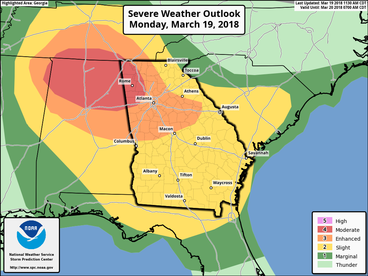
 Here are the slides from the latest severe weather briefing. First, the SPC discussion ...SUMMARY... Strong tornadoes, very large hail, and damaging winds are expected across parts of the Tennessee Valley and Southeast during the late afternoon and evening. ...TN Valley and Southeast... Have upgraded to Moderate risk for the increasing likelihood of several tornadic supercells between 21-03Z, centered on northern AL and portions of adjacent states. Expansions to Enhanced and Slight risks have also occurred across parts of GA and SC for this evening and tonight. Lowest confidence remains on northern extent of the strong tornado risk where the degree of surface-based destabilization is quite uncertain. An elevated storm cluster is ongoing across far northern MS to the Mid-MS Valley, still removed from appreciable surface-based instability that is present near/south of the warm front in north-central MS/AL. See MCD 144 for additional short-term information. Guidance is highly varied in the degree of warm front movement today, which may be in part explained by differences in the handling of the ongoing convection. The NAM robustly destabilizes into middle TN but has a distinct absence of convective precip where convection is ongoing. While the RAP has substantially less buoyancy in TN with SBCAPE >500 J/kg remaining largely south of the state border. While low/deep-layer shear and hodograph size will become increasingly favorable for rotating storms, confidence in the degree of northward destabilization in the late afternoon across TN is low. However, farther south in parts of MS/AL/GA, confidence is greater in moderately large buoyancy developing with MLCAPE of 1500-2500 J/kg becoming common south of the warm front. The northern extent of this instability plume with enlarged low-level hodographs should render the potential of several tornadic supercells during the late afternoon and early evening, a couple of which may be long track. Morning CAMs suggest the southern extent of probable supercell development will be across north-central AL, with convection becoming increasingly sparse to the south/southwest. During the evening, convection should become increasingly clustered/semi-discrete, but a risk for a few strong tornadoes should continue across parts of northern/central GA near the warm front. Damaging wind/tornado risk should persist but become increasingly localized across parts of SC tonight.  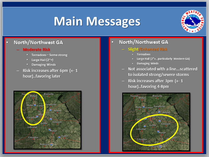 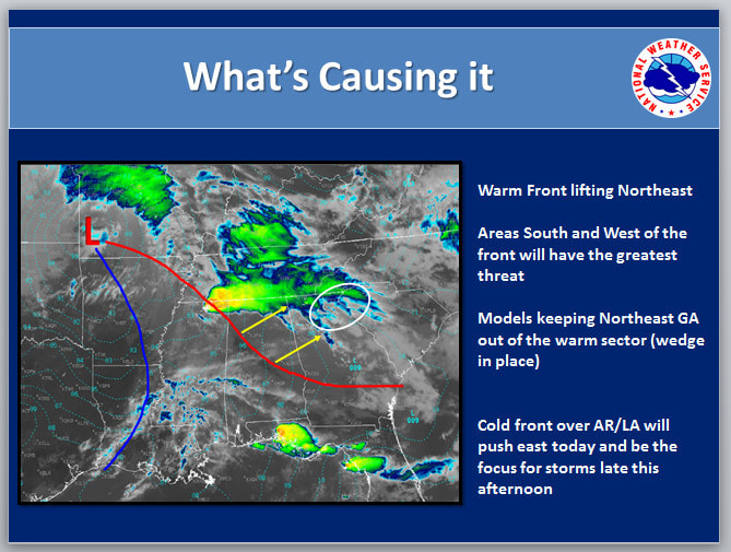 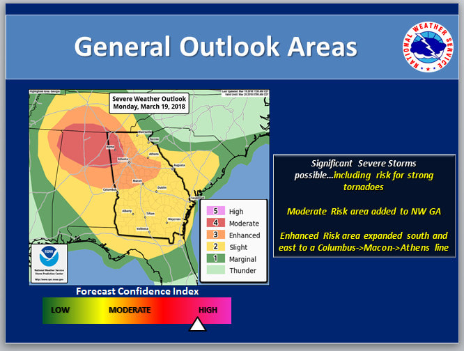  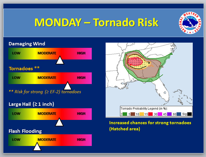 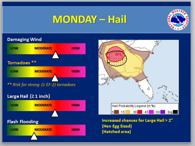 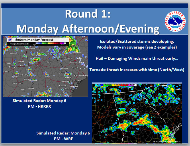 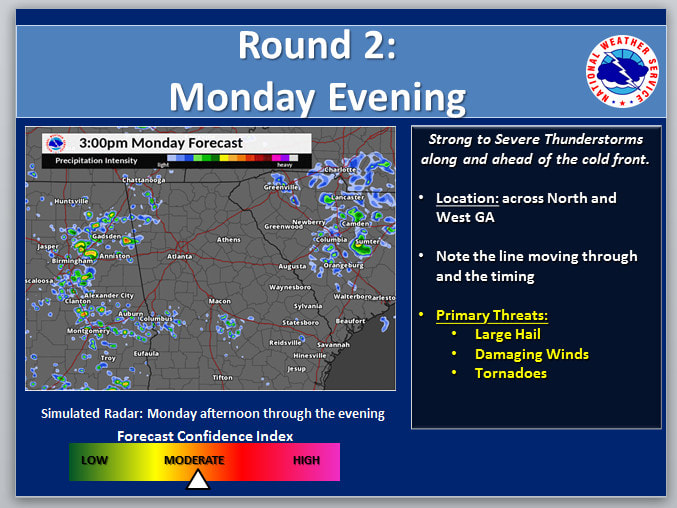 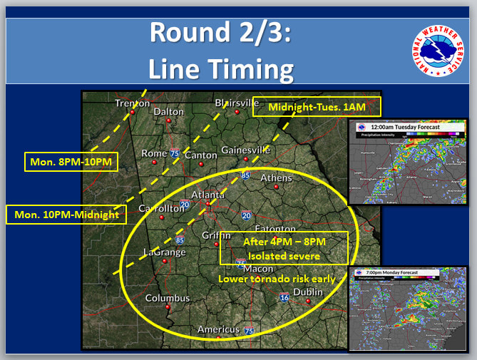  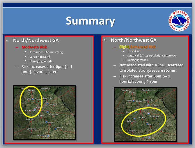 |
Archives
March 2019
Categories
All
|
OLD NORTH GA WX BLOG
 RSS Feed
|
Never base important decisions on this or any weather information obtained from the Internet. Always have a backup method of receiving weather information such as a battery powered weather radio.
Copyright © 2018 NorthGeorgiaWX.com and DaculaWeather.com 
|