|
Attention continues to be on the winter weather potential at the end of the short term period. Latest model runs are advertising slightly better moisture, and that, combined with cold thermal profiles and partial thicknesses, will allow for a mainly an all snow event. SO models are indicating some better lift in the dendritic growth zone, especially late Tuesday night and into Wednesday morning over portions of western Georgia and the south Metro/middle Georgia area, which could locally enhance accumulations. In general, the models have an overall consensus that this could happen, but with a lack of consistency run-to-run, have opted to hedge amounts upward, but trend towards the more conservative side. This is especially the case with the snow grids for areas south of LaGrange to Macon to Warrenton. The models are also in agreement in depressing snowfall amounts in the Gainesville area due to downsloping. At this time, have advertised less than half an inch accumulations in this area instead of the near zero accumulations, but will need to monitor how subsequent model runs sort this out. TIMING... Onset timing has sped up even from the overnight solutions, with pops increasing in far northwest Georgia from slight chance mid morning to likely by 1 PM. Although the Atlanta area could see some flurries in the afternoon, the better chances will be in the early evening hours through the wee morning hours. AMOUNTS... At this time, have gone with around 1 to 1.5 inches for the higher elevations of north Georgia, 0.75-1 inch for areas generally north of a line from Rome to Ellijay, to Blairsville, and under 0.5 inches for areas south. At this time, have a tenth of an inch advertised for as far south as Americus (do not have any accumulations for our far southeast corner counties). A Winter Weather Advisory has been issued for far north Georgia and the north and west metro Atlanta area, with counties parsed out to best reflect onset timing. At this time, although accumulations are similar on the west side of the state (down to LaGrange/Columbus) confidence is much lower in these amounts for middle/central Georgia. As a result, these areas have not yet been included in any Advisory, and instead a Special Weather Statement has been issued for them. OTHER HAZARDS... Taking a back seat to the snow potential is the wind chill threat. Expect bitterly cold temperatures to impact the area in the wake of the snow as extremely cold air settles over the area. Temperatures Wednesday morning will be sub-zero or the single digits in the far north, and in the teens across the metro Atlanta area and southwestward toward LaGrange. Have opted to end the Winter Weather Advisory at 12Z Wednesday to best capture both the snow and the wind chill threat without having to issue multiple products. That being said, it may be necessary to go ahead and issue a separate Wind Chill Advisory with tomorrow's afternoon package. 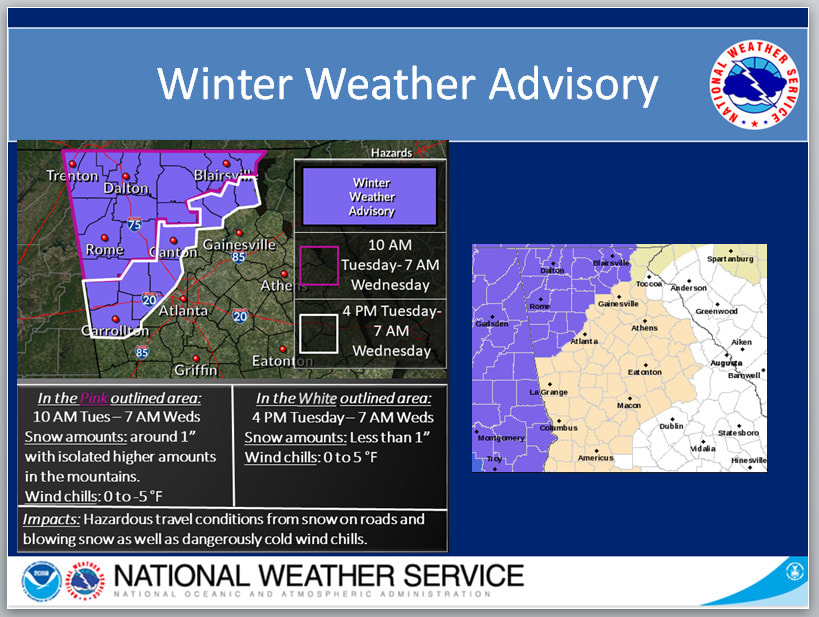 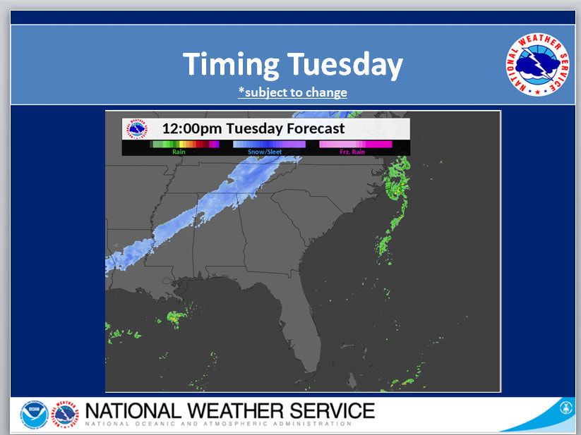 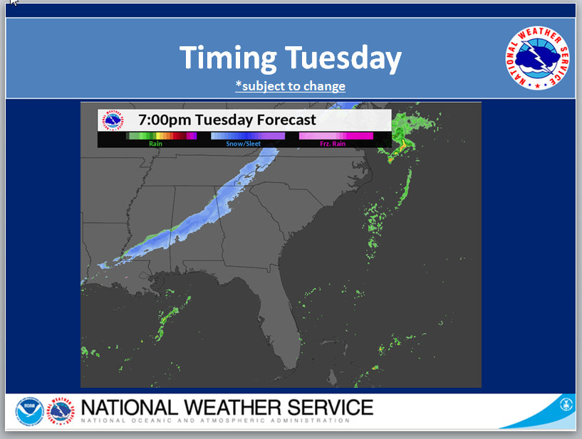 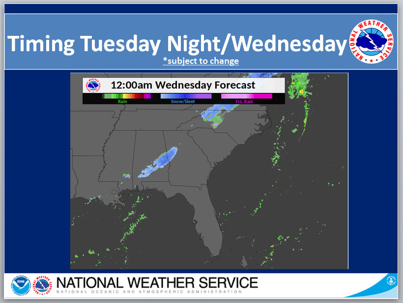 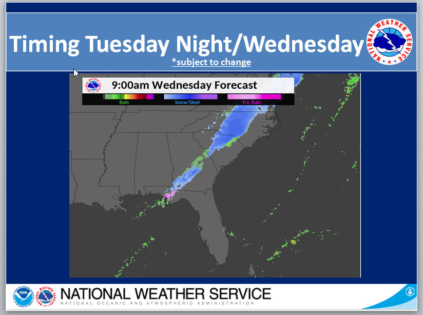 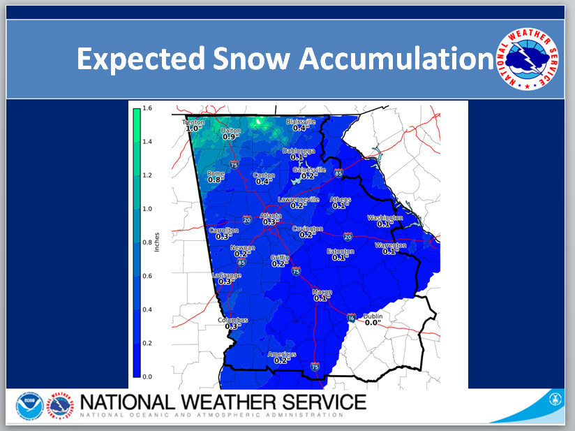 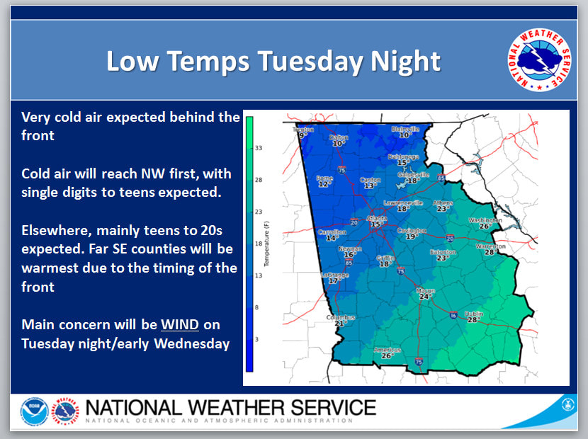 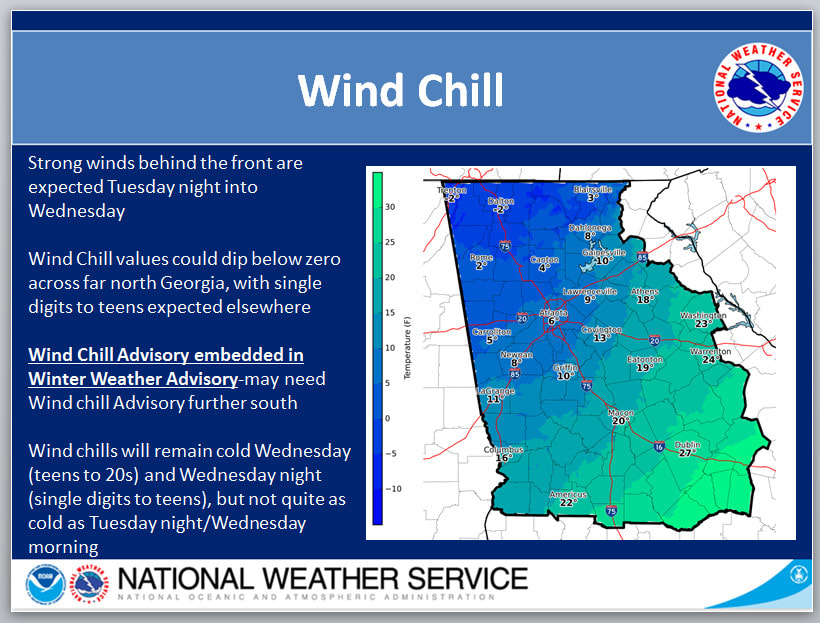 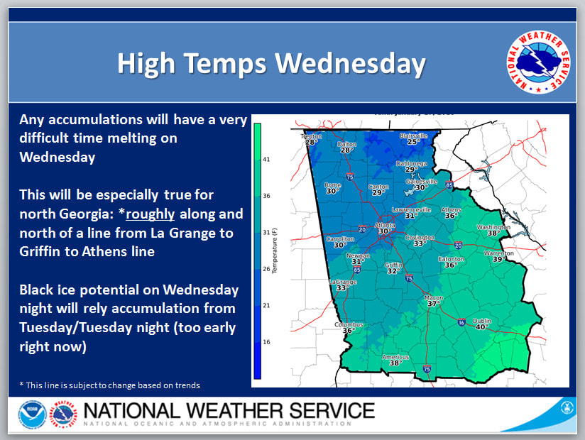 Slides follow the Weather Advisories...  URGENT - WINTER WEATHER MESSAGE National Weather Service Peachtree City GA 300 PM EST Sun Jan 7 2018 Whitfield-Murray-Fannin-Gilmer-Gordon-Pickens-Dawson-Bartow- Cherokee-Forsyth-Paulding-Cobb-North Fulton-Gwinnett-Carroll-Douglas-South Fulton-DeKalb-Heard-Coweta-Fayette-Clayton- Including the cities of Calhoun, Cartersville, Marietta, Atlanta, Lawrenceville, Carrollton, Douglasville, East Point, Decatur, Newnan, and Peachtree City 300 PM EST Sun Jan 7 2018 ...WINTER WEATHER ADVISORY IN EFFECT FROM 5 AM TO NOON EST MONDAY... * WHAT...Light freezing rain is expected to develop very late tonight into Monday morning. Total ice accumulations of a light glaze to less than a tenth of an inch are expected. * WHERE...Portions of North and Central Georgia including the Atlanta metro. * WHEN...From 5 AM to noon EST Monday. * ADDITIONAL DETAILS...The freezing rain will result in difficult travel conditions, including during the morning commute on Monday. Elevated surfaces such as bridges and overpasses will be most susceptible to icing. PRECAUTIONARY/PREPAREDNESS ACTIONS... A Winter Weather Advisory means that periods of freezing rainwill cause travel difficulties. Be prepared for slippery roads. Slow down and use caution while driving. ----------------------------------------------------------------------- Union-Towns-Lumpkin-White-Hall-Banks-Jackson-Barrow- Including the cities of Dahlonega, Cleveland, and Gainesville 300 PM EST Sun Jan 7 2018 ...WINTER WEATHER ADVISORY IN EFFECT FROM 6 AM TO 1 PM EST MONDAY... * WHAT...Light freezing rain is expected to develop very late tonight into Monday morning. Total ice accumulations of a light glaze to less than a tenth of an inch are expected. * WHERE...Portions of north central and northeast Georgia. * WHEN...From 6 AM to 1 PM EST Monday. * ADDITIONAL DETAILS...The freezing rain will result in difficult travel conditions, including during the morning commute on Monday. Elevated surfaces such as bridges and overpasses will be most susceptible to icing. PRECAUTIONARY/PREPAREDNESS ACTIONS... A Winter Weather Advisory means that periods of freezing rain will cause travel difficulties. Be prepared for slippery roads. Slow down and use caution while driving. ------------------------------------------------------------------- Dade-Walker-Catoosa-Chattooga-Floyd-Polk-Haralson- Including the city of Rome 300 PM EST Sun Jan 7 2018 ...WINTER WEATHER ADVISORY NOW IN EFFECT FROM 1 AM TO 11 AM EST MONDAY... * WHAT...Freezing rain expected. The ice will result in difficult travel conditions, including during the morning commute on Monday. Total ice accumulations of around one tenth of an inch are expected. * WHERE...Portions of northwest Georgia. * WHEN...From 1 AM to 11 AM EST Monday. * ADDITIONAL DETAILS...The freezing rain will result in difficult travel conditions, including during the morning commute on Monday. Elevated surfaces such as bridges and overpasses will be most susceptible to icing.. PRECAUTIONARY/PREPAREDNESS ACTIONS... A Winter Weather Advisory means that periods of freezing rainwill cause travel difficulties. Be prepared for slippery roads. Slow down and use caution while driving. 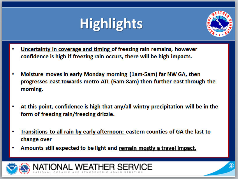 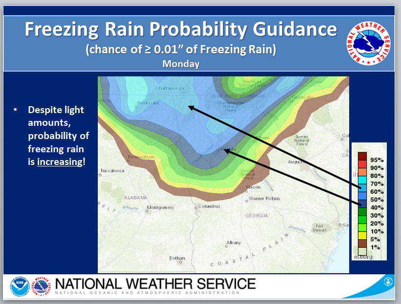 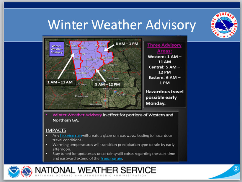 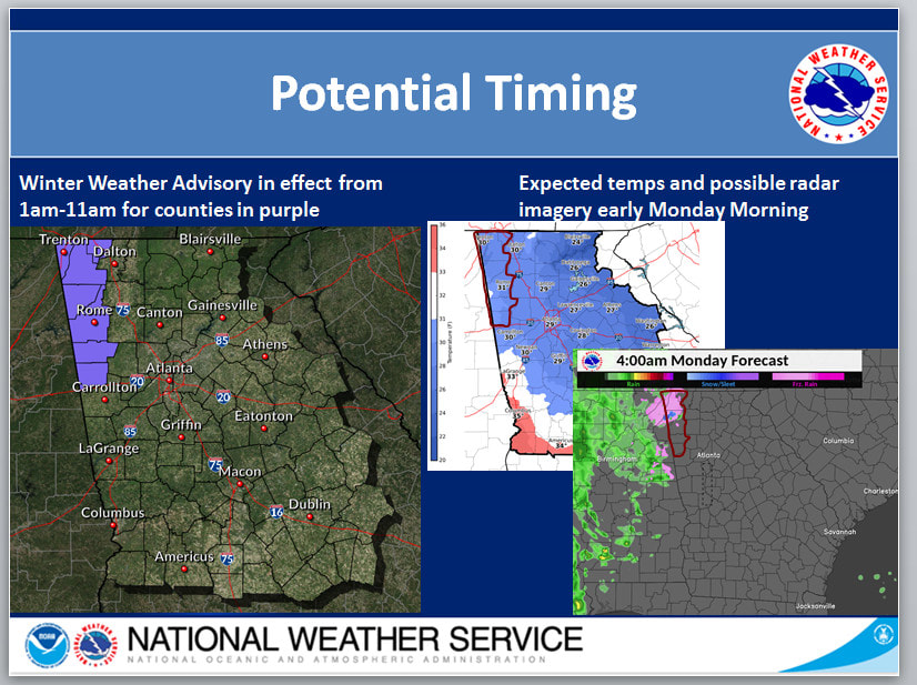 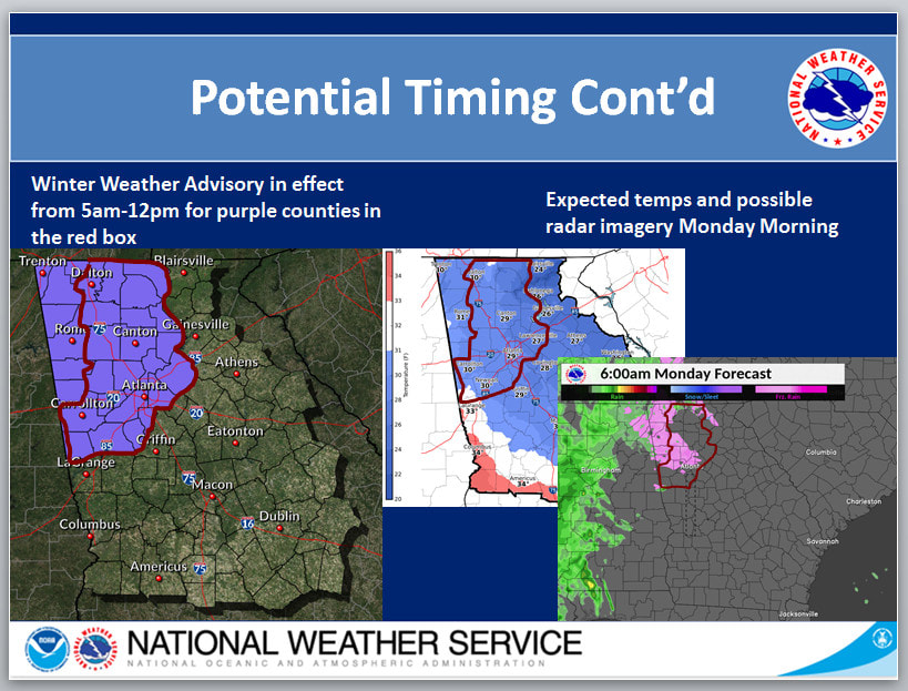 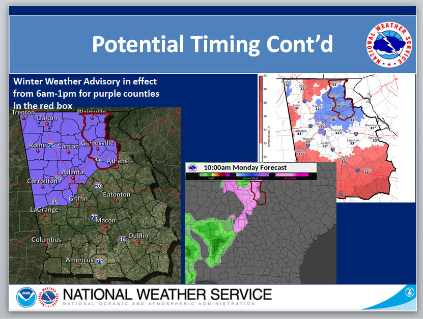 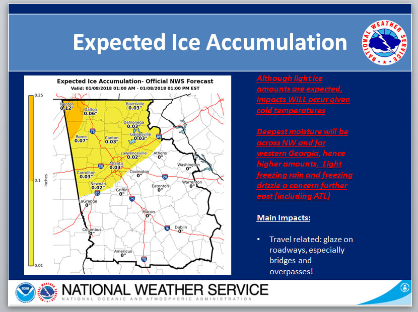 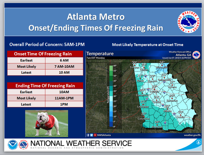 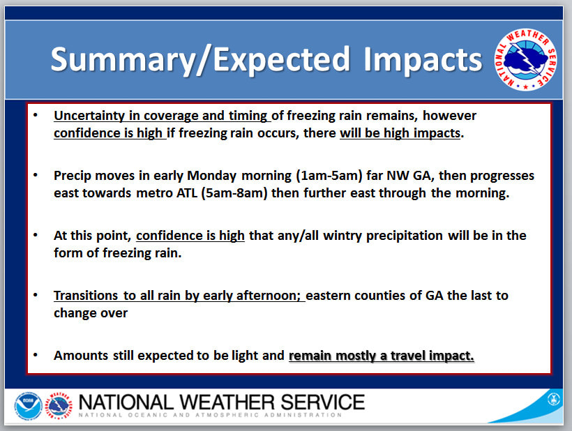  Forecast continues to be complicated and tricky given recent trends of the upper trough energy cutting off more to our south,though still a lingering shortwave influencing the TN valley and some isentropic upglide potential along a lingering hybrid wedge for Monday. Timing has shifted overall a bit later than previous runs as far as when the best moisture/forcing is present in our NW... thinking mainly after 7 AM is best chance for parts of the NW to see some light freezing rain. Overall amounts have come down from before (generally less than a tenth of an inch for north and west central GA), though may not matter much since impacts with any ice accumulation on roadways would not change much (higher amounts would be of more impact to trees/powerlines). As far as temps, there still looks to be a decent majority of north and parts of central GA below the freezing mark or right around by Monday morning...the Canadian and Nam and the coldest, though the Nam is pretty dry and actually delays the precip until late morning or even afternoon. The GFS still has the NW with a morning onset (that could include the Atlanta metro). Some sounding analysis indicates potential for a low/mid level column of lingering drier air that saturation aloft could be battling, otherwise some higher QPF could be a factor. Not thinking anything warrants a Winter Storm Watch at this point, but may need a Winter Weather Advisory for some portions in future updates as we get closer - though likely have changes in timing/amounts. 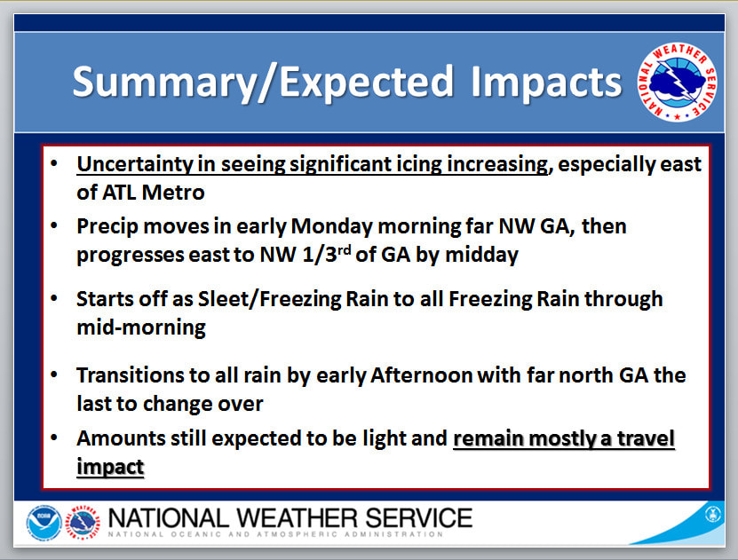   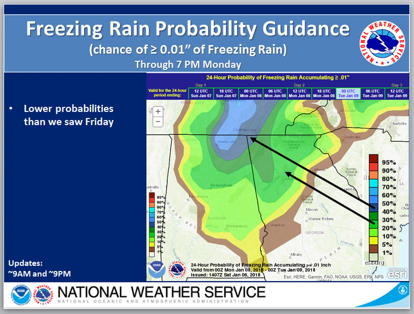 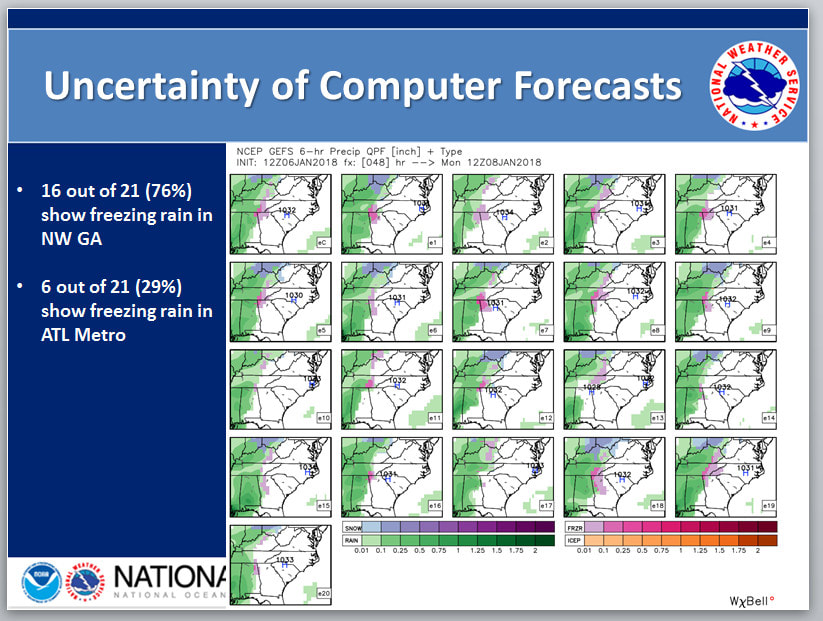 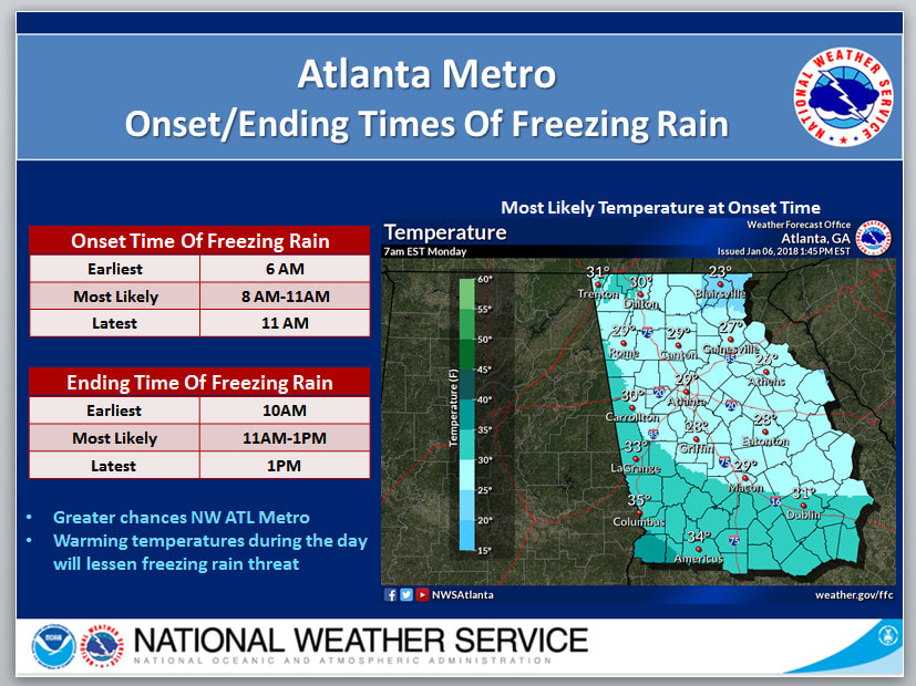 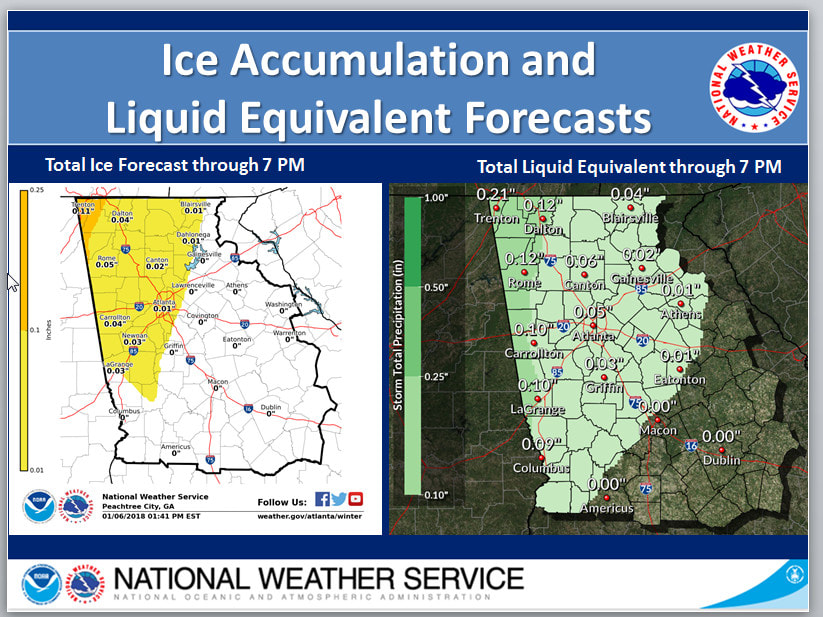 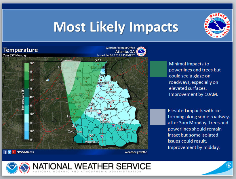 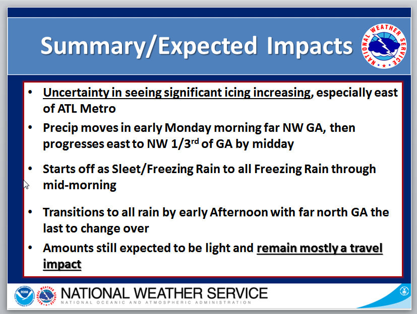 Good afternoon. Here's the latest from the Atlanta National Weather Service office in Peachtree City regarding the potential for freezing rain and icing Monday. First, the text below is from the latest Area Forecast Discussion: ------------------------------------------------------------------------------- Obviously focused on late Sunday through Monday period with the update as we are getting more guidance consensus (albeit the latest Euro) on some freezing rain potential within a lingering hybrid CAD wedge. Nam and the Canadian continue to be the coldest/more robust solutions and the GFS ensemble members have all but a few indicating some freezing rain including the Atlanta Metro by Monday morning pretty much centered around 7 AM. Thermal profiles support some possible sleet transition and not much chance for snow, though primarily freezing rain given a pretty thick warm nose overrunning the wedge. Big question remains on the onset timing of precip and diabatic in-situ reinforcement potential of the wedge. Kept the temp trend slower to warm into Monday given this. Most locations should get above the freezing mark by mid to late morning. Also ended up fairly close to WPC QPF in the period and adjusted the ice accumulations to mainly upwards of 2 tenths of an inch though greater chance for closer to 1 tenth extending generally from south metro farther north. WPC keeps us in primarily the less than 1 tenth range. Will update accordingly and will need to consider Watch/Advisory products if confidence increases in this, but still too far out in period to include (also if the much drier Euro starts to trend in consistency).  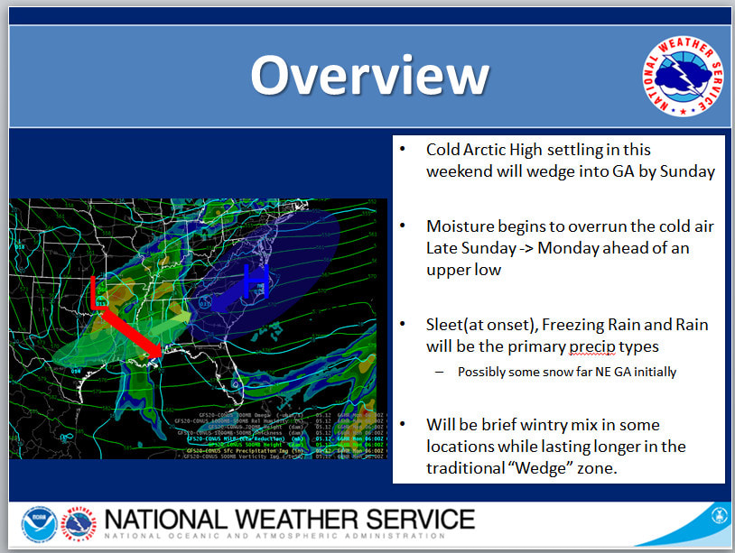 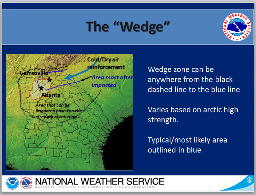 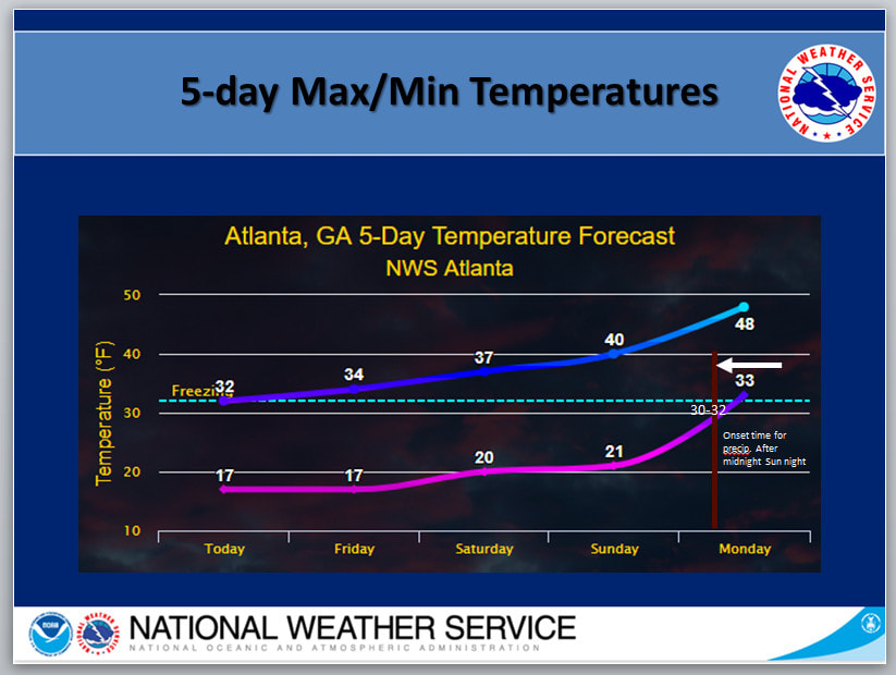 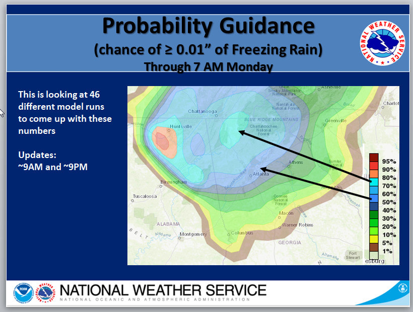 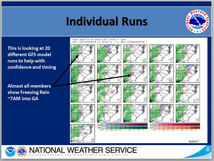 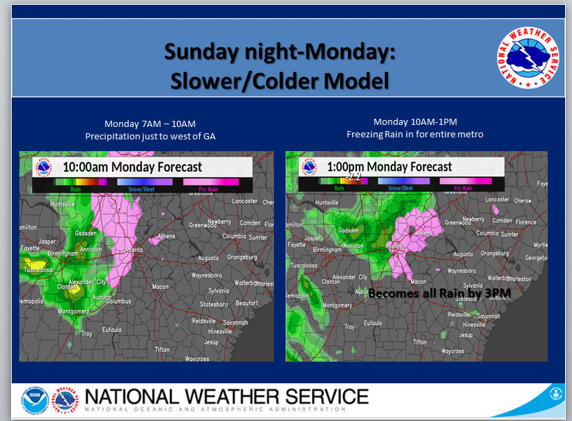 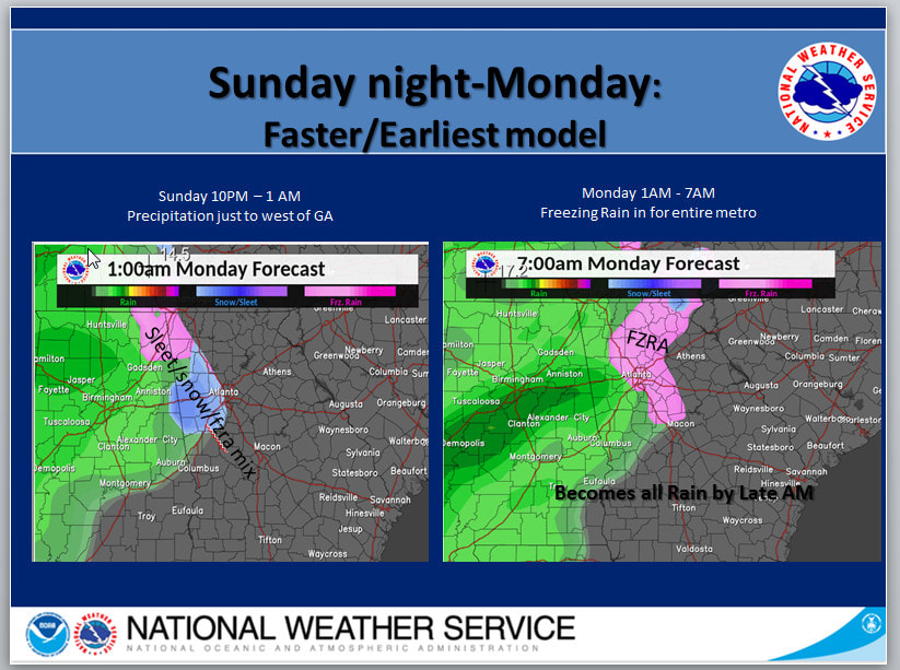 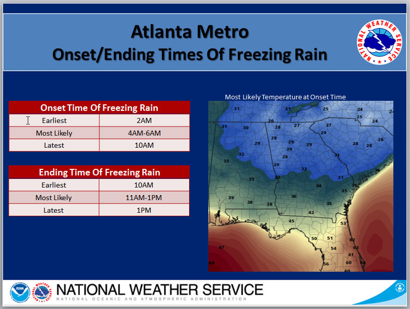 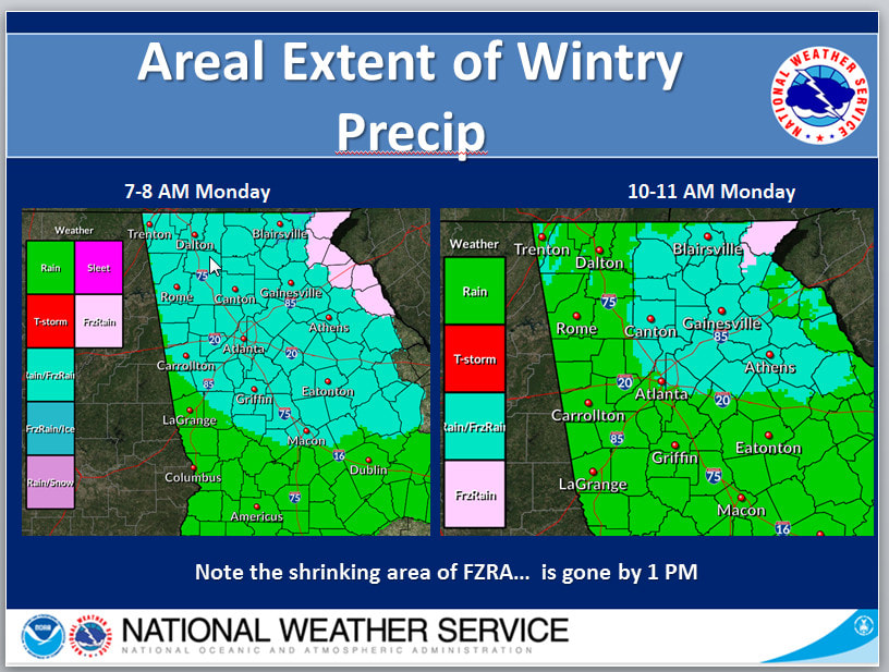 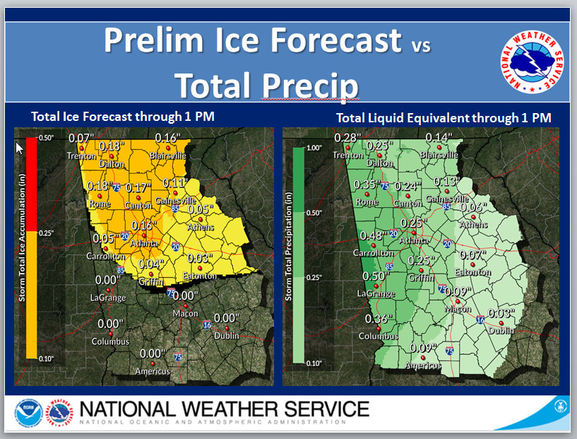   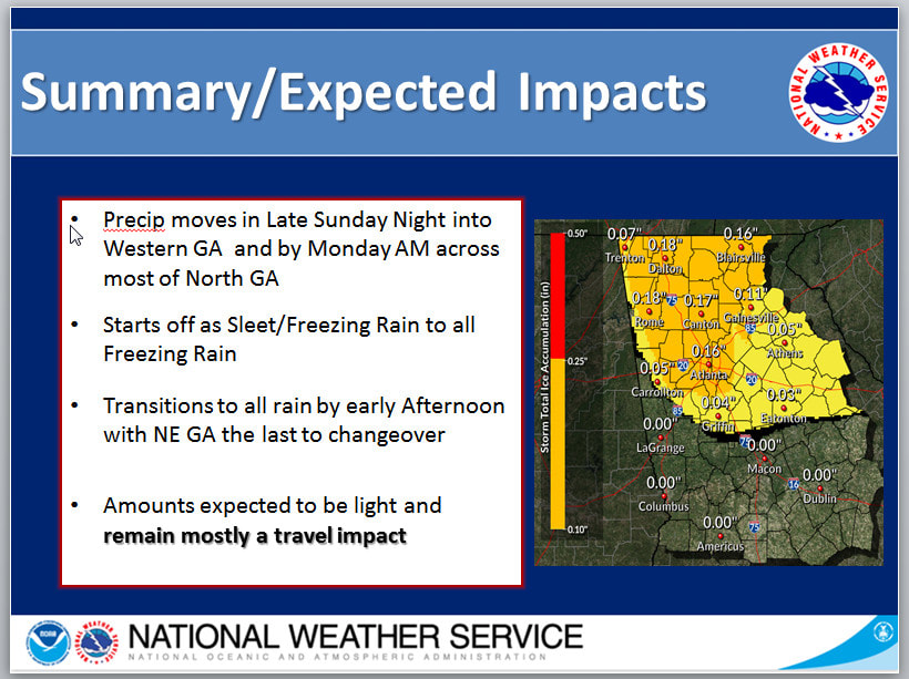 |
Archives
March 2019
Categories
All
|
OLD NORTH GA WX BLOG
 RSS Feed
|
Never base important decisions on this or any weather information obtained from the Internet. Always have a backup method of receiving weather information such as a battery powered weather radio.
Copyright © 2018 NorthGeorgiaWX.com and DaculaWeather.com 
|