 Forecast continues to be complicated and tricky given recent trends of the upper trough energy cutting off more to our south,though still a lingering shortwave influencing the TN valley and some isentropic upglide potential along a lingering hybrid wedge for Monday. Timing has shifted overall a bit later than previous runs as far as when the best moisture/forcing is present in our NW... thinking mainly after 7 AM is best chance for parts of the NW to see some light freezing rain. Overall amounts have come down from before (generally less than a tenth of an inch for north and west central GA), though may not matter much since impacts with any ice accumulation on roadways would not change much (higher amounts would be of more impact to trees/powerlines). As far as temps, there still looks to be a decent majority of north and parts of central GA below the freezing mark or right around by Monday morning...the Canadian and Nam and the coldest, though the Nam is pretty dry and actually delays the precip until late morning or even afternoon. The GFS still has the NW with a morning onset (that could include the Atlanta metro). Some sounding analysis indicates potential for a low/mid level column of lingering drier air that saturation aloft could be battling, otherwise some higher QPF could be a factor. Not thinking anything warrants a Winter Storm Watch at this point, but may need a Winter Weather Advisory for some portions in future updates as we get closer - though likely have changes in timing/amounts. 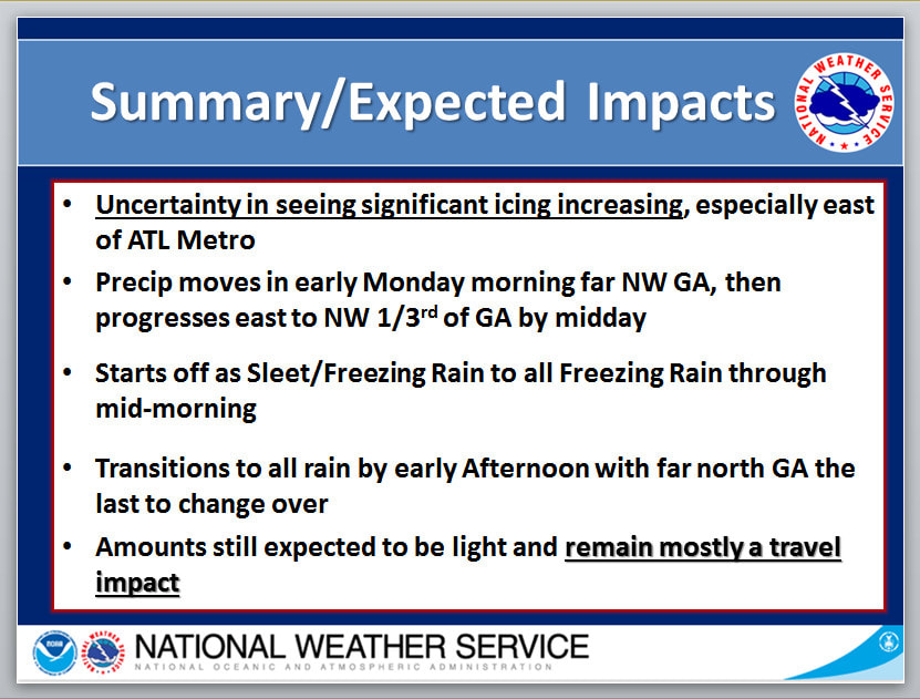 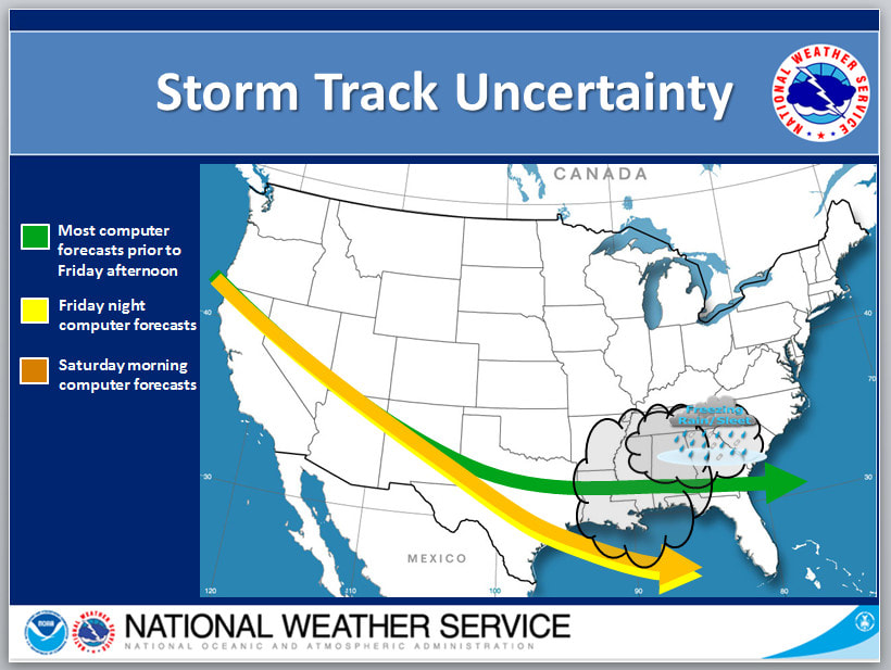 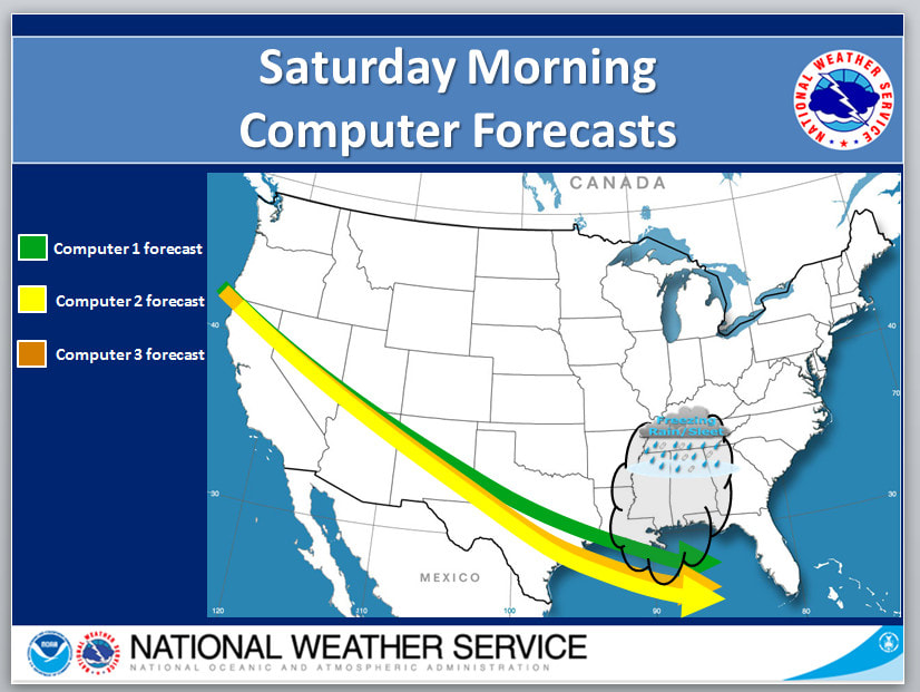 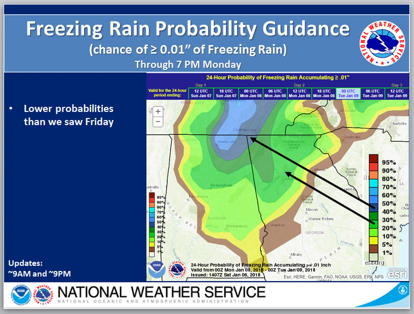 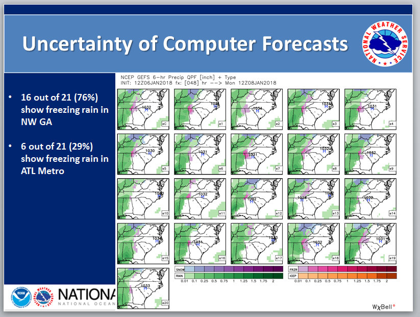 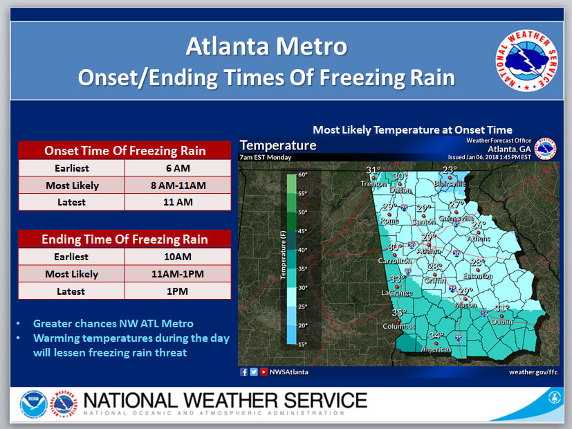 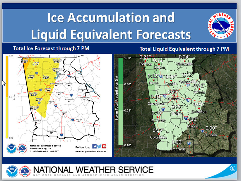 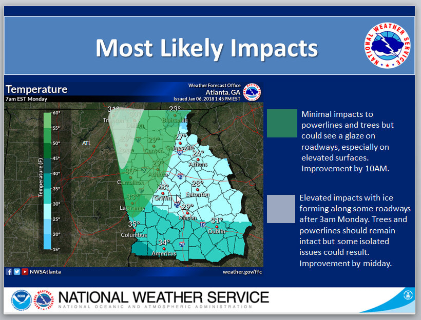 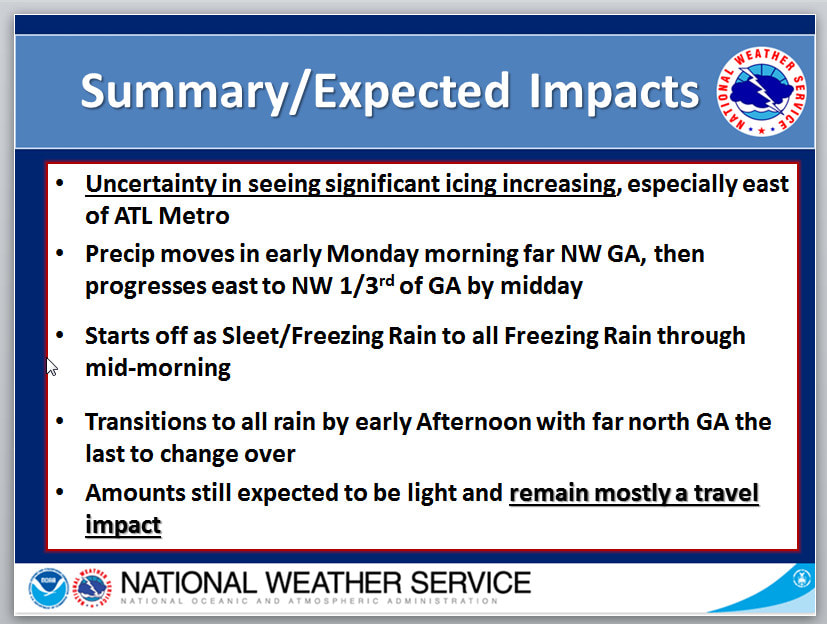 |
Archives
March 2019
Categories
All
|
OLD NORTH GA WX BLOG
 RSS Feed
|
Never base important decisions on this or any weather information obtained from the Internet. Always have a backup method of receiving weather information such as a battery powered weather radio.
Copyright © 2018 NorthGeorgiaWX.com and DaculaWeather.com 
|