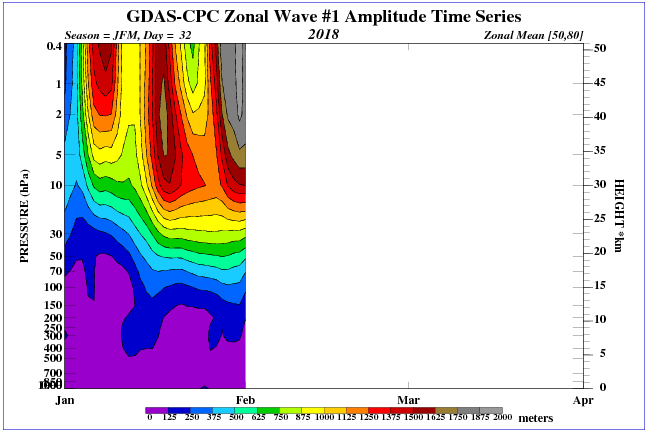
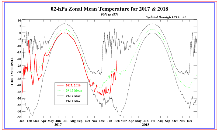
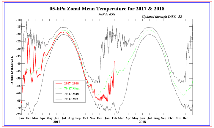
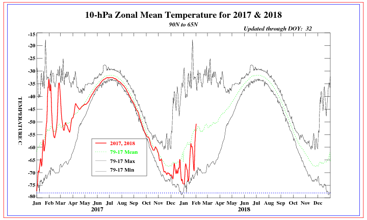
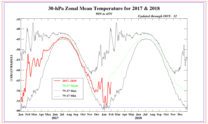
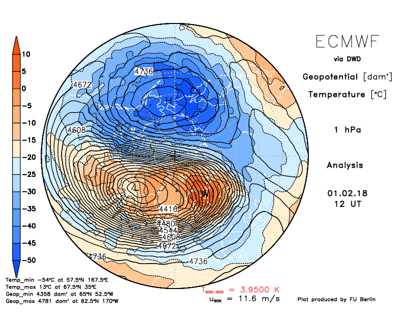
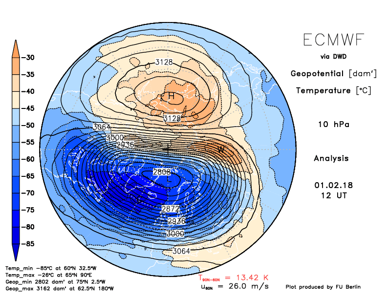
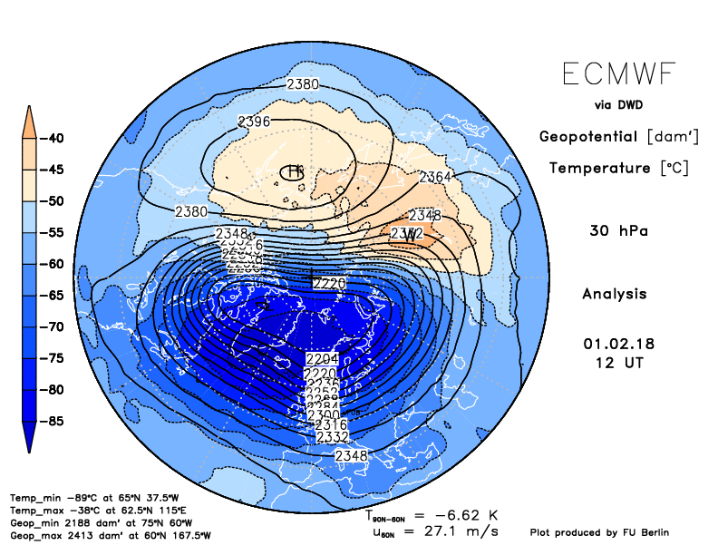
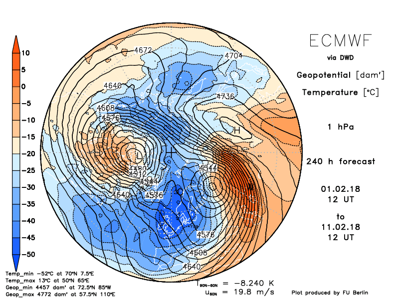
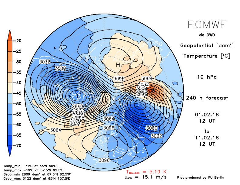
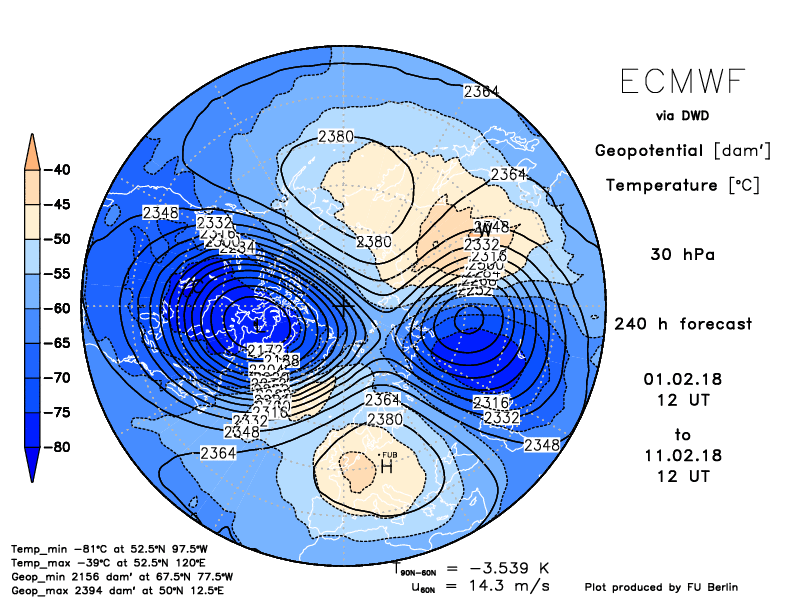
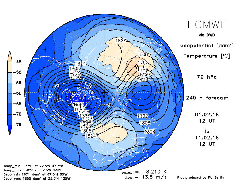
 Wave 1 pressure changes Wave 1 pressure changes The winds of change are blowing... the upper levels of the stratosphere are beginning to quickly warm and winds toward the upper levels have started a reverse. Let's look at a few images. First, we'll look at the temperatures beginning at 1mb down to 30mb. Right now the warming is starting at the top as you see in the first few images. 1mb is to the left and 30mb is to the right. Also, notice that the warming hasn't reached or effected the 30mb region just yet, but it looks like it might be getting started. Click on any image to enlarge.
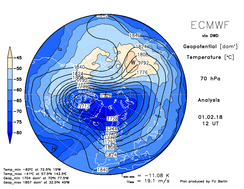
Once the upper levels warm, the westerly winds begin to slow and we are beginning to see that in this next image. That little sliver of green shows -20 to -30 meters/second which indicates an easterly component instead of the normal westerlies. Also note that during an east based QBO, winds will also reverse which helps to explain why during east based QBO's, we generally have better high latitude blocking. 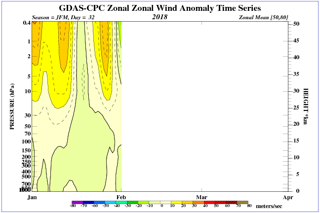 This image shows the warming (yellow and orange colors at the top right of the image) that is beginning to occur. 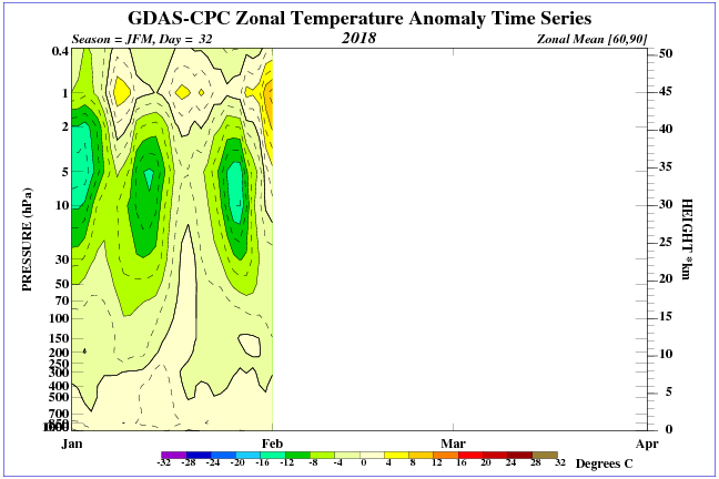 The Euro is seeing the splitting of the stratospheric polar vortex at 1mb, 10mb, 30mb and at 70mb. The current state is in the first column, the second column is 10 days. You can click on any image to enlarge it.
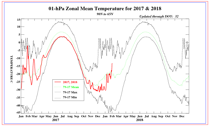
Almost all signs are pointing toward a disruption of the stratospheric polar vortex, and the implication is that this will also have a major influence on the tropospheric polar vortex. Depending on the strength of this event, the chances for high latitude blocking should be on the increase, which would generally mean colder arctic air getting pushed from the polar region southward. |
Archives
March 2019
Categories
All
|
OLD NORTH GA WX BLOG
 RSS Feed
|
Never base important decisions on this or any weather information obtained from the Internet. Always have a backup method of receiving weather information such as a battery powered weather radio.
Copyright © 2018 NorthGeorgiaWX.com and DaculaWeather.com 
|