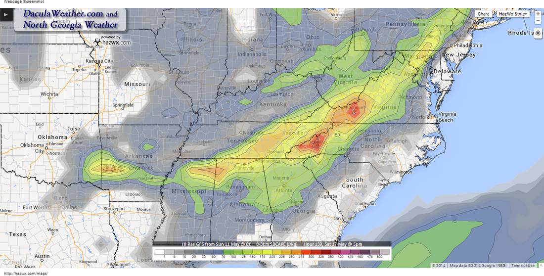
 GFS SBCAPE 5PM Sat - Click to enlarge GFS SBCAPE 5PM Sat - Click to enlarge Some of you have no idea what the SCCA Atlanta Match Tour is... so a little explanation is in order. First, it's an autocross and I've made several blog post about what that is over on my autocross blog, but the Match National Tours are run with a slightly different format than a normal Tour. For more information about that, click on this link. Anyway... THIS blog post is about the weather for that event which is being held next weekend, May 17-18th down at Atlanta's Turner Field Green Lot, the one with the big blue wall. If you'd like to see some of the best drivers from around the country, stop by and visit. You'll need to sign a waiver but it's free to watch. Either way, here is next weekends outlook as it is right now. Weather in the southeast can be difficult to forecast at times during the spring and summer when moisture and pop-up thundershowers can show up just about anywhere. Next weekend is going to have at least two pretty good days, and maybe all three. But this morning I noticed a little feature that could possibly have an impact on the weather at some point during the three day weekend. Hopefully if there is any impact from this in the form of precipitation, it will be during the evening and overnight hours and a non-factor for all of the competitors. It is the fly in the ointment for next weekend and something to keep an eye on. But overall, I'm not so sure that at this point, we could have ordered a better weekend for this event. Friday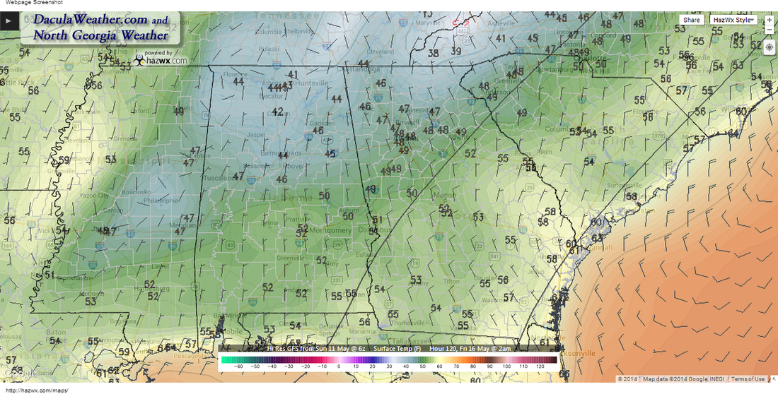 GFS Temps Friday 2AM - Click to enlarge GFS Temps Friday 2AM - Click to enlarge After a low chance rain week, temperatures will cool down sharply behind a fairly strong cold front, especially for this time of year. The image to the left shows temperatures on Friday at 2AM... and 40's are pretty cold for this time of year. High pressure sitting to our west will bring a NW flow to the metro area during the day on Friday, keeping afternoon temperatures in the low to mid 70's along with low humidity readings. It will be a great day to get in some practice runs and get use to the Turner Field surface. I'll see you Saturday... :-) 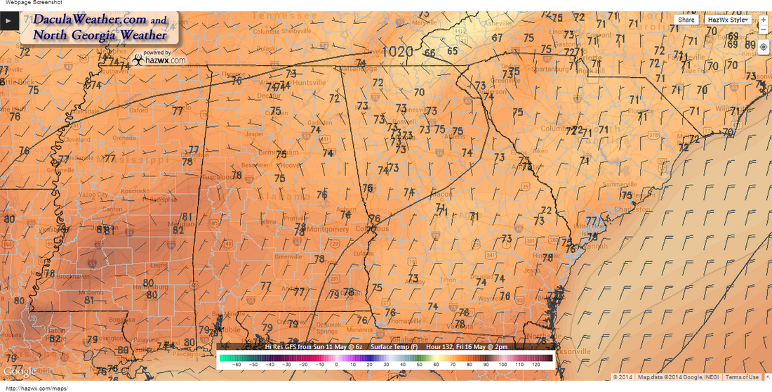
GFS Temps Friday 2PM - Click to enlarge
Saturday/Sunday GFS Temps 8AM Sat/Sun - Click to enlarge GFS Temps 8AM Sat/Sun - Click to enlarge It appears that the front may stall just south of the metro area overnight on Friday into Saturday. Temperatures and moisture increase Saturday as we get in a westerly flow. The image to the left shows 8AM temperatures on Saturday/Sunday mornings. You notice that the Saturday morning temperatures are warmer than both Friday and Sunday. Temps Saturday afternoon will rebound back to the upper 70's, but drop back down on Sunday to the lower 70's. Precipitable water values increase, with a larger area of 1" values pass over central Georgia during the day on Saturday and creep toward the metro area as the day goes on. 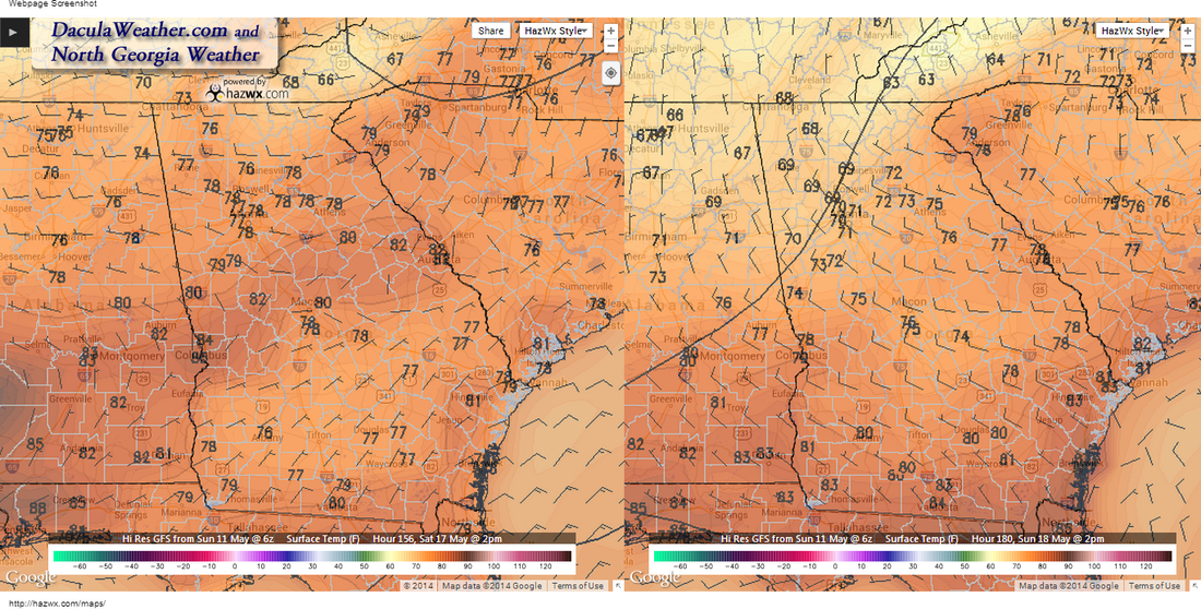
GFS Temps 2PM Sat/Sun - Click to enlarge
The only thing that I worry about, is that there is a blob of higher PW values passing the metro area Saturday evening, This is in conjunction with an upper level trough that will be swinging through to our north. Most of the energy from the trough stays well north of us, but could still trigger a shower or two as it passes by (see the image at the very beginning of this post). Timing would be everything, and as it looks right now, the evening hours would be the most likely time for this to happen, at least for now. Things can and will change as we get closer, so we'll keep an eye on this feature. 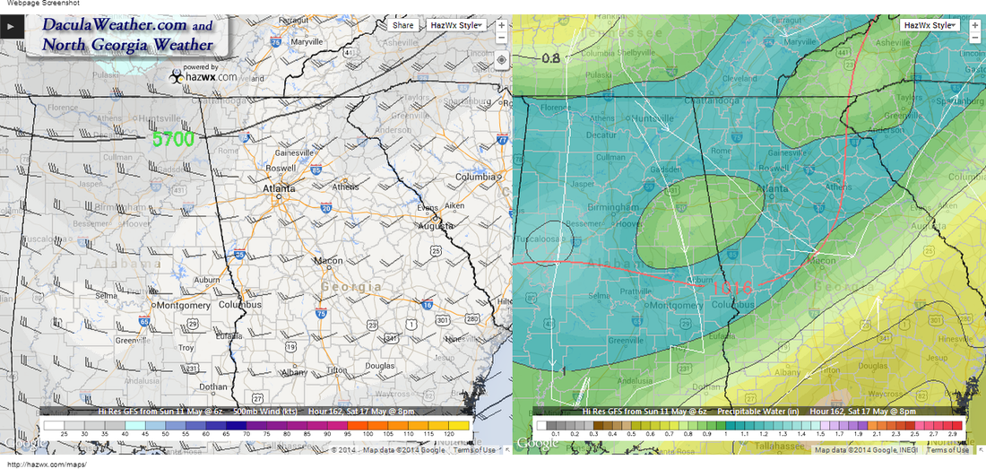
GFS 500MB/Precipitable Water Sat 8PM - Click to enlarge
Sunday should be a great day with highs in the low 70's and much lower dew point values. A great day to autocross! 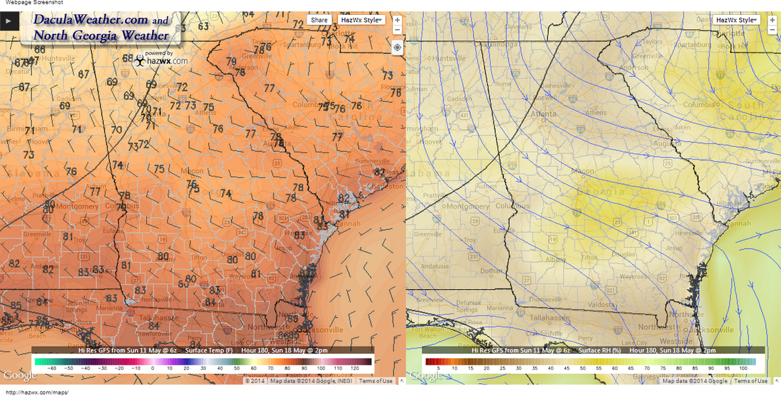
GFS Sunday Temps and Humidity - Click to enlarge
We are still at the limits of what the models are any good at, so many of the details will change between now and Friday. I'll take a look in another day or two and see how it stands then.
|
Archives
March 2019
Categories
All
|
OLD NORTH GA WX BLOG
 RSS Feed
|
Never base important decisions on this or any weather information obtained from the Internet. Always have a backup method of receiving weather information such as a battery powered weather radio.
Copyright © 2018 NorthGeorgiaWX.com and DaculaWeather.com 
|