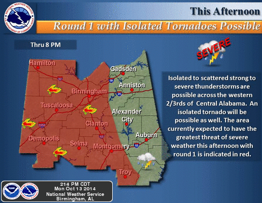
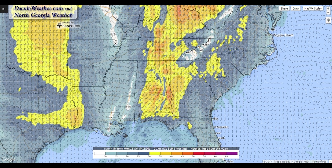
 Just wanted to share the latest thoughts on this upcoming severe weather event. Today, a strong upper level low has brought numerous severe thunderstorms and tornadoes across several states in the mid south. So far (as of 5pm) there have been 4 tornado, 53 severe thunderstorm, and 6 hail reports so far today. As of 5:30pm there have been 36 Tornado Warnings, and 133 Severe Thunderstorms Warnings issued. So what does this mean for us and when? We'll start with our upstream friends, Huntsville and Birmingham. This system will reach them during the overnight hours unfortunately. This from Huntsville NWS a little while ago: ...SEVERE WEATHER LIKELY THIS EVENING AND OVERNIGHT WITH DAMAGING It seems that the systems may be moving a little faster than the models had anticipated as noted by the Birmingham office in their latest forecast discussion:
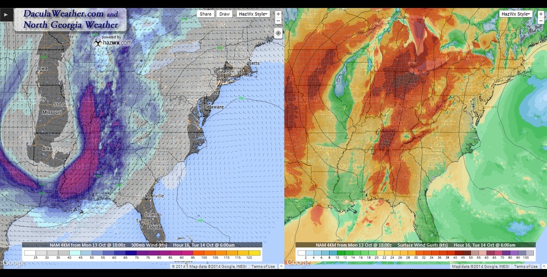
One of the hi-res models they were referring to is the new HRRR or High Resolution Rapid Refresh model. Here is the current thought from that model on where the main line of precip should be at 5 AM (left) and what the 4km NAM thinks it ought to be at 6 AM on the right.
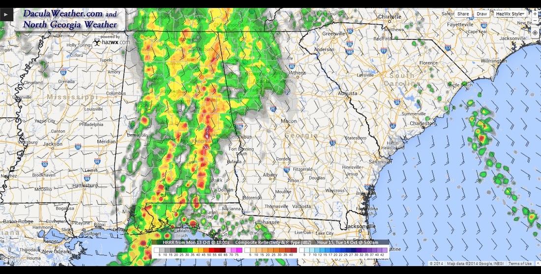
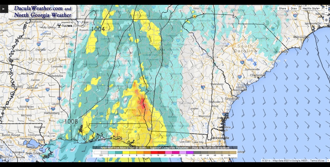
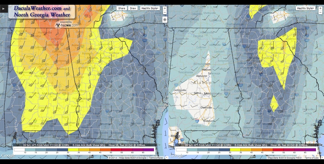
One thing the NAM is showing is the first line getting weaker as it passes through the metro area, with a secondary line forming later in the day. Shear values will be very high all day, so it appears that the severe threat may last until sometime after 2 PM. 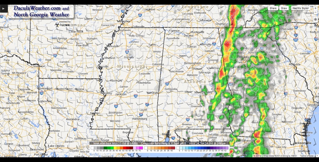 GFS shows a secondary line forming. 2 PM image Severe Maps
As always, you can follow the latest weather information on my following pages:
Facebook @ https://www.facebook.com/NorthGeorgiaWeather Twitter @ DaculaWeather DaculaWeather.com |
Archives
March 2019
Categories
All
|
OLD NORTH GA WX BLOG

 RSS Feed
|
Never base important decisions on this or any weather information obtained from the Internet. Always have a backup method of receiving weather information such as a battery powered weather radio.
Copyright © 2018 NorthGeorgiaWX.com and DaculaWeather.com 
|