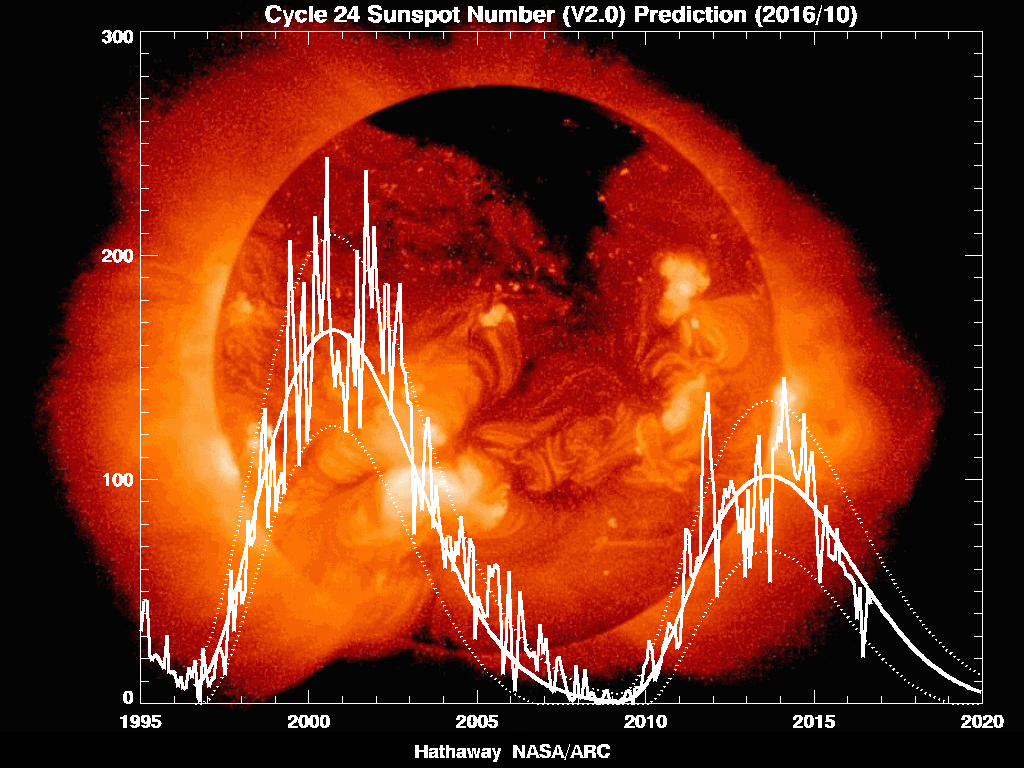
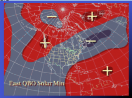
 Current ENSO Index Current ENSO Index I as discussed yesterday, many winter forecast place a lot of emphasis on the state of the ENSO ie, La Nina or El Nino, and I'm sure you've seen the maps the say Nina's are warm and dry in the southeast during the winter. I'm thinking that some of those forecast may end up being wrong. The effects of every indices and patterns modulate and change the effects of all the others, so you can't really make a blanket statement as to warm and dry. Plus the strength of the Nina changes the final outcome for our weather. Strong Nina's generally do mean warm and dry for us, but we are not expected to have a strong Nina and right now we are sitting pretty close to a neutral reading. To give you an example, take a look at the next two images that show past Nina's 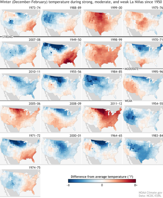 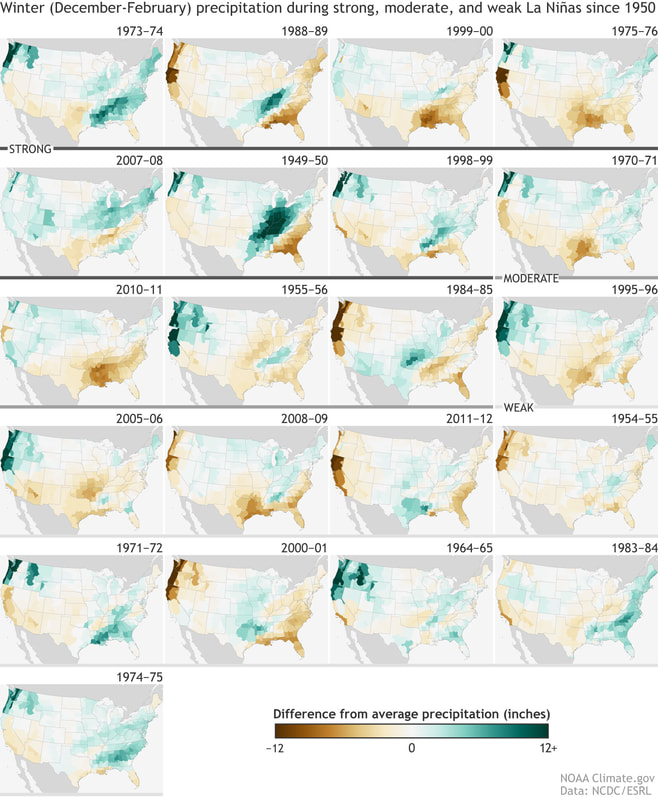 As you can see, not every Nina was warm and dry, and there are a few other variables that may come into play this year that may change the effects of a La Nina. QBOThe QBO or Quasi-biennial Oscillation is a quasiperiodic oscillation of the equatorial zonal wind between easterlies and westerlies in the tropical stratosphere with a mean period of 28 to 29 months. The alternating wind regimes develop at the top of the lower stratosphere and propagate downwards at about 1 km (0.6 mi) per month until they are dissipated at the tropical tropopause. Downward motion of the easterlies is usually more irregular than that of the westerlies. The amplitude of the easterly phase is about twice as strong as that of the westerly phase. At the top of the vertical QBO domain, easterlies dominate, while at the bottom, westerlies are more likely to be found. Yea, lots of weather speak there but the important thing to take away from all of that is that we generally have better winters during a easterly QBO than a westerly. Eastward phases of the QBO often coincide with more sudden stratospheric warmings, a weaker Atlantic jet stream and cold winters in Northern Europe and eastern USA whereas westward phases of the QBO often coincide with mild winters in eastern USA and a strong Atlantic jet stream with mild, wet stormy winters in northern Europe. Also, an easterly QBO tends to generate more negative NAO's (North Atlantic Oscillation) which helps to contain the cold air over North America. It appears that this year we will have a easterly QBO. I showed this image yesterday and it depicts the placement of ridges (+) and lows (-) during la Nina's, and how that changes based on whether you have a west or east based QBO. Notice that with an easterly QBO, the Bermuda ridge is suppressed south while a trough is also extended south over the central part of the country. 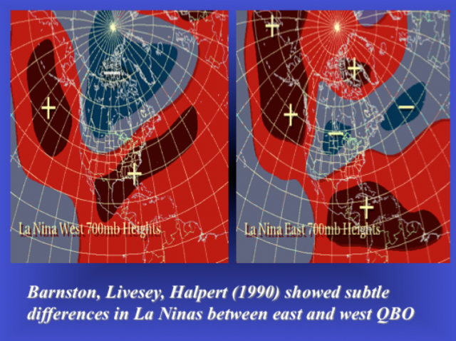 Let's look at another angle. The sun is beginning to "go to sleep" as it heads toward a solar minimum and that also has an effect on our winters. Notice in the image below how the ridge is suppressed even further during those low solar periods.
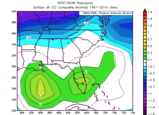
WeatherBELL released a few charts for the southeast that show what their internal "Pioneer" model thinks will happen this winter.
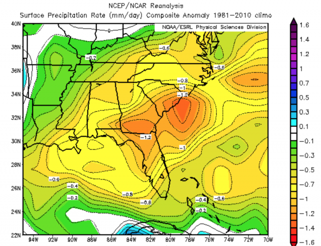
These bottom images show the effects of four parameters on our winter weather based on the forecasted state of each one, the ENSO (Nina/Nino), the AMO, TNA, and AO. As you can see, none of those are warmer than normal. 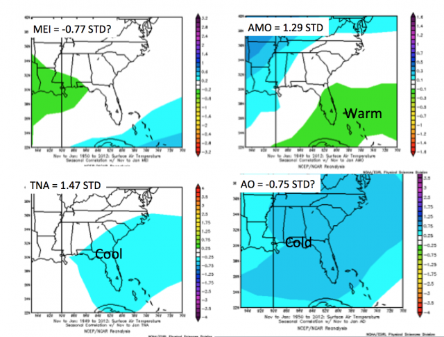 The final factor I'll talk about today is the potential for a Stratospheric Warming event. SW's occur more frequently during easterly QBO's and are always welcomed if you're a winter weather lover. SW events cause a disruption of the polar vortex, and depending on the strength, can dislodge some bitterly cold air south.
I'll be anxiously watching all of this as we head toward winter because as you know, I love winter weather. Not that I'd want to live all winter with cold and ice, but give me 4 or 5 good winter storms and I'll be good. :-) |
Archives
March 2019
Categories
All
|
OLD NORTH GA WX BLOG
 RSS Feed
|
Never base important decisions on this or any weather information obtained from the Internet. Always have a backup method of receiving weather information such as a battery powered weather radio.
Copyright © 2018 NorthGeorgiaWX.com and DaculaWeather.com 
|