|
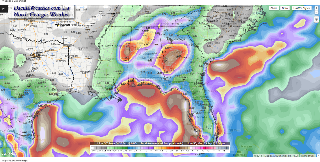
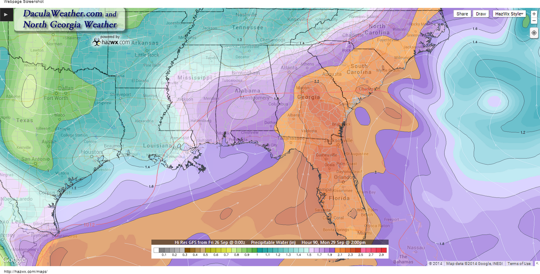
Well, I'm not very confident about the placement of the bullseye of rain by the GFS, but someone is going to get a lot of rain this weekend as an area of low pressure forms and tracks across the Gulf coast. It appears now that the bulk of rain heavier will stay south of I-20, but everyone in Georgia may see some rain before it's all over. Most of this begins later Saturday, so if you have yard work to do, get out early if possible. We'll start with the latest Area Forecast Discussion by the Atlanta National Weather Service Office. I bolded a few sections that I thought were important. .LONG TERM /SATURDAY NIGHT THROUGH THURSDAY/... MODELS SHOW VARIOUS LEVELS OF INTERACTION BETWEEN THE SHORTWAVE TROUGH OVER THE MIDWEST AND THE SHORTWAVE TROUGH OVER TEXAS DURING DAYS 2 AND 3. THE MAJORITY OF SOLUTIONS AGREE ON 2 DISTINCT AREAS OF RAINFALL... ONE OVER THE NORTHERN GULF COAST STATES... AND ANOTHER AREA ALONG THE CENTRAL GULF COAST PERHAPS EVEN OFFSHORE. Listening to them, they favor more coastal to offshore development. The GFS paints the bullseye somewhere toward central Georgia as you can see in this image. The WPC has their own thoughts about this system as you can see in this image: There will be some very high precipitable water values this weekend, upwards of 2.2". Notice how the NW corner of Georgia is missing out.
|
Archives
March 2019
Categories
All
|
OLD NORTH GA WX BLOG


 RSS Feed
