|
Attention continues to be on the winter weather potential at the end of the short term period. Latest model runs are advertising slightly better moisture, and that, combined with cold thermal profiles and partial thicknesses, will allow for a mainly an all snow event. SO models are indicating some better lift in the dendritic growth zone, especially late Tuesday night and into Wednesday morning over portions of western Georgia and the south Metro/middle Georgia area, which could locally enhance accumulations. In general, the models have an overall consensus that this could happen, but with a lack of consistency run-to-run, have opted to hedge amounts upward, but trend towards the more conservative side. This is especially the case with the snow grids for areas south of LaGrange to Macon to Warrenton. The models are also in agreement in depressing snowfall amounts in the Gainesville area due to downsloping. At this time, have advertised less than half an inch accumulations in this area instead of the near zero accumulations, but will need to monitor how subsequent model runs sort this out. TIMING... Onset timing has sped up even from the overnight solutions, with pops increasing in far northwest Georgia from slight chance mid morning to likely by 1 PM. Although the Atlanta area could see some flurries in the afternoon, the better chances will be in the early evening hours through the wee morning hours. AMOUNTS... At this time, have gone with around 1 to 1.5 inches for the higher elevations of north Georgia, 0.75-1 inch for areas generally north of a line from Rome to Ellijay, to Blairsville, and under 0.5 inches for areas south. At this time, have a tenth of an inch advertised for as far south as Americus (do not have any accumulations for our far southeast corner counties). A Winter Weather Advisory has been issued for far north Georgia and the north and west metro Atlanta area, with counties parsed out to best reflect onset timing. At this time, although accumulations are similar on the west side of the state (down to LaGrange/Columbus) confidence is much lower in these amounts for middle/central Georgia. As a result, these areas have not yet been included in any Advisory, and instead a Special Weather Statement has been issued for them. OTHER HAZARDS... Taking a back seat to the snow potential is the wind chill threat. Expect bitterly cold temperatures to impact the area in the wake of the snow as extremely cold air settles over the area. Temperatures Wednesday morning will be sub-zero or the single digits in the far north, and in the teens across the metro Atlanta area and southwestward toward LaGrange. Have opted to end the Winter Weather Advisory at 12Z Wednesday to best capture both the snow and the wind chill threat without having to issue multiple products. That being said, it may be necessary to go ahead and issue a separate Wind Chill Advisory with tomorrow's afternoon package. 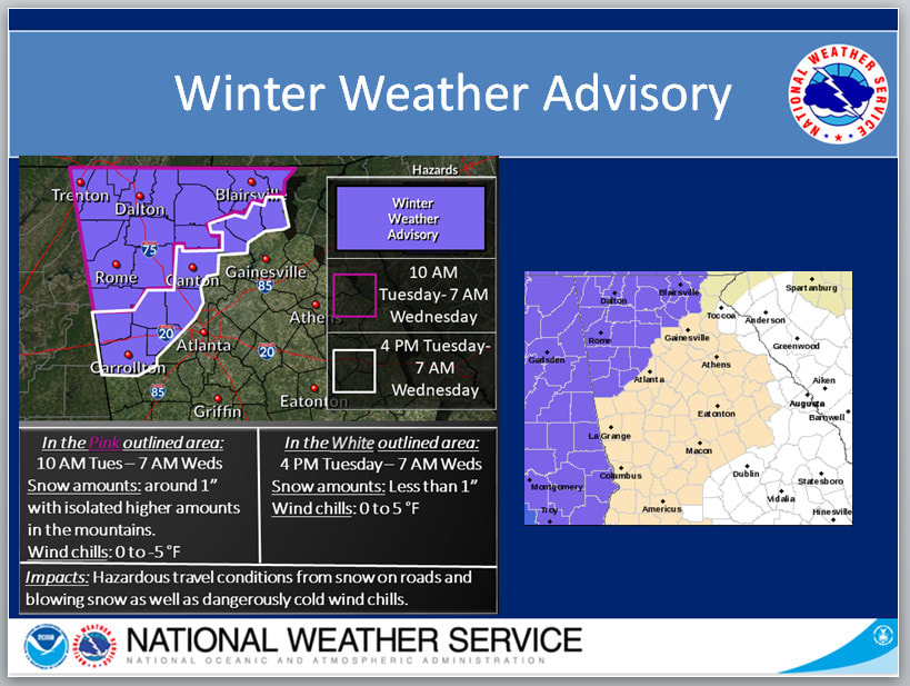 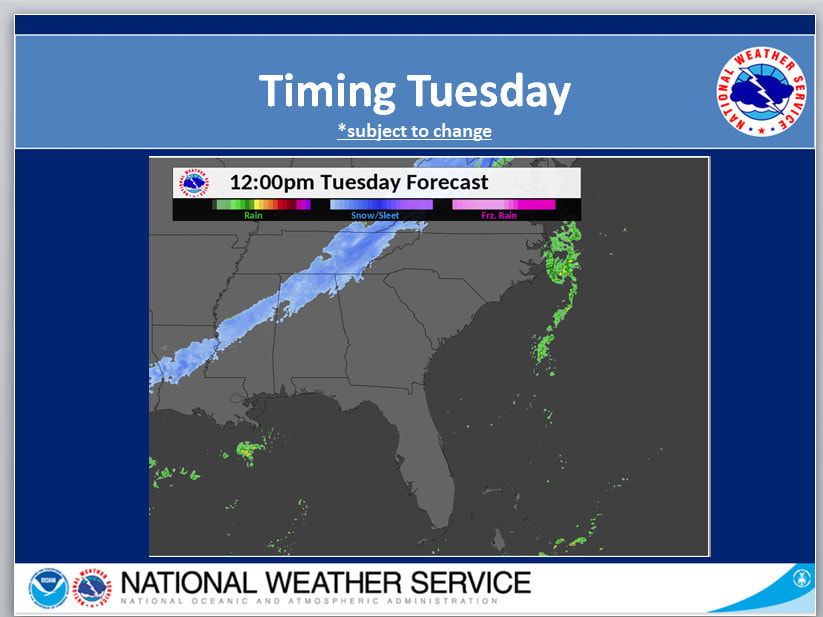 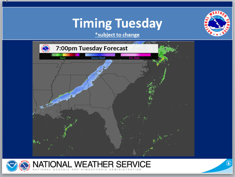 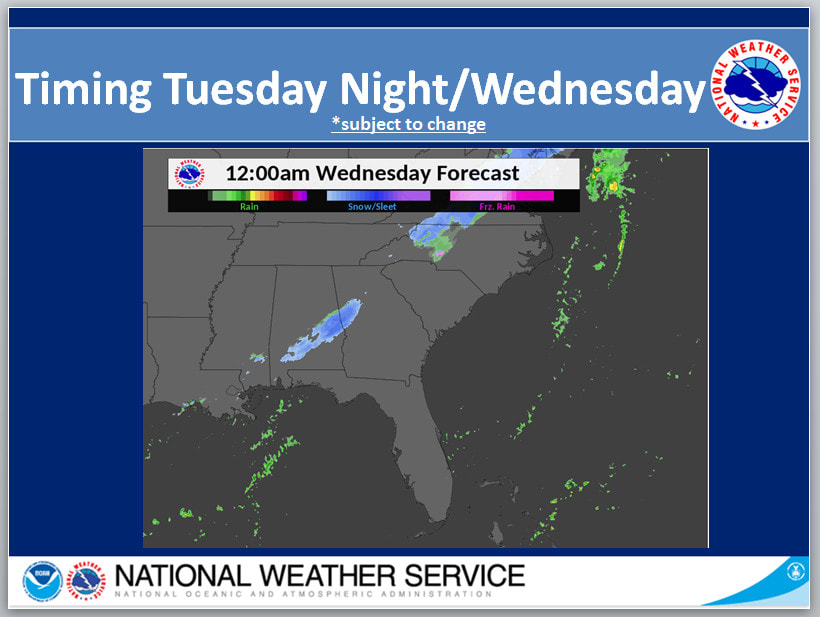 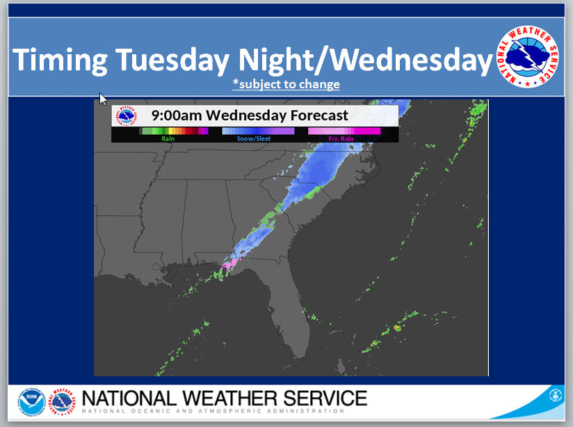 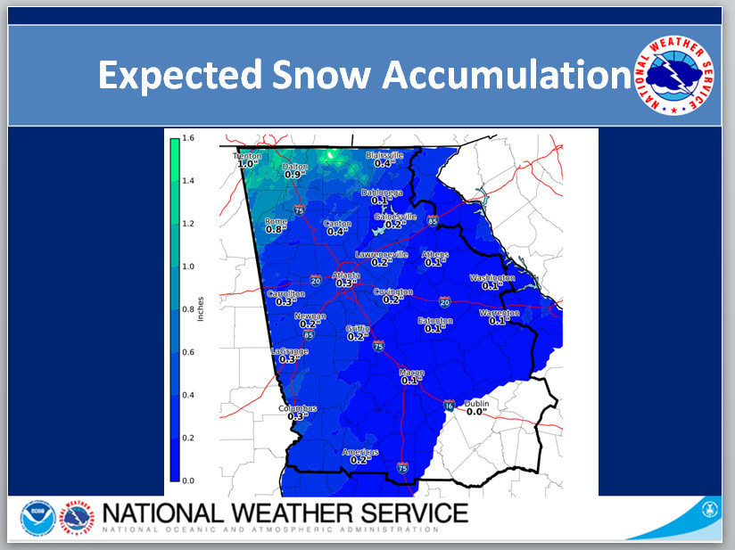 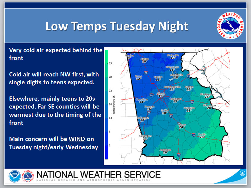 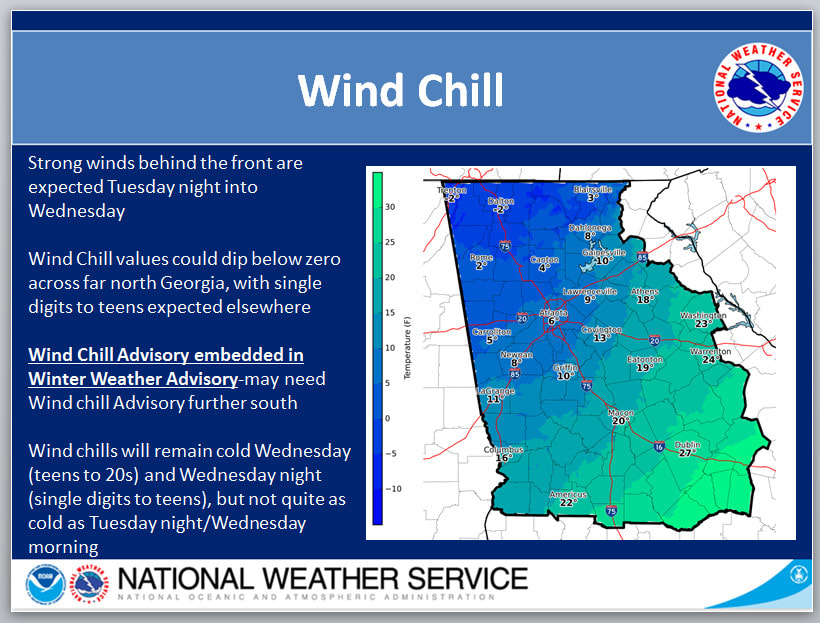 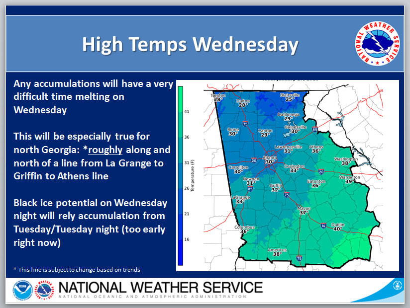 |
Archives
March 2019
Categories
All
|
OLD NORTH GA WX BLOG
 RSS Feed
|
Never base important decisions on this or any weather information obtained from the Internet. Always have a backup method of receiving weather information such as a battery powered weather radio.
Copyright © 2018 NorthGeorgiaWX.com and DaculaWeather.com 
|