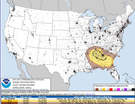
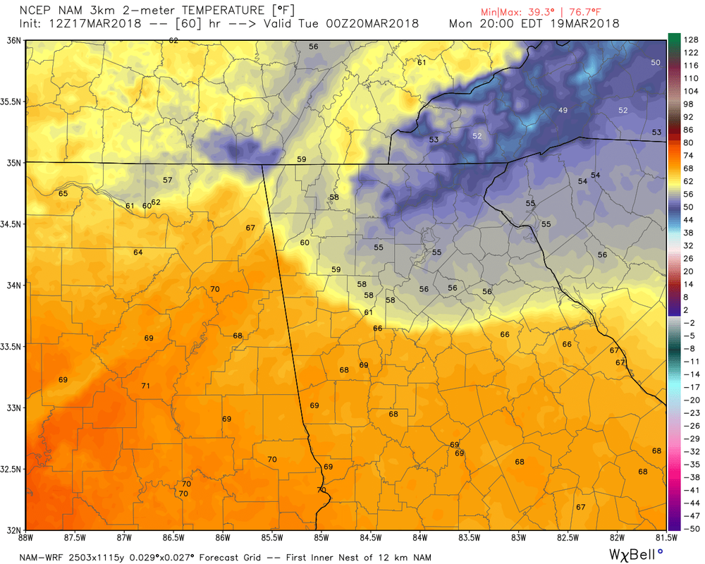
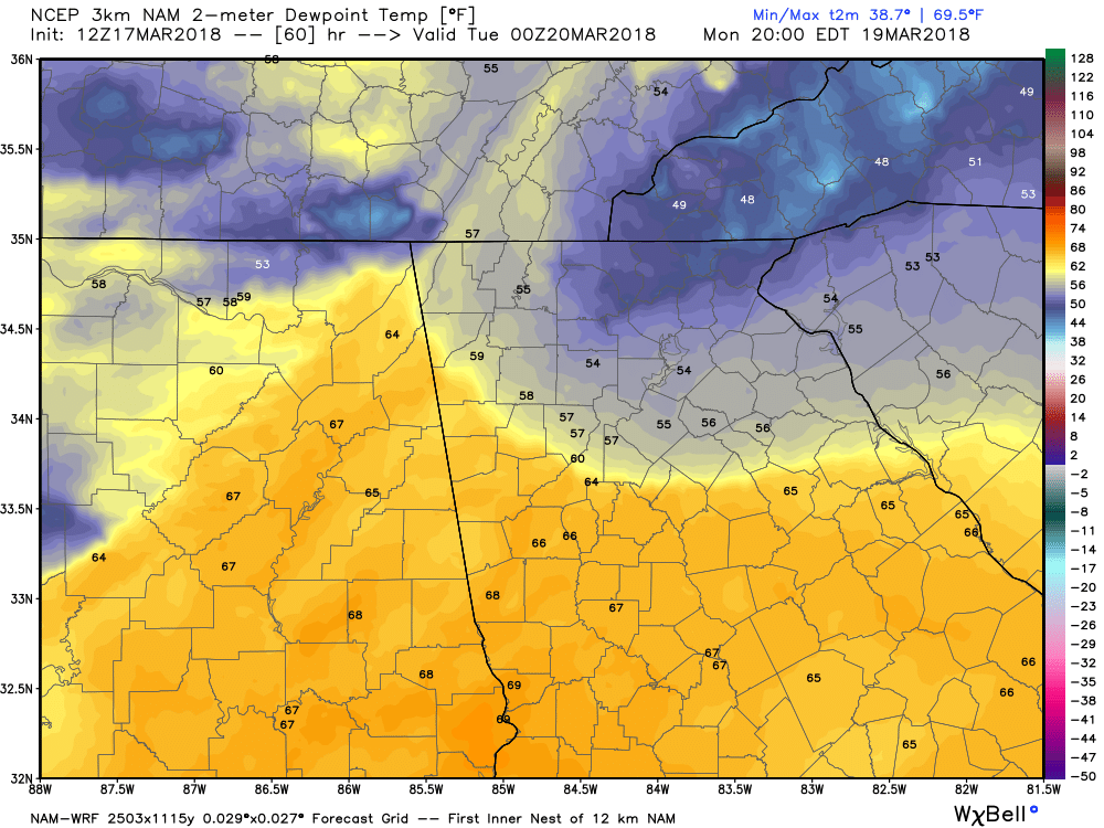
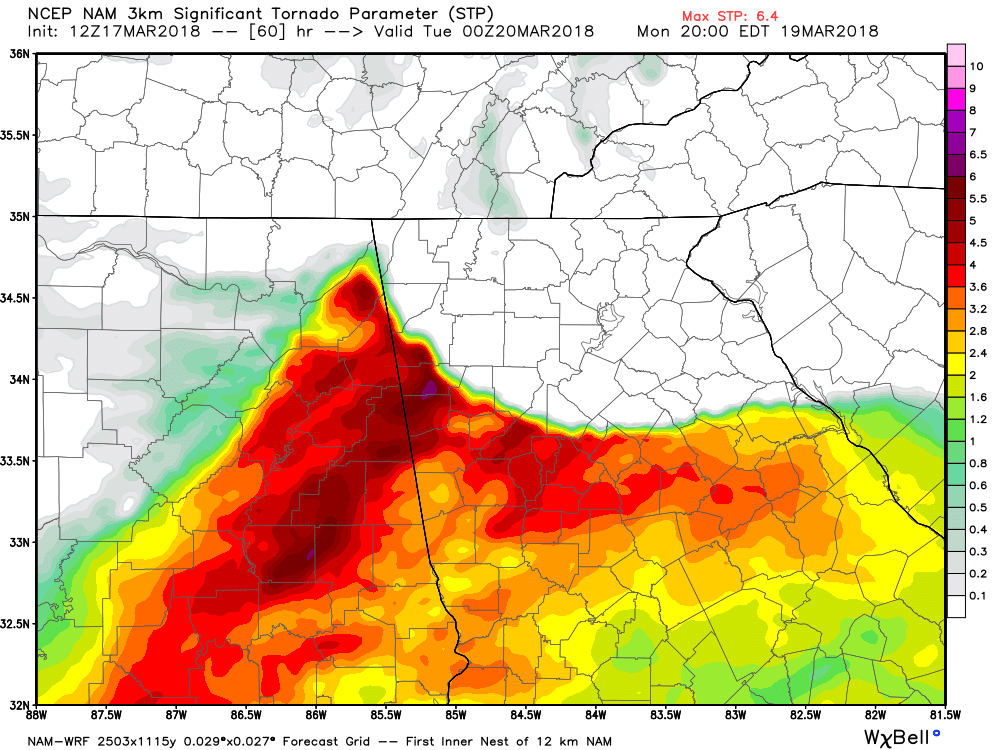
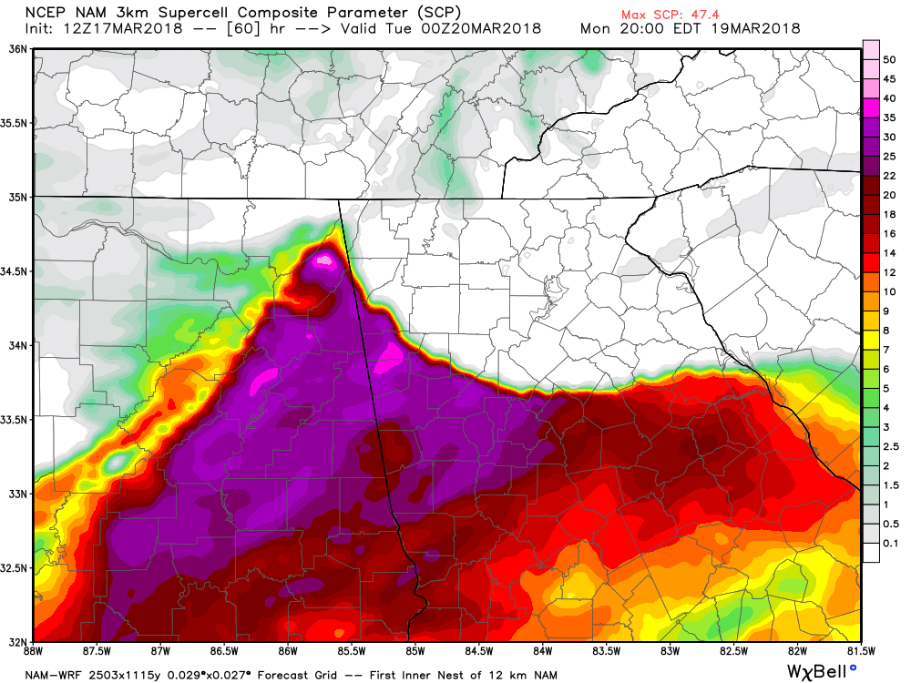
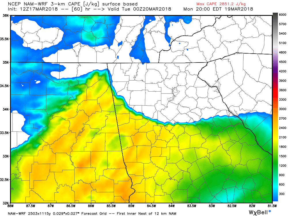
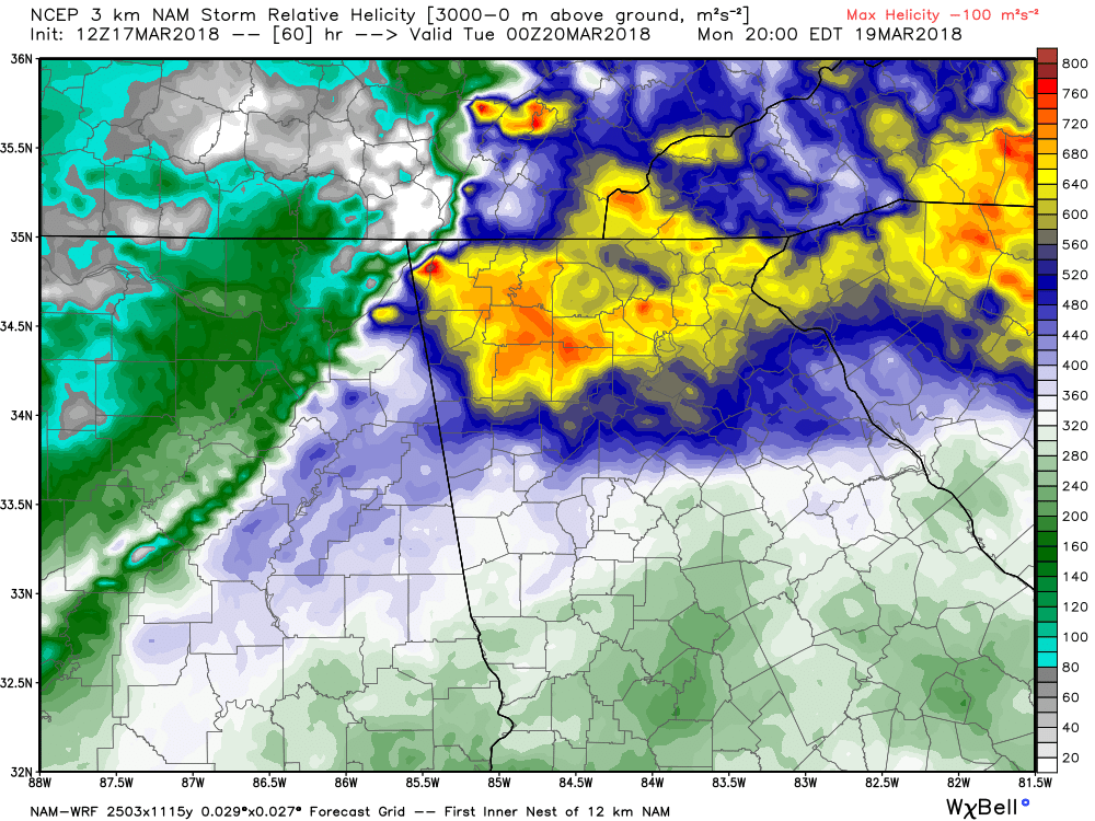
 In order to get severe weather, there are several ingredients that need to come together, a warm moist atmosphere and a method to generate lift. If the winds turn with height, you get helicity or rotation. The latest NAM 3km high resolution model is really bumping up the severe potential on Monday, but not for everyone. The NAM has been the stronger of the models to this point. The images below show a weak wedge pushing into the east and north metro area Monday evening, keeping temperatures and dew points down. Also notice that the composite severe parameters keep the worst of the severe chances outside the wedge. There is still plenty of time for change, but in the scenario the NAM is showing, the north and northeast areas of north Georgia would not be in the worst location for severe. However, for those areas outside the wedge, the severe parameters are much more disturbing. The Supercell Composite alone is near the top of the scale while the Significant Tornado parameter runs 4-6. This is just one model and one run, and as you know, things can and will change, so a few more model runs will be needed before specifics will be known. Everyone needs to have a plan for Monday evening. More later... #knowwhereyoulive
|
Archives
March 2019
Categories
All
|
OLD NORTH GA WX BLOG
 RSS Feed
|
Never base important decisions on this or any weather information obtained from the Internet. Always have a backup method of receiving weather information such as a battery powered weather radio.
Copyright © 2018 NorthGeorgiaWX.com and DaculaWeather.com 
|