|
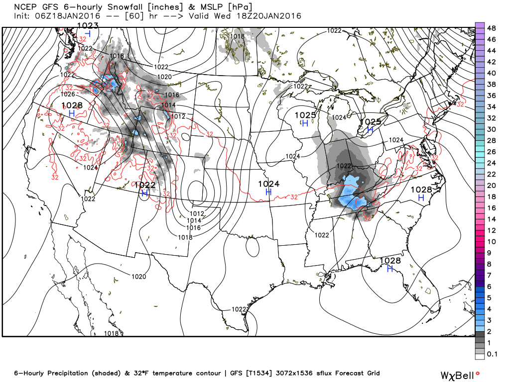
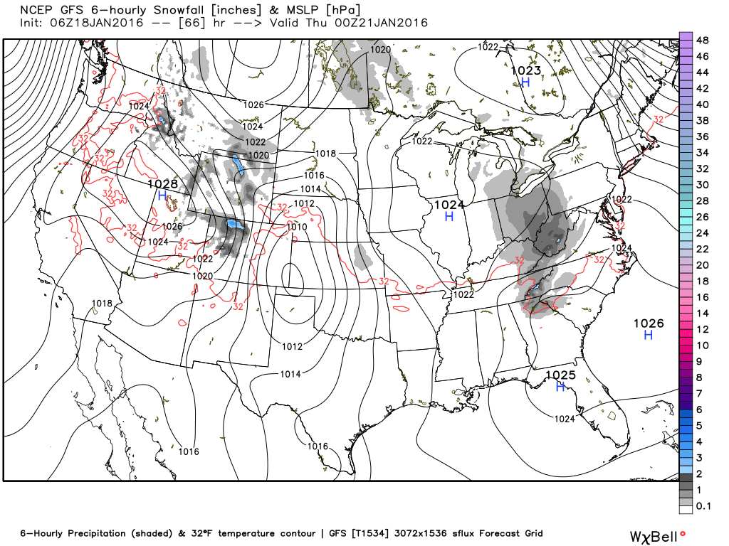
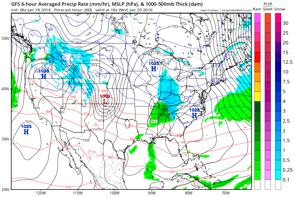
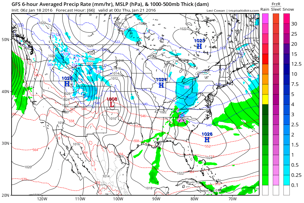
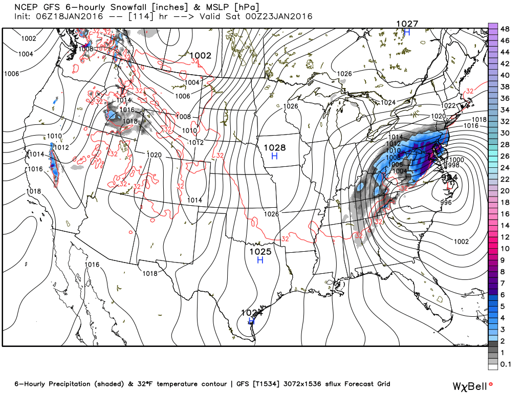
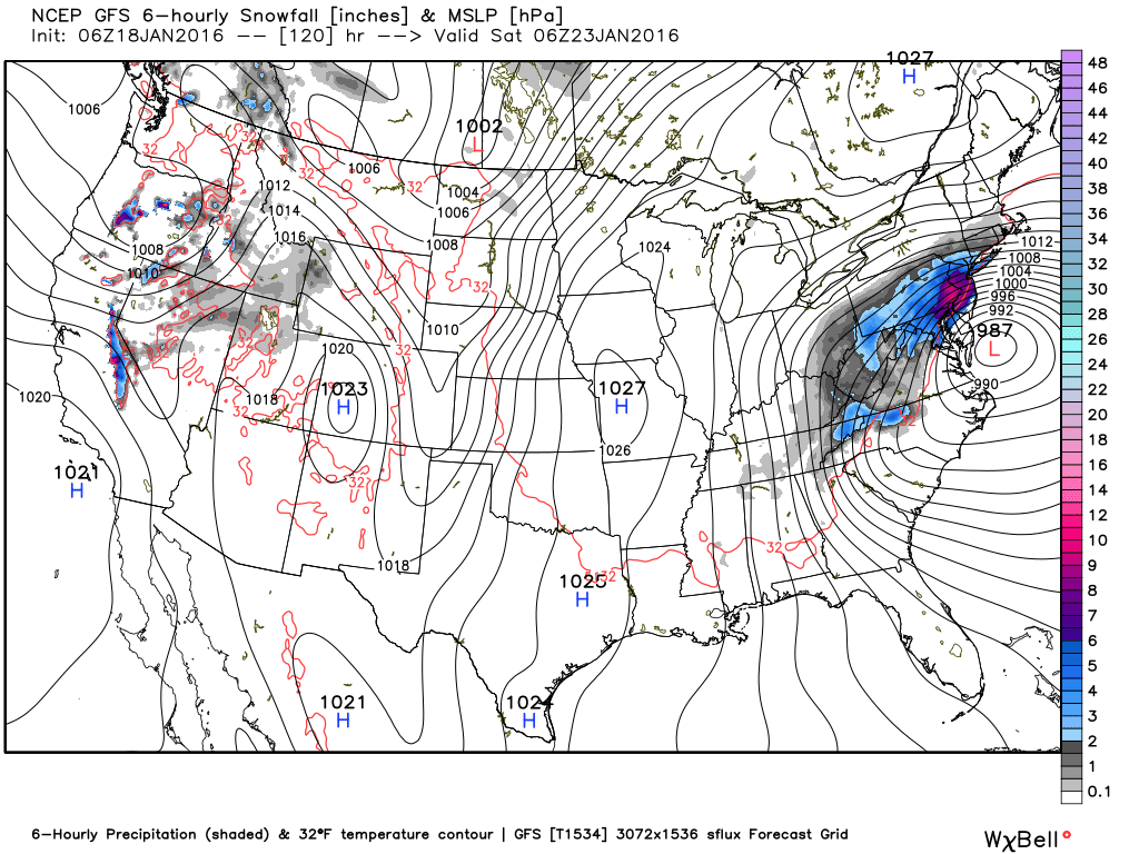
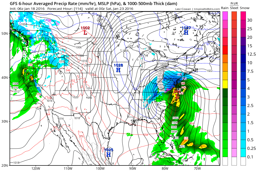
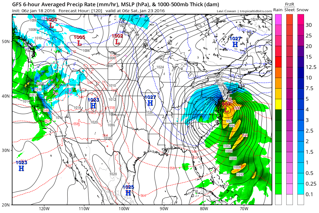
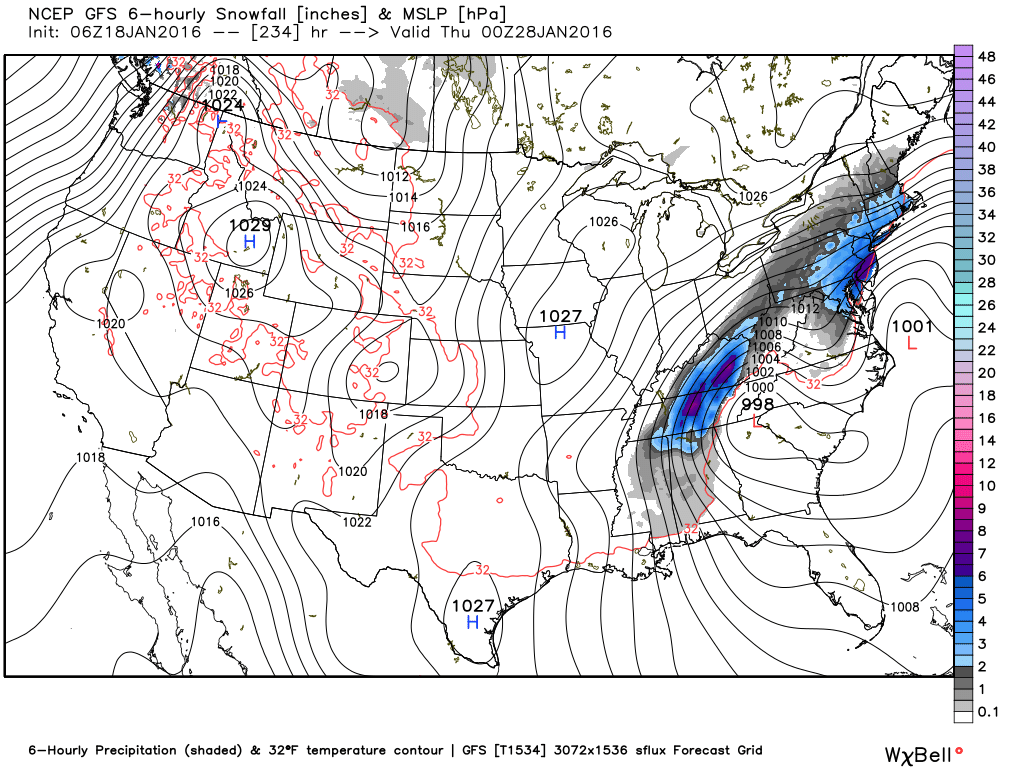
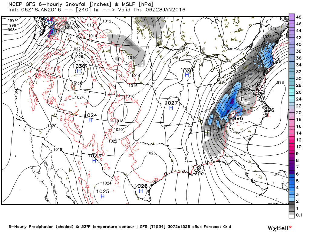
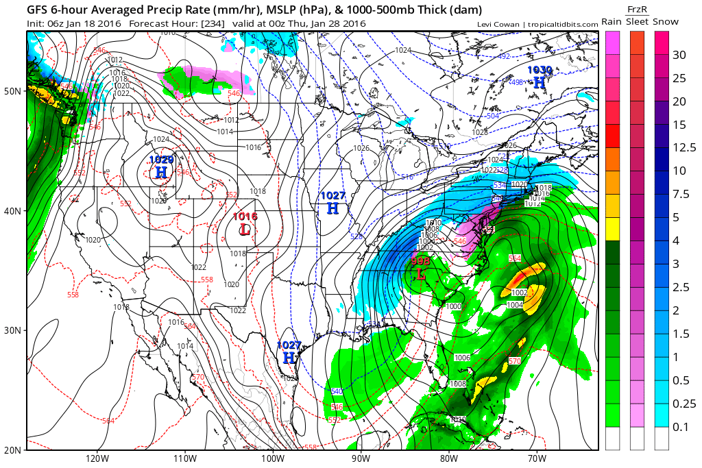
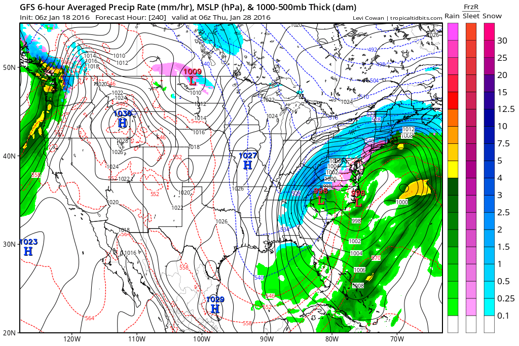
**** SNOW WISHCAST **** OK...I'm going to do something I don't like to do, but just so no one gets too discouraged after reading my message this morning... THIS IS NOT A FORECAST, THIS MAY NOT HAPPEN AT ALL, AND IT WILL MOST LIKELY NOT HAPPEN LIKE YOU SEE IT HERE. Do not go tell people I said it was going to do what these maps say. Do we have a deal? :-) This is the GFS on Wednesday. They simply show we're close. The image on the right shows some potential for icing as the moisture departs, although temps should rise above freezing. The next set of images are for Friday. you can see that our only hope in this scenario is that we get some wrap around moisture. This look is not usually good for us. This system on the 28th is a big dog storm. Granted, for us at the moment these maps were produced, the low is too close, we would only get wrap around snow, but this is very much something to keep our eye on. And notice something else, notice how the track is further south than the system that we will see this Friday. As we go into February, those tracks should get even lower, and that's when we start to get excited. We get that track a little bit lower for this system and we might be looking at our first real winter storm. Drop that track down just a little further than that and it might just end up being a big winter storm.
This is 10 days out, so I don't want to give any false hope to anyone, but we are heading into the prime time of our winter season, so there is certainly lots of reason to have hope. Images WeatherBELL and Tropicaltidbits |
Archives
March 2019
Categories
All
|
OLD NORTH GA WX BLOG
 RSS Feed
