|
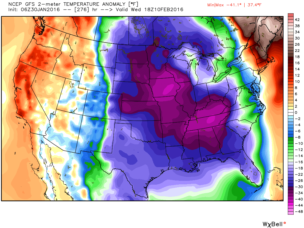
I started looking at the computer models this morning, and I usually look at the GFS first since it appears first in the list of modes on the WeatherBELL site. I got out to around day 10-11 and and my jaw hit the floor. The GFS was bringing the whole arctic into the US. The images are explained below, but what the GFS is showing are temperatures 40-50 degrees below normal. Lows in north Georgia would be in the single digits if not lower, and highs would struggle to get above 20. But.... there is a possibility of a big storm during that period. THIS is the storm and period we can't afford to miss out on, so we'll wait and see if the low takes a more southern track. There is a lot of time for this pattern to evolve but it appears to be a prime period for winter weather. Just a reminder that these images are not a forecast, but one model run from one model. But we are certainly headed the correct direction for winter weather.
|
Archives
March 2019
Categories
All
|
OLD NORTH GA WX BLOG
 RSS Feed
|
Never base important decisions on this or any weather information obtained from the Internet. Always have a backup method of receiving weather information such as a battery powered weather radio.
Copyright © 2018 NorthGeorgiaWX.com and DaculaWeather.com 
|