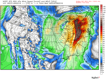
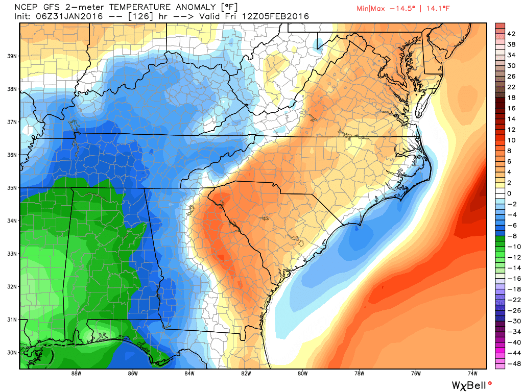
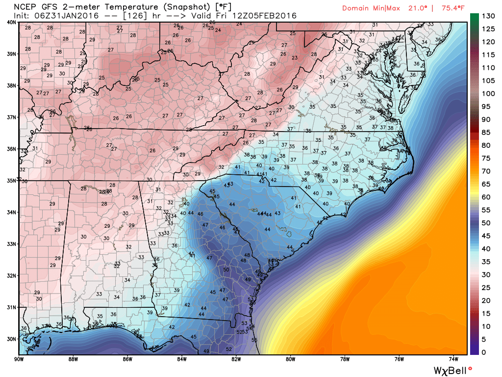
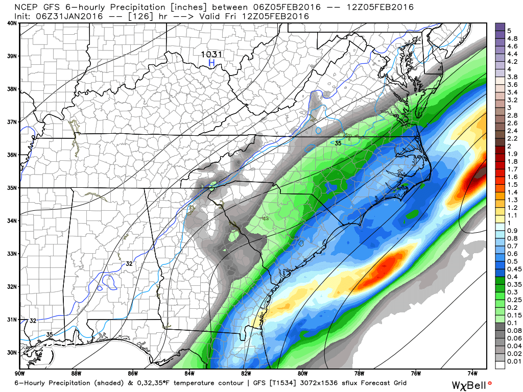
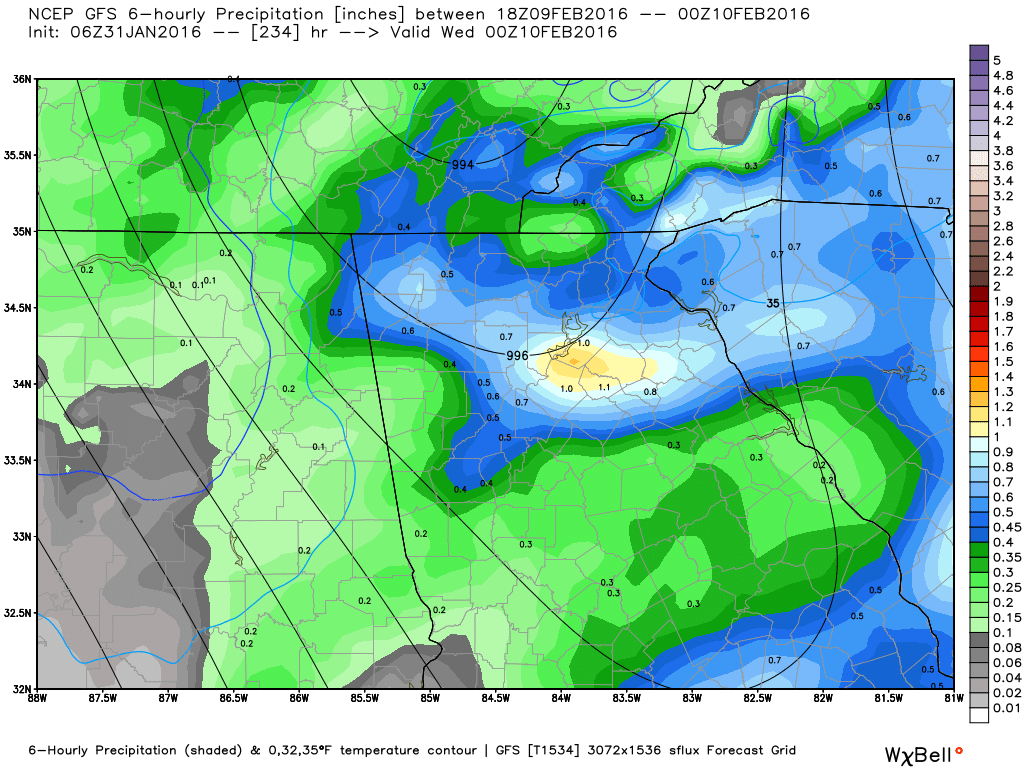
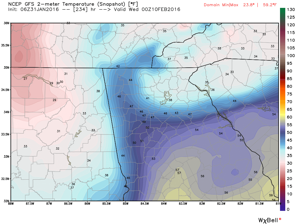
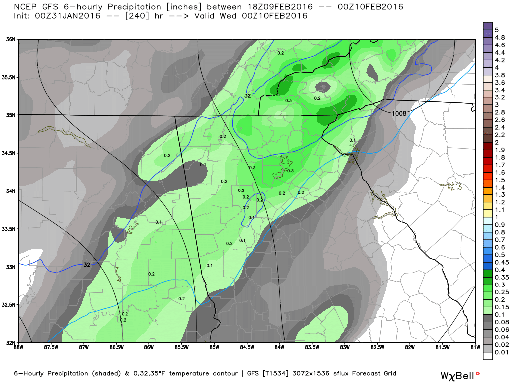
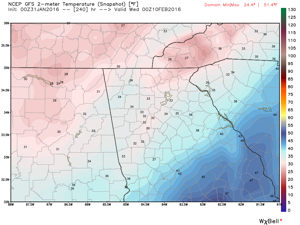
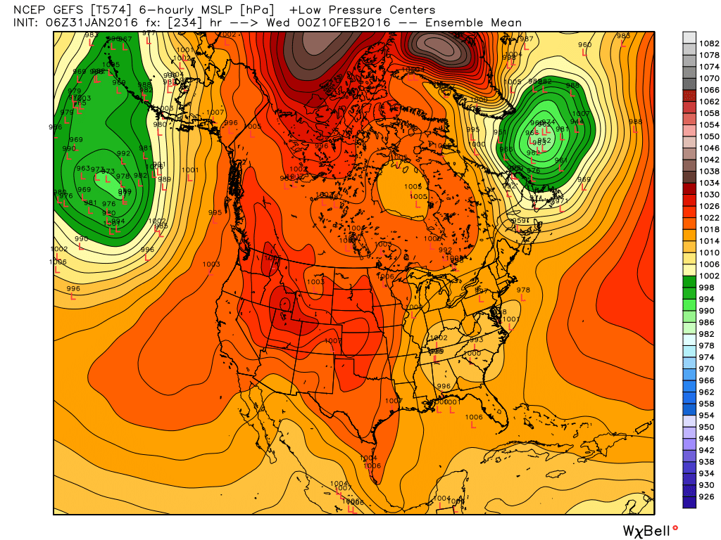
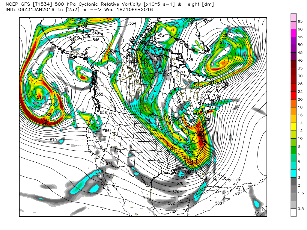
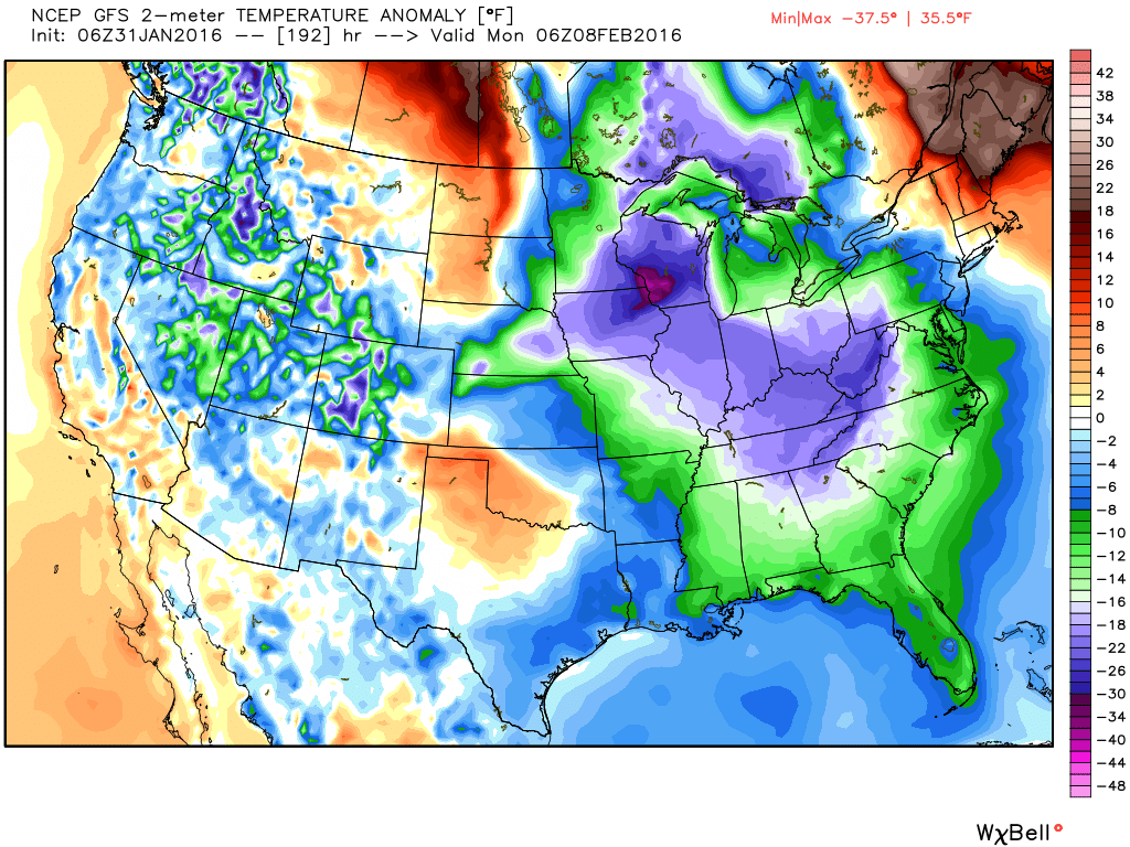
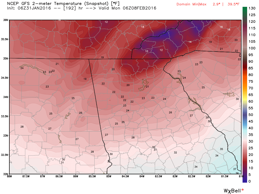
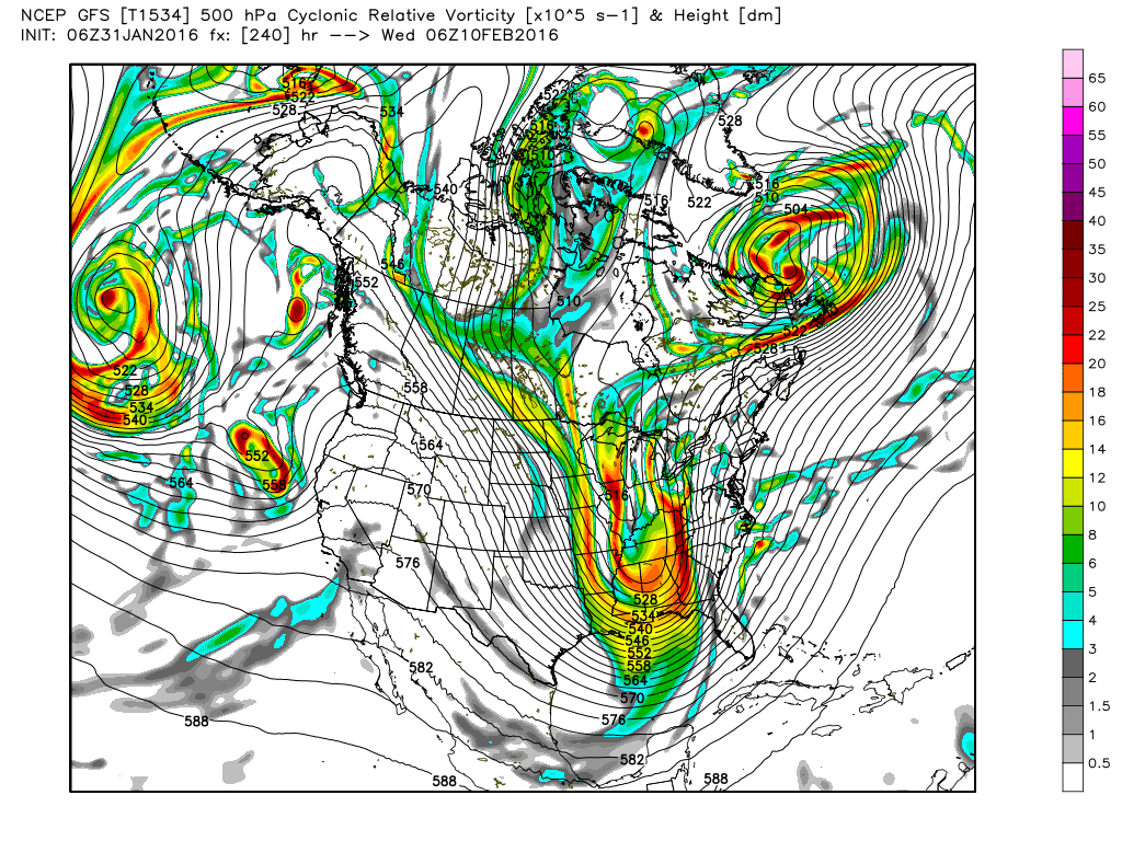
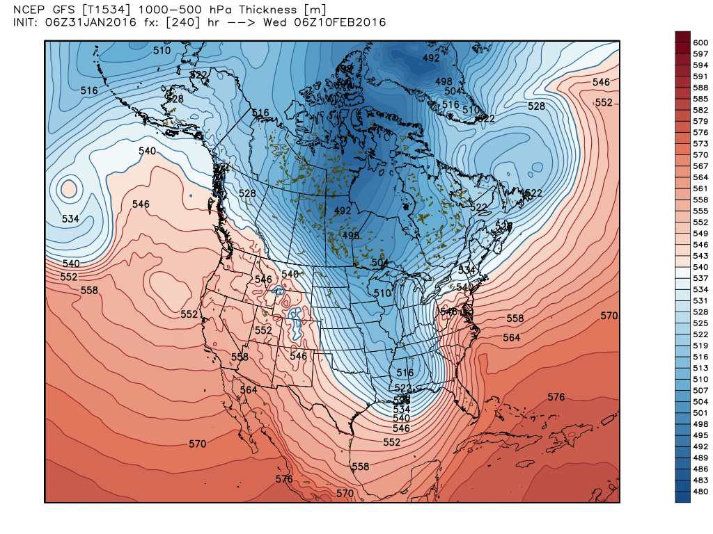
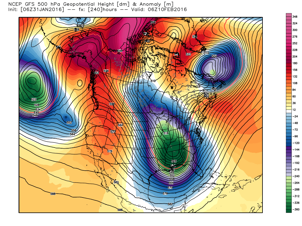
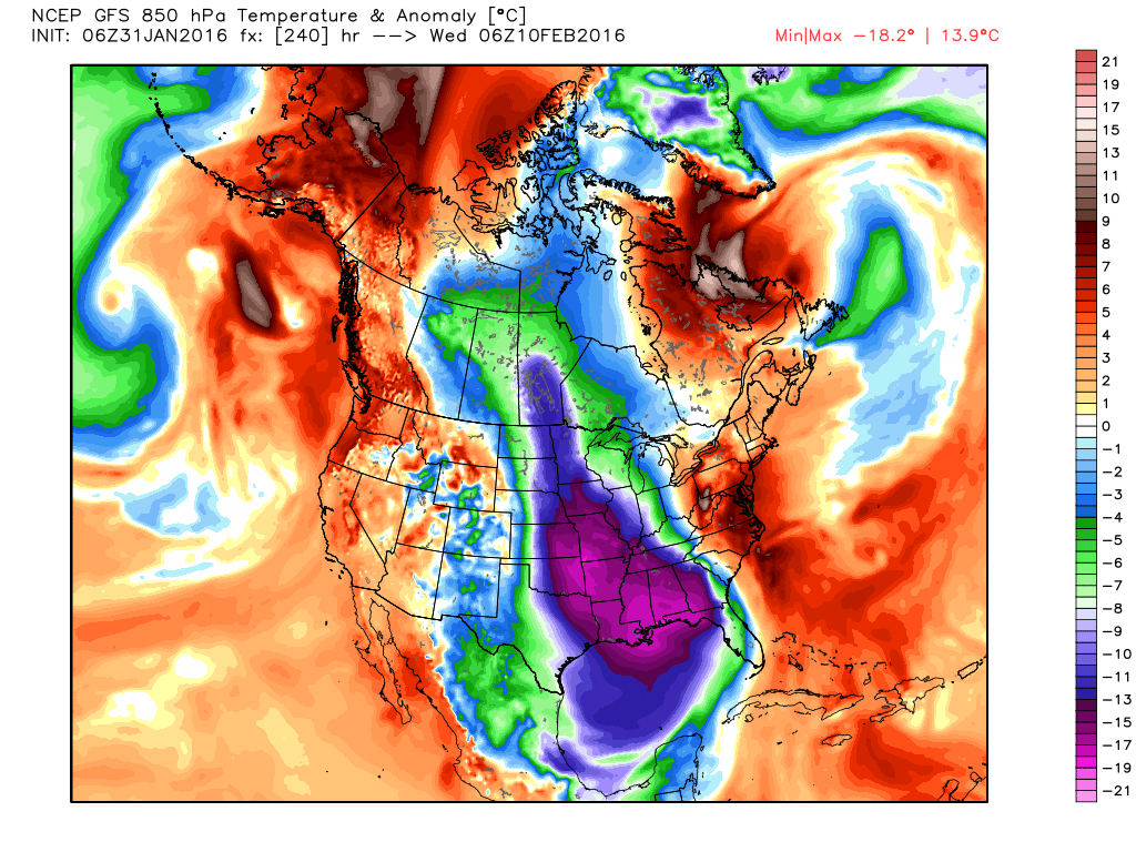
 850 MB wind speed in knots and MLSP @ 1 AM Tuesday in advance of the cold front. 850 MB wind speed in knots and MLSP @ 1 AM Tuesday in advance of the cold front. While there is currently not a lot to add about the upcoming changes, it appears that there should be a very active 6 weeks of winter left to come. The system to kick everything off will be coming here on Tuesday/Wednesday and will be bringing us showers and thunderstorms to start this party. IT appears for now that most of the severe weather will remain to our west. as the low that's bringing this weather moves from the southwest to northeast across the central part of the country, taking most of the severe dynamics with it. Behind the front, the cold air will slowly begin to filter in. Initially, there won't be a big blast, but instead a slow decrease in temps as the eastward movement of the front slows down and almost stalls. There may be a slight chance that some areas in the mountains see some flurries or light snow, depending on where the front decides to stall. The Arctic cold appears to make its appearance around the 7th of February, and we're watching the time period around the 8-11th as a very promising period for potential winter weather across the southeast as multiple shots of arctic air and impulses riding the southern branch of the jet stream should combine at some point to finally bring us some real winter weather. Specifics for this period are unknown as it's just too far out for the models to have a good handle on it yet. Various models runs have seen big Gulf lows as well as systems like the one we just had that brought some of us some snow. Until we get within about 5-7 days of this system, we just won't know the whole potential. Larry Cosgrove said this just last night... This part of the forecast may prove to be downright troublesome, as many of the numerical models and the respective ensemble packages are implying that a significant (or worse) storm will take shape in Texas by February 9. Since it is odd to see that much agreement this far from the time, and case, of cyclogenesis, the situation must be watched. Analog forecasts also strongly endorse the threat, with the scenario of a strong southward intrusion of Arctic air through the Great Plains and Mississippi Valley late in the medium range. The images below show the Sunday, 06Z GFS run (top row of images below). A much stronger low than the 00Z run (2nd row of images below) gives indications of a CAD possibly building in from the NE on the 10th with a ton of precip dumping into cold air. I believe the low will eventually take track further south and the CAD scenario will not be an option. Sunday, 00Z GFS Run Here's a look at the vorticity of the 500 MB trough as it comes through... notice how the GFS has the trough taking on a negative tilt as it rotates through. This could have big implications on the strength of the UL low. Again, in this current configuration, the low would be too far north for us, but I suspect we'll see a southward trend. You can see in this low pressure plot from the GFS ensembles, there are plenty of options on the table. While I can't show you the Euro, it has very similar looks to it. Here are 1 AM temperature and temp anomalies on Monday the 8th. These are NOT the coldest temps coming... just the first of the real cold shots. And a few images for Wed the 10th. There will be lot's more to come on this, as we're still at least 7 days away from the real cold air, and it should be VERY exciting to watch unfold. |
Archives
March 2019
Categories
All
|
OLD NORTH GA WX BLOG

 RSS Feed
