|
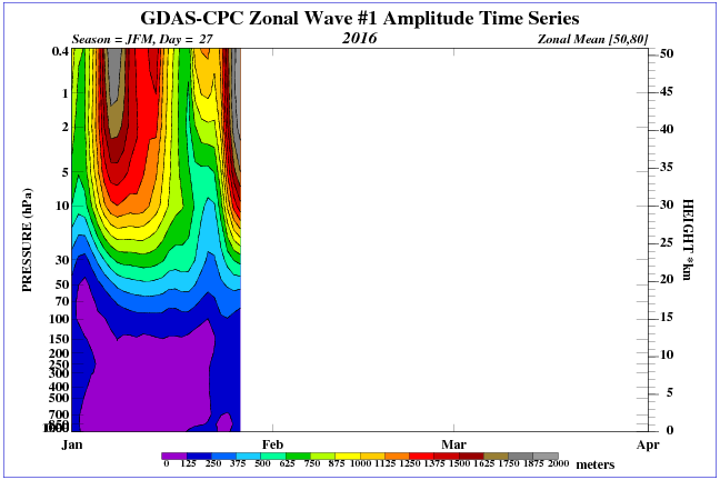
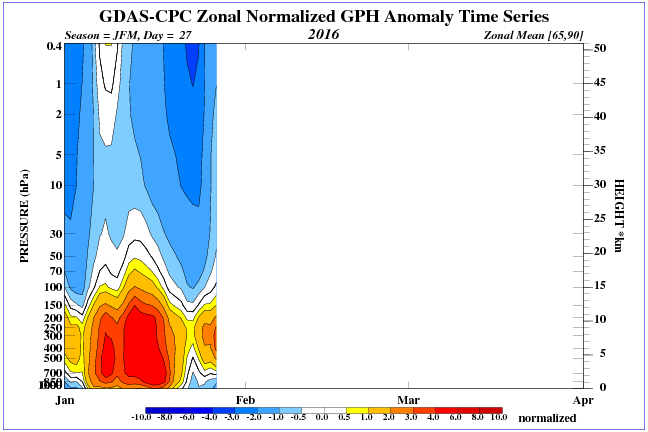
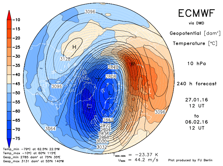
As you are aware, we're watching with interest as a stratospheric warming (SW) event occurs. If you've missed past post, SW events can have a big influence on the weather at the surface, as they tend to move the cold air off of the pole and displace it further south. In extreme events, it can tear the Polar Vortex (PV) into pieces and cause the high altitude stratospheric winds to reverse their flow, which in turn, causes ridging over the pole and sends the cold air elsewhere. You can see from the two images below, there are changes going on in the stratosphere. The image on the left shows the amplitude of Wave 1 heat flux and the pressures it creates. The higher pressures above heat the air and the stronger the pressures, the heat and the pressures will permeate further down in the atmosphere and help to move the PV off the pole. The second image shows pressure anomalies further down in the atmosphere due to changes in the stratosphere. These images and more can be found by clicking here. Many of the images in the post are from WeatherBELL.
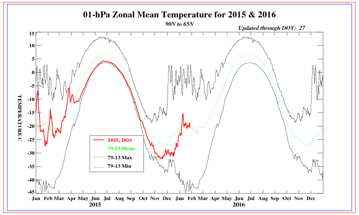
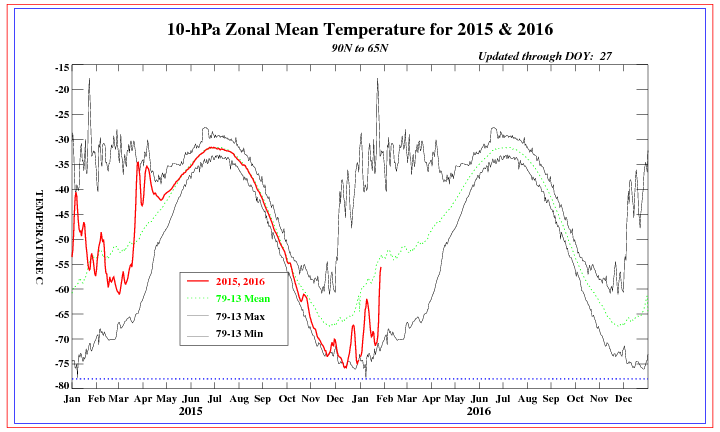
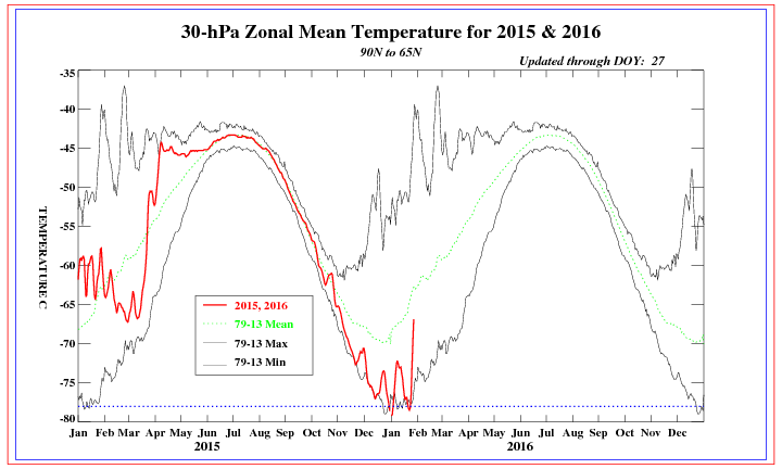
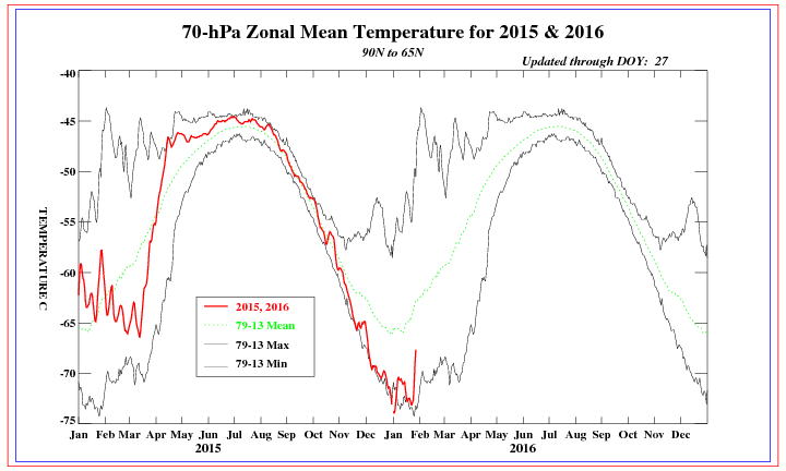
Temperature spikes are showing at all levels of the stratosphere right now, and the pounding on the PV has been pretty relentless over the winter. The constant beating will help to weaken the PV and dislodge the cold air from the pole. All of these images can be found by clicking here.
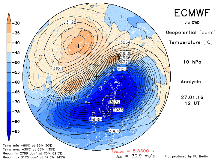
Here are two images from the Euro, current and 10 days. Notice how the PV is getting pushed around. These images can be found by clicking here.
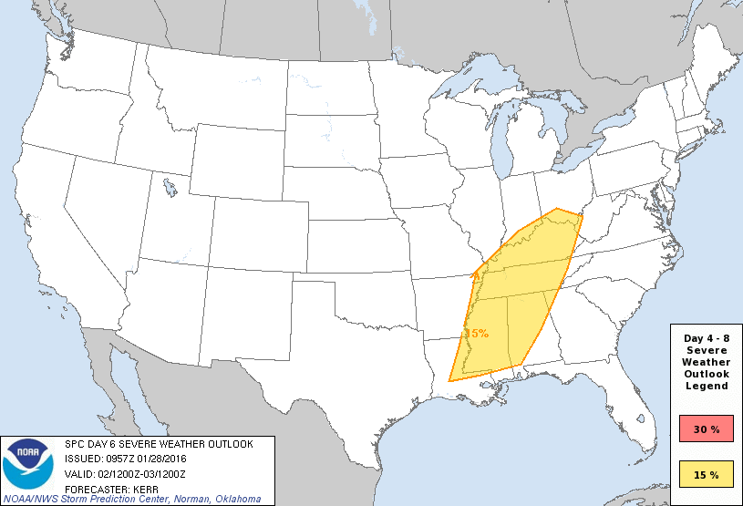
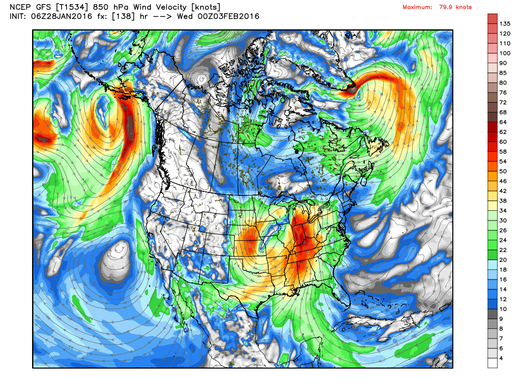
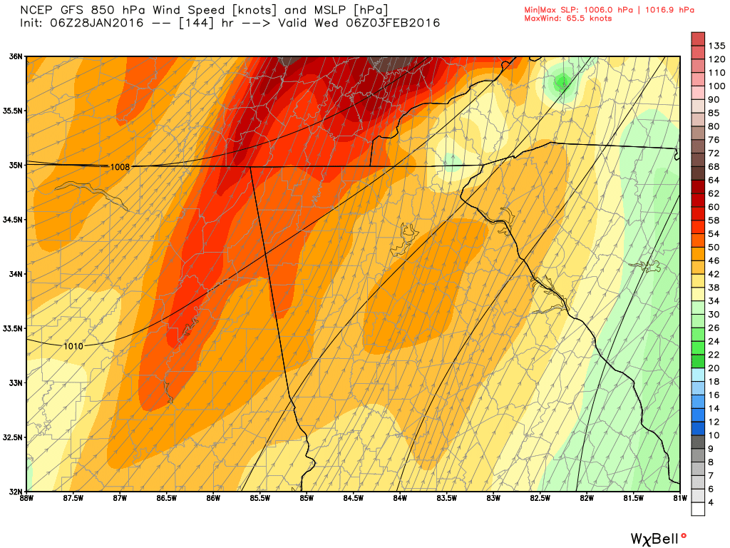
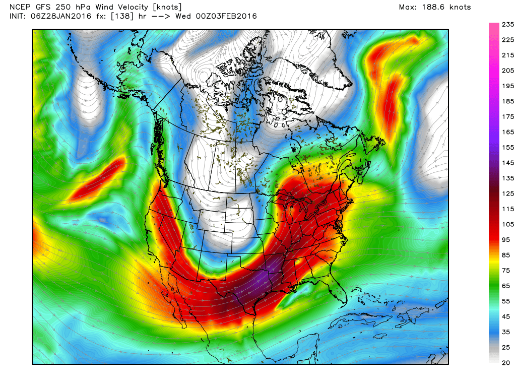
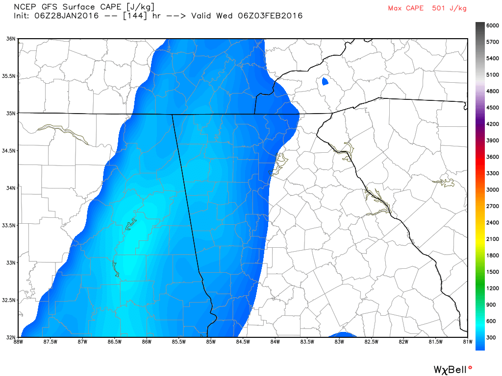
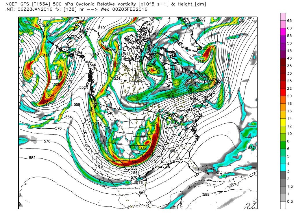
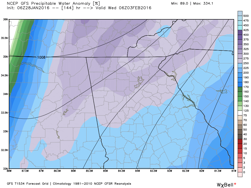
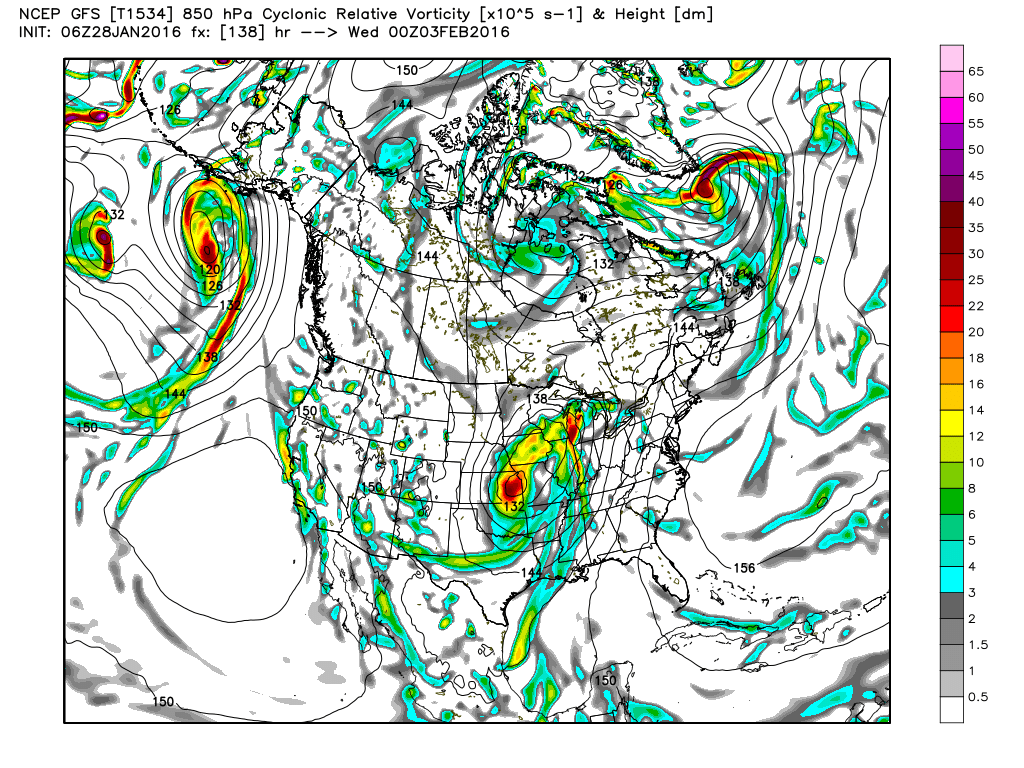
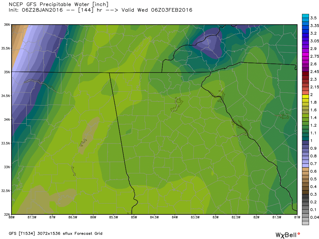
So while we're all looking ahead for the next snow system, I am beginning to have a big concern for the severe weather that the models are depicting for next week. The Storm Prediction Center already has part of northwest Georgia in the 4-8 day outlook for severe weather, and I would expect to see that expanded to the east over much of georgia before it's all said and done. Here's what the SPC had to say (Click here for full text) this morning. This event is something that we will need to watch very carefully as the time gets closer. "It still appears that strong cyclogenesis will accompany this feature along an arcing path... from the south central plains into the Ozark Plateau and Ohio Valley... through the St. Lawrence Valley by late week. These images below show various parameters that will be occurring in advance of the severe weather. The first two show the upper level winds at two different levels (as mentioned in the SPC text above), and the last two images show the vorticity or the amount of "spin" or rotation in the atmosphere. The second row of images show a close up of several severe parameters for 1 AM Tuesday. The large image below all of the smaller ones comes from the Storm Prediction Center (SPC).
 |
Archives
March 2019
Categories
All
|
OLD NORTH GA WX BLOG
 RSS Feed
|
Never base important decisions on this or any weather information obtained from the Internet. Always have a backup method of receiving weather information such as a battery powered weather radio.
Copyright © 2018 NorthGeorgiaWX.com and DaculaWeather.com 
|