|
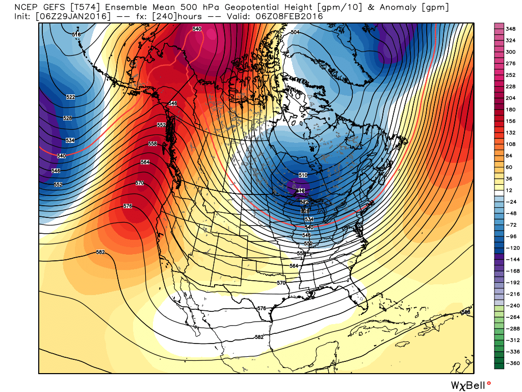
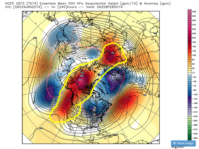
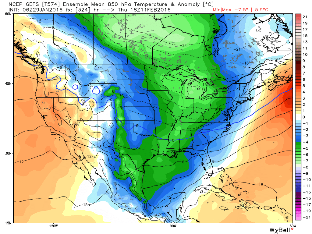
I've talked about the upcoming severe potential for next week, but for us and much of the central and eastern part of the country, may be the Arctic outbreak that is showing up on the models. Let's first take a look at the GFS ensemble mean and the evolution of the cold air. Remember, the ensemble consist of 21 members plus 1 low resolution control run and 1 high resolution deterministic run. These anomalies are in centigrade so the temp in fahrenheit will be colder than the temp values on the legend. 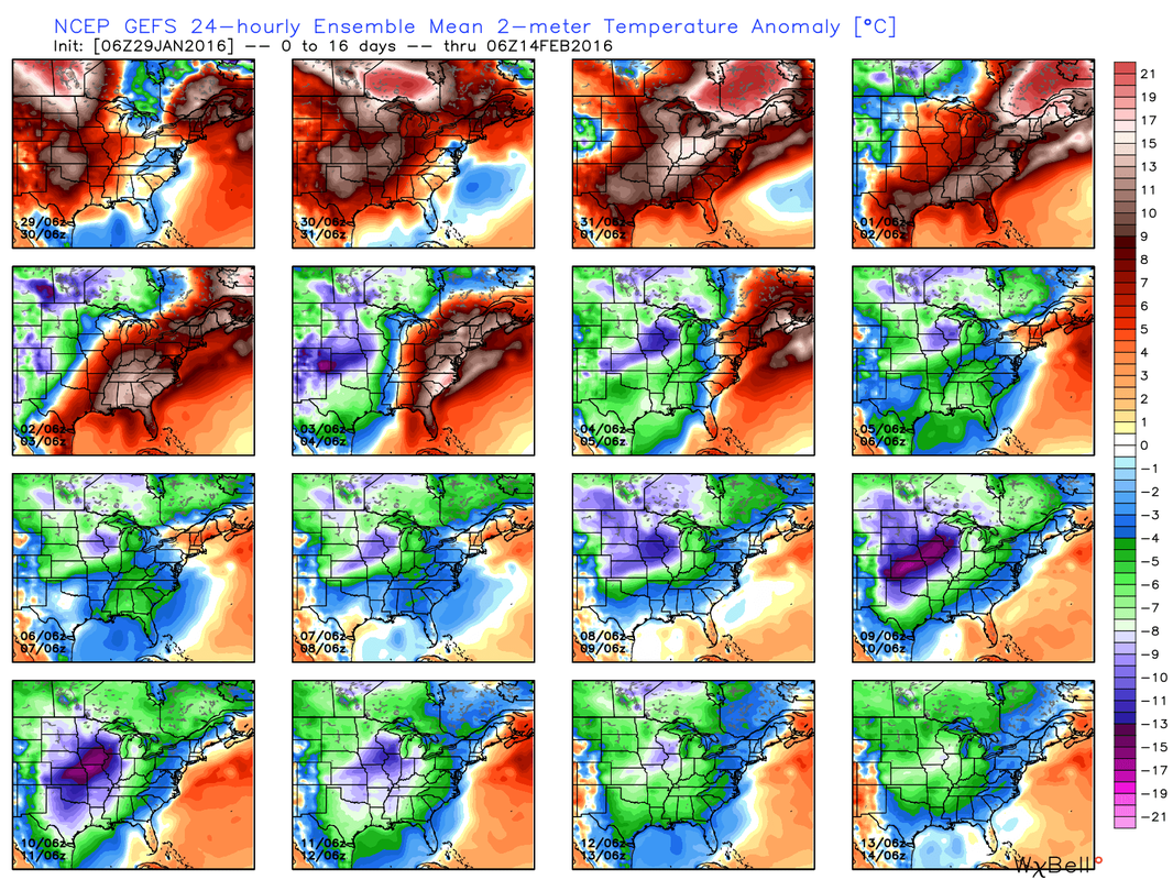 Looking at the upper air pattern, you can see that as we go out 10 days, we finally see strong blocking out west with the ridge extending all the way across the pole.
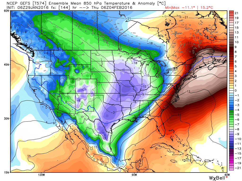
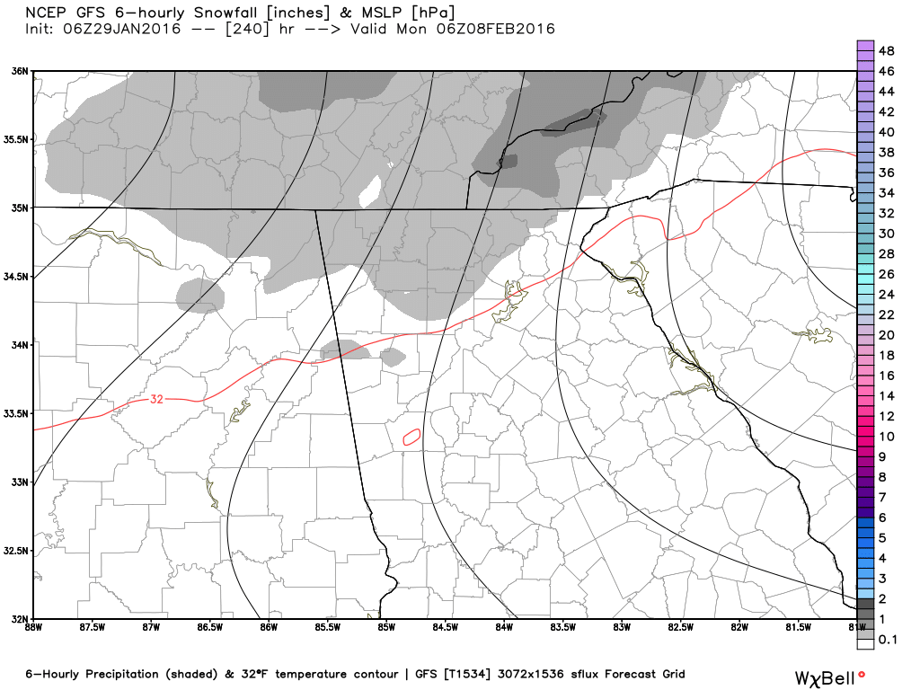
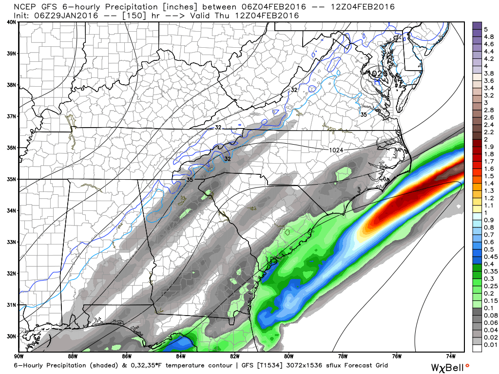
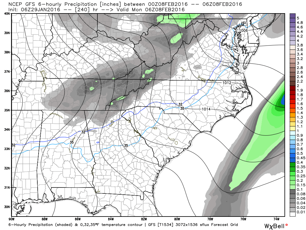
Even though this will be arctic air and is relatively shallow, temps higher up will be right where we need them to be for snow. Here's a look at 850 MB temps beginning around the 4th when the front comes through and again on the 11th. These images show anomalies and also the freezing line.
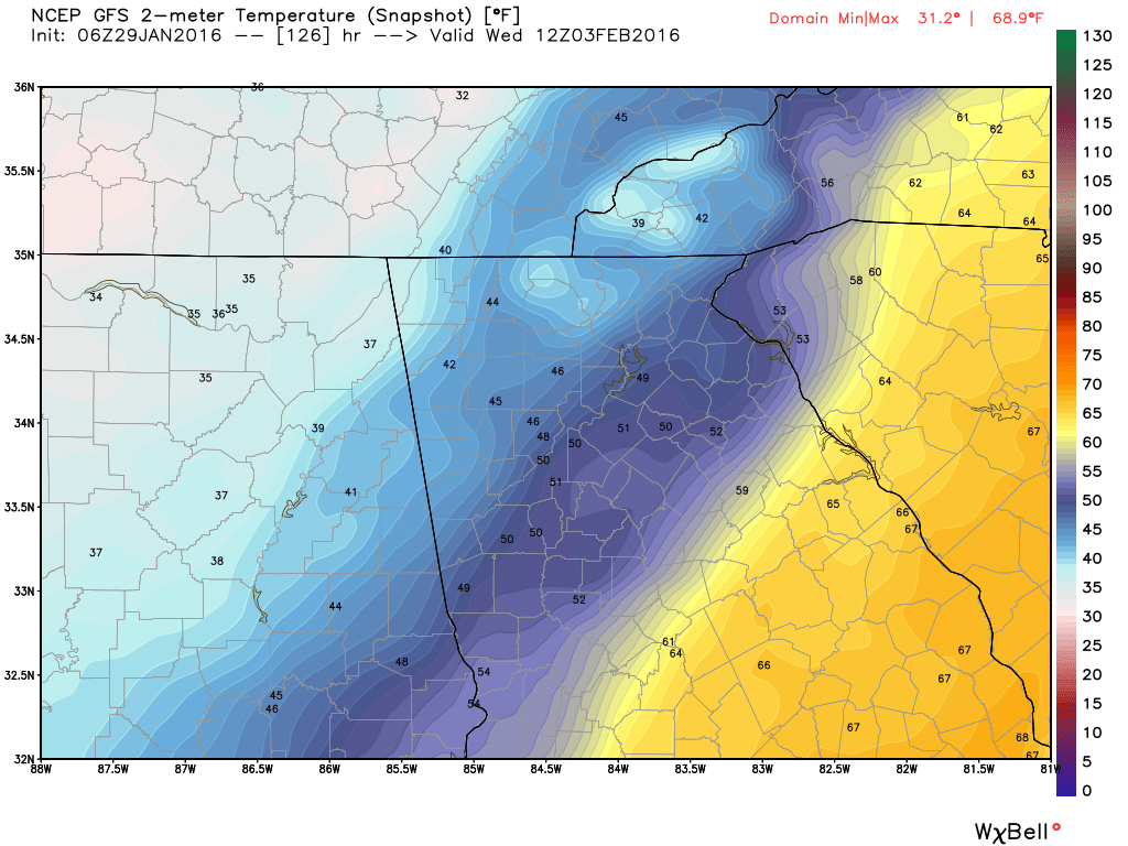
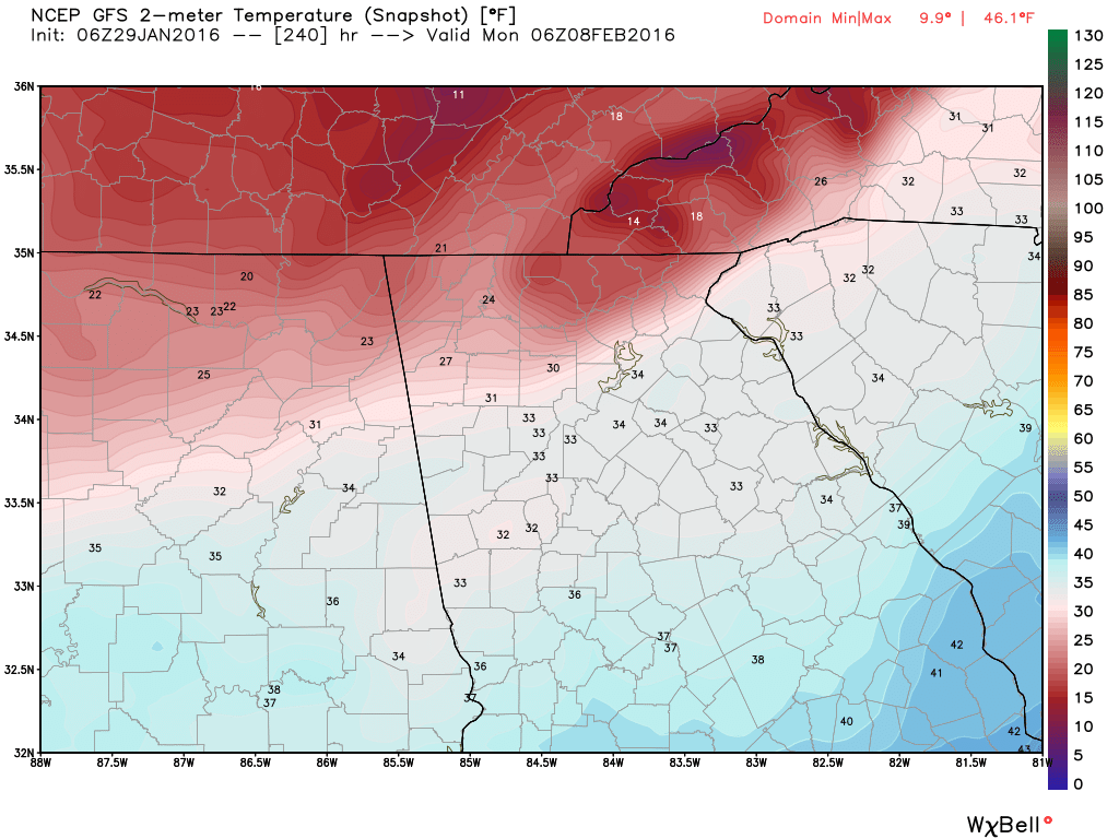
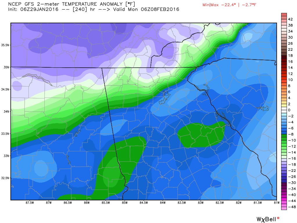
Keep in mind that you are looking at ensembles, so the 21 or so runs are all averaged or blended together. If we take a look at the deterministic run (zoomed in for us) for for around the same period we see these images. Waves of cold with
|
Archives
March 2019
Categories
All
|
OLD NORTH GA WX BLOG
 RSS Feed
|
Never base important decisions on this or any weather information obtained from the Internet. Always have a backup method of receiving weather information such as a battery powered weather radio.
Copyright © 2018 NorthGeorgiaWX.com and DaculaWeather.com 
|