 WeatherBELL Analogs for February WeatherBELL Analogs for February
Lots of talk about the early demise of winter among the naysayers and beach bunnies, but if you look out into the future, you start to see something else on the horizon.
Winter is not over folks, and winter is probably not going to be over until well into March. Nino winters are generally backloaded winters, meaning that the bulk of the winter weather occurs later in the season instead of early, and we certainly saw evidence of this during December. But in the original WeatherBELL forecast that was made back in August had December as being a warm month and February being the coldest relative to normal. I've included all three months of the WeatherBELL analogs here so you could see what they thought may happen.
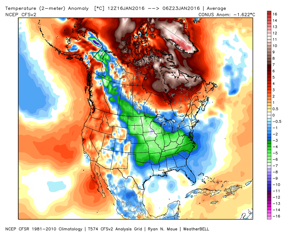
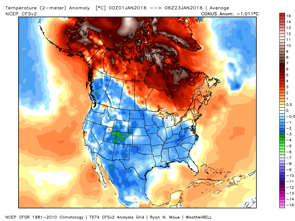
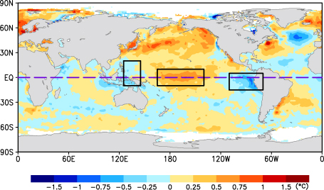
After the scorching December that we had, January was a complete flip for the entire country. The images below show temperature anomalies for the last 7 days (left) and the month to date. You can see that so far, the entire country has been below normal for the month.
But cold doesn't always equal snow, at least here in the south. While some areas have been hammered, we are not one of those areas. The lows have been wanting to take a more northern track (cutters or clippers) across the country, as none of the lows have started their life way down south like we need for them to do.
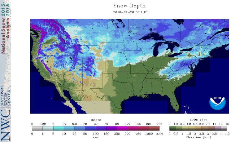
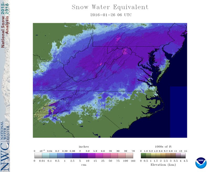
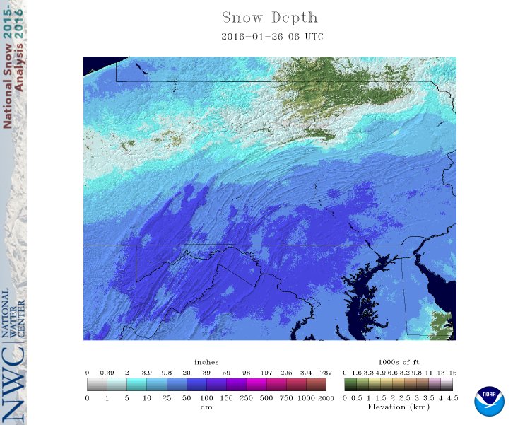
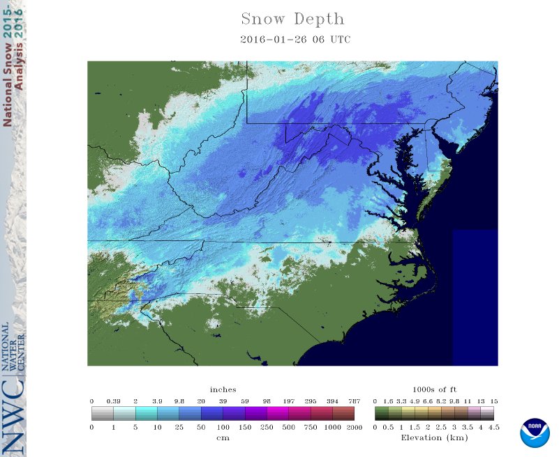
Luckily, February, especially in a Nino, historically brings the storm tracks much further south which will help to deliver the goods to the southeast. Take a look at the current snow cover across the northeast. still pretty incredible. This morning, 48.1% of the country is covered by snow, with an average depth of 5.5".
I know, I know... cold is not snow, and most of you want snow, and I know you are reading this to hear about that. :-) Sooo...
From this point forward, we will have several things going for us that will contribute to the possibility of winter weather. Since many of you don't really want ALL of the details, I will highlight what is important to take away from all of this. Strat Warming
I've talked about this in previous post, and it did contribute to the cold and snow that we just had, but we need more! :-)
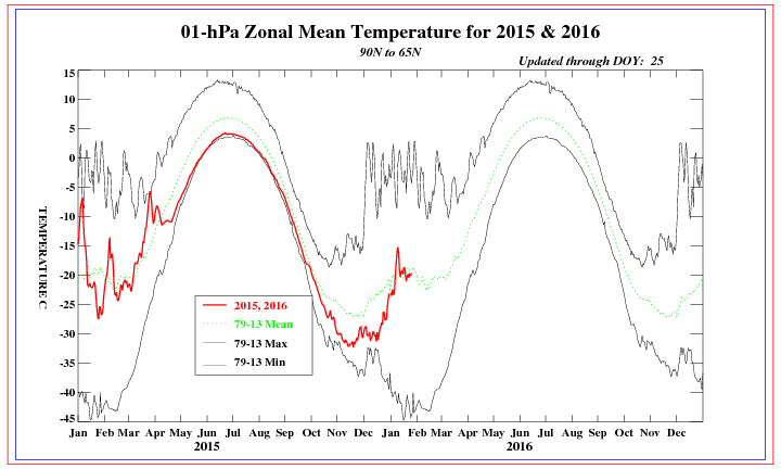
The image below if from the Euro and shows various paramters about the northern stratospheric region. There a several key points about this image:
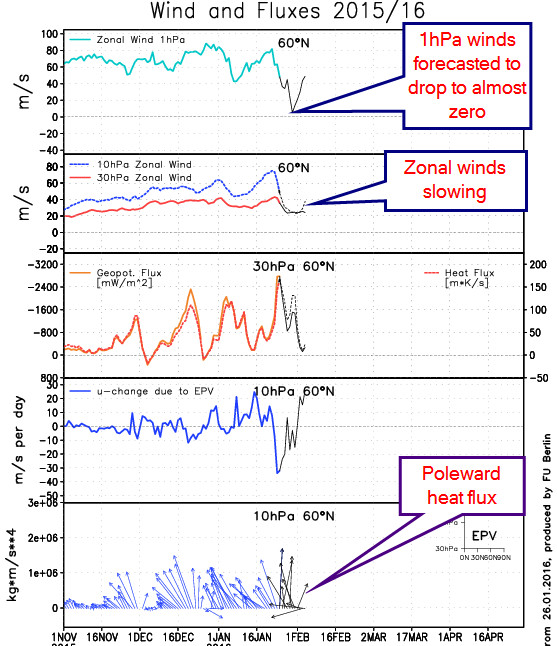
You can see evidence of the top down heat rise that's taking place
This from Dr. Cohen about the state of the Arctic Oscillation (AO). For us to get cold air, we need a strong -AO in place. Click here to read more from Dr. Cohen
The initial tropospheric precursor just initiated what is predicted to be a strong transfer of energy from the troposphere to the stratosphere that is also forcing a positive AO this week. In contrast, the predicted strong pulse of vertical energy will force a negative trend in the stratospheric AO as the polar vortex becomes more and more perturbed. Once the SSW peaks, the tropospheric AO will once again trend negative and the overall negative AO should persist for much of the remaining winter. Nino Climatology
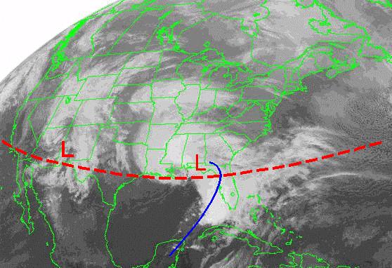
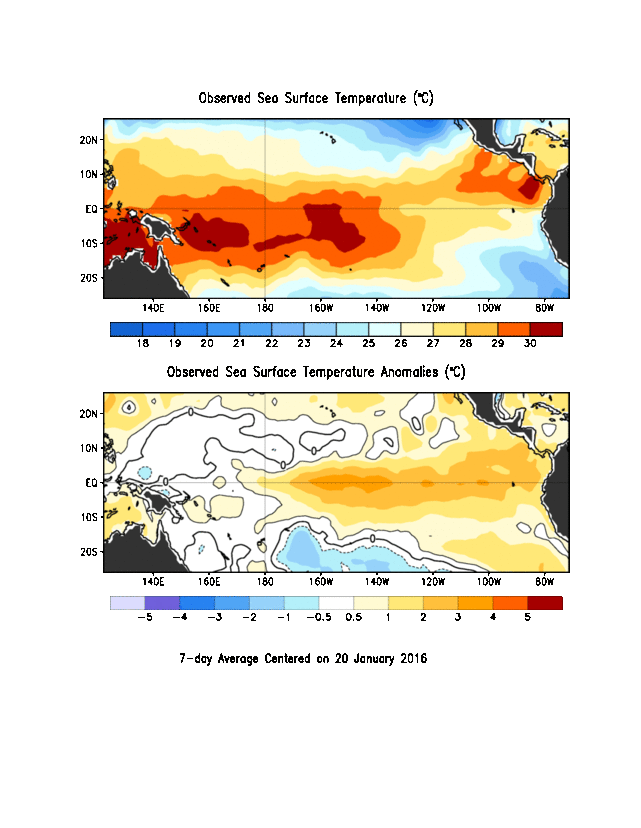
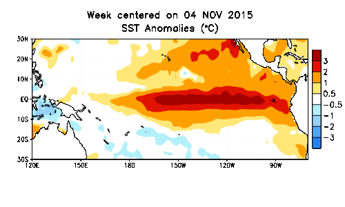
Strong El Nino's typically have a very southern track to the lows as evidenced by this image from FSU. The systems that have been entering the country so far have been coming in across the upper part of California and northward, and not from southern California. We ideally want to see that low near the Baja of Mexico before it starts its trek across the country. This type of track will allow the low to pull in cold air on the north side and give us the chance for snow, and we should this this in February. Couple that with the fact the Nino is quickly waning and the warmest waters now appear to be in the central Pacific, which implies more of a Modoki look to it. You can see from the images below what affect a Modoki El Nino has on our weather in the southeast.
Upper Air Pattern
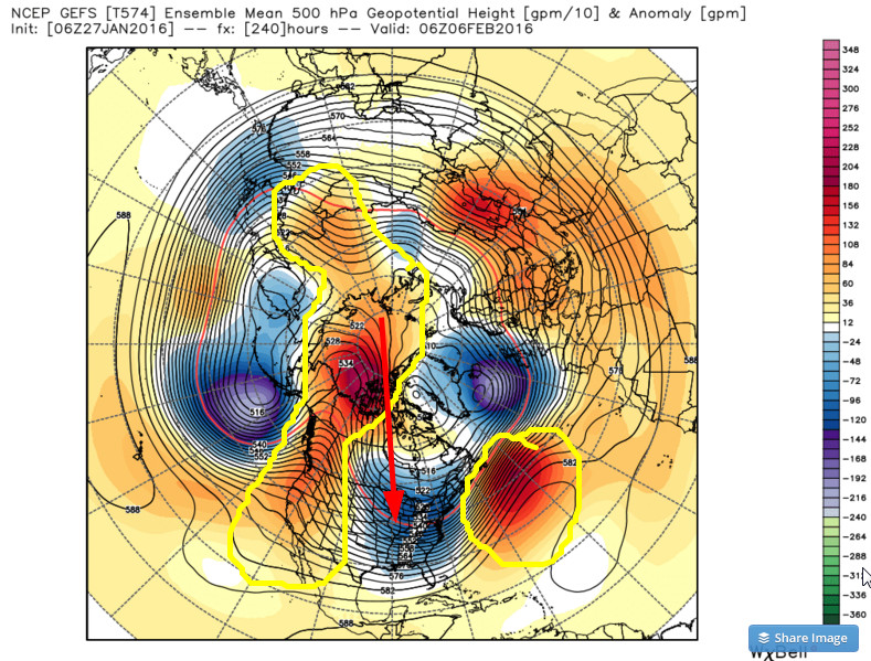
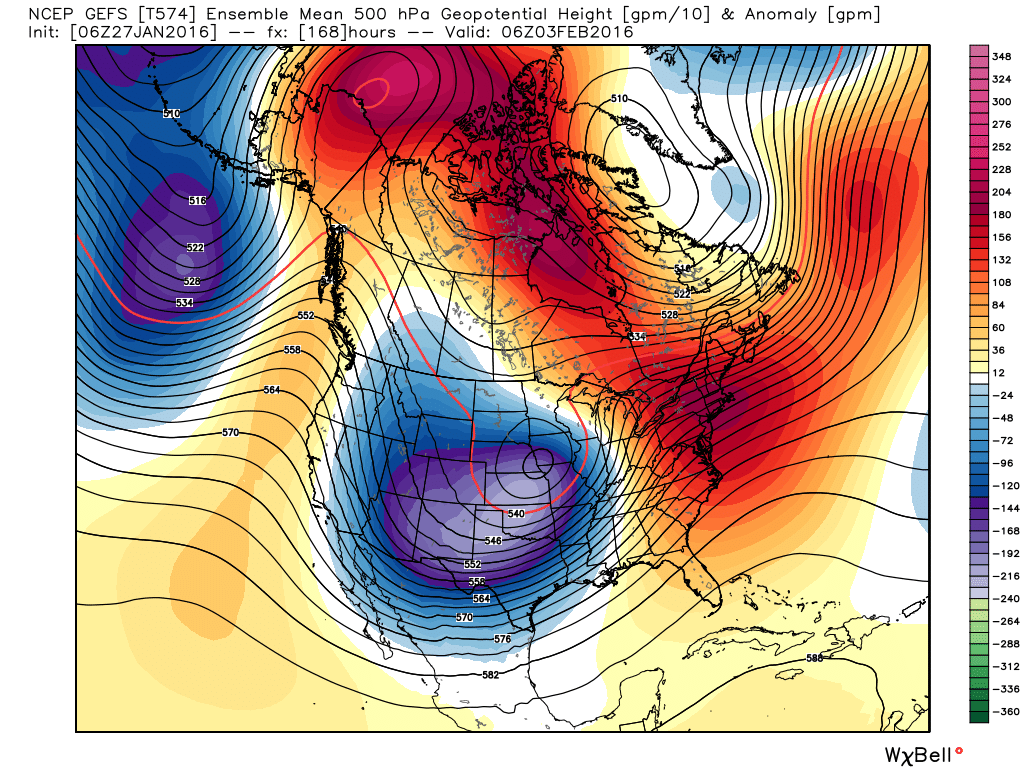
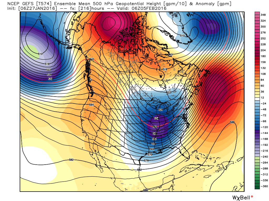
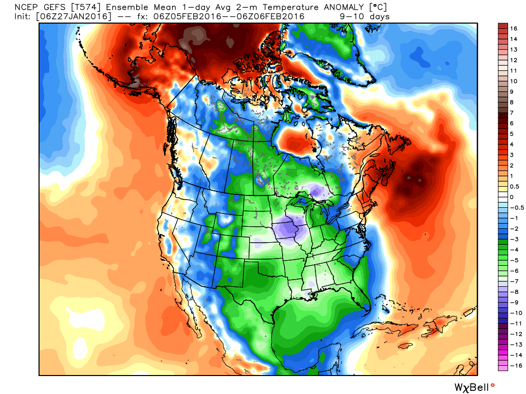
Both major models are now showing a major cold outbreak after mid week next week. These images are from the GFS ensembles (The Euro has the same look). The left image is 7 days, the center is 9, and the right image with temperature anomalies is day 10. Notice the strong blocking out west that ridges
Notice the ridging that takes place over the top. This is called cross-polar flow and pulls bitterly cold air from Siberia. If this look comes to fruition, I would expect the temperatures at the surface to get colder as time goes on. Also notice the blocking to the east. The models teleconnections have been hinting that the blocking will return.
You've noticed I haven't talked about snow for us... and that is simply because we are too far out to get a feel for that right now. What we do see are the ingredients coming together that point toward a wild and wooly finish to the winter season. All of the details are still to be worked out, but I would be VERY surprised if we don't see a MAJOR snow event in the southeast before it's all said and done.
Ok... took a break to regroup... time to look ahead. We have one system coming up later this week that was looking more promising a week ago, but I'm not feeling this one. Where we had a pretty good layer of cold air (for us) for this last system, this next one doesn't look like it will have as much cold air to work with. This morning, it would appear to be more of an overrunning event with moisture riding along a stalled frontal boundary with marginal temperatures. And to be honest, I'm not seeing anything out to 10 days right now. There will be a warm up after this next system, and may last most of the following week. Winter is not over, and we're expected to go back to our winter pattern after the reload.
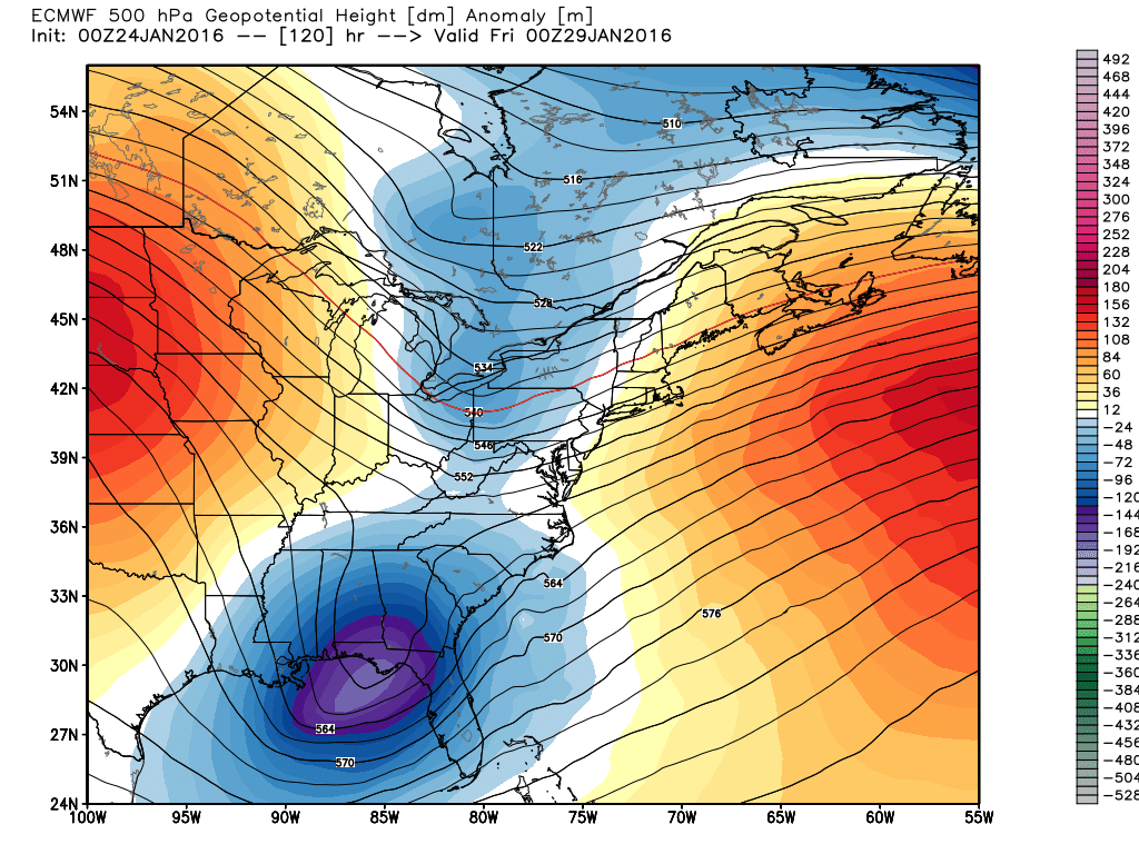
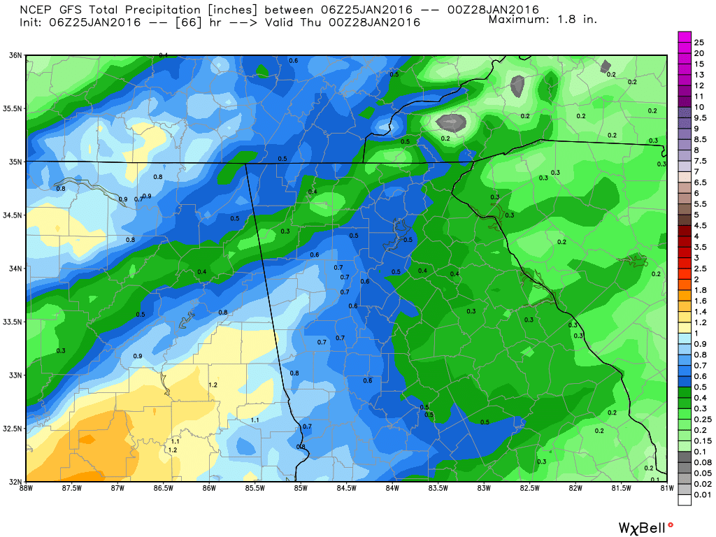
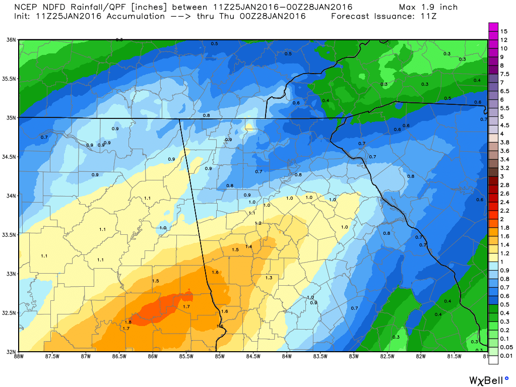
This is our chance. A stalled frontal boundary with cooler air to the north and warmer air to the south. I actually expected to see more of this by now, except with colder air. This would be considered an overrunning event. Again, I don't have a lot of confidence in this as there isn't much cold air over the top. If I were seeing a 1035 or higher high pressure to the north or NE, I might be more excited. 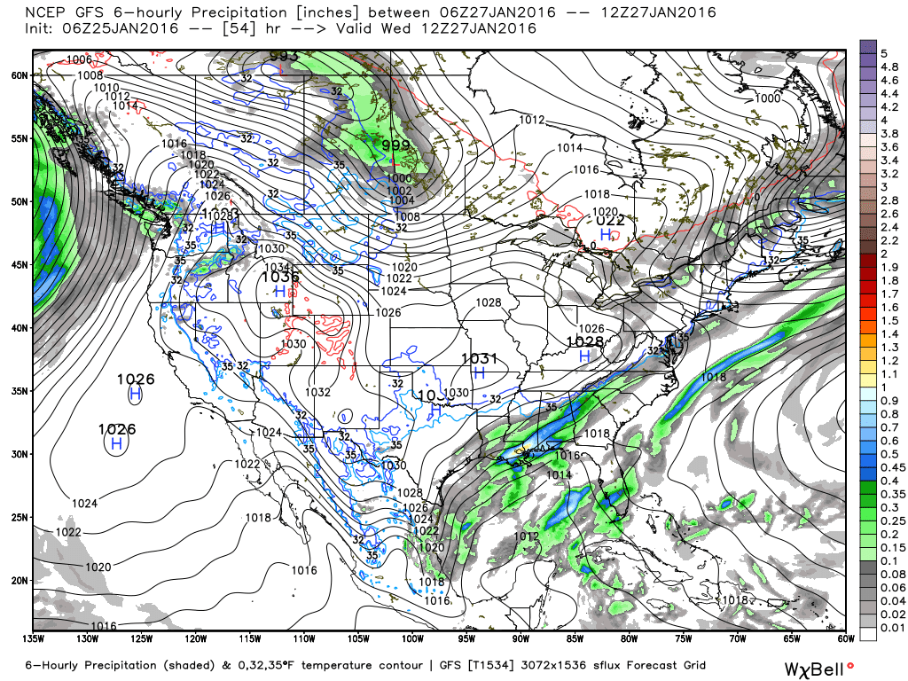 We will have some more rain. Oh yea. You can tell I'm as excited as you are. :-) Sorry guys, I just report on the weather... I don't make it happen. There are rainfall totals through late Wednesday, depending on what model or forecast you believe.
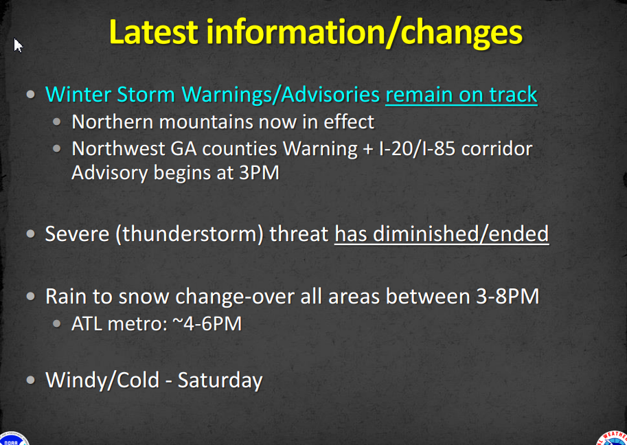
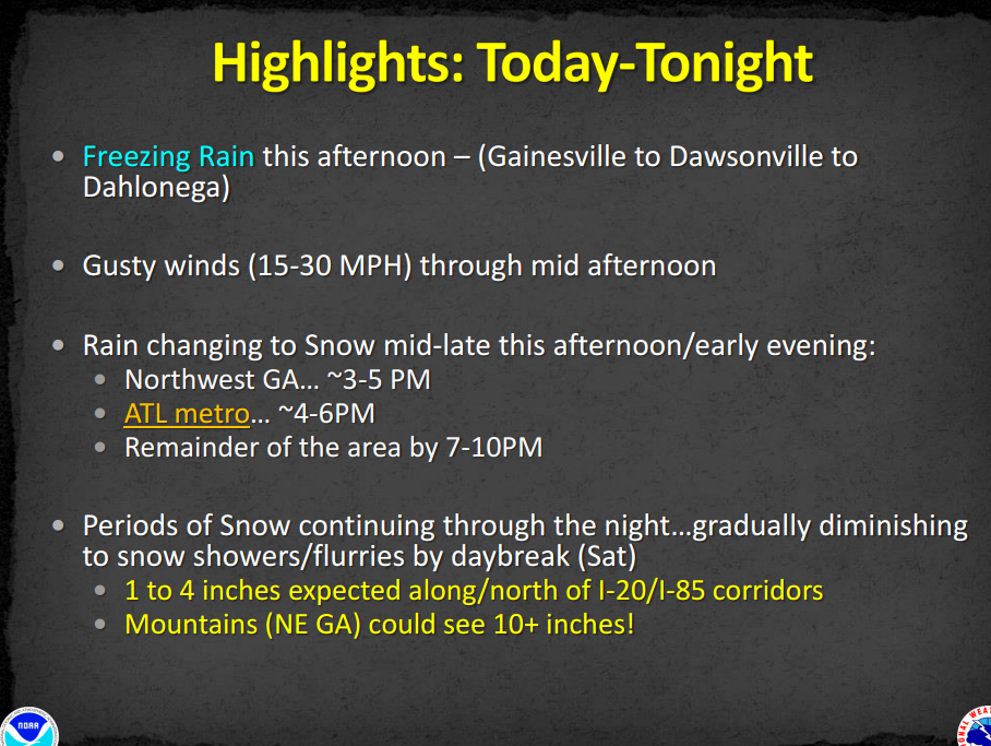
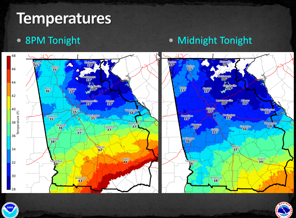
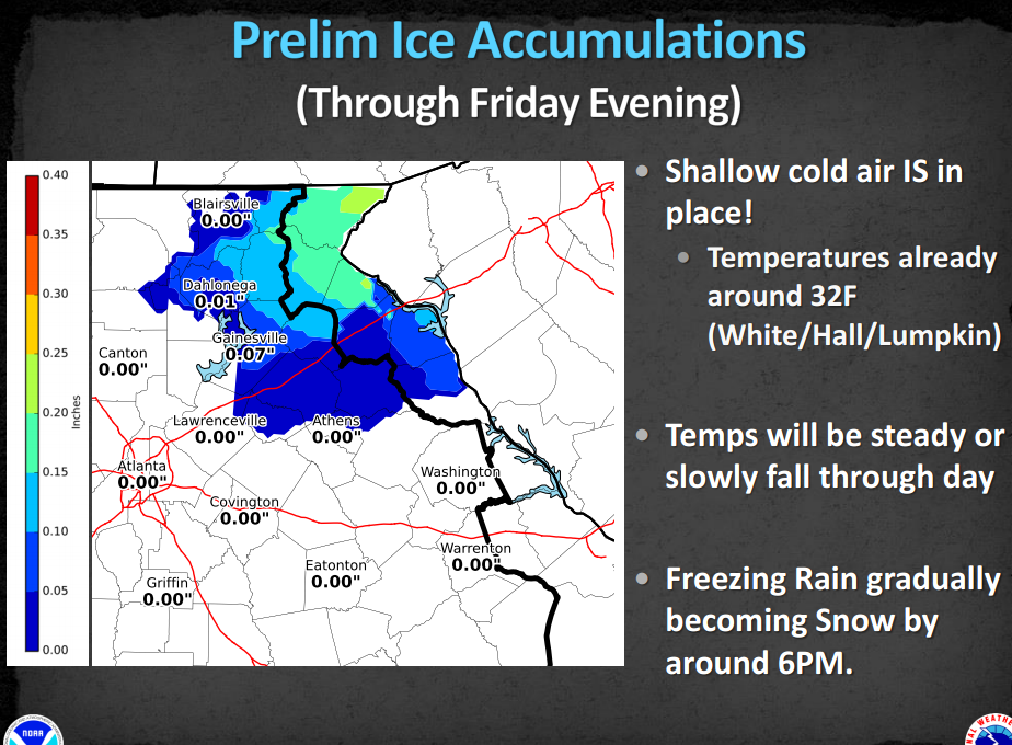
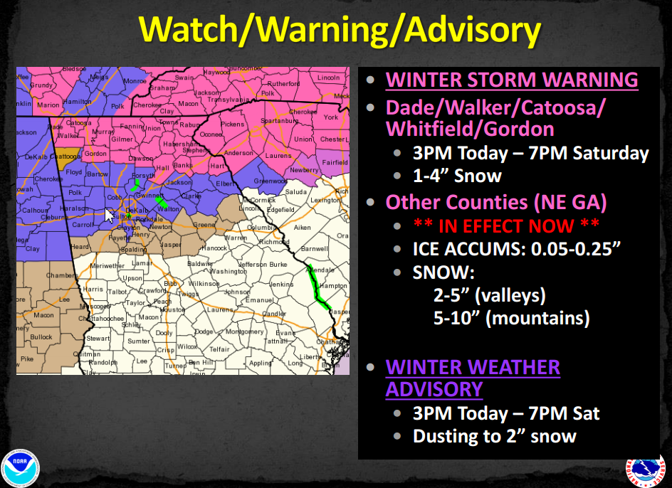
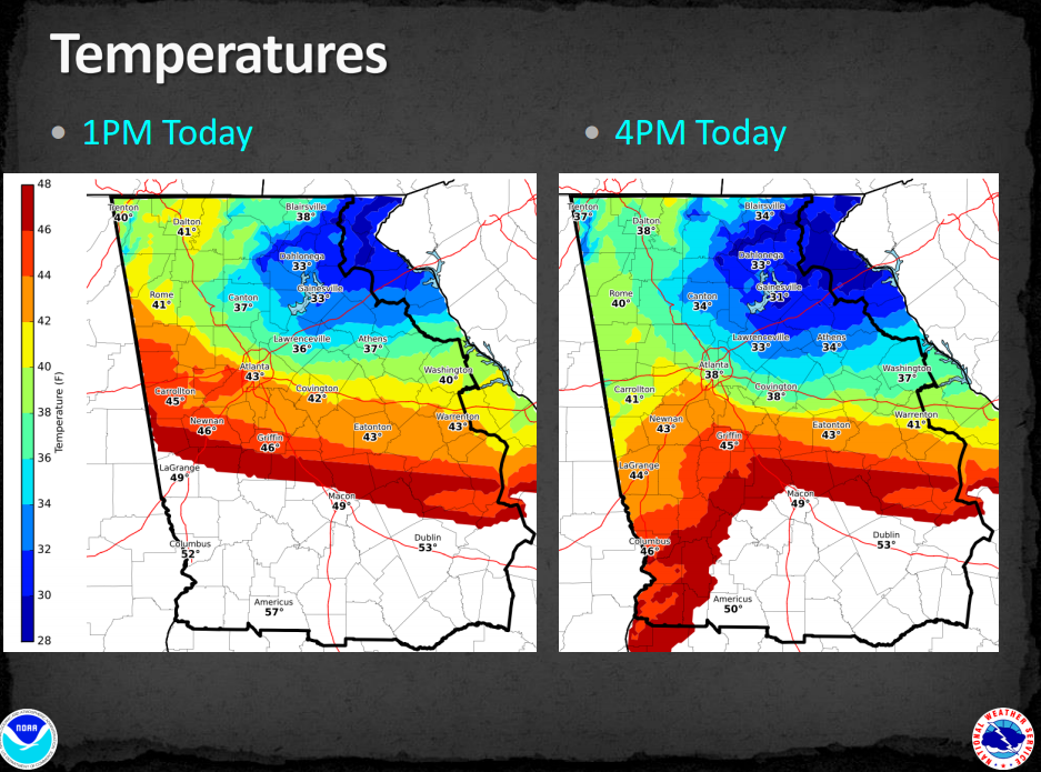
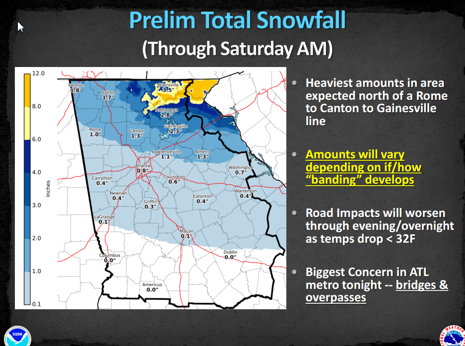
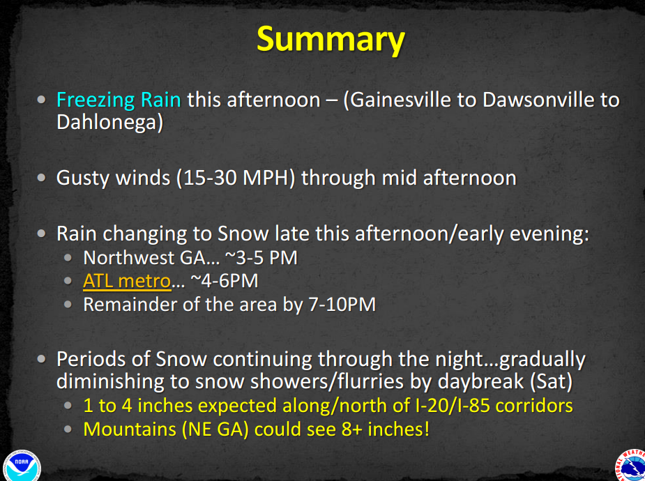
So I'm still watching for signs and I expect to see those on the horizon soon. Winter is not over by a long shot. Many of our best snows have happened in that month, and I fully expect to see a good one this year. If you've been following for while, you should remember that almost all of the winter forecast called for February to be the best month. But... I really expected more than 3 chances for January as well. The morning after... :-) Sometimes that might be good, sometimes not. It works the same way with winter weather in Georgia. The are many reasons why it was quite as strong as expected. I told people yesterday that Miller B storms rarely work for us here and I was surprised that we were actually going to get something. So after my good dusting this morning, I still consider this a success. I know everyone doesn't get the same amount and some had more and some had less. If you didn't get much for this one, there will be more chances, and we'll be talking about what is coming down the road tomorrow. Here are preliminary snowfall totals for Georgia and the surrounding area. Tennessee didn't have a graphic, but they do have a page with storm reports that you can find here. 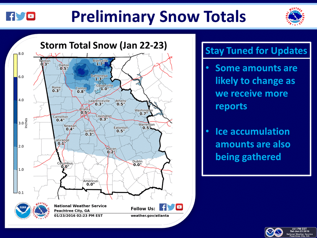 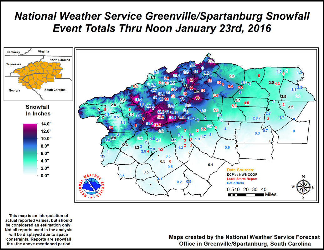 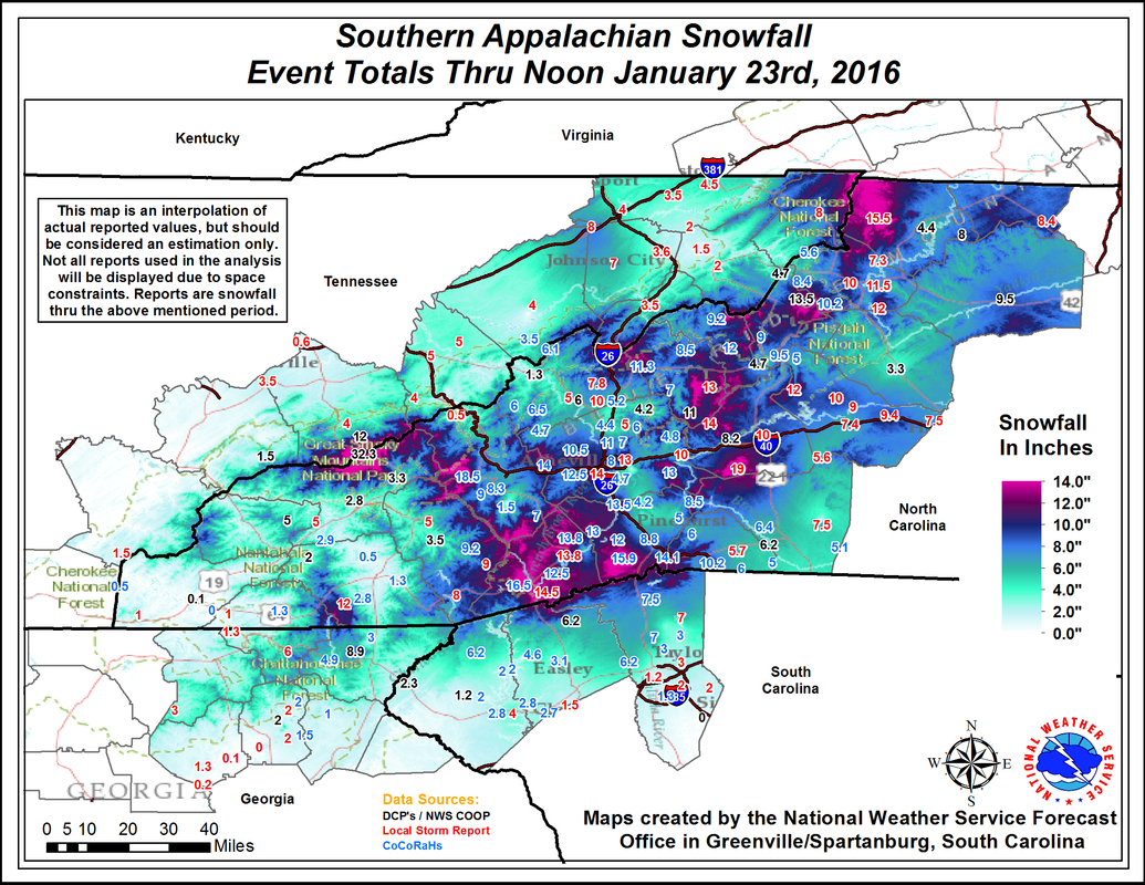 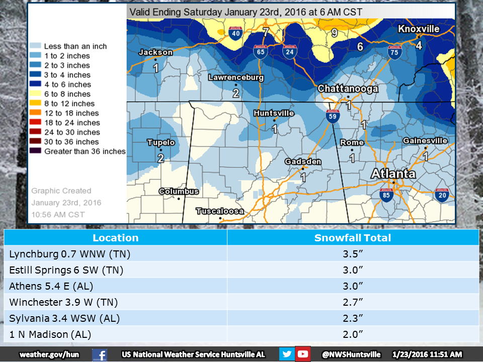 Here's a summary of the 11 AM NWS Weather Briefing
|
Archives
March 2019
Categories
All
|
OLD NORTH GA WX BLOG
 RSS Feed
|
Never base important decisions on this or any weather information obtained from the Internet. Always have a backup method of receiving weather information such as a battery powered weather radio.
Copyright © 2018 NorthGeorgiaWX.com and DaculaWeather.com 
|