NWS Omaha Forecast Discussion
Thunderstorm chances/intensity/timing/rain amounts will provide the main forecast challenges through Monday. Pattern early this morning is not too different than last night, and it will remain similar the next few days.
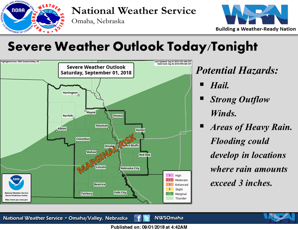
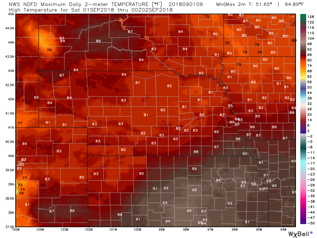
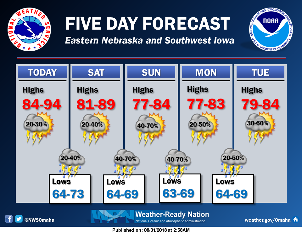
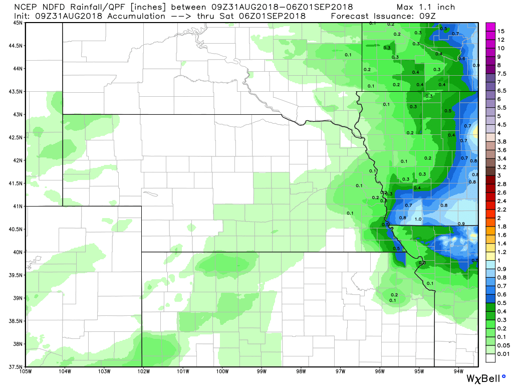
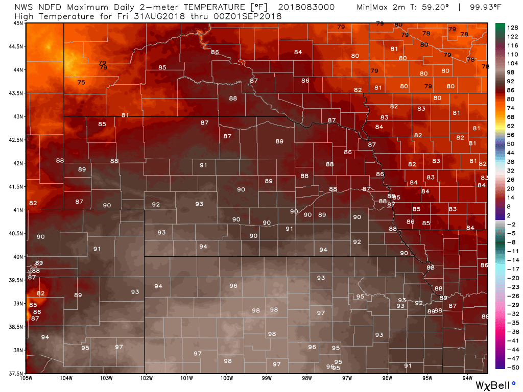
Will keep some chance of storms around this morning, but overall confidence on what will happen this afternoon is not high. This is because of a fairly wide spread of what the short range, high resolution convection allowing models (CAMS) are indicating. In regards to the 00z runs of the GFS and NAM, the GFS seemed to handle the activity last evening and this morning better than the NAM so will give it a bit more weight for this evening/tonight. There is potential for heavy rain in the forecast area tonight, but exactly where is yet to be seen. There will be a stalled front in the area and models generally show PW around or over 2 inches. Will keep thunderstorm chances tonight in the 30 to 70 percent range, lowest near the SD and MO border areas. Rainfall rates could be high enough to cause flooding, but will not issue a Flash Flood Watch at this time. Cloud cover and precipitation held most temperatures down on Friday. Most areas today should see highs in the lower or mid 80's, with mid 80's to near 90 possible for parts of southeast NE and southwest IA. (See images below) Weather Prediction Center - Excessive Rainfall Discussion
Convection may maintain in some capacity through the day, but the combination of the wave flattening as it moves east, the upper jet streak progressing east, and weakening of the low level inflow, should result in less organization of convection with time today (or at least a shrinkage in size of any organized activity). However by later this afternoon into the evening hours should see convection once again begin to expand in coverage from KS/NE northeastward into MO/IA/IL.
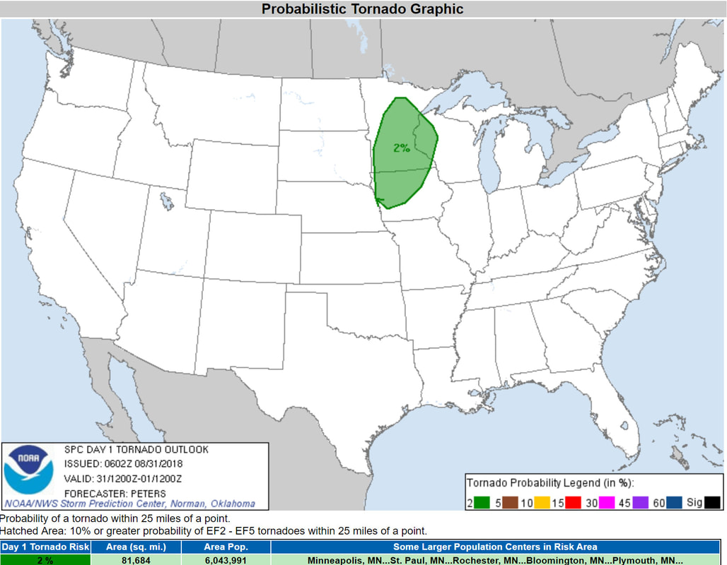
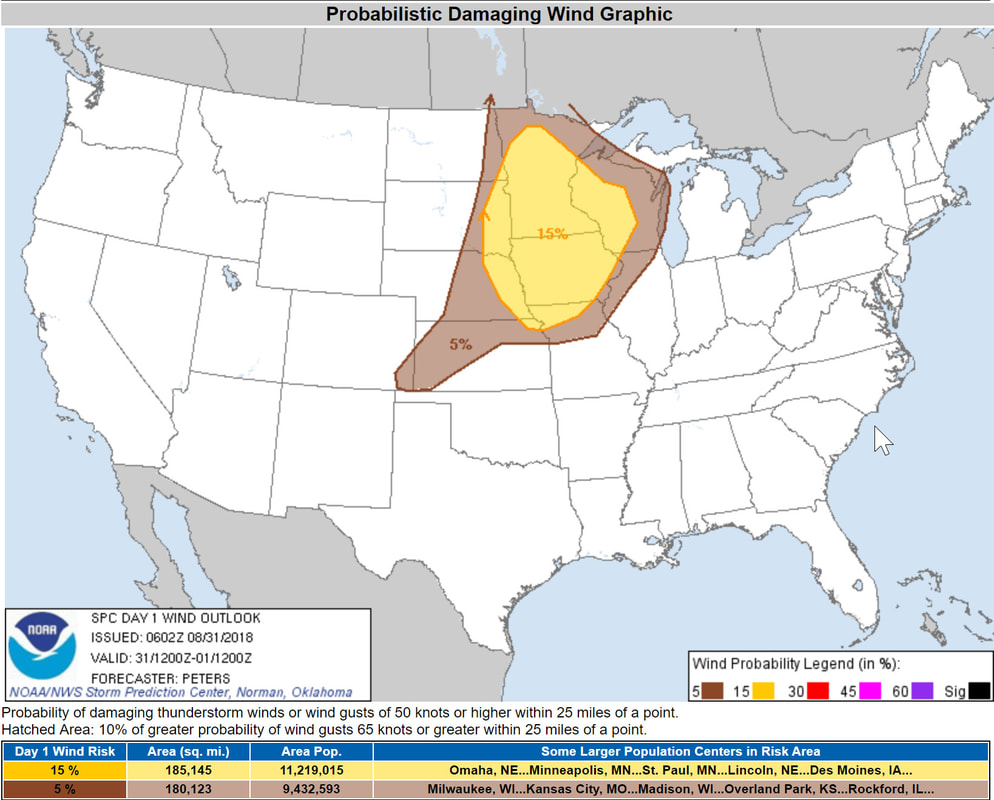
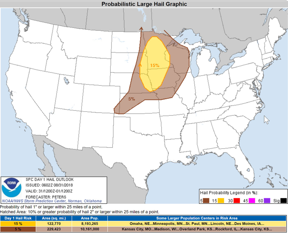
In the mid and upper levels should have another shortwave pushing east, with another strengthening jet streak to the north increasing upper level diffluence. In the lower levels will have a few west to east boundaries helping focus convection, with outflow from this mornings activity potentially a feature in play. Will also have another round of increased southerly 850mb moisture transport... with this axis a bit broader this time. This should favor a wider west to east zone of convective activity... and while this moisture transport axis may try to lift northward with time... cells back building to the south into the enhanced flow may help keep the convective axis nearly stationary for a period of time... resulting in a training threat. Thus... looks like another good setup for heavy rainfall and potential flash flooding this evening into the overnight hours. Given the multiple rounds at play... some potential that a portion of the Slight Risk may need to be upgraded at some point if there is sufficient overlap geographically with the multiple rounds. However will wait and see what falls out of this mornings activity... and wait and see what the 12z HREF/HRRR depict for the second round of activity... before considering any upgrade. Models are in pretty good agreement on the overall setup... and their QPF axis are not all that different either. Although still some latitudinal and timing differences noted. The Slight Risk follow close to the axis depicted by the 12z HREF and HRRR runs. NWS Omaha Graphical Weather Outlook
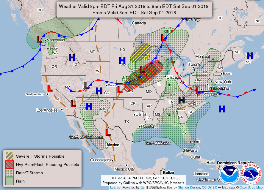
Today's Weather Map
TODAY'S FORECAST
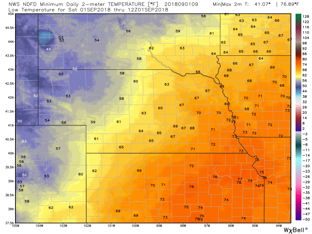
TEMPERATURES
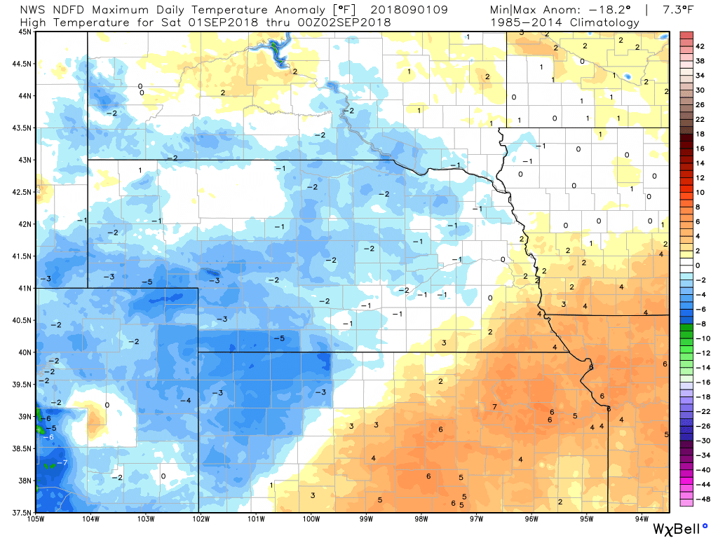
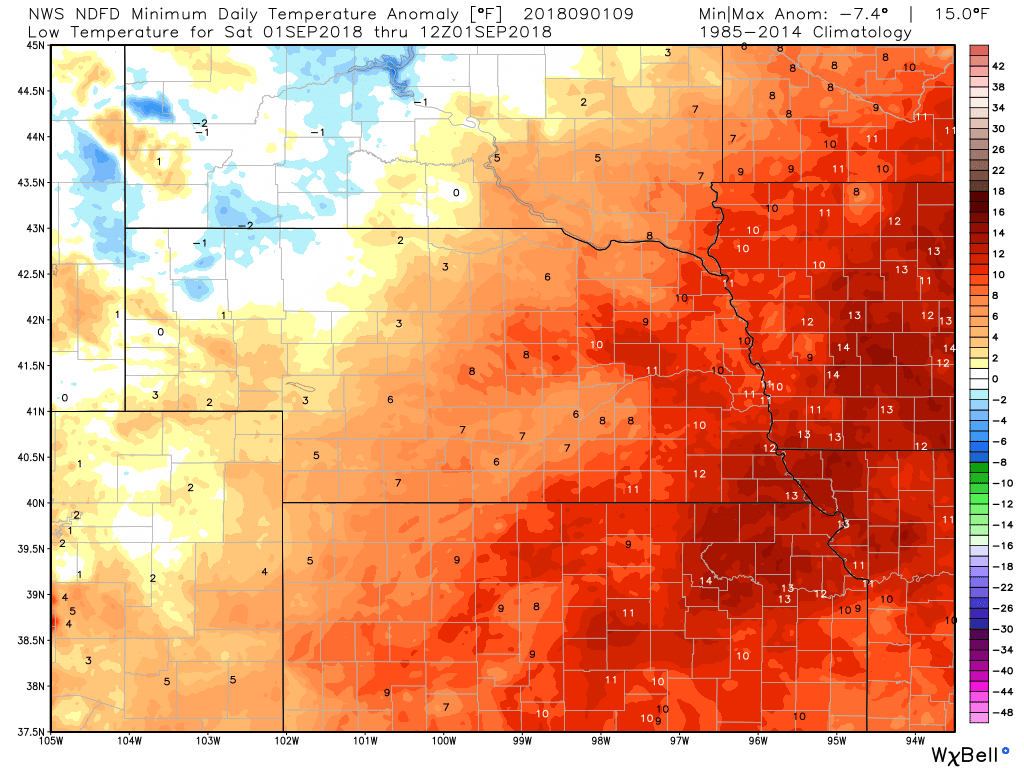
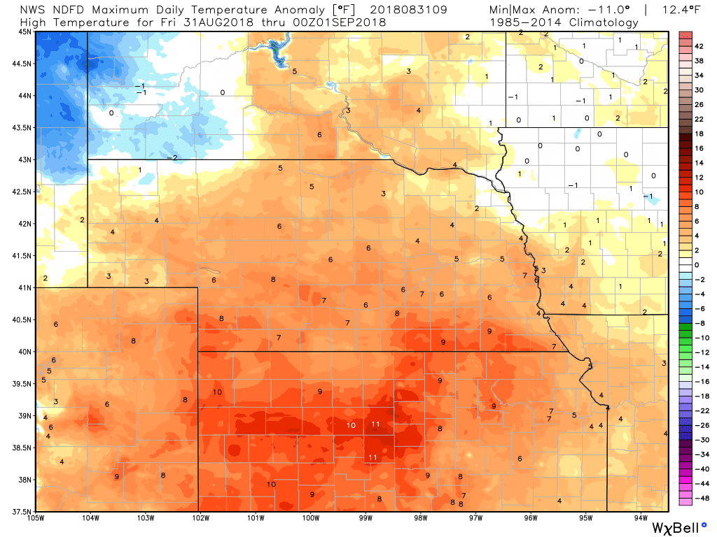
TEMPERATURE ANOMALIES
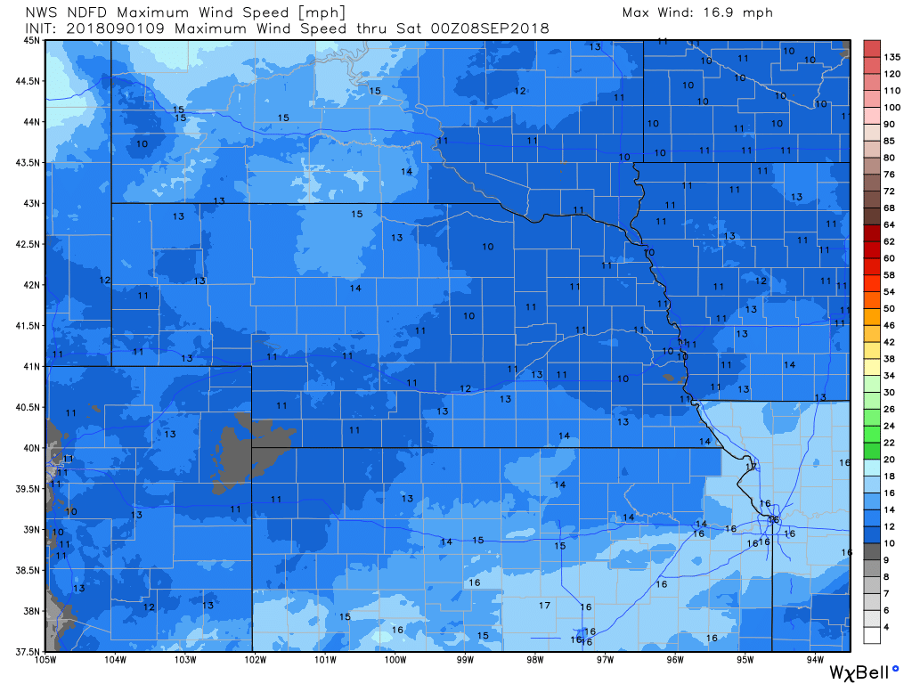
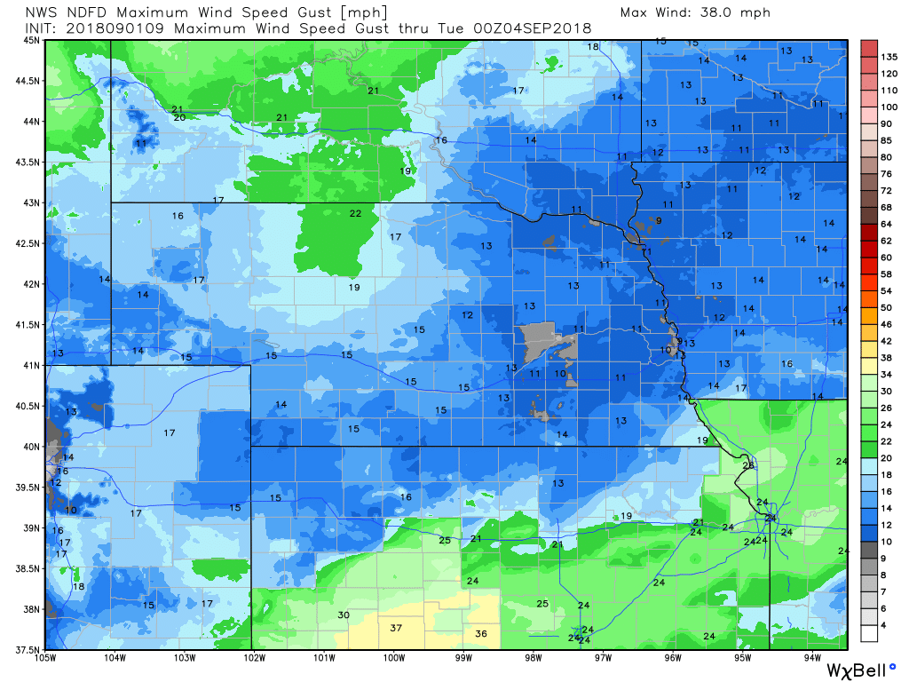
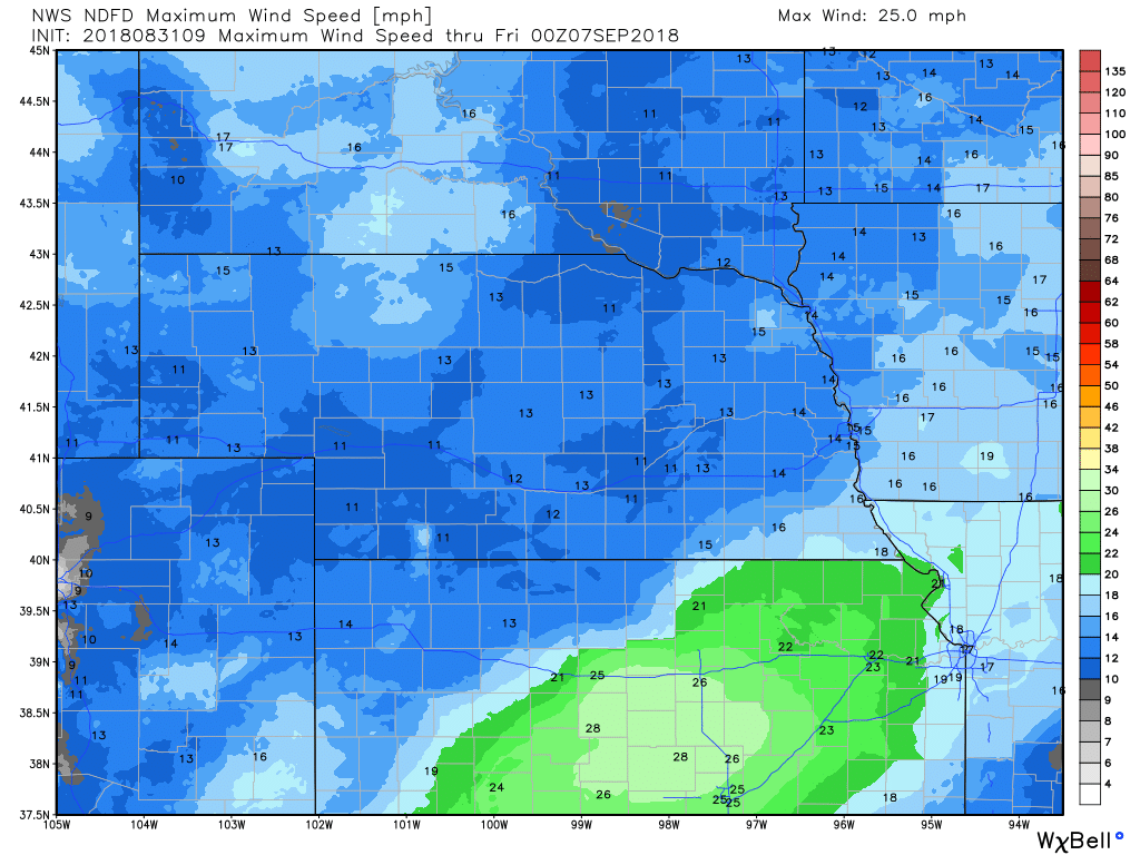
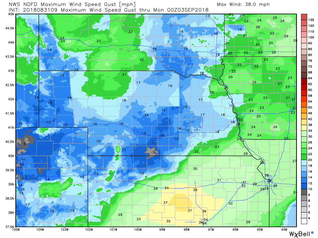
WIND
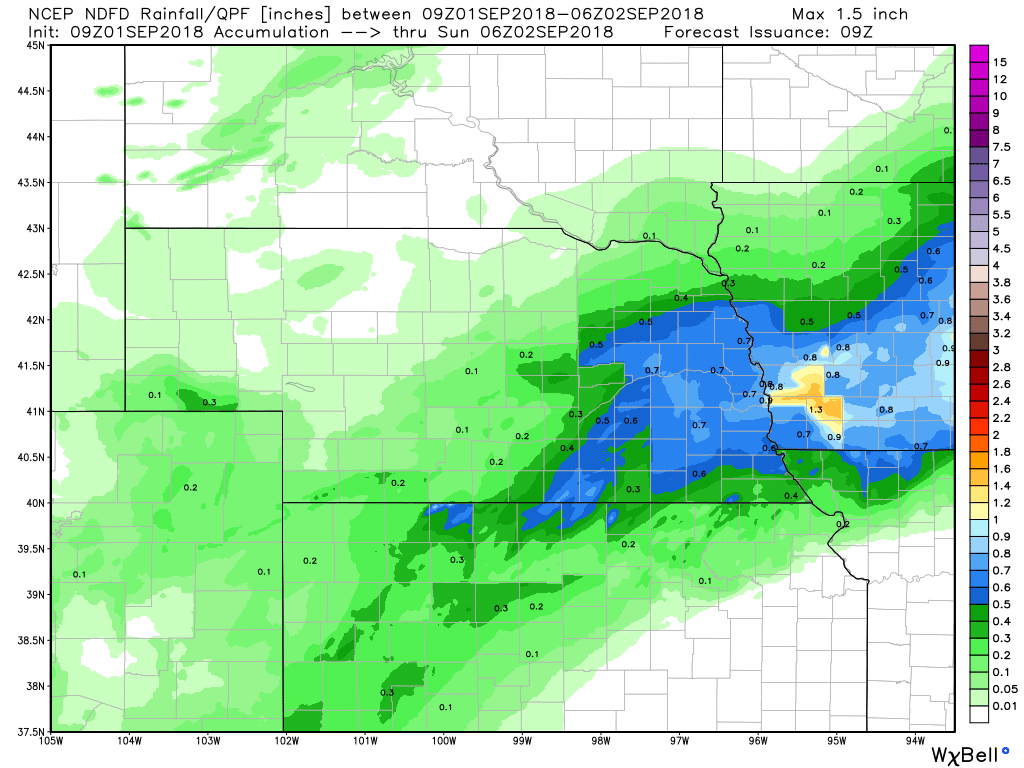
PRECIPITATION
Hour by Hour Forecast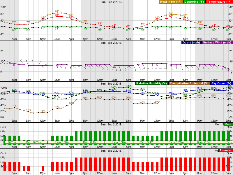
Current Radar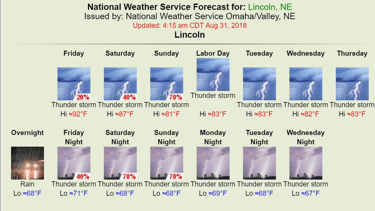
Text Discussion
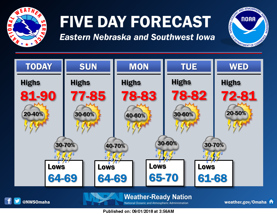
Main concerns through the short term are thunderstorm chances, the potential for severe storms and threat of locally heavy rain. the heavy rain threat appears to be highest Saturday night and then again from late Sunday afternoon into Sunday night.
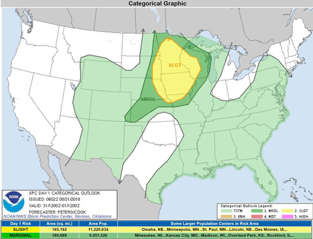
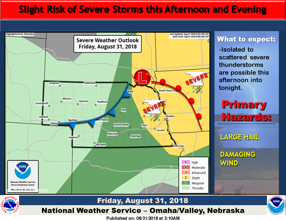
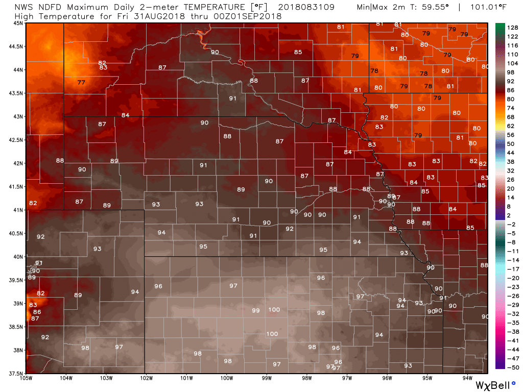
For today, the general consensus from the available high resolution short range convection allowing models (CAMS) is that the bulk of storm activity should shift east of our area and be mainly over central iowa by around 7 am CDT. Then there may be an increase in activity from west to east across the forecast area from the late morning through the afternoon. Outside of possibly some outflow that could mess up the surface pattern, we generally expect south or southeast surface winds from 10 to 20 mph today. Temperatures should reach the mid to upper 80's in the northern parts of the forecast area. Highs in the southern parts of the area will likely reach around 90 to the lower and possibly mid 90's. Storm Prediction Center - Day 1 Severe Weather Outlook
NWS Omaha Graphical Weather Outlook
TODAY'S TEMPERATURES
TEMPERATURE ANOMALIES
WIND
PRECIPITATION
HOUR BY HOUR FORECAST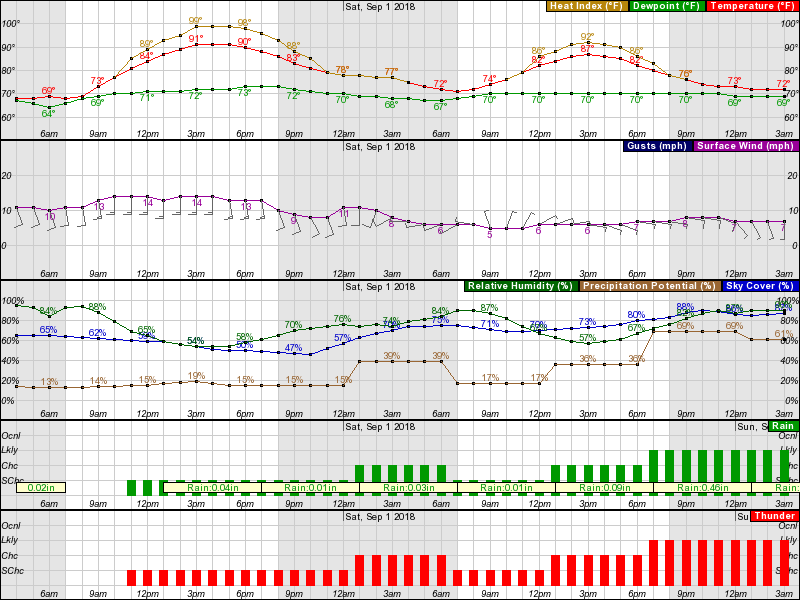
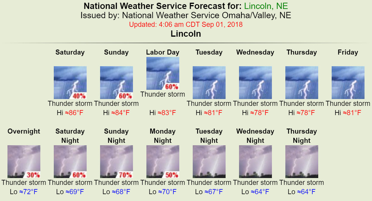
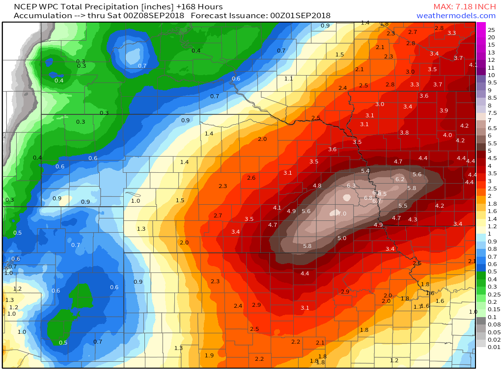
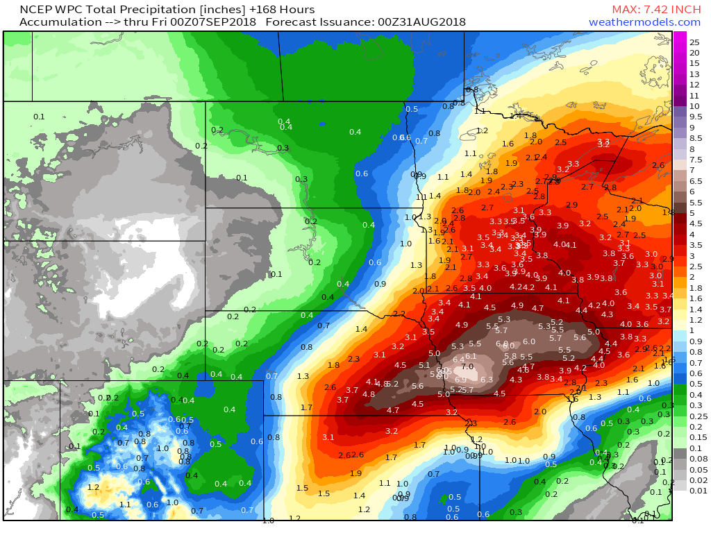
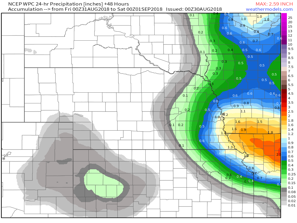
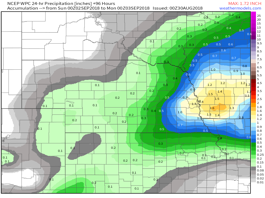
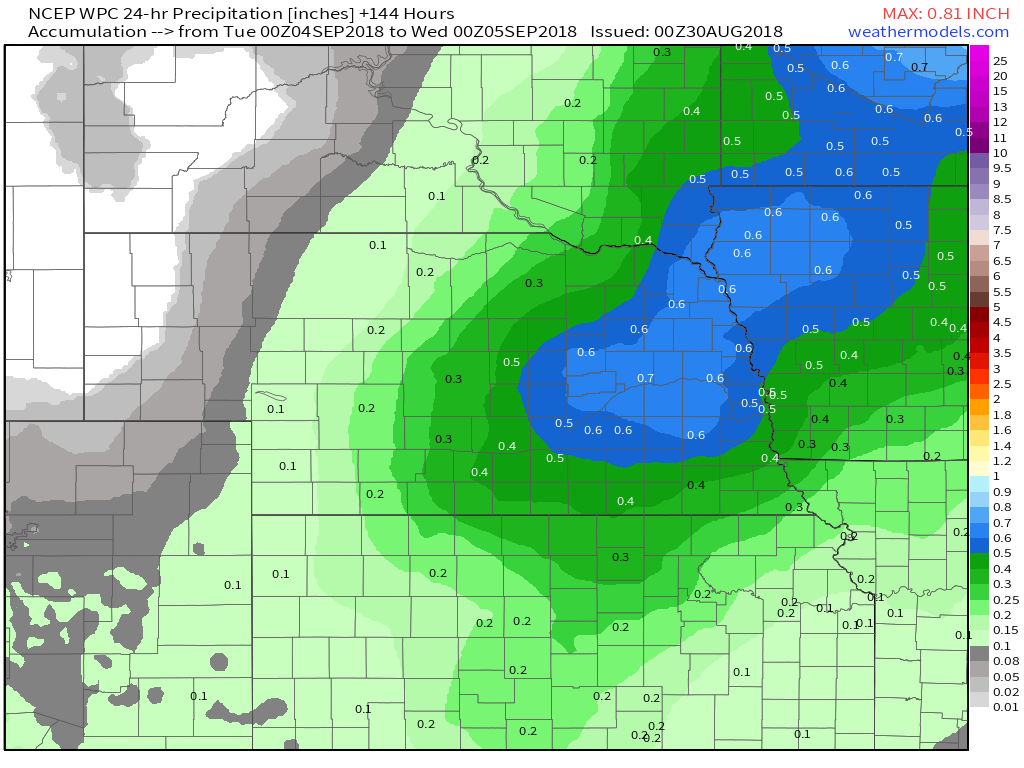
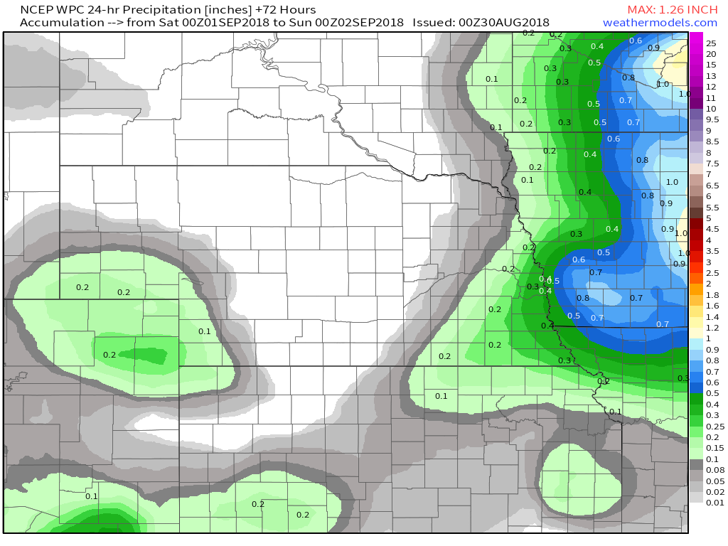
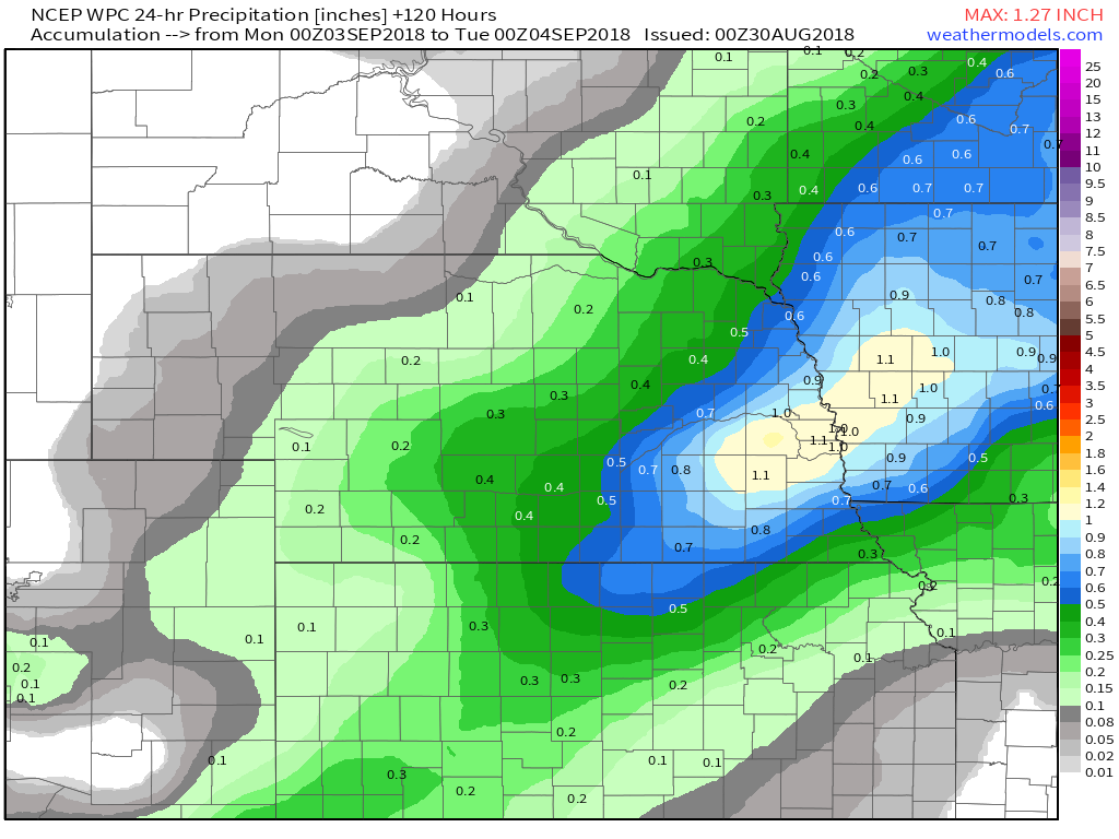
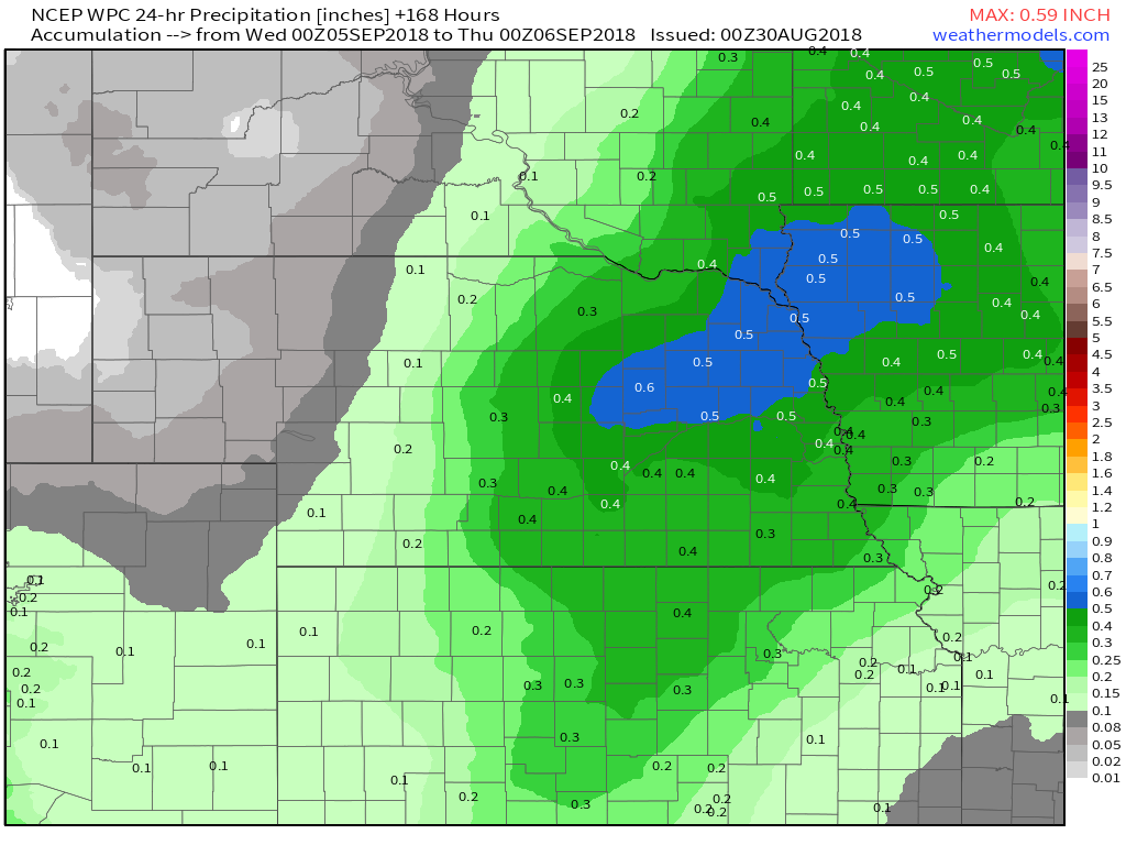
Current RadarI wanted to share a day by day precipitation forecast from the Weather Prediction Center. Each image covers the 24 period that you see in the caption below each image, and the grand total at the end. 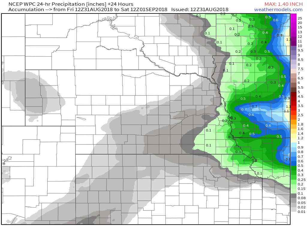 Friday 8 am - Saturday 8 am EDT 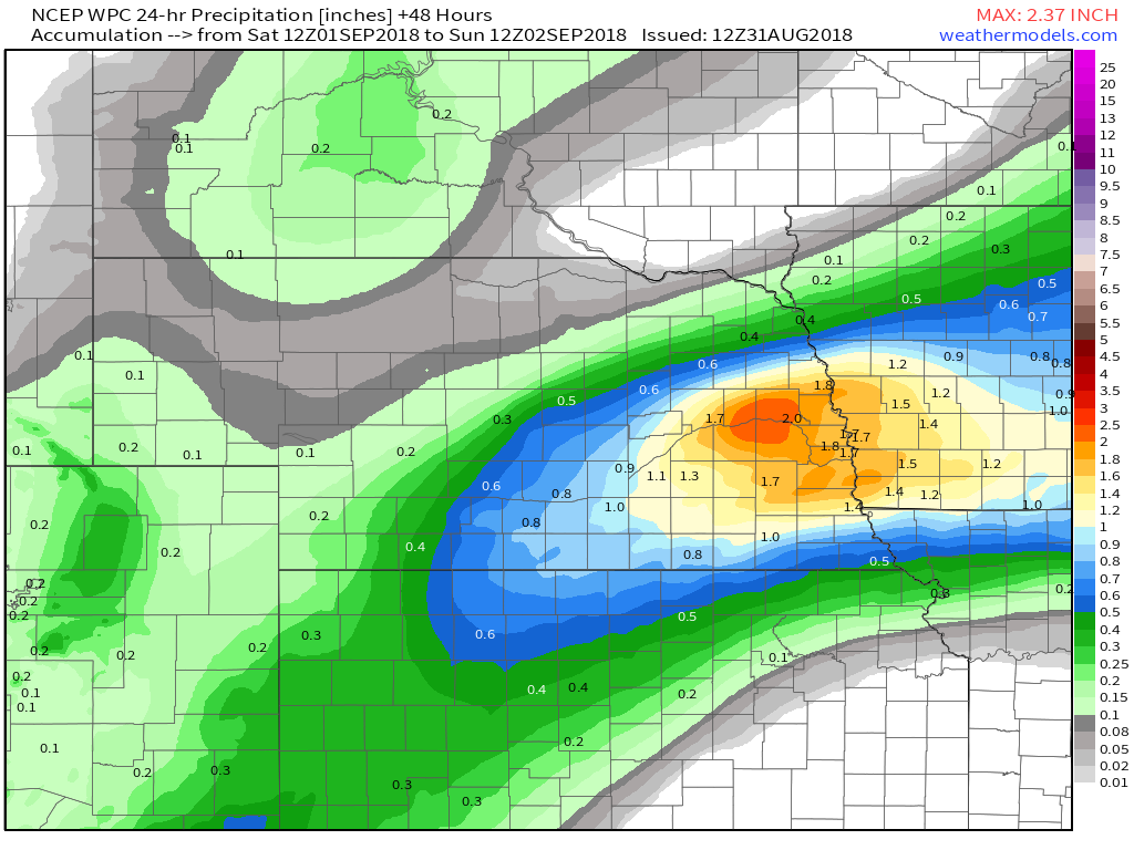 Saturday 8 am - Sunday 8 am EDT 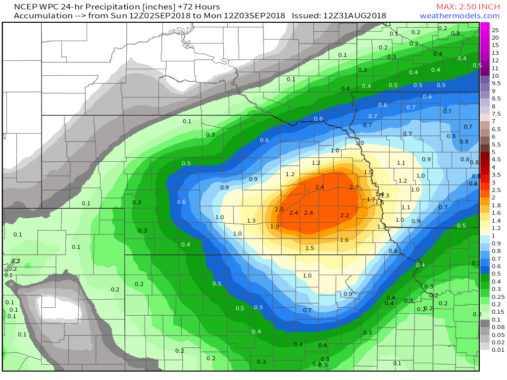 Sunday 8 am - Monday 8 am EDT 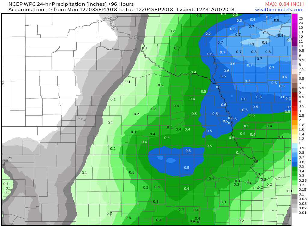 Monday 8 am - Tuesday 8 am EDT 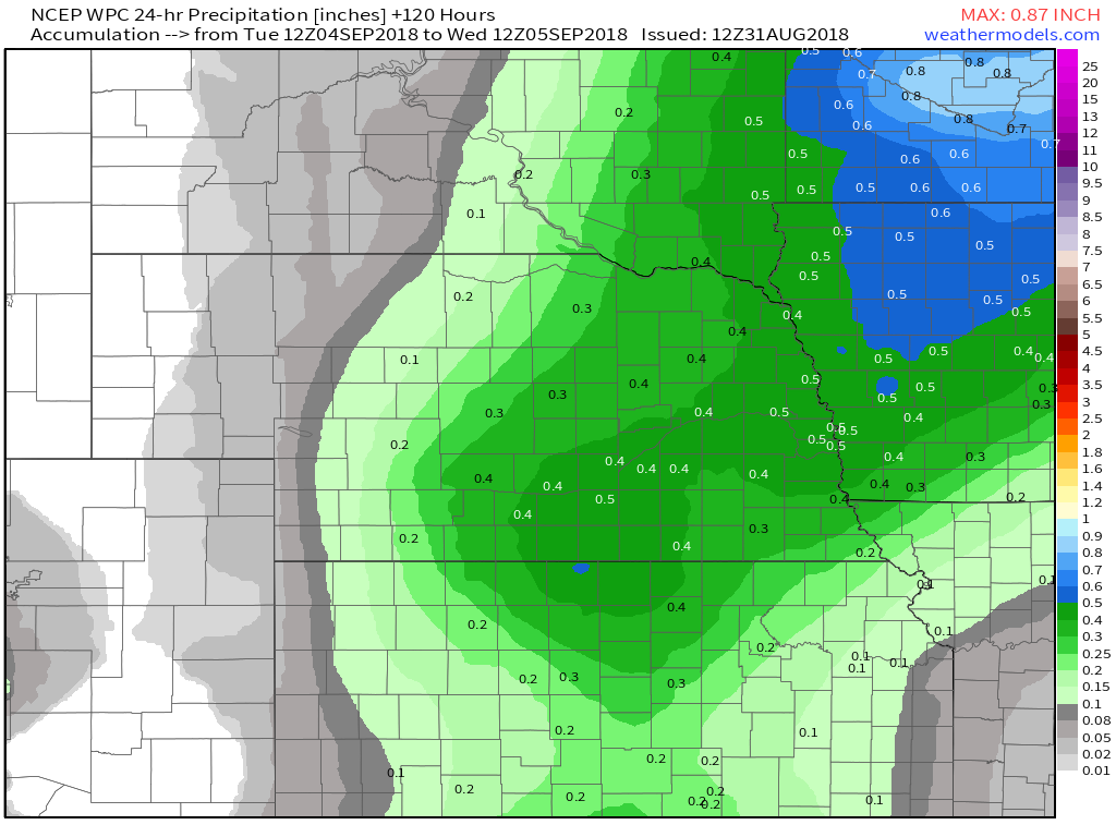 Tuesday 8 am - Wednesday 8 am EDT 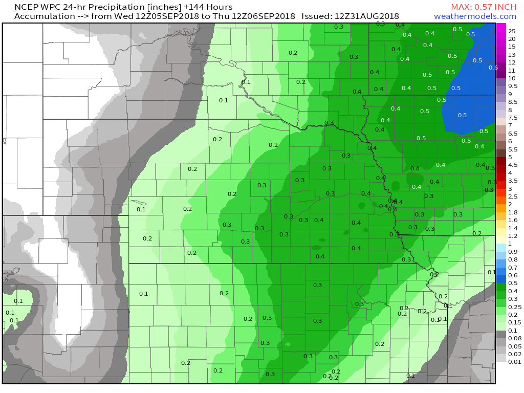 Wednesday 8 am - Thursday 8 am EDT 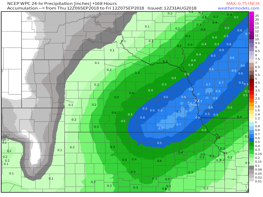 Thursday 8 am - Friday 8 am EDT 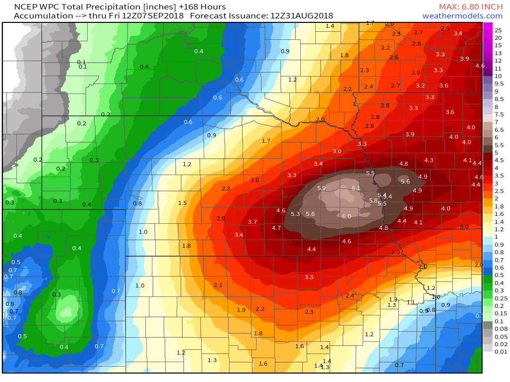 7 Day Totals 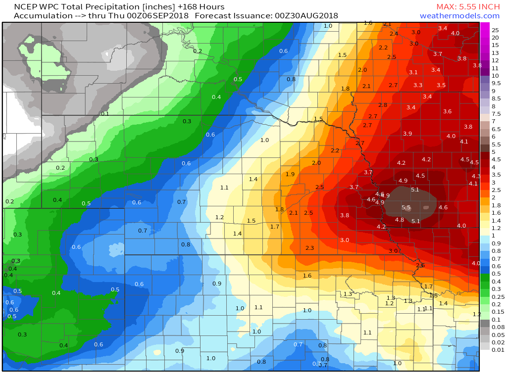 WPC Rainfall Totals through 8 pm EST Wednesday WPC Rainfall Totals through 8 pm EST Wednesday Well folks, I wish I could say the entire event was going to be sunny and cool, but you'd find out pretty quick when the rain started falling that I was lying. Let's go ahead and first look at Friday into Saturday. This from the Omaha NWS office... "There is a pretty decent front coming into the area Friday evening into Friday night. Various models have different depictions of the timing of the front, with the Nam a little quicker, and the GFS and little slower and the EC even slower still. Will have chance pops of storms along the front, and if storms could get going, there is a slight risk of severe storms Friday evening. The front will remain in the area Saturday, perhaps just south of I-80, which will provide a continued chance of rain for the southern half of the area. LONG TERM...(Saturday night through Wednesday)Several rain chances exist during the extended period, and there is some potential for heavy rains both Saturday night and again Sunday night. The stalled frontal boundary, combined with a short wave ejecting out of the central/southern Rockies could lead to numerous showers/storms. PW values could be around 2" Saturday night, and the GFS is suggesting rainfall could be excessive, although it's just outside our QPF window for this forecast, but it's certainly something we're watching closely. The boundary lifts north during the day Sunday, but remains in the area, thus rain chances continues. Additional heavy rain signals are in place Sunday night with more convection expected along the boundary, again with PW values near 2", which could lead to additional excessive rainfall. While we can probably take one night of heavy rain without too much trouble, a second night in possibly some of the same areas could lead to flash or river flooding. Still 5 days out, but again, we'll continue to monitor it closely. The previously mentioned front seems to wash out Monday, but the GFS remains the wetter model with rain chances continuing. Models do suggest another front could be moving into the area Tuesday afternoon into Wednesday, so rain chances continue those days as well. Bottom line, the extended period, including the Labor Day holiday weekend is looking very active, with numerous rain chances, and the potential for heavy rain and flooding that linger into mid week." Weather Prediction Center 24 Hour Rainfall Totals
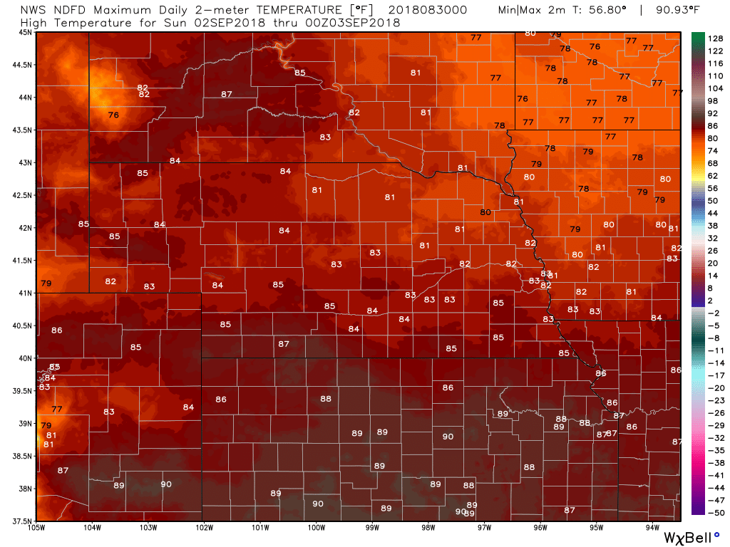
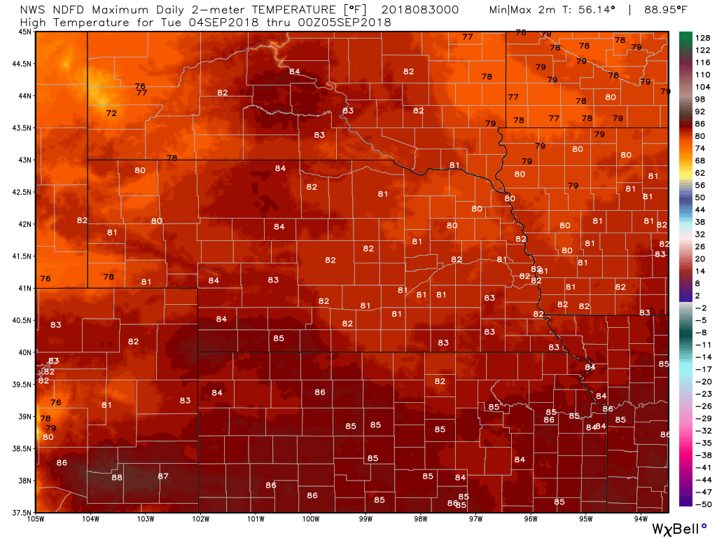
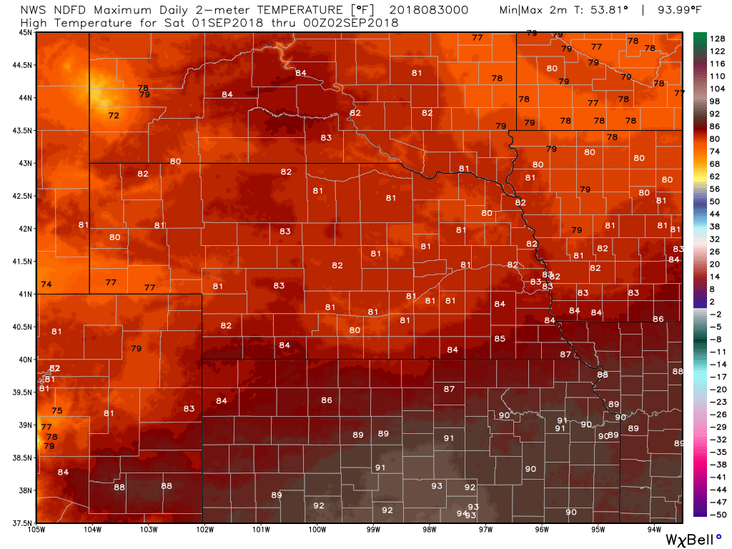
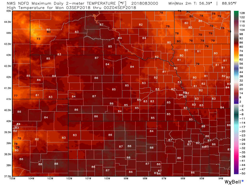
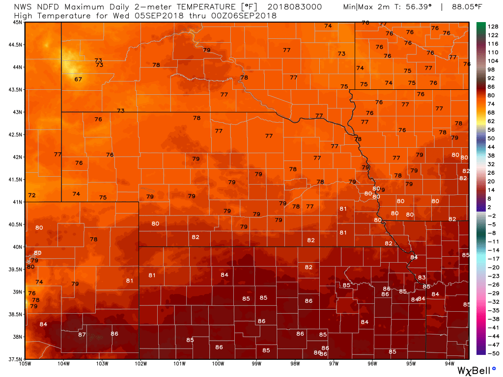
High Temps
|
Archives
March 2019
Categories
All
|
OLD NORTH GA WX BLOG

 RSS Feed
|
Never base important decisions on this or any weather information obtained from the Internet. Always have a backup method of receiving weather information such as a battery powered weather radio.
Copyright © 2018 NorthGeorgiaWX.com and DaculaWeather.com 
|