Text Discussion
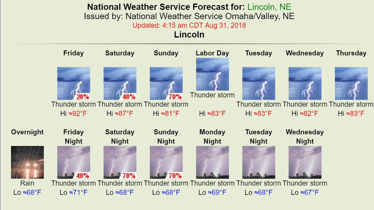
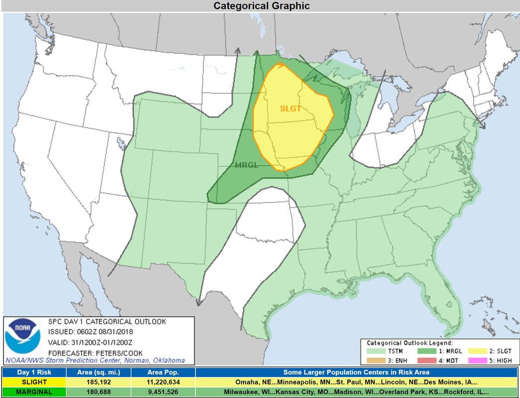
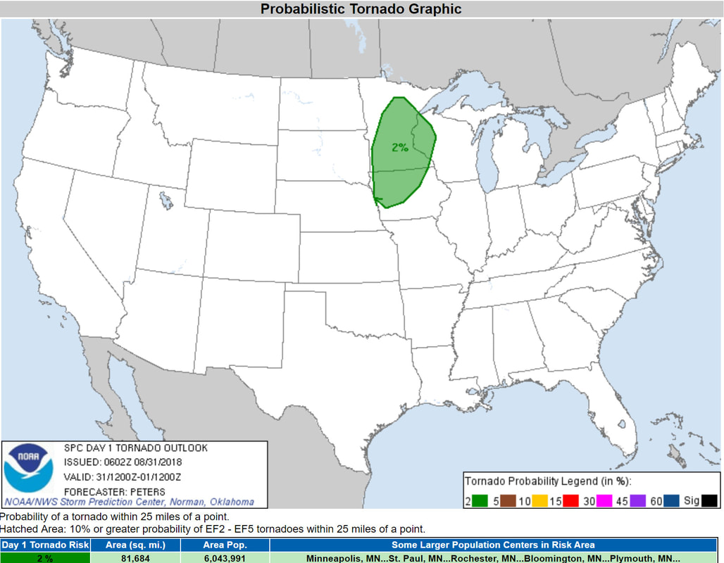
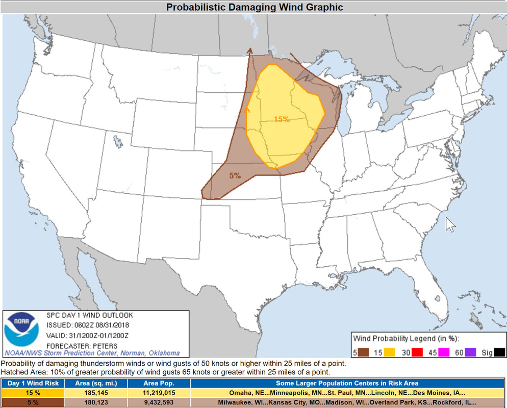
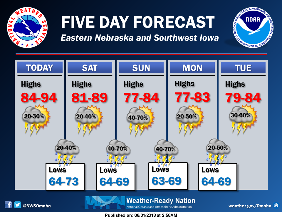
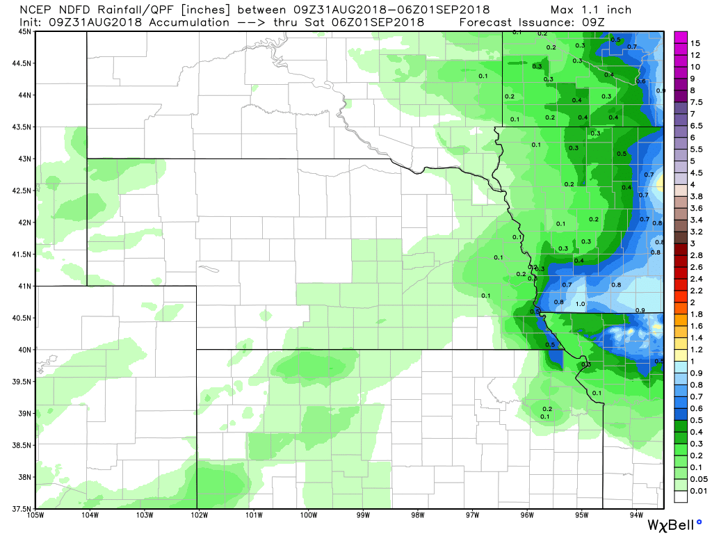
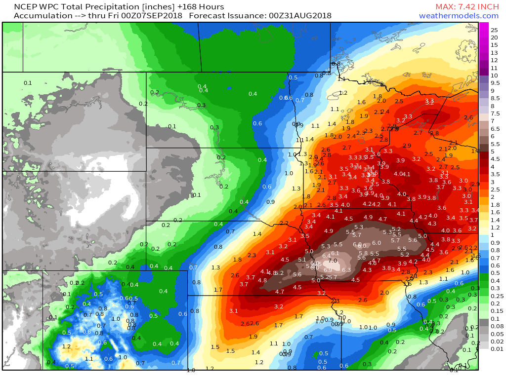
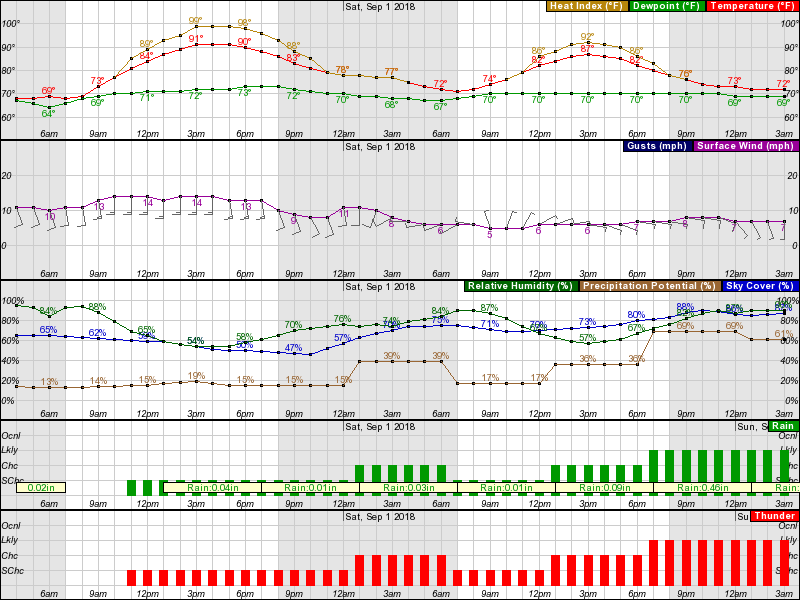
Main concerns through the short term are thunderstorm chances, the potential for severe storms and threat of locally heavy rain. the heavy rain threat appears to be highest Saturday night and then again from late Sunday afternoon into Sunday night.
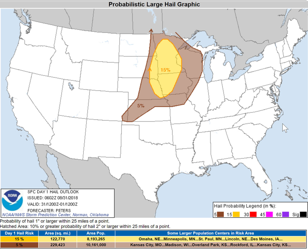
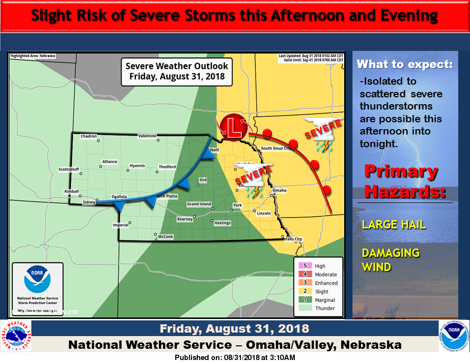
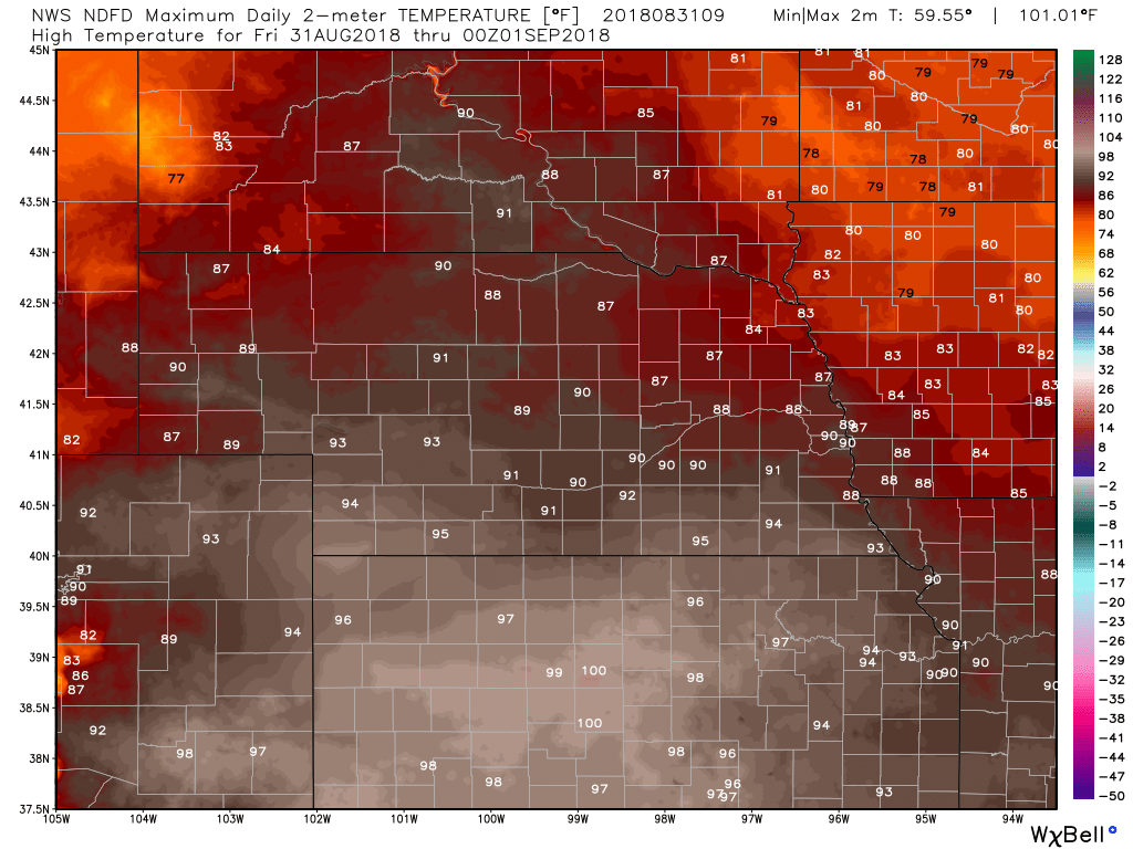
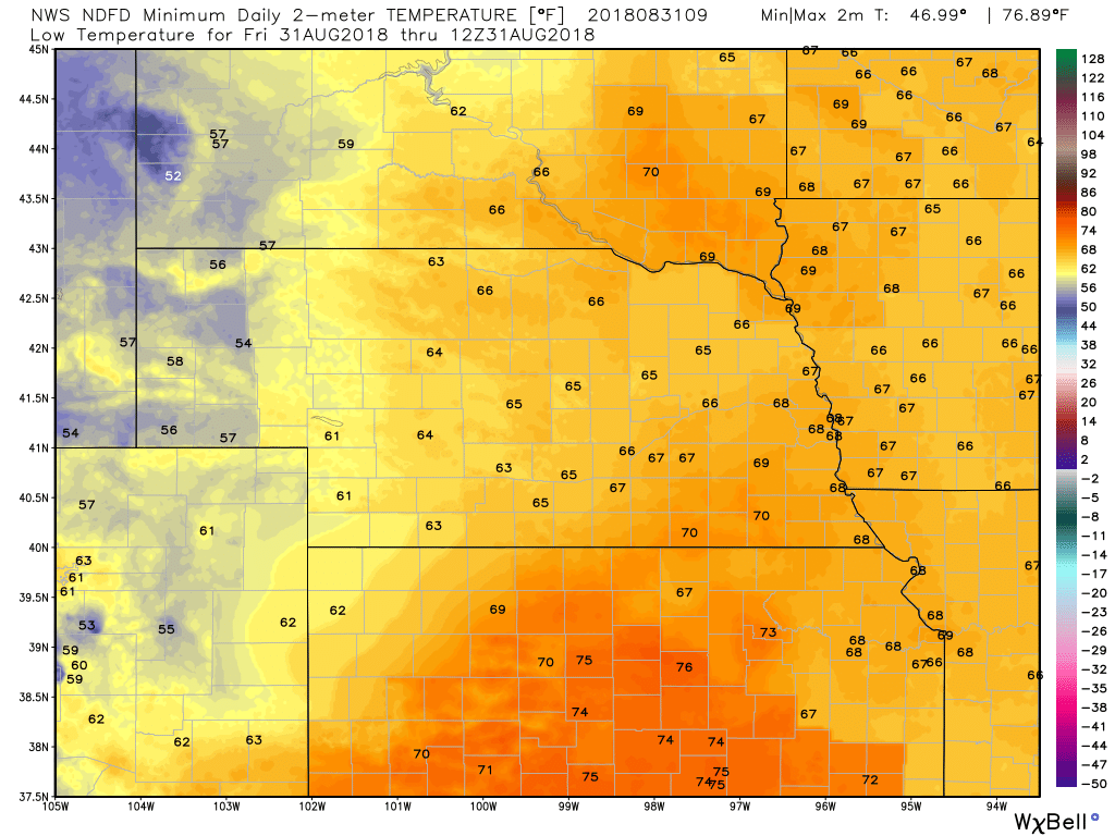
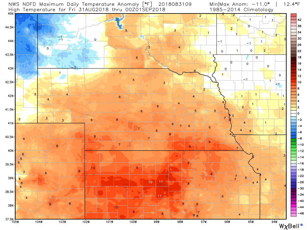
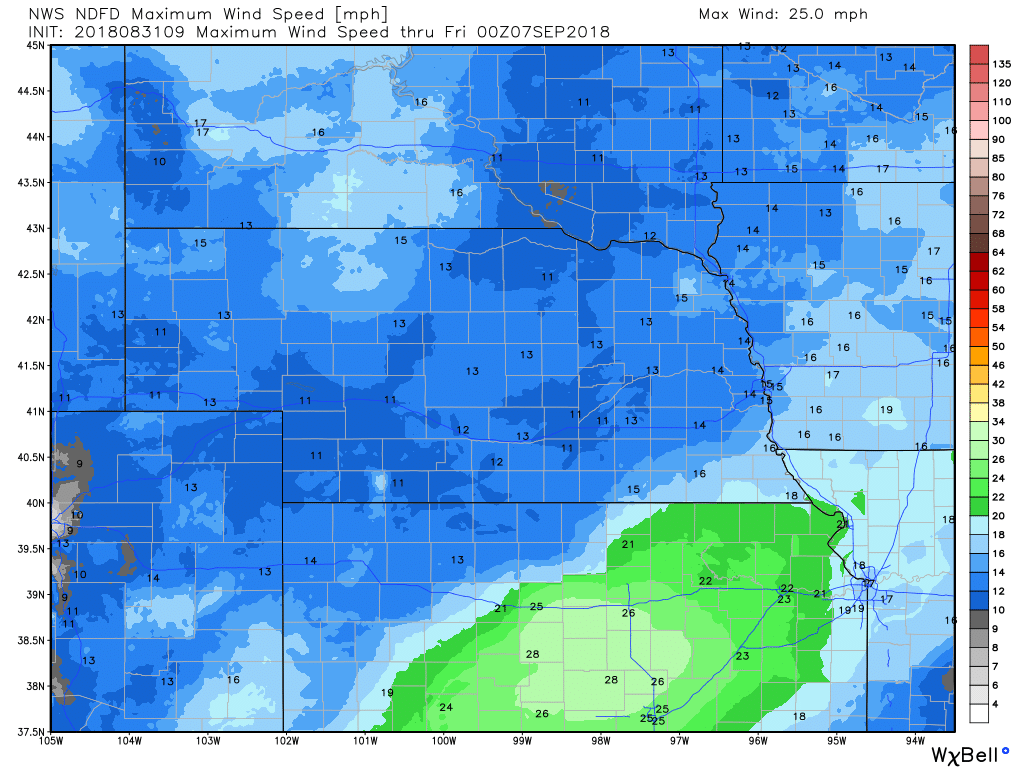
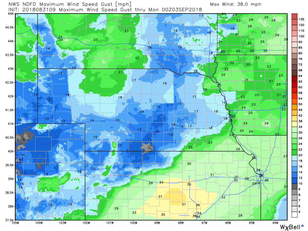
For today, the general consensus from the available high resolution short range convection allowing models (CAMS) is that the bulk of storm activity should shift east of our area and be mainly over central iowa by around 7 am CDT. Then there may be an increase in activity from west to east across the forecast area from the late morning through the afternoon. Outside of possibly some outflow that could mess up the surface pattern, we generally expect south or southeast surface winds from 10 to 20 mph today. Temperatures should reach the mid to upper 80's in the northern parts of the forecast area. Highs in the southern parts of the area will likely reach around 90 to the lower and possibly mid 90's. Storm Prediction Center - Day 1 Severe Weather OutlookNWS Omaha Graphical Weather OutlookTODAY'S TEMPERATURESTEMPERATURE ANOMALIES
WINDPRECIPITATIONHOUR BY HOUR FORECASTCurrent Radar |
Archives
March 2019
Categories
All
|
OLD NORTH GA WX BLOG

 RSS Feed
