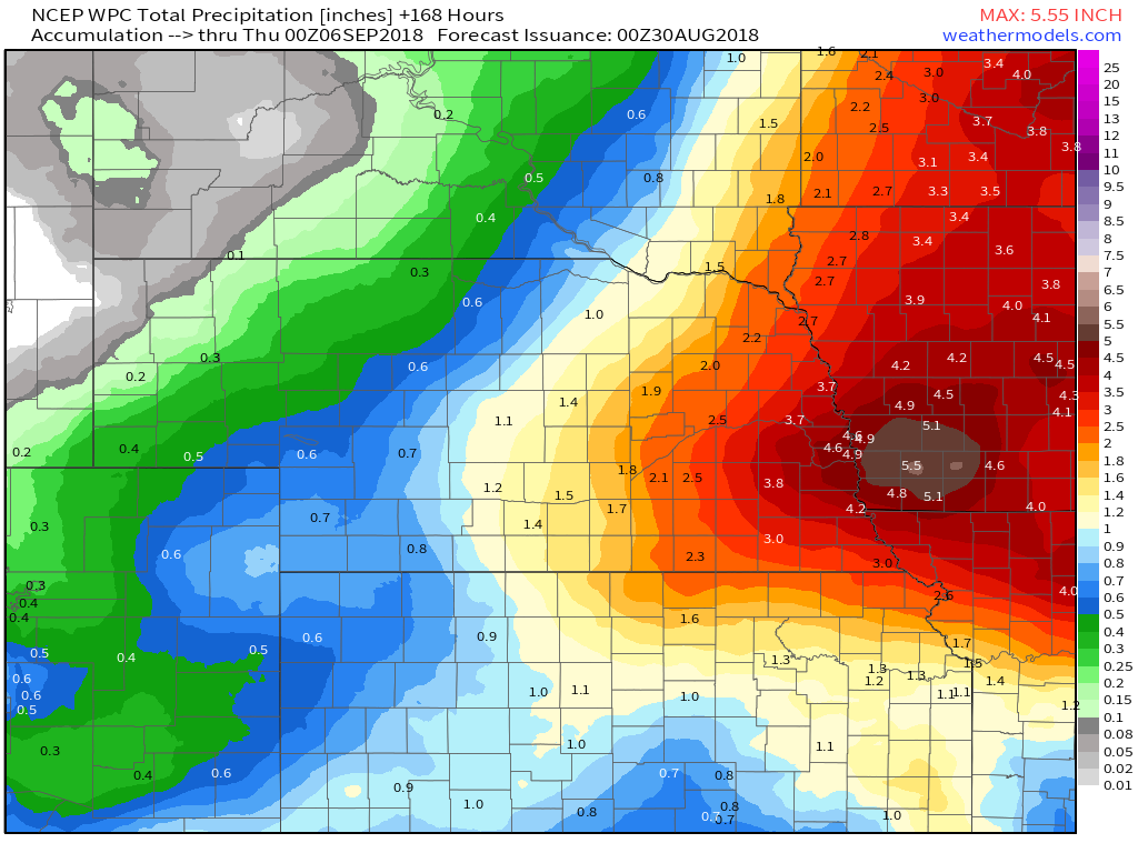
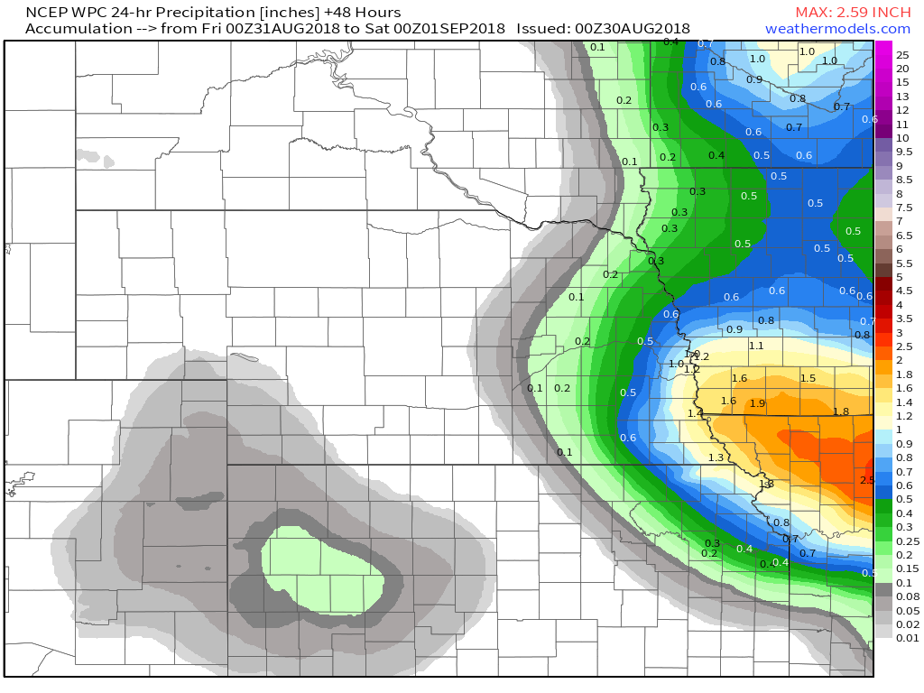
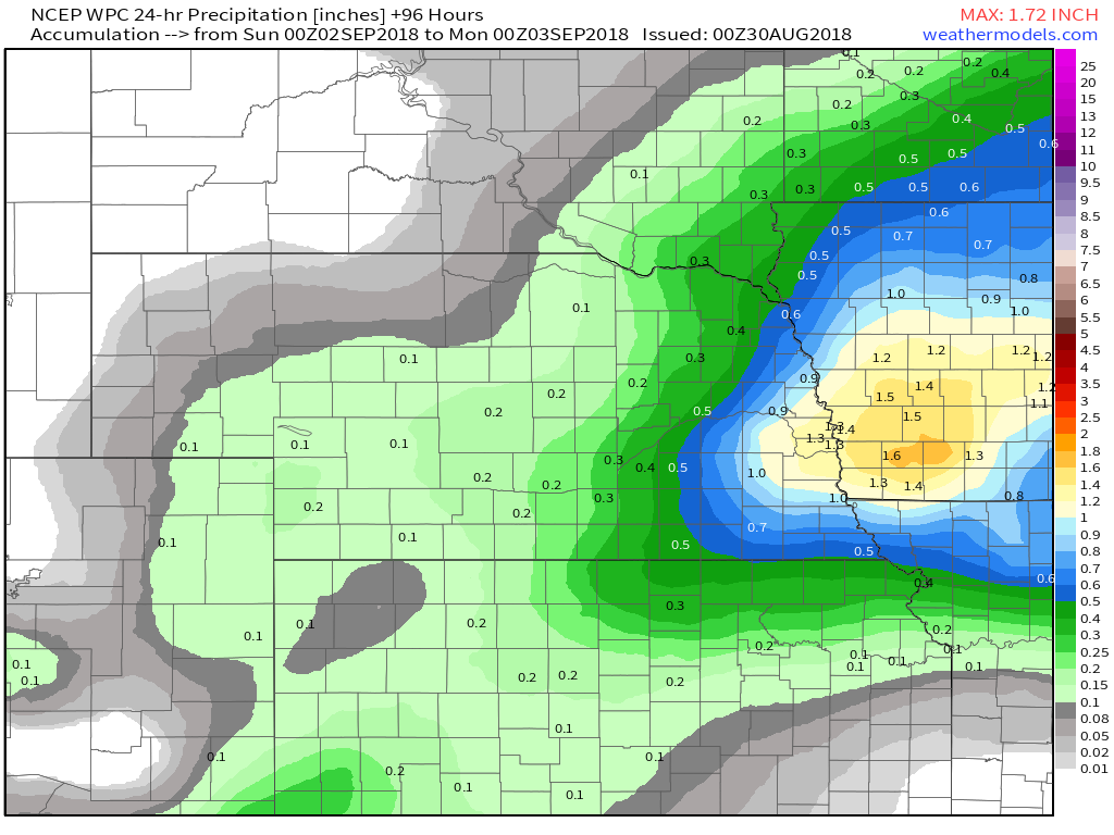
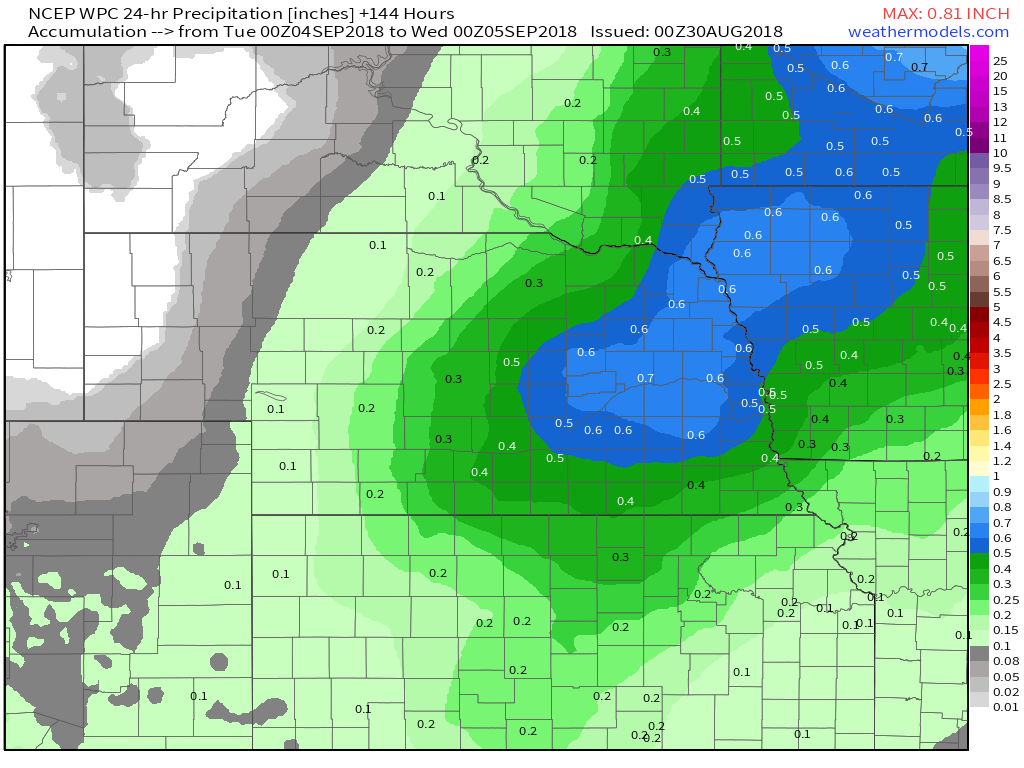
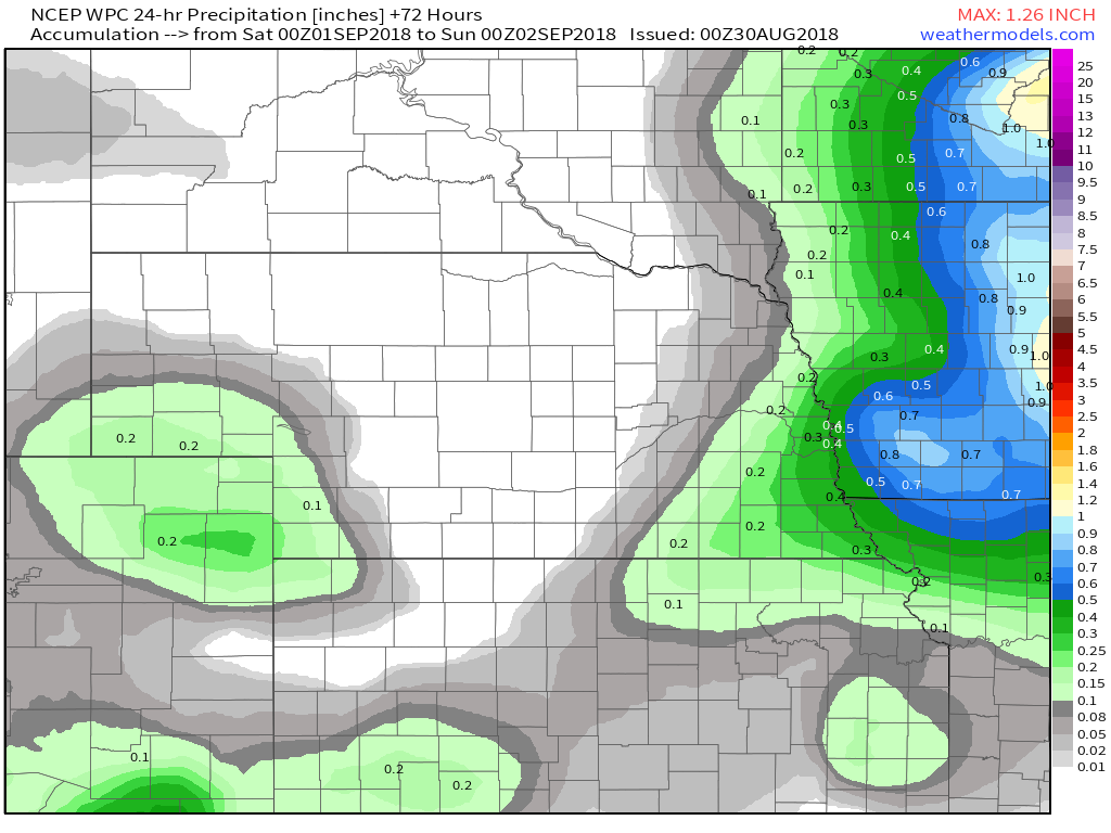
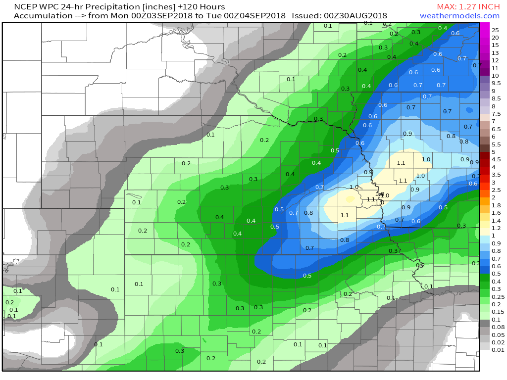
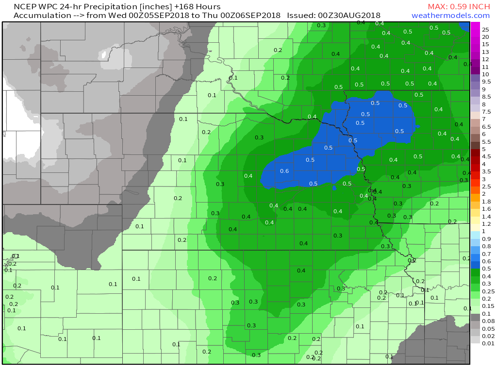
 WPC Rainfall Totals through 8 pm EST Wednesday WPC Rainfall Totals through 8 pm EST Wednesday Well folks, I wish I could say the entire event was going to be sunny and cool, but you'd find out pretty quick when the rain started falling that I was lying. Let's go ahead and first look at Friday into Saturday. This from the Omaha NWS office... "There is a pretty decent front coming into the area Friday evening into Friday night. Various models have different depictions of the timing of the front, with the Nam a little quicker, and the GFS and little slower and the EC even slower still. Will have chance pops of storms along the front, and if storms could get going, there is a slight risk of severe storms Friday evening. The front will remain in the area Saturday, perhaps just south of I-80, which will provide a continued chance of rain for the southern half of the area. LONG TERM...(Saturday night through Wednesday)Several rain chances exist during the extended period, and there is some potential for heavy rains both Saturday night and again Sunday night. The stalled frontal boundary, combined with a short wave ejecting out of the central/southern Rockies could lead to numerous showers/storms. PW values could be around 2" Saturday night, and the GFS is suggesting rainfall could be excessive, although it's just outside our QPF window for this forecast, but it's certainly something we're watching closely. The boundary lifts north during the day Sunday, but remains in the area, thus rain chances continues. Additional heavy rain signals are in place Sunday night with more convection expected along the boundary, again with PW values near 2", which could lead to additional excessive rainfall. While we can probably take one night of heavy rain without too much trouble, a second night in possibly some of the same areas could lead to flash or river flooding. Still 5 days out, but again, we'll continue to monitor it closely. The previously mentioned front seems to wash out Monday, but the GFS remains the wetter model with rain chances continuing. Models do suggest another front could be moving into the area Tuesday afternoon into Wednesday, so rain chances continue those days as well. Bottom line, the extended period, including the Labor Day holiday weekend is looking very active, with numerous rain chances, and the potential for heavy rain and flooding that linger into mid week." Weather Prediction Center 24 Hour Rainfall Totals
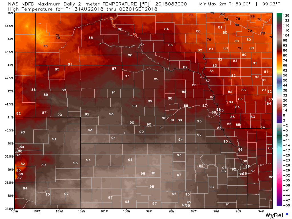
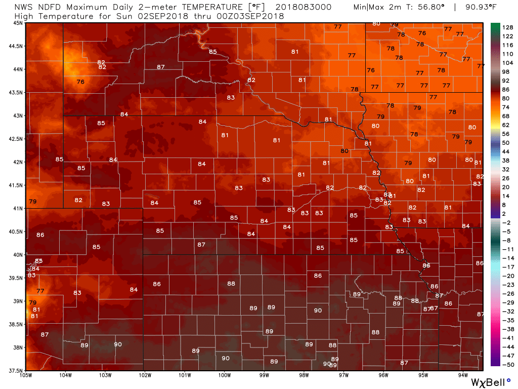
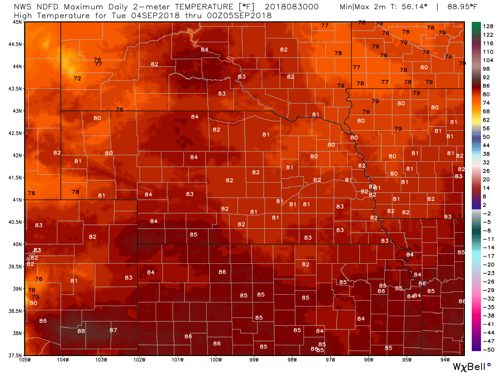
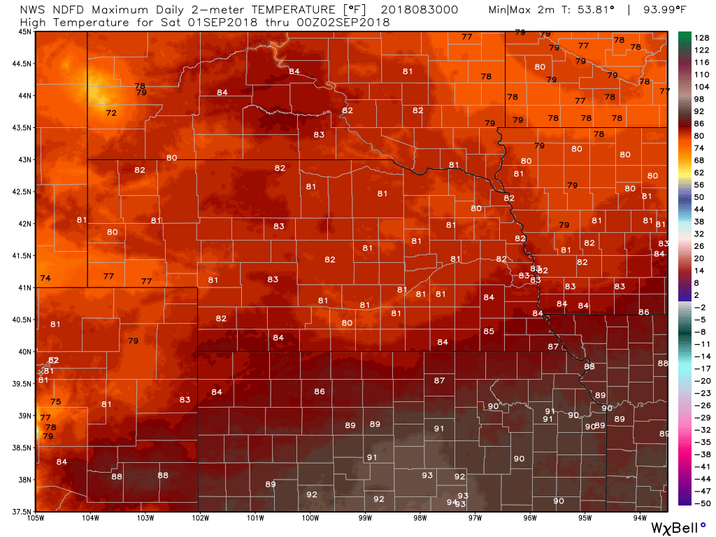
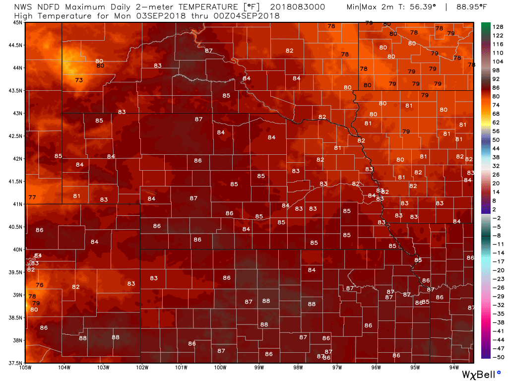
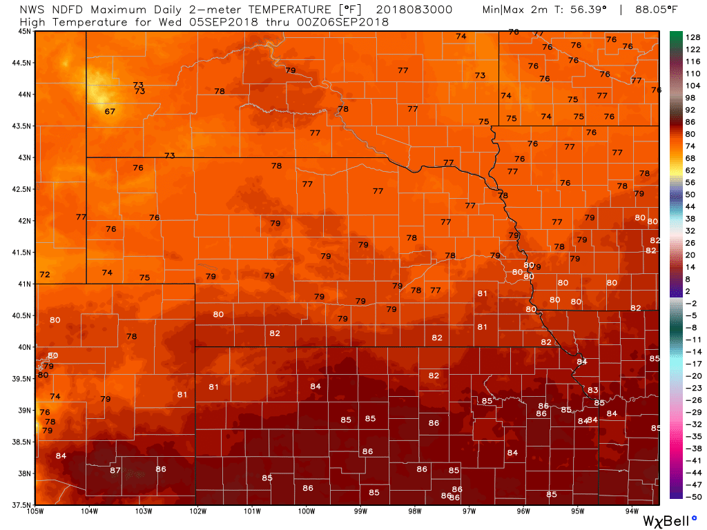
High Temps
|
Archives
March 2019
Categories
All
|
OLD NORTH GA WX BLOG
 RSS Feed
|
Never base important decisions on this or any weather information obtained from the Internet. Always have a backup method of receiving weather information such as a battery powered weather radio.
Copyright © 2018 NorthGeorgiaWX.com and DaculaWeather.com 
|