|
While I know it's been a frustrating winter for everyone, myself included, it doesn't mean this non-cooperative winter is over just yet. As a matter of fact, there are signs that the warmth may be short lived and the cold will return into mid March. Now I know at this point, this may or may not be something that you want to hear, and I understand, many people think that if we're not going to have snow, let's move on to spring.
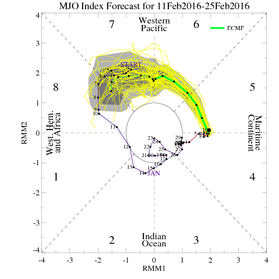
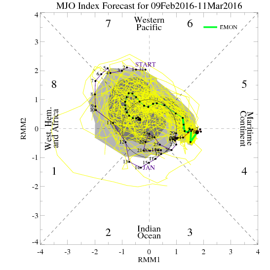
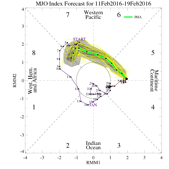
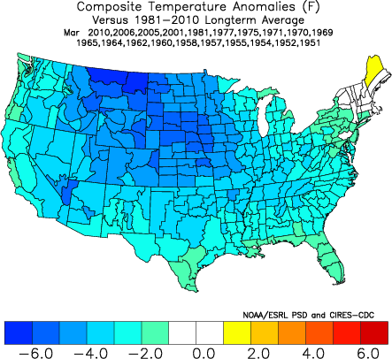
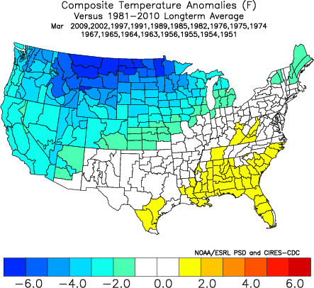
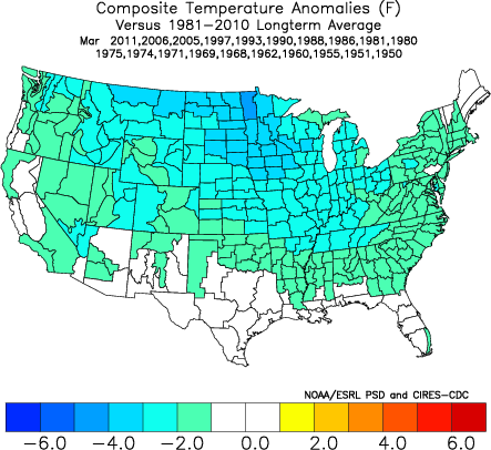
It is very common in strong Nino's for the end of winter to be colder than the beginning, and I've discussed this aspect before. They are called "back loaded" winters and it was part of the forecast that most of the meteorologist made for this winter season. So lets take a look at what the models see and where that might lead us. MJO
Teleconnections
Again, this has been discussed many times in the past, and if you go to any of the major teleconnection pages I have at DaculaWeather.com (like this one for the AO) you can learn more about these oscillations in the atmosphere that help to determine weather patterns, and there is alink on each page that will take you to a different oscillation.
In the winter time in Georgia, we need all the help we can get to have winter weather, and we need certain patterns to help us get this weather. Ideally February and March (for that matter, all of winter) we want to see:
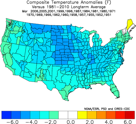
Now... as you know, you hardly ever get the stars lined up just right, and it is no different in this case. Each index can be at a different strength level and placement, so you could have an infinite number of combinations of these indices to factor into a forecast. These images are from a website called MadUSWeather.com, and show the outcome at the surface for temperatures based on the index values (negative or positive etc) values you see above.
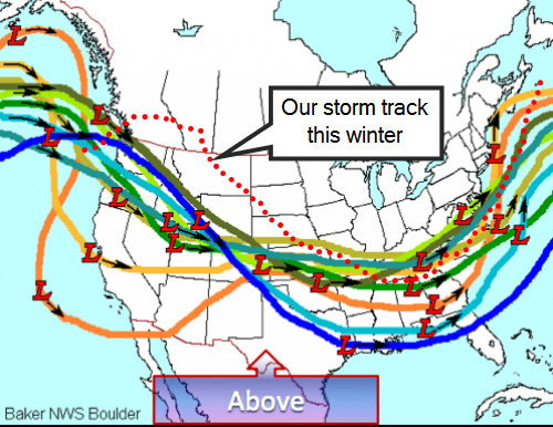
Models in General
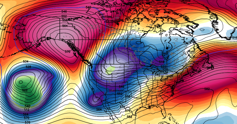
The ensembles are suggesting a return to colder weather beginning around the 21st or so, and by the end of the month, the Euro control is digging a deep trough in the southwest and trying to close off a low. A big ridge is to the west anchored over the corner of Alaska and Canada. Bastardi was talking about the Euro weeklies this morning and how they are also coming around to a short lived warm up and then back into winter.
Week 2 is much colder than what it looked like last Thursday (for what is now Week 3) or Monday. Week 3 is colder too. The moral is that I think our idea that the warmup after the major winter event next week will be short lived is spot on. We will roll well into March before this colder than normal pattern can break.
Where this all leads is to be determined, but the signs that winter is over are just not there, and in fact, it's just the opposite. I don't mean to drag it out any longer than necessary, but it's not really my call to make, Mother Nature has her own ideas.
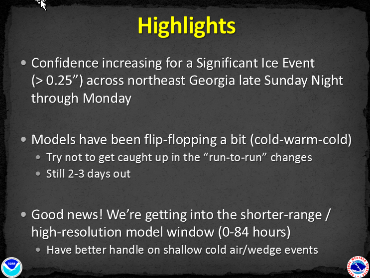
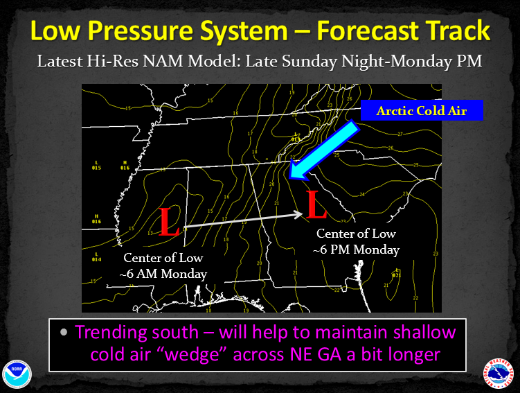
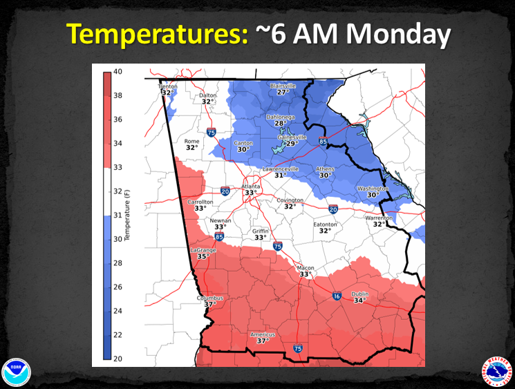
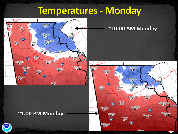
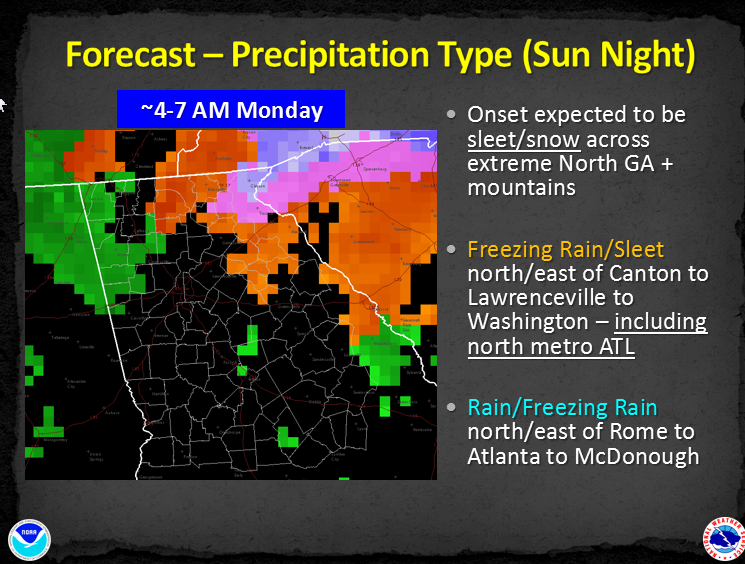
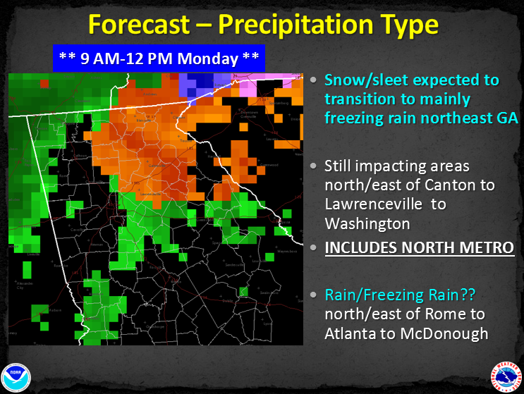
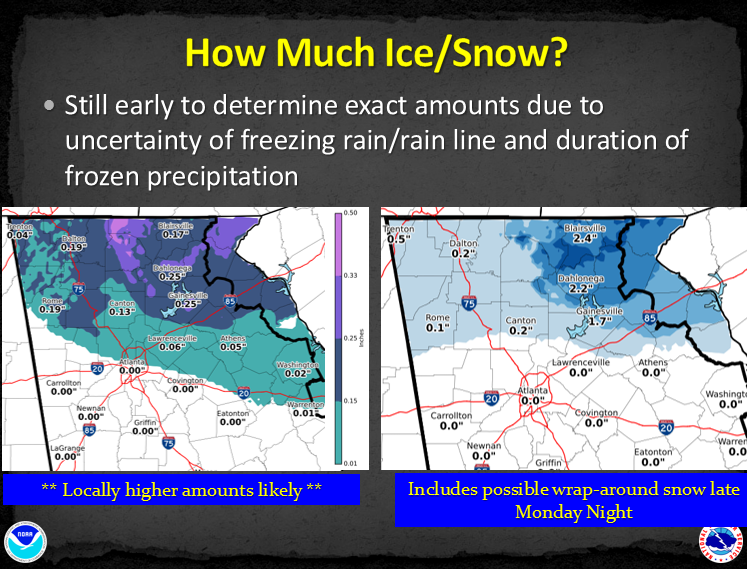
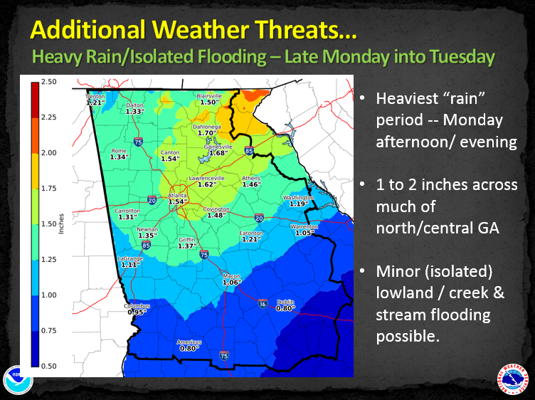
I wanted to share the information that was released from the NWS a little while ago. More changes coming today, and they are in the process of drawing up some winter precip maps that they should have available later today. I will include any text that was in the briefing. 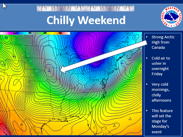 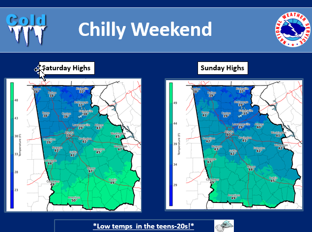 After a warm and wet start to the week, we are back to normal and these conditions will continue into the weekend. High temperatures will be in the 50s for much of the area with lows in the upper 20s and 30s north…and the 30s south. Other than a few showers over the extreme southeast part of the county warning Saturday night…it will be dry across the entire area through Sunday. 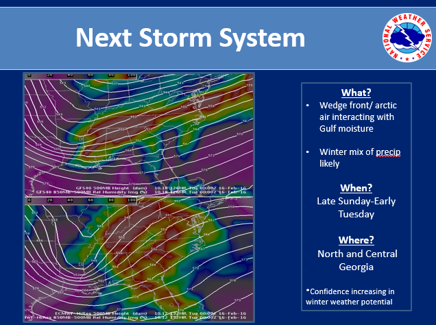 However, a change is coming. An arctic cold front will be moving across the region Monday and Monday night. This front will usher in much colder air that will spread across the region Tuesday and last into the end of the week. There is also a chance of a mix of light rain and light snow across mainly north Georgia beginning Sunday night and ending early Tuesday night. 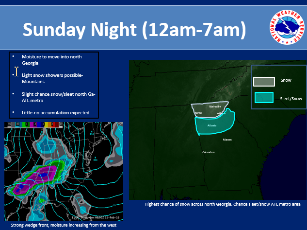 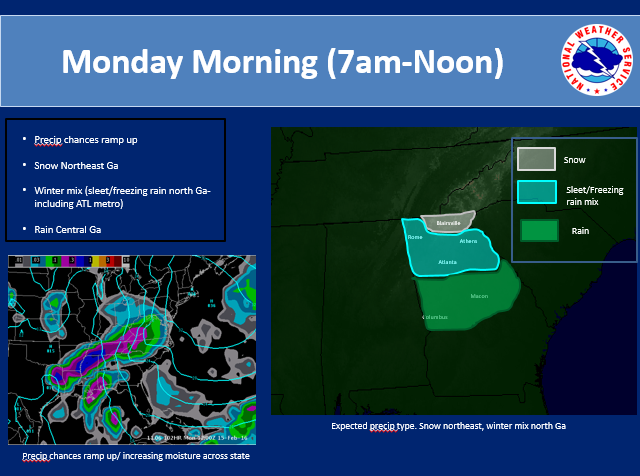 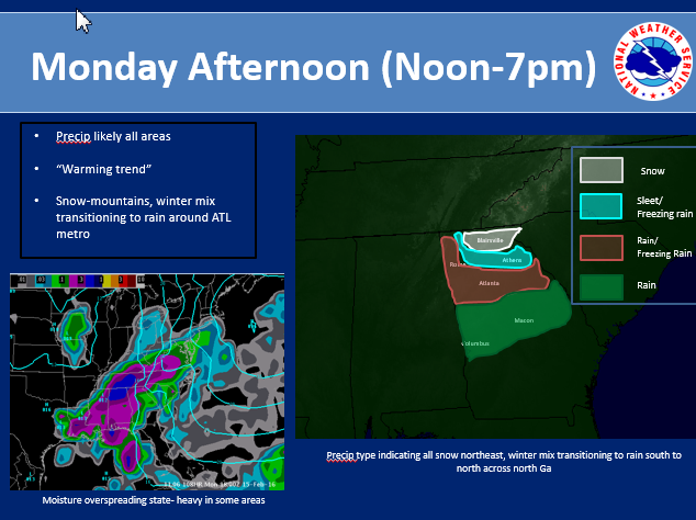 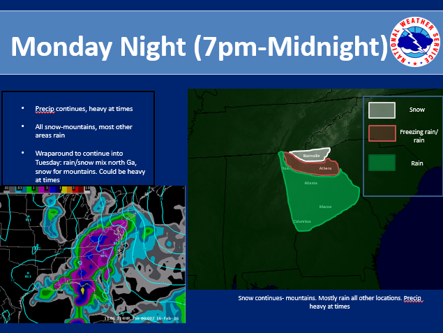 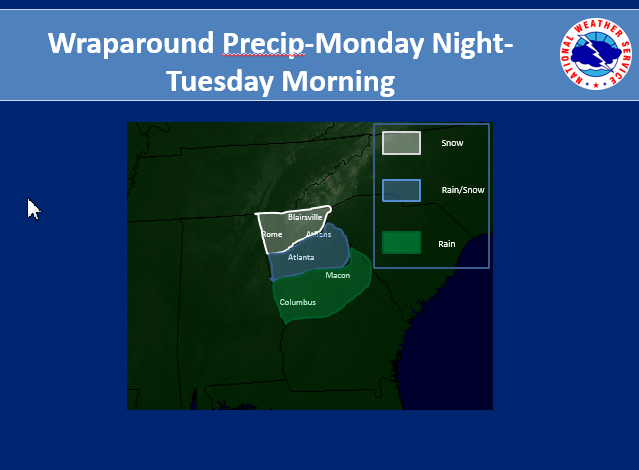 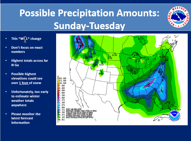 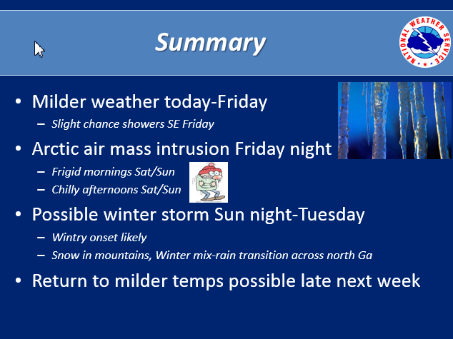 In summary: Severe Weather Preparedness Week continues. The tornado drill has been re-schedule for tomorrow, Friday, February 5, at 9 AM. We will be near normal for temperatures this weekend, however things are going to be changing for early next week. It will be turning much colder behind an arctic cold front that will move across the region Monday and Monday night. The coldest day will be Tuesday and it will be blustery. This will produce wind chills in the upper single digits and teens in the mountains…and the 20s to lower 30s across the rest of north Georgia Tuesday afternoon! There will also be a chance of light snow and light rain across north Georgia Monday night into Tuesday with predominantly light snow and flurries across the mountains. Some light accumulation of snow is possible across the mountains Monday night and Tuesday. Have a great weekend and we’ll see you next week!
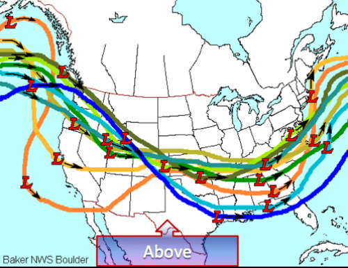
For the longest time we had wave after wave crashing into the west coast and overwhelming any block that tried to develop. Lately, we have developed some blocking, but the waves that eventually become our weather maker come over the top of the block, and not underneath.
I think part of the problem is that the pattern has been SO progressive and fast flowing, nothing ever gets a chance to develop. Even the cold shots that looked so promising in the medium to long range, break down quickly and move on out to sea. Without a mechanism to lock in the cold and slow down the progression, we are going to be hard pressed to get a big winter system it appears. It's looking more and more like we need a strong -NAO (North Atlantic Oscillation) during winters that are strong Nino's, and a -NAO block is never a bad thing. There are signs that winter is not over and that it may persist into March, but as time goes on, our chances get smaller and smaller. I still remain optimistic that we're going to catch a break as the Nino rapidly weakens and warming is still occurring in the stratosphere over the pole and the Euro and Canadian ensembles are still showing a return to winter. I'm still not giving up yet on the Monday system, the potential is still there for a major winter event in the southeast, exactly where is to be determined... we may be down but I don't think we're out. |
Archives
March 2019
Categories
All
|
OLD NORTH GA WX BLOG


 RSS Feed
|
Never base important decisions on this or any weather information obtained from the Internet. Always have a backup method of receiving weather information such as a battery powered weather radio.
Copyright © 2018 NorthGeorgiaWX.com and DaculaWeather.com 
|