|
I wanted to share the information that was released from the NWS a little while ago. More changes coming today, and they are in the process of drawing up some winter precip maps that they should have available later today. I will include any text that was in the briefing. 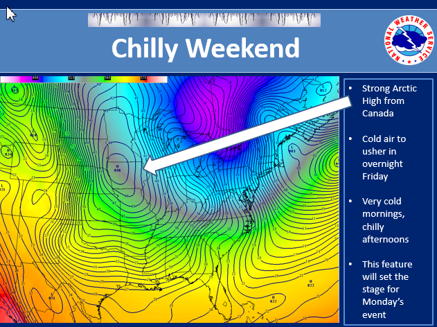 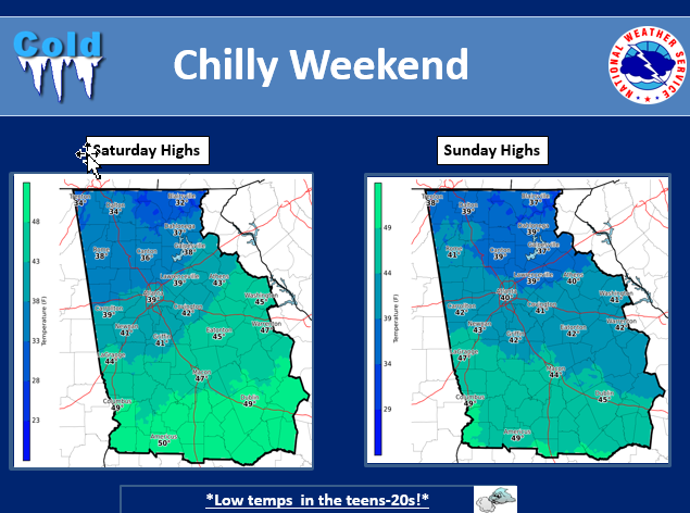 After a warm and wet start to the week, we are back to normal and these conditions will continue into the weekend. High temperatures will be in the 50s for much of the area with lows in the upper 20s and 30s north…and the 30s south. Other than a few showers over the extreme southeast part of the county warning Saturday night…it will be dry across the entire area through Sunday. 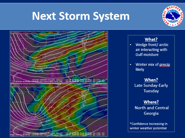 However, a change is coming. An arctic cold front will be moving across the region Monday and Monday night. This front will usher in much colder air that will spread across the region Tuesday and last into the end of the week. There is also a chance of a mix of light rain and light snow across mainly north Georgia beginning Sunday night and ending early Tuesday night. 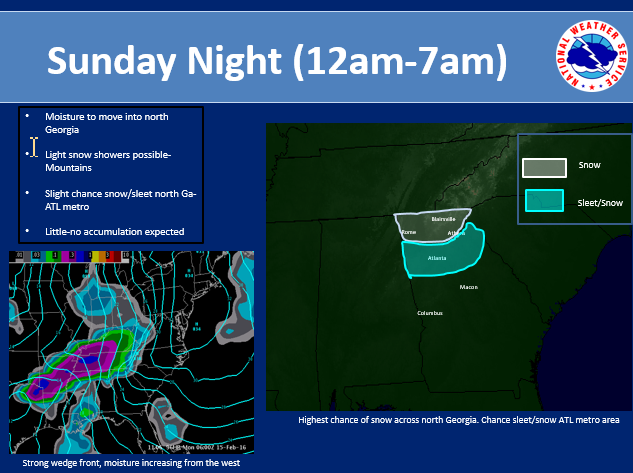 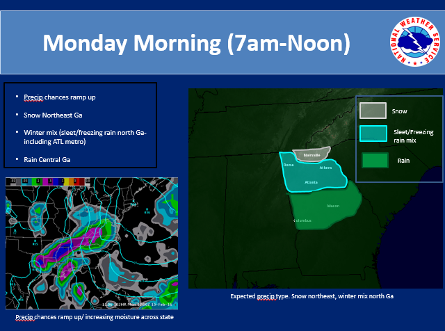 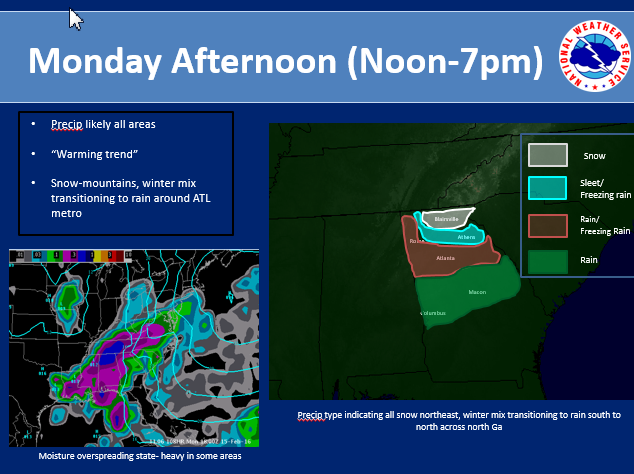 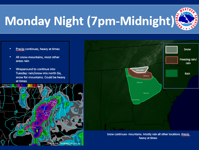 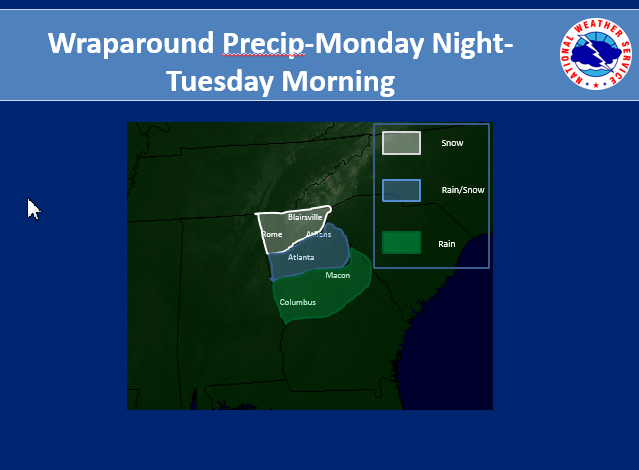 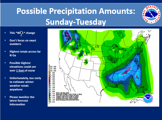 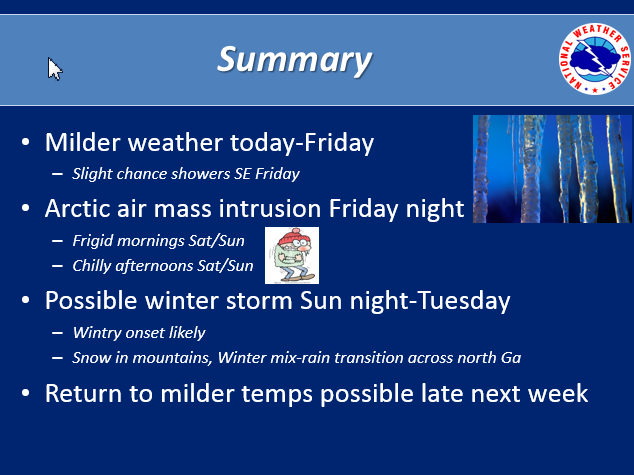 In summary: Severe Weather Preparedness Week continues. The tornado drill has been re-schedule for tomorrow, Friday, February 5, at 9 AM. We will be near normal for temperatures this weekend, however things are going to be changing for early next week. It will be turning much colder behind an arctic cold front that will move across the region Monday and Monday night. The coldest day will be Tuesday and it will be blustery. This will produce wind chills in the upper single digits and teens in the mountains…and the 20s to lower 30s across the rest of north Georgia Tuesday afternoon! There will also be a chance of light snow and light rain across north Georgia Monday night into Tuesday with predominantly light snow and flurries across the mountains. Some light accumulation of snow is possible across the mountains Monday night and Tuesday. Have a great weekend and we’ll see you next week! |
Archives
March 2019
Categories
All
|
OLD NORTH GA WX BLOG
 RSS Feed
|
Never base important decisions on this or any weather information obtained from the Internet. Always have a backup method of receiving weather information such as a battery powered weather radio.
Copyright © 2018 NorthGeorgiaWX.com and DaculaWeather.com 
|