|
Well folks... it's NOWCast time. At this point, other than 2 short range models, there isn't much to look at for us, other than watching the temps and radar. THis storm is slow moving and will take a while to transfer east to the coast. We ideally want to see a more a more direct east movement as that would put us in better position to take advantage of the wrap around moisture. For most of us, that is where our frozen precip will come from. So here's what it looks like at 5 AM
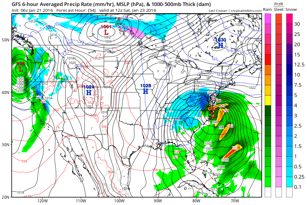
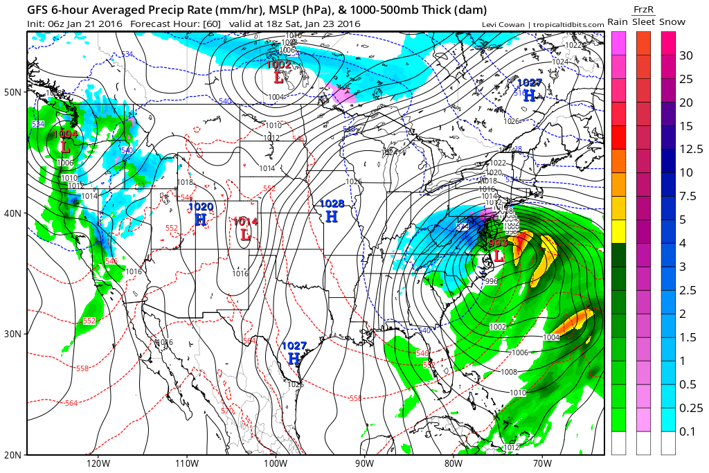
The models are still showing the low slowly crawling east through tonight, where it begins its turn northeastward. As the colder air wraps around the low, the rain will changeover to all snow. From this map you can see where it's colder and snow is falling. Also notice the wide variation in temperatures. 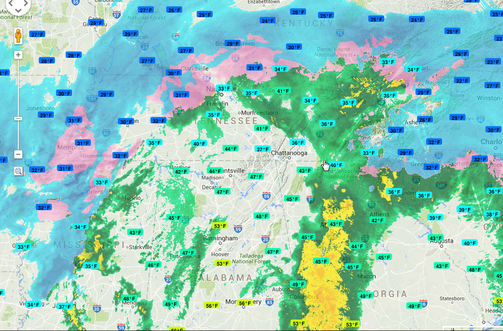 http://bit.ly/1SJdufq  http://www.daculaweather.com/4_nh_wv_loop.php At this point, we're kind of along for the ride on this roller coaster. I'll be making updates all day, and I've posted links for everything thing you see here, so you can also follow along. Oh... forgot the clown maps. GFS, Euro, and NAM. Remember, these are only approximations. :-)
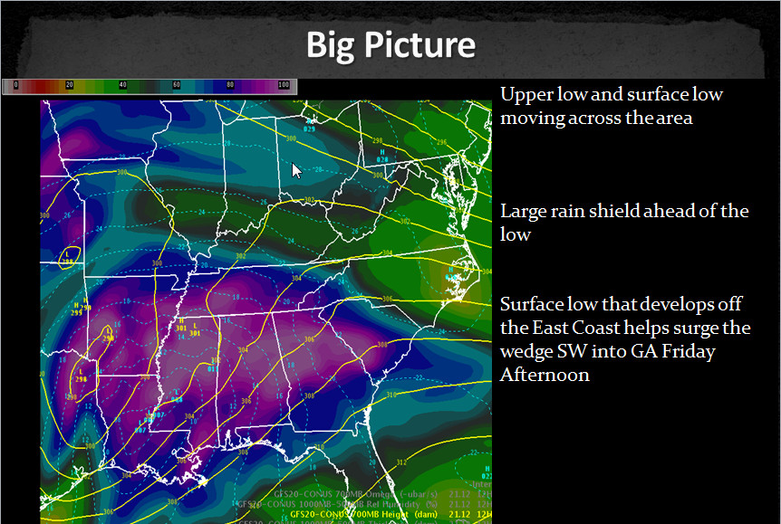
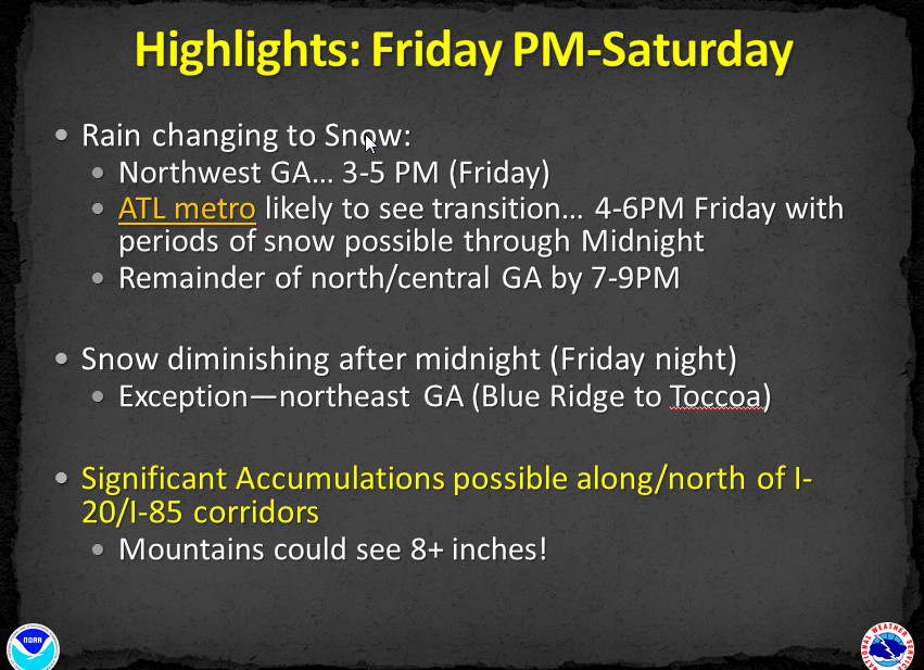
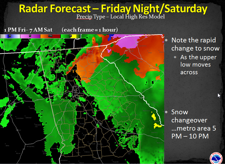
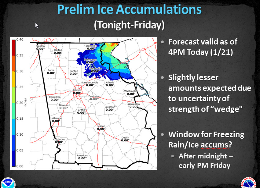
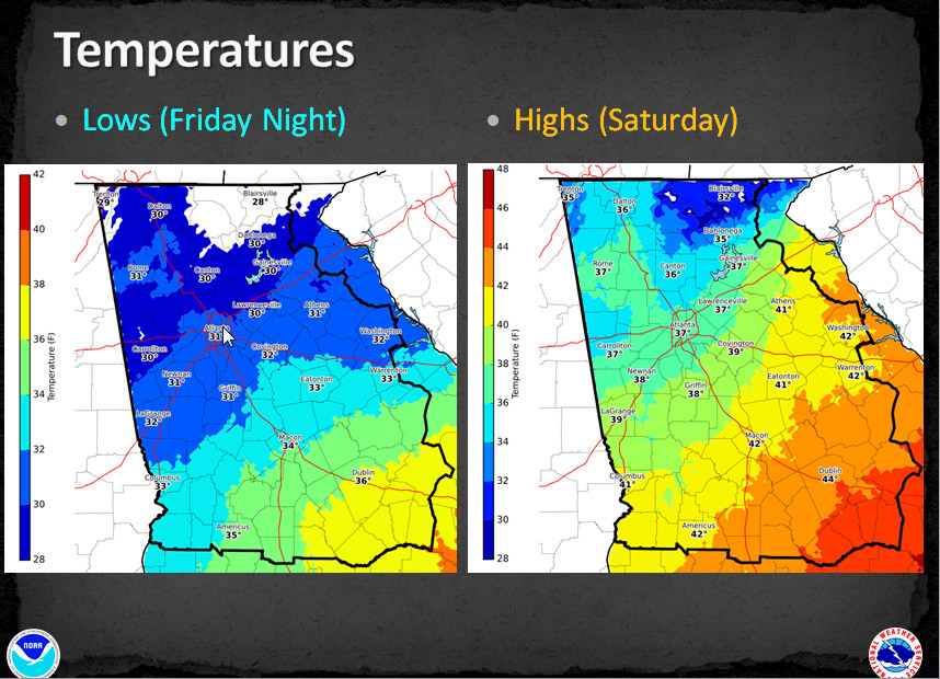
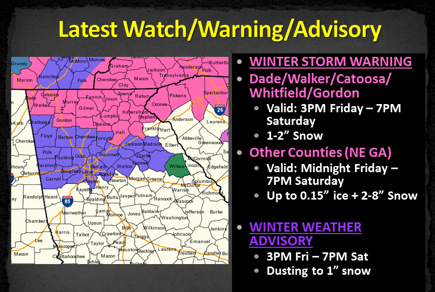
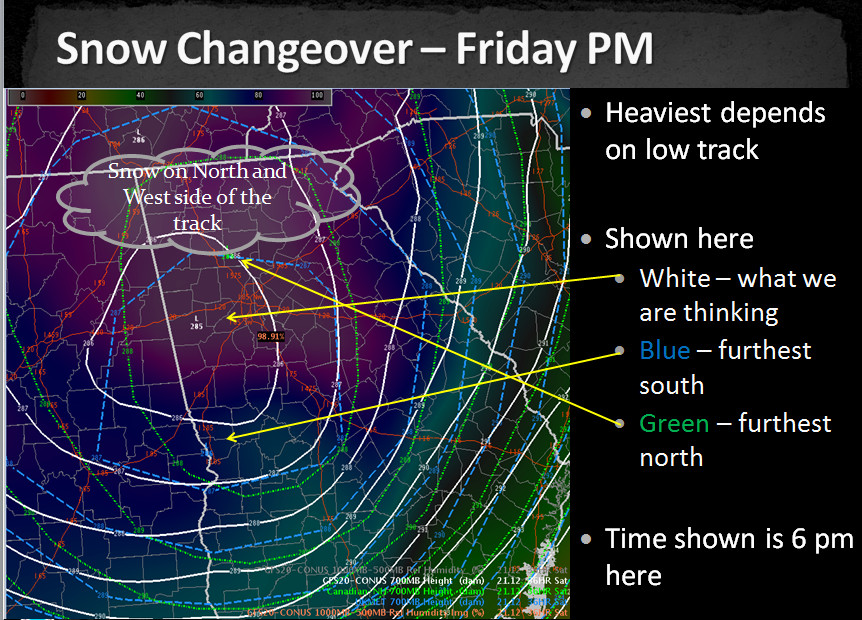
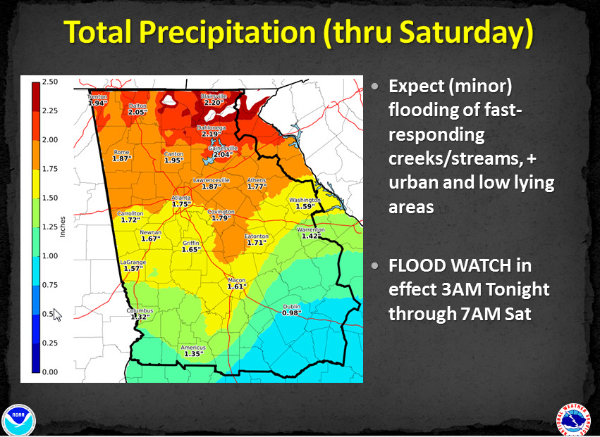
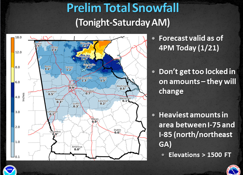
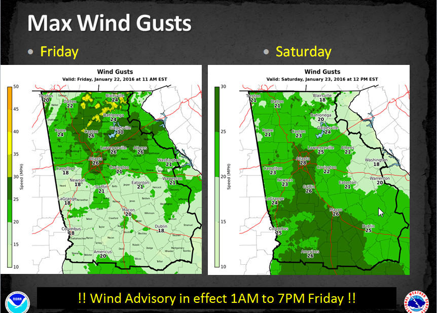
Here are most of the slides from the latest briefing from the Atlanta NWS Office. The next briefing is 11 AM tomorrow.
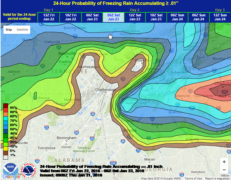
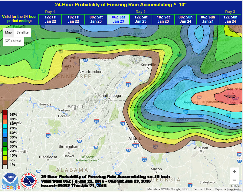
Good morning again! The winter storm that's about to form will have serious implications for many millions of people, from Georgia all the way to the New England states. There are currently 74 million people under a blizzard watch. Many people will be hammered by feet of snow and others will hear the sound of trees crashing to the ground from heavy icing. This will be a major winter storm if there ever was one, and major storms can sometimes have major consequences and unexpected twist and turns By now you have hopefully read Step 1, the latest Area Forecast Discussion from the NWS. If not click here to read it. It appears they are being conservative for now, and rightfully so. I never try to second guess the NWS, they are the experts, they make the forecast, and they are the final answer. But in some cases, I will give you my thoughts and how they differ from theirs. Right or wrong. :-) First, freezing rain probability maps. The one on the left is for 0.01" and the right is 0.10". I think they are way underdone and believe they will be changed, and I'll show you why I think that in a minute. I expect ice to be a very serious concern for many people, as far south as the metro area
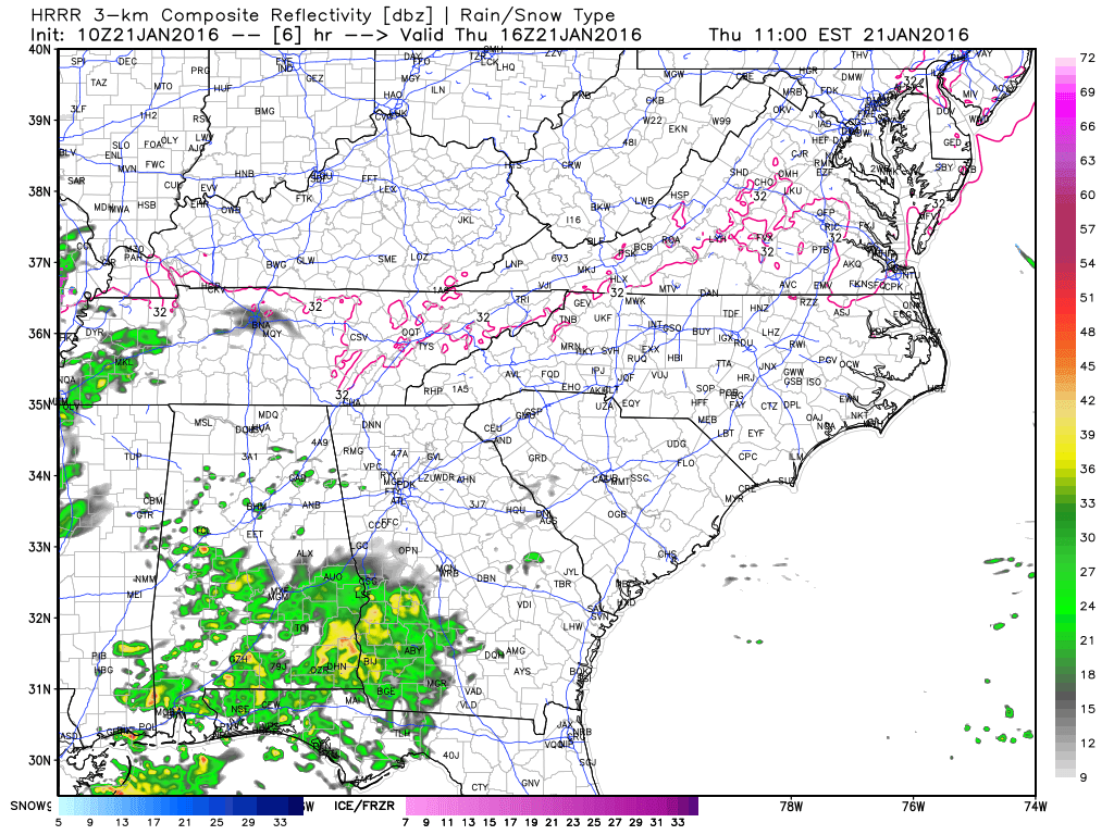
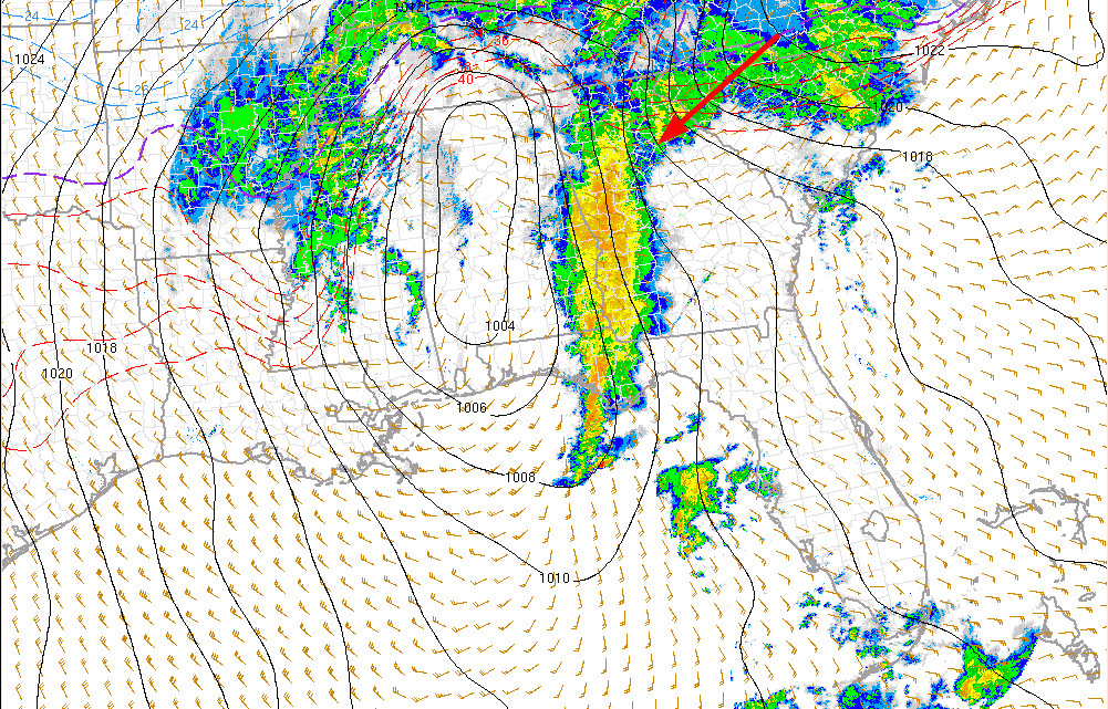
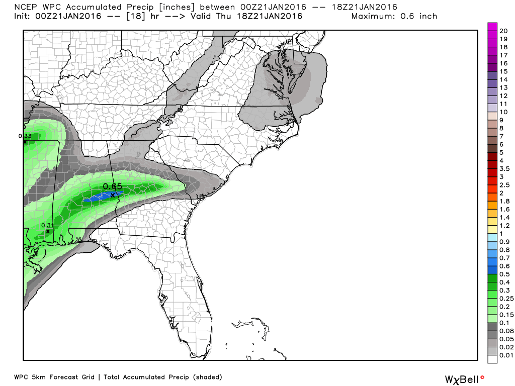
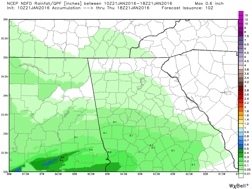
Both major models converged on a solution last night and this morning. First, here's a look at our current surface map and where our future storm is this morning. The red circle is the low pressure at the moment, and the read dotted line is the expected path. Notice how the low will come north toward GA and then rapidly move east. That is a Miller B type storm. The energy transfers from GA to the coast rapidly as it approaches the mountains. It the sotm continued tracking on a southerly course and then made a turn near the coast of FL/GA, that would be a Miller A type of storm. Right now, that is what next Tuesday/Wednesday looks like, and those are our most favorable type of storms. 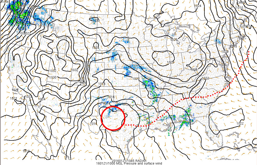 As you can see, precip is already breaking to the north and east of the developing low, and that rain will be on the increase today. These maps show the expected rainfall through 1 PM today. The HRRR simulated radar image is for 11 AM today.
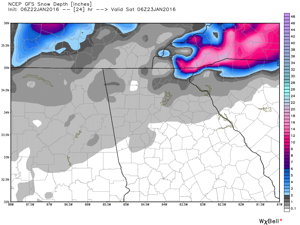
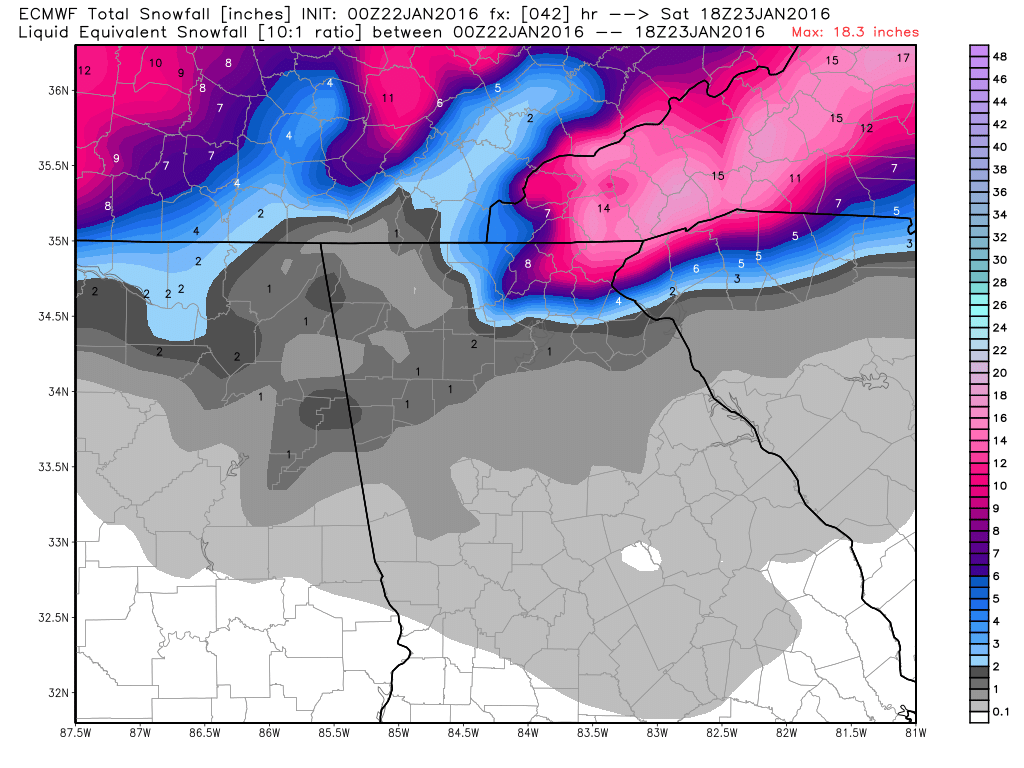
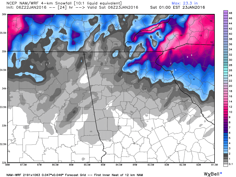
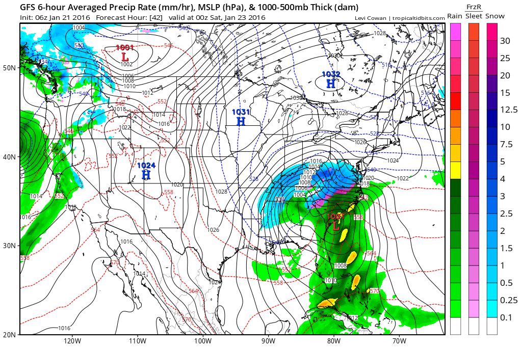
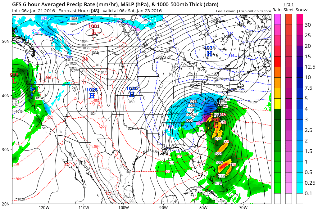
 As the day goes on, a wedge or CAD (cold air damming) begins to build southwest our of the Carolina's. The air there this morning is very cold, and as the high pressure to our north slides east, the clockwise flow will push cold air southwest down the side of the mountains. As the low pressure approaches, the gradient from the low to the south and the high to the north strengthens the CAD. Here's a look at the 06Z GFS. It shows the low pressure moving toward north Georgia, then making the transfer to the coast. I talked with by friend Robert @ Wxsouth.com this morning to see if his thoughts had changed since yesterday, and this is what he had to say about the deformation band: "The GFS latest run and the ECMWF both have that strong wrap around deformation banding swirling snow through NC, eastern TN, eastern KY, and all of Virginia for quite a long time for a storm system... again, I think the models are doing that because the storm tends to go east slowly, rather than rocket up the East Coast as a traditional nor'easter would do. A foot or more of snow now covers more of central and western NC and more of western SC, northeast GA... with still not enough shown in my opinion in Alabama and Georgia with the deformation band later on. We'll see though."
Robert also had this to say... "I am thinking the 5h, 7h and 850 lows will come right over Birmingham to Atlanta or just right north of there tomorrow night and then roll east, not northeast. That will initially allow a backside deformation band. Now I know there's a tight play from downslope in that flow for Atlanta, but still a few hours of moderate snow is doable, and especially east off the northeast side of the chain, going into Upstate SC to western NC, where I think for a few hours, the flow will really hit them, and maybe have some thundersnow. I'm not sold, but its slightly possible. This 850 low is really going to wind up nicely and the mountains will force it to the southeast of the chain. I think all models are still too light on the deformation band immediately behind it, but then again, the mountains play funny tricks all the time. If this were March, I'd definitely honk Thunder-snow. I see the new Hi Res NAM just went south and due east... the folks in NYC are in a panic I bet. I think todays 12z may drop a fraction more, won't surprise me. Robert made a post yesterday, and he has graciously allowed me to share some pieces from it. Here you'll get a inside look at what Robert is thinking about when, where, and how much. So here are Robert's bulleted points from yesterday.
i will have much more to come this afternoon after we get another round of models under our belts.
Get ready, this roller coaster is about to leave the station, it it looks like one heck of a ride. :-) Good morning to everyone. Since you're here reading this, I know what you're here to see. :-) But first, let's see what happened over night. First, a quick look at the Friday system. King Euro held serve in its 00Z model run last night. Reminds me of a Tom Petty song, "Won't Back Down". The Euro isn't budging on its thoughts, as it still brings a surface low across the southeast and then takes a slight turn and heads northeast. This track is just a little bit further south and a little big slower than the previous run. Also, the wrap around moisture looks to be stronger on this run as well. i think this system holds a lot of promise for us. More on this one in a different post, it needs one all by itself. :-) Today! What a mess. Let's start with the Winter Storm Warning and Winter Weather Advisory. Those pretty much tell you all you need to know. Also, if you'd like to read it, I've attached the NWS Atlanta Weather Briefing from 4 PM yesterday.
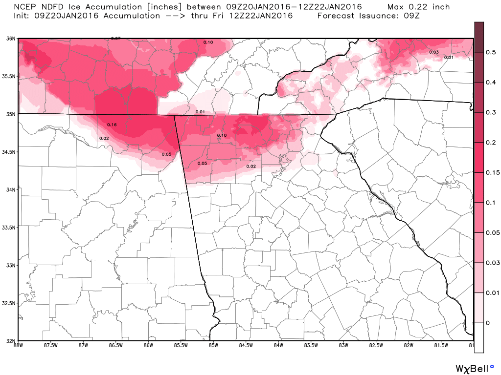
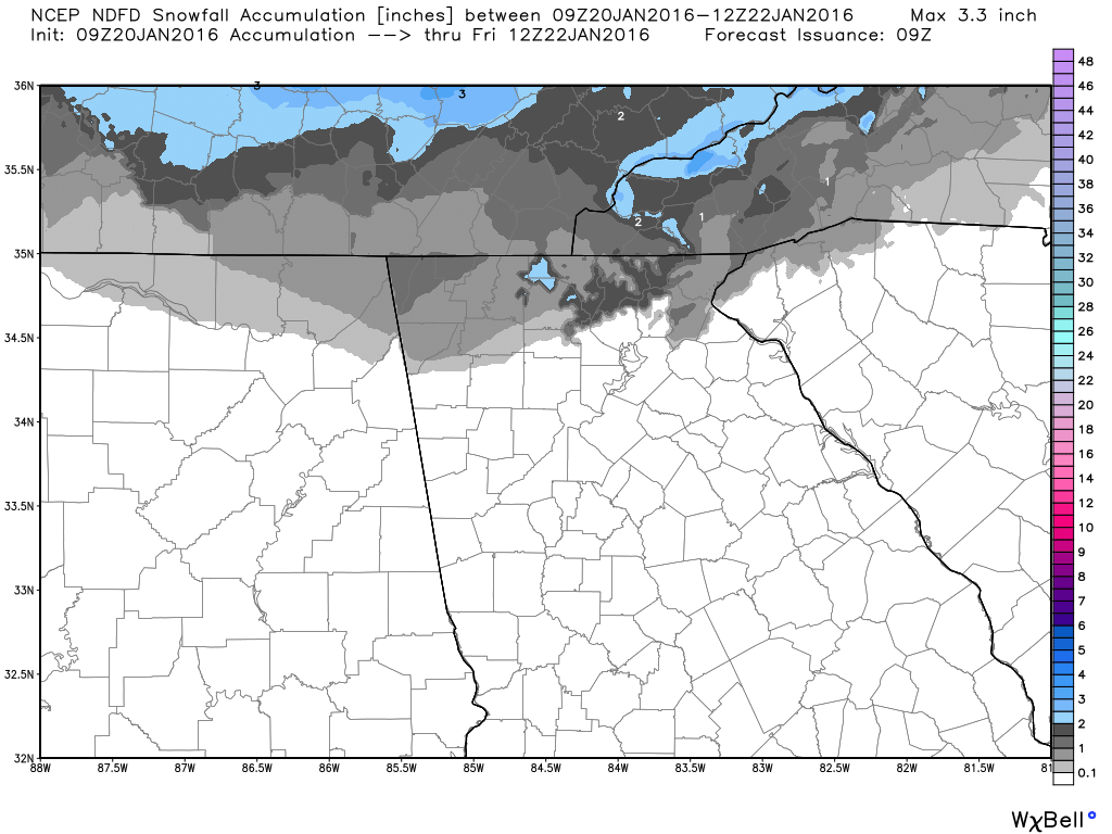
URGENT - WINTER WEATHER MESSAGE  The temperature profiles will need to be watched today, as they will vary quite a bit across the area. As you can see in this image (click to enlarge), temperatures to our west are warmer than we are in the east. i'm still at 25ºF with a dew point of 17ºF. Could be close by the time the precip gets here. The maps below show the NDFD forecast for accumulating ice and snow. Again, this can and will vary somewhat today as the temperatures move around as warm air moves in. It will be important to be particularly careful when it starts, as the surfaces will be well below freezing and anything that falls on it will freeze. I'll also add, the metro area is not out of the woods yet. We will see how the system progresses, and I will have constant updates through the day about this on my Facebook page, so please keep checking back.
|
Archives
March 2019
Categories
All
|
|||||||||||||||||||
OLD NORTH GA WX BLOG
 RSS Feed
|
Never base important decisions on this or any weather information obtained from the Internet. Always have a backup method of receiving weather information such as a battery powered weather radio.
Copyright © 2018 NorthGeorgiaWX.com and DaculaWeather.com 
|