|
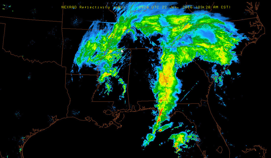
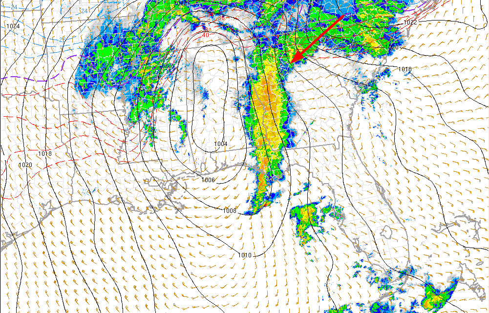
Well folks... it's NOWCast time. At this point, other than 2 short range models, there isn't much to look at for us, other than watching the temps and radar. THis storm is slow moving and will take a while to transfer east to the coast. We ideally want to see a more a more direct east movement as that would put us in better position to take advantage of the wrap around moisture. For most of us, that is where our frozen precip will come from. So here's what it looks like at 5 AM
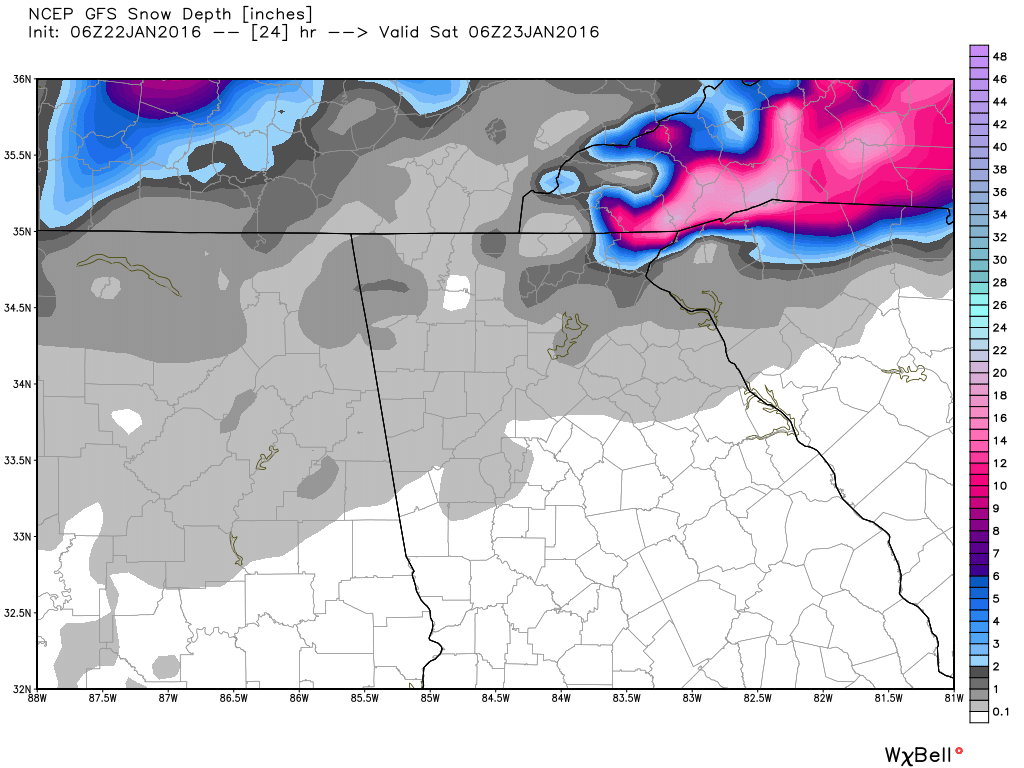
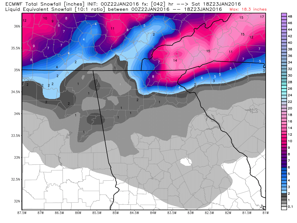
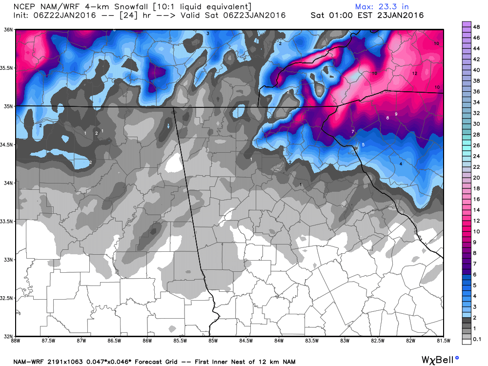
The models are still showing the low slowly crawling east through tonight, where it begins its turn northeastward. As the colder air wraps around the low, the rain will changeover to all snow. From this map you can see where it's colder and snow is falling. Also notice the wide variation in temperatures. 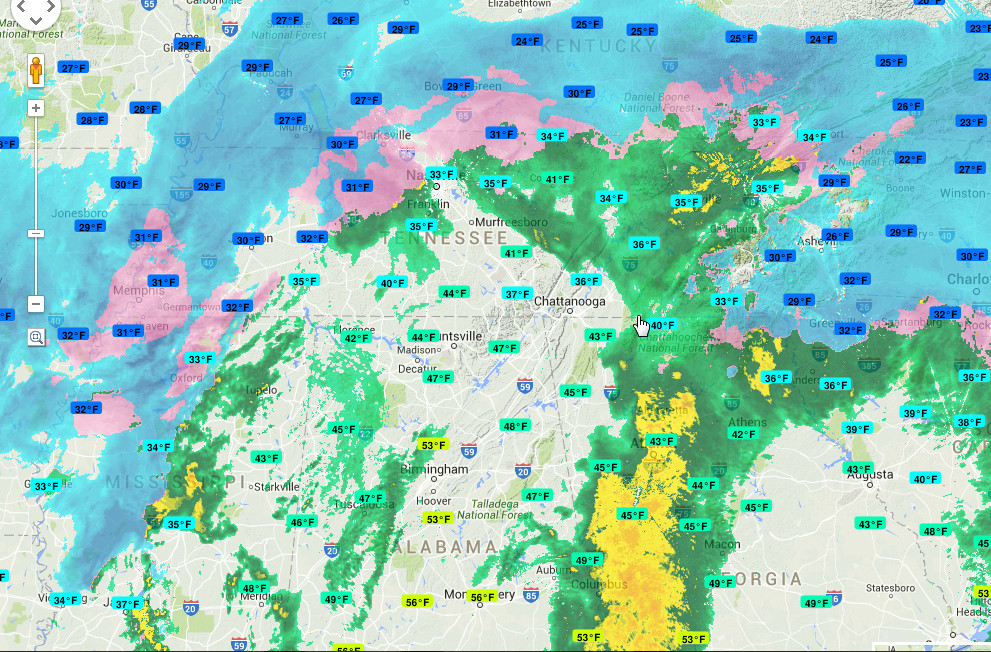 http://bit.ly/1SJdufq  http://www.daculaweather.com/4_nh_wv_loop.php At this point, we're kind of along for the ride on this roller coaster. I'll be making updates all day, and I've posted links for everything thing you see here, so you can also follow along. Oh... forgot the clown maps. GFS, Euro, and NAM. Remember, these are only approximations. :-)
|
Archives
March 2019
Categories
All
|
OLD NORTH GA WX BLOG
 RSS Feed
|
Never base important decisions on this or any weather information obtained from the Internet. Always have a backup method of receiving weather information such as a battery powered weather radio.
Copyright © 2018 NorthGeorgiaWX.com and DaculaWeather.com 
|