|
Good morning to everyone. Since you're here reading this, I know what you're here to see. :-) But first, let's see what happened over night. First, a quick look at the Friday system. King Euro held serve in its 00Z model run last night. Reminds me of a Tom Petty song, "Won't Back Down". The Euro isn't budging on its thoughts, as it still brings a surface low across the southeast and then takes a slight turn and heads northeast. This track is just a little bit further south and a little big slower than the previous run. Also, the wrap around moisture looks to be stronger on this run as well. i think this system holds a lot of promise for us. More on this one in a different post, it needs one all by itself. :-) Today! What a mess. Let's start with the Winter Storm Warning and Winter Weather Advisory. Those pretty much tell you all you need to know. Also, if you'd like to read it, I've attached the NWS Atlanta Weather Briefing from 4 PM yesterday.
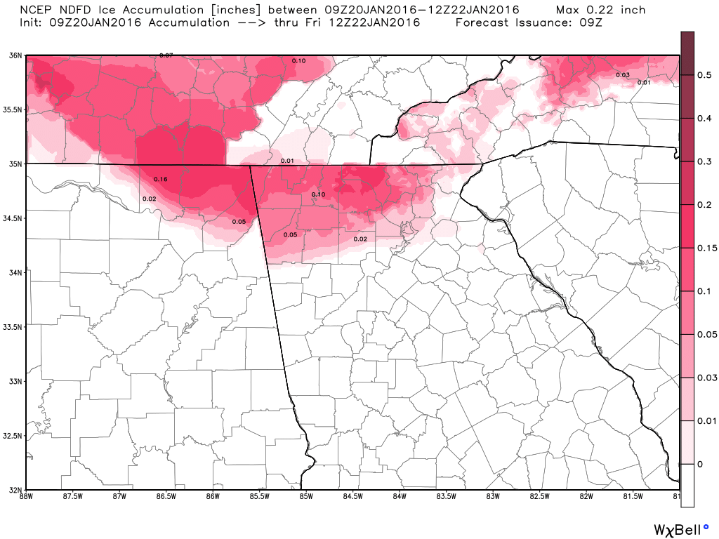
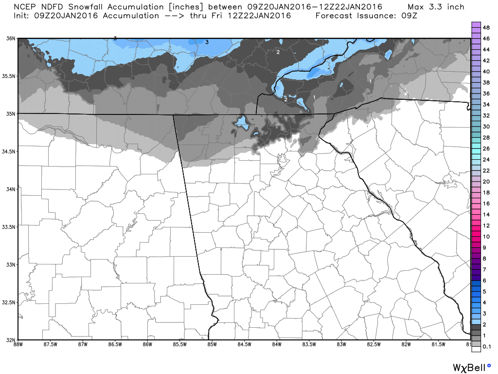
URGENT - WINTER WEATHER MESSAGE  The temperature profiles will need to be watched today, as they will vary quite a bit across the area. As you can see in this image (click to enlarge), temperatures to our west are warmer than we are in the east. i'm still at 25ºF with a dew point of 17ºF. Could be close by the time the precip gets here. The maps below show the NDFD forecast for accumulating ice and snow. Again, this can and will vary somewhat today as the temperatures move around as warm air moves in. It will be important to be particularly careful when it starts, as the surfaces will be well below freezing and anything that falls on it will freeze. I'll also add, the metro area is not out of the woods yet. We will see how the system progresses, and I will have constant updates through the day about this on my Facebook page, so please keep checking back.
|
Archives
March 2019
Categories
All
|
||||
OLD NORTH GA WX BLOG
 RSS Feed
|
Never base important decisions on this or any weather information obtained from the Internet. Always have a backup method of receiving weather information such as a battery powered weather radio.
Copyright © 2018 NorthGeorgiaWX.com and DaculaWeather.com 
|