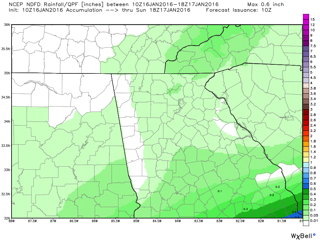
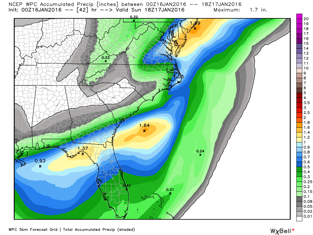
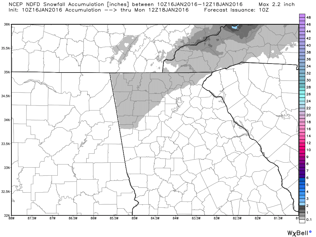
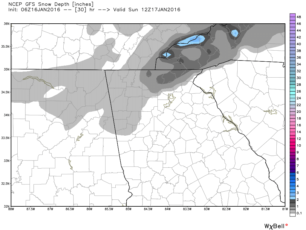
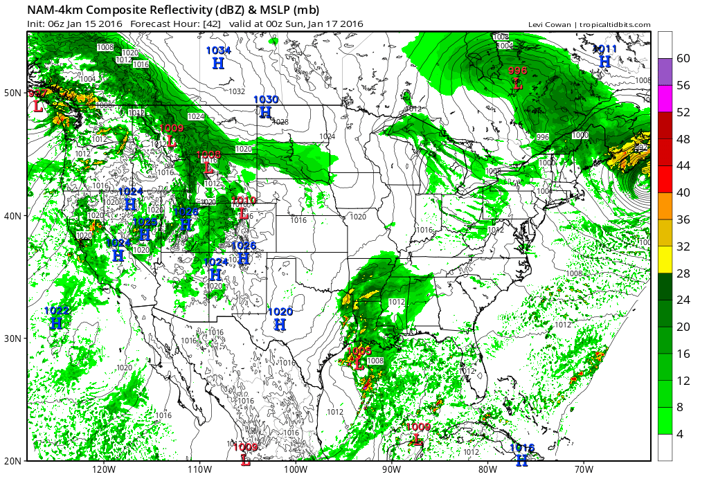
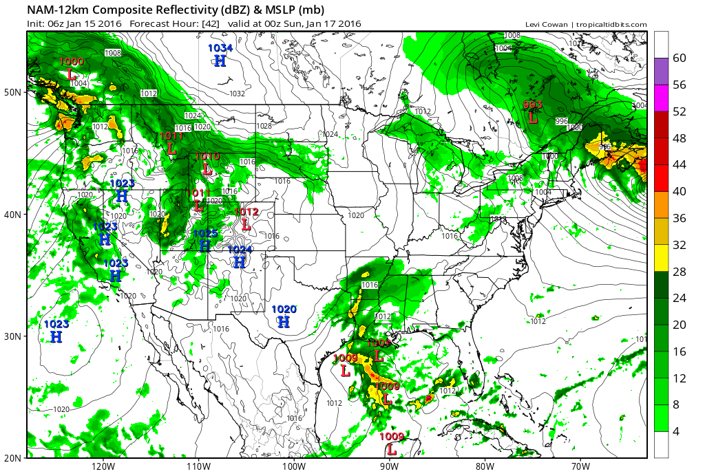
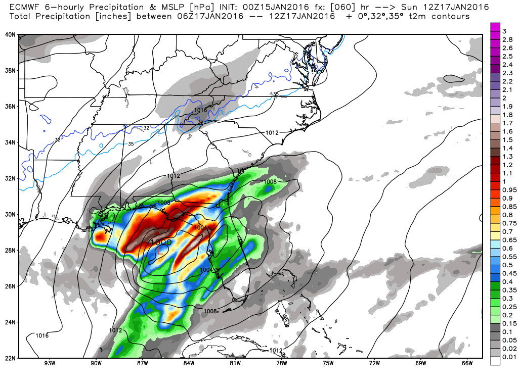
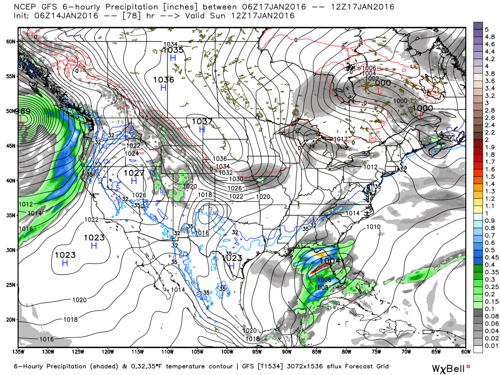
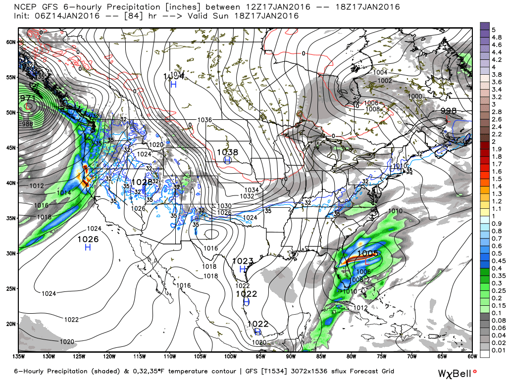
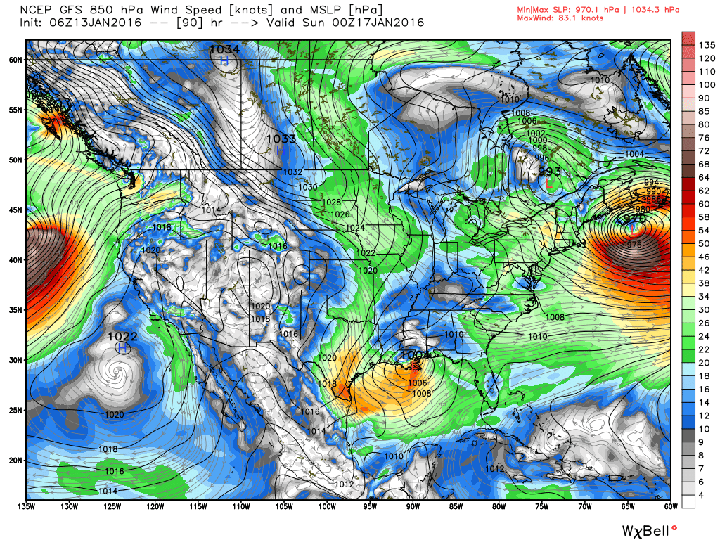
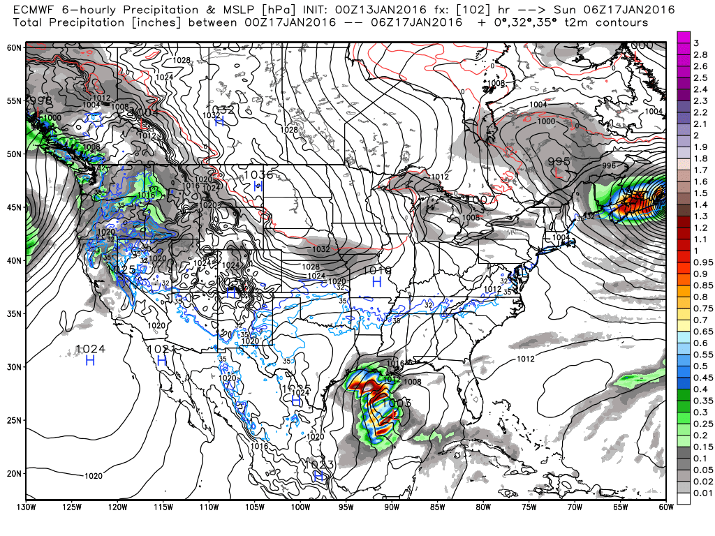
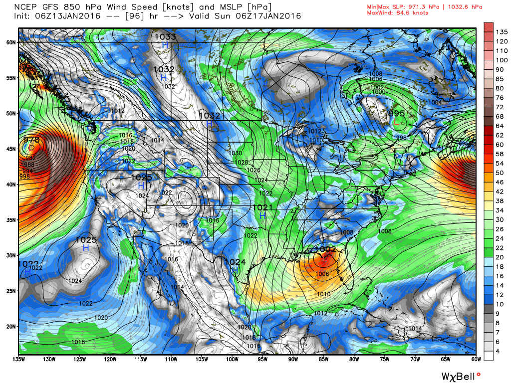
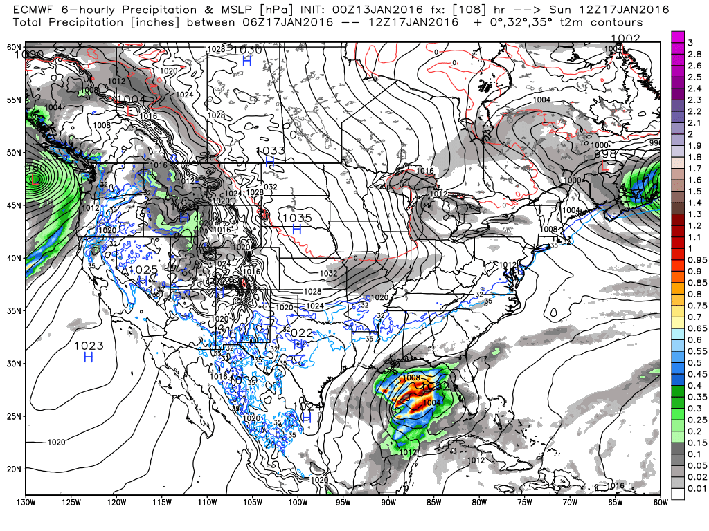
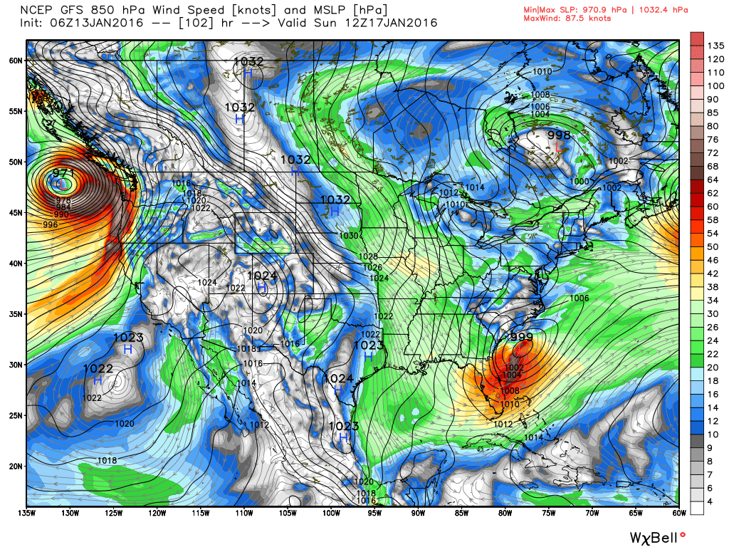
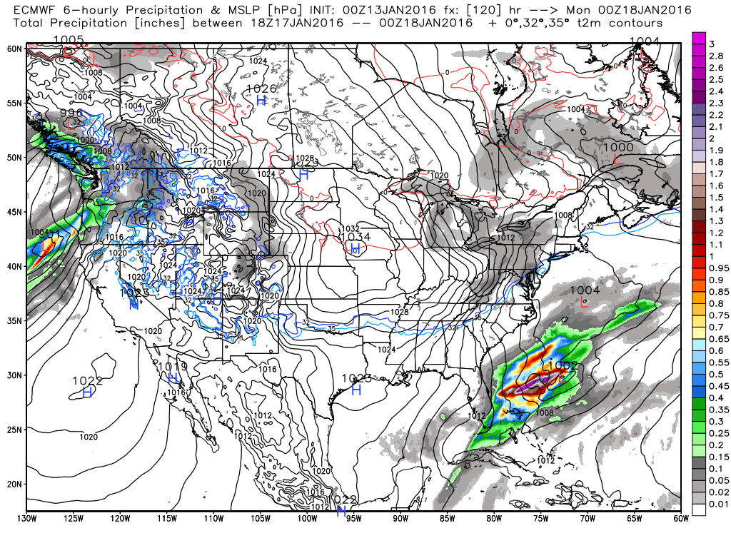
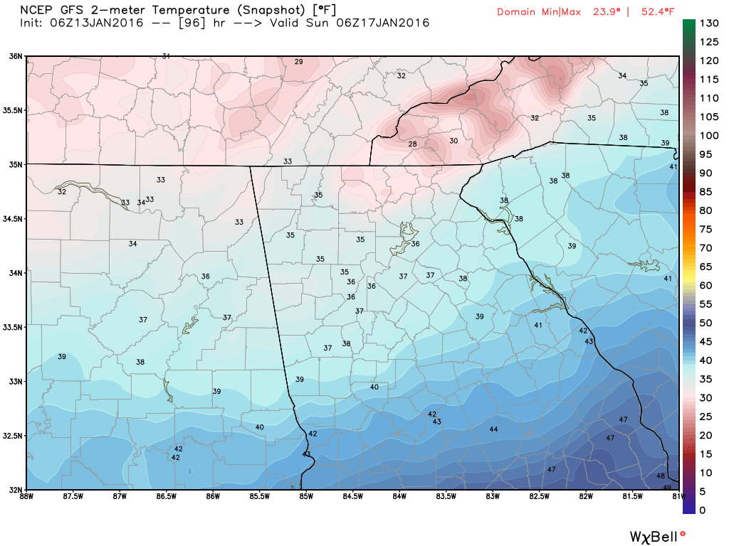
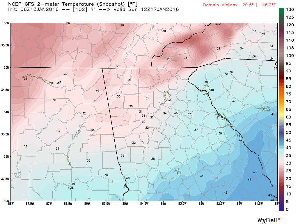
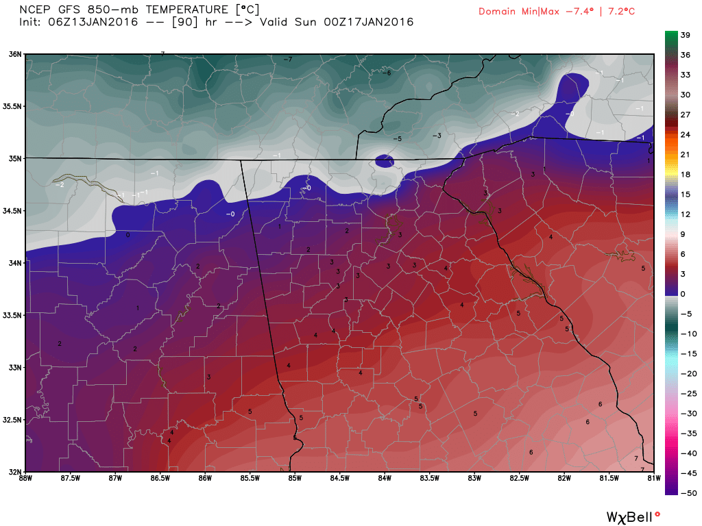
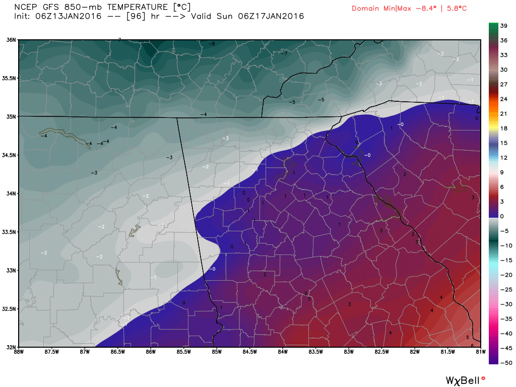
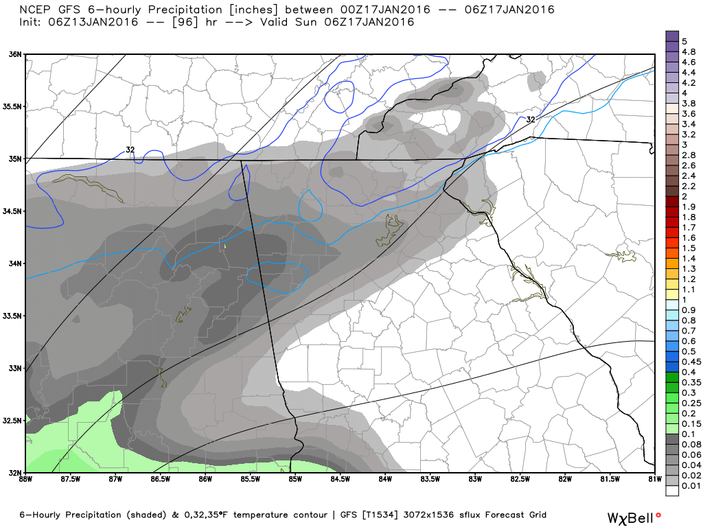
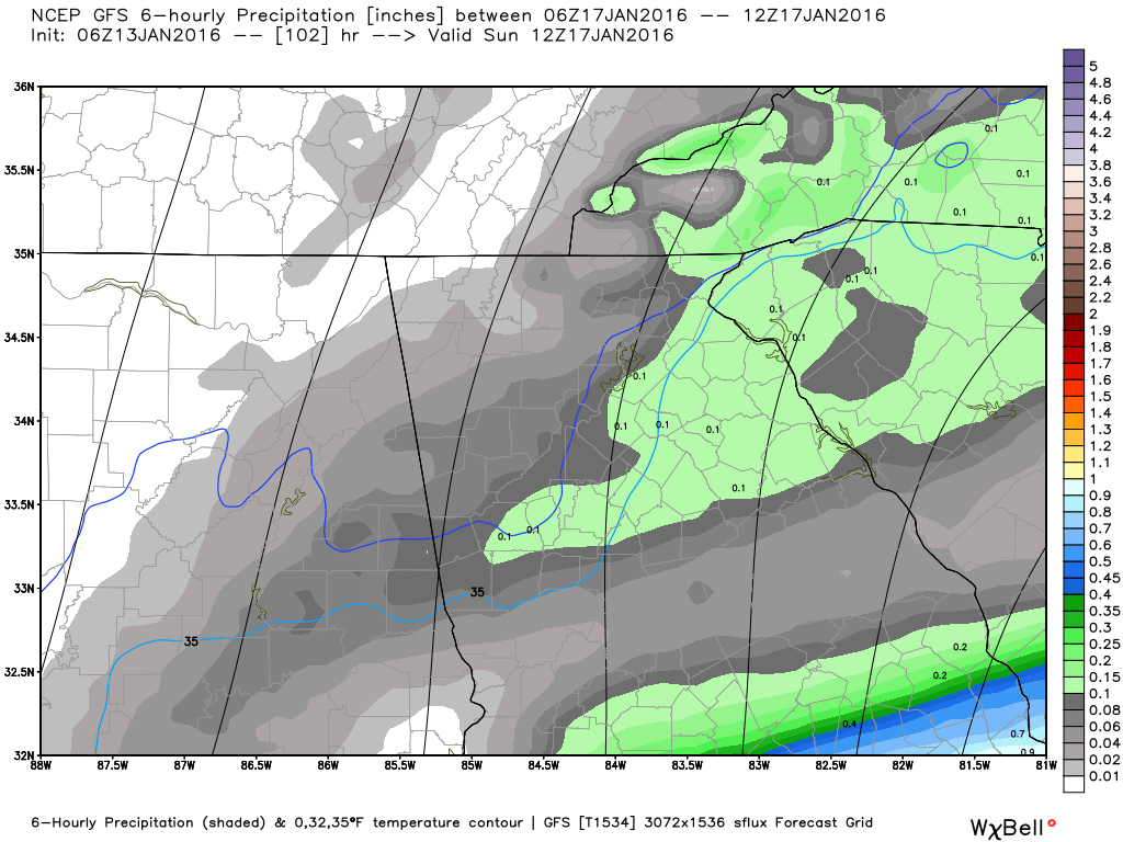
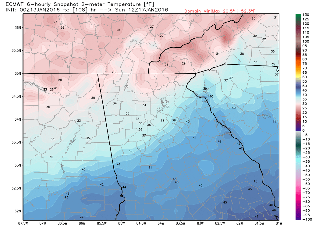
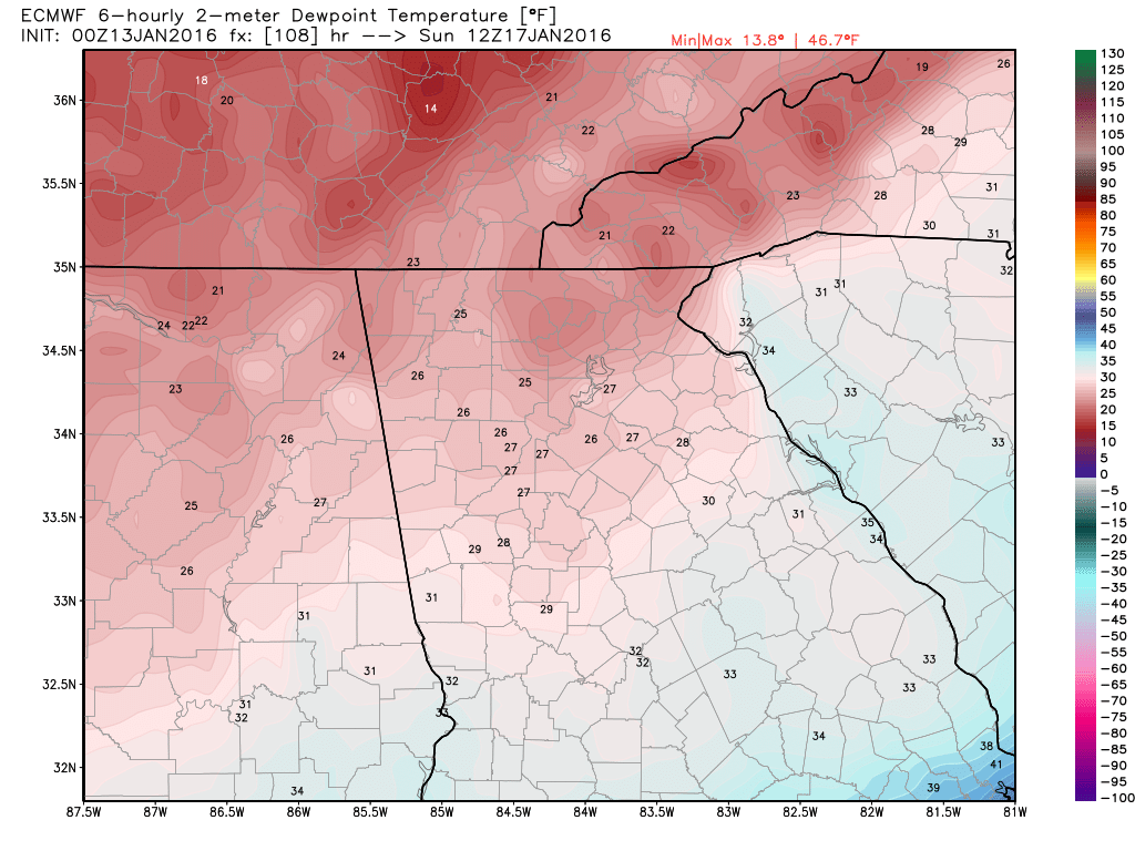
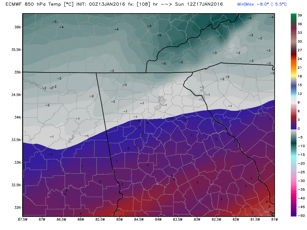
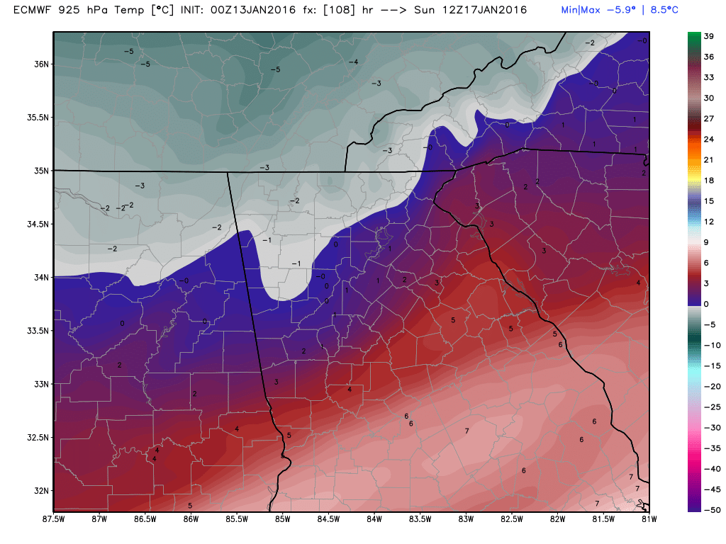
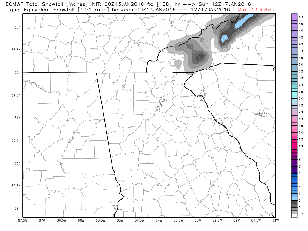
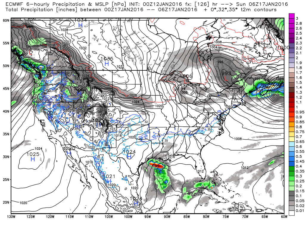
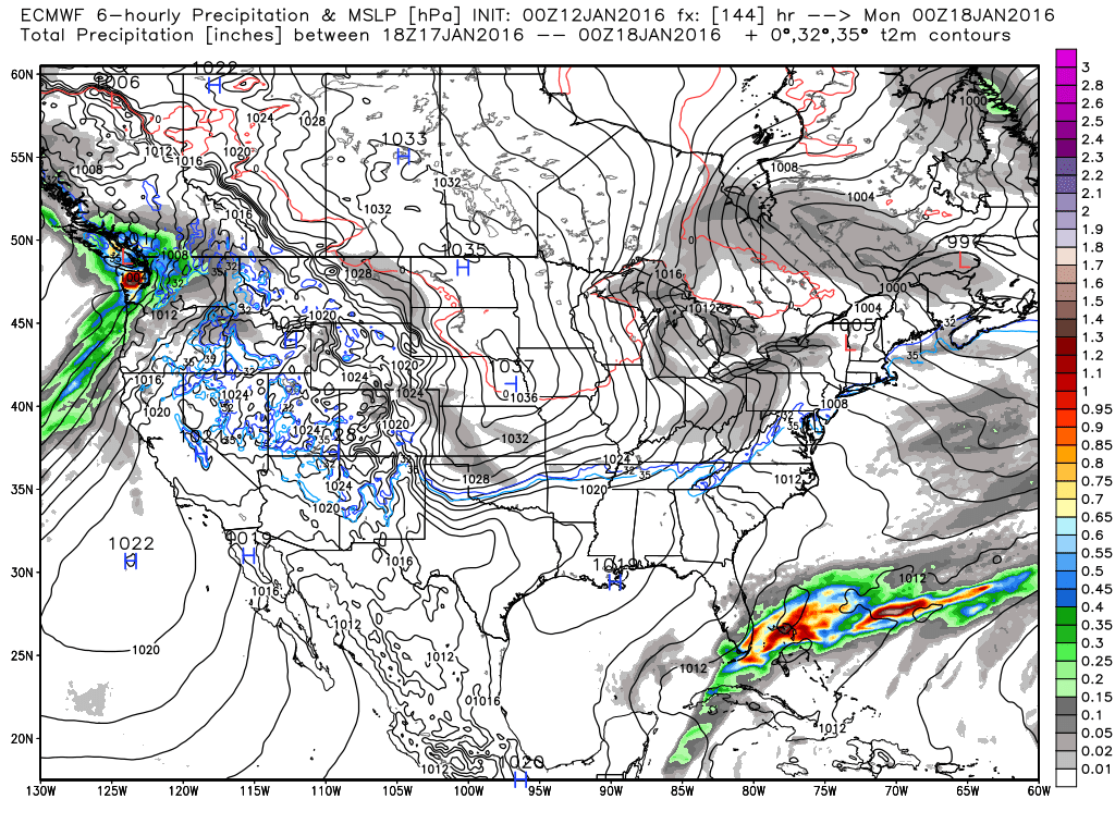
Saturday, 01/16/16Someone is going to get some their first snow of the season tonight and it most likely won't be me! :-) Smile everyone. You've made it to within 24 hours of the first system of the winter. Ok... it's not "big" and not everyone is going to enjoy it, but it will at least allow some of you to have a moment of glory! And I'm actually pretty pleased. Although the majority of us won't see accumulating snow, we spotted this 10 days out, and followed it the whole way, if that's not keeping you on the bleeding edge, I don't know what is! :-) The moisture with this system appears to be staying to our south. Without heavier precip, there won't be enough moisture to bring down the surface temps and most will be a little too warm . We knew this was going to be borderline, we just weren't sure which side of the border we would end up on. It could have gone either way... but just not this time. Today, forget the models except a few of the short range. It's nowcast time, the time when you watch in real time what is going on. I will use the SPC's Mesoscale Analysis tool for much of this. It has a plethora of options including a winter weather menu. This is the full conus view link and this is the southeast link. You can get to any region by clicking the "Change Sector" option on the page. So here is where we are at this morning. Our low pressure has formed over the panhandle of Oklahoma and the northern part of Texas. The low is expected to drop down to the Gulf before moving east and then northeast. 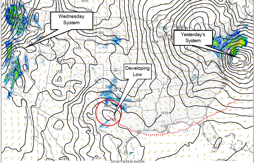 Here you see the departing system from yesterday, the system that may bring snow tonight, and yet another system for Wednesday on the horizon. The red dots are the expected track for the low 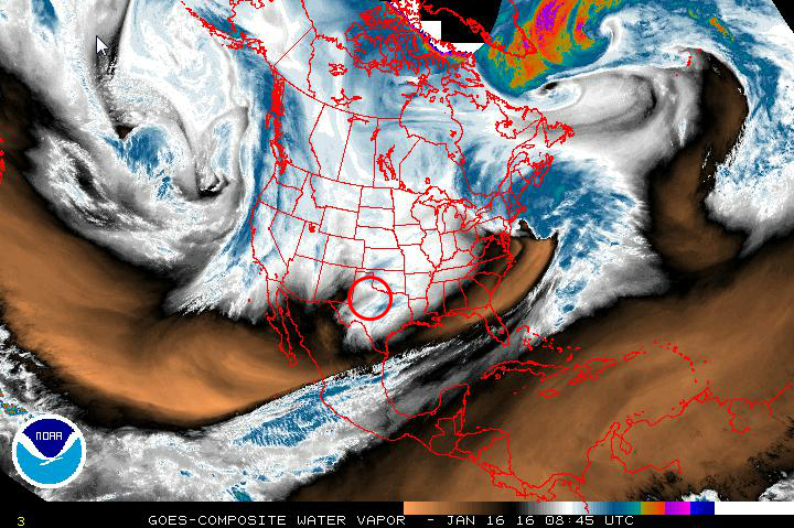 Water vapor image .SHORT TERM /TODAY THROUGH SUNDAY/... PRIMARY CONCERN THROUGH THE SHORT TERM PERIOD CONTINUES TO BE WINTER PRECIPITATION POTENTIAL FOR PORTIONS OF NORTH GEORGIA TONIGHT THROUGH SUNDAY MORNING. MODELS FAIRLY CONSISTENT WITH DEVELOPING A SURFACE LOW OVER THE NORTHERN GULF AND TRACKING IT NORTHEASTWARD ACROSS THE NORTHERN FLORIDA PENINSULA. LATEST MODEL SOLUTION TRENDS CONTINUE TO KEEP THE LOW FARTHER SOUTH... WITH BEST MOISTURE REMAINING SOUTH OF THE CWA. THAT BEING SAID... MODEL CONSENSUS STILL KEEPS ENOUGH MOISTURE ACROSS FAR NORTH GEORGIA TO KEEP SLIGHT CHANCE TO CHANCE POPS... PARTICULARLY OVER THE NORTHEAST GEORGIA MOUNTAINS. THERE STILL REMAINS A QUESTION OF WHETHER THE MODELS HAVE RESOLVED THE NORTHERN EXTENT OF THE MOISTURE WELL WITH THE SURFACE LOW POTENTIALLY CUTTING THE STATE OFF FROM AMPLE MOISTURE. HAVE CONTINUED MENTION OF RAIN/SNOW IN THE FORECAST WITH OVERNIGHT TEMPERATURES DROPPING INTO THE 30S... INCLUDING SLIGHT CHANCES IN THE NORTHERN ATLANTA METRO AREA. AT THIS TIME... LITTLE TO NO ACCUMULATIONS ARE EXPECTED... EXCEPT FOR THE POTENTIAL FOR 0.5 INCH ACCUMULATIONS IN THE NORTHEAST GEORGIA MOUNTAINS.
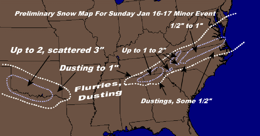 Snow map from Wxsouth.com. This is from early last night so this will be different later today, and he will be issuing another one. Friday, 01/15/16 Update #2We're starting to get within range of the short range models right now (48 hours), so I thought I'd show you what they show for 48 ours out. Each run of these will allow us to narrow our focus. most of these models show a larger precipitation shield, so this is going to be something to watch very carefully. Either way, this is going to be a blast to see how things evolve, and for the moment, this system can actually go either way... :-)
Friday, 01/15/16 UpdateWell... remember the image I showed yesterday from a post I made on the 6th? It was an image of the Euro and showed a 996 mb low sliding across south Georgia. This morning,both models have converged on a very similar solution, just a little bit further south than where we want it and just a little south of that image I was referring to. :-) Bit it is hard to get this any closer within 2 days. I think we are right where we want to be now. The precip shield is suppressed and cutoff sharply, we need to see that part get fixed before we can any anything appreciable. So I think awesome trends overnight, it it wouldn't surprise me to see a little bit of a NW move today. What we find out today will decide what happens for the Sunday event.... still a few more dips and curves to go on this ride. Hold on, it's almost over. :-) .LONG TERM /SATURDAY NIGHT THROUGH THURSDAY/... 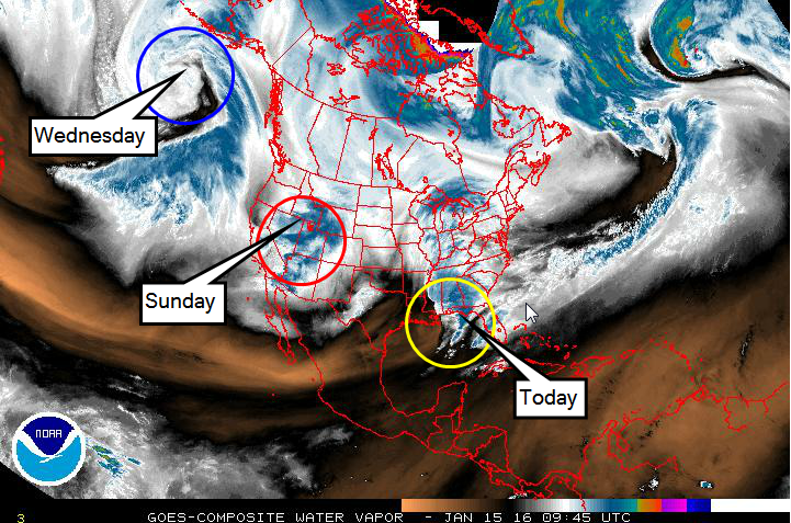
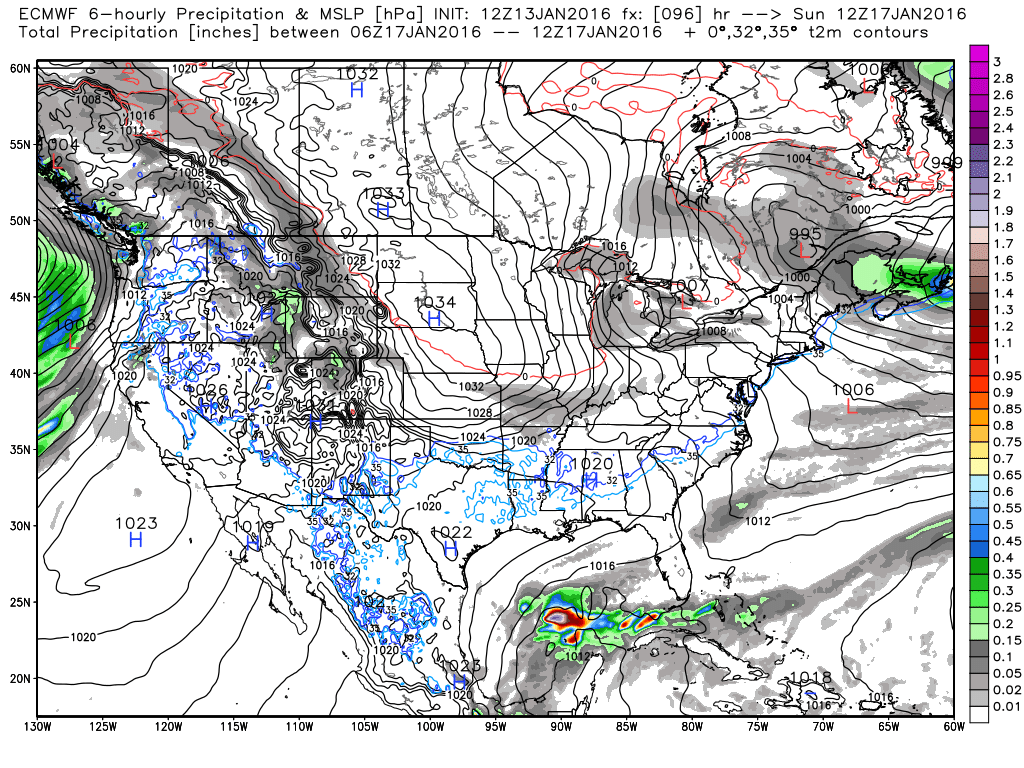
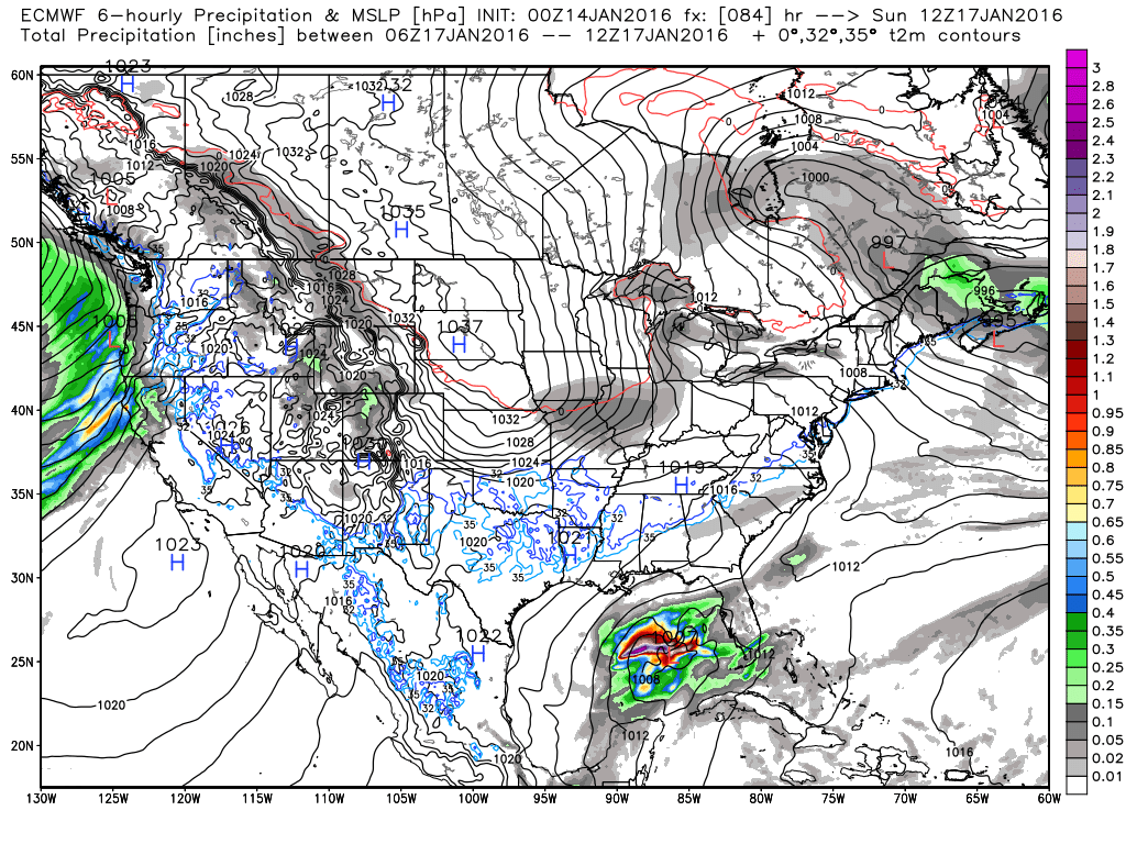
Thursday, 01/14/16 UpdateIt takes a while to go over all the models, listen to all the talk, go back through Tweets, and FB post to catch up on what happens overnight. :-) Everyone talks about the Euro and calls it "The King" and generally it does better than the American models. The Euro is a medium range model. That is what it was designed for and it does it the best. The American models, and there are a plethora of them, are all based off of the GFS. This model does it all, short range, medium range, and long range, all through its suite of sub models. I tell you this so you understand that while there are limitations with any model, the americans may have a few more. But that doesn't mean it's always wrong, that's hardly the case. I may be wrong, but one thing I believe it is good at, and better than the Euro, is in fast flow patterns. Overnight, the Euro moved northwest in its depiction of the low compared to its previous run, and you can see that in the two images below, older run left, newer run right.
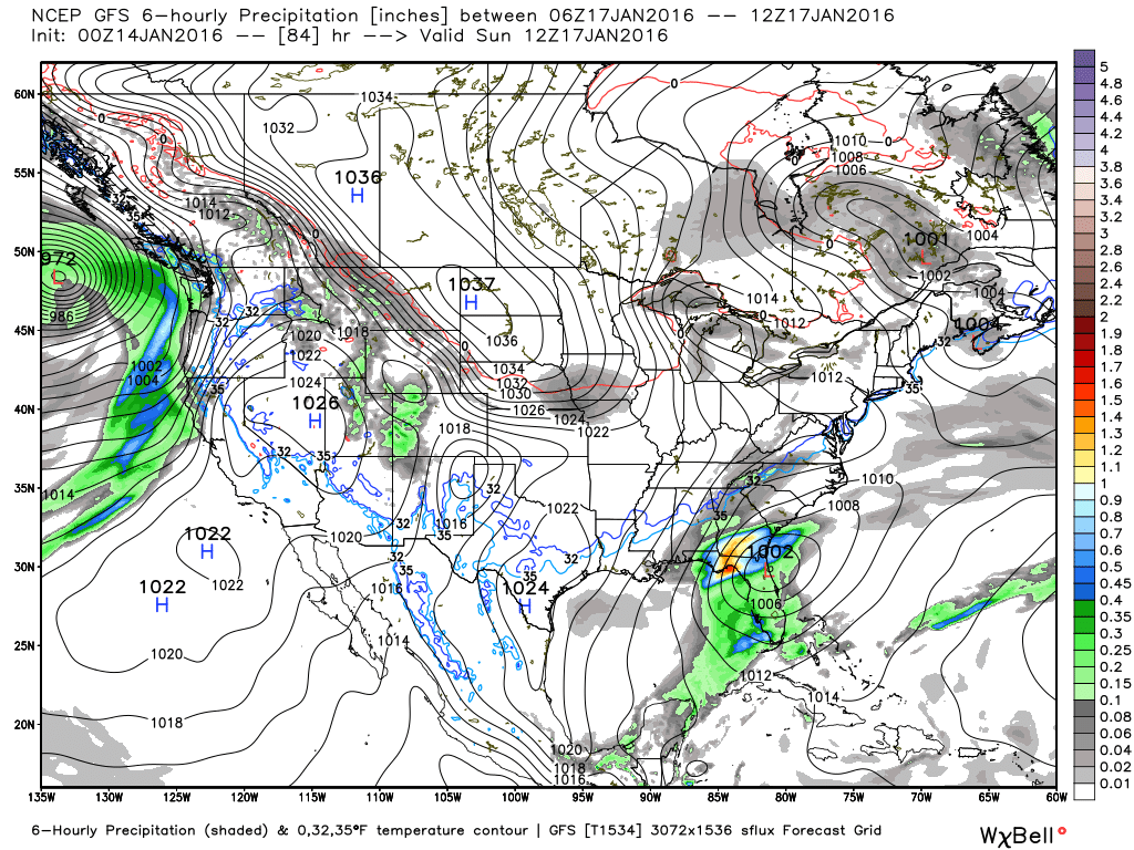
While it is still not close enough, it is s start in the right direction. We still have 3 days or about 5 more Euro model runs (2x a day) to correct.. if it is going to continue. And guess which model the Euro trended to? The GFS. The GFS has been steadfast in showing a stronger low taking a more northern track. Unfortunately, the GFS dipped a little south as well. Again, we need additional model runs to see if these trends continue or not.
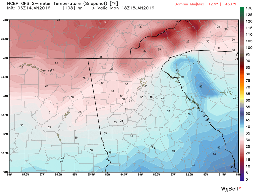
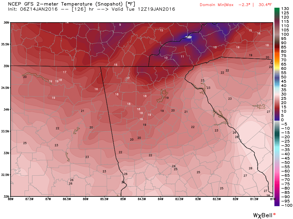
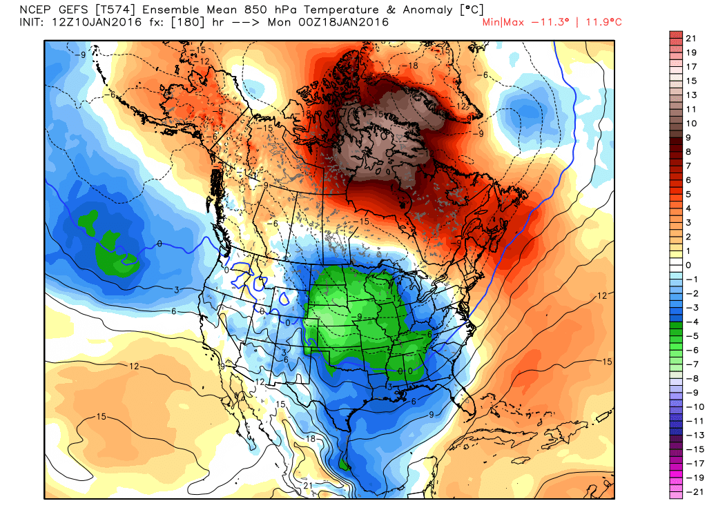
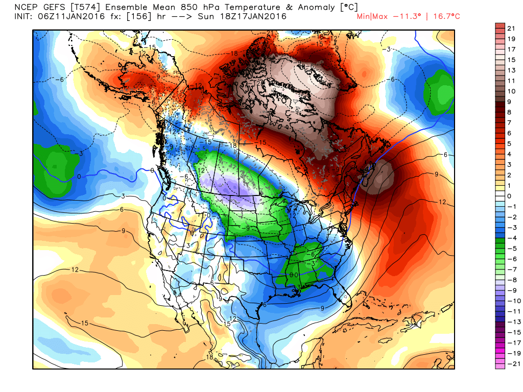
So while we watch the models battle it out, cold air is filtering south and by Monday, the GFS is showing highs in the low 30's and lows Tuesday morning, in the teens.
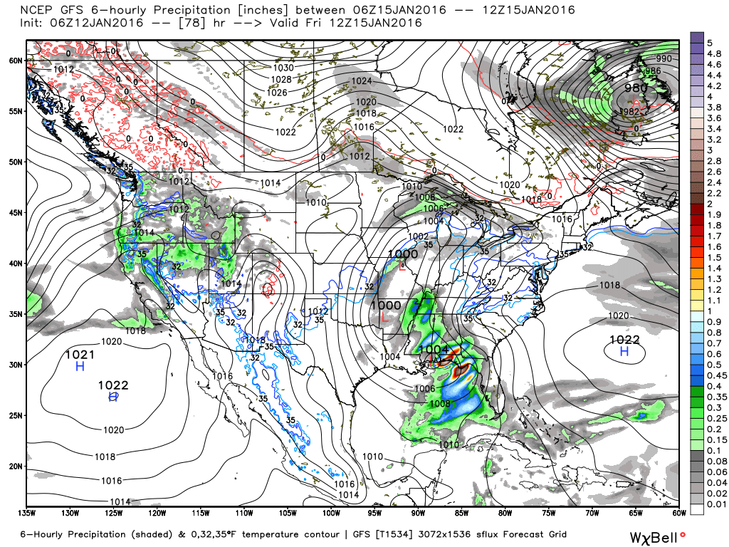
Do not despair though. Right now the GFS ensemble shows about half of its members showing snow over our area over the next 4 days. Let's take that and run with it! This is going to be very interesting to watch evolve over the next 3-4 days, and if you're reading this, you are already on that roller coaster. Hang on, you never know what might happen! Welcome to a southeast winter. :-)  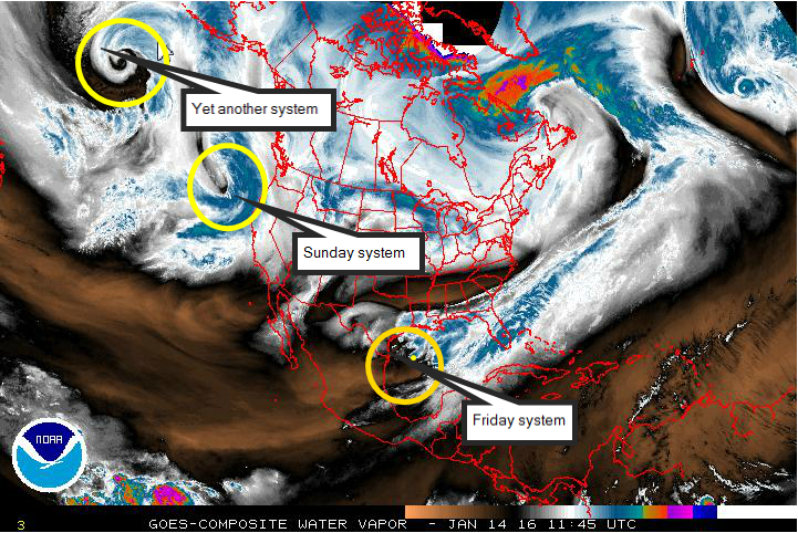  Wednesday, 01/13/16 UpdateGood trends from last night. The GFS had been on it's own update until the last run or two from the Euro. It has been very consistent in showing some light snow over north Georgia for the last several days, and overnight, the Euro inched a little more toward the GFS solution. Here is the GFS at the surface. It takes a 1004 mb low across the coast of the Gulf of Mexico and exits to a 999 mb low off of the coast of South Carolina. I'm not sure you could ask for a much better track this many days away.
As you can see, the Euro is suppressed further south than the GFS, but this is further north than it's previous runs, so we'll see if that trend continues with the 12Z run. I have some surface maps from both models below. Again, the GFS has been pretty consistent in showing snow, and it appears the NW corner of Georgia may be a bit colder and see a little more snow. It's still way to early to make any calls on exactly where or what. Temperatures at the surface have been a bit borderline, but are cold enough. When moisture begins falling into the dry air, it evaporates and cools the air further through evaporative cooling. Temperatures at the onset may not be cold enough for snow, but as the cold air filters in, any moisture should changeover. All in all, we're still on track. The change in the Euro was encouraging, and the fact the GFS didn't move NW is good as well. GFS
Euro
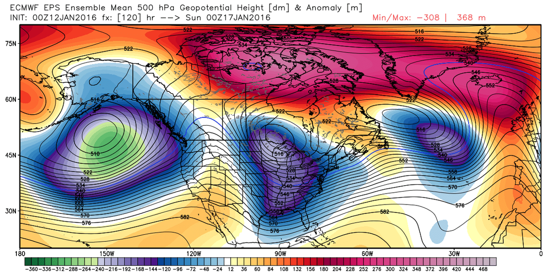
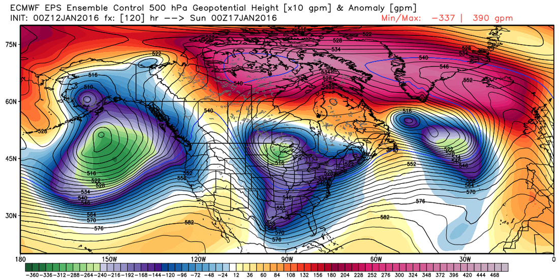
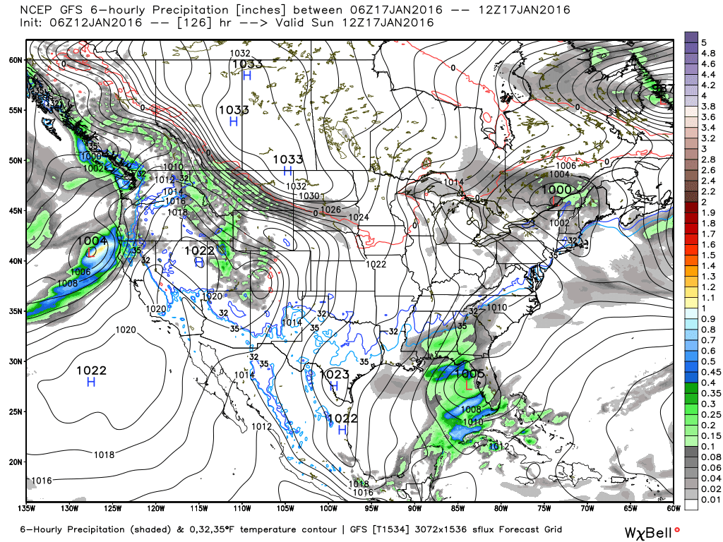
ANOTHER UPPER TROUGH/SHORT WAVE AND GULF OF MEXICO SURFACE LOW PRESSURE SYSTEM MOVE THIS WAY FOR SATURDAY NIGHT INTO SUNDAY. GFS AND EUROPEAN ARE VASTLY DIFFERENT WITH THE EUROPEAN MAINLY DRY AS IT KEEPS THE BULK OF THE MOISTURE S AND THE GFS WANTING TO PRODUCE SNOW FOR N GA WITH COLD AIR IN PLACE. THE FORECAST IS VERY MUCH A COMPROMISE UNTIL WE CAN GET A BETTER HANDLE ON WHAT IS MOST LIKELY WITH A SLIGHT CHANCE OF RAIN OR SNOW FOR MUCH OF NORTH GA. THE SYSTEM PASSES BY QUICKLY ON SUNDAY. THE EUROPEAN MODEL IS THEN DRY THROUGH TUESDAY. HOWEVER...THE GFS HAS ANOTHER UPPER TROUGH WITH SIGNIFICANT MOISTURE ASSOCIATED FOR MONDAY THAT COULD CAUSE A WINTER MIX FOR MAINLY N GA. FOR NOW WILL KEEP THINGS DRY AND MONITOR FUTURE MODELS RUNS. Tuesday, 01/12/16 UpdateGood morning! A few new things to talk about this morning. The main one is concerning the potential for this weekend. You may have read the comment from the Atlanta NWS office regarding a slight chance for some frozen precip this weekend, so I thought we'd explore that a little further to see what might transpire. This is one of those systems I was talking about, they will just pop up out of nowhere as a possibility. ANOTHER UPPER TROUGH/SHORT WAVE SATURDAY NIGHT INTO SUNDAY AND THE GFS AND EUROPEAN SIGNIFICANTLY DIFFER WITH THIS SYSTEM WITH THE GFS WETTER. ENOUGH COLD AIR WILL BE IN PLACE FOR THAT A MIX OF LIGHT RAIN OR SNOW WILL BE POSSIBLE FOR MAINLY PORTIONS OF N GA SATURDAY NIGHT AND THE FIRST PART OF SUNDAY. THEN DRY CONDITIONS ARE EXPECTED THROUGH TUESDAY. And Birmingham NWS: LONG- RANGE GUIDANCE IS IN OVERALL AGREEMENT WITH THIS SHORTWAVE EJECTING EASTWARD INTO THE GULF COAST STATES BY EARLY SUNDAY. HOWEVER...THEY DON`T AGREE WITH THE OVERALL EVOLUTION OF THE SYSTEM WHICH WILL IMPACT THE DEVELOPMENT AND PLACEMENT OF A SURFACE LOW IN THE GULF. AS IS ALWAYS THE CASE THIS TIME OF THE YEAR...MINOR DIFFERENCES CAN MEAN A LOT ESPECIALLY WITH COLD AIR JUST TO OUR NORTH. Let's take a look at what they see. Here's a look at the Euro ensembles, both the control and mean are on the same page for the late Saturday/Sunday system.
The Euro develops a low near the coast of Texas, but keeps a very suppressed track across Florida.
The GFS takes the low in a mode favorable track for us in north Georgia. Also has the freezing line very close to the precip.
 I'll be keeping an eye on this, as well as what we expect to next week. Monday, 01/11/16 UpdateWell, the models at the surface are completely lost, at least the ensembles are a little more stable. Here's a look at the GFS, Euro, and Canadian. The fast moving Subtropical jet stream (STJ) is wreaking havoc on the computer models and causing very inconsistent results. Compare these images to the ones I posted at the bottom of this post. I've added these images here, and back down in the original post where it's easier to see the changes.
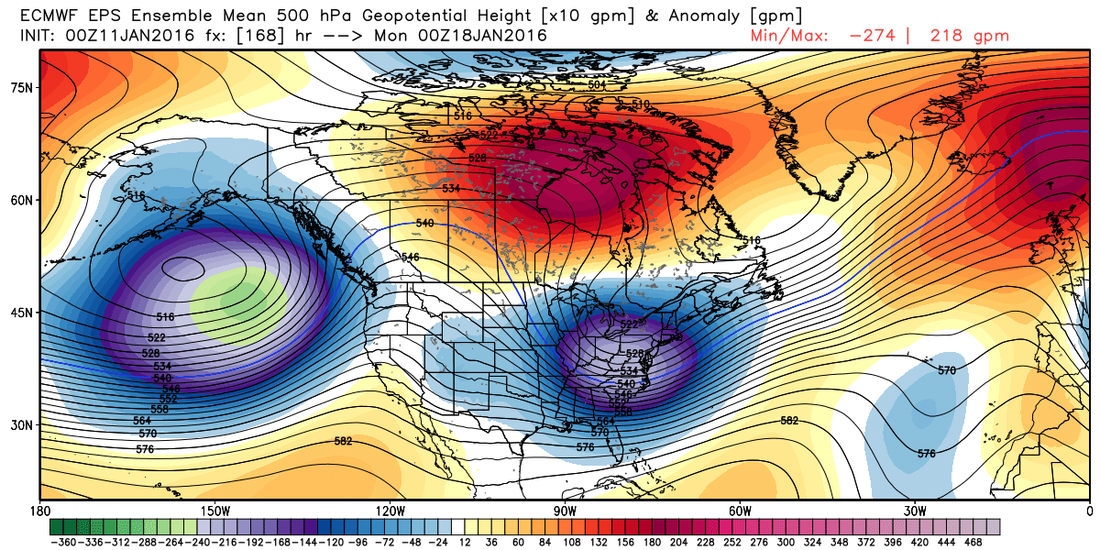
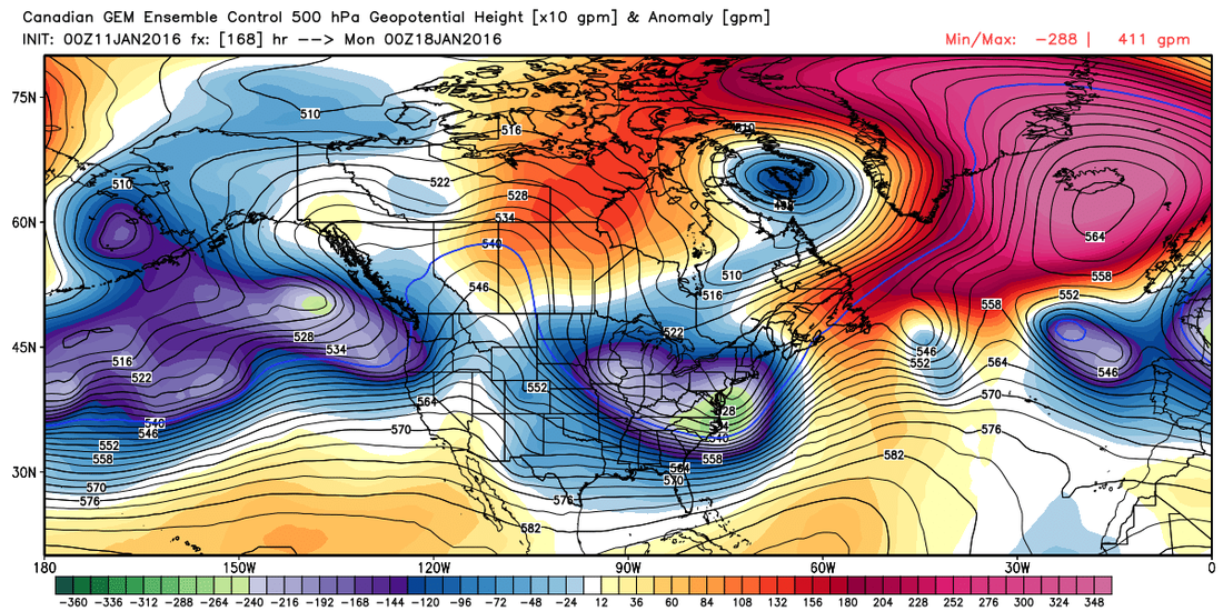
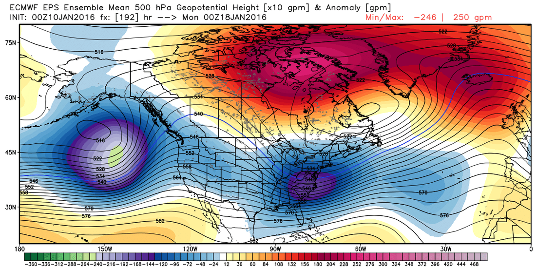
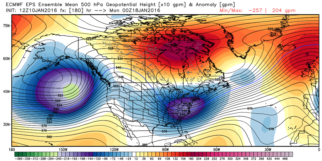
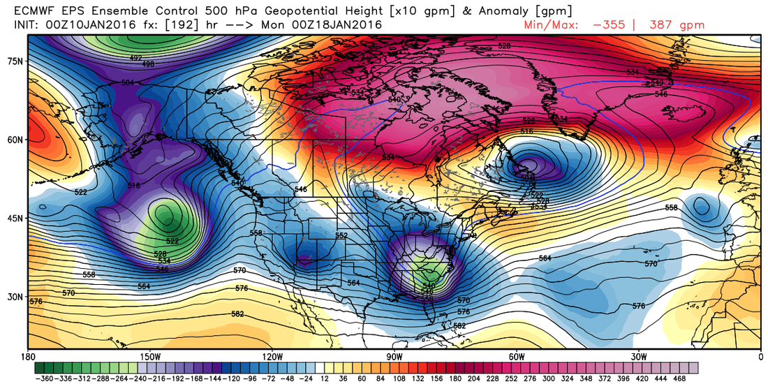
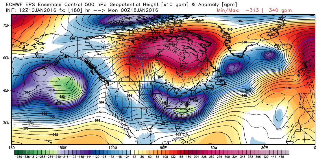
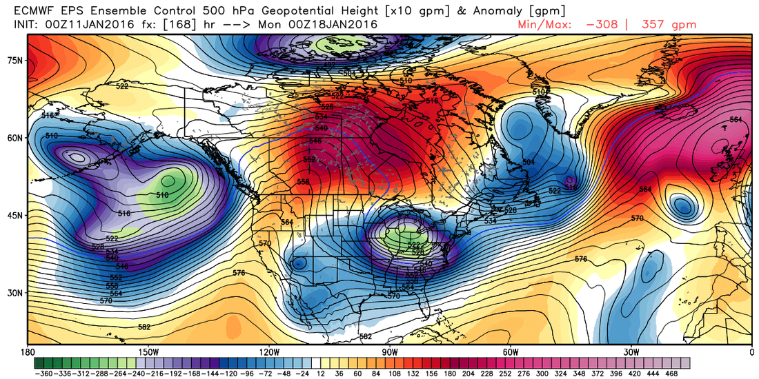
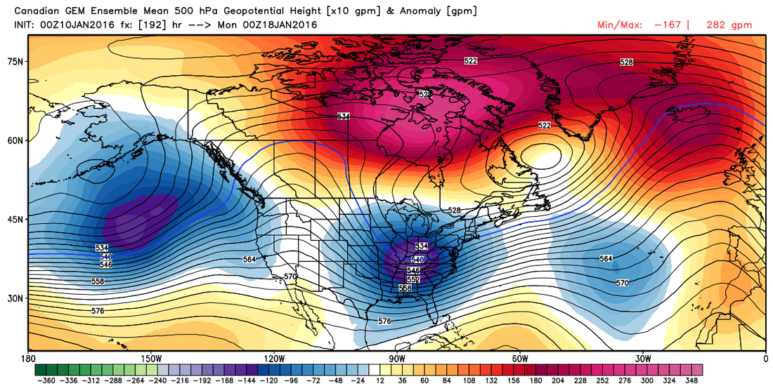
Original Post - 01/10/16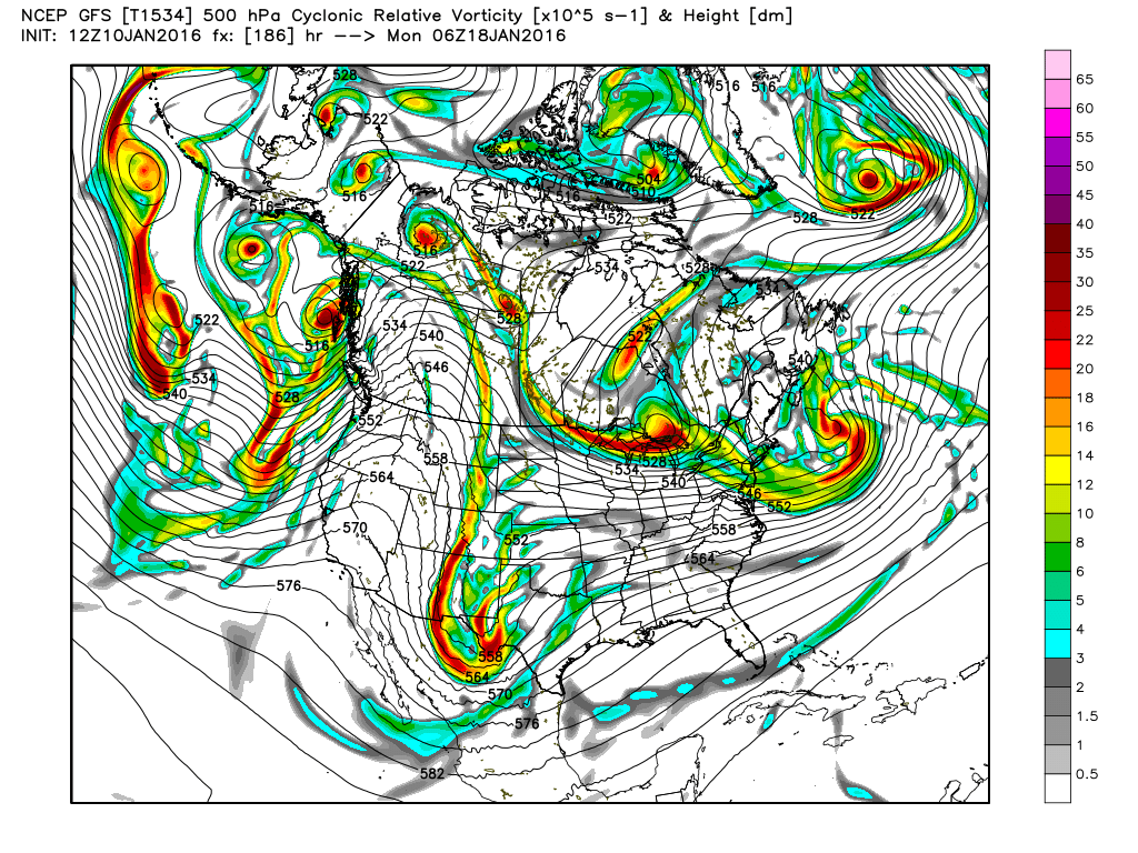 While I don't know that this will be anything, I'm not convinced that is won't, so I've decided to go ahead and track this upcoming period. I will be making these post in chronological order and just updating this post without making a new one, unless of course we actually end up with a storm. Because we more than 5 days away, all we're going to look at to start with will be the ensemble runs. Once we get to within 5 days, we'll start adding surface maps to the mix. So on to the most recent ensembles. ECWMF EPSHere we have the Euro ensemble mean on the left and the control run on the right, and these images are for 7PM Sunday evening and are 500 mb anomalies. This is the level of the atmosphere that is generally considered the area that "steers" the weather. Both images depict an area of below normal anomalies over the southeastern states, and also make a note of how far south the 540 line goes, that becomes important for snow, along with many other factors that we'll discuss later when we need to talk about snow. UPDATE through Monday 01/11/16 - I will continue to add the 00Z runs here until next Monday and will no longer add them to the top of the post. The Euro is showing signs of the AO gong back positive, you can see that as the polar cap goes from red colors to blues. There is a little more western ridging in the later runs, which we need in order to slow down the active subtropical jet and give some of these shortwaves a chance to develop. Also note the multiple shortwaves it sees out west in the last run. Not sure if the Euro is holding back energy (a known bias) or if those are real.
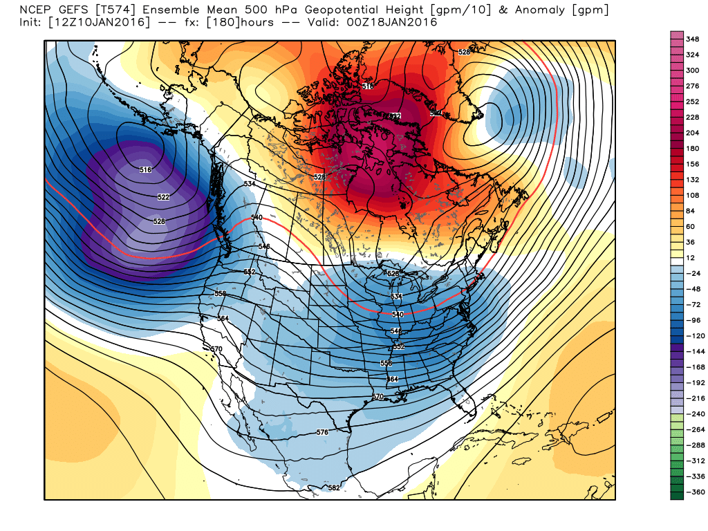
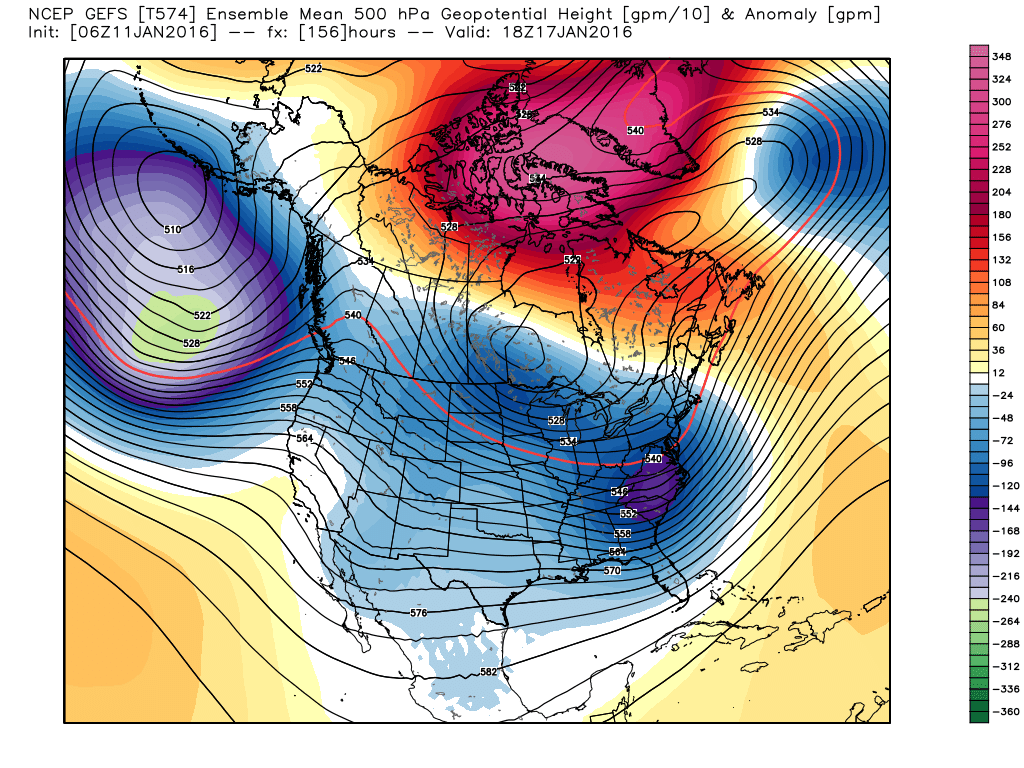
GFSAt the same time, this is latest GFS ensemble mean (this run is later than the Euro you see above but both for the same time period). We also see a trough over the southeast similar to the Euro but not quite as deep. The Euro has more blocking near Greenland and Iceland, a sign of a -NAO. I also show the 850 temp anomalies here as well. This latest run shows the GFS is a little stronger with the trough and a little colder as well.
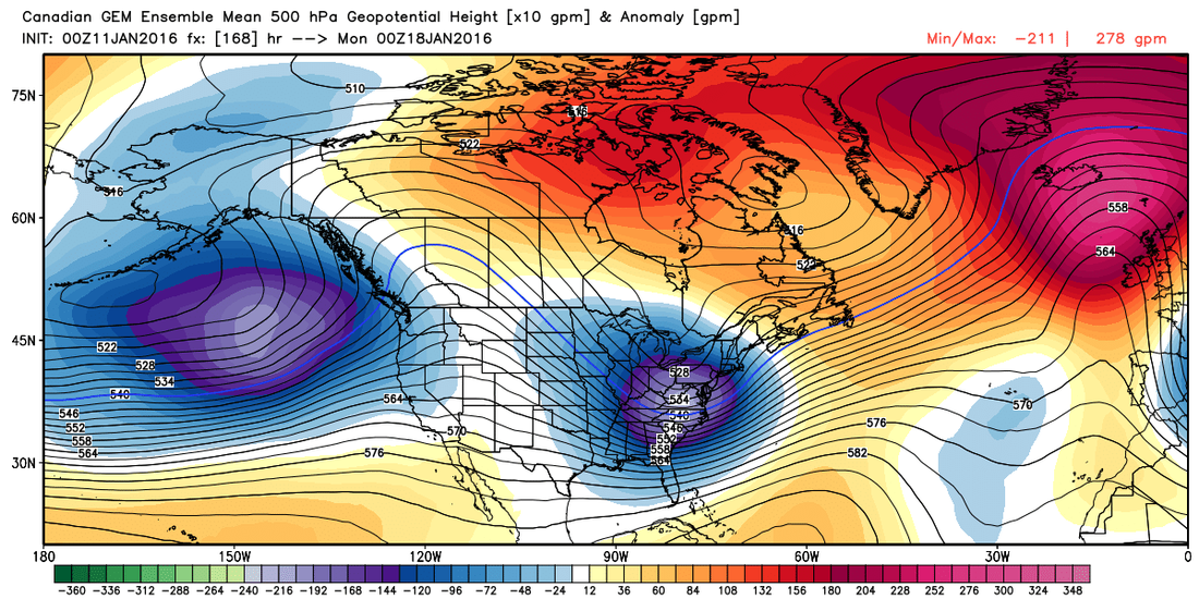
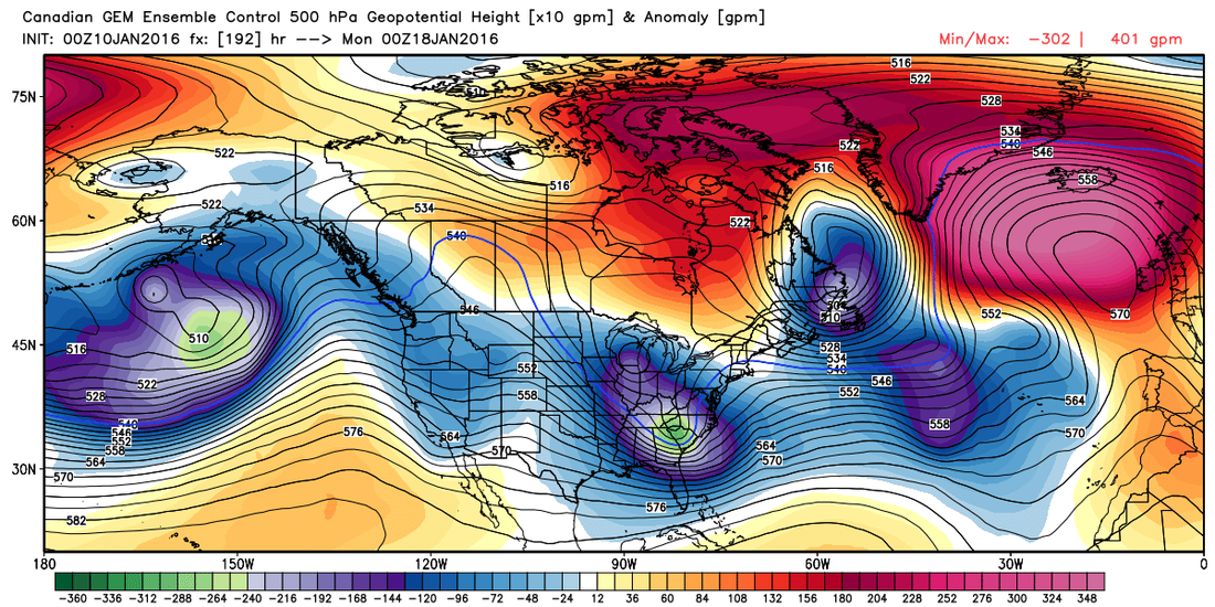
CanadianThis is from the Canadian ensembles and the mean is on the left, the control on the right. Very similar look as the Euro and the control run is even taking a negative tilt as it starts its move out to sea. Both are very deep troughs and bring the 540 line very far south. The Canadian still keeps a strong -NAO block but has picked up a little speed.
To me, and simply summed up, all of the ensembles show a deep trough that takes a path somewhere along the gulf coast before heading out to the Atlantic during this time frame. They are all pretty consistent with the timing as well as the general placement. Good for us! The big question is whether they will consistently show this type of setup between today and the time it happens. The 12Z Euro is getting ready to run, so we'll sit back and see what happens.
Before we know if there is going to be any winter weather, we're going to have to look at how this upper air pattern translates down to the surface and at that point we'll need to look at the surface maps. Even though some of those are showing winter weather in our area for this period, I would rather wait a few days, unless they show a 2-3 foot snowfall in which case you will hear me screaming no matter where you live, and see how the ensembles look then. I'll let you know when I have a new update or feel free to check back any time! |
Archives
March 2019
Categories
All
|
OLD NORTH GA WX BLOG


 RSS Feed
|
Never base important decisions on this or any weather information obtained from the Internet. Always have a backup method of receiving weather information such as a battery powered weather radio.
Copyright © 2018 NorthGeorgiaWX.com and DaculaWeather.com 
|