|
It looks like we may be in for a pretty damp weekend. A large area of above normal moisture is pooled over the southeastern part of the country, and will help to bring more heavy rain and thunderstorms throughout the day today and into tomorrow. 
Precipitable water values - 8am Saturday August 9th.
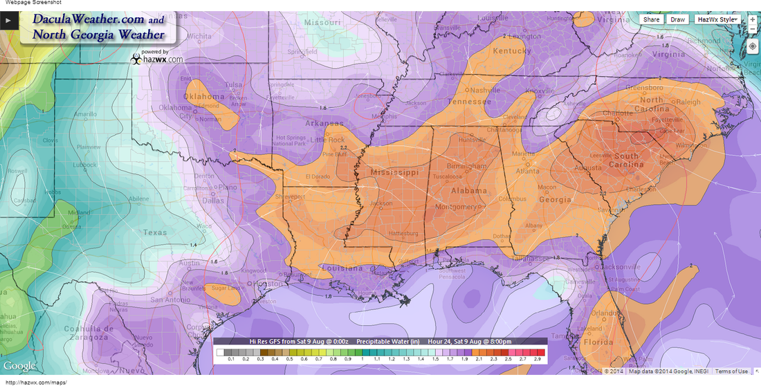 PW Values 8pm Saturday PW Values 8pm Saturday The image above depicts the PW values at 8am Saturday morning and 2"+ is pretty high, even for this time of year. A weak surface front is lingering across north Georgia this morning and will help to focus the showers and thunderstorms that develop this afternoon and evening. Notice in the image on the left (click to enlarge) how a wedge of drier air tries to work down the east side of the Apps toward Atlanta. While it shouldn't make it this far south, it will help to focus additional showers and thunderstorms over our area. Much of the area received rain yesterday, and that may lead to some minor flash flooding in those areas that may get heavy rain again today. You can see from the radar estimated rainfall totals below, some areas of north Georgia received more than 4" of rainfall. 
Rainfall from Friday through Saturday AM
Flash flood guidance shows that some won't need much rain at all to get into a flash flooding situation. So if you're out driving, slow down for the ponding and running water on the roadways. The image below explains what I'm talking about. 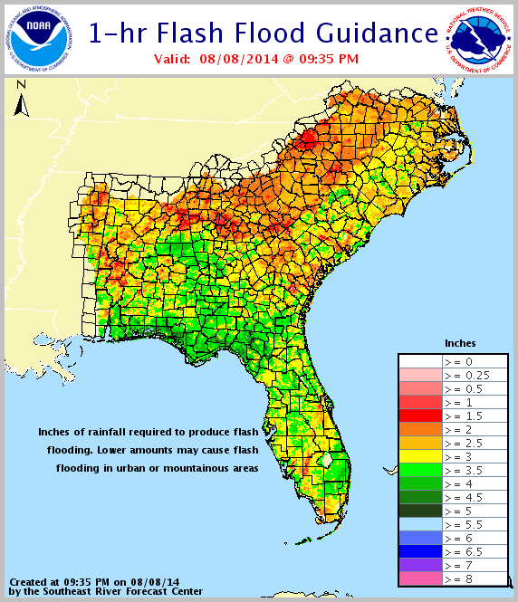
The image below shows the "Percent of Normal" rainfall we've had so far this year. 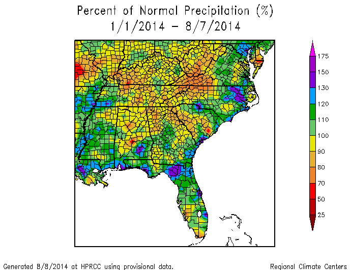
All in all, it doesn't look much like a beach or lake weekend. Speaking of that... I have a page just for lake forecast around Georgia. Click here to take a look. Just click on any lake (or on the name of the lake on the right hand side) and a window will open for that forecast. Give it a try!
|
Archives
March 2019
Categories
All
|
OLD NORTH GA WX BLOG
 RSS Feed
|
Never base important decisions on this or any weather information obtained from the Internet. Always have a backup method of receiving weather information such as a battery powered weather radio.
Copyright © 2018 NorthGeorgiaWX.com and DaculaWeather.com 
|