|
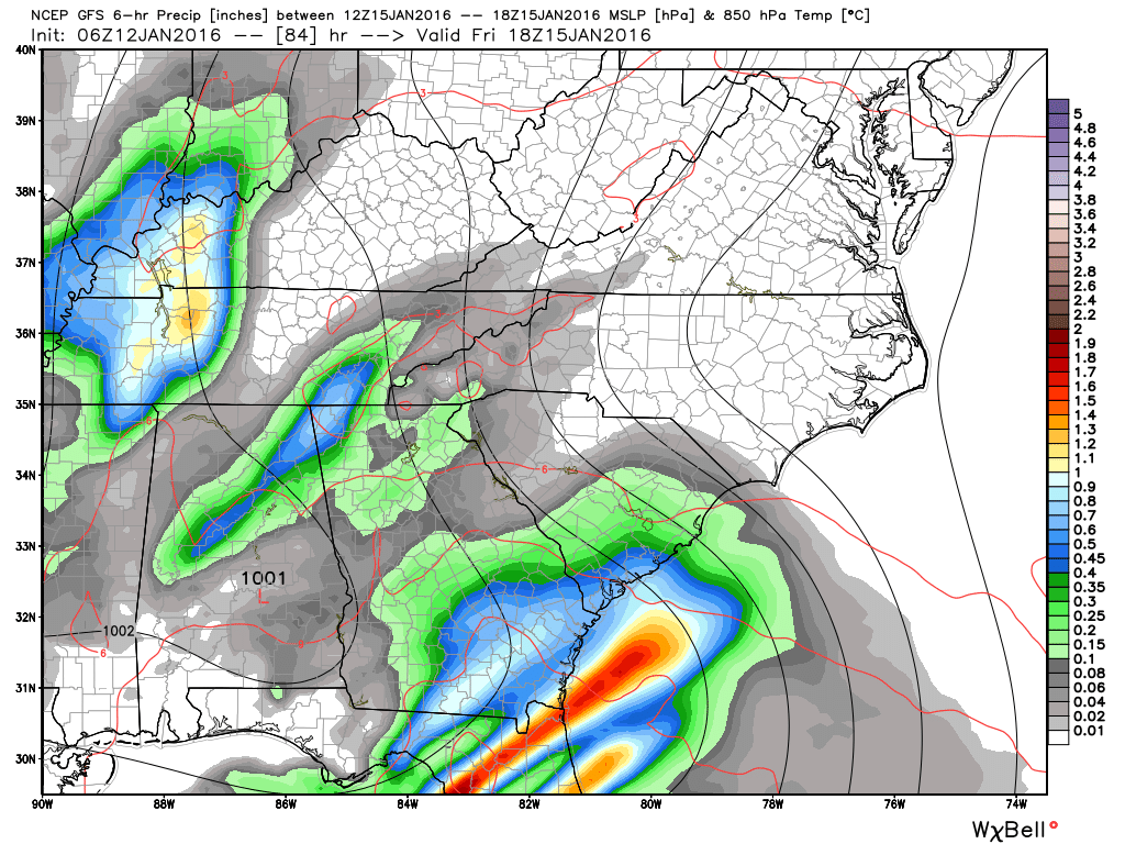
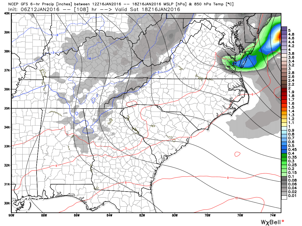
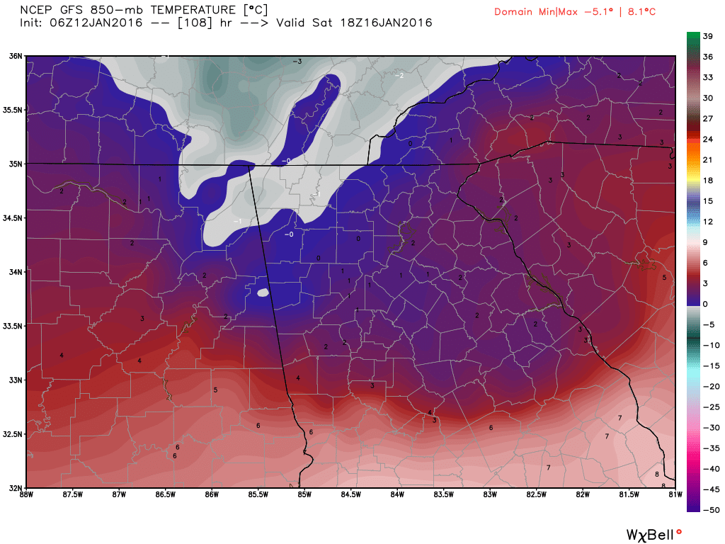
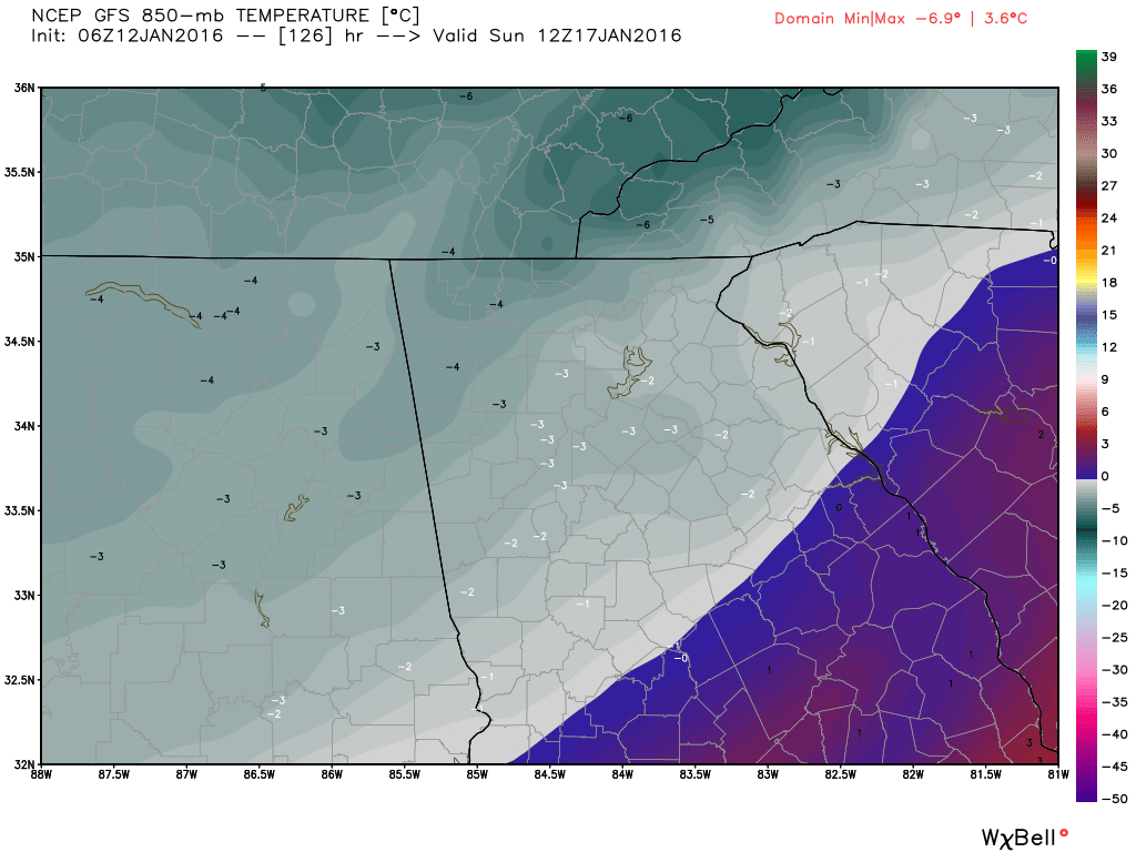
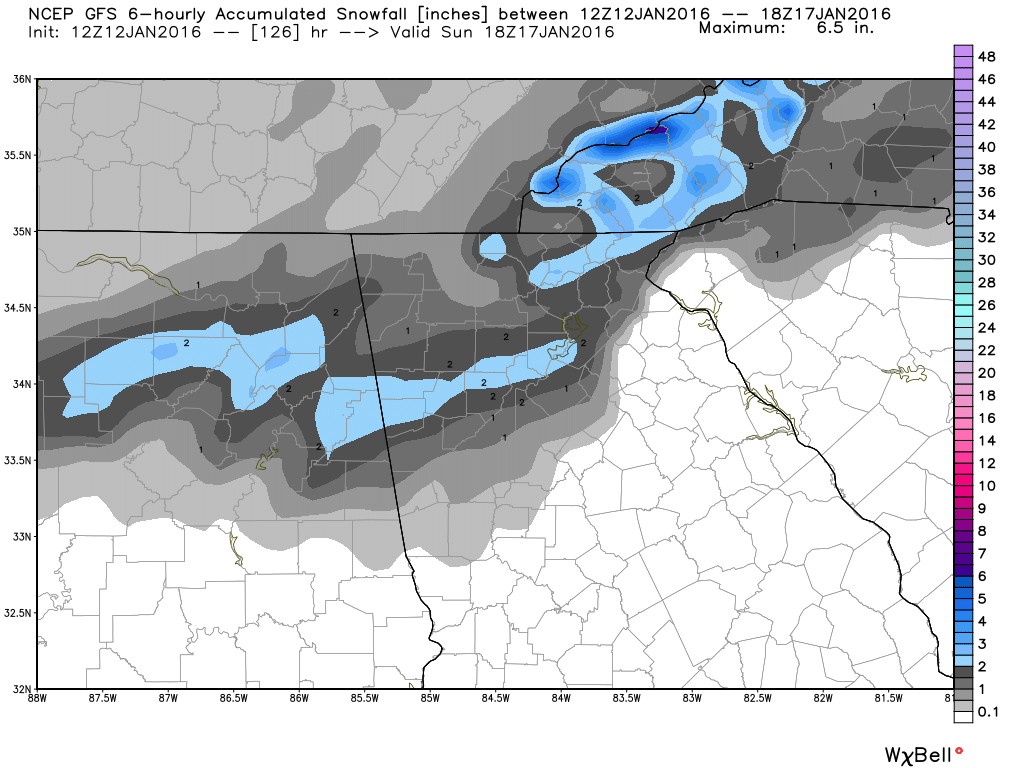
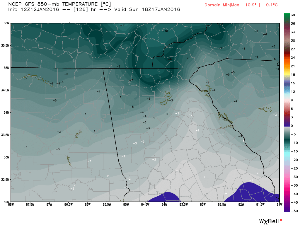
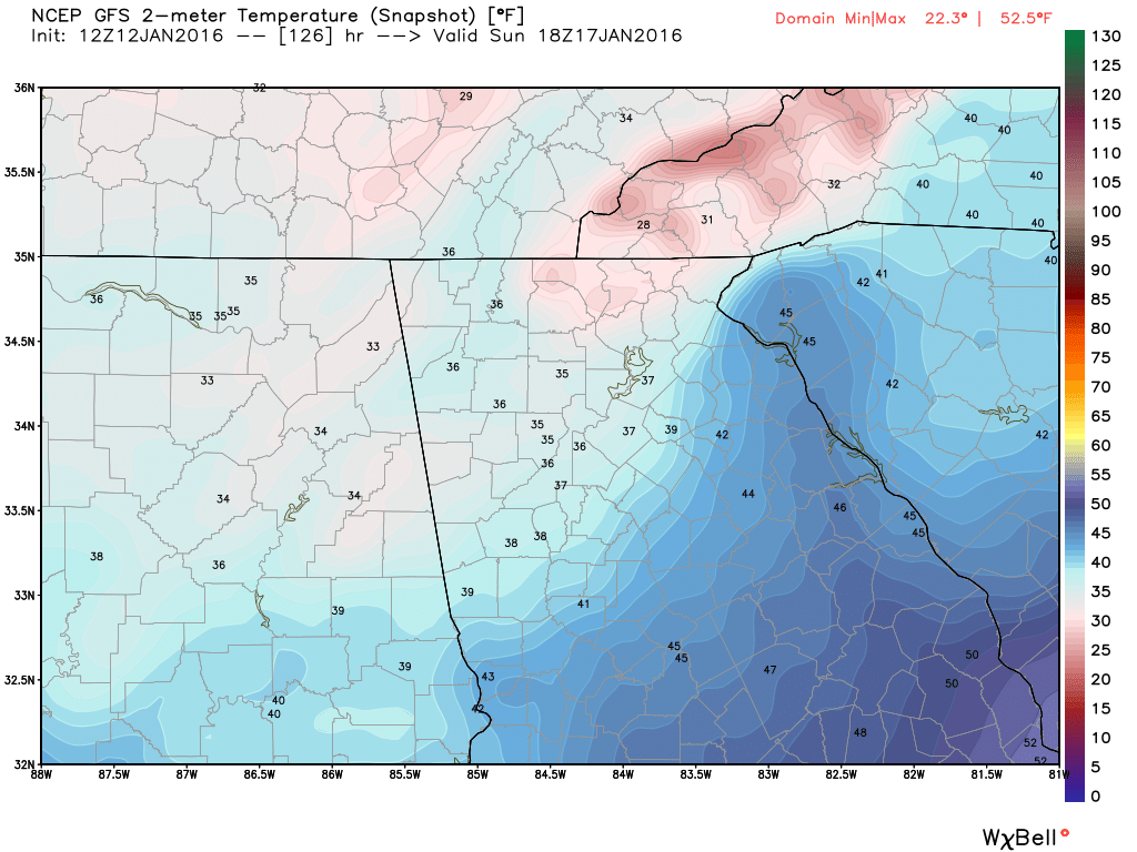
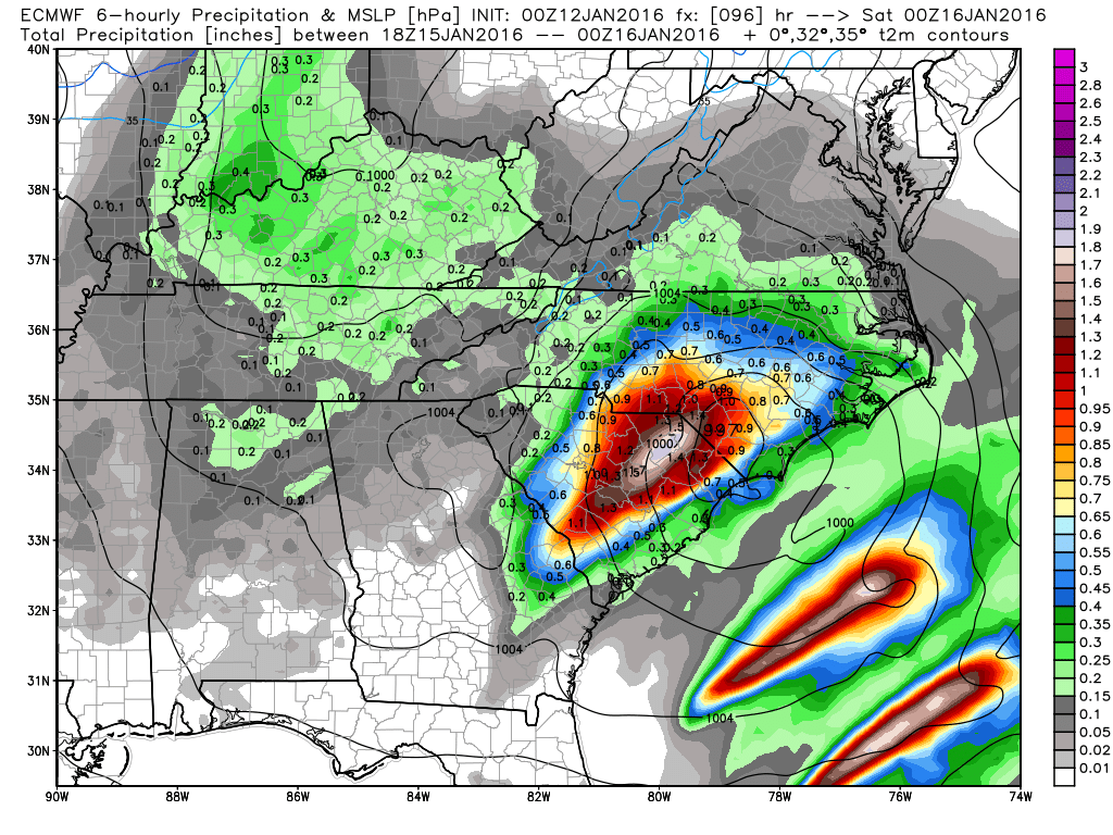
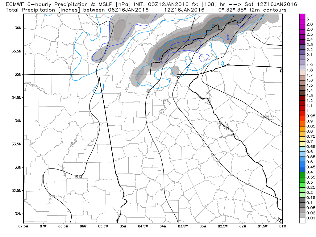
EDIT: I got confused... I'll leave this here, but all the updates are in the previous post. You can get to that by clicking here. I think this system deserves a post of it's own at this point. We are now about 5 days away and the models are consistently showing something intriguing about this timeframe. When I initially started doing these updates, this was the period I focused on, now as time gets closer, we're starting to see multiple possibilities coming up. So let's take a look at this one. Let's start with the GFS, as it has been more consistent in depicting a system around that timeframe. this first image is the GFS for 18Z (1PM) Friday. It shows an area of low pressure forming in south Alabama and Georgia and moving it northeast. Nothing in this for us except rain. However, one thing it does do, is start to pull cold air in behind it. Here's Saturday at 1 PM. Notice the precip behind the freezing line. It is very light wrap around moisture being brought in on NW winds. It may or may not be cold enough to make any flurries, but the 850 temperatures will be dropping below freezing as well as the surface, so there would be some support for some possible flurries or light snow. Again, this will all change... 12Z 2 meter tempEarly sunday morning is when it starts to get tricky. The GFS is bringing moisture back early that morning and temperatures will be borderline at that point. It's possible (at the moment) that the mountains may see more in the way of frozen precip, but it's way too early to tell. As the moisture starts to pull away, the cold comes in and you can see the 850 mb temps plummet once it does. Here is the brand new 12Z GFS run. Trends are currently in our favor. 2 meter temps are a little warm, but those may change with time. The Euro is much like the GFS initially, with a low in an ideal spot for winter weather, but the cold lags behind. The next low that tries to come through is suppressed and we don't see anything from that.
|
Archives
March 2019
Categories
All
|
OLD NORTH GA WX BLOG
 RSS Feed
