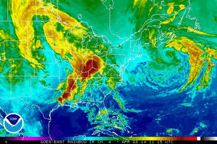
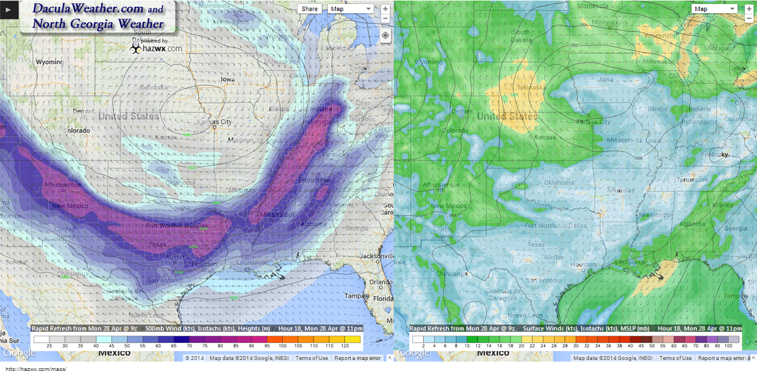
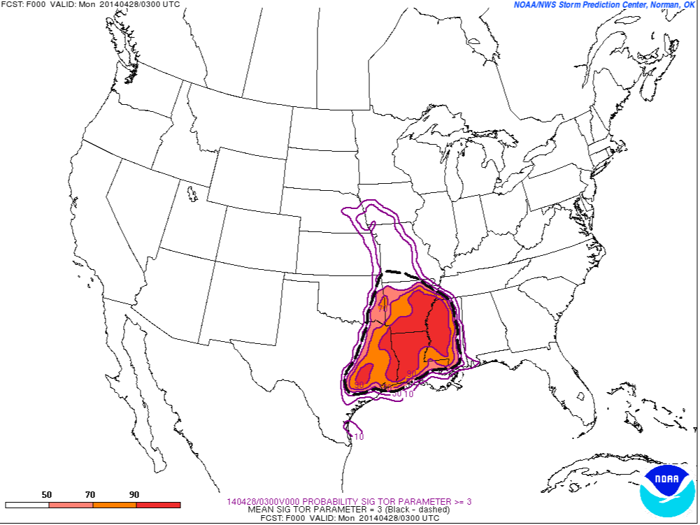
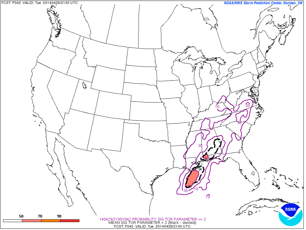
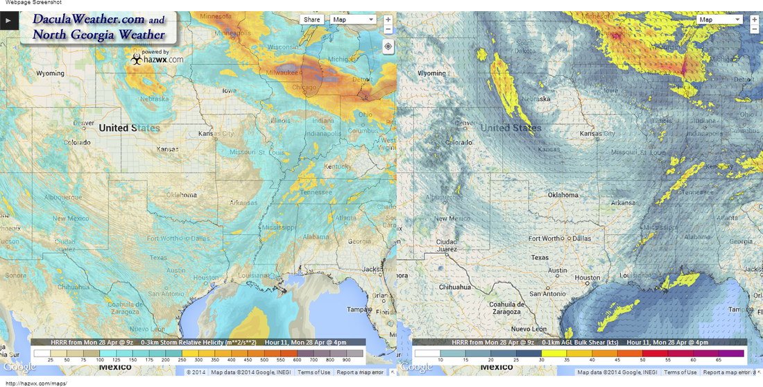
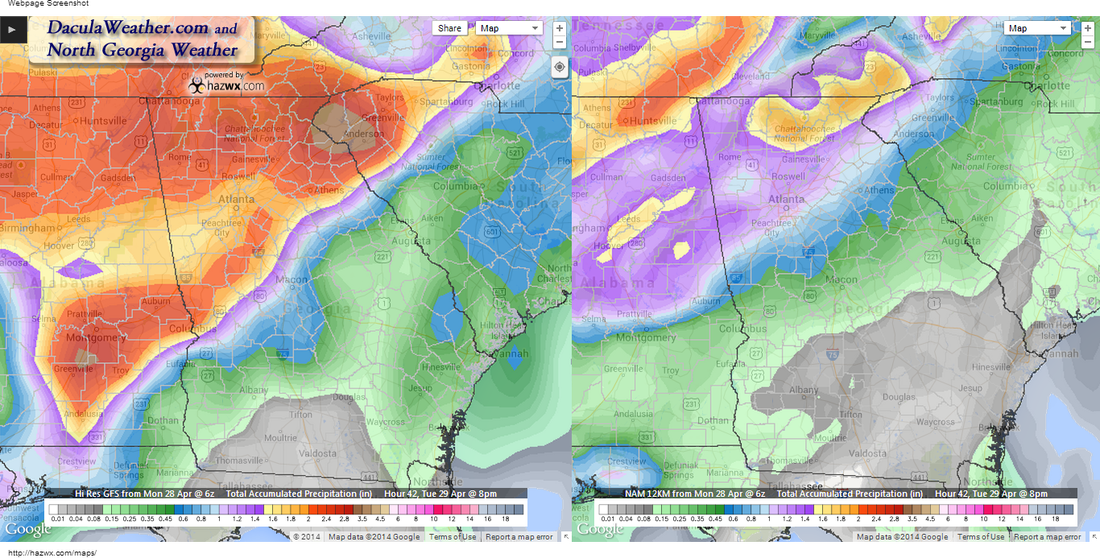
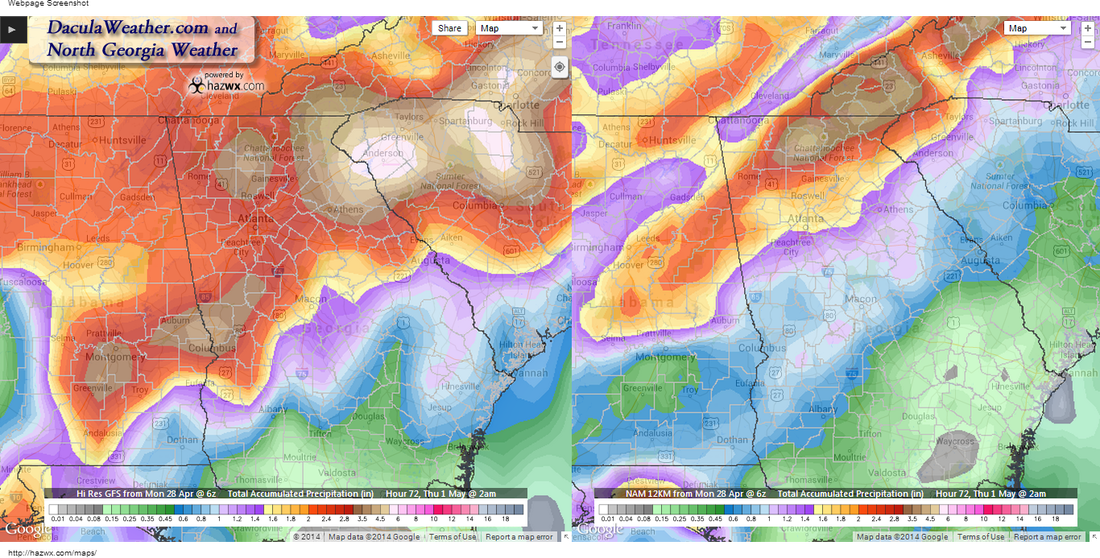
 NOAA Goes East - IR Channel 4 Rainbow loop NOAA Goes East - IR Channel 4 Rainbow loop By now I'm sure that most of you have heard about the severe weather in Arkansas and Oklahoma that killed at least 16 people overnight. It's even sadder to think that these 16 people woke up on a Saturday morning in April, and went about their daily plan, not knowing that their lives would be over later that evening. It's believed that one of those tornadoes may have been an EF5, as at least two homes were wiped clean of the concrete slab. If so, it would be the first EF5 in Arkansas since 1929. The image below depicts the winds and pressures at 11 pm tonight. The image on the left is at 500 mb or roughly 18,000 feet, and the image on the right is at the surface. A few things to note. The upper level low depicted on the left, is sitting right on the border of IA, NE, KS, and MO, whereas this morning it was sitting over the heart of Nebraska. This low is forecasted to very slowly drop east-southeast before pulling northeast. That southeast motion brings the highest upper level winds just to our west. With a warm moist flow at the lower levels, and a diverging jet stream overhead, significant lift can occur. bringing large thunderstorms and very heavy rain. The Significant Tornado Parameter's (STP) are quite high today over Mississippi, Tennessee, and parts of Kentucky and Alabama. This area shifts to the east as the day goes on, but the STP index drops lower as it progresses. The next two maps show the probability of the STP index being =>3. The first image is current, the next image is for Tuesday around 5 pm. What this means is that the likelihood of a widespread tornado outbreak over our area is not nearly as high as it is to our west today. By 4pm today, we're actually starting to get in on some of the shear and helicity that people to our west will be experiencing throughout the day. Helicity tells a meteorologist how much rotation may be present in the atmosphere. The stronger the shear, and the more the wind speeds increase with height, the higher the helicity. Rainfall amounts are going to push our stream and river levels into flood stage most likely. Be alert to ponding on the roadways as you travel and don't drive into standing water unless you know it's safe. The NAM and the GFS differ on how much rain will fall between today and tomorrow at 8pm, this is the GFs on the left and the NAM on the right. The 2nd image is at 2am Thursday after most of the precip is over. Who is going to win? 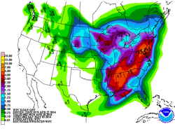 WPC 5 Day Accumulated Precip Forecast WPC 5 Day Accumulated Precip Forecast The WPC has much more information on the rainfall potential in the morning QPF discussion, but here is a excerpt from it: "OROGRAPHIC EFFECTS ARE EXPECTED TO FURTHER ENHANCE THE EXCESSIVE THREAT ACROSS PORTIONS OF NORTHERN GA..UPSTATE SC AND WESTERN NC -- WHERE 3-5 INCH TOTALS CAN BE EXPECTED BEFORE THE EVENT ENDS." The entire discussion can be read here. So for now, be aware and stay alert and make sure you have a working weather radio and multiple ways of receiving weather alerts. Also, if you don't have helmets for you and your family, please get one, they are one of the most effective means of protecting your head in case of a tornado. I will be posting from both Twitter and Facebook as things get going, I'll keep you updated every step of the way. Below is a video taken right after the tornado struck Mayflower Arkansas yesterday. |
Archives
March 2019
Categories
All
|
OLD NORTH GA WX BLOG
 RSS Feed
