|
In case my regular readers are wondering what in the heck I'm talking about... The SCCA (Sports Car Club of America) Solo National Championship is held in Lincoln Nebraska starting this weekend and running through next weekend. It is billed as the largest motor sports event in the world with almost 1200 competitors this year. People come from around the country and Canada to try to win the coveted "Jacket" and a National Championship. I've talked about this sport in previous blog post, but here's a link just in case you missed it. Oh... and I'm participating. :-) Weather is always an important factor in any type of racing, and this one is no different. So with that, we going to take a preliminary look at what may happen. Things will change and I'll be making updates as necessary. We'll start by taking a look at the Area Forecast Discussion issued by the Omaha NWS office: .LONG TERM...(FRIDAY NIGHT THROUGH TUESDAY) ISSUED AT 318 AM CDT WED AUG 27 2014 A FEW SHOWERS LINGER INTO FRIDAY NIGHT...BUT SATURDAY LOOKS MAINLY DRY. THERE IS STILL SOME POCKETS OF MOISTURE AND ELEVATED INSTABILITY SO WILL NEED TO KEEP AN EYE ON THIS. LIFT INCREASES SATURDAY NIGHT THROUGH SUNDAY NIGHT AS ANOTHER SHORTWAVE TROF AFFECTS THE AREA WITH A GOOD CHANCE FOR RAIN SUNDAY NIGHT. What this means is that the weak ridge should bring decent weather for the Pro Solo Championship, but some showers may develop Sunday and into Monday as a trough enters the state and begins to flatten out or weaken. Shortwaves rounding the base of the trough will trigger some light showers through the period... but the timing is unknown right now. There doesn't appear to be any major rain events for the beginning of the event, all of that appears to stay to the north and east. But images speak louder than words (my words anyway...) to here is a visual look at what may happen. I'm going to save the Tue/Wed forecast for another day or so in order to get a clearer picture of the way things will evolve. 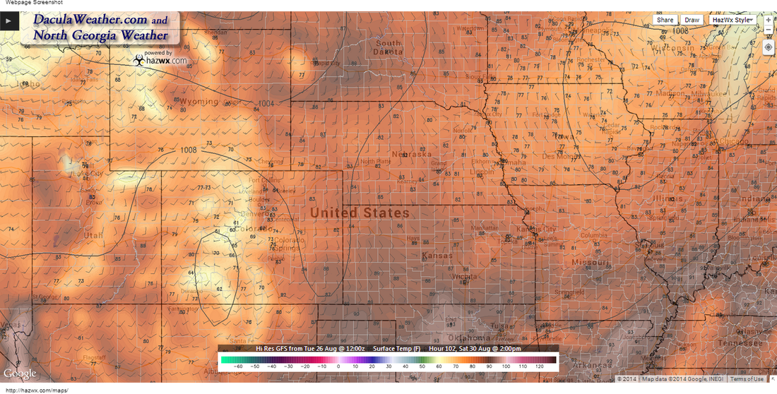
These are the temperatures for Saturday around 2pm. If you like low 80's you'll like Saturday. It may start off cloudy with a few showers around, but start to clear as the weak low in the upper right of the image, moves to the northeast. 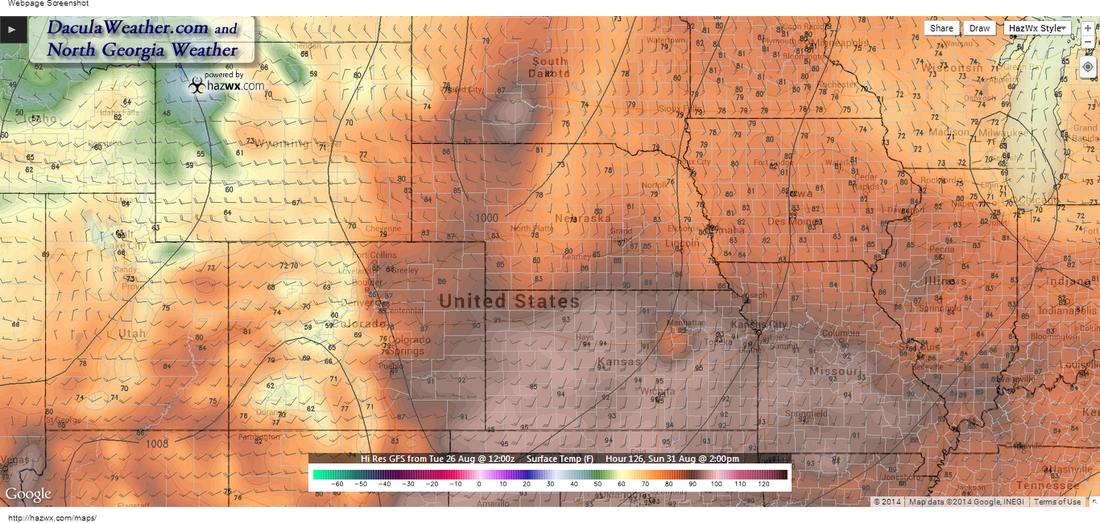
Sunday brings a mixed bag as the trough swings southeast from South Dakota. Notice the temperatures range from 90 to the mid 70's. 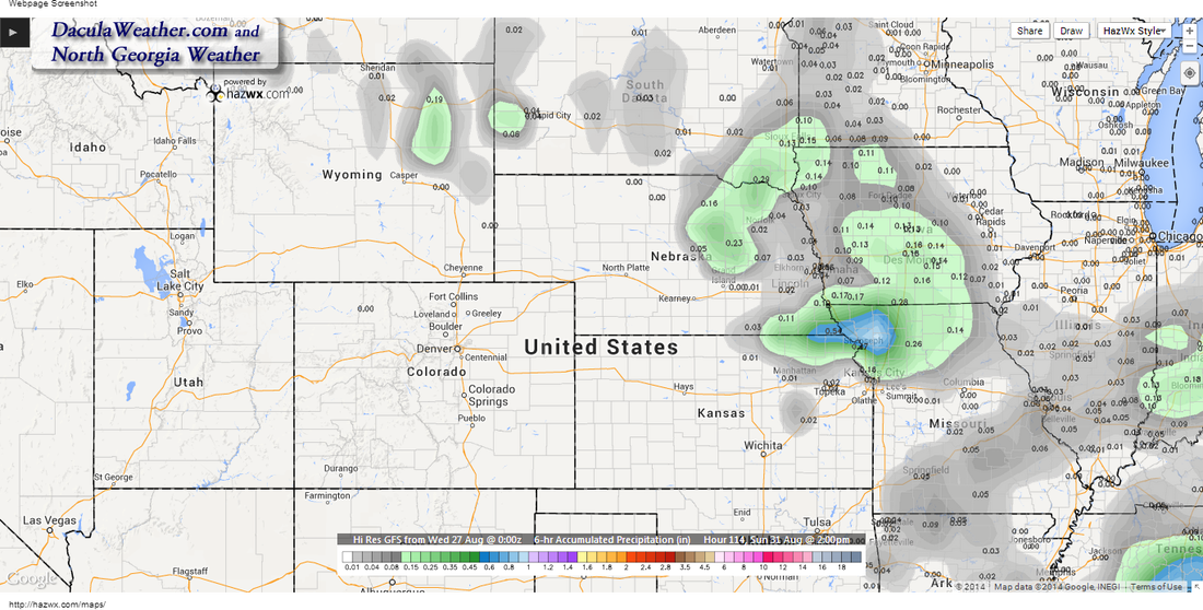
6 hour accumulated precipitation ending at 2pm Sunday. It may be damp in the morning hours as a shortwave passes through. 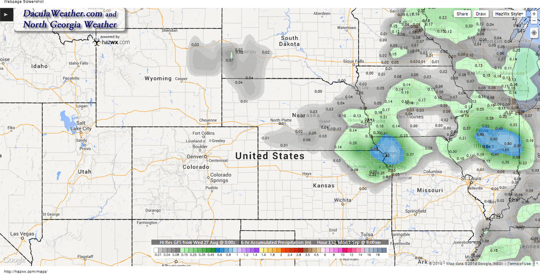
Again Monday at 8am. This would indicate showers occurred overnight. Monday appears to be a mostly cloudy day at this point. 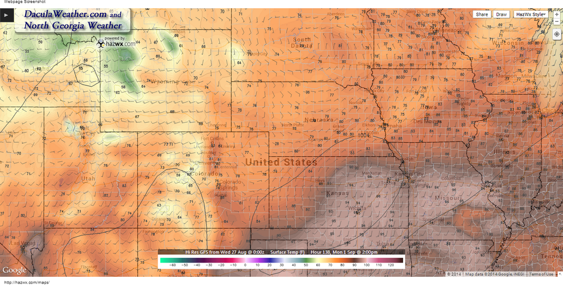
Temps on Monday. Luckily we're on the cooler side of things. 90's to the south. Note that Lincoln is just north of the front with winds out of the northeast. Also note the 1004mb contour, as that piece of energy may bring some showers to the area.
|
Archives
March 2019
Categories
All
|
OLD NORTH GA WX BLOG
 RSS Feed
|
Never base important decisions on this or any weather information obtained from the Internet. Always have a backup method of receiving weather information such as a battery powered weather radio.
Copyright © 2018 NorthGeorgiaWX.com and DaculaWeather.com 
|