Wednesday Weather Summary
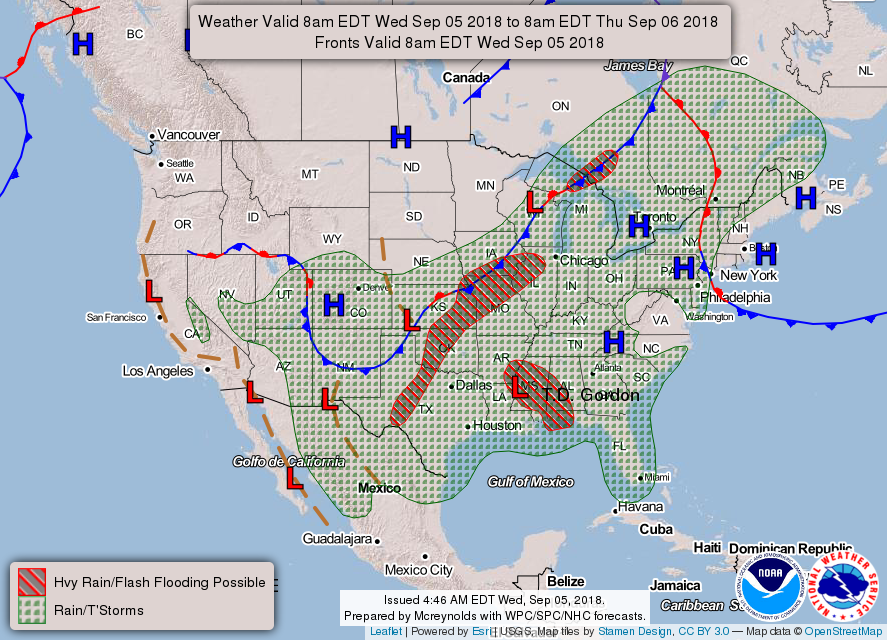
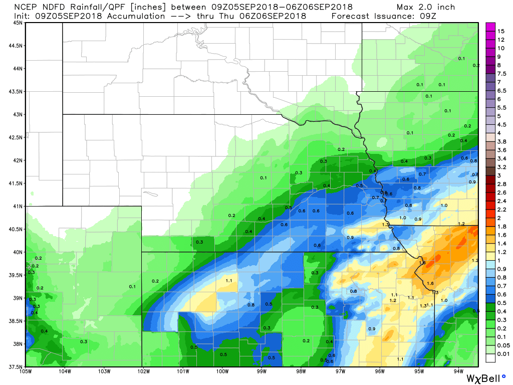
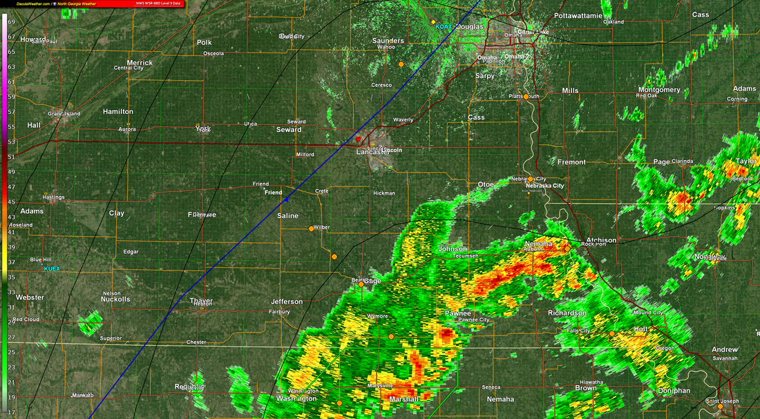
For today axis of precip is progged to shift southeast gradually through the day with progression of the cold front. At this point 3hr/6hr QPF per RAP13/HRRR/NB in agreement that accumulations will remain below latest FFG. Therefore will allow current Flash Flood Watch in effect over southeast NE to expire at 18z.
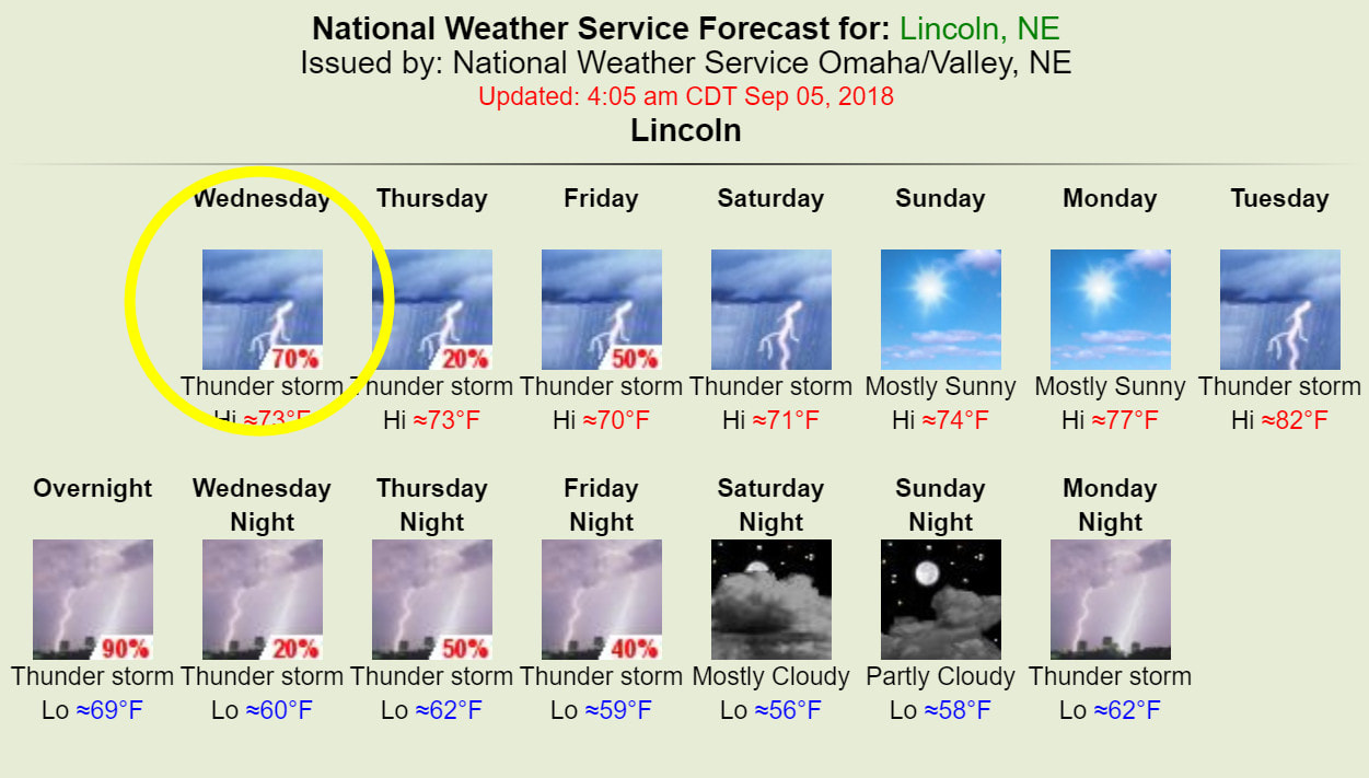
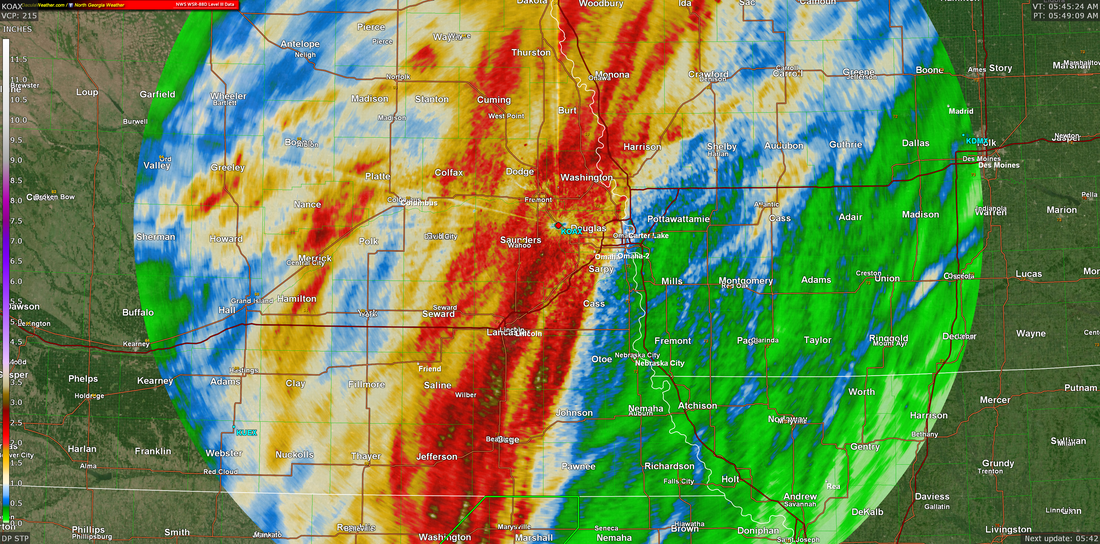
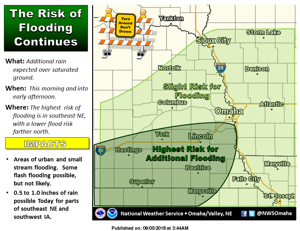
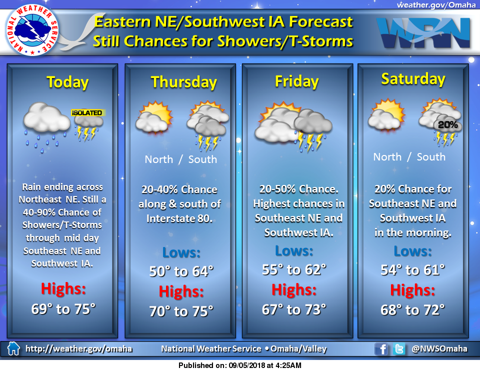
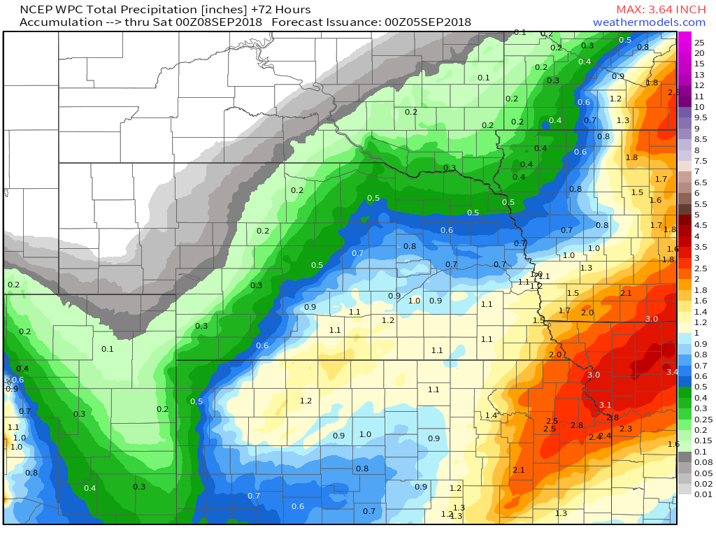
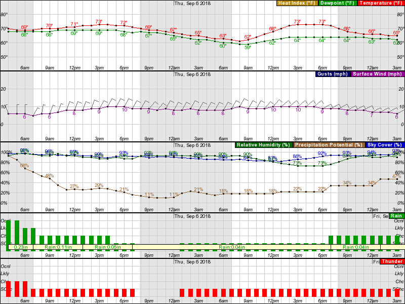
For today, Lincoln will have some overrunning showers in the area, so there is still a decent chance for rain. The rain won't be as heavy as past days and the coverage will be much less. Unfortunately, WPC as again placed portions of the southern CWA under a slight risk for excessive rainfall tonight through Thursday night where total accumulations over the last 7 days are running roughly 300-500% of normal. All this in part to the cold front progged to stall and remain in the vicinity of the NE/KS IA/MO border and act as a trigger for additional rainfall. By Thursday night the surface boundary is progged to lift slightly to the north and allow ongoing precip to expand across the rest of the CWA. The bottom line is that we are not out of the woods yet. Monday/Overnight into Wednesday Radar Estimated RainfallNWS Omaha Graphical Weather Outlook
TODAY'S WEATHER MAP
TODAY'S FORECAST
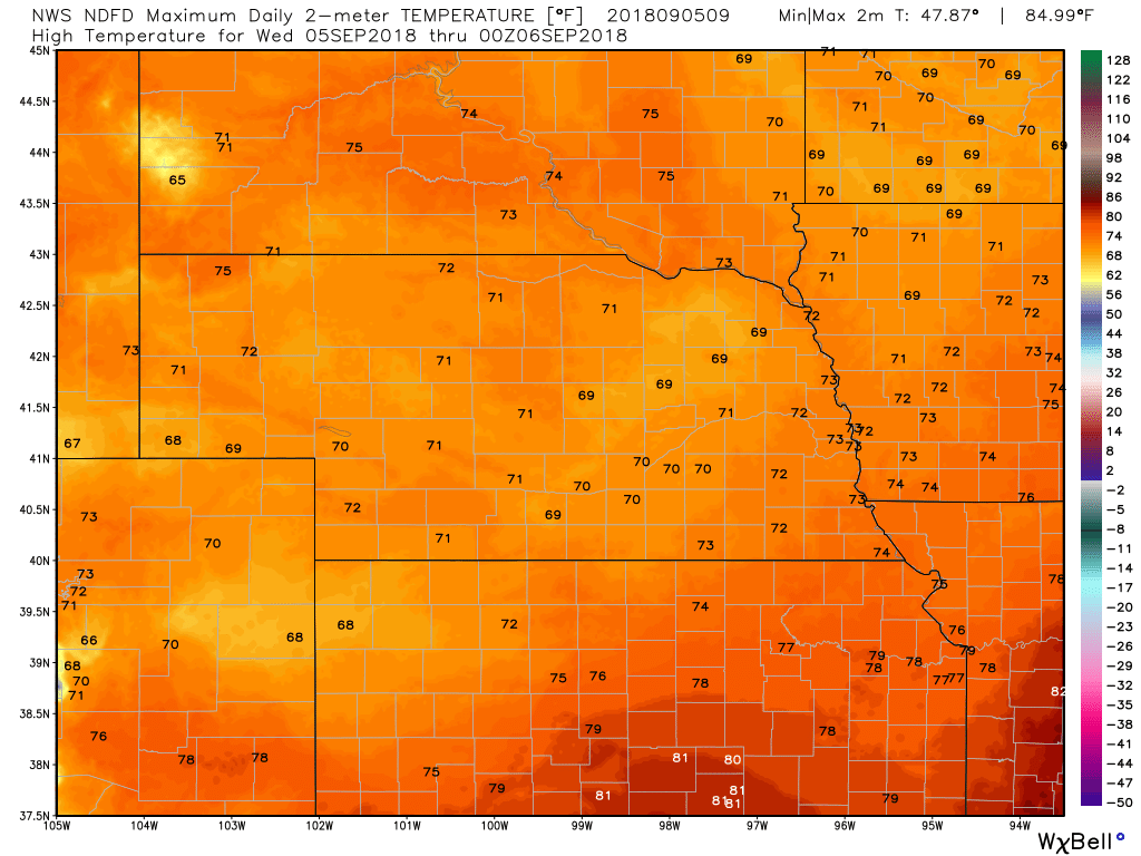
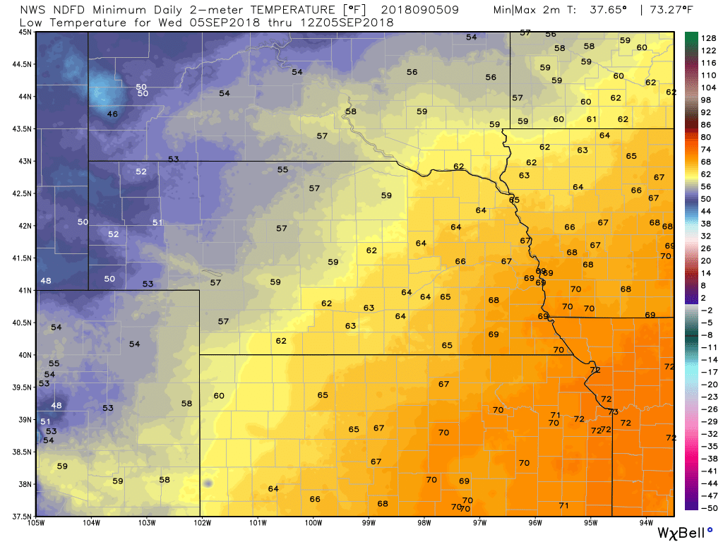
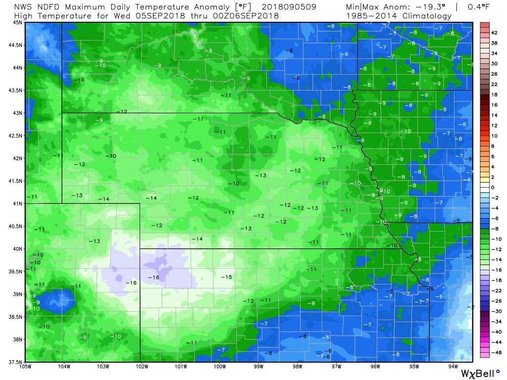
TEMPERATURESTEMPERATURE ANOMALIES
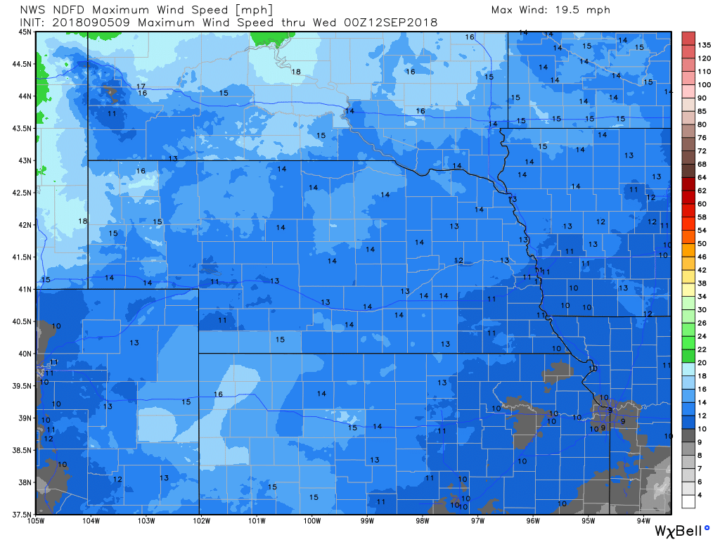
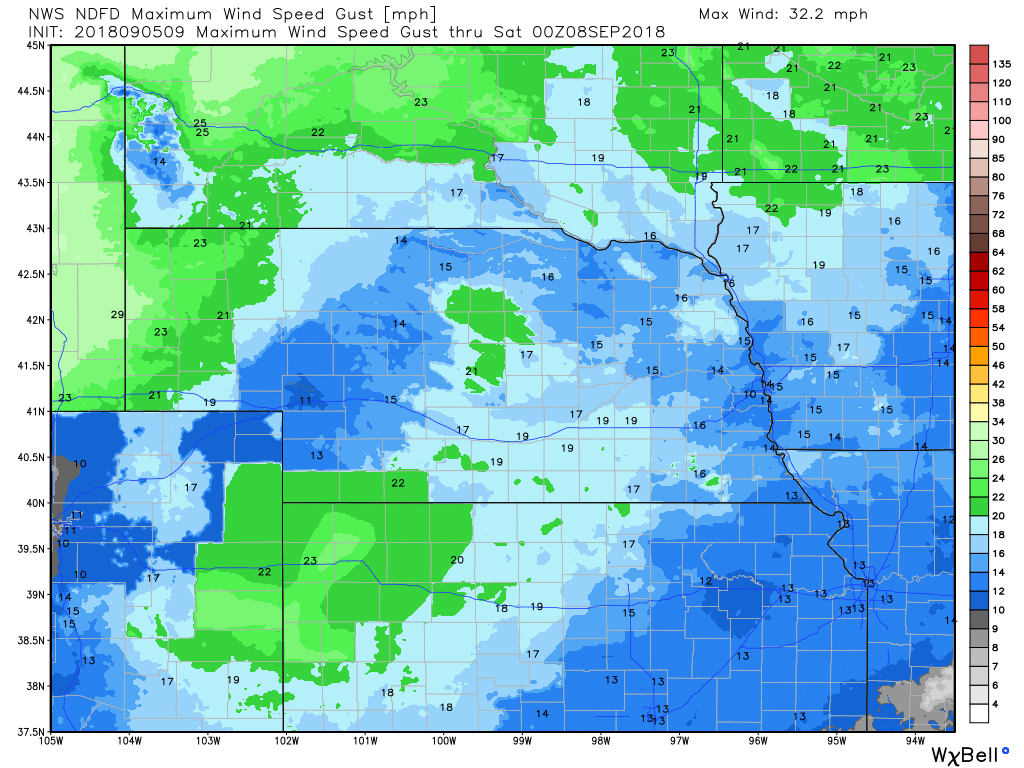
WIND
PRECIPITATIONHour by Hour ForecastCurrent Radar at 5:00 am CDTLive Radar
|
Archives
March 2019
Categories
All
|
OLD NORTH GA WX BLOG

 RSS Feed
