Tuesday Weather Summary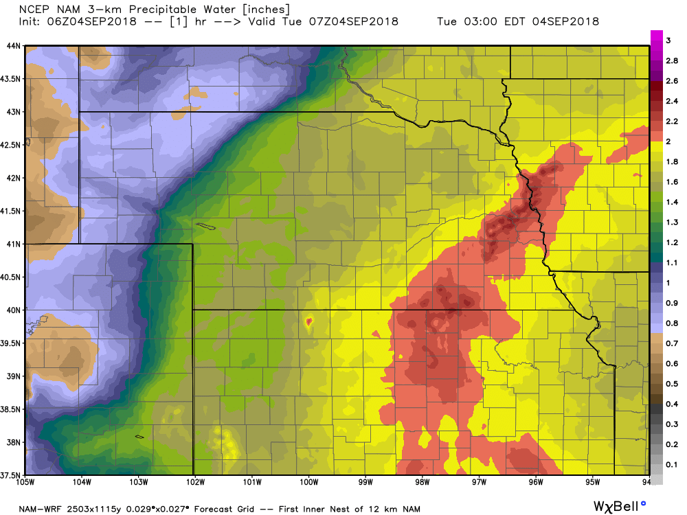 Precipitable Water Values (PWAT) Precipitable Water Values (PWAT)
WV/IR imagery this morning showing near meridional flow over the central and southern plains resulting in a northward trajectory of precip extending southward from the CWA all the way into OK. Meanwhile GOES 16 imagery was revealing the continuous influx of moisture has pushed PWAT values close to 200 percent of normal over parts of eastern KS and most of the CWA.
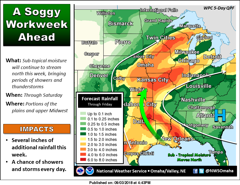
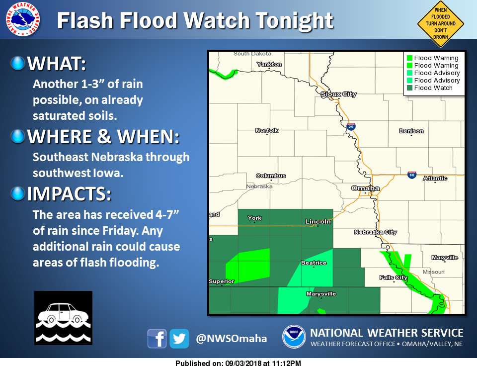
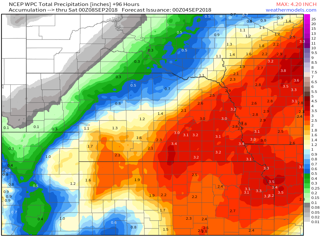
Unfortunately precip chances remain in play over the next couple days prompting WPC to include most of eastern Nebraska and southwest Iowa in a slight risk for excessive rainfall today through Wednesday. Models advertise near meridional flow with embedded impulses remaining in place over the central and southern plains through today. Radar mosaic the last several hours suggest area of precip currently lifting out of northeast KS will take a slight turn to the west through this morning with additional accumulation focused over areas already in a flash flood watch... Seward/Butler/Jefferson/Lancaster/Gage counties. Given this have opted to extend the watch up through early afternoon. 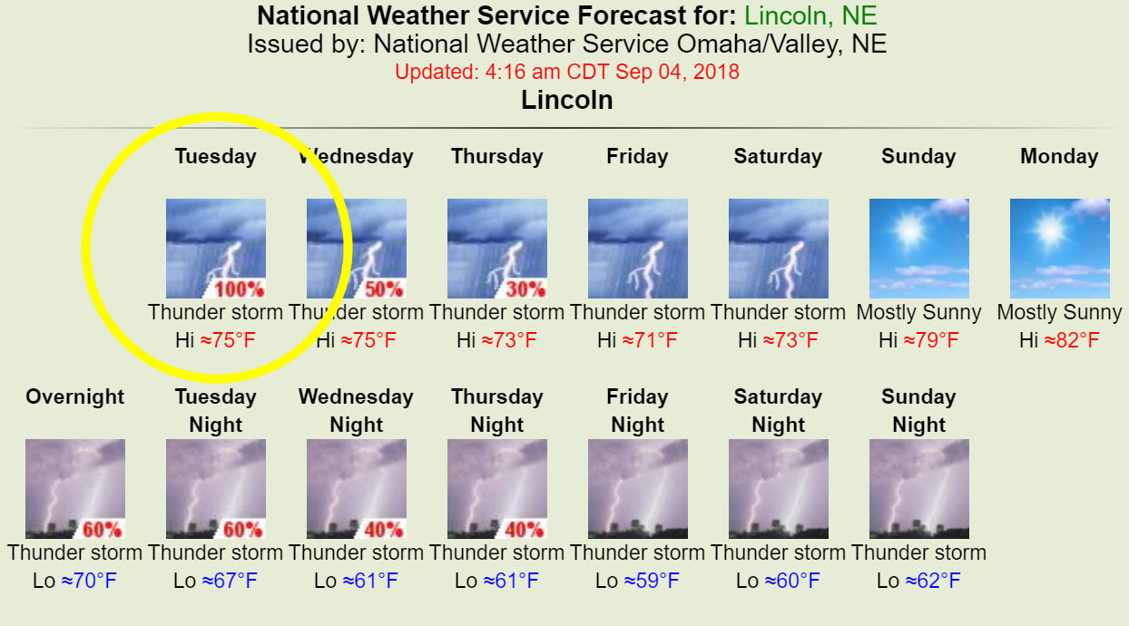
Weather Prediction Center - Excessive Rainfall Discussion WPC Day 1 Excessive Rainfall Outlook WPC Day 1 Excessive Rainfall Outlook
Another active convective day from the Plains, northeast into the MS Valley and Great Lakes region. Several well defined features at play that will likely result in a more organized flash flood threat today compared to yesterday.
The first feature is a shortwave currently moving north across OK as of 08z. The second is a cold front moving southeast across the northern Plains this morning. Third is a strengthening upper level jet from the Dakotas into MN. The shortwave moving north across OK is forecast to maintain or even become more well defined as it shifts northward through the day. Strong 850mb moisture transport will persist ahead and east of this wave, moving into the MS Valley by this afternoon. This wave and increased moisture transport will run into the eastward moving cold front resulting in an enhanced area of lower level convergence. By this time will also begin to see interaction with the upper level jet to the north, increasing upper level divergence above the lower level convergence signature. Thus all in all should have many synoptic ingredients in place for a heavy rainfall event. The wave moving along and just ahead of the front should allow for an axis of training convection across portions of IA/MN/WI. This will all be happening within a very moist airmass with PWs forecast around 2", which is around record values for early September. Monday/Overnight Tuesday Radar Estimated Rainfall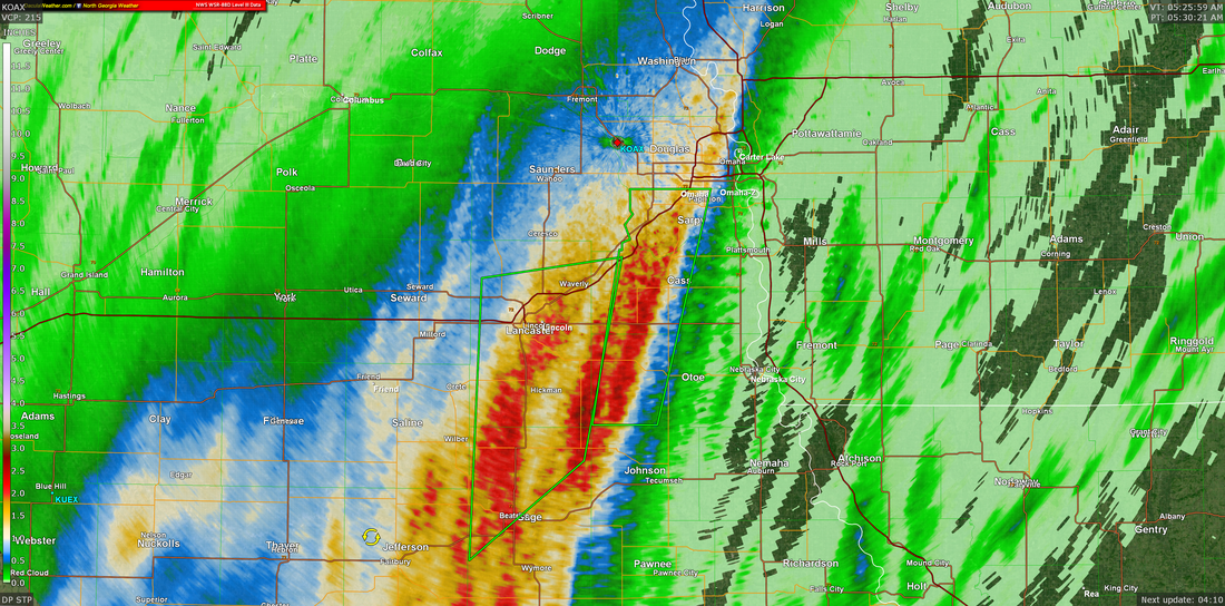
NWS Omaha Graphical Weather Outlook
TODAY'S WEATHER MAP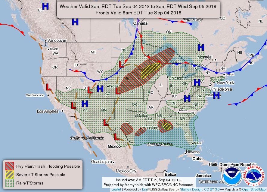
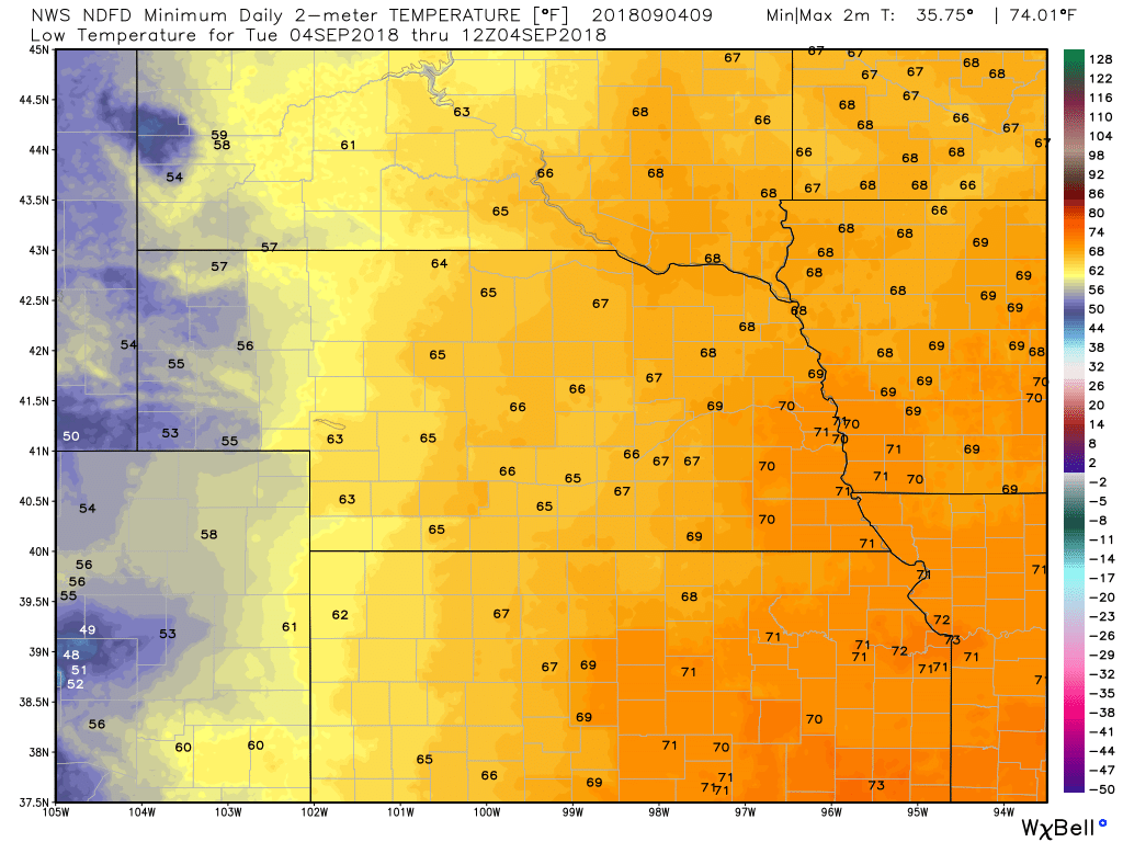
TODAY'S FORECASTTEMPERATURES
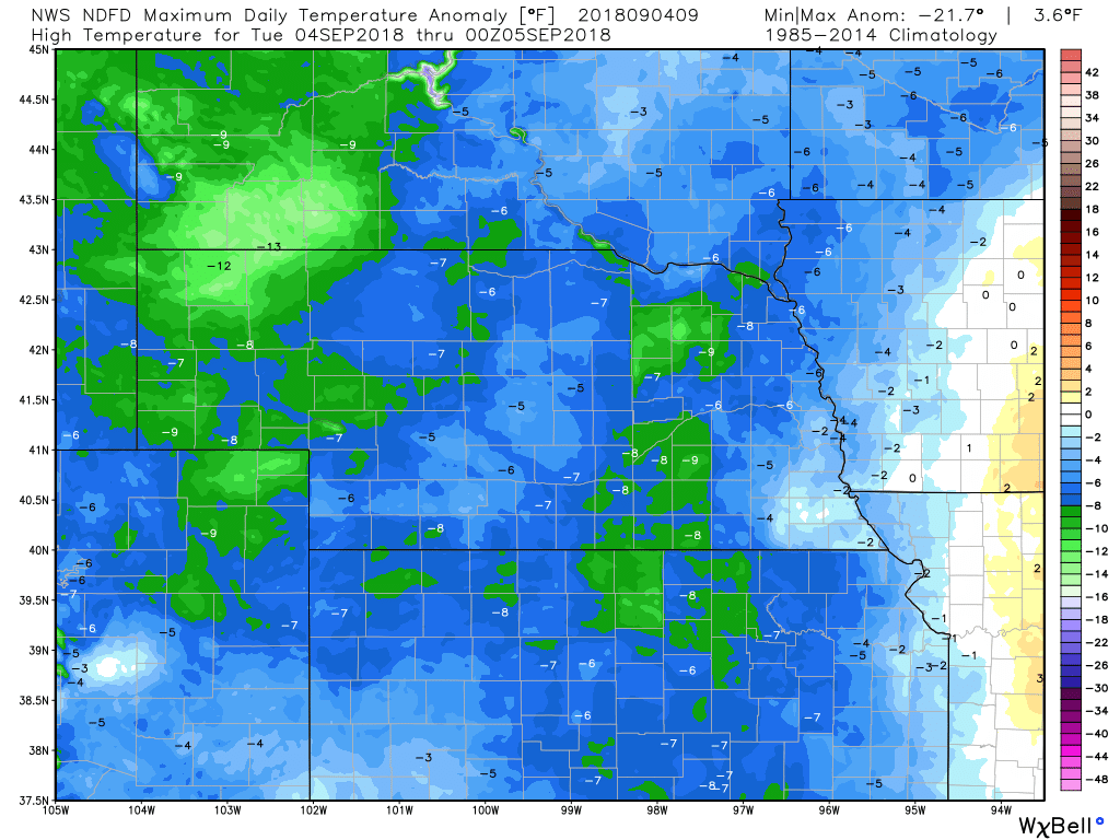
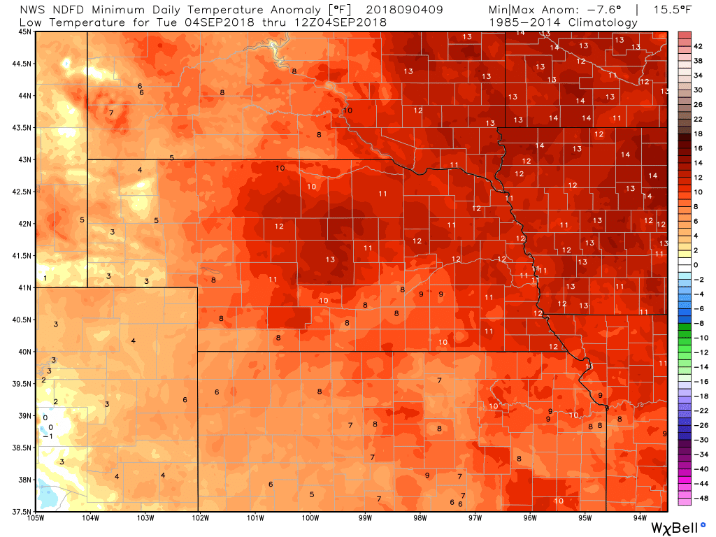
TEMPERATURE ANOMALIES
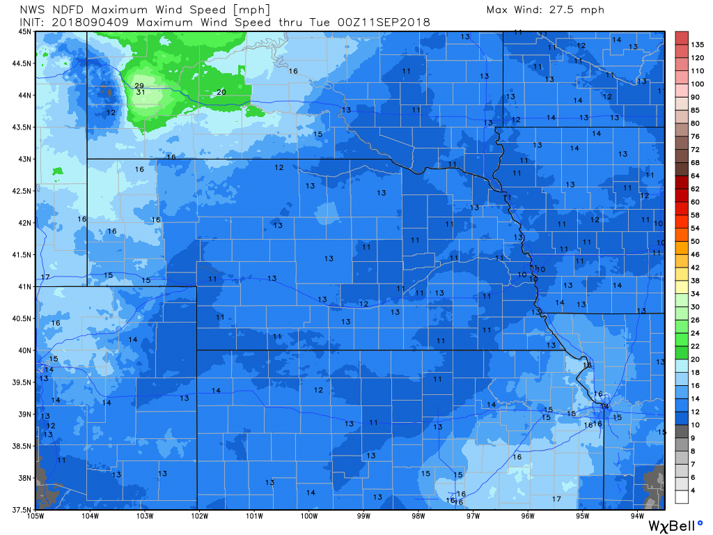
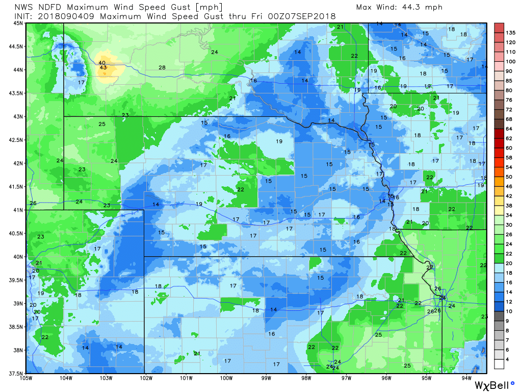
WIND
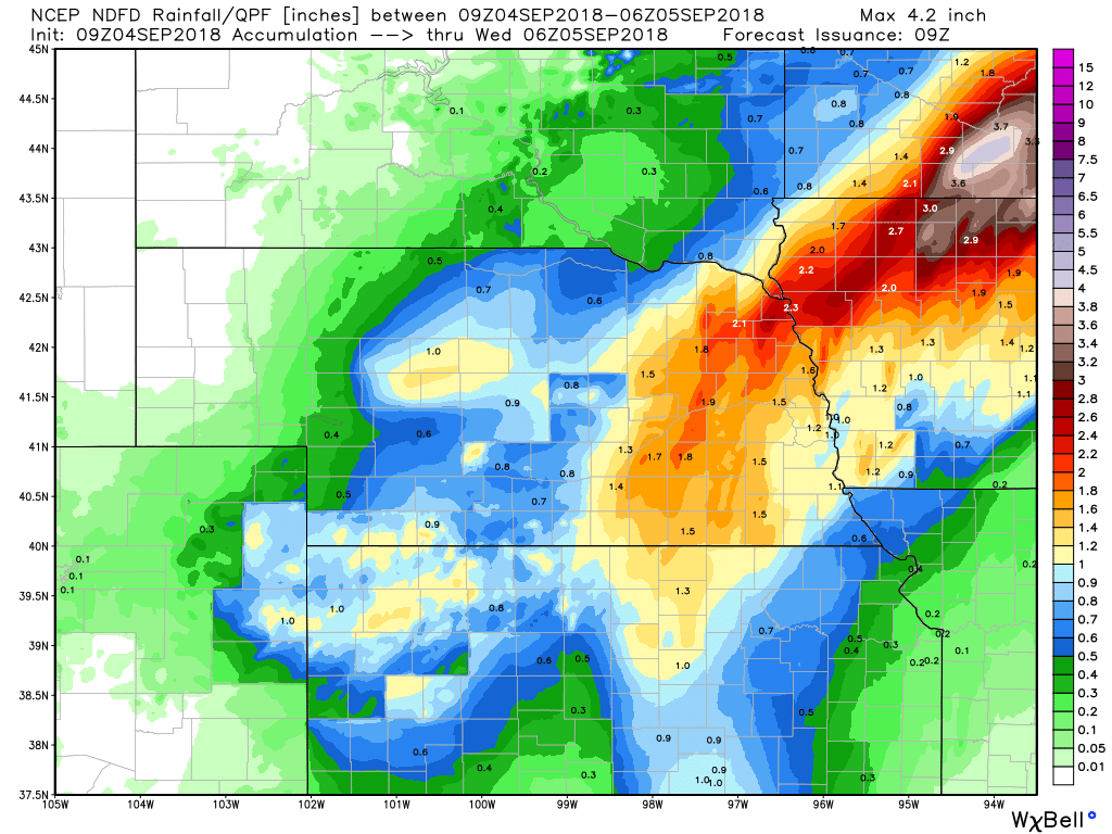
PRECIPITATION
Hour by Hour Forecast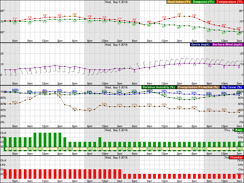
Current Radar at 4:48 am CDT
Live Radar |
Archives
March 2019
Categories
All
|
OLD NORTH GA WX BLOG
 RSS Feed
|
Never base important decisions on this or any weather information obtained from the Internet. Always have a backup method of receiving weather information such as a battery powered weather radio.
Copyright © 2018 NorthGeorgiaWX.com and DaculaWeather.com 
|