Monday Summary
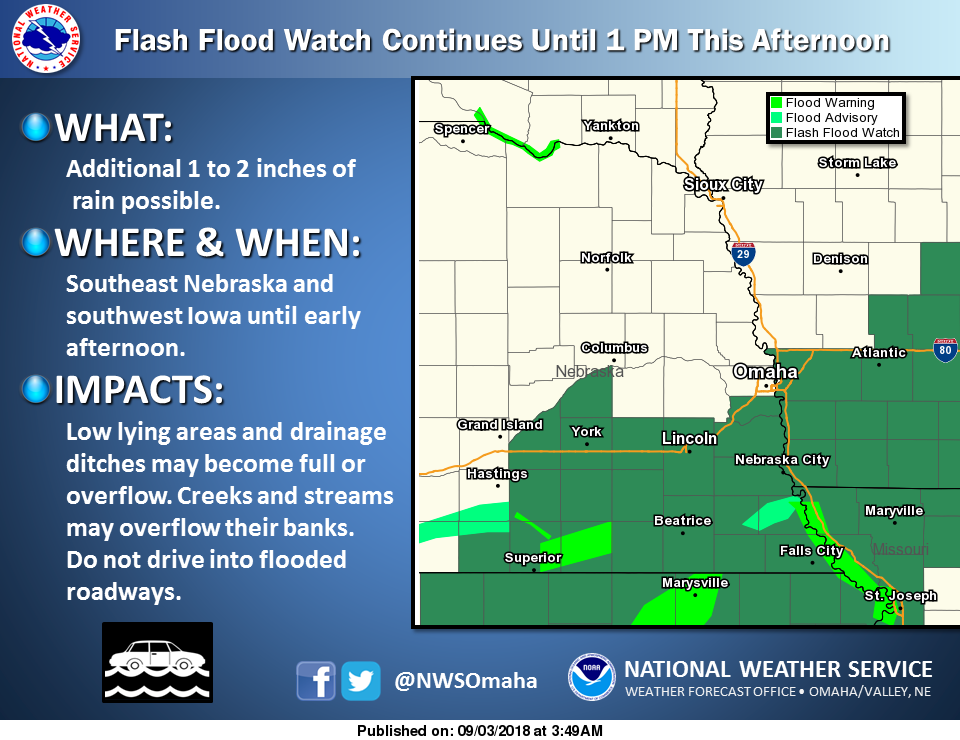
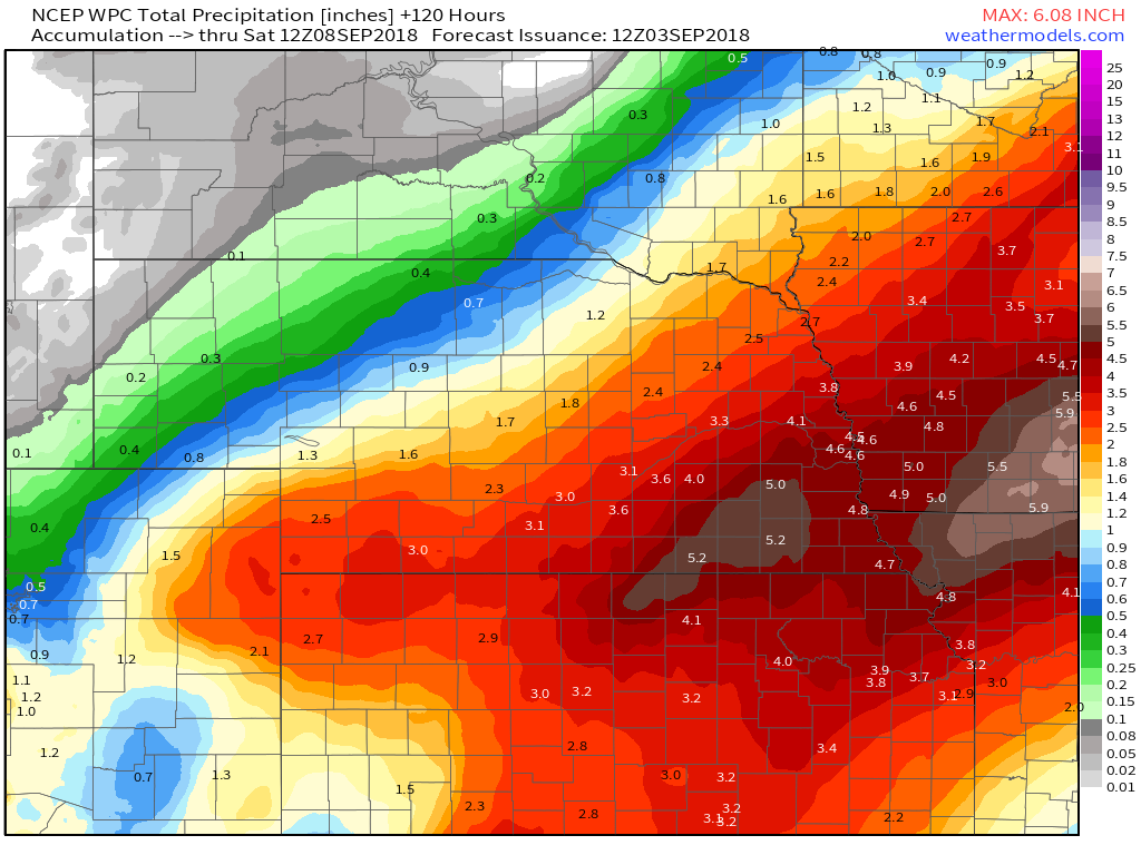
Thunderstorm chances, rain amounts and the potential for flash flooding are the main forecast concerns. Will extend the current Flash Flood Watch until 1 pm and let the day shift take a look at things. Parts of the area may need another watch for tonight into Tuesday. There could be a lull during Monday morning into early afternoon.
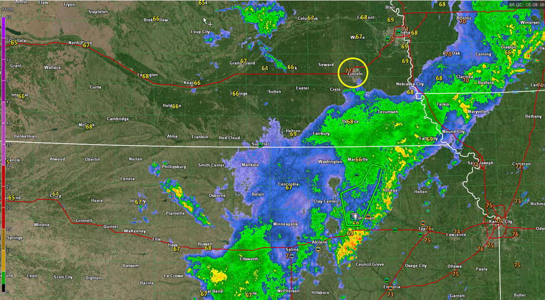
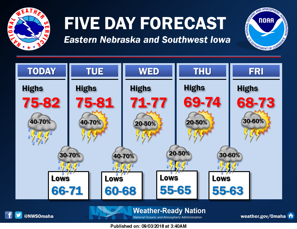
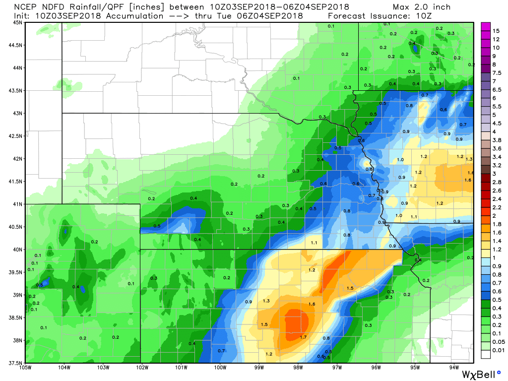
Thunderstorms are expected to continue across at least parts of eastern Nebraska and southwest Iowa this morning. Some storms could be strong with locally heavy rain. Additional heavy rain where the ground is already wet, could cause flooding. Thus a flash flood watch remains in effect until 1 pm today for parts of southeast Nebraska and parts of southwest Iowa. With low pressure to the west, we should generally stay in southerly low level flow until a cold front pushes across the area from the northwest late Tuesday into Tuesday night. Rain chances will remain generally high for any 12 hour period, but timing will be problematic. We could see additional heavy rain tonight, but if it does not fall where conditions are already quite wet (mainly southeast NE into parts of southwest IA) then we may be able to handle the rain. There signals that the axis of heaviest rain could shift farther to the west tonight. the axis of heaviest rain then may be shifting back to the east through the area on Tuesday. rain chances should be lower on Wednesday, especially across the northern half of the forecast area.
RECORD EVENT REPORT
NATIONAL WEATHER SERVICE OMAHA/VALLEY NE 135 AM CDT MON SEP 3 2018 ... RECORD DAILY MAXIMUM RAINFALL SET IN LINCOLN, NEBRASKA... A RECORD RAINFALL OF 2.42 INCHES WAS SET AT LINCOLN NE YESTERDAY. THIS BREAKS THE OLD RECORD OF 1.63 SET IN 1926. 
Weather Prediction Center - Excessive Rainfall Discussion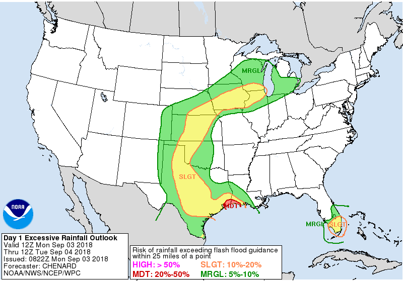 Day 1 Excessive Rainfall Outlook Day 1 Excessive Rainfall Outlook
The area remains in between troughing over the west and ridging over the east, resulting in a broadly convergent flow pattern over the region. The continued southerly flow will support PWs equal to or greater than previous days (with the 2"+ PW area gradually increasing in size)...plenty high enough for heavy
rainfall rates. The stagnate nature of the pattern will also continue to support repeat convection over similar areas... resulting in a continuing saturation of soils and flash flood potential. The setup today is a bit messy, with no strong synoptic feature to help focus an area of excessive rainfall. Thus tough to really narrow in on an area of greatest concern today... instead it appears like a large corridor will see conditions favorable for at least some flash flooding. Thus have opted to go with a large Slight Risk stretching from TX north across the Plains, and east into portions of IA/IL/WI. All in all should be a busy convective day across the central US. Possible that a Moderate Risk may be needed somewhere within the large Slight Risk, but confidence is just too low with the details at this point given the lack of a strong synoptic feature to focus the heavier rains. Forcing does begin to increase some overnight with diffluence in the upper levels and lower level moisture transport both increasing. Although by this time some questions on the degree of instability remaining over the areas where this lower and upper level forcing overlaps. Thus unclear how intense rainfall rates will be overnight. Sunday/Monday Radar Estimated Rainfall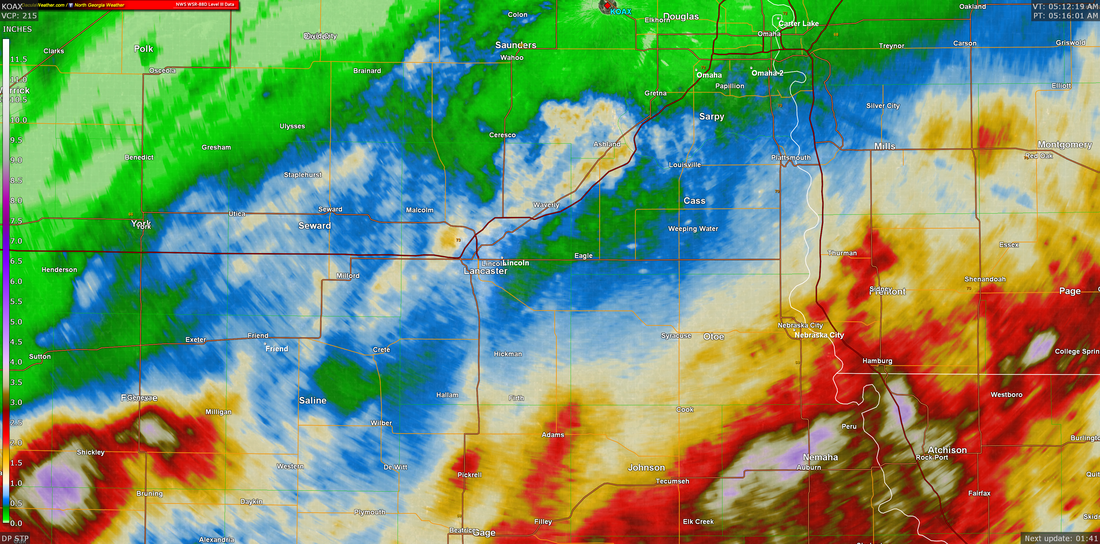
NWS Omaha Graphical Weather Outlook
TODAY'S WEATHER MAP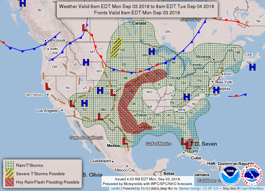
Weather at 5:18 am CDT
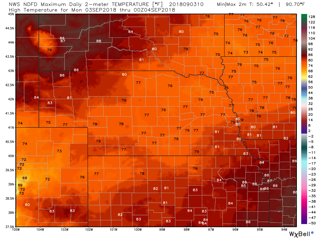
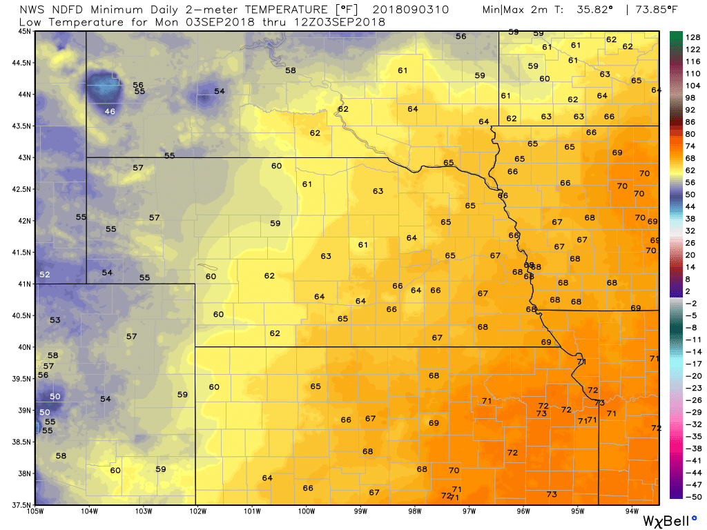
TODAY'S FORECASTTEMPERATURES
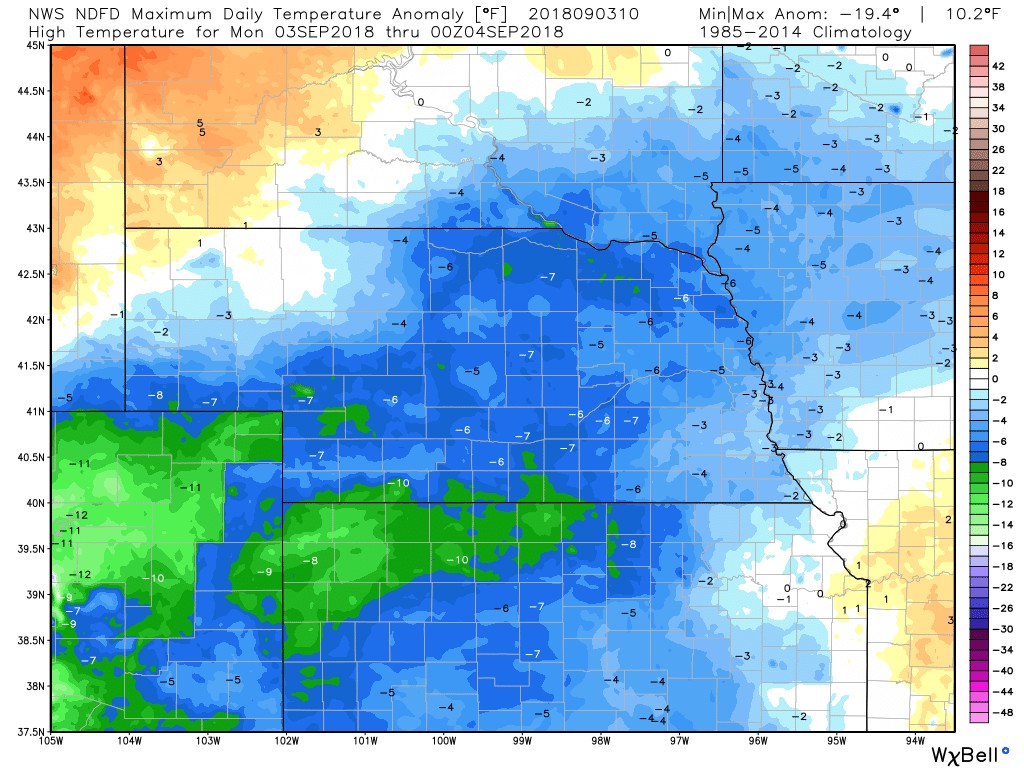
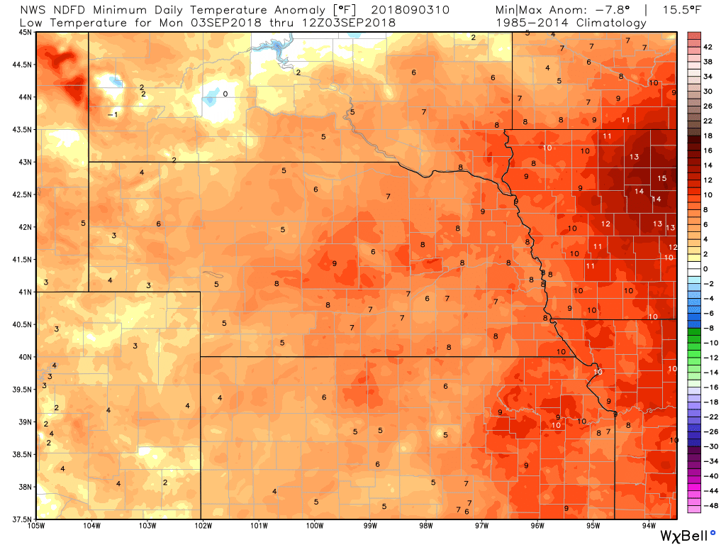
TEMPERATURE ANOMALIES
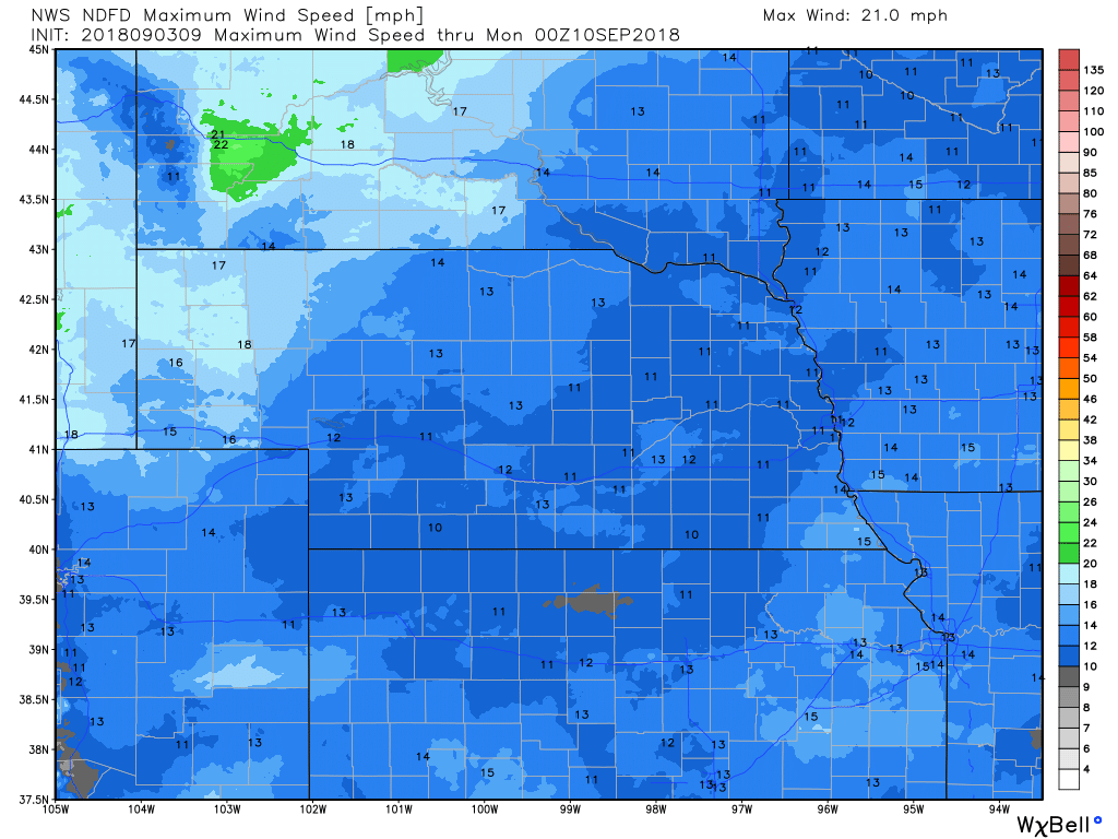
WIND
PRECIPITATION
Hour by Hour Forecast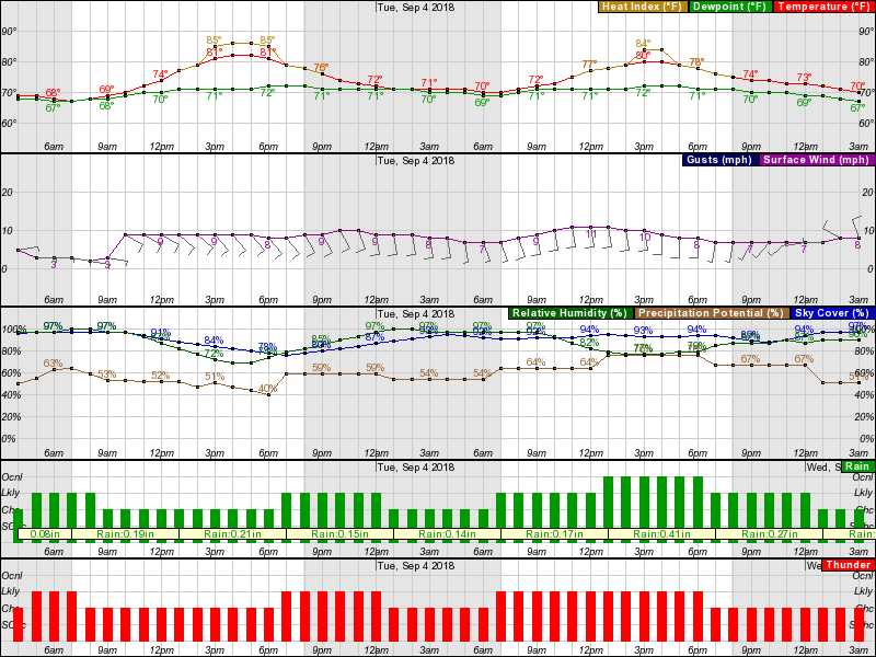
CURRENT RADAR |
Archives
March 2019
Categories
All
|
OLD NORTH GA WX BLOG
 RSS Feed
|
Never base important decisions on this or any weather information obtained from the Internet. Always have a backup method of receiving weather information such as a battery powered weather radio.
Copyright © 2018 NorthGeorgiaWX.com and DaculaWeather.com 
|