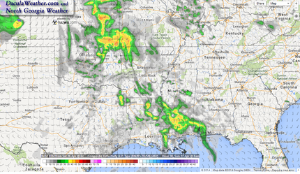
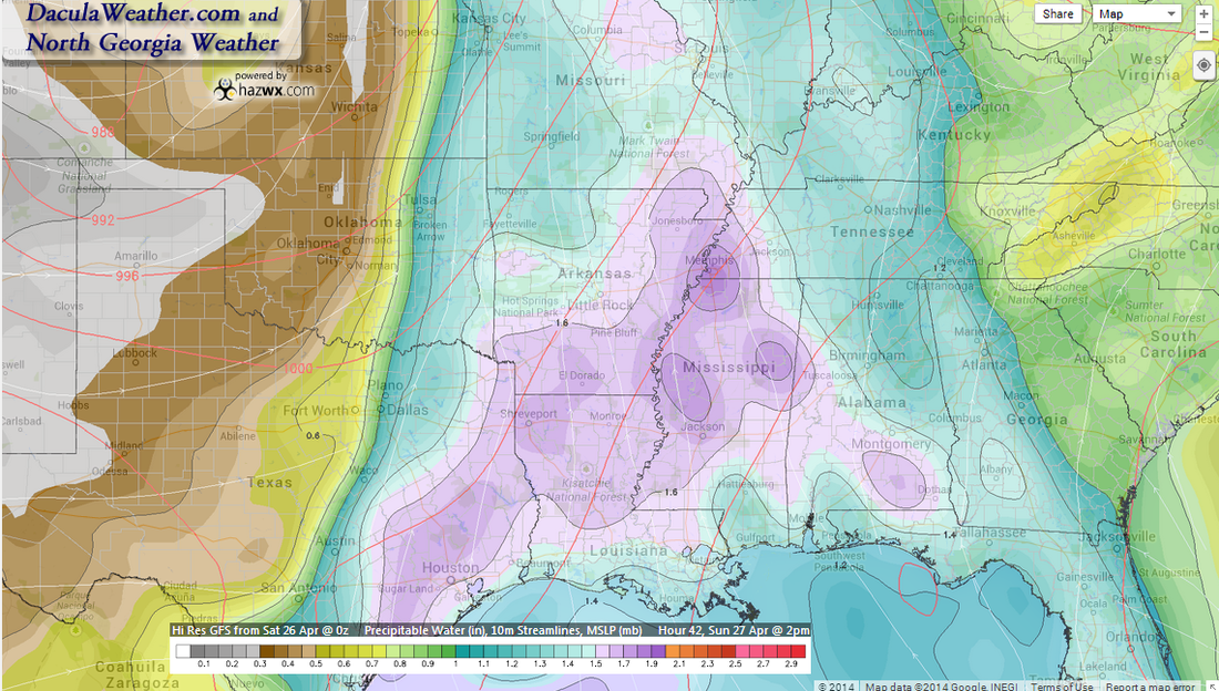
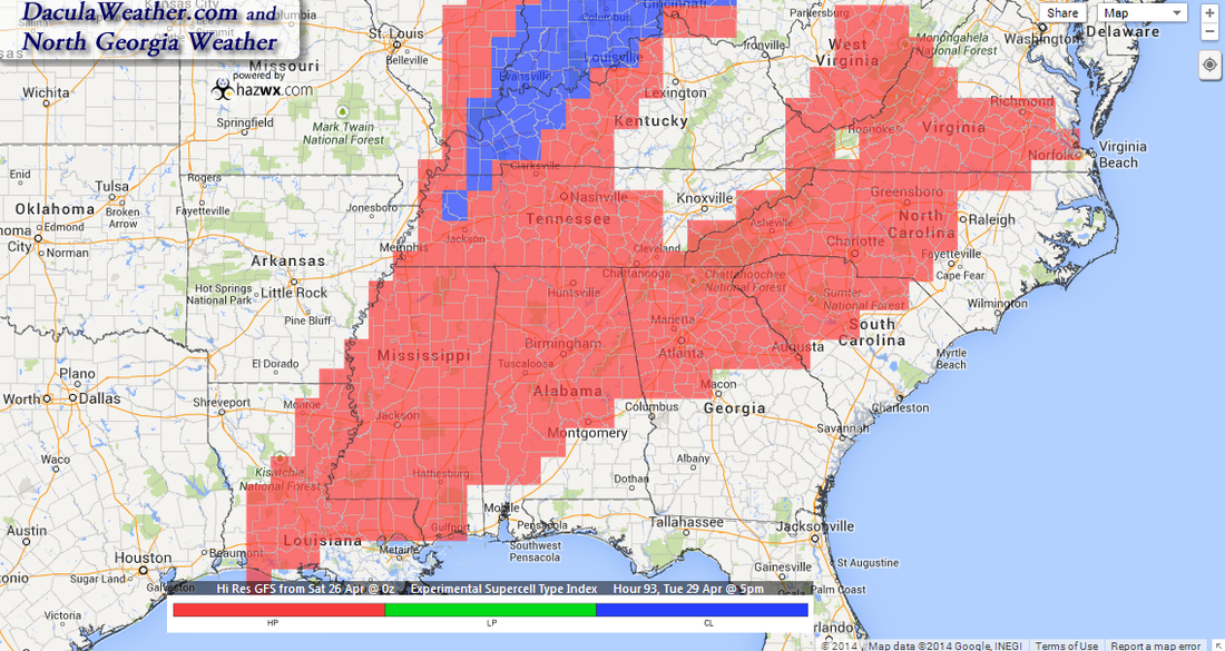
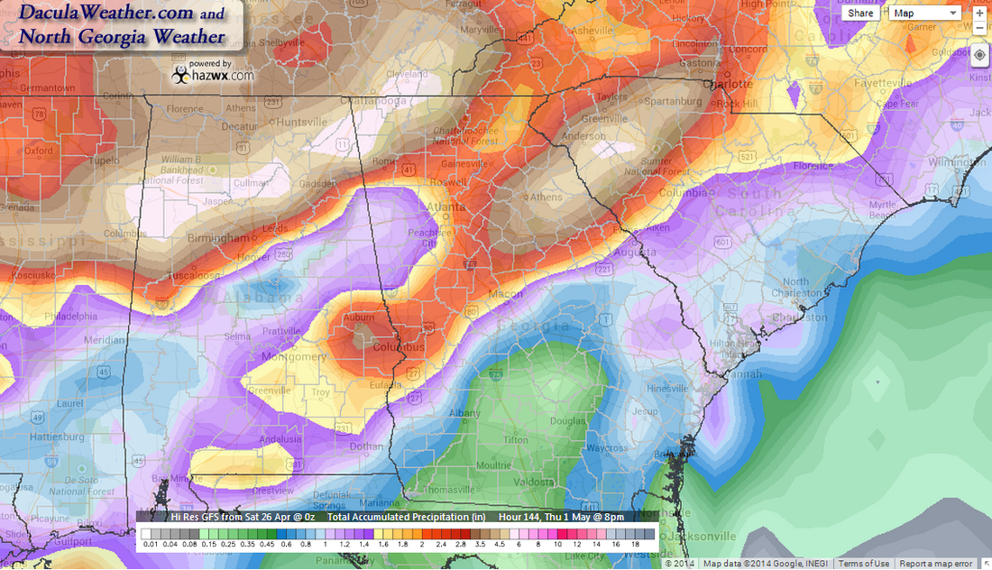
 NAM 4km Simulated Radar 8am Sunday NAM 4km Simulated Radar 8am Sunday Beginning Sunday, we are going to be in for a prolonged rainy wet period, possibly all week long, interspersed with severe weather along the way. After a chilly start, today will be beautiful day with sunny skies and temperatures hitting 80 degrees. Sunday will be a repeat for the most part, but moisture will be on the increase starting Sunday morning, and showers and thunderstorms will already be breaking out over portions of the southeast. By 2pm, precipitable water values of more than 1" will creep into our area and the showers will begin to creep into portions of western Georgia as the late afternoon and evening progresses. Monday won't be too bad of a day with temperatures skyrocketing to the low to mid 80's on a flow of warm moist air from the Gulf of Mexico, with only a slight chance for showers during the day. By Tuesday, the possibility of severe weather will be in the forecast, and this severe potential will last through late Wednesday. And as it is now, the Euro is now showing a return of deeper moisture on Thursday and Friday, so don't put up the umbrella yet. To quote Jimmy Buffet: "Where I go, I hope there's rum! Not to worry, Monsoon come..." SevereBeginning Monday night, the dynamics begin to change a little, and the National Weather Service office here in Atlanta had this to say: ANOTHER CONCERN WILL BE SEVERE THUNDERSTORM POTENTIAL AHEAD OF THE FRONT AS LOW LEVEL SHEAR INCREASES STARTING AS EARLY AS MONDAY EVENING OVER N GA AND EVENTUALLY MOVING TO CENTRAL GA TUESDAY NIGHT INTO WEDNESDAY NIGHT. PLENTY OF MLCAPE...VARYING WITH THE HEATING OF THE DAY AND HOW IT ALL PLAYS OUT WILL NEED TO BE MONITORED. We're still in the 4-8 Day outlook range for the Storm Prediction Center, so we'll have better details as we get a little closer, but here is what they had to say this morning. Severe weather potential begins for us around mid-day on Tuesday, and the metro area is in an area that has the potential for High Precipitation (HP) Supercells, according to the HazWx experimental Supercell Type index model. This potential will last through late Wednesday afternoon before the threat lessens. The timing of impulses rotating around the big upper level trough with the heating of the day, will help to determine what precipitation falls where, and trying to pinpoint those is rather difficult to impossible this far out. We'll have to wait to see how those details play out. Right now it looks like Tuesday through Tuesday night will be the most likely time for severe weather here. PrecipitationThis will be a very slow moving system, and with that comes the potential for large amounts of rainfall over a wide area, and the Atlanta NWS is calling for a widespread 3" over north and most of central Georgia. The NWS Weather Prediction Center describes the system like this in their QPF Discussion: A SIGNIFICANT LARGE SCALE PRECIPITATION EVENT IS EXPECTED TO DEVELOP ACROSS THE CENTRAL U.S. SUN-TUE, AS A VIGOROUS SHORTWAVE MOVING INTO SOUTHERN CA THIS MORNING ASSUMES A NEGATIVE TILT AND LIFTS OUT INTO THE CENTRAL PLAINS BY SUN AFTERNOON, WITH A STRONG SURFACE LOW DEEPENING IN THE LEE OF THE COLORADO ROCKIES THAT GRADUALLY LIFTS NORTHEASTWARD INTO THE CENTRAL PLAINS. THE ENTIRE STORM SYSTEM WILL SLOW...HALTED BY DOWNSTREAM RIDGE WITH A HIGH BUILDING SOUTH OF HUDSON BAY. THE GULF OF MEXICO WILL BE COMPLETELY OPEN WITH ANOMALOUS PWS SURGING NORTHWARD THROUGH THE MS VALLEY BEFORE SHIFTING EAST INTO THE OH AND TN VALLEYS. With all of the expected rainfall, we have to be mindful of flash flooding. The NWS issues flash Flood Guidance maps that depicts how much rainfall has to fall over a given period of time in order to create Flash Flood conditions. I have a new Flash Flood guidance page, and one page was just modified. The NWS didn't call me up to tell me they were changing images :-) so the old page wasn't working correctly. The new page is an interactive Flash Flood Guidance page.
As always, these pages look and work best using Google Chrome, Safari, or Firefox. and hope everyone likes the new maps that I'm able to bring you from HazWx! Have a GREAT weekend and enjoy the beautiful weather while you can! |
Archives
March 2019
Categories
All
|
OLD NORTH GA WX BLOG


 RSS Feed
