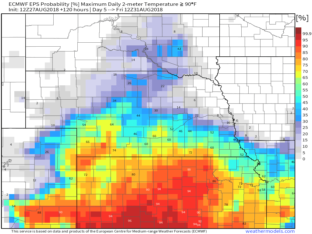
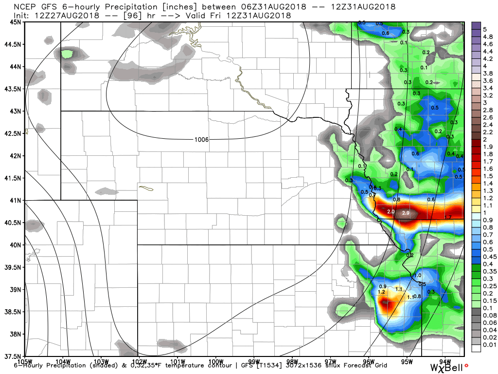
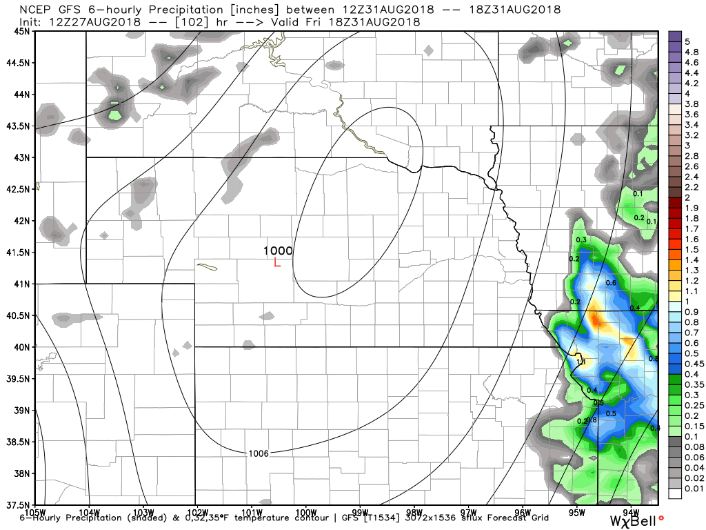
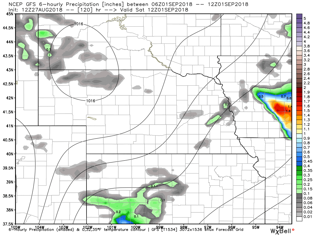
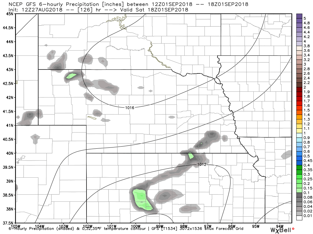
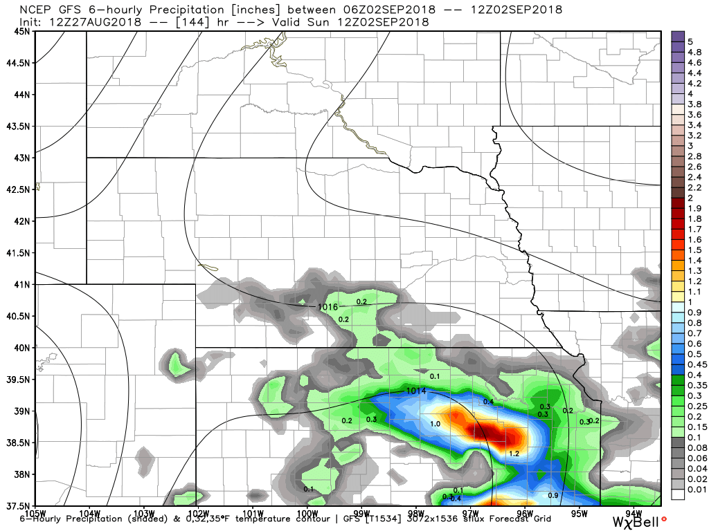
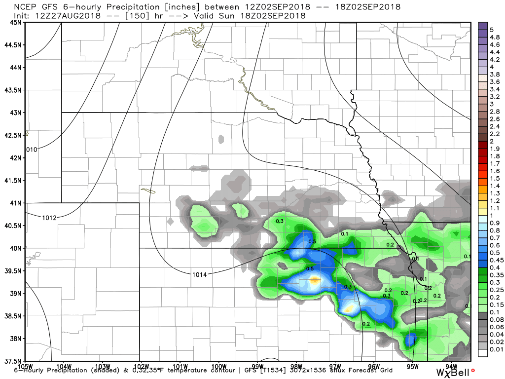
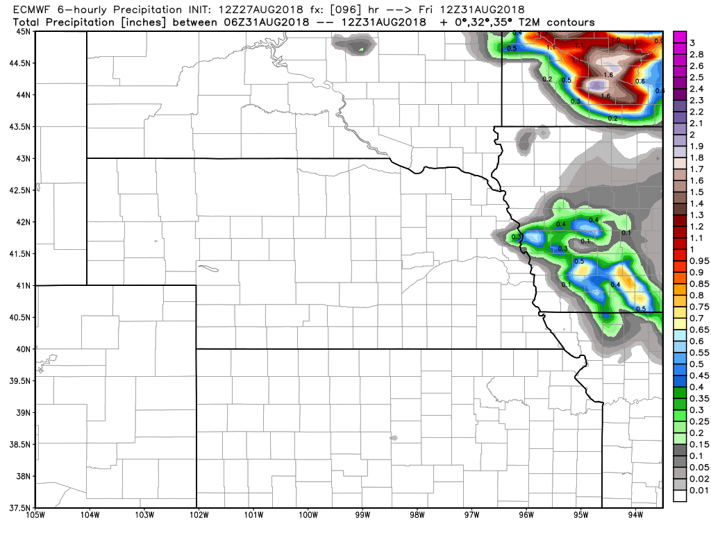
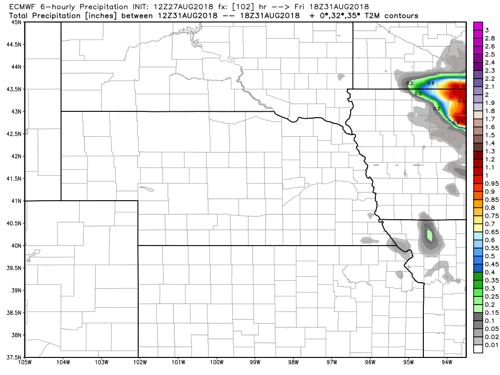
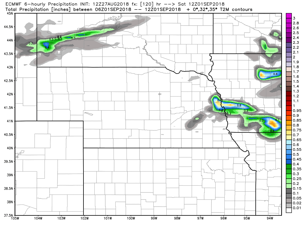
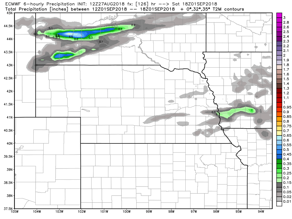
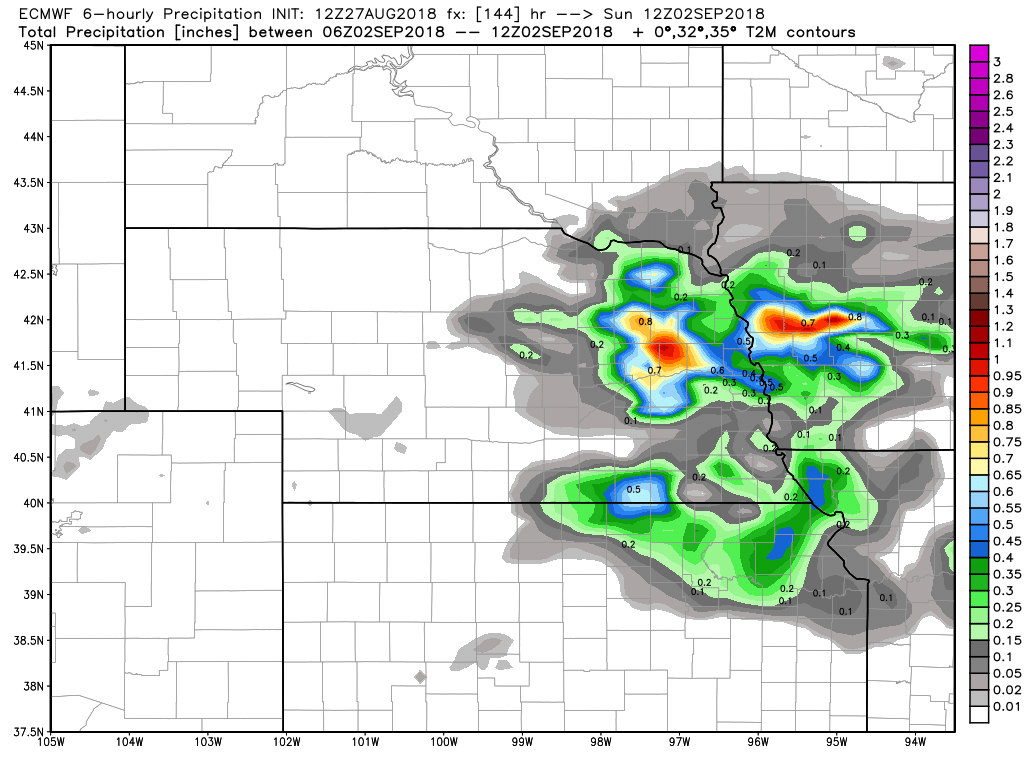
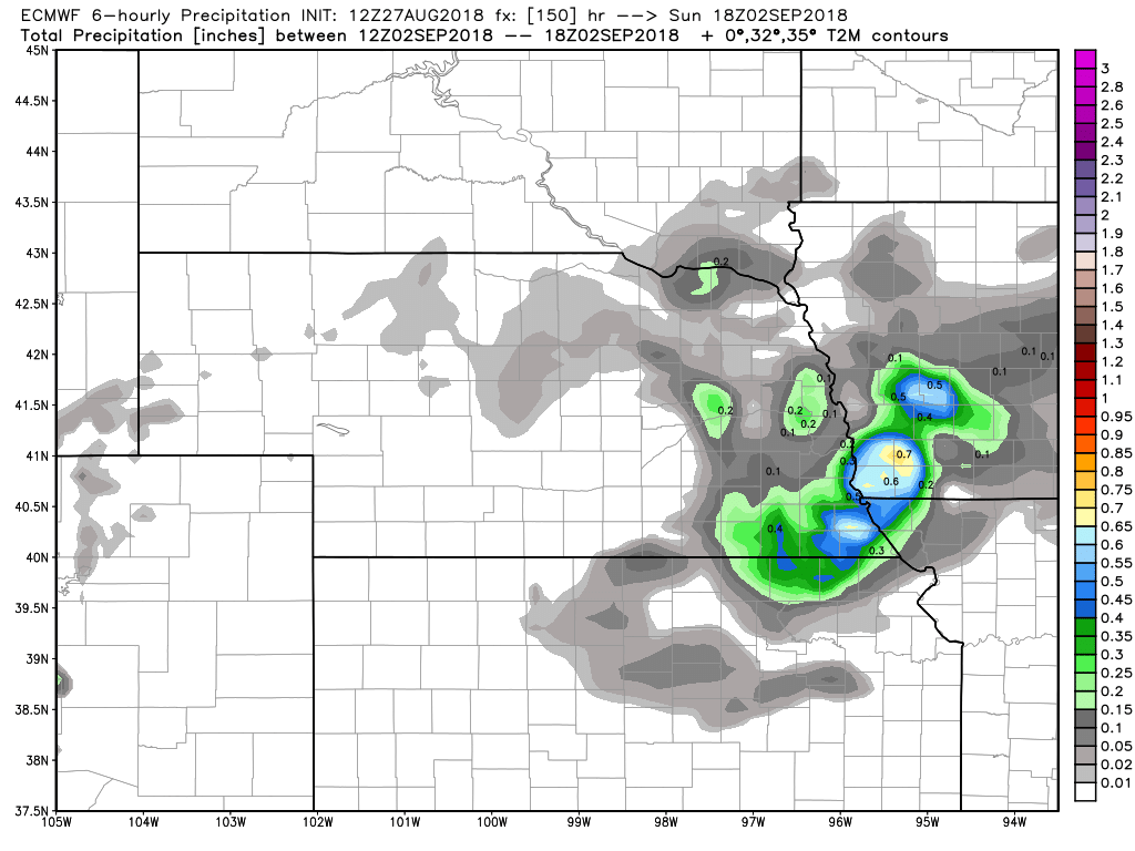
 Probability of Temps >=90 on Friday Probability of Temps >=90 on Friday I had a little too much to share on Facebook, time to use the blog. :-) I wanted to give an update on the weather for the ProSolo and CAM Challenge coming up at the end of the week. If you were to look at the NWS forecast, it contradicts what they say in their Area Forecast Discussion, so we need to take a look at the discrepancies. The image below is the current NWS forecast for Lincoln through Sunday. They do have thunderstorms in the picture for Friday, but for the moment, Saturday and Sunday are mostly sunny and mid 80's. You can always find that forecast here: http://www.daculaweather.com/4_track_lincoln.php 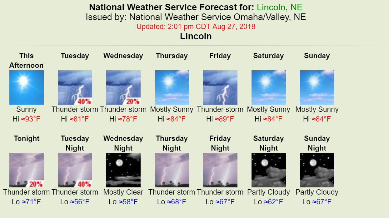 But if you read the AFD (those are posted automatically on the Facebook page), it says this... "Medium range models indicate a more active period for later in the week and into Labor Day weekend as upper-level flow becomes southwesterly and subtle waves are forecast to move through the area." My guess is that they are waiting to get a little closer in time before they modify the Saturday and Sunday forecast. PrecipitationHere's a comparison between the GFS and Euro for the moment (both 12Z runs from today), and they are showing fairly similar things. There is one thing to note. Trying to pinpoint the exact locations where rain is going fall and when, when you are 4-5 days out is usually not very productive, and especially in this case. There are no major systems that will cause this rain, it's mainly from a warm moist flow around the backside of an area of high pressure with little waves of enhanced moisture rotating through, so the models really have no clue at the moment where those areas will end up. Click on any image to enlarge.
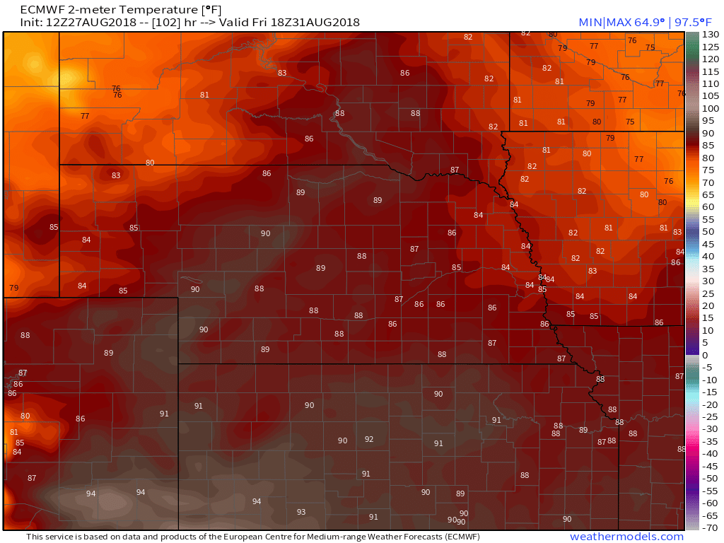
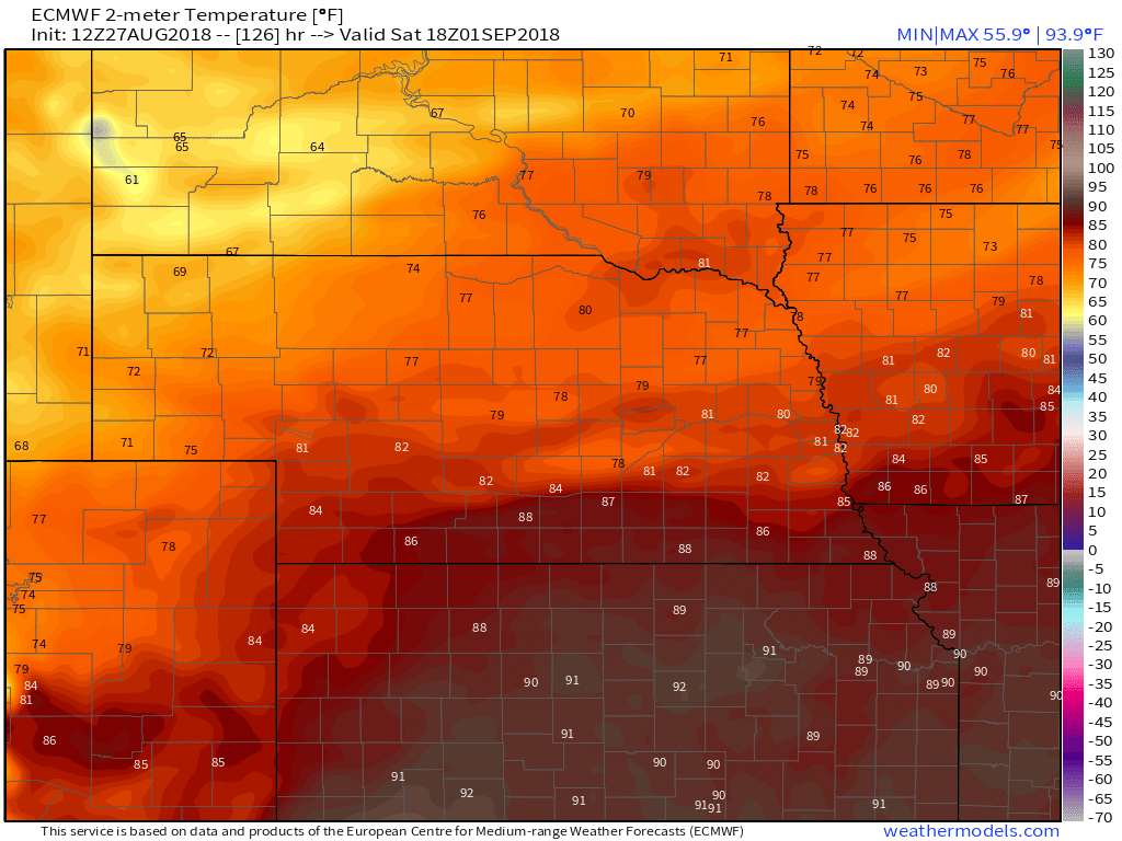
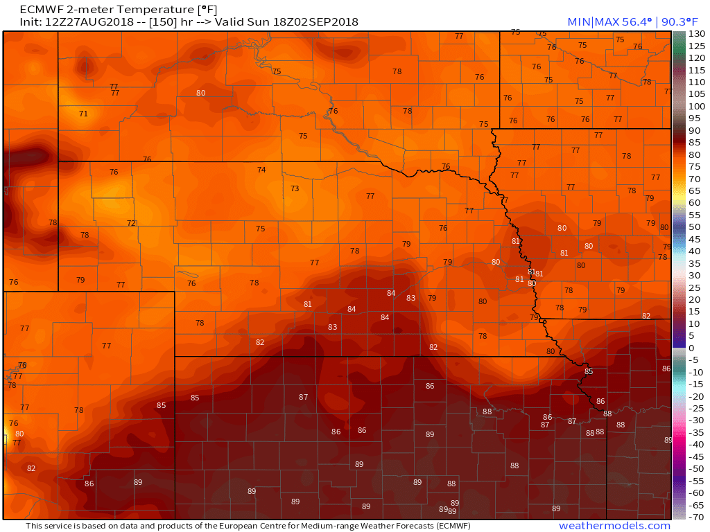
Lincoln stays on the edge of the heat and rain, but it's never too far away, and that is probably one reason why NWS Omaha is waiting to see how some of this evolves before updating the Sat-Sun forecast. TemperaturesHere's a look at the temps from the Euro which I'm sticking with for now. I'm not showing the GFS because all summer it has had outrageously high temps that have not verified. It's now looking Friday will be the warmest day of the 7 day period, but notice how the upper 80's and 90's aren't too far away. These are all 1pm (central time) temps
So here is the summary of temps to this point. The top image is the deterministic model run, the bottom image are the ensembles, and you can see the differences between the two. Pretty close on Friday and Saturday, but they start to diverge a little after that. That diverging trend is the reason for using the ensembles to help average out the various ensemble members, and one of those ensemble members is the deterministic run in the 1st image below. While we're looking, look at Wednesday on the top image... if that holds true, you might need a jacket. :-) 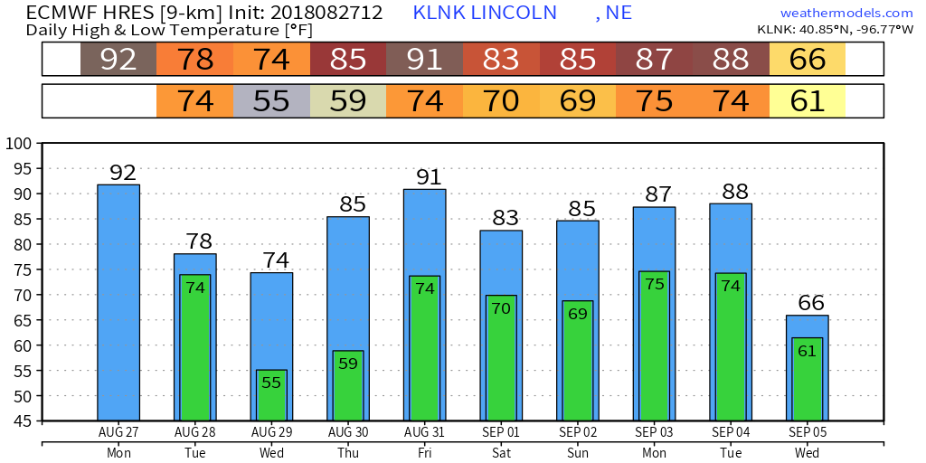 Euro Deterministic Model Run 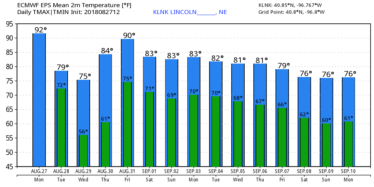 Euro Ensemble Model Run |
Archives
March 2019
Categories
All
|
OLD NORTH GA WX BLOG
 RSS Feed
|
Never base important decisions on this or any weather information obtained from the Internet. Always have a backup method of receiving weather information such as a battery powered weather radio.
Copyright © 2018 NorthGeorgiaWX.com and DaculaWeather.com 
|