|
We're coming up on meteorological winter (December 1) and it's time to start to get serious about some winter weather. Looking back at all of the parameters that we looked at back in October such as Siberian snow cover, El Nino patterns and strength, location of warm SST's off of the western US coast, and some local statistics showing correlations between monthly temps and our winter outlook, all pointed toward well below normal cold and above normal precipitation for the December through February season. November and December are transition months for winter weather here in Georgia, and winter usually doesn't get into high gear for us until late December into early January. Moving into December, we start the month with average highs of 57/36 degrees, but by the end of the month, those drop to 50/31. The chaotic atmosphere is making it very difficult for the computer models to pick up on changes much more than 5 days out right now. Because of that, the weather weenies that hug every model run looking for chances of snow, get all out of sorts and are ready to call off winter before it even starts. :-) So to address those that are ready to jump off a cliff, I'd like to repost this discussion by meteorologist John Homenuk from New York City (his weather blog here), that will help to understand some things that are brewing in the background and setting the stage for the winter that everyone has been expecting. To the quickly accumulating amount of people panicking about the pattern evolution over the next few weeks, I have three words: 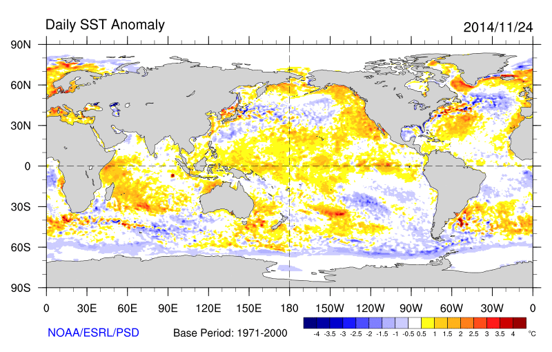 Monthly SSTA's show a continued "textbook" +PDO pattern and Atlantic pre-NAO loading pattern setup. Those of you panicking about the NAO not going and staying negative over the past few days will have to take a step back from your computers --- because it probably won't do so for a few more weeks. The SSTA pattern we observed in October has a very correlation to -NAO winters, but almost all of them didn't develop fully until mid December.
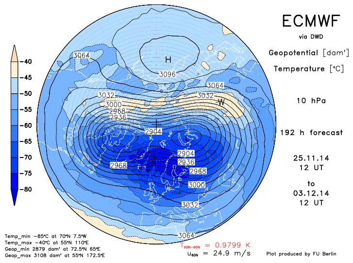
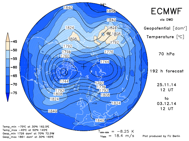
While I can't speak for the exact timing and accuracy of individual models, recent medium range forecasts play right into the forecast from several weeks ago. Much above normal snow cover over Siberia and the heat flux results in a step-down progression of a stratospheric warming event, eventually leading to a disrupted PV and changing pattern by Mid December. Historically, these events have led to a -AO and -NAO response in 2-4 weeks lead time. StratosphereI have quite a few pages of stratospheric information at DaculaWeather.com. Teleconnections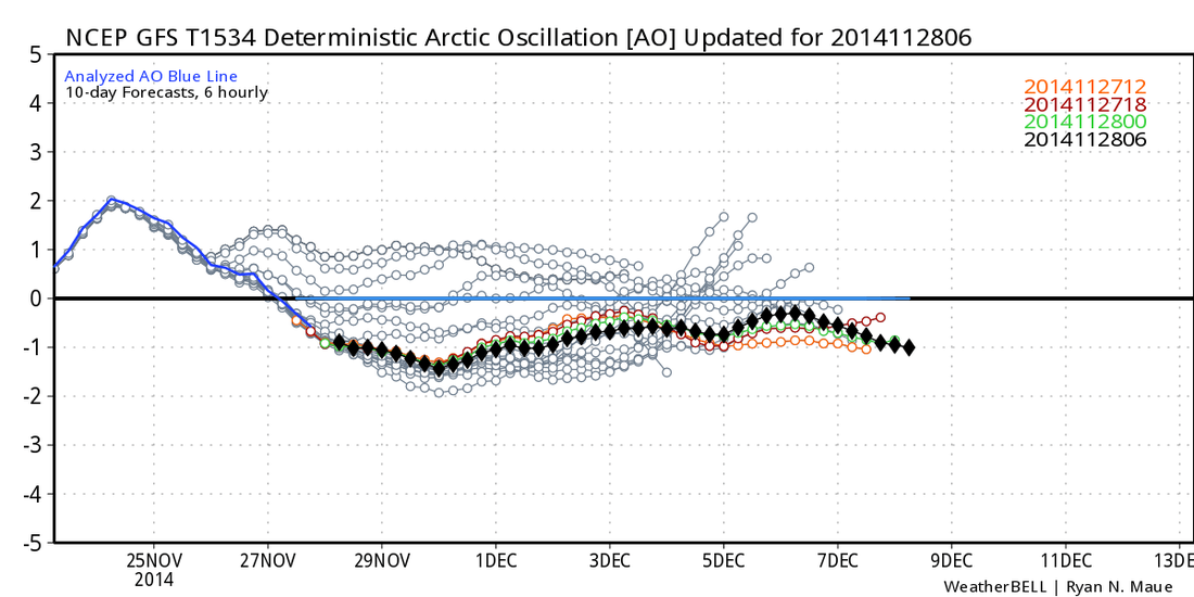 The Arctic Oscillation (AO) and North Atlantic Oscillation (NAO) help to determine the amount of blocking that may or may not appear. The SCE and SAI indexes that have to do with the Eurasian Snow Cover were strongly pointing toward a negative AO which would imply cold air intrusions into the US. If we get a negative NAO, that in conjunction with a -AO would lock in the cold air for an extended time.
But what has happened is that there have been contradictions between the models... within the same model. The 500 MB patterns don't match the teleconnection forecast from the same model. The 500 MB patterns imply warmer weather while the teleconnection patterns point toward cooler than normal temperatures. So the model battles begin. It's always a battle between the models, but rarely is it a battle within the models. It's going to be fun to watch all the twist and turns as the models struggle to come to grip with the change over to the winter pattern. According to all the signs, we're still heading toward a winter to remember. |
Archives
March 2019
Categories
All
|
OLD NORTH GA WX BLOG
 RSS Feed
|
Never base important decisions on this or any weather information obtained from the Internet. Always have a backup method of receiving weather information such as a battery powered weather radio.
Copyright © 2018 NorthGeorgiaWX.com and DaculaWeather.com 
|