|
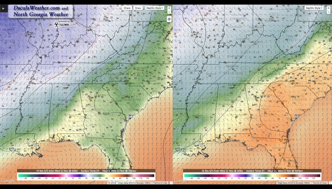
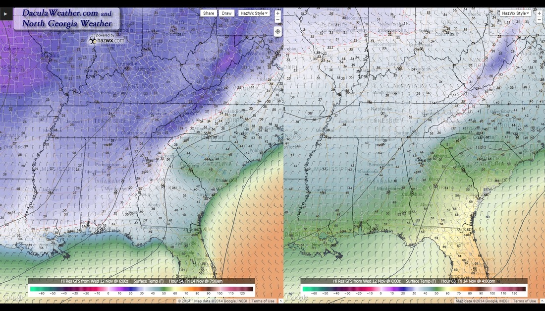
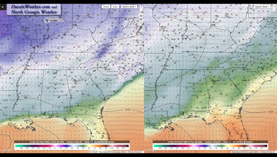
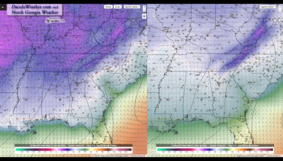
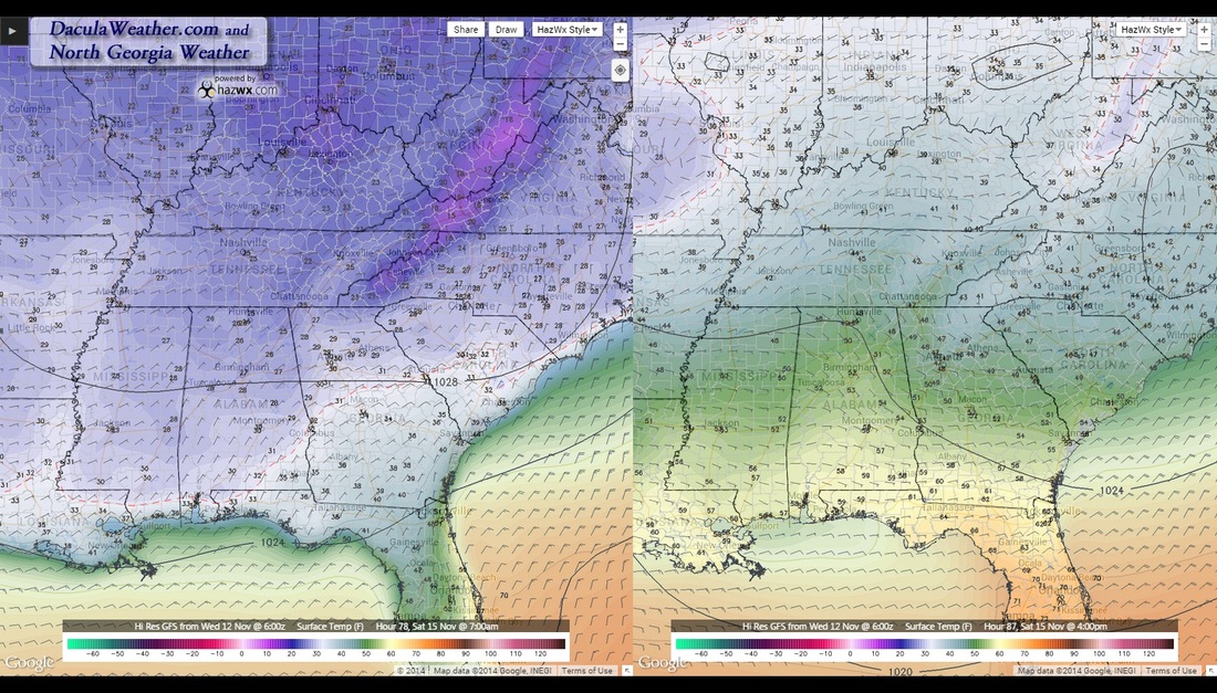
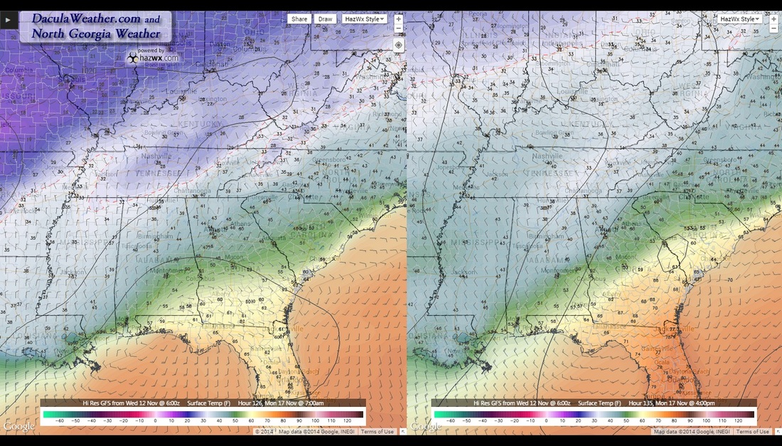
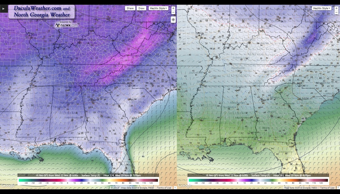
Hope you enjoyed fall, because after tonight, it's only going to be a nice warm memory. As I've been discussing on my North Georgia Weather Facebook page, all the signs have come together and pointing toward a cold and potentially snowy December through February. It just so happens, we're starting early! Also, keep in mind that our "normal" highs and lows right now are 61/40 degrees. Arctic air is slowly oozing south and will enter the metro area later this evening. The front will be slow to move through Atlanta as a small lee side low develops over South Carolina and slows the progression. Of course, the mountains are another obstacle and another reason that this low forms. But the cold air will finally win and by Friday we'll really start to feel the effects. Here's what the Atlanta NWS has to say right now: THE NEXT BIG CHANGE BEGINS SATURDAY NIGHT AS AN OVERRUNNING FLOW DEVELOPS WITH LOW CHANCE PRECIP POTENTIAL STARTING LATE. CURRENT RUNS OF THE EUROPEAN AND GFS ARE NOW SLOWER AND TEMPERATURES WILL BE CRITICAL FOR SOME AREAS OF N GA. THINK LOW TEMPERATURES IN THE LOWER 30S WILL OCCUR EARLY BEFORE PRECIP CHANCES KICK IN AND THIS WILL NEED TO BE MONITORED FOR THE POSSIBLY OF A RAIN/FREEZING RAIN/SNOW These temperatures are going to hang around for a while as a -AO as well as a -NAO continue to build. Here's a look a temperatures for the next 7 days, at 7 AM (left side) and 4 PM (right)
|
Archives
March 2019
Categories
All
|
OLD NORTH GA WX BLOG

 RSS Feed
|
Never base important decisions on this or any weather information obtained from the Internet. Always have a backup method of receiving weather information such as a battery powered weather radio.
Copyright © 2018 NorthGeorgiaWX.com and DaculaWeather.com 
|