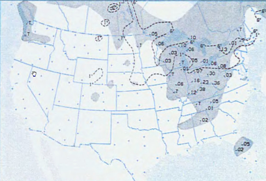
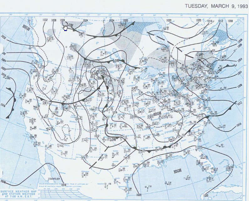
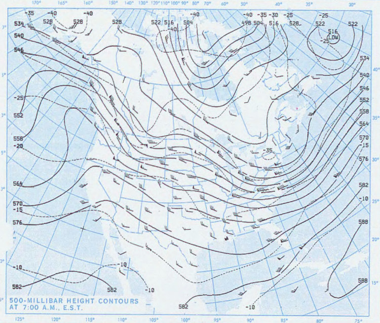
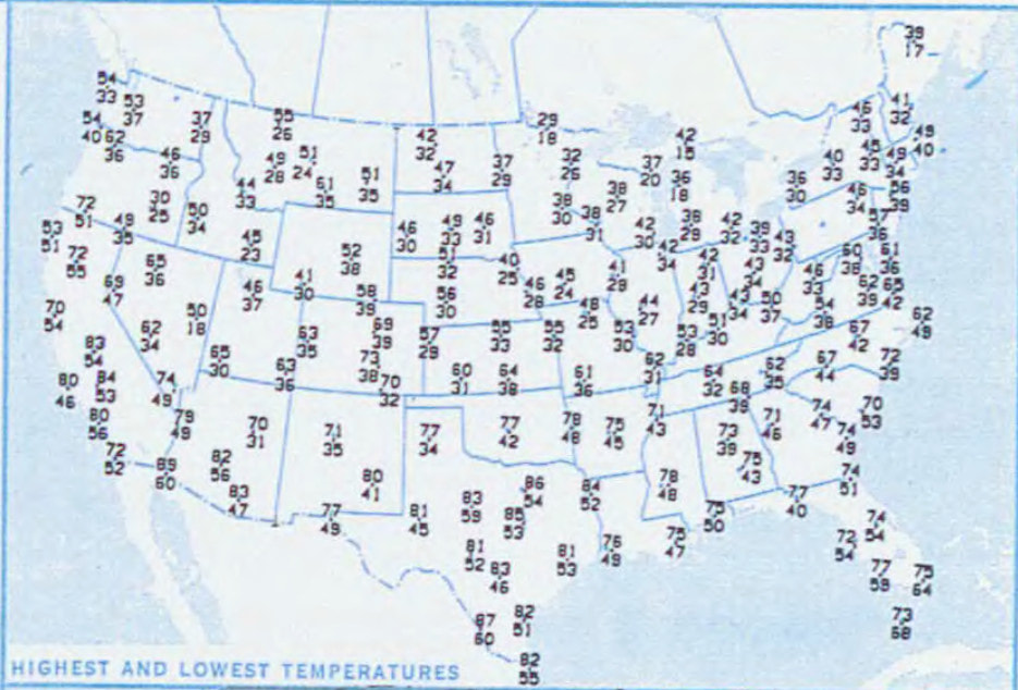
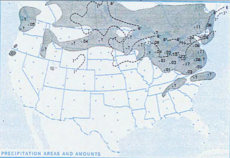
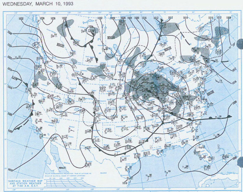
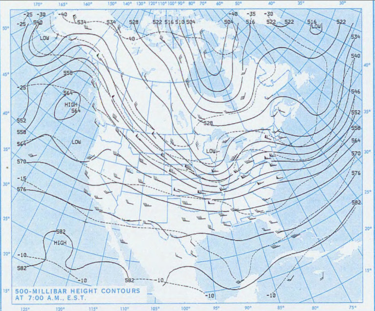
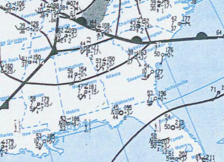
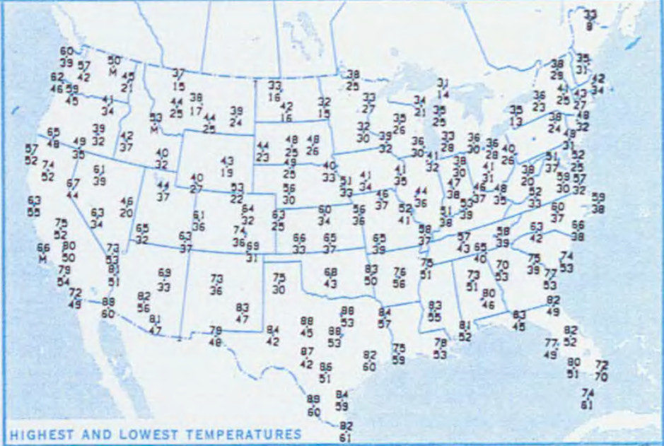
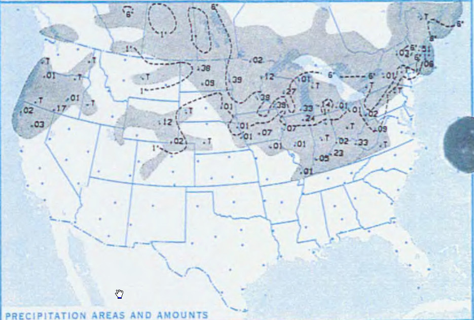
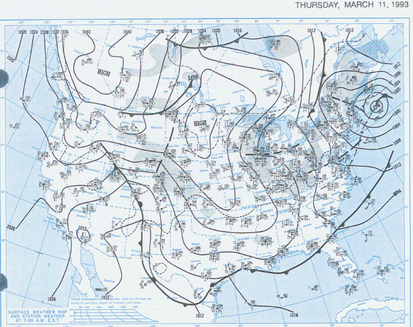
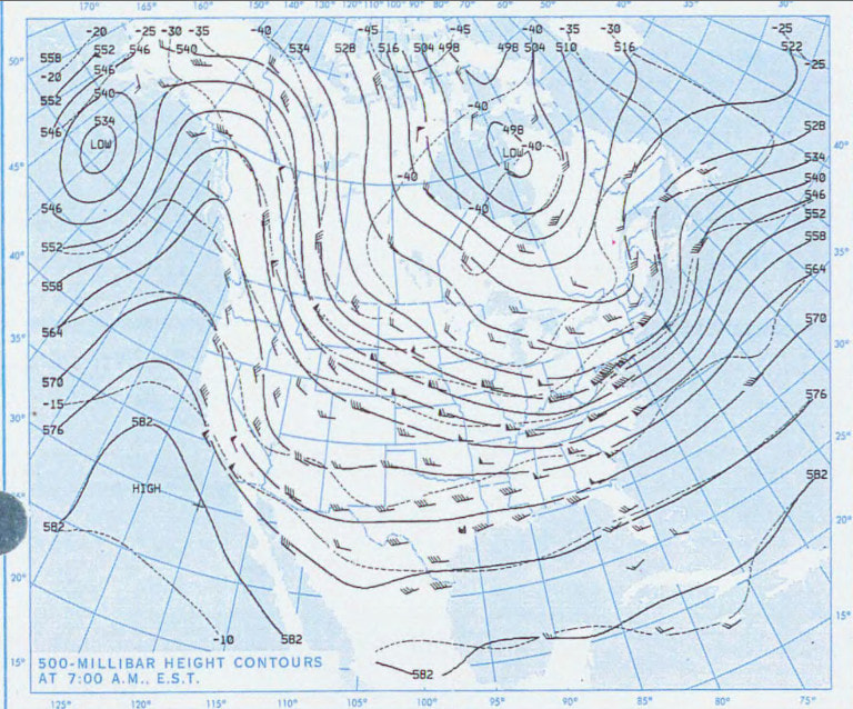
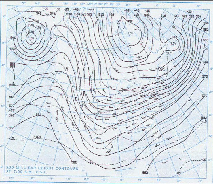
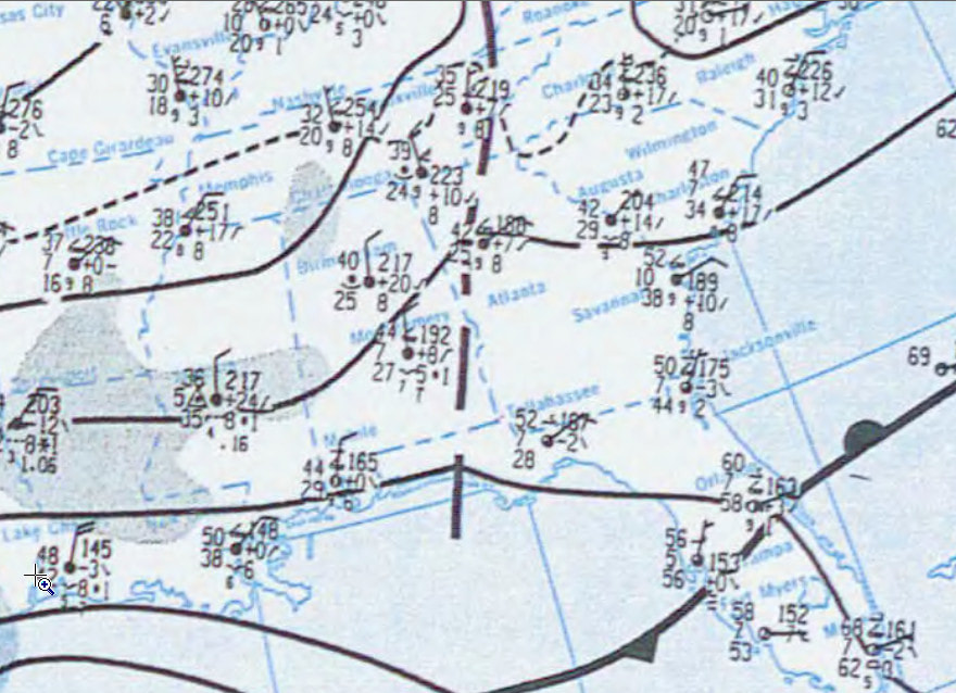
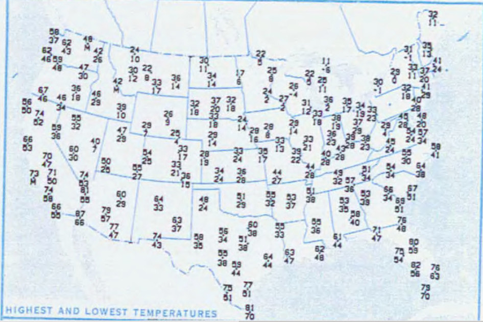
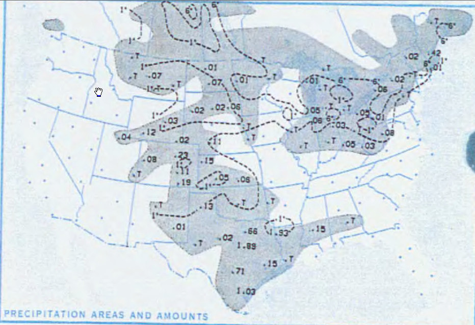
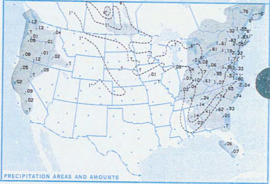
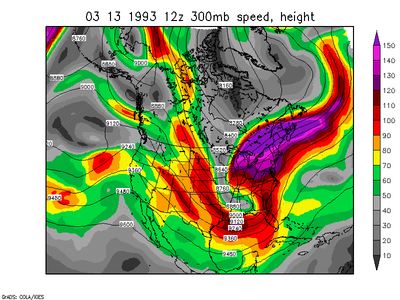
 1993 Storm of The Century Snowfall 1993 Storm of The Century Snowfall I could include a lot of talking here, but by now there is nothing I can add to any previous Storm of The Century post or discussion, but since this will be the 25th anniversary of the storm, I thought I would include the weather maps leading up to the day of the storm as well as the day after (for us). Actually, I can't take credit, Melissa C. on my North Georgia Weather page on Facebook had the suggestion, so thanks to her for the great idea! I'll take a lot of the text from various sources and try to note all of those in the correct places, but most of the text comes from Wikipedia except where noted. You can also find additional information from several NWS offices that were impacted by the storm. Here are a few links:
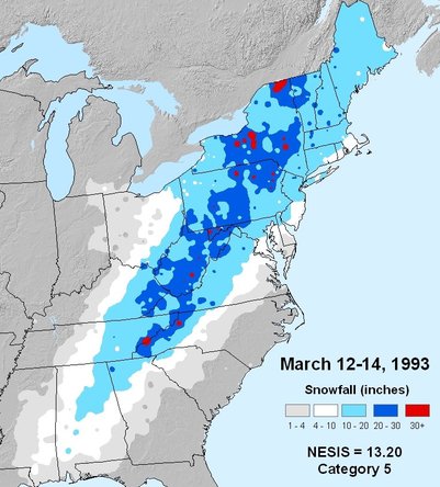
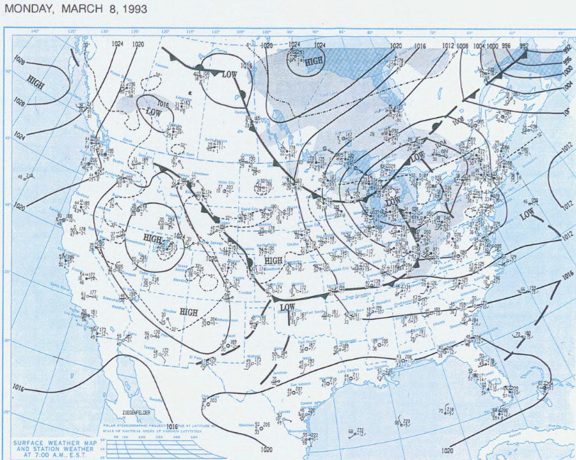
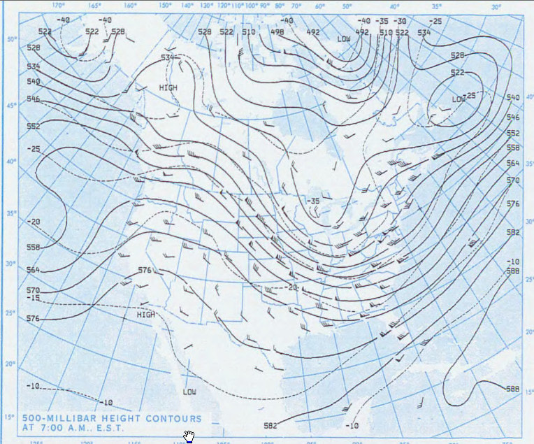
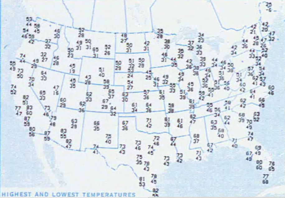
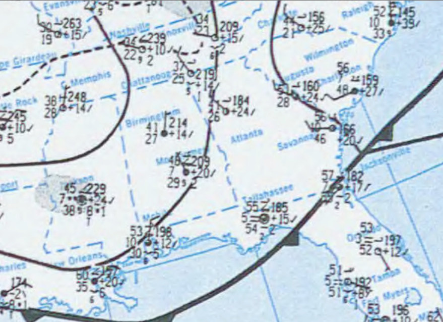
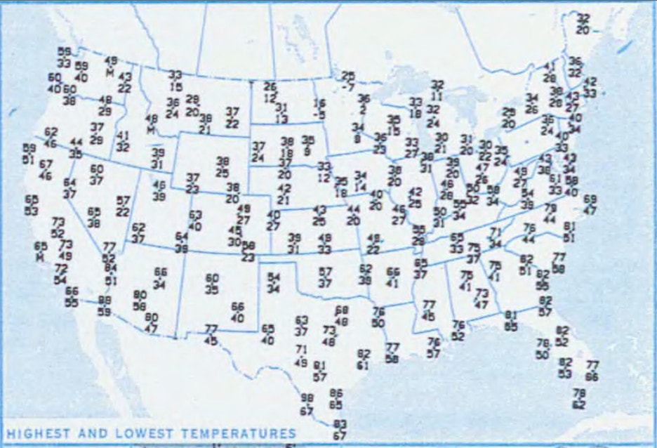
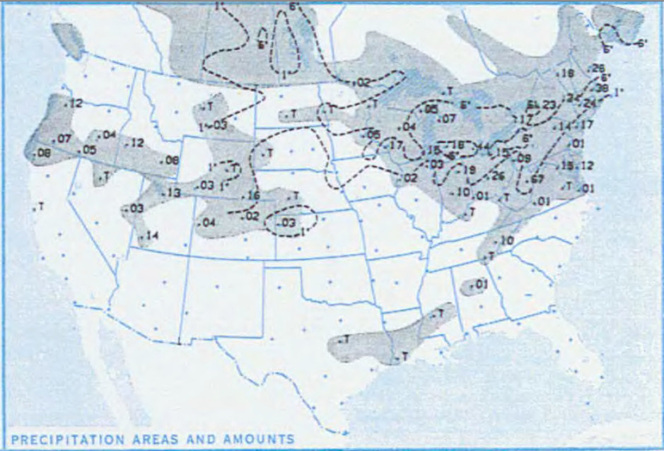
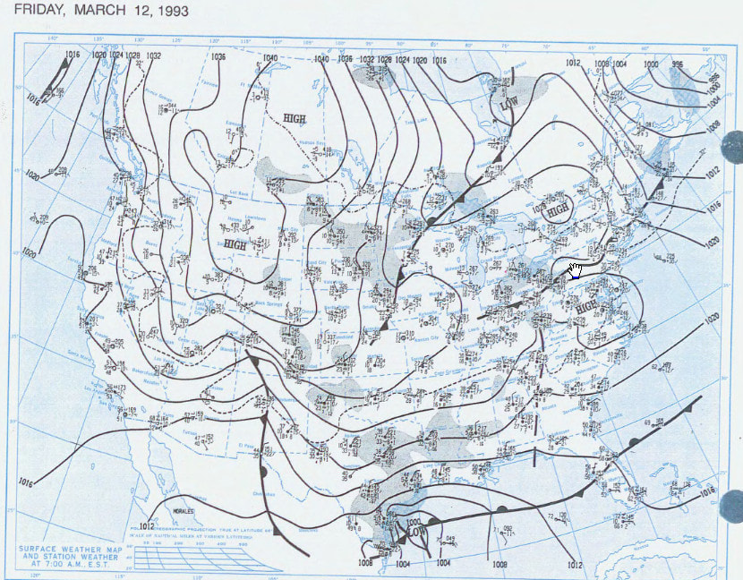
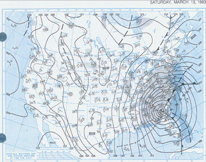
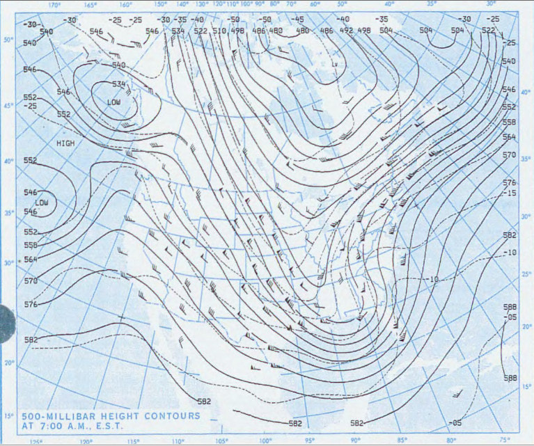
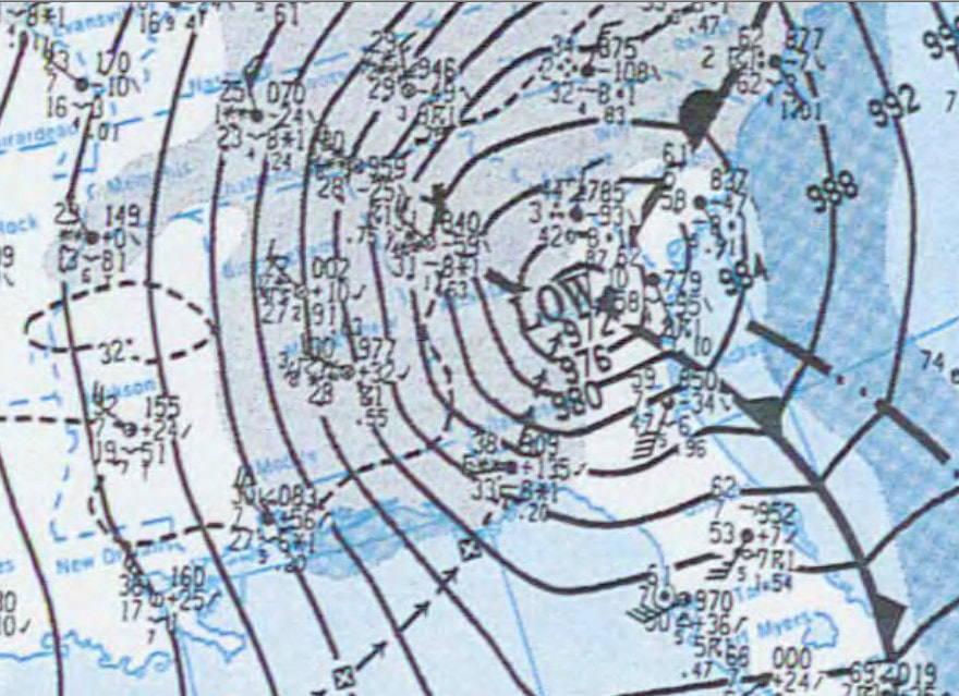
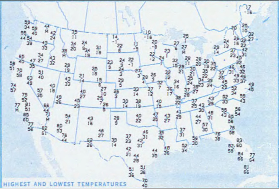
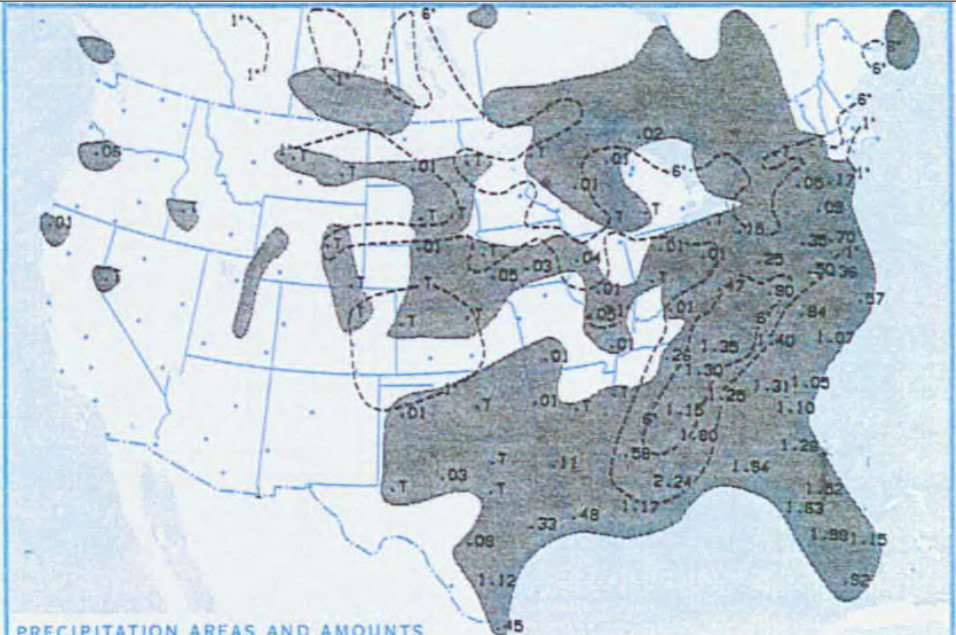
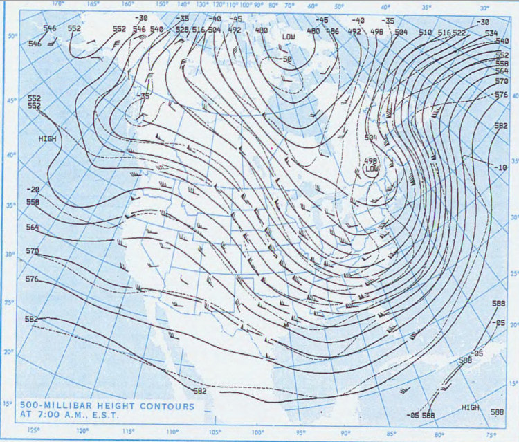
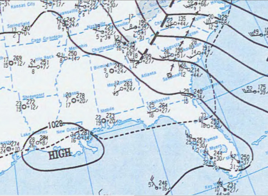
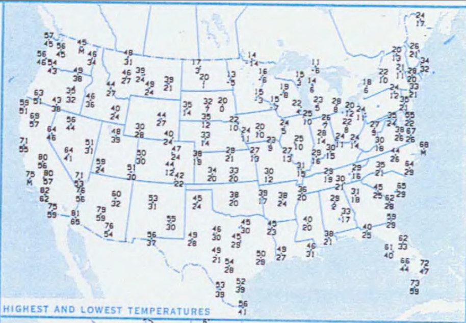
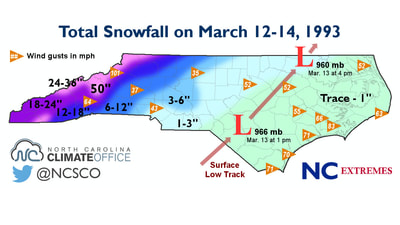
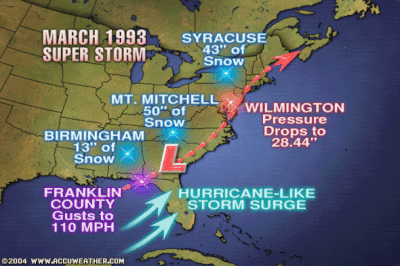
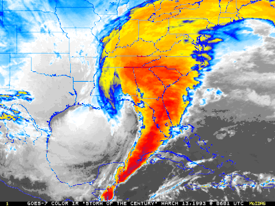
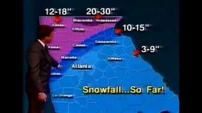
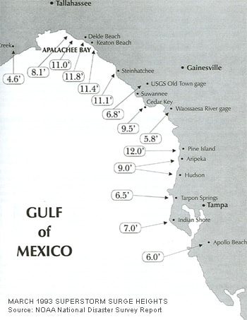
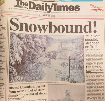
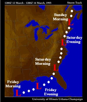
Monday March 8, 1993 "The 1993 Storm of the Century (also known as the '93 Superstorm, The No Name Storm, or the Great Blizzard of 1993) was a large cyclonic storm that formed over the Gulf of Mexico on March 12, 1993. The storm was unique and notable for its intensity, massive size, and wide-reaching effects; at its height, the storm stretched from Canada to Honduras. The cyclone moved through the Gulf of Mexico and then through the eastern United States before moving on to Canada. The storm eventually dissipated in the North Atlantic Ocean on March 15, 1993. The 1993 Storm of the Century marked a milestone in the weather forecasting of the United States. By March 8, 1993, several operational numerical weather prediction models and medium-range forecasters at the United States National Weather Service recognized the threat of a significant snowstorm. This marked the first time National Weather Service meteorologists were able to predict accurately a system's severity five days in advance. Official blizzard warnings were issued two days before the storm arrived, as shorter-range models began to confirm the predictions. Forecasters were finally confident enough of the computer-forecast models to support decisions by several northeastern states to declare a State of Emergency even before the snow started to fall." Tuesday March 9, 1993 Wednesday March 10, 1993 Thursday March 11, 1993 "During March 11 and 12, 1993, temperatures over much of the eastern United States began to drop as an arctic high pressure system built over the Midwest and Great Plains. Concurrently, an extratropical area of low pressure formed over Mexico along a stationary front draped west to east." Friday March 12, 1993 "By the afternoon of March 12, a defined air mass boundary was present along the deepening low. An initial burst of convective precipitation off the southern coast of Texas (facilitated by the transport of tropical moisture into the region) enabled initial intensification of the surface feature on March 12. Supported by a strong split-polar jet stream and a shortwave trough, the nascent system rapidly deepened." Saturday March 13, 1993 "The system's central pressure fell to 991 mbar (29.26 inHg) by 00:00 UTC on March 13. A powerful low-level jet over eastern Cuba and the Gulf of Mexico enhanced a cold front extending from the low southward to the Isthmus of Tehuantepec. Furthermore, the subtropical jet stream was displaced unusually far south, reaching into the Pacific Ocean near Central America and extending toward Honduras and Jamaica. Intense ageostrophic flow was noted over the southern United States, with winds flowing perpendicular to isobars over Louisiana. As the area of low pressure moved through the central Gulf of Mexico, a short wave trough in the northern branch of the jet stream fused with the system in the southern stream, which further strengthened the surface low. A squall line developed along the system's cold front, which moved rapidly across the eastern Gulf of Mexico through Florida and Cuba. The cyclone's center moved into north-west Florida early on the morning of March 13, with a significant storm surge in the northwestern Florida peninsula that drowned several people." Sunday March 14, 1993 "Barometric pressures recorded during the storm were low. Readings of 976.0 millibars (28.82 inHg) were recorded in Tallahassee, Florida, and even lower readings of 960.0 millibars (28.35 inHg) were observed in New England. Low pressure records for March were set in areas of twelve states along the Eastern Seaboard, with all-time low pressure records set between Tallahassee and Washington, D.C. Snow began to spread over the eastern United States, and a large squall line moved from the Gulf of Mexico into Florida and Cuba. The storm system tracked up the East Coast during Saturday and into Canada by early Monday morning. In the storm's wake, unseasonably cold temperatures were recorded over the next day or two in the southeast." Impacts "The storm complex was large and widespread, affecting at least 26 US states and much of eastern Canada. It brought in cold air along with heavy precipitation and hurricane-force winds which, ultimately, caused a blizzard over the affected area; this also included thundersnow from Georgia to Pennsylvania and widespread whiteout conditions. Snow flurries were seen in the air as far south as Jacksonville, Florida, and some areas of central Florida received a trace of snow. The storm severely impacted both ground and air travel. Airports were closed all along the eastern seaboard, and flights were cancelled or diverted, thus stranding many passengers along the way. Every airport from Halifax, Nova Scotia, to Tampa, was closed for some time because of the storm. Highways were also closed or restricted all across the affected region, even in states generally well prepared for snow emergencies. Some affected areas in the Appalachian Mountain region saw 5 feet (1.5 m) of snow, and snowdrifts were as high as 35 feet (11 m). Mount Leconte, Tenn. recorded 60 inches of snowfall and Mount Mitchell, N.C. recorded 49 inches. The volume of the storm's total snowfall was later computed to be 12.91 cubic miles (53.8 km3), an amount which would weigh (depending on the variable density of snow) between 5.4 and 27 billion tons. The weight of the record snowfalls collapsed several factory roofs in the South; and snowdrifts on the windward sides of buildings caused a few decks with substandard anchors to fall from homes. Though the storm was forecast to strike the snow-prone Appalachian Mountains, hundreds of people were nonetheless rescued from the Appalachians, many caught completely off guard on the Appalachian Trail or in cabins and lodges in remote locales. Snow drifts up to 14 feet (4.3 m) were observed at Mount Mitchell. Snowfall totals of between 2 and 3 feet (0.61 and 0.91 m) were widespread across northwestern North Carolina. Boone, North Carolina— in a high-elevation area accustomed to heavy snowfalls — was nonetheless caught off guard by 30" plus of snow and 24 hours of temperatures below 11 °F (-12 °C). Boone's Appalachian State University closed that week, for the first time in its history. Stranded motorists at Deep Gap broke into Parkway Elementary School to survive and National Guard helicopters dropped hay in fields, to keep livestock from starving in northern N.C. mountain counties. Electricity was not restored to many isolated rural areas for up to three weeks, with power cuts occurring all over the east. Nearly 60,000 lightning strikes were recorded as the storm swept over the country for a total of 72 hours. As one of the most powerful, complex storms in recent history, this March 1993 storm was described as the "Storm of the Century" by many of the areas affected. The United States Coast Guard dealt with "absolutely incredible, unbelievable" conditions within the Gulf of Mexico. The 200-ft. freighter Fantastico sank 70 miles off of Ft. Myers, Florida, during the storm. Seven of her crew died when a Coast Guard helicopter was forced back to base due to low fuel levels after rescuing three of her crew. The 147-ft. freighter Miss Beholden ran aground on a coral reef ten miles from Key West, Florida. Several other smaller vessels sank in the rough seas. In all, the Coast Guard rescued 235 people from over 100 boats across the Gulf of Mexico during the tempest. Besides producing record-low barometric pressure across a swath of the southeast and Mid-Atlantic states, and contributing to one of the nation's biggest snowstorms, the low produced a potent squall line ahead of its cold front. The squall line produced a serial derecho as it moved into Florida and Cuba shortly after midnight on March 13. Straight-line winds gusted above 100 mph (87 kn, 160 km/h) at many locations in Florida as the squall line moved through. The supercells in the derecho produced eleven tornadoes. One tornado killed three people when it struck a home which later collapsed, pinning the occupants under a fallen wall. A substantial tree fall was seen statewide from this system. A substantial storm surge was also generated along the gulf coast from Apalachee Bay in the Florida Panhandle to north of Tampa Bay. Due to the angle of the coast relative to the approaching squall, Taylor County along the eastern portion of Apalachee Bay and Hernando County north of Tampa were especially hard-hit. Storm surges in those areas reached up to 12 feet (3.7 m), higher than many hurricanes. With little advance warning of incoming severe conditions, some coastal residents were awakened in the early morning of March 13 by the waters of the Gulf of Mexico rushing into their homes. More people died from drowning in this storm than during Hurricanes Hugo and Andrew combined. Overall, the storm's surge, winds, and tornadoes damaged or destroyed 18,000 homes. A total of 47 lives were lost in Florida due to this storm." Videos about the storm
Image Gallery
|
Archives
March 2019
Categories
All
|
OLD NORTH GA WX BLOG



 RSS Feed
