|
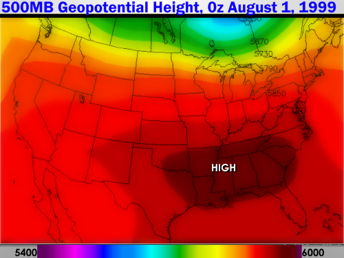
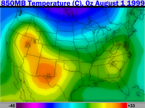
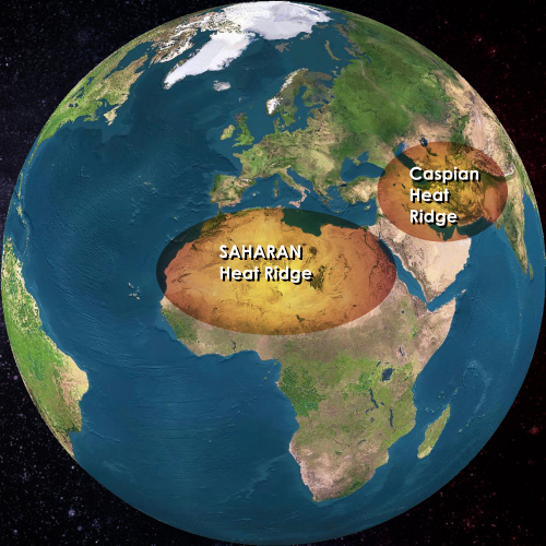
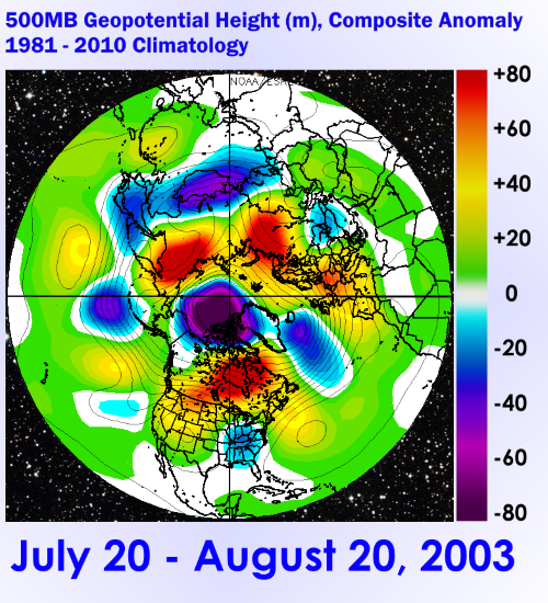
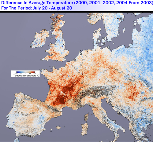
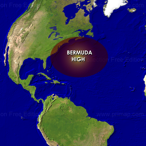
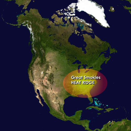
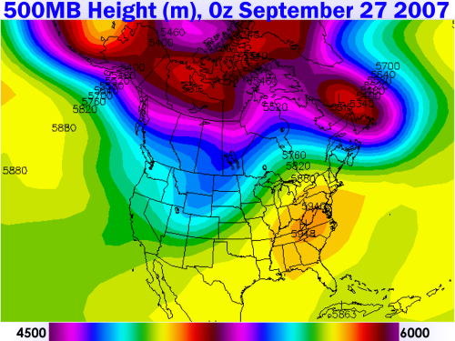
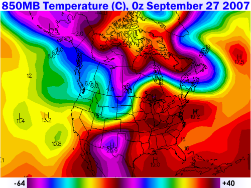
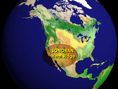
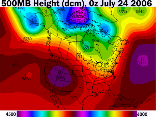
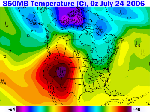
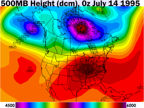
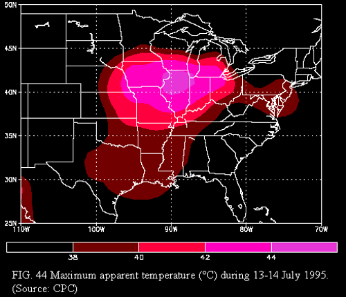
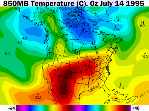
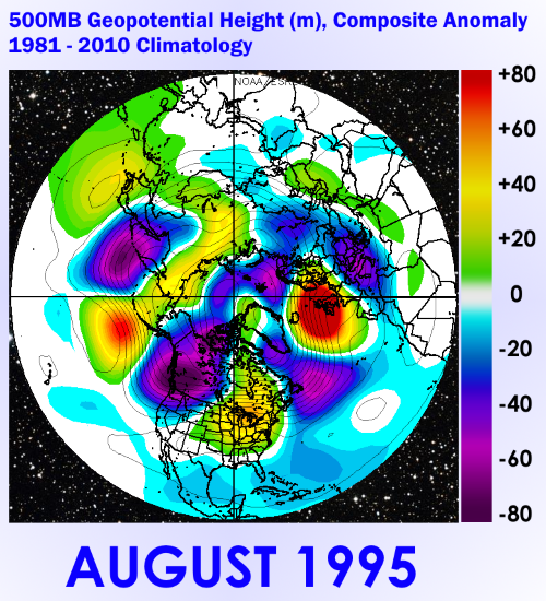
The following post comes from meteorologist Larry Cosgrove from an email I received from him earlier, so all credit for this information and images goes to Larry. I thought that it was too valuable not to share. Definition Of Heat Ridge (also known as Subtropical High) In order to be classified as a heat ridge (synonym: subtropical high), an anticyclone must have an identifiable core circulation or center that builds to 5880dcm or greater at the 500MB level. These ridges are typically associated with daily maxima in excess of 90 deg F at surface which may continue over a period of many days, weeks, and perhaps months (in rare cases). How To Look For Heat Ridge Formation On Weather Charts There are three synoptic charts which can tell you of a threat for serious rises in temperatures that are associated with the formation and placement of subtropical highs. As a first order of business, check the 1000-500MB thickness charts for readings of greater than 5760dcm. This measurement is the distance between the mid-levels of the atmosphere and close to the surface or sea-level. Next, go the 850MB temperature forecast maps. This corresponds to about 5000 feet above surface, and is a reliable indicator of increasing heat at lower levels. When 850MB readings go higher than 20 deg C, corresponding sea level readings will be above 100 deg F (or 95 deg F when dewpoints exceed 70 F). Then retrieve the 500MB graphics, and look for the "H" on the map with core readings above 5880dcm. If a closed circulation greater than that height level is found, expression of surface hot weather will be more widespread. If the highest value in decameters exceeds 5940, then a critical heat wave may occur. In rare cases, the center of the upper level high may reach or exceed 6000dcm. In such scenarios, barring unforeseen anomalies such as sea breezes, trapped marine layers, or valley fog banks, readings may greatly surpass 100 deg F for a number of days. As a last precaution, check out the 700MB relative humidity charts to see if maximum (or at least partial) sunshine is achieved. If the demarcation is below 60 percent, then enough insolation will be present with the compressed, subsident, capped atmosphere to yield dangerous heat levels at surface. Saharan Heat Ridge SystemIt figures that a vast desert would be the site of continued hot and dry weather. And truth be told, the Sahara Desert is, for the much if not most of any given year, the location for a semi-permanent ridge complex. Simply termed the "Saharan Heat Ridge", this anticyclone is the largest of all 500MB ridges and is the determinant for temperature and general weather trends in Europe, the Middle East, the northern half of Africa. Occasionally, the ridge complex will partition, with one portion of ridging lodging over Iran and the Caspian Sea. In such situations, pollution may build across cities in Persia and the Caucasus, with higher relative humidity an issue over Mesopotamia and the Arabian Peninsula. The position and strength of the positive height anomaly also affects tropical cyclone formation in summer and fall in two ways: setting up an east-to-west steering mechanism for impulses along the ITCZ and also, through imparting dry air and desert sand/dust into the disturbances, eliminating many of the waves through elimination of thunderstorms. A rule to follow: the weaker and more northward the position of the Saharan anticyclone, the better chance that any given low pressure area emerging off of western African shoreline (i.e. "Cape Verde" cyclones) will survive and intensify across warming waters over the equatorial Atlantic Ocean. It is interesting to note that during the "fatal summer" in Europe during the July/August period of 2003, the Saharan heat ridge was not exceptionally strong. But the ridge core was positioned in such a way as to funnel the cTw air quickly northward into France, since a trough offshore of the European subcontinent remained stationary. Thus, no relief from precipitation occurred. And some communities had to deal with nearly a solid month of readings in excess of 100 deg F. Azores High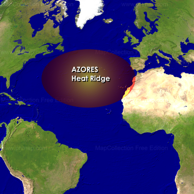 Image courtesy of Larry Cosgrove Image courtesy of Larry Cosgrove The Azores High is a smaller heat ridge located near the island group of the same name. Unlike its larger companion ridge to the east, this anticyclone is a standard fixture only in the summer (although the circulation can turn up at any time of the year). The importance of the appearance of an Azores High is simple: if the ridge is not present, developing tropical waves will recurve northward into the cooler waters of the northern Atlantic Ocean. Also, in cases where this ridging links or becomes merged with the Saharan ridge complex, sand and dust from the desert may move westward, eliminating convection and thereby weakening or destroying ITCZ-born impulses before warm-core cyclogenesis can occur. Bermuda HighBy itself, the Bermuda High (centered over the Sargasso Sea or near the island commonwealth of the same name) is NOT a frequent contributor to heat waves in the U.S., although its presence favors higher temperatures and sometimes extremely high dewpoints and relative humidity. Since winds about this anticyclone pass over vast quantities of water, the resultant weather pattern is usually accompanied by unstable air with frequent bouts of diurnal or sea breeze convection (thus providing some measure of cooling in late afternoon and evening). This ridge complex is a critical player in steering and development of tropical cyclones; in the classic position any disturbance near the Greater Antilles, or just north of same, will almost always strike the continental U.S. And if the SST profile is favorable (warm), the outflow capability provided by the high should enable intensification of any nearby warm-core low. Great Smokies Heat RidgeIn many cases, the Bermuda High may shift westward, or bridge into an extension centered over the southeastern U.S. In such cases (common under "La Nina" episodes, such as September 2007), this type of heat ridge may last well into the fall. The lower half of the Appalachian Mountain chain is called "the Great Smokies" because early settlers saw haze and smoke trapped over the mountains as a result of stagnant high pressure. When this anticyclone is present, extremely high temperatures, air pollution, and persistent drought will result from the Mason-Dixon line to the Gulf Coast, and often westward to the Ozark Plateau. Sonoran Heat RidgeThe Sonoran heat ridge derives its name from the desert of the same name, which straddles the Mexican border with California, Arizona, and New Mexico. A critical player in summer heat waves over the Southwest, this anticyclone acts in concert with topography and the general atmospheric circulation to enhance heat and drought. If the positive height anomaly becomes situated over the Great Basin and expands westward, then the mP marine layer will stay offshore and the cities of San Francisco, Sacramento, Los Angeles and San Diego will go through an excruciating hot spell with high demands on the power grid (example: July 24 - August 17 2006). Northward extension of the subtropical high brings unusual heat to the Pacific Northwest, while dislocation of the highest 500MB heights can render the Salt Lake Valley, Denver CO, and points eastward into the Great Plains a veritable furnace with blinding sunshine and parched ground. Conjoined Anticyclones And Mega-RidgesWhen searching for exceptionally long and punishing heat wave threats, look at model representations at 500MB where ridging above 5880 dcm and higher occurs in a conjoined or geographically expansive display. The more coverage of subsidence, the lesser the chance for clouds and precipitation that would hinder the rise of temperatures under broad daylight. A broad anticyclonic circulation can steer deep mean easterlies carrying higher dewpoints away from a target heat zone. Evidence the scene over the central and eastern U.S. in July and August 1995, where a merger of sorts between the Sonoran and Great Smokies heat ridge created a widespread case of fatal hyperthermia in the Chicago IL metro (July 9 - 14), and extreme drought with hot weather in the Mid-Atlantic region. SummaryA "heat ridge" or "subtropical high" is often the driver of periods of extensive hot air. Climate studies have revealed key favored positions for these anticyclones: the Sahara Desert (occasional extension to Iran and the Caspian Sea), the Azores chain, Bermuda/western Atlantic Ocean, the Great Smokies Range, and the Sonoran Desert. Additionally, sometimes these positive 500MB height anomalies will link or merge, resulting in critical spells of severe heat that can tax the power grids, fuel resources and public utilities. |
Archives
March 2019
Categories
All
|
OLD NORTH GA WX BLOG


 RSS Feed
