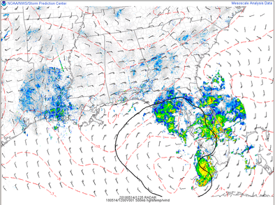
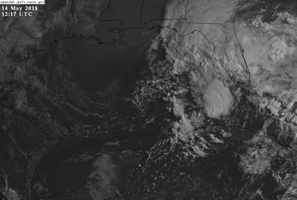
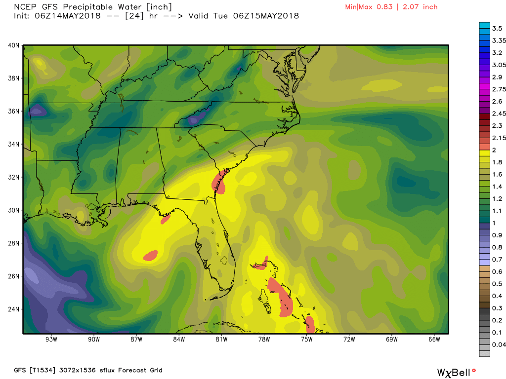
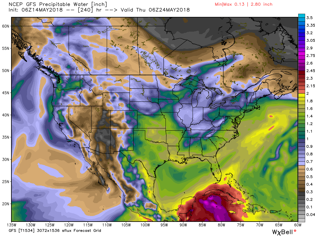
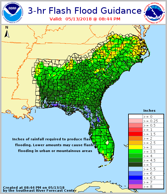
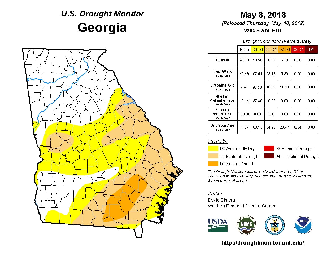
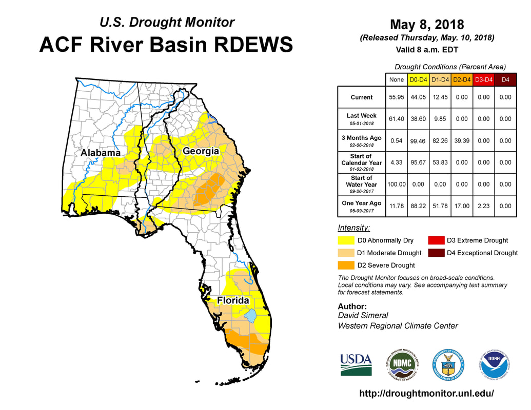
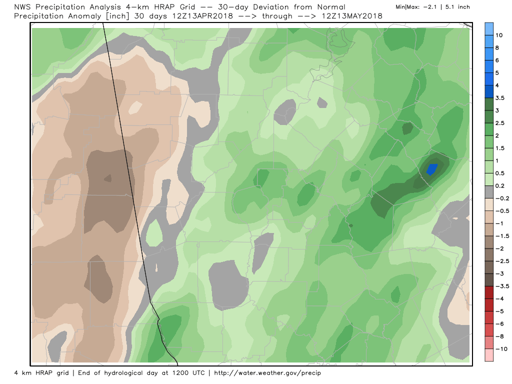
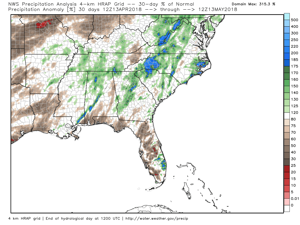
 500 MB Upper Level Low 500 MB Upper Level Low It finally looks like we'll be getting the much needed rainfall this week as a early season tropical feature takes shape in the Gulf of Mexico. The models are showing a surface low forming in the east Gulf off the west coast of Florida today. Satellite imagery show a large area of disturbed weather over the state of Florida, as well as offshore to the west of the state this morning. This area is getting stirred up from an upper level low that is currently spinning over the Gulf and this is slowly transferring to the surface. Depending on the model, this low will move up the west coast, take a turn west, circle back out into the Gulf and then back up across Georgia. There is some consistency in the models for this development, both from the numerical models as well as the ensembles, so it is looking like the drought conditions for Florida and parts of Georgia will be wiped clear. The Weather Prediction Center's Day 2 Outlook talks about the potential of 3"+ of rainfall over areas of the southeast. 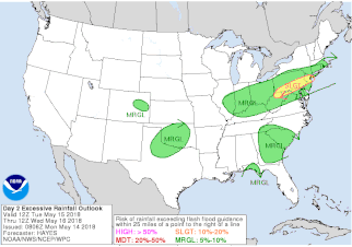 WPC Day 2 (8 AM Tue - 8 AM Wed) Excessive Rainfall Outlook WPC Day 2 (8 AM Tue - 8 AM Wed) Excessive Rainfall Outlook Day 2... As the closed mid level low crosses the Gulf Coast and reaches the Southeast states during Day 2, a low level southwest flow continues to transports 1.75/2.00 inch precipitable water air (which is between two and three standard deviations above the mean) across much of FL, as well as GA/SC into NC. Model soundings showed moderate instability over these areas, and the moisture and instability is expected to feed mainly diurnal convection. Slow cells motions associated with the mid level system could result in local 3.00+ inch rainfall amounts over GA/SC/NC, and despite the fairly high three hour flash flood guidance (see image below), may pose a flash flood threat during Day 2. Thus, a large Marginal Risk was placed here. Further south over the FL Panhandle and portions of southern AL, a surface system associated with the mid level low meanders just offshore. There is some spread on how fast the system moves northward, but there is some signal that the low level southeast flow ahead of it could begin to transports higher moisture to the Gulf Coast. While the highest QPF totals were kept offshore during Day 2, there could be enough convection across the Gulf Coast for localized flash flooding issues, so a Marginal Risk was placed here for Day 2. (WPC Quantitative Precipitation Forecast Discussion) The surge of moisture will slowly begin through the day today and will take precipitable water values over the 1.5" range for the southeast for the rest of the week and through the weekend. Toward the end of the extended period, the GFS is showing the potential for another tropical type system, so it is something that may need to be watched as time goes on. According to Joe D'Aleo at Weatherbell, the 500mb day 8 and day 11 analogs from CPC had years with 8 tropical events, 1 tropical storm and 2 hurricanes. There are areas across the southeast that are in drought conditions but most of the area has actually had normal to above normal rainfall over the last 30 days. |
Archives
March 2019
Categories
All
|
OLD NORTH GA WX BLOG
 RSS Feed
