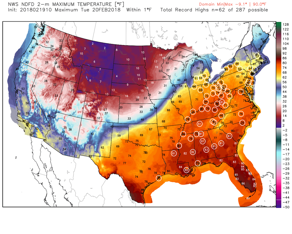
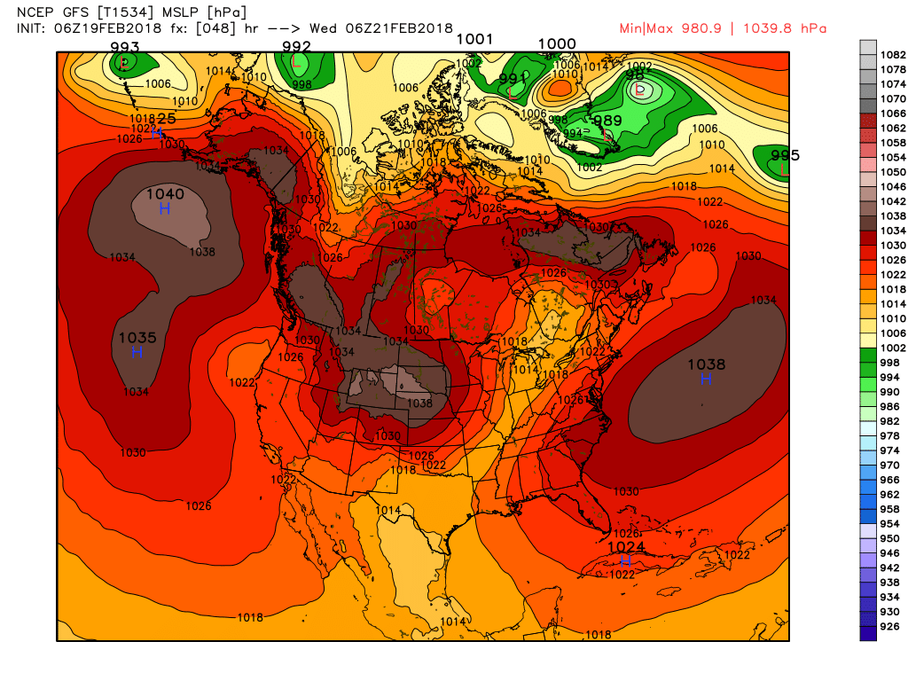
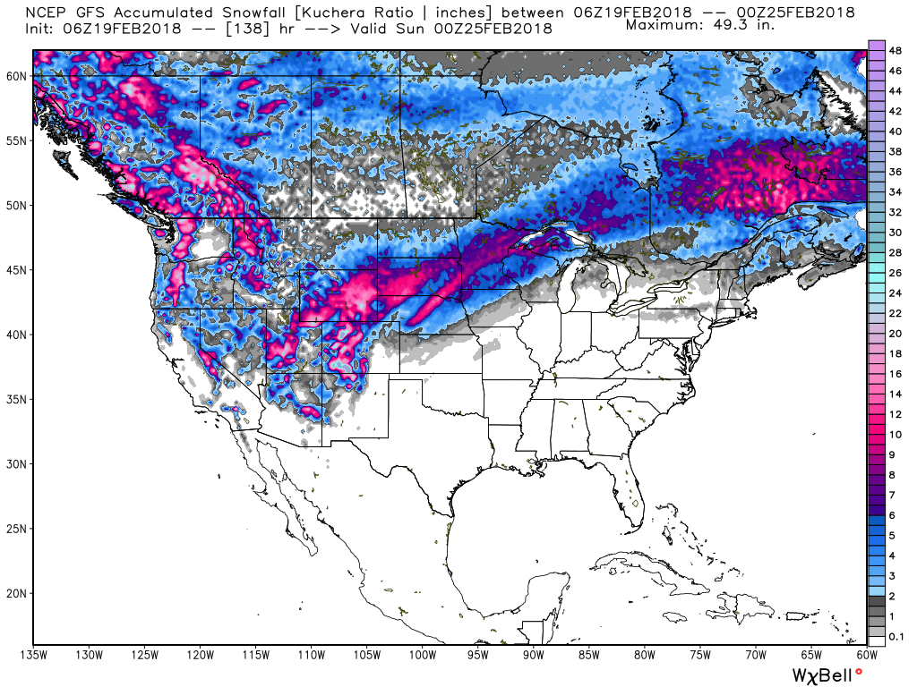
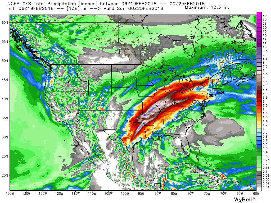
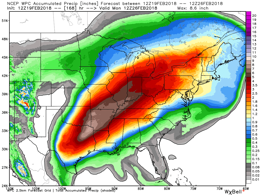
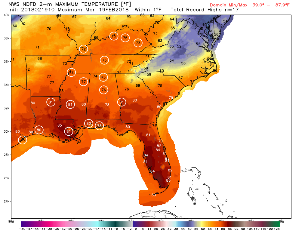
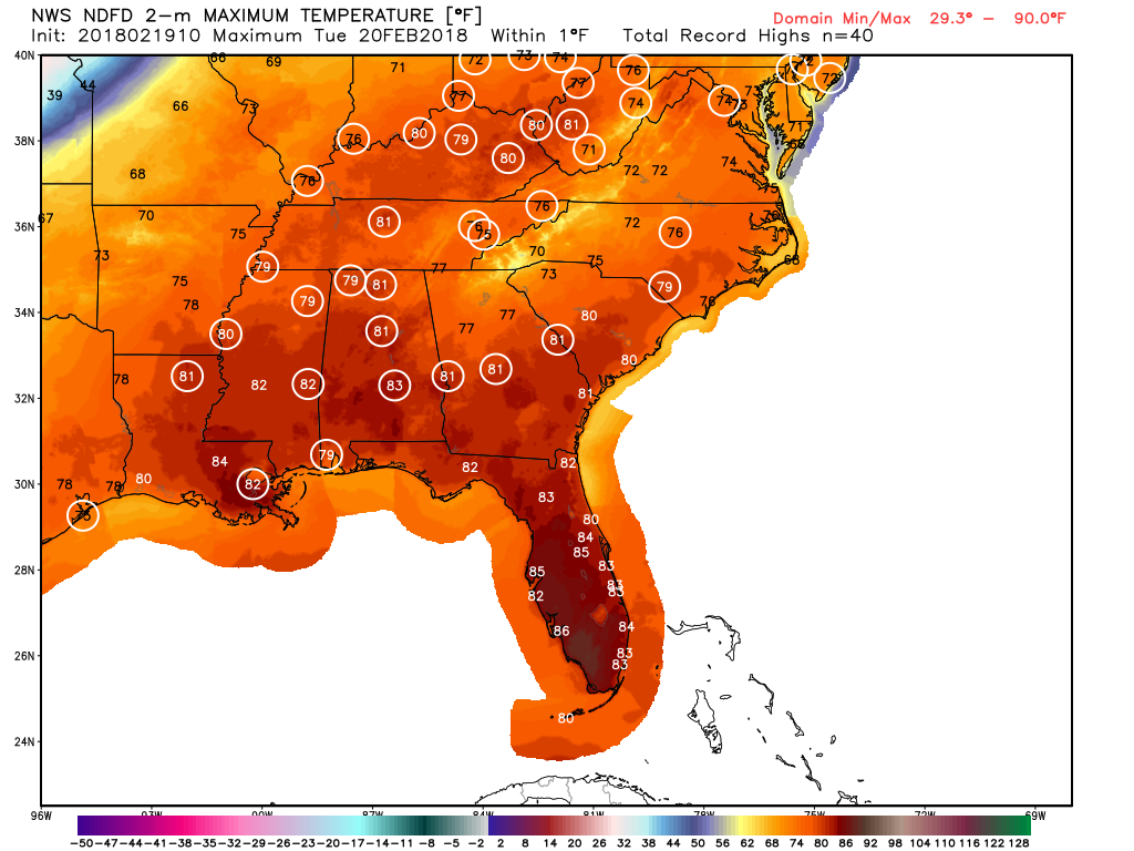
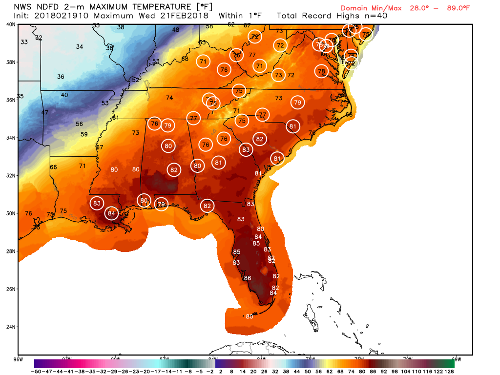
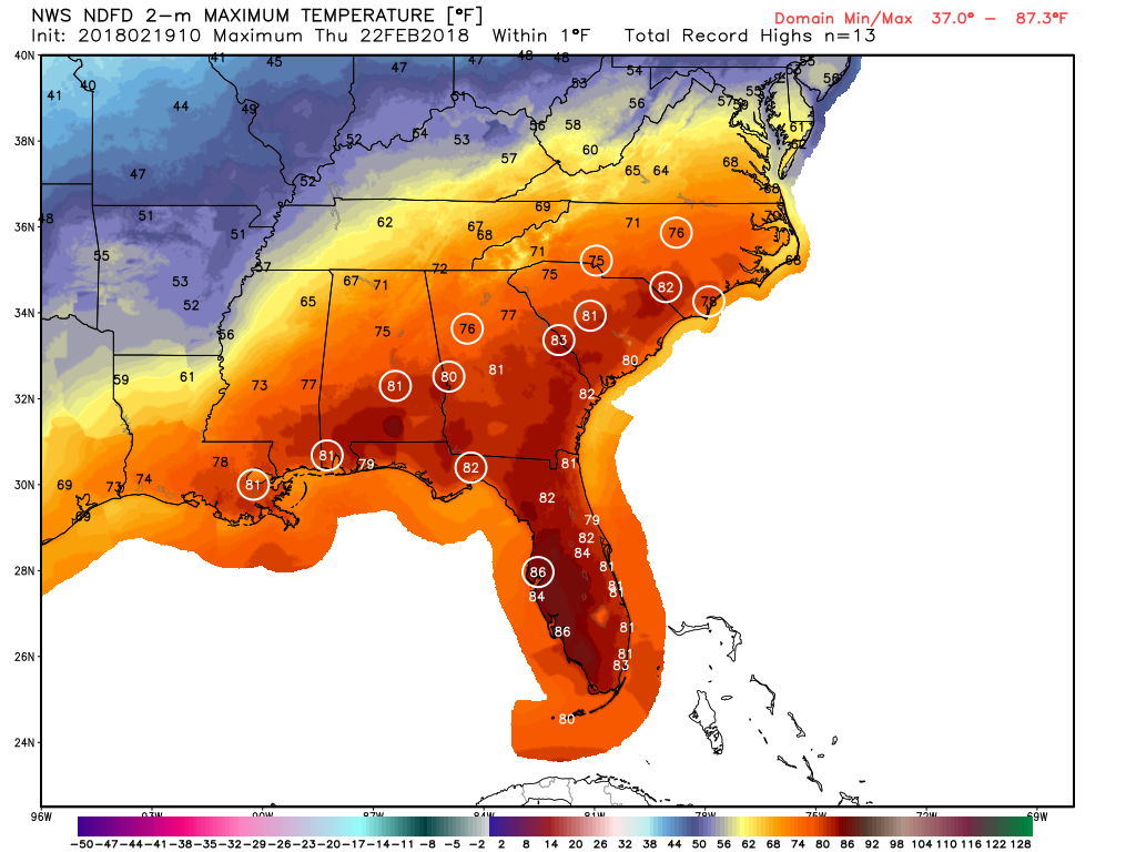
 Potential high temp records that may be broken on Tuesday Potential high temp records that may be broken on Tuesday Temperature records are going to be challenged this week as our warmest period of the winter is about to get underway. A pair of dueling 1038 mb high pressure areas (image #2), one out in the Atlantic and one over the central plains, are battling to see which one will be the strongest, and for us in the southeast, the one in the Atlantic is going to win out. A warm moist flow around the periphery of the high pressure will keep our temperature anomalies running 15-20 degrees above normal for highs and 20-25 degrees above normal for our lows. In between, a precipitation battleground is shaping up with large quantities of rainfall (image #3) on the southern edge and heavy snow (image #4) on the northern side. Some of this precipitation could be heavy and some areas across the central part of the country could see upwards of 8 inches of rainfall (image #5) over the next 7 days. When we have these types of clashes between two very different air masses, severe weather is usually a by-product, and there will be a slight change for severe across the middle of he country, especially on Tuesday. All images from WeatherBELL
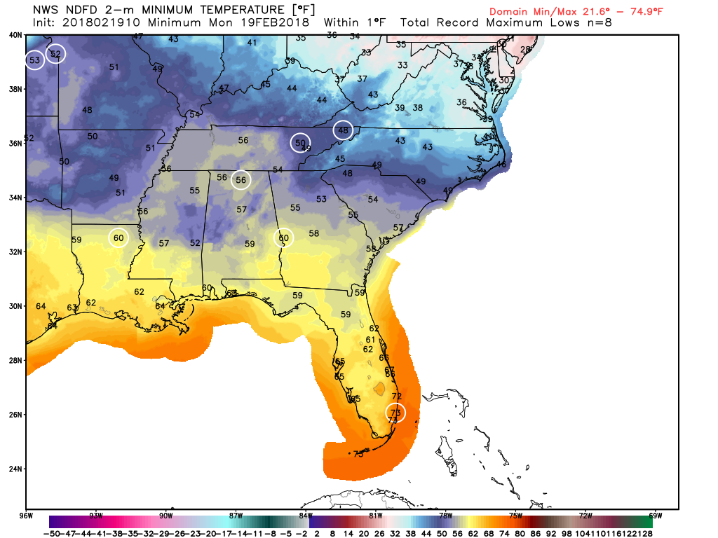
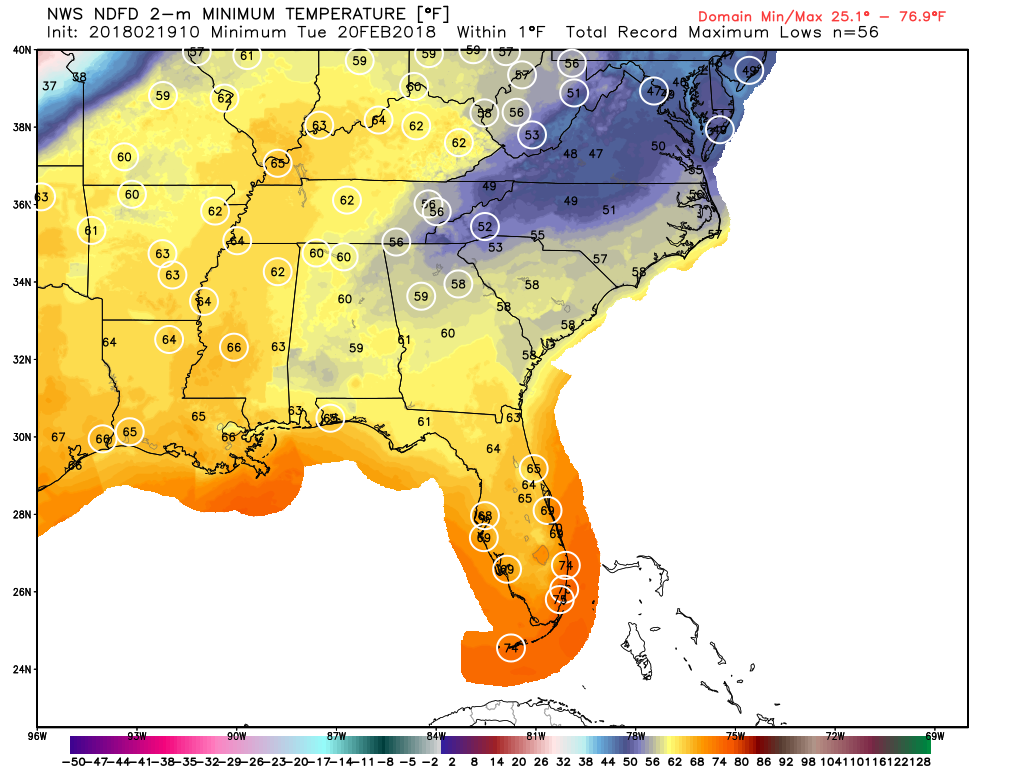
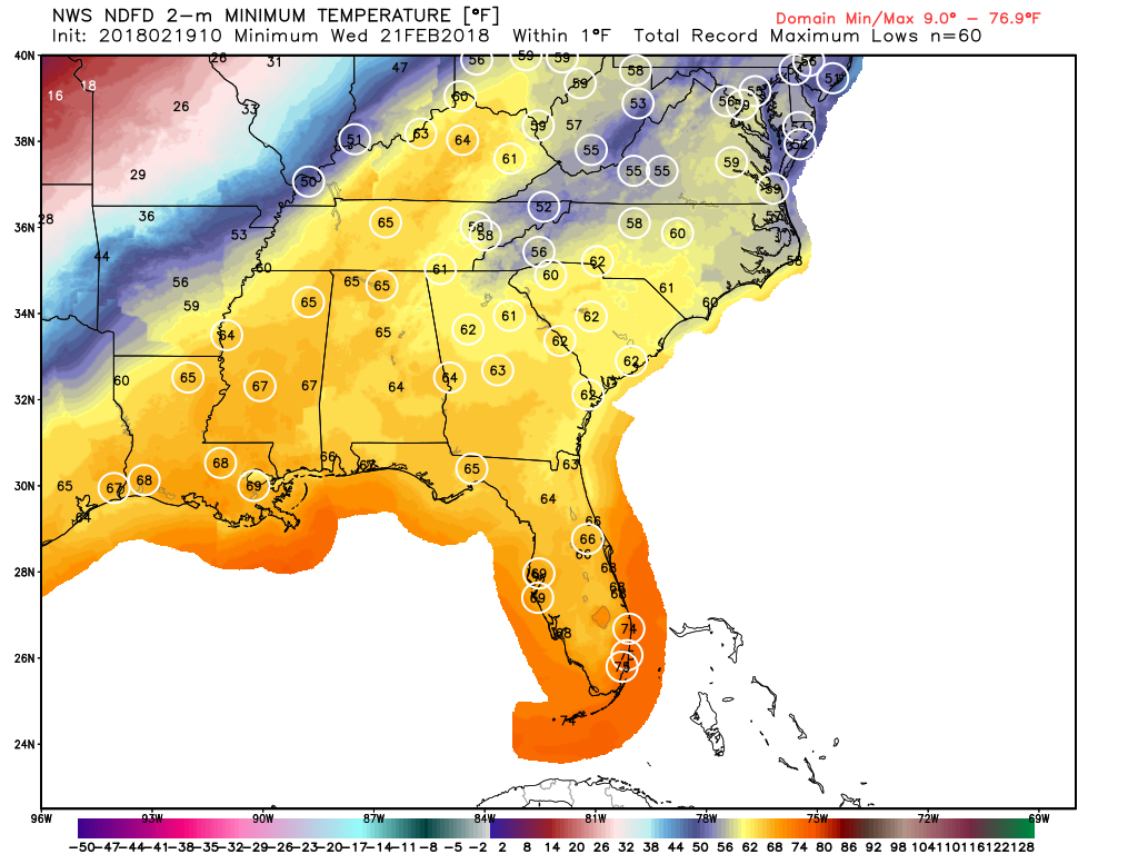
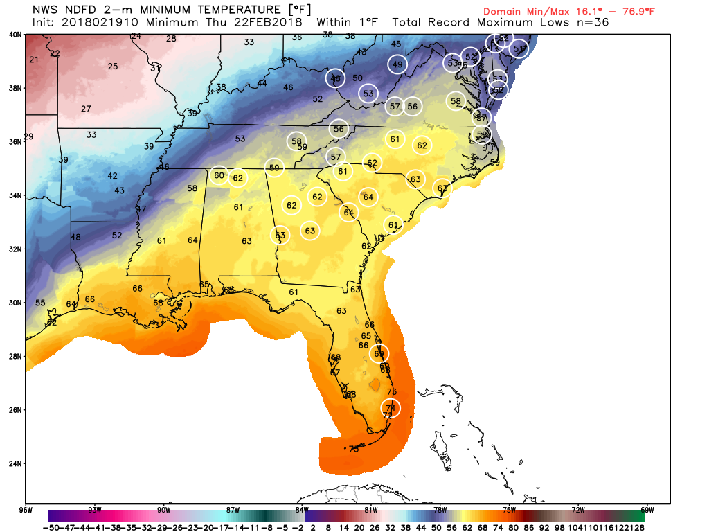
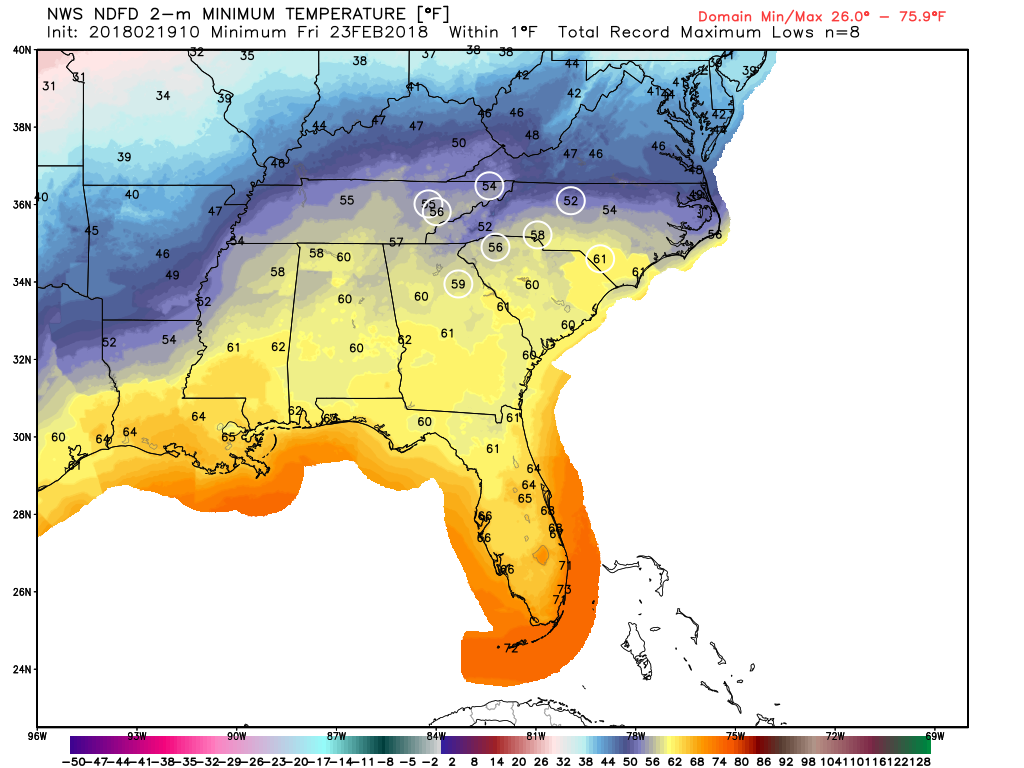
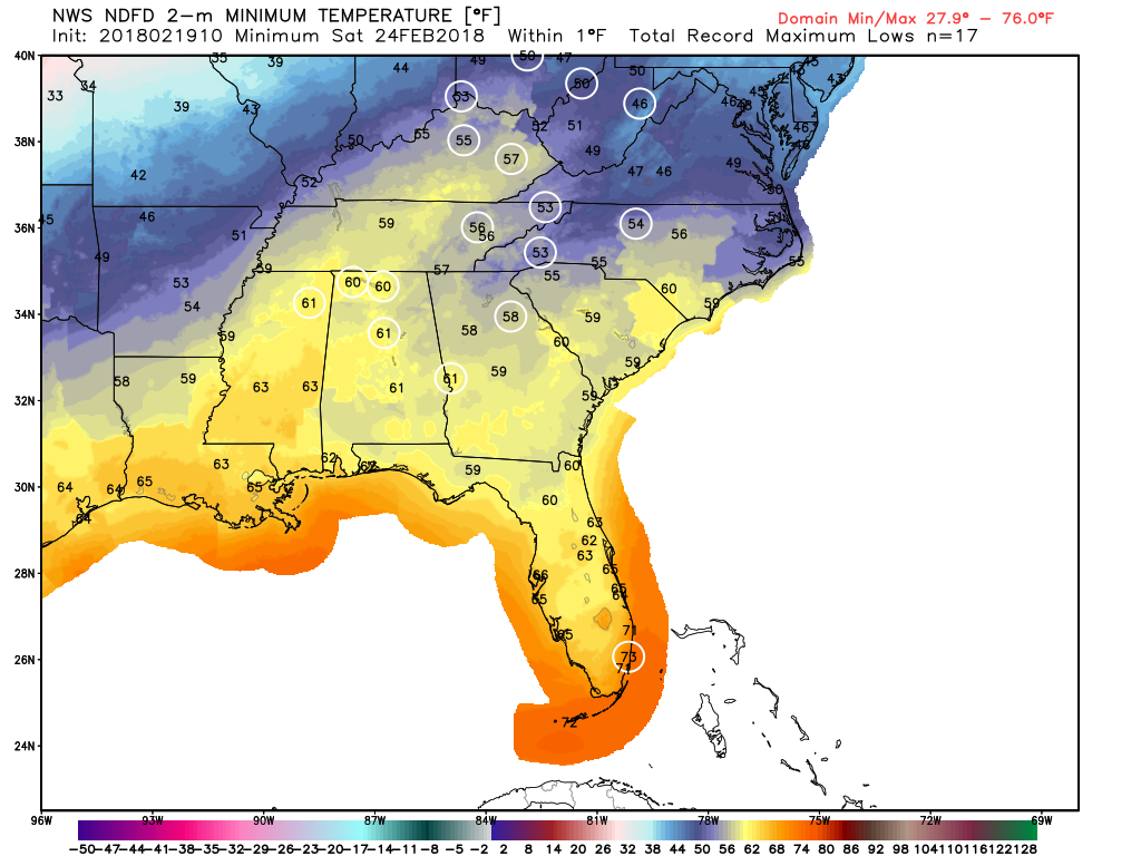
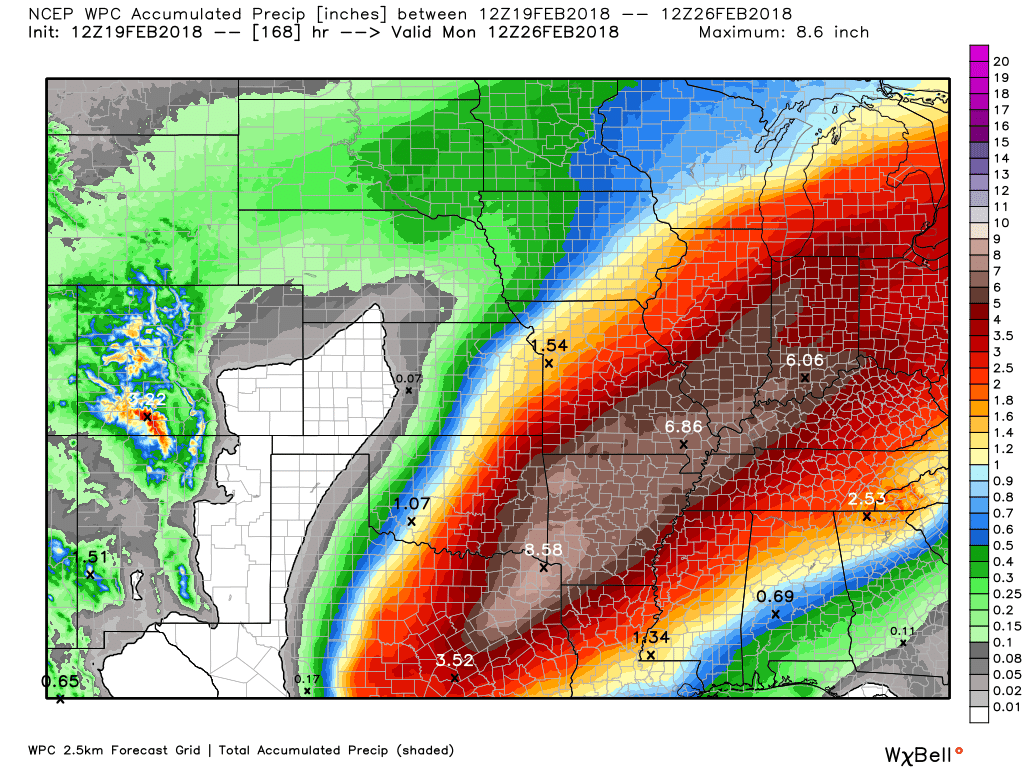 Image #5 - Flooding rainfall over the next 7 days These are some of the high temp records that may be broken this week across the southeast. Click to enlarge. There will also be many max low temp records set this week, and the max low temp records will continue on through the weekend. Click to enlarge. |
Archives
March 2019
Categories
All
|
OLD NORTH GA WX BLOG

 RSS Feed
|
Never base important decisions on this or any weather information obtained from the Internet. Always have a backup method of receiving weather information such as a battery powered weather radio.
Copyright © 2018 NorthGeorgiaWX.com and DaculaWeather.com 
|