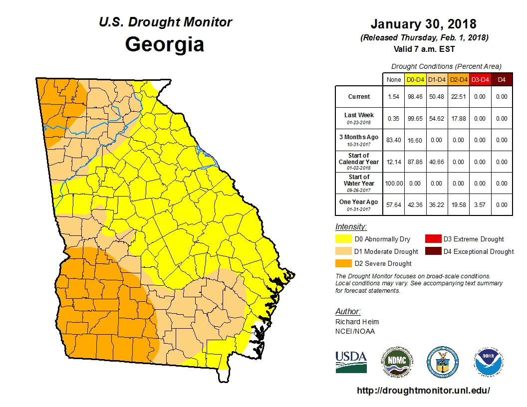
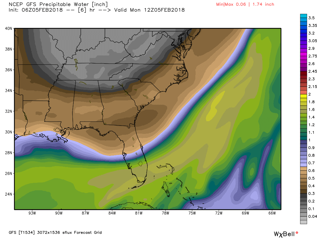
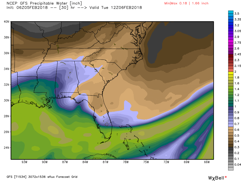
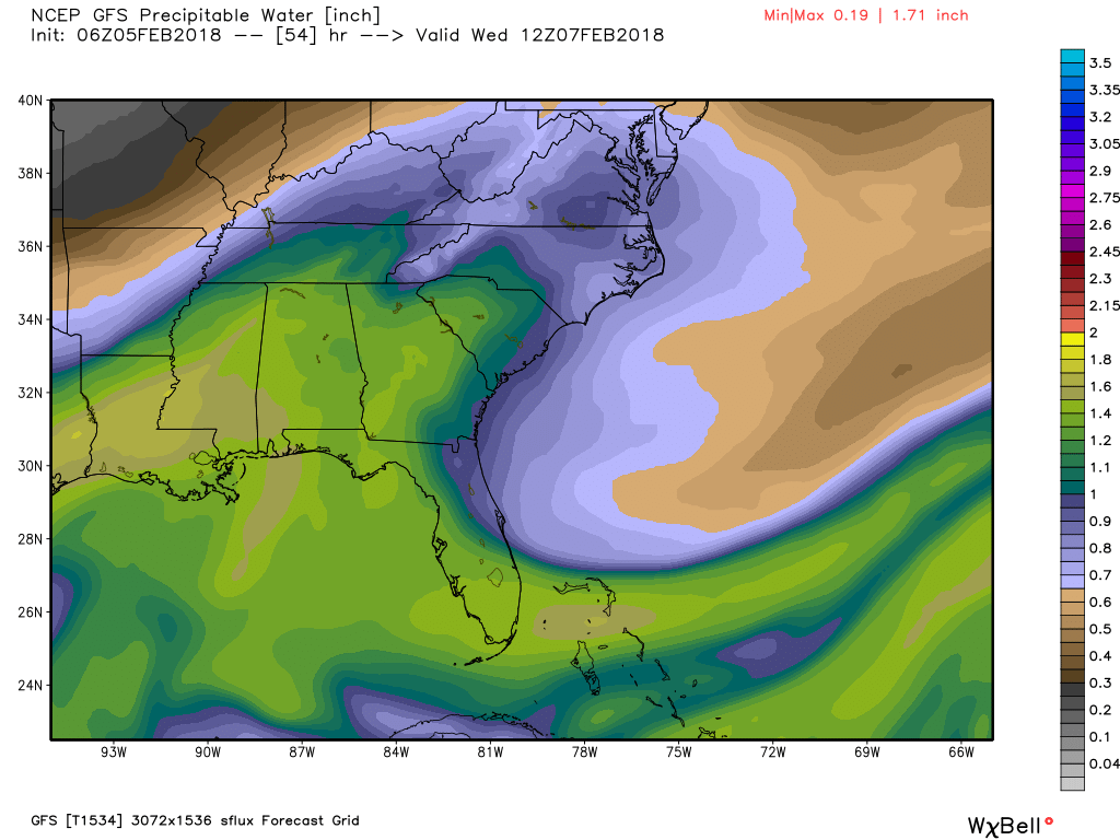
 Most recent drought map (Updates Thursday) Most recent drought map (Updates Thursday) One benefit of the warmer temperatures has been the rainfall we've seen over the last week, and it appears that the drought busting rain will continue through the rest of this week. The latest drought map (to the left, click to enlarge) was issued last Thursday and doesn't account for the rainfall we've had since the 28th of January. While we will dry out a little today, the moisture will be on the increase beginning tomorrow and we will be back into the soupy atmosphere for Wednesday. According to the NWS, Wednesday will end up being like last Saturday in terms of being a washout and there will even be a chance for a few thundershowers, but nothing severe. The three images below show the precipitable water values for Mon-Wed. The brown and grey colors show very dry air, while the greens are very moist. You can see how our low and mid level flow starts to bring a return flow from the Gulf on Tuesday (center image) and a deeper surge for Wednesday.
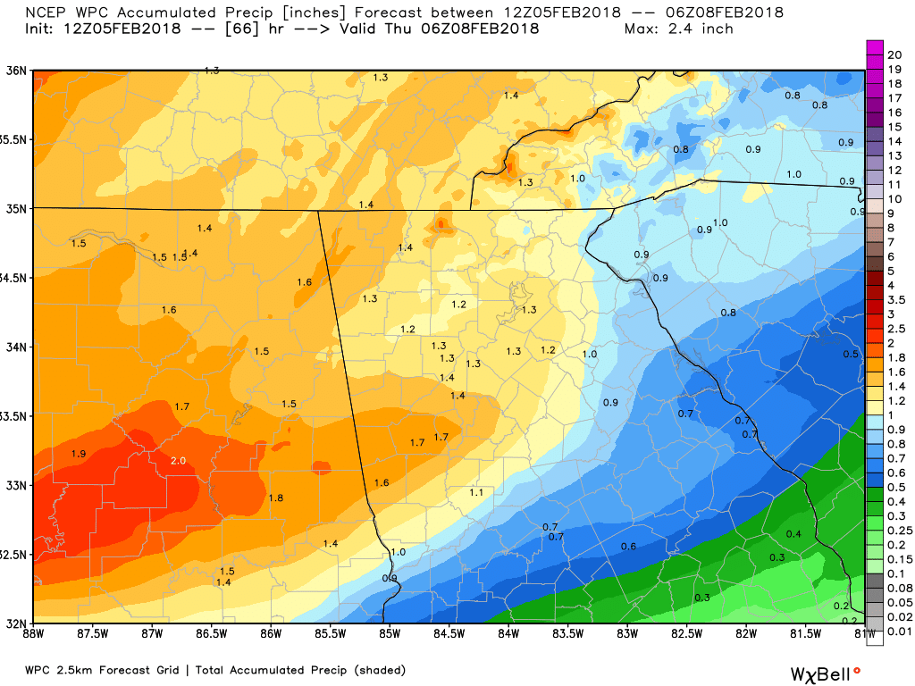
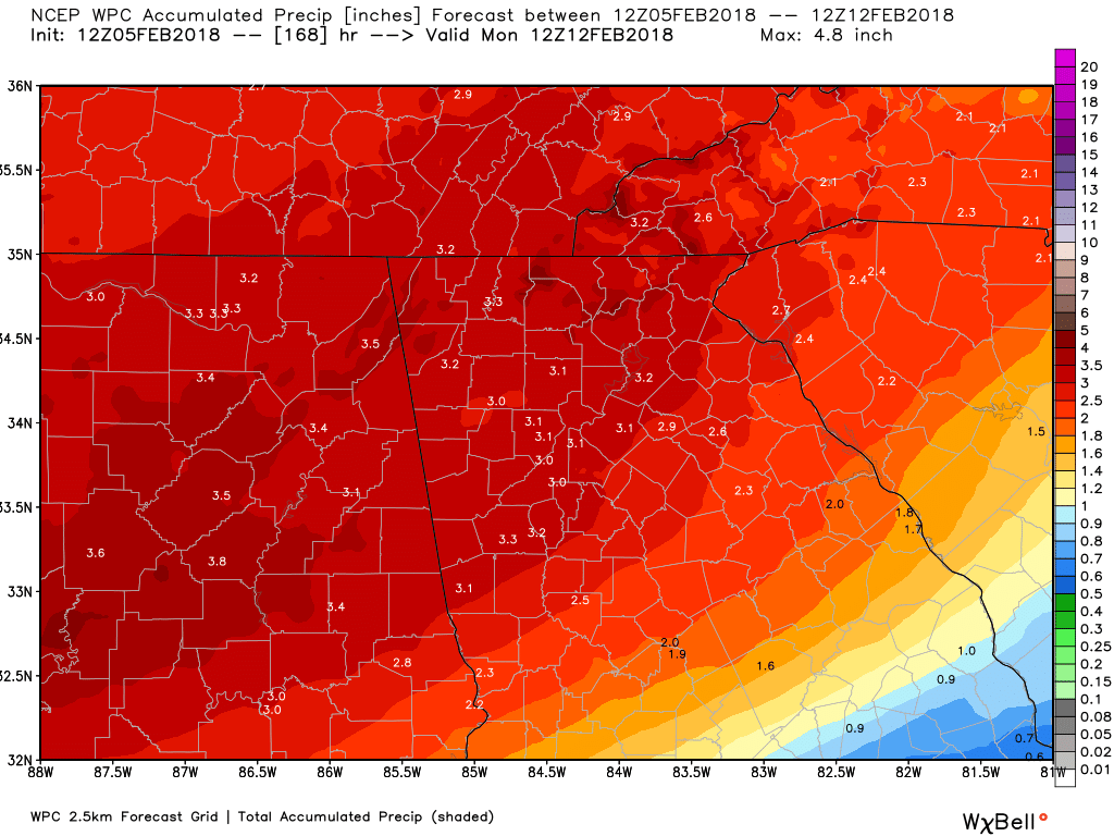
Round #1 rainfall totals are forecast to look like the left image, and then add the rainfall from system #2 from next weekend, and you get a grand total that looks like the image on the right.
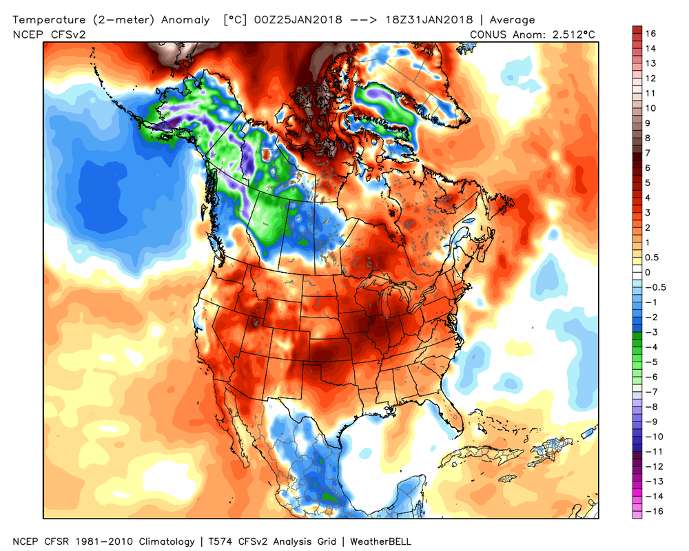
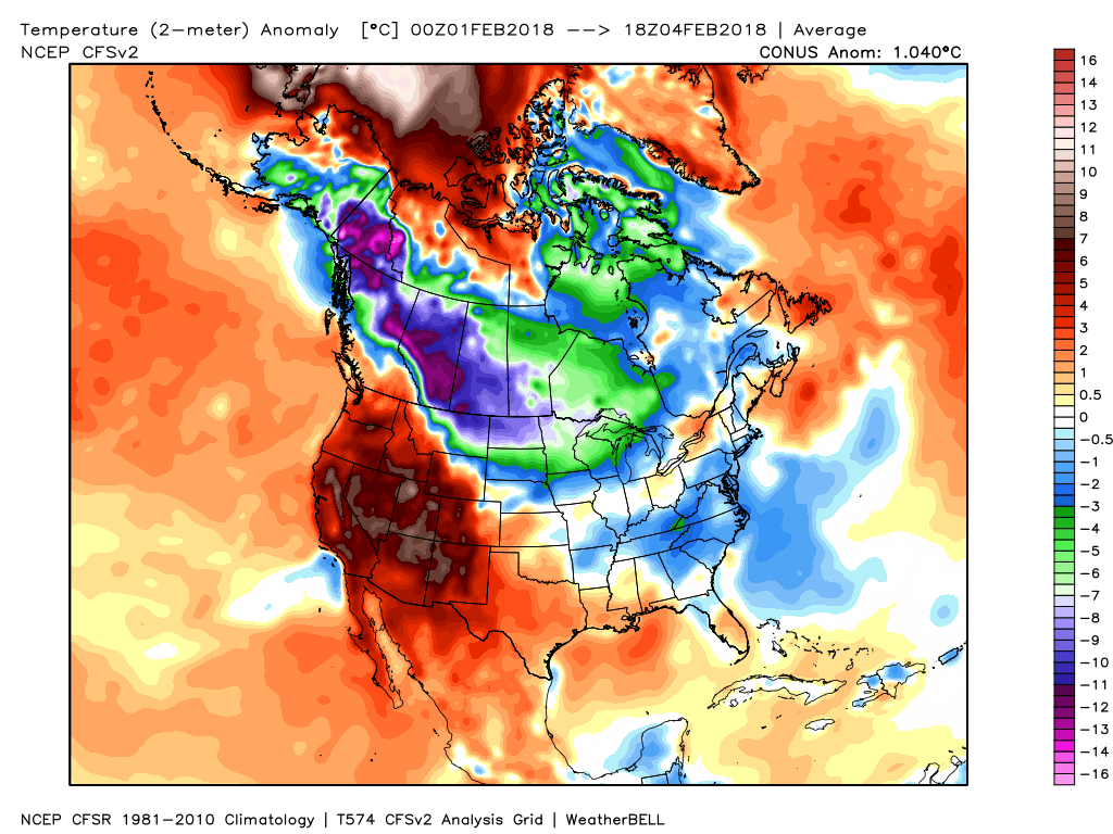
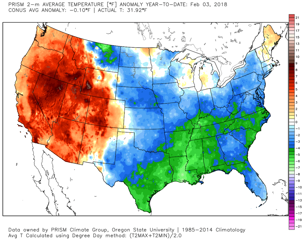
Here is the rainfall reanalysis map at a look back at the last 7 days that shows our total rainfall from 7 am Sunday, January 28th through 7 am Sunday, February 4th. 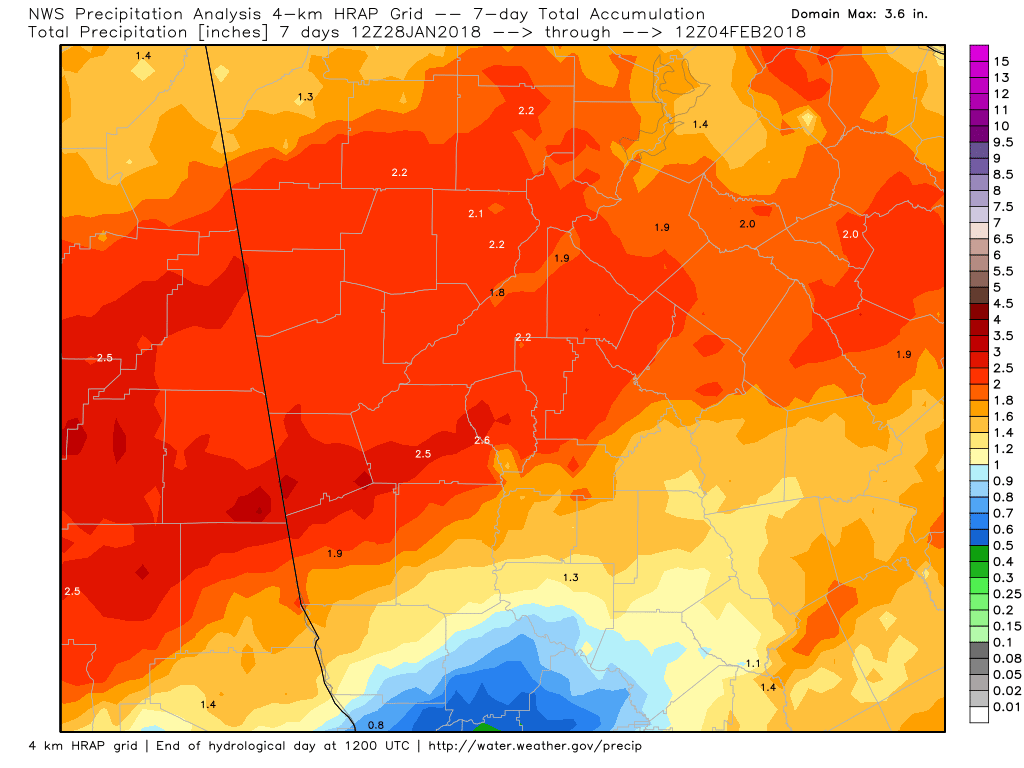 As if you didn't already know, temperatures over the last 7 days have been above normal (left image) and we expected this, so no surprises here. The image to the right is for this month so far, and you can see we've been slightly below normal. Temperatures will be running some 10-15 degrees above normal this week, so enjoy the comfortable temperatures while you can. Winter is not over by a long shot.
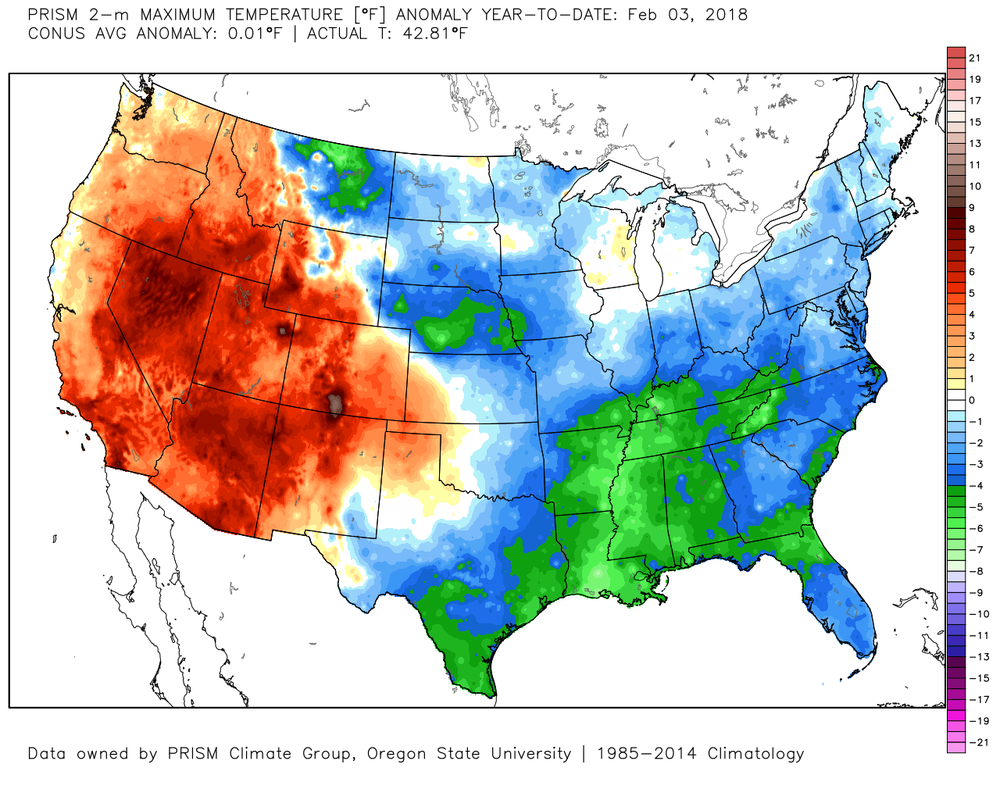
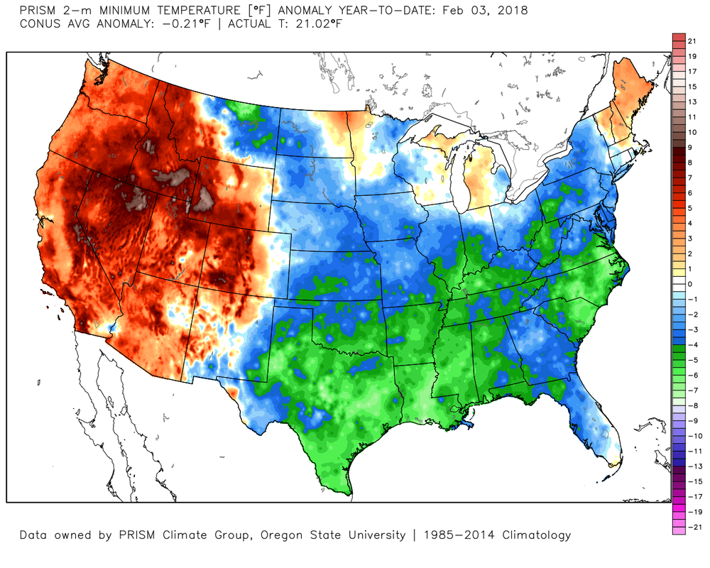
Here's a look at our temperatures (not anomalies) since January 1 from the Prism 4km Reanalysis.
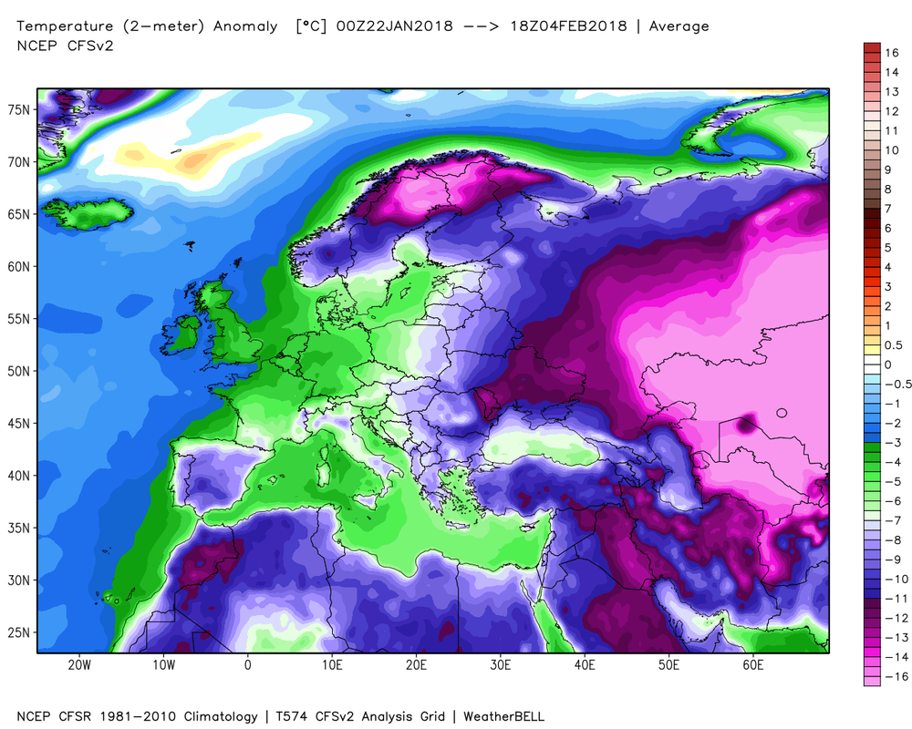
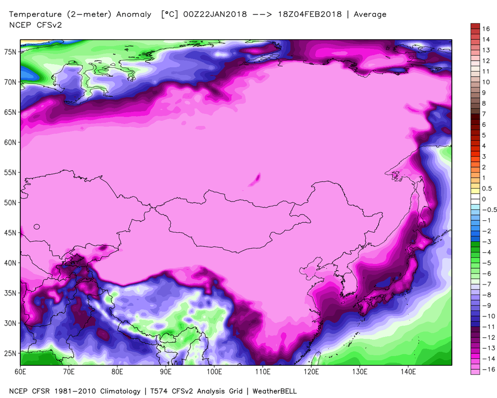
Want to see where the coldest temperature anomalies have been while we basked in mid-winter warmth? Here's a look at the past 14 day anomalies in Europe and Asia.
Here's a look at the coldest places in the Northern Hemisphere ending at 7 am this morning (Feb 5th). You can find the weather extreme's page here: www.daculaweather.com/4_world_extremes.php The page defaults to the U.S. but you can choose other regions of the world. Be patient... it takes 10 seconds or so for the script to retrieve the data. 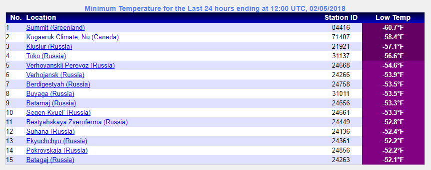 |
Archives
March 2019
Categories
All
|
OLD NORTH GA WX BLOG
 RSS Feed
|
Never base important decisions on this or any weather information obtained from the Internet. Always have a backup method of receiving weather information such as a battery powered weather radio.
Copyright © 2018 NorthGeorgiaWX.com and DaculaWeather.com 
|