I know a lot of people are wondering if the cold is coming (not to mention any snow) so I just wanted to talk for a minute about that future.
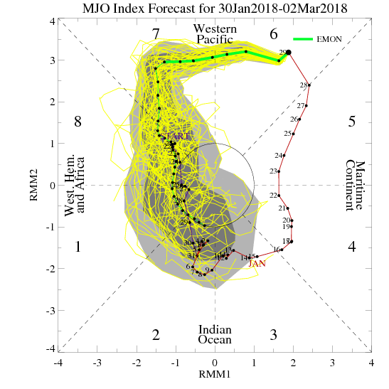
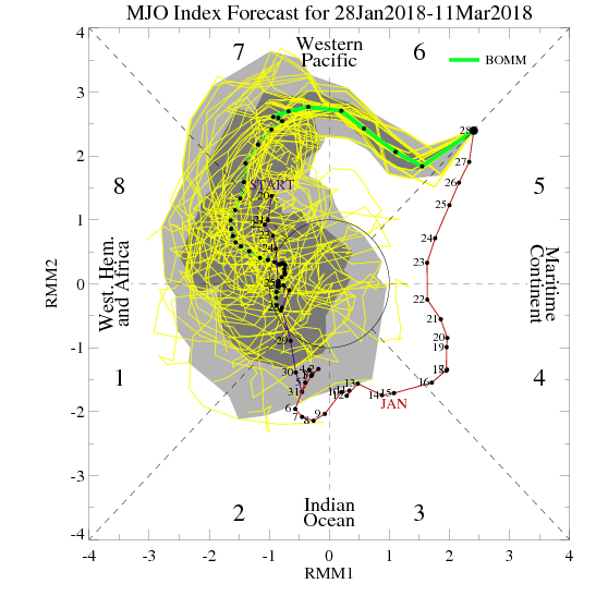
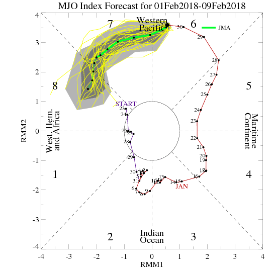
We're watching several different events to see how they are going to effect us here in the southeast. Let's take a look. MJO - The MJO has been moving at a snails pace as it heads toward some favorable cold phases for this time of the year. The amplitude of the MJO has been pretty extreme which can help to cause wide swings in the weather. Right now the MJO is in Phase 7 which is a warm phase, but it looks like most of the models want to head into phase 8, 1, 2, 3, which are all relatively cold phases for us in February and March. However, some of the models have backed off on the strength of the MJO and even take into the neutral area, so we will need to watch to see how this progresses. MJO forecast are not the most accurate at a distance. All of the MJO maps and data can be found at this link: http://www.daculaweather.com/4_mjo_phase_forecast.php
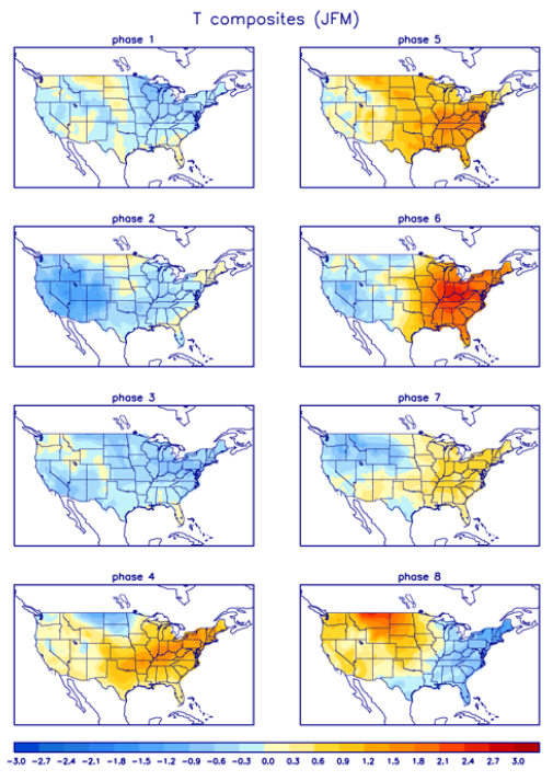
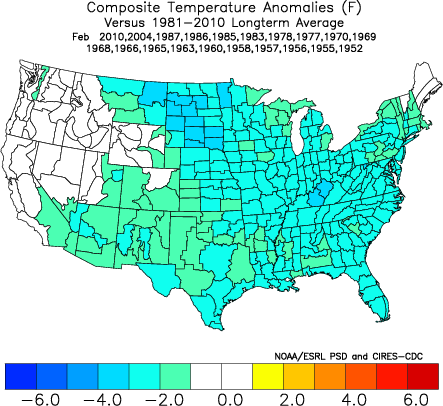
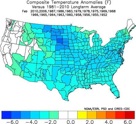
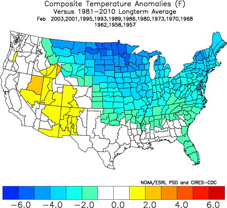
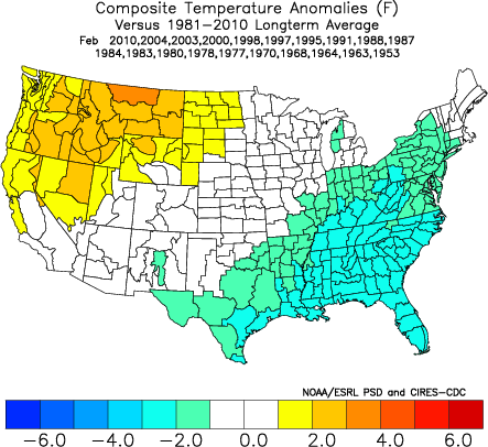
Temperature composites showing the expected temp outcome for JFM depending on the phase of the MJO
Stratosphere -
There are signs that there may be a stratospheric warming event on the horizon, and that is good news if you like the cold and want more winter. Instead of me trying to explain the complexities of a stratosphere forecast, I'll let the following Tweets speak for themselves. I have a full compliment of stratosphere maps and forecast at DaculaWeather.com. From the menu at the top, click on "Models", and then "Stratosphere Model Data".
Teleconnections -
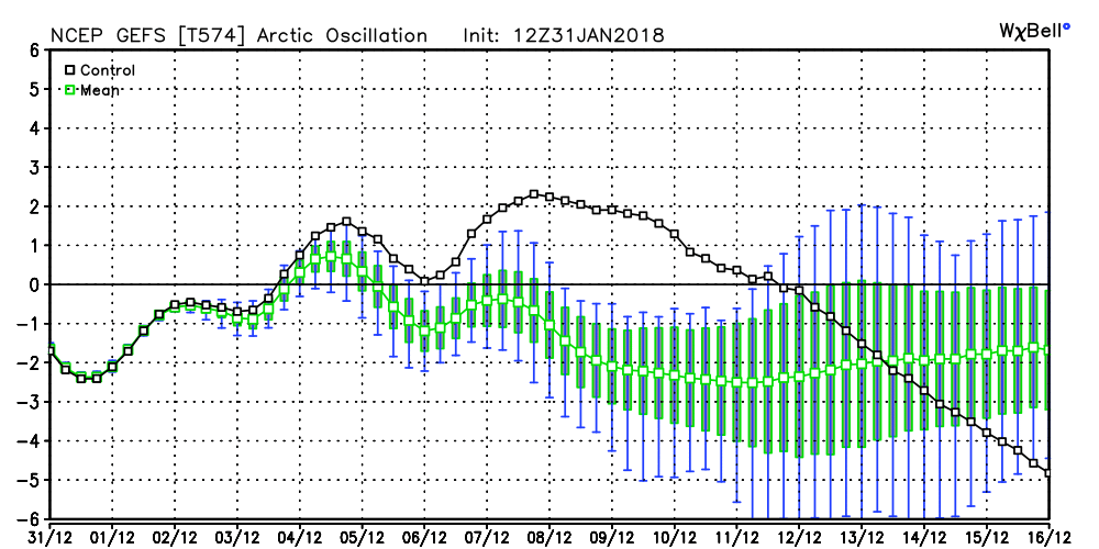
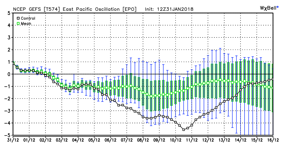
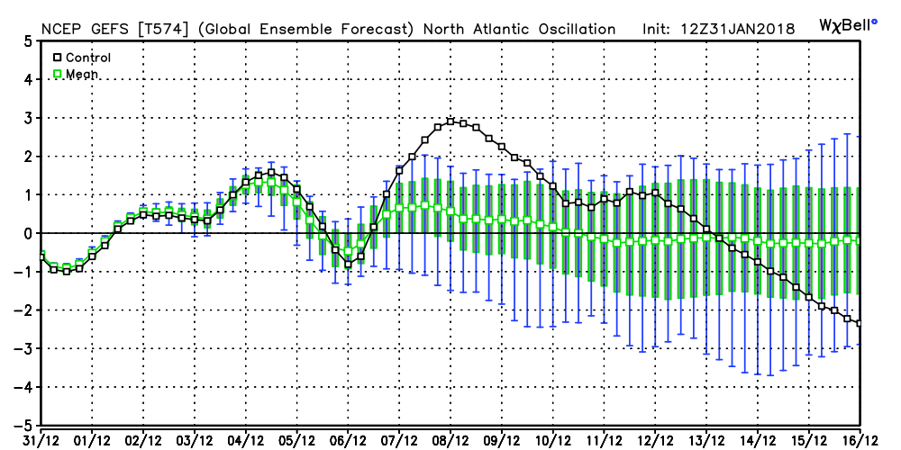
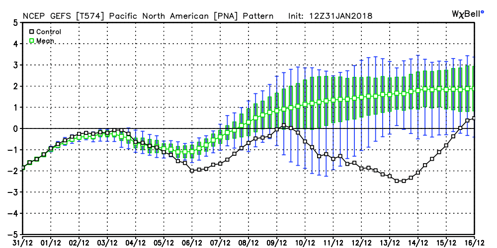
I've talked about teleconnections before, so let's talk about how the models see all of this playing out. As you may know, teleconnection indexes are simply measurements of the different patterns in the atmosphere, and during certain times of the year like in the winter, they are particularly important in defining when and where the cold air may go. The Euro has been a little indifferent in the strength of these indexes but the GFS ensemble is beginning to show some signs of major high latitude blocking. The top row of images are the current readings and the forecast, and the corresponding images in the bottom row show how the temps normally respond. The first image shows the AO going negative, the second the NAO going negative, the third image the EPO showing a tilt toward negative, and the last image is the PNA possibly heading to a positive state. You can find much more about these 4 teleconnections from the following links at http://www.daculaweather.com:
Bottom Line -
All signs are beginning to point to a change toward a cold period beginning is two weeks or less, and continuing into March. One unknown is the outcome of the stratospheric event and whether or not we can get the high latitude blocking that we need here in the southeast, and another unknown factor will be the timing of the phase and strength of the MJO. Whether or not we have precipitation to go with it is still unknown, but you can't have winter weather without cold air and it doesn't look like cold is going to be an issue. |
Archives
March 2019
Categories
All
|
OLD NORTH GA WX BLOG
 RSS Feed
|
Never base important decisions on this or any weather information obtained from the Internet. Always have a backup method of receiving weather information such as a battery powered weather radio.
Copyright © 2018 NorthGeorgiaWX.com and DaculaWeather.com 
|